The Jewish cemetery of Aalten, located on Haartsestraat, has a rich history dating back to the beginning of the 19th century. Although the site officially became the property of the Jewish community in 1852, there are indications that the cemetery had been in use since approximately 1820.
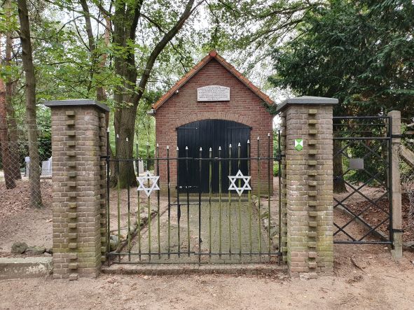
The cemetery is situated in a wooded area and is enclosed by sturdy fencing. The older section consists of a low, densely wooded hill with scattered funerary monuments. To the east lies the newer section, which is characterized by an orthogonal layout.
There are approximately seventy gravestones on the grounds, varying in age and design. At the entrance on Haartsestraat stands a metaheerhuis (mortuary), a ritual building used for the purification of the deceased according to Jewish traditions.
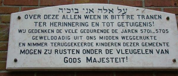
During World War II, the cemetery was damaged, but it was restored after the war. In memory of the Jewish children from the municipality who were deported and killed during the war, a plaque has been placed on the facade of the metaheerhuis.
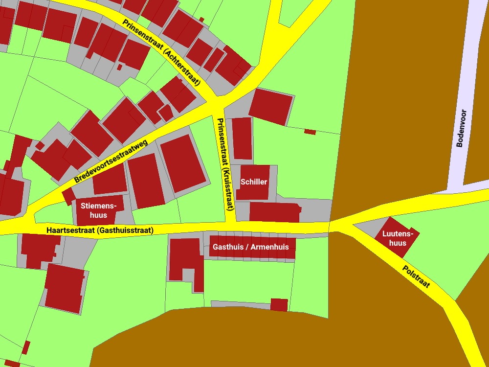
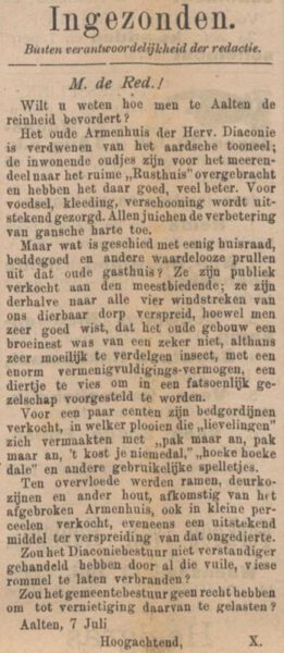
The Almshouse (‘Gasthuis’) was an institution run by the Reformed diaconate (charitable board) located on what was then Gasthuisstraat, now known as Haartsestraat, in Aalten.
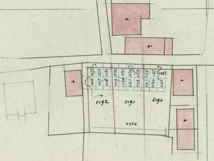
On the 1832 land registry map (cadastre) shown on the right, the exact location is visible, situated approximately where Haartsestraat 14 to 18 stands today.
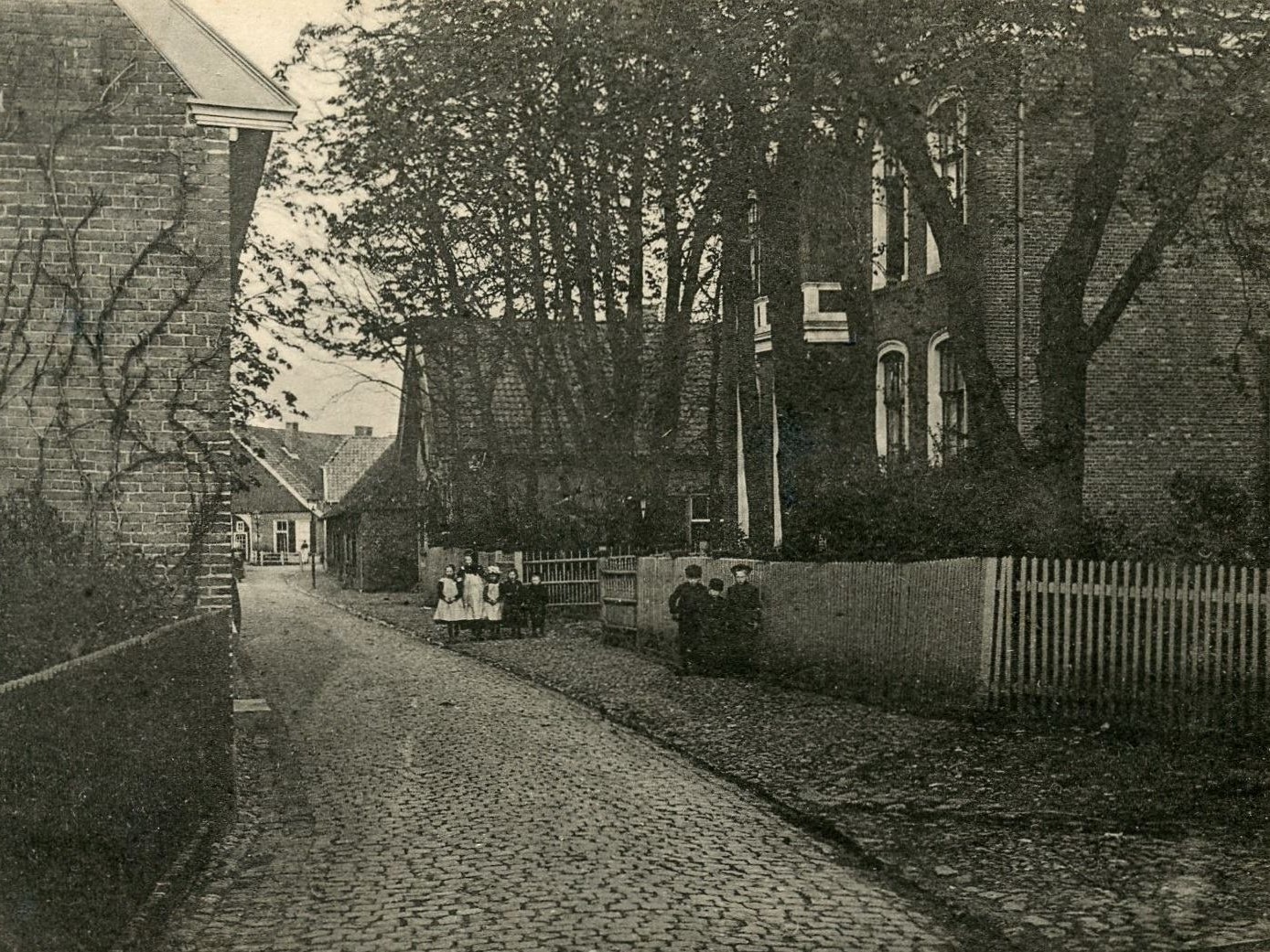
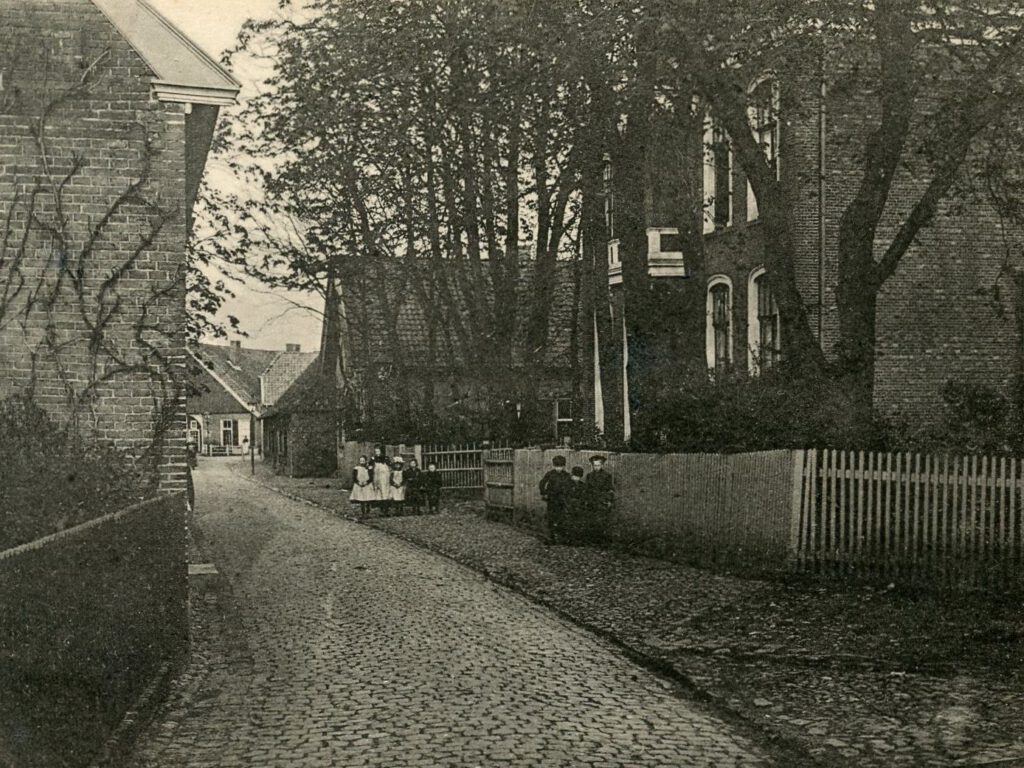
Bovenstaande foto toont de Gasthuisstraat rond 1900. Rechts, voorbij de burgemeesterswoning – het latere postkantoor – zien we nog net een gedeelte van het Gasthuis. Helemaal achteraan zien we ook nog net het Luutenshuus.
The Almshouse contained ten rooms on the street side and ten on the garden side, each with a floor area of 17 to 22 m². Each room was equipped with two box-beds (bedsteden). Occupants shared a privaat (toilet) between several rooms. In the garden, many residents also kept a ‘sikkestal’ (a small shed for a goat).
The residents were not only among the poorest members of the population but were also generally the least educated. Consequently, the Almshouse and its surroundings were frequently the scene of shouting matches and petty quarrels. The residents were often the targets of harassment by the local youth of Aalten.
One of the residents would deliver wheelbarrows of fine white sand door-to-door for a penny, which people used to strew across their stone floors. Once he had earned a few pence, he would quickly spend it on a borrel (a small glass of gin) before starting to ‘save up’ for the next one.
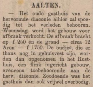
In 1904 werd het Gasthuis afgebroken. De oudjes er op dat moment nog woonden verhuisden naar het Rusthuis aan de Hogestraat.
Owners
This overview is incomplete.
Year
Plot
Owner
Description
1832
I1116 – I1135
the Reformed Poor of Aalten
House Numbering
In the population register, every room or household is listed on a separate family card. The overview below provides links to the first family card in the population register for each period that corresponds to the almshouse on Haartsestraat. From there, one can browse further to find all residents for that specific timeframe.
An extensive table listing all residents is planned for the future to assist genealogists in identifying former occupants. Please note: records may contain errors.
Aalten had vroeger ook nog een katholiek gasthuis. Het Armenpad tussen de Hogestraat en de Stationsstraat, één van de typisch Aaltense Gängeskes, herinnert hier nog aan.
Features
Cadastral no.
I-8761/8762/ 13144/13140
Function
Almshouse
Year of construction
unknown
Demolition
1904
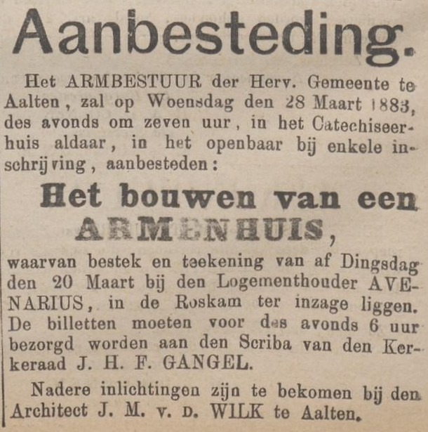
Land Registry 1832, Source: hisgis.nlFragment cadastral map, 1905Zutphensche Courant, 19 March 1883Nieuwe Winterswijksche Courant, 25 May 1904Aaltensche Courant, 9 July 1904
Deze website gebruikt cookies voor een optimale ervaring en analyse van bezoekgegevens. Ga je hiermee akkoord? Zonder toestemming werken sommige onderdelen van de site mogelijk minder goed.
Functioneel
Always active
De technische opslag of toegang is strikt noodzakelijk voor het legitieme doel het gebruik mogelijk te maken van een specifieke dienst waarom de abonnee of gebruiker uitdrukkelijk heeft gevraagd, of met als enig doel de uitvoering van de transmissie van een communicatie over een elektronisch communicatienetwerk.
Voorkeuren
De technische opslag of toegang is noodzakelijk voor het legitieme doel voorkeuren op te slaan die niet door de abonnee of gebruiker zijn aangevraagd.
Statistieken
De technische opslag of toegang die uitsluitend voor statistische doeleinden wordt gebruikt.De technische opslag of toegang die uitsluitend wordt gebruikt voor anonieme statistische doeleinden. Zonder dagvaarding, vrijwillige naleving door je Internet Service Provider, of aanvullende gegevens van een derde partij, kan informatie die alleen voor dit doel wordt opgeslagen of opgehaald gewoonlijk niet worden gebruikt om je te identificeren.
Marketing
De technische opslag of toegang is nodig om gebruikersprofielen op te stellen voor het verzenden van reclame, of om de gebruiker op een site of over verschillende sites te volgen voor soortgelijke marketingdoeleinden.