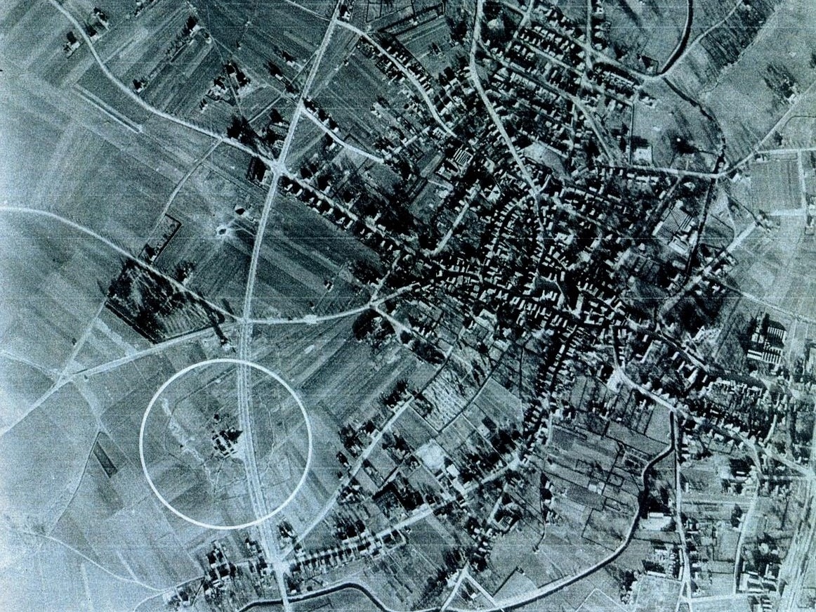
During World War II, the Germans constructed a Freya-type radar station on the outskirts of the village of Aalten. The location was situated north of the Ringweg, approximately halfway between the Tolhuis (tollhouse) and the water tower. This radar site was part of an extensive air defence system operated by the Luftwaffe.
The radar system, named after the Germanic goddess Freya, had been developed by the Germans in the late 1930s. It was capable of detecting enemy aircraft at a distance of approximately 150 kilometres.
The radar installation was situated on a site with a circumference of about 800 metres, surrounded by a system of trenches and barbed-wire fencing. Additionally, anti-aircraft artillery was present on the site.

There was a large radar unit, consisting of a red brick base, approximately seven by seven metres and three metres high. Mounted on top was the antenna, a metal framework measuring six by six metres. The large, square antenna screen could be rotated manually to the desired direction.
There was also a smaller radar unit, which lacked a brick base. Furthermore, there were approximately ten wooden barracks on the site, measuring four by six metres and painted green, used to house the personnel.
The immediate surroundings of the radar site were declared a Sperrgebiet (restricted area). The Ringweg was closed to pedestrians from the Tolhuis to the water tower. Signs marked “Militäre Werke” were placed in these areas. Cars and cyclists were permitted to drive through, but stopping or dismounting was strictly forbidden.
The Freya radar site in Aalten was constructed at the end of the summer of 1942. The site was abandoned in the autumn of 1944. Traces of the radar site, such as the concrete and brick housing for the antenna screen, remained visible until the early 1950s.
Features
| Cadastral no. | L-583 |
| Function | Radarstation |
| Year of construction | 1942 |
| Demolition | 1950s |

with the water tower in the background
Sources
- Britse littekens in Aaltense bodem, feiten en achtergronden over de bevrijding op 30 maart 1945, Wim Rhebergen
- Cadastral map
- Oorlogsbronnen
Leave a Reply