Ancient trade routes as lifelines of the Achterhoek
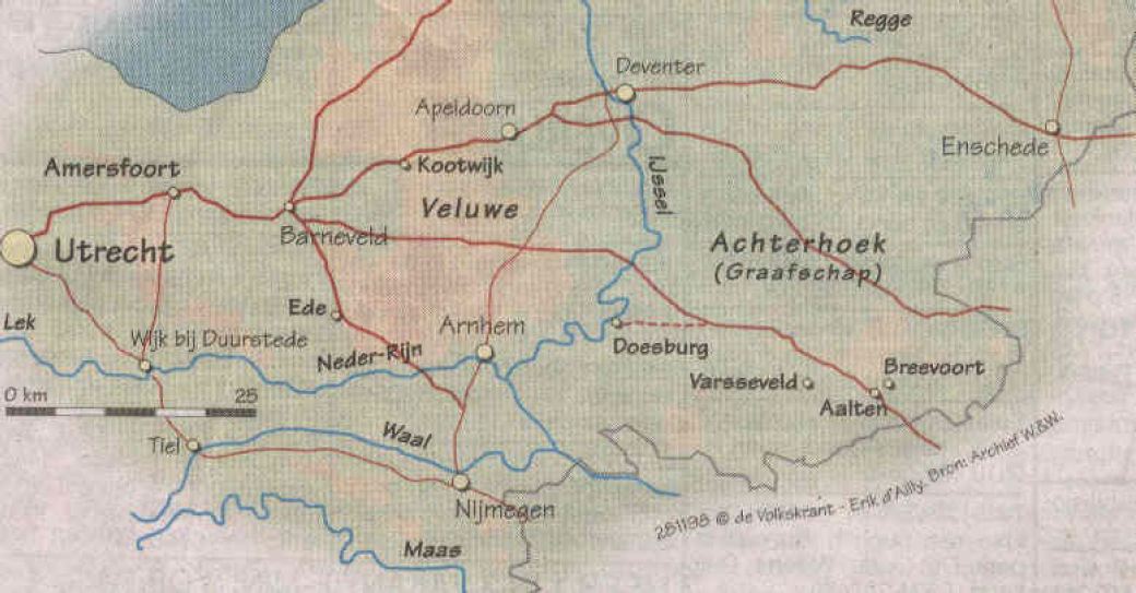
For centuries, German merchants traveled through the Achterhoek with their heavy carts via the so-called Hessenwegen: ancient trade routes that connected the region with Germany and the Dutch trading cities. One of these roads ran from Bocholt via Aalten towards Zutphen and Doesburg. The Hessenwegen were of great importance for early modern trade in this region.
The term Hessenweg has been used since the 17th century. The traditional explanation refers to the merchants who came from the Landgraviate of Hesse-Kassel and the surrounding area. Within etymology, however, the name is explained differently: it is said to be a corruption of hers, meaning horse. These roads usually ran over high, dry sandy soils and along ridges.
Four major Hessenwegen ran through the Achterhoek. Three of them followed a northern route, from Vreden and Ammeloe via Groenlo, Rekken, and Neede, among others, to Deventer or Zutphen.
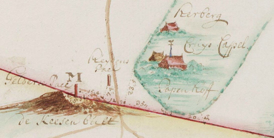
In the southern Achterhoek, a Hessenweg ran past Aalten. From Bocholt, this route crossed the current border at the Kesenbulte and continued via the Bodendijk, Dijkstraat, Landstraat, Berkenhovestraat, and the Romienendiek to De Radstake. From there, the road continued past Zutphen and Barneveld, with a branch between Halle and Zelhem towards Doesburg.
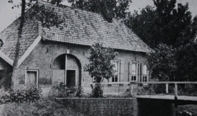
De Leste Stuver near Bredevoort
From the IJssel cities, the Hessenwegen crossed the Veluwe, converged in the Gooi, and continued to Amsterdam. The Hessenwegen had numerous branches. One of these ran near Aalten from the Romienendiek, via the Koningsweg, Hessenweg, past the Walfort, via Bredevoort and Winterswijk to Vreden.
For those living along a Hessenweg in the 19th century, the arrival of the Hessenkeerls was quite an event. On the windward side of the procession walked men with heavy clubs, dressed in their characteristic blue Hessenkiel: a shirt of fine linen, closed with copper hooks in the shape of lion heads and three small bone buttons. Decorated facings were applied to the chest and shoulders.
On the road, donkeys trudged through the loose sand, with a basket of woven willow twigs full of merchandise on either side. Once they arrived in a village, the men tied their donkeys near an inn or on the village square. The animals were fed and watered, while the men refreshed themselves at the village pump.
Afterward, the baskets were opened and the Hessians went from house to house peddling. Their merchandise included light glassware and soft straw hats. These hats were in high demand: as soon as the Hessians arrived, customers were already waiting for them to buy a new summer hat. The hats were elastic and therefore almost always fit. After a few hours, the Hessians moved on.
Pottenkeerls, musicians, and hannekemaaiers
In addition to the Hessenkeerls, pottenkeerls also appeared on the Hessenwegen. They used heavy covered wagons that stood high on their wheels, the so-called Hessenkaoren, pulled by sturdy Holsteiner horses. The carts were full of Cologne pottery: gray or yellow-brown pots with blue decoration. The horses wore richly decorated harnesses, fitted and hung with copper decorations, so that their arrival could be heard from afar.
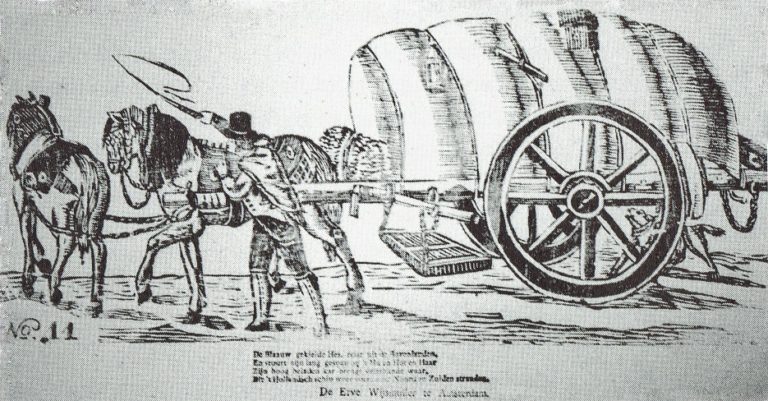
An image of a carter with his Hessenkar from around 1830, from the Popular Prints collection of Museum ‘t Oude Slot in Veldhoven, with the text:
The blue-smocked Hessian travels from the Uplands, And guides his long team with ‘Hu’ and ‘Hot’ and ‘Haar’. His high-laden cart brings many kinds of wares, Which the Dutch ship carries again to North and South shores.
In the spring, groups of German musicians traveled over the Hessenwegen to the Netherlands. Some bands were very well known in Amsterdam, Rotterdam, and The Hague. Although they presumably came from the same region, they were not called Hessians because they did not wear the Hessenkiel.
In addition, the hannekemaaiers came by in the summer: seasonal workers from Westphalia who helped in Holland with mowing grass and during the harvest. Women and children stayed behind at home to work on the land, while the men earned money elsewhere for the winter.
The end of the Hessenwegen
In the course of the 19th century, the significance of the Hessenwegen declined. In 1875, the last Hessians were seen near Zelhem, a meager group compared to former times. The Franco-Prussian War of 1870 and the subsequent industrial boom in the Ruhr area provided the Germans with a livelihood closer to home. Even many young people from the Achterhoek went that way to earn good money. With that, the Hessenwegen had had their day.
Older origins
Although the term Hessenweg was used from the 17th century, archaeological finds along these roads indicate that they had been in use for much longer. For example, in Aalten, at De Hoven near the Landstraat, traces of an 8th-century settlement have been found, including remains of sunken-floor huts, refuse pits, and spindle whorls. This is a strong indication that the later Hessenwegen built upon much older traffic routes, the so-called volkerenwegen (peoples’ roads).
It is therefore logical to assume that the village of Aalten partly owes its origin to this ancient peoples’ road. De Hoven was a favorable spot, because in the middle of the wild landscape of forest, heath, and marshes, there was a hill here, high and dry, directly on a through road. Moreover, a stream flowed at the bottom of the hill, providing fresh water.
Hessentocht
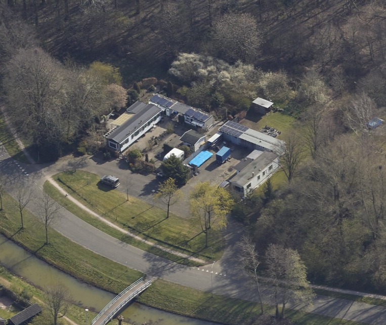
The memory of the Hessians still lives on. In 2011, a Hessentocht (Hessian Trek) was organized for the second time in the vicinity of Bredevoort and Aalten. During this trek, in which a historical caravan was simulated, an impressive ox cart took part: 2.60 meters wide, six meters long, and four meters high. In addition, three wagons participated, each pulled by three horses. Jan Oberink captured the trek on film and created the atmospheric impression below.
Acknowledgements
The content of this article is largely based on the article by G.J. Klokman (Zelhem, 1864), published in 1937. There are numerous other publications about Hessenwegen that present a different picture on some points. For this article, Klokman’s description was primarily chosen because his memories and observations specifically relate to the Hessenweg near Zelhem, the same route that also ran through Aalten.
Sources
G.J. Klokman, De Hessenwegen, in: Eigen Volk. Algemeen tijdschrift voor volkskunde (folklore) en dialect, 1937. National Library of the Netherlands
G.J. Klokman, De Achterhoekers, in: De Nederlandse volkskarakters, 1938. DBNL
Several theories circulate regarding the origin of the name Aalten. But what are they based on and how credible are they? Old Aalten delved into history to discover more about this.
We begin with the oldest historical mentions of Aalten, as these may contain clues about the origin of the name. Next, we examine what toponomy (the study of place names) can teach us about this. We then discuss several theories regarding the origin and meaning of the name Aalten and conclude with our findings.
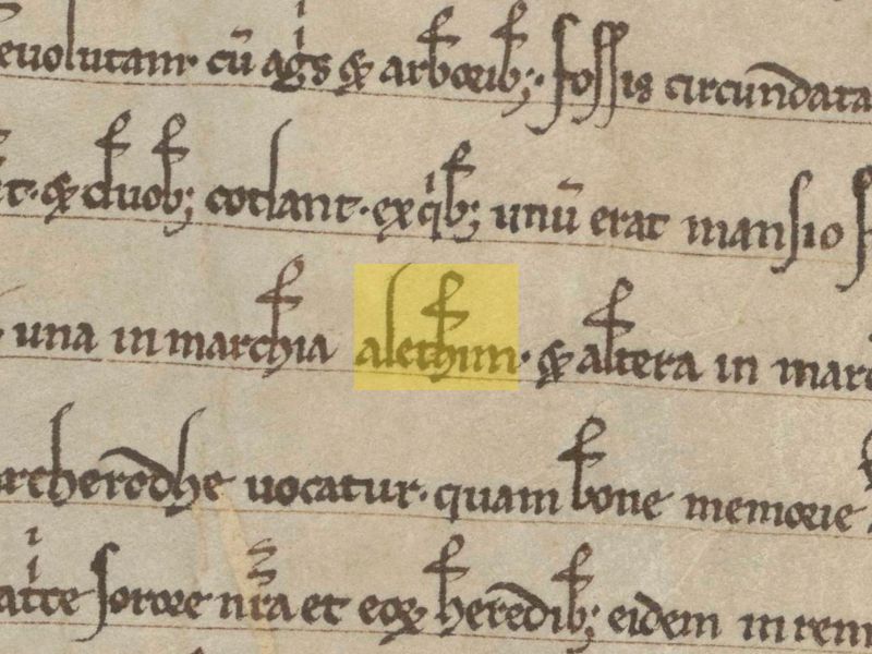
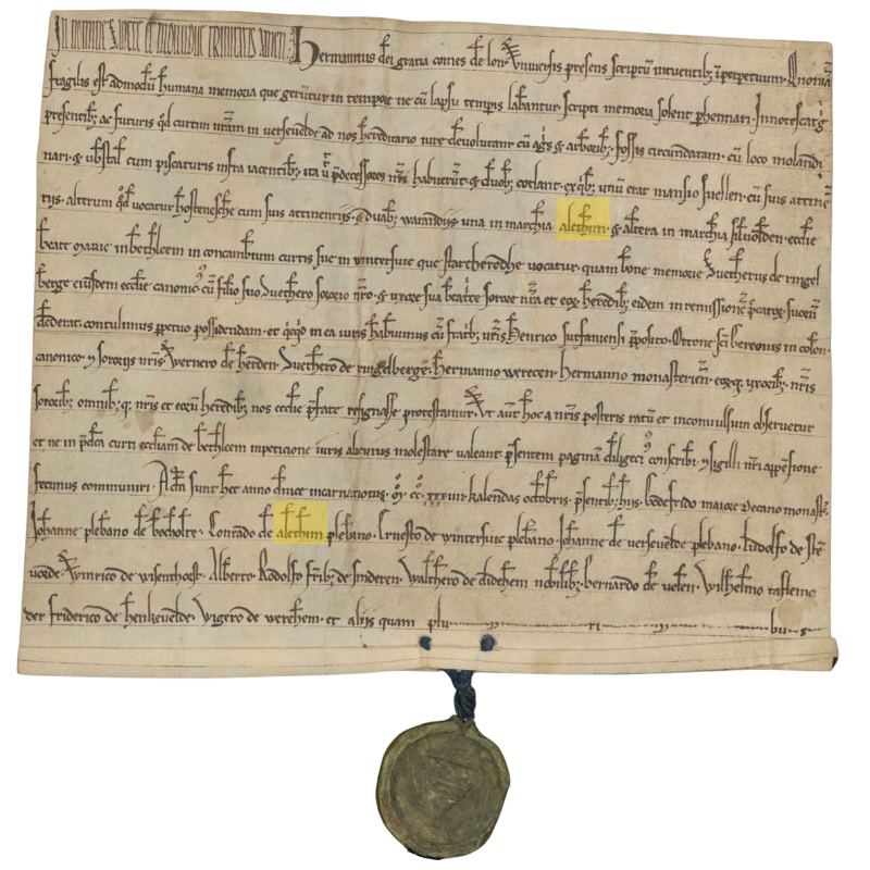
Deed from 1234, in which Aalten is mentioned twice as ‘Alethim’
Earliest mentions
There are several medieval documents containing a reference to Aalten, with varying spellings. The best-known mentions are Aladna and Aladon, after which the Aladnaweg and a school are named. Below is an overview of historical mentions, including a reference to the oldest known source.
828
A charter from 828 describes how a certain Geroward donated all his possessions, including those in Aladna, to the St. Martin’s Church in Utrecht on February 7 of that year. Little is known about Geroward’s identity, but he was presumably a Frankish nobleman in the service of the Carolingian Emperor Louis the Pious, son of Charlemagne.1
1138/ 1139
In 1138 or 1139, Godschalk of Versnevelde (Varsseveld), with the consent of his brother Count Gerhard (II) of Lohn, enters into an exchange agreement with the canons of the St. Mary’s Church in Rees. He transfers an estate in Megchelen near Gendringen, including associated hunting rights, two fields, a meadow, and nine serfsof both sexes. In exchange, he receives a property in Alethnin, with all yields and seven serfs.2
1152
In 1152, Count Godschalk (II) of Lohn, son of Gerhard II, reached a settlement with Bishop Frederick II of Münster. Godschalk claimed authority over the parishes of Lon, Winethereswik, Aladon, Versnevelde, Selehem, and Hengelo on the basis of his comital title. The bishop held a different view, after which it was formally established that Godschalk did not hold these territories in his own right, but was to administer them as a liegeman of the bishop.3
1188
In 1188, during the reign of the Holy Roman Emperor Frederick I, priest Everhardus, chaplain to Count Henry of Dalen and Diepenheim, compiled an inventory of Henry’s feudal (vassal) and allodial (free) possessions. The feudal properties were recorded under the parishes to which they belonged, including Ecberghe, Gronlo, Winterswic, Nehde, Ghesterne, Lochem, Almen, Dotinchem, Zelhem, and Althen.4
1234
In 1234, Count Herman (I) of Lohn, Lord of Bredevoort, together with his brothers Henry, provost of Zutphen, and Otto, canon of St. Gereon in Cologne, as well as his brothers-in-law Werner van Herden, Sweder van Ringelberg, Herman Werecen, Herman van Munster and their spouses, and all their further heirs, entered into an exchange with the Bethlehem Monastery. In this agreement, the monastery receives from the count, among other things: duabus warandiis, una in marchia Alethim et altera in marchia Silvolden (two hunting grounds; one in the mark of Aalten and the other in the mark of Silvolde). Witnesses include the parish priests Johannes from Bocholte, Conradus from Alethim, Ernestus from Winterswic, and Johannes from Versevelde.5
1254
In 1254, mention is made of the “curtis Grevinkhof sita in parochia Alethe“ (the estate Grevinkhof, situated in the parish of Aalten): Gotscalco de Reme receives from Otto van Loon in castle-fief the curtis Grevinkhof in Aalten, with the mill and further appurtenances, with the exception of the timber court. Present here Gerardus Canoninicus “frater domini G. de Reme”.6
1313
In a register of churches belonging to the Diocese of Münster from the year 1313, the following parishes, currently located in the Netherlands, are mentioned: Alten, Dinxperle, Eiberghe, Gheesteren, Grolle, Hengelo, Neede, Seelfwalde, Selehem, Versevelde and Wynterswik.7
1386
Derich Willemssoen van Lyntloe has been granted Varenvelde in parish Alten, sabbato na Briccii ep. (17 November) 1386.8
1409
Derk van Linteloe and his children Derk and Herman, declare to have sold to Johan Rensynck the estate ten Nygenhues, located in the hamlet of Lynteloe under Aelten and held in fief from the Lordship of Borculo, 1409 July 24 (in vigilia beati Jacobi apostoli maioris).9
Toponymy and sound development
Toponymy, or the study of place names, is a branch of linguistics that studies place names and seeks to explain their origins.10 A generally accepted principle within toponymy is that the sound development of a name is more reliable than its spelling, as written mentions in pre-modern times were inconsistent and influenced by scribes, dialects, and time-bound conventions. The sound of a name, by contrast, usually remains more consistent and therefore offers better insight into the original pronunciation and meaning.
Now, we are not toponymists, but when we view the sound development of the earliest mentions of Aalten chronologically, we believe we recognize a pattern:
For a period of four centuries (9th-13th century), these mentions consist of three syllables, starting with ‘ala’ or ‘ale’, followed by a d or t, and in most cases ending with an n. Although the spelling varies, the sound structure remains largely consistent. From the 13th/14th century onwards, we see that the second syllable gradually disappears and that the name corrupts into Althen/Alten/Aelten/Aalten.
Theories on origin and meaning
Below we discuss the best-known theories regarding the origin and meaning of the name Aalten.
Place on a hill
A frequently cited theory states that the name Aalten is derived from the Latin altus, meaning ‘height’. This explanation seems primarily based on the fact that Aalten originated on a hill and the phonetic similarity between altus and Aalten. However, there is no historical or linguistic evidence for this theory. Furthermore, this explanation does not take into account the sound development in the oldest known mentions of the name.
Homestead by the altar
Another theory suggests that Aalten was inhabited around 150 BC by Angles from the area that is now Berkelland. According to this explanation, the name is derived from the Anglian ael (altar, place of sacrifice) and thun (garden, enclosed yard). This would lead to Aelthun, or ‘homestead by the altar.’11 This explanation is also speculative and does not fit the sound pattern of the medieval mentions of the name.
Plant or tree name
In Gelderse plaatsnamen verklaard, Gerald van Berkel states that the name Aalten may be related to a plant or tree name and refers to the Old Norse alað (nourishment, food), aldin (edible tree fruit), or alda (fruit-bearing oak).12 Although there is no direct evidence for this explanation, it does fit the sound pattern of the medieval mentions.
Place by the water
In Prehistorische waternamen Maurits Gysseling suggests that the name Aalten is derived from the Indo-EuropeanAlatanā, meaning “situated in a bend of a stream”.13 In the case of Aalten, this would refer to the Slingebeek. Van Berkel, however, calls this theory far-fetched in Gelderse plaatsnamen verklaard.
Place name researcher Bas Kloens disagrees. In his study on place names and their origins, Valkuilen in de Plaatsnaamkunde, he states that it is actually “abundantly clear” that Aalten, like many other similar place names, owes its name to its location on a watercourse or stream.14
Conclusion
No single theory regarding the origin of the place name Aalten can be supported with hard evidence or completely ruled out. It remains, therefore, largely a matter of speculation. Nevertheless, we lean towards the theories of Gysseling and Kloens, who state that Aalten owes its name to its location on a watercourse, namely the Slingebeek.
Furthermore, despite Van Berkel’s skepticism, a connection with the Indo-European Alatanâ, which bears a strong resemblance to Aladna, seems plausible to us.
In short, although not scientifically proven, our nomination for the most plausible explanation for the origin and meaning of the name Aalten goes to Place by the water / situated in a bend of a stream.
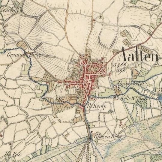
The village of Aalten, situated on a hill by the Slingebeek (fragment of a topographical map from 1845)
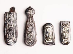
Archaeological finds indicate that the early inhabitants of Aalten were already burying their dead around 800 AD in a burial field on the current Damstraat. During excavation work in the late 19th and early 20th centuries, traces of a Merovingian-Frankish burial field were discovered there. Notable finds, such as spearheads, stirrups, a shield boss, and silver belt links, suggest that a warrior may have been buried here.
On De Hoven, traces of habitation from the same period have been found, consisting of various so-called sunken huts – rectangular pits that served as work or storage spaces. Pottery fragments found here correspond with the finds from the burial field on the Damstraat.
The Christianization of Aalten
Following the subjugation of the Saxons by Charlemagne around 785, the Christianization of Aalten and the surrounding area began. Missionary Liudger, later Bishop of Münster, played a significant role in the founding of churches in the region, presumably including the first church in Aalten.
This church, originally likely a simple wooden chapel, was founded on a strategic and symbolic site: the elevated location where the current Old Helenachurch stands today. This site became the religious and social center of the community.
Archaeological research has shown that the residents of De Hoven abandoned that site around the year 1000. It is possible that, after converting to Christianity, they decided to live closer to the recently founded church to enjoy the protection of the faith. From that time on, the deceased were also presumably buried in and around the church.
Churchyard
A churchyard developed around the church, which played an important role in the life of the community during the Middle Ages. The churchyard in Aalten was originally much larger than the current plot surrounding the Old Helenachurch. It served not only as a burial ground but also as a place for social and religious gatherings. In those days, people even lived around or on the churchyard, often officials such as sextons or clergy who were directly involved with the church.
In recent centuries, skeletal remains have been frequently encountered during excavation work in the ground around the church, such as on the Köstersbulte, the path along Elim, and also on the Kerkstraat, where buildings now stand. The original burial ground around the church was therefore much larger than the current site on which the church stands.
Until the 19th century, the deceased were primarily buried in and around the church. Burial inside the church itself was reserved for people of status, such as clergy, nobles, and benefactors. It was believed that a grave within the church guaranteed a better position in the afterlife. However, most people were buried in the churchyard surrounding the church. Individual tombstones were rare in the Middle Ages; many people were buried in unmarked graves.
Health Risks
However, burial inside the church brought significant problems. A lack of space and the decomposition of bodies led to health risks; churchyards became overcrowded, and the situation became untenable.
Subsidence in the floor occurred regularly within the church, and the owners of the respective graves often failed to carry out the necessary repairs. The odor of decay in the pews near the hole in question was sometimes unbearable for weeks, especially during the summer months.
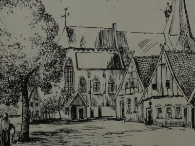
Aalten Market with church and ‘bone hall’, c. 1740 – drawn by Piet te Lintum
Epidemics such as the plague exacerbated this problem. Consequently, a regulation was established stating that churchwardens, in cases of negligence, were permitted to contract out the necessary repairs, whereby the respective plot would revert to the church.
The condition of the burial ground around the church was also often poor. Because burials had not been conducted at a sufficient depth for a long time, bones frequently came to the surface. A bone collector would gather these remains from time to time, for two bushels of rye per year, and cast them into the bone hall (also known as a charnel house), a small building in the churchyard on the Market side. When the supply became too large, it was cleared away.
Royal Decree of 1827
In 1827, King William I decreed by law that, from 1829, cemeteries had to be established outside built-up areas. For many people, this was a major step—to break with all traditions and leave the dead outside the village “just anywhere in the ground.”
The practice of burial in and around the church symbolized an era in which religion, death, and community were closely intertwined. The ban on this practice was a turning point that not only benefited public health but also marked a shift in how death was handled: individual graves were given more space, more funerary monuments appeared, and cemeteries were landscaped.
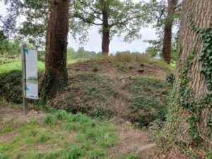
Christiaan Caspar Stumph, Mayor of Aalten since 1811, was annoyed by burials within the village. In 1818, he therefore had an ‘outside cemetery’ created for himself and his family on his estate, Het Smees. His son Abraham Anthony was the first to be buried here, followed by Stumph himself in 1820. In total, seven people rest on this unusual burial mound, which is still visible on the Nannielaantje in Aalten.
Following the royal decree of 1827, a site on the Varsseveldsestraatweg in Aalten was designated as a cemetery. Due to the growth of the village, this cemetery became increasingly enclosed by the early 20th century. In 1923, the Berkenhove cemetery was put into use. Although the Old Cemetery has since taken on the function of a memorial park, it is still sporadically used for the interment of the deceased in existing graves.
When the cemetery on the Varsseveldsestraatweg was established, the Catholic community was given its own section across the street, on the corner with the Molenstraat. This cemetery became full after only thirty years, after which a new Roman Catholic cemetery on the Piet Heinstraat was put into use in 1868. The small old cemetery later took on the function of a public green space.
On the Haartsestraat in Aalten, just outside the village, lies the Jewish cemetery of Aalten. Although the site officially became the property of the Jewish community in 1852, there are indications that the cemetery had been in use since approximately 1820. There are about seventy tombstones on the site, varying in age and design. At the entrance on the Haartsestraat stands a metaheer house, a ritual building used for the cleansing of the deceased according to Jewish traditions.
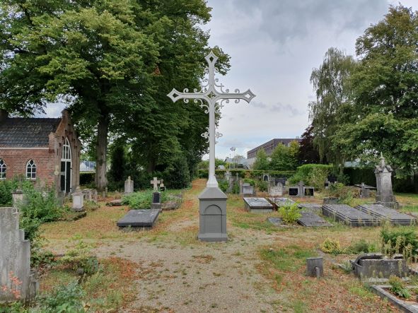
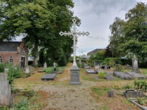
When the Catholic cemetery on the Varsseveldsestraatweg became full, textile manufacturer Anton Driessen donated a piece of land on the current Piet Heinstraat in 1868 to be laid out as a cemetery. He also donated an iron Calvary cross and an iron gate. The bier house dates from 1888. A century later, this cemetery also became full. From 1960 onwards, Catholic deceased were therefore buried in the new Roman Catholic section of the Berkenhove cemetery.
After the Old Cemetery on the Varsseveldsestraatweg became full, the ‘Berkenhove’ cemetery on the Romienendiek was put into use in 1923. The original section is enclosed between the Romienendiek, the Barloseweg, and the Koningsweg. Over the years, the cemetery has been regularly expanded. In 1960, a Catholic section was added because the Roman Catholic cemetery on the Piet Heinstraat was full. A modern funeral center and crematorium are located at Berkenhove.
The Old Cemetery on the Prins Mauritsstraat was established around 1830, simultaneously with the adjacent Jewish Cemetery. The site became available after the dismantling of the fortifications on the eastern side of the town. In 1925, a new entrance gate was installed, and a bier house was built a few years later.
Bredevoort once had two Jewish cemeteries. The oldest was located on the former castle grounds behind Hozenstraat 5. In 1953, this site was sold to the municipality of Aalten for housing construction. The remains and tombstones were then transferred to the second cemetery on the Prins Mauritsstraat.
The Jewish Cemetery on the Prins Mauritsstraat was established around 1830, simultaneously with the adjacent general cemetery. The last Bredevoort Jews to be interred in this cemetery were brother and sister Levi and Sara Sander. Both died in 1938, shortly after one another. The cemetery is not accessible to the public.
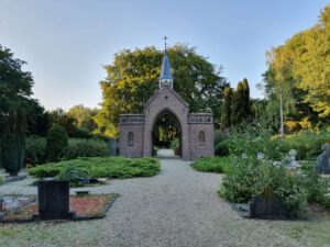
The Kloosterhof cemetery on the Kloosterdijk in Bredevoort was established in 1862-1863 and originally served as a Roman Catholic cemetery. The oldest, centrally located part has a symmetrical layout with a characteristic entrance gate, a bier house, and a Calvary cross. In the 1980s, the cemetery was expanded with a general section. A mortuary was also erected in 1989.
In August 2024, archaeological research was carried out on a site at De Hoven in Aalten, shortly before apartments are built. This research, carried out by members of the antiquities association ADW led by archaeologist Willem Doodeheefver, provided valuable insights into the early medieval history of Aalten.
The finds, which include remains of hut bowls, waste pits and metal objects, offer a unique insight into life around the year 900 AD. Previous excavations in this area, in 1982 and 1892, had already found traces of a so-called Frankish-Merovingian settlement.
Hut bowls
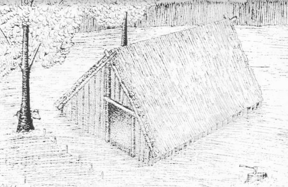
This is what the Aalten hut bowl could have looked like (sketch made by Willem Doodeheefver)
The most striking finds during the excavations in 2024 are the remains of some hut bowls, which became visible due to dark discolorations in the soil. A hut bowl was a half-buried, rectangular building, about three meters wide and four meters long. The pit was 0.5 to 1 meter deep and had no above-ground walls; The roof construction rested partly on ground level. This construction method provided shelter from the summer heat and provided relative warmth in winter.
Hut bowls served as craft rooms, usually on a farmyard. They were used for activities such as weaving, woodworking, metalworking or working bone. Slag was found at one of the hut bowls found at De Hoven, remnants of molten rock. This may indicate that the hut may have served as a blacksmith’s shop.
Waste pits
Several waste pits have been found scattered around the site. The waste left behind by the residents at the time provides valuable information about their daily lives, utensils and the dating of the hut bowls. Among other things, shards of pottery were found in the waste pits, dated around the year 900 AD.
1100 years of habitation
The finds give a picture of the landscape as it looked more than 1100 years ago. A favorable circumstance is that the soil of De Hoven has remained largely untouched during the past thousand years. The name ‘De Hoven’ refers to the gardens that were here for centuries, and the area has remained largely undeveloped to this day.
This and earlier archaeological finds on De Hoven, but also on the Damstraat, confirm that people were already living in Aalten 1100 years ago. This period coincides with a mention of a place that was mentioned in a document from 828 Aladna .
Why this place?
The choice of this place of residence in the early Middle Ages is easy to explain. Aalten is located on seven slopes that were formed in the ice age. De Hoven is located on one of the higher, dry and safe parts. For the residents, it was only a short walk to the Slingebeek, where they could get water and fish. De Hoven is also a stone’s throw from the Landstraat. It is possible that this was already an important traffic route in the Achterhoek at that time, an area that was still quite empty and largely unexplored at the time.
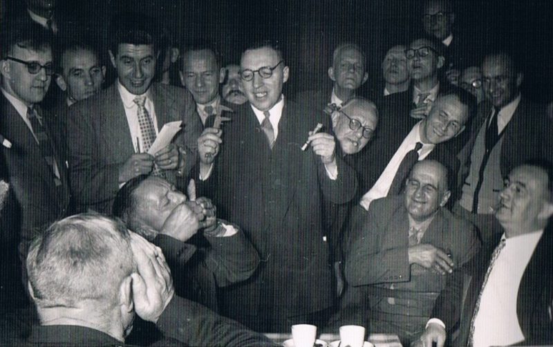
Smoking Competition in Aalten – Photo: Annemieke Klein Hesselink
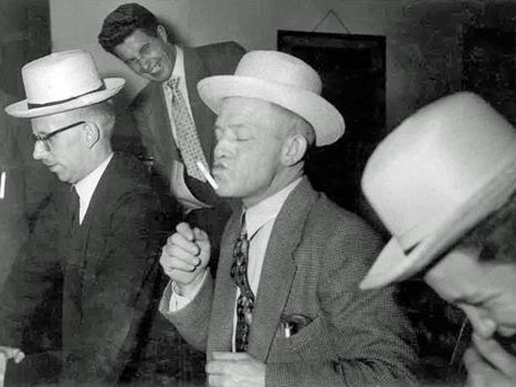
We can hardly imagine it nowadays, but in the last century, competitions were organised in which participants competed against each other in various disciplines related to the smoking of cigars and cigarettes.
The Arnhemsche Courant wrote on 6 March 1908:
In the Catholic circle in Aalten, a smoking competition was held in slow and fast smoking. Mr J. Betting received the first prize for fast smoking, smoking his cigar in 7 minutes, and in slow smoking, the 1st prize was won by H. Weijkamp, who took an hour and 45 minutes over his pipe of tobacco. A useful way to pass the time as well!
In the 1960s, Dick Fries organised smoking competitions in Aalten. On the right, you can see a photo of the “Throwing a cigarette butt in the air and catching it in the mouth” event.
Photo: André Heersink
On 21 March 1961, the Dagblad Tubantia wrote:
Aalten has another smoking champion
Mr E. Jentink, Lintelo 67, became the champion cigar smoker of Aalten on Monday evening, for the time being for a year. He won this title during the annual smoking competition held at the Sociëteit on the Hofstraat. As is known, this competition is about the longest cone of ash on a 110 mm cigar. Mr Jentink managed to produce one of no less than 104 mm, however 1 mm shorter than last year’s champion.
The interest in this smoking festival grows every year and had already grown to over 200 participants yesterday. It went without saying that when the command “fire” was given around half-past eight and the brand was lit in over 200 cigars simultaneously, all were soon shrouded in dense mists.
It cost the participants effort to see how far his neighbour was progressing with the ash cone. It did not take long, however, before exclamations of “Oh, what a shame, I’ve lost it” rang through the hall.
After about an hour, there were only a few left who could be eligible for the championship. Very carefully, an attempt was still made to take one last puff in order to stretch for another millimetre. The result, however, was usually a couple of “glowing” fingers and an avalanche of ash over their clothing.
When the last cone had fallen and the balance could be made, it turned out that Mr Jentink had become champion with 104 mm. Mr A. Pokhuizen occupied second place with a cone of 103 mm. For the third prize, there were two candidates, namely Mr A. Driessen and Mr W. Winkelhorst, each with a cone of 102 mm.
After this battle, the participants were treated to a somewhat “lighter” programme, namely with a performance by Rudi Carell and Dick Harris.
Dagblad Tubantia, 19 March 1963:
Champion smoker produced an ash cone of 100 millimetres
Geert did not have it easy
With an ash cone of exactly 100 mm, Mr G. te Lindert, Lankhofstraat 23, became the champion cigar smoker of Aalten last night. It was certainly not an easy task for Geert, because more than 200 hopefuls competed with him for this title. It was the tenth time in succession that this competition was held.
Great tension and “avalanches”
Little has changed, however, over the course of the years. This was hardly possible, for since the first time this competition was held, this gathering has been at the centre of attention. Only the occasion with which numerous participants enter the fray has grown larger annually. For many, it is no longer a “gamble,” as they practise busily months in advance, and many let their nails grow longer to be able to hold the “butt” for as long as possible.
The sociability of the evening and the tension are certainly no less. From the moment the over 200 cigars go “into the fire,” a deathly silence prevails in the hall. “Shrouded in mists,” the jury members move between the tables to use the callipers where necessary.
“Skew burners” and “curvers” are already plentiful halfway through the competition. Familiar phenomena yesterday were again the avalanches of ash, under which a face, lapel, or jacket were often buried.
Geert te Lindert, a true lover of the cigar, succeeded in bringing the ash cone to 100 mm before it fell. How tense the battle was is proven by the 99½ mm ash cone that his competitor, and last year’s cup holder, Mr D.A. Driessen managed to produce. With a cone of 99 mm, Mr L.C. Rodenburg, who also won prizes last year, took third place.
After this exciting battle, a sociable evening was made of it with the cooperation of Lubbert van Gortel and Kees Schilperoort. The NCRV broadcaster recorded the competition for broadcast in the radio newspaper.
Dagblad Tubantia, 9 March 1965:
Smoking competition was a success
With an ash cone of exactly 100 mm, Mr A. Driessen became the winner on Monday evening of the annual and 12th smoking competition, which was held to great interest in the sociëteit. When the starting signal was given at a quarter to eight, the fire was lit in over 200 substantial cigars at once.
Within a few minutes, the smoke was so thick you could cut it, and the participants could hardly distinguish their neighbour. Of course, that was not necessary, as everyone had enough to do with themselves. Especially when the ash cone increases in length, and then often tends to start pulling askew, no one has any need to interfere with their neighbour’s smoking art.
It becomes different when, after half an hour, the first “victims” see their ash cone fall into pieces with a face of “Oh, what a shame.” Then the dropouts gather in large numbers around the survivors who, often at the cost of a blister and twisting themselves into all sorts of contortions, try to add a few millimetres to the wobbly cone by taking a few more puffs. It becomes deathly quiet in the hall, and the tension can be read on the faces.
So too last night, when all attention was focused on the smoking art of Mr Driessen, who finally succeeded in emerging from the smoke screen as the winner. Last year, he also won the 1st prize. If he succeeds in winning the championship again next year, he will become the definitive owner of the challenge cup.
In second place finished Mr H. Arentsen with a cone of 99½ mm. Mr J. Pluimers came in third place with a cone of 99 mm.
After the smoke screen had cleared somewhat, the participants were treated to a cheerful programme, provided by a cabaret company from Apeldoorn, under the motto: “Lachen is troef” (Laughter is trump).
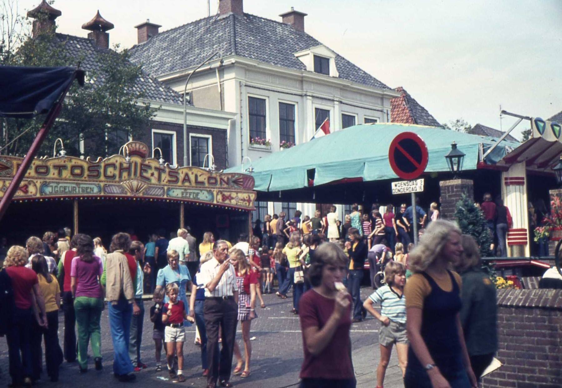
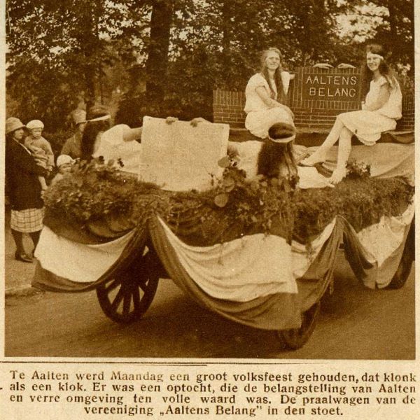
The Aalten Volksfeest is an event that many residents of Aalten look forward to every year. Nowadays, it is celebrated during the third weekend of September. In earlier years, it was also celebrated on other dates. The folk festival is also often referred to as the ‘kermis’ (fair). However, the actual fair, meaning the attractions, is nowadays called the ‘lunapark’.
For many decades, the king shooting and the fair were held on the grounds near the ‘Festival Hall’ / ‘De Pol’. Nowadays, however, these activities take place in the center, primarily on the Markt and the Hoge Blik.1
The oldest mention of the fair in Aalten dates back to 1835. That year, the ‘Geldersche Volks-almanak’ mentioned that the fair in Aalten would take place on October 19. 2
In the ‘Eleventh report on the state and activities of the Dutch association for the abolition of strong drink’, published in 1855, it is written: “the fair in Aalten is insignificant, mostly children’s joy”.3
Volksfeest 1876 – silver medal
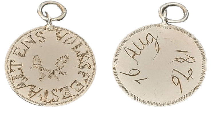
Medals are often a material reminder of an event in the past. This also applies to the small medal depicted here:
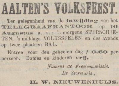
Silver medal Aalten Volksfeest, 1876 (photo: H. Schutte)Zutphensche Courant, August 12, 1876
The medal consists of a silver plate with a diameter of 22 mm, to which an eyelet has been soldered. The front is engraved with the text: AALTENS VOLKSFEEST, with a ribbon surrounded by a border of stripes. On the reverse is the date 16 Aug 1876, within a border of small lines and stripes. The edge of the medal is serrated; the plate is presumably a ground-down coin. It is striking that the engraving was carried out quite amateurishly.
Regarding the occasion for the folk festival, the Zutphensche Courant of August 12, 1876, reports: the opening of the Telegraph Office in Aalten. The precise reason for the production of the medal is unknown; it may have been awarded as a prize during the star shooting. 4
Stichting Volksfeest Aalten
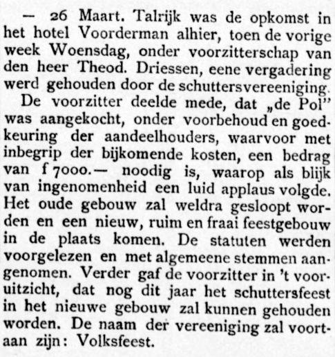
In September 1973, a ‘Volksfeest Committee’ was established, created by the merger of the ‘Festival Hall’, the Schuttersvereniging (Marksmen’s Association), and the Fair Committee. Later, this became the ‘Stichting Volksfeest Aalten’. Ten years later, Wout Delleman (1927), Jan Willem Bilderbeek (1920), and Johan Diederik Beskers (1918) appeared before notary Obbink for the establishment of Stichting Volksfeest Aalten (SVA).
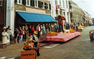
Parade during the Volksfeest in Aalten, 1970s
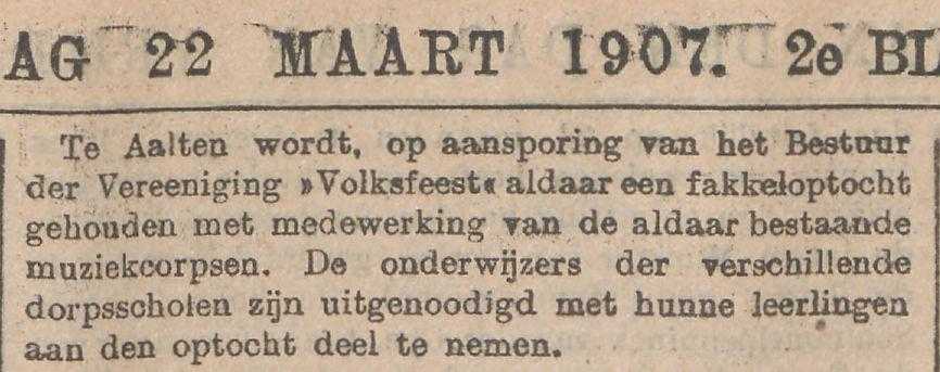
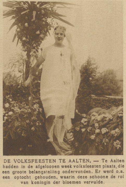
The core activities of Stichting Volksfeest have hardly changed in 50 years. Long before SVA was established, a festival, then called a fair, was organized every year. Children’s games, a lantern parade, king shooting, and the Allegorical parade are traditionally part of the ‘festival for everyone’. The locations have changed several times, and the Volksfeest has also moved from June to the third weekend of September.
Previously, the Volksfeest was held from Thursday to Saturday. Since 2014, Sunday has been added to the program with Frühshoppen.
King Shooting
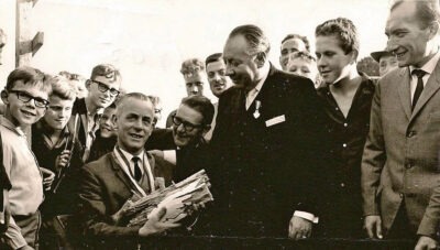
Marksman King Mr. Veldhuis, c. 1965 (photo via H. Schutte)
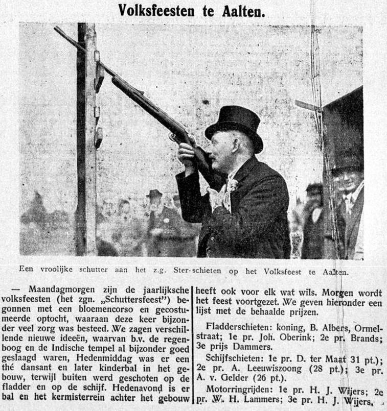
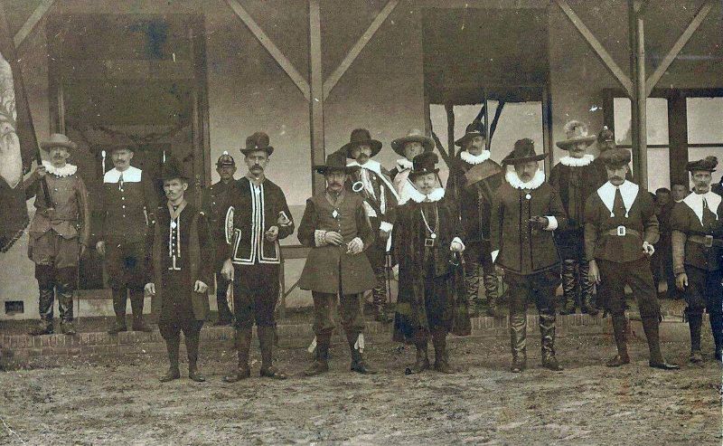
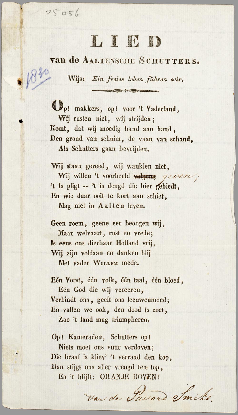
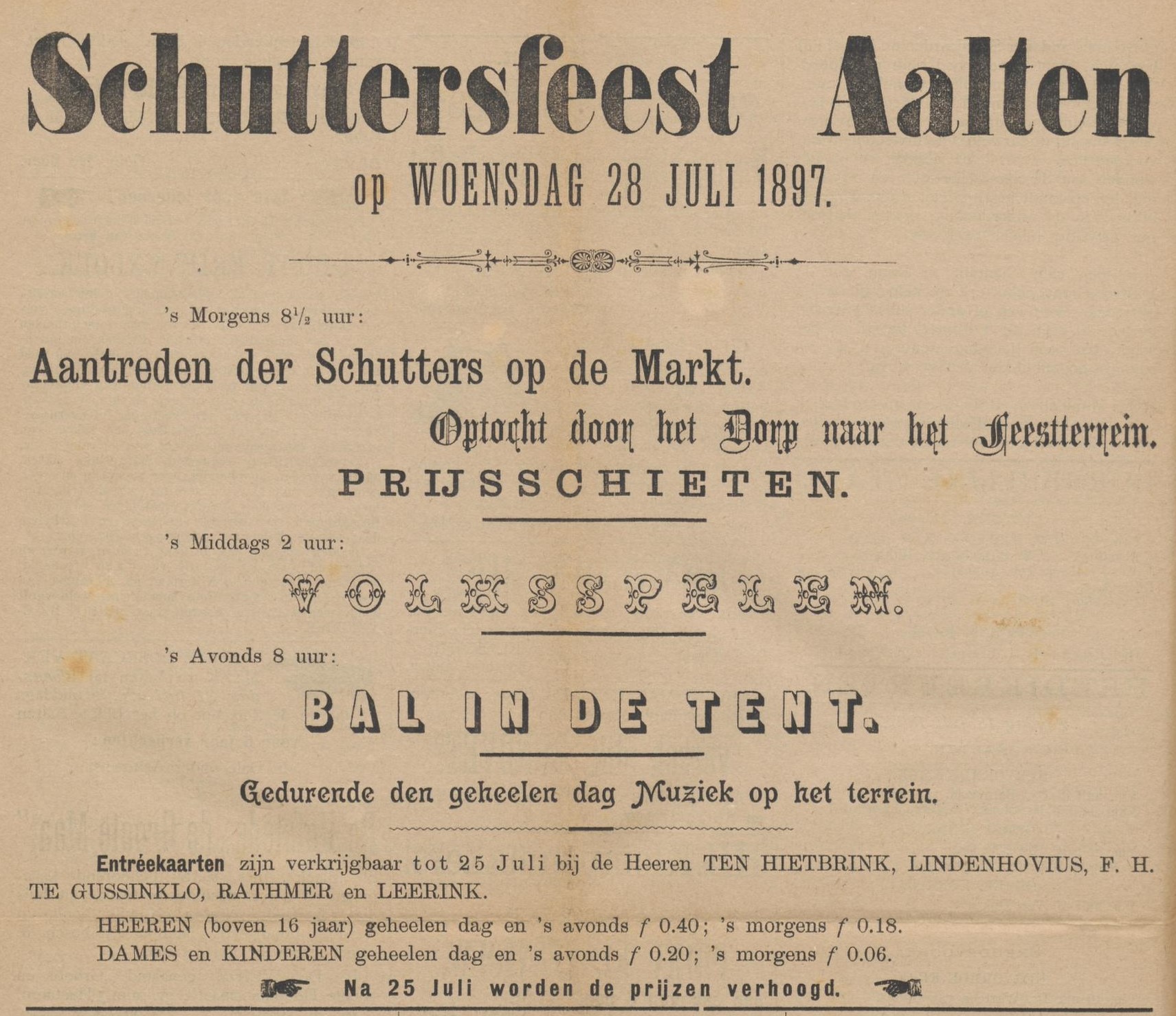
A traditional part of the folk festival is the king shooting or bird shooting. King shooting is an old custom found in large parts of Europe. King shooting originates from the schuttersfeest, the annual festive folk entertainment of the local marksmen’s guild.
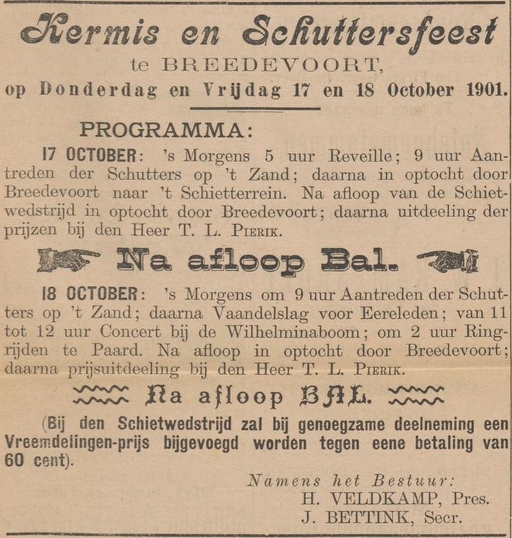
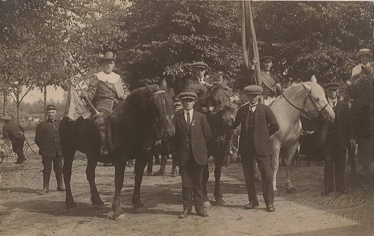
The tradition of king shooting has been known in Aalten since well into the last century. In addition to king shooting, Aalten also had ‘fladder’ and target shooting, and bird clubbing for ladies. Furthermore, at the beginning of the last century, one could also participate in ring tilting on horseback or bicycle.
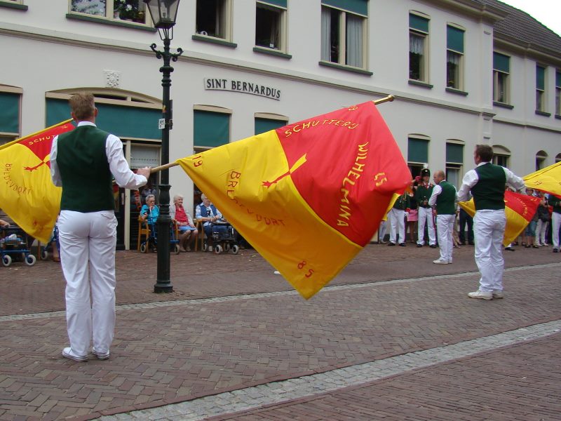
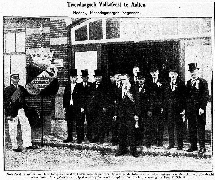
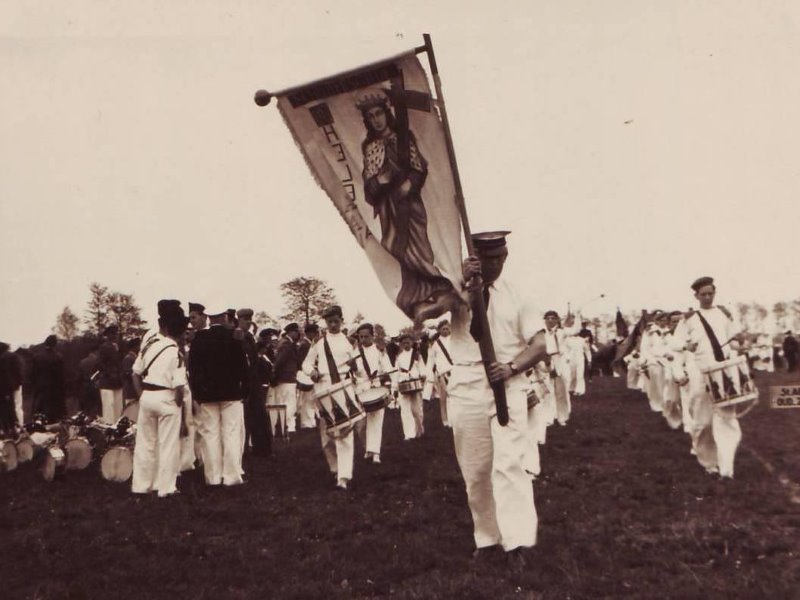
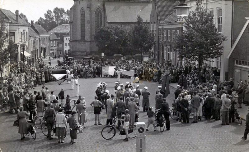
The winners of the shooting competitions on Friday may call themselves king, queen, and youth king/queen of Aalten for a year. The following day, they are driven around in a carriage or cabriolet during the allegorical parade to greet the public. This is followed by the tribute to the flag by the flag wavers of St. Helena on the Markt.
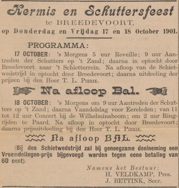
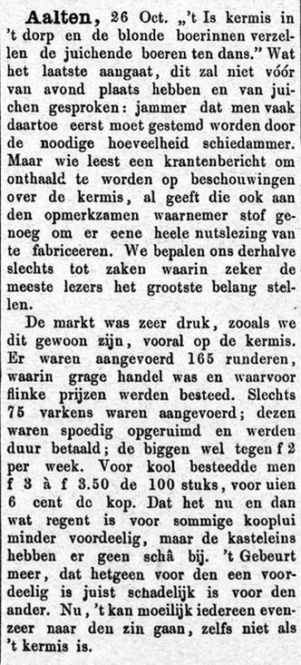
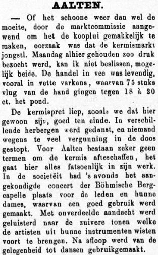
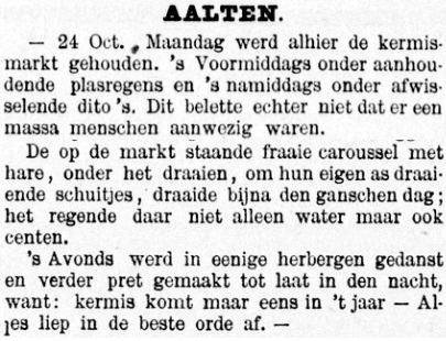
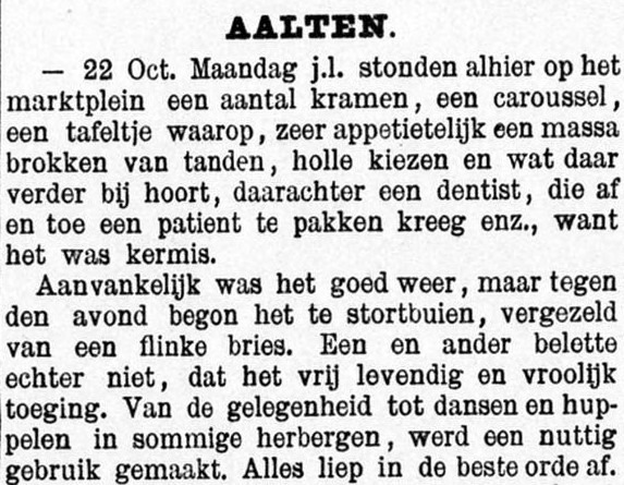
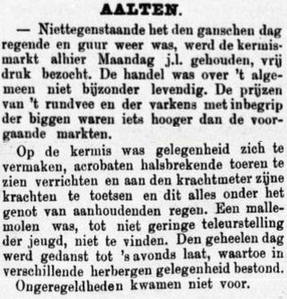
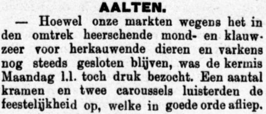
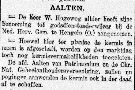
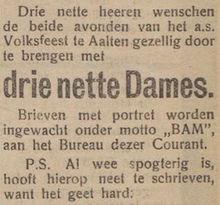
De Graafschapbode, 30 October 1880De Graafschapbode, 20 October 1888De Graafschapbode, 26 October 1889De Graafschapbode, 24 October 1891
De Graafschapbode, 20 October 1894De Graafschapbode, 24 October 1896Aaltensche Courant, 12 October 190122 March 1907De Graafschapbode, 14 November 1908Aaltensche Courant, 15 July 19191927
5 May 19141928Carousel at the fair behind the ‘Festival Hall’, year unknownDe Graafschapbode, 22 July 1930De Graafschapbode, 20 July 1936
Your contribution is welcome! We would appreciate receiving more (historical) information and photographs regarding traveller caravans, families, residential sites, and related matters within the municipality of Aalten. Can you help us? Please comment below or send us a message!
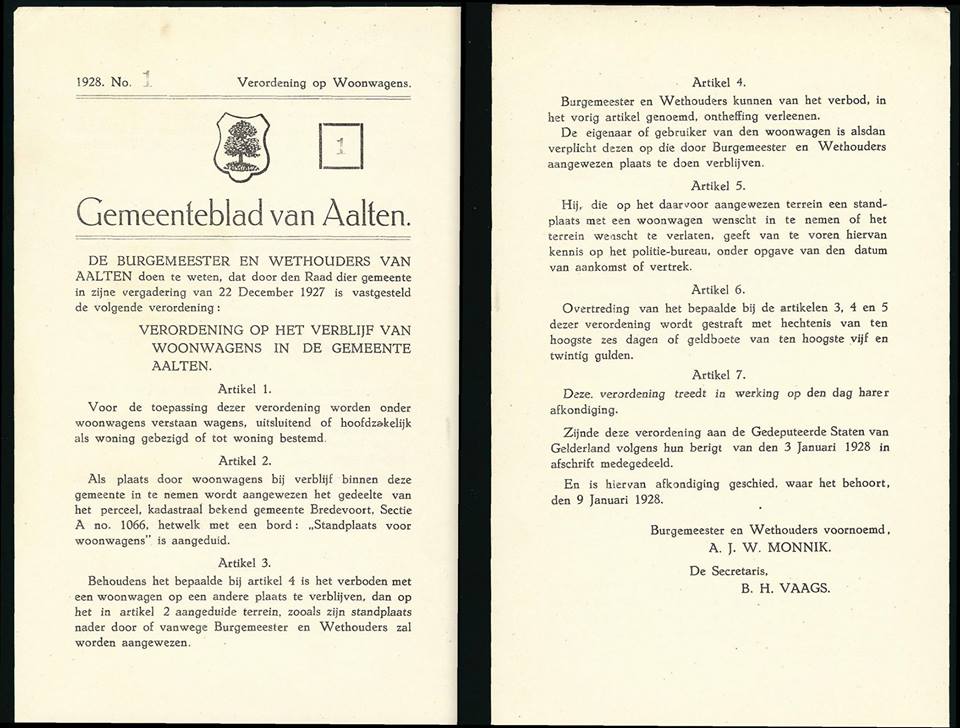
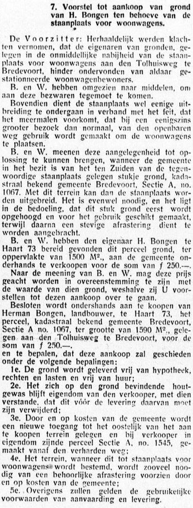
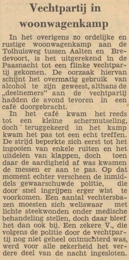
In 1928, the municipality of Aalten published an ‘Ordinance on Caravans’. This designated a site on Tolhuisweg as the only location where caravans were permitted to park.
Ordinance of 22 Dec 1927 regarding the designation of a site for caravans in Bredevoort
World Travellers in Bredevoort
De Graafschapbode, 22 February 1935:
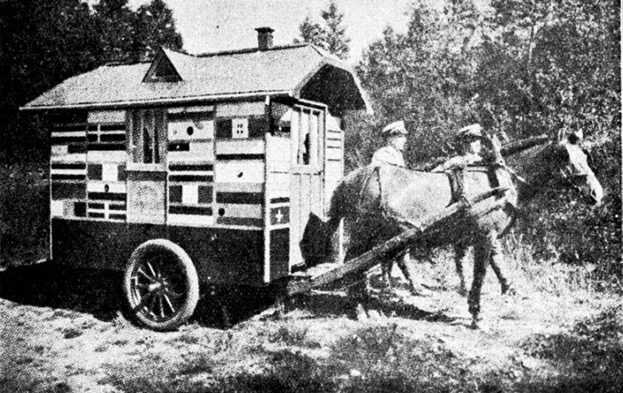
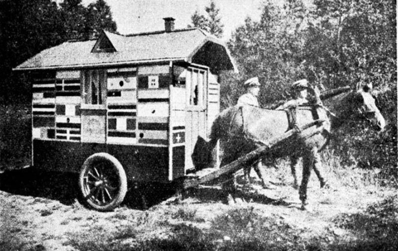
“Our Gelderland Achterhoek region is currently enjoying the honour of a visit from two ‘world travellers’, who are housed in the pictured, very practically and efficiently equipped caravan. In the front section is the sleeping area for the pair, as is understandable primitive in design, yet just sufficient. They provide for their livelihood by selling postcards.
From a chat with the travellers, it emerged that they originate from South Slavia, one of the Balkan states. Since 1928, they have been busy completing their ‘Journey Around the World’. A large part of the mainland of the European continent has already been ‘covered’, while currently, the Dutch—in this case, Achterhoek—soil is the focus of their visit.
The living area in the wagon contains ‘furniture’ of, believe it or not, a table and two chairs. The wall decoration consists of an extensive and certainly noteworthy collection of postcards from almost most countries and larger cities in Europe. To the question: ‘How is travelling here in Holland?’ we received the reply in broken Dutch that it is far preferable here to most other countries. A police officer might come to your bedside at night, but they have had almost no trouble with raids by rowdy youths or, as sometimes happens, from bandits trying to make their move. We also learned that another four years will be needed before the trip can be considered finished as a whole.”
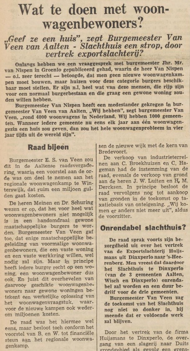
What to do with Travellers?
Graafschapbode, 15 October 1937
Nieuwe Winterswijksche Courant, 21 October 1964
1968 Caravan Act
In 1968, the national government prohibited the nomadic lifestyle of the Traveller community as a result of a new Caravan Act (Woonwagenwet). They were forced to relocate to large, regional caravan sites. On 1 May 1970, the regional camp ‘Dennenoord’ was opened in Winterswijk.
All Traveller families, from Winterswijk to Zevenaar, were obliged to live at this site. The site featured a primary school, a clubhouse, and a scrapyard. There were paved roads, and every caravan had its own toilet.
With the abolition of the Caravan Act in 1999, housing policy for Traveller communities became the responsibility of local municipalities. In the municipality of Aalten, there are currently only a few residential sites for caravans remaining on the Singelweg.
Traveller site, Singelweg, Aalten
Newspaper clippings
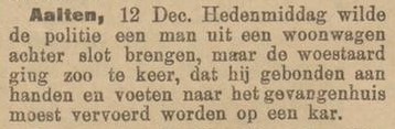
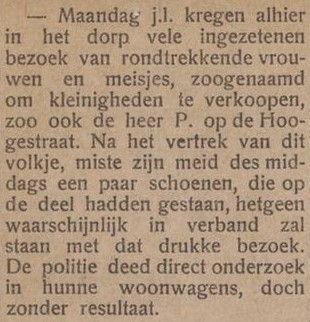
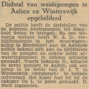
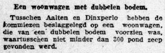
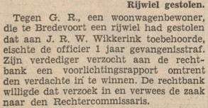
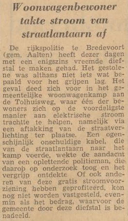
Whenever Traveller families were mentioned in the Aalten news, it was often in a negative context. A search on Delpher yielded, among other things, the following reports:
Zutphensche Courant, 14 December 1904Aaltensche Courant, 23 October 1917Tubantia, 14 November 1951Tubantia, 28 June 1962
Arnhemsche Courant, 9 December 1912Nieuwe Aaltensche Courant, 6 July 1923Graafschapbode, 19 December 1924Tubantia 19 April 1960
De Telegraaf, 5 April 1917Zutphensch Dagblad, 14 April 1947Tubantia, 8 August 1961Tubantia, 19 October 1961
During the final years of the Second World War, many people in hiding (onderduikers) found refuge in the Achterhoek region. Aalten topped the list, with an estimated 2,400 people pursued by the Germans. “The inhabitants were not only devout, but also linked that faith to providing shelter to those who had been driven from their homes.”
Pieter Schaap (84) now lives in a tidy apartment in the centre of Aalten, having purchased the property with his wife, who is nearly 80, several years ago. “We lived a little further away, but the house was too big, and we could no longer keep up with the garden.”
That is not to say that the Aalten resident and his wife are not spry. The couple regularly visits their children in the west of the Netherlands and travels by plane to visit a son in Norway. Pieter’s wife regrets that they can no longer make those trips by car and boat. “You see so much more that way.”
The Aalten resident, distinguished by a thick shock of grey hair, still drives in the Netherlands. Among other things, he delivers meals for Tafeltje Dekje (Meals on Wheels). “But the physical ailments are starting to show. I recently had cataract surgery on one eye, and my hands shake a little; I can no longer write properly. I am considering stopping with the meal deliveries this year.”
Spoiled butter
Sixty-five years ago, Pieter Schaap came to the Achterhoek for the first time. The native of The Hague was forced to report to Winterswijk in late 1942 following a summons from the Germans, who were coercing young men into forced labour. “I reported to Kamp Vosseveld as instructed. It was very German there, very strict. We were allowed to go to church on Sundays, at least.”
Schaap grew up in a Reformed family but later joined the Gereformeerde church. “After the service, the minister invited us for coffee. We were regularly allowed to stay for a meal. They thought we were starving in that camp. That wasn’t true, but as a young guy, you could always manage a bit extra.”
Photo: Jan Ruland van den Brink
He disliked the conditions. “We repaired backroads and replaced sections of railway track. Everything was done by hand. You only had a spade and a wheelbarrow. Meanwhile, you were being drilled. We had to sing all sorts of nasty songs. I didn’t like the regime. I spoke about it, and then the minister said: ‘Why don’t you go into hiding?’ He said he could arrange an address. However, we were being watched closely; there were constant roll calls, making it impossible to escape. Until the moment we were served spoiled butter. That was early 1943; I don’t remember the exact date. Almost everyone had diarrhoea, and there was no roll call. That was when I slipped away. Together with Henk Bossemeijer, a lad from the Alphen aan den Rijn area.”
Pieter and Henk exchanged their uniforms with a family in Winterswijk, donned civilian clothes that had been laid out for them, and boarded the train to Aalten. “The minister had said we would be taken care of. And indeed, we were met by members of the resistance. Through ‘Ome Jan‘, the leader in Aalten, we were given shelter for the night. The next day, we went to ‘t Paske farm in the rural district of Dale.”
Schaap immediately felt that their presence was too much of a burden on the farming family. “The responsibility for two people in hiding was too great. ‘Do you know of another place for one of us?’ I asked. After a few weeks, I was able to go to ‘t Heegt farm in Lintelo, another rural district. There, with the Rensink family, I stayed until the end of the war.”
A hollow above the horse stable
The young man from the west with a technical background was quickly retrained as a farmer. He ploughed and harrowed the land using horses, cleaned stables, and fed the cows. “I even learned to milk, thanks to the family’s eldest daughter, who had just taken a course in it.”
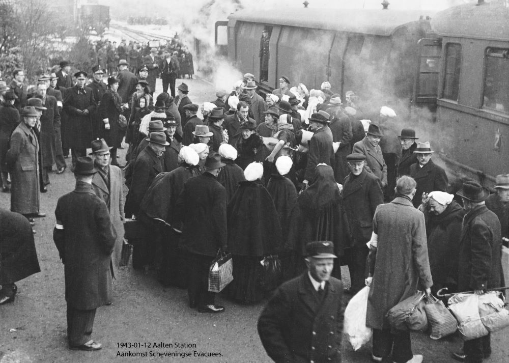
At first, Schaap slept in the opkamer (parlour) of the farmhouse. Later, a group of 500 people from Scheveningen arrived in Aalten, having been driven from their village by the Germans in connection with the construction of the Atlantikwall. Schaap remembers it well. “The Gereformeerde evacuees went to Aalten, while the Hervormde evacuees from Scheveningen went to Winterswijk. That had been agreed upon with the local churches. Some of the Scheveningen evacuees were also offered shelter at ‘t Heegt.”
For the rest of the war, he slept in a hollow above the horse stable. “Above the manger where the horses ate. If I stood on that, I could just reach a small hatch that couldn’t be seen from below. I had a bed there, and some light fell in through a glass roof tile.”
He was not there often. Pieter spent most of his time in the fields. The man in hiding did not find it truly dangerous. “We didn’t have much trouble from the Germans. We did have to watch out for landwachters (Dutch collaborators), but they were always spotted in this area long in advance. I would usually go to a piece of land further away, somewhat hidden behind the trees. Or I would crawl away. I never stayed on the farm if there was trouble.”
A wagon full of crispbread
He stayed at ‘t Heegt for two and a half years, amidst many other people in hiding. Aalten was teeming with them. “There were more and more of them. The Germans also began to notice, and on 30 January 1944, the Westerkerk was surrounded by SS soldiers during a service. A number of people in hiding tried in vain to escape past the organ. The churchgoers were checked and fined if they had left their identity cards at home.”
The story of Gerrit Hoopman (19), a person in hiding, is well-known; in the chaos, he was provided with an outer skirt, a shawl, and a traditional headpiece by a woman from Scheveningen, allowing him to escape the church. That did not apply to a large group of other people in hiding; more than forty men were arrested.
Schaap, a faithful visitor to the Westerkerk, was not there that day. “We felt it was becoming too dangerous, so that Sunday we organised a service in a secret location for one of the first times. We called that the ‘underground church’. We did that at farms, always at different addresses. Often one of the boys would lead the service; sometimes we had a minister.”
Later, German soldiers were billeted at the farm. “They were young boys, paratroopers who no longer had any planes and therefore had to serve in the infantry.” He had little trouble from them. “To them, I belonged to the family. When they requisitioned a horse and wagon from the farmer at one point and gave the command ‘Bauer mit!’ (Farmer, come with us!), I jumped onto the driver’s seat. We headed toward Bocholt, but during a bombing raid, my passengers quickly disappeared—they looked for cover elsewhere. I waited for a while until I saw farmers with horses and wagons driving back and forth from a large warehouse in the area. I went over and said I had been sent to pick something up. I was given a wagon full of knäckebröd (crispbread), ha ha! I drove back with that.”
He was also part of the farming family to others. “All those years, I was ‘Piet van ‘t Heegt’. Some people still know me by that name today. We were recently at a gathering where we met an acquaintance from that time. She lives in Zeeland now. ‘Hey, there’s Piet van ‘t Heegt,’ she said.”
He did not suffer from hunger in the Achterhoek. “Every two weeks, I even sent a large rye bread to my parents. The postman was called ‘the baker’ at their place; he helped distribute the bread.”
Until his retirement, Schaap worked as a technician for the Royal Netherlands Army. His pre-war ideal of becoming a marine engineer did not come to fruition due to the war. In the hamlet, Pieter met his future wife. “She lived a few farms away.” The courtship did not go smoothly, as her father thought she was too young, and after the liberation, Pieter signed up as a volunteer for the Dutch East Indies. Only years later did he return to Aalten, where the farmer’s daughter was still waiting for him. “We have now been married for 56 years. We were truly destined for one another.”
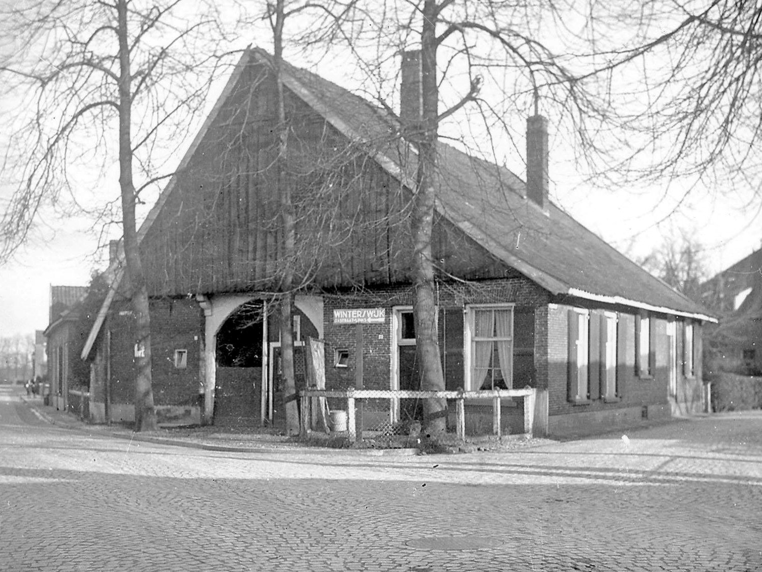
Rond 1960 leefde er in Aalten een vrouwtje met de bijzondere bijnaam ‘Knonnepoetse’. Zij woonde in het Luutenshuus, een eeuwenoude boerderij op de hoek Polstraat/Haartsestraat die in 1962 is afgebroken om plaats te maken voor de doortrekking van de Polstraat.
Op weg naar school daagden kinderen elkaar uit om daar op de ramen te kloppen. Er kwam dan een woedend oud vrouwtje naar buiten gestormd die half Duits sprak. Kinderen waren doodsbang voor haar.
Guste Mina
In de volksmond werd ze ook wel Guste Mina genoemd. Van oorsprong zou ze Poolse zijn en rond de oorlogsperiode uitgeweken naar Duitsland. Ze trouwde met een zekere Koskamp uit Aalten.
Het ‘Luutenshuus’, in 1962 gesloopt
Deze Koskamp was in de oorlog ‘fout’. Hij liep met een geweer om zijn nek rond door het dorp. Dit geweer noemde hij ‘seine Kanone’. Hij poetste zijn geweer dikwijls. Vaak zei hij dan: “Ik moet nog even mijn ‘Kanone’ poetsen”. Na zijn dood hield het vrouwtje er de bijnaam ‘Knonnepoetse’ aan over. De naam was dus oorspronkelijk toebedacht aan haar echtgenoot.
Het echtpaar woonde aanvankelijk op de hoek van de Stationsstraat en de Admiraal de Ruyterstraat in Aalten, in de oude woning van Lurvink. Later is deze woning afgebroken en vestigde zich daar Nijman met zijn tankstation, later tankstation Veneman en tegenwoordig cafetaria ‘De Admiraal’. Het echtpaar Koskamp verhuisde vervolgens naar het Luutenshuus.
Wie was zij?
Haar echte naam was Auguste Koskamp-Schürmann. Zij werd geboren in Sterkrade (D) en in 1919 te Aalten getrouwd met Bernardus Gerhardus Koskamp. Ze woonden omstreeks 1920 in het dorp Aalten op adres A211a, later omgenummerd naar B215a. Vermoedelijk werd dit adres later/tegenwoordig Hogestraat 60a.
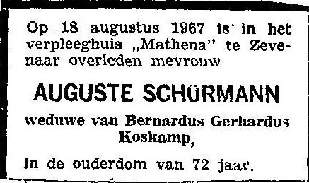
In het Adresboek der gemeente Aalten uit 1967 staat zij vermeld op het adres Polstraat 17a. Op 18 augustus in datzelfde jaar overleed Auguste in een verpleeghuis te Zevenaar. Zij werd begraven bij haar man op begraafplaats Berkenhove.
‘Knonnepoetse’ heeft geen gemakkelijk leven gehad; ze kon snel kwaad worden. De jeugd wist dit en maakte daar misbruik van. Pesten was iets dat in die tijd ook al voorkwam.
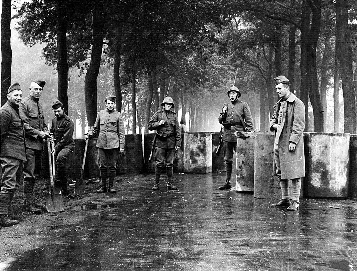
In April 1939, a border guard detachment of 36 men was stationed in Aalten, housed in farms. Sand filled tubes are placed here and there as obstacles. Around 1 September, at the beginning of the Second World War, several hundred residents of Aalten left by train for the various garrison places. On 9 May 1940, the municipal architect was instructed to install barricades on several roads.
On 10 May, German army units thundered into Aalten. The soldiers stationed around farms offer no resistance. A few days later, Dutch prisoners of war are seen being transported to Germany in open trucks. Four people from Aalten are killed at the Grebbeberg. A group of five hundred returned prisoners of war are enthusiastically welcomed in the party building and then travel on by train.
Two hundred and fifty Rotterdam children stayed here in the summer months. This was also the case in 1941. A lot of (young) people go to work in Germany because it earns well. There is already a lot on the coupon. Food production comes under control, for which Aalten is divided into three districts, each under a local office holder.
People in hiding
In the summer of 1942, the first people in hiding came to Aalten to evade the Arbeidseinsatz. Shortly before, the first group of employees of Dutch Button Works in Bredevoort had themselves photographed neatly in their suits with a view to employment in Germany. A group from the Driessen textile factory is also deployed.
About five hundred Scheveningen evacuees found shelter here in January 1943. Almost all of them belong to the Reformed Church. In Winterswijk there are eight hundred, all Reformed. Once every three weeks a Scheveningen pastor stays here who also leads a church service.
Hostages
The Germans increased the pressure to get men to dig. The most intimidating thing was the detention of 12 hostages on October 18. The next day, 550 men leave for Zevenaar. Ten days later, another seven men are taken hostage and 250 people report. The pastors and R.C. clergy had made an appeal to ‘show mercy and charity towards those who are in immediate danger of death’.
By circular, a representative group of municipal residents insists on a repayment scheme. It will come. A pastor in Zevenaar will be there at all times for support and spiritual care. But there is also a clandestine stencil circulating with the call to ask oneself ‘whether it is responsible to cooperate in the enemy’s defences, as a result of which many more than eleven human lives (…) will soon be lost.’
The last months
A few moments from the last three dark months: Individual food collectors keep coming, but a committee ‘Aid to the West’ also manages to collect a few cartloads of mainly grain. Doctor Der Weduwen succeeds in transferring sick people from camp Rees to the emergency hospital in Avondvrede on the Hogestraat. Serious cases go to the hospital set up in the boys’ boarding school in Harreveld. Der Weduwen is killed when his car is shot at from the air.
A drama is taking place around a resistance group that is hiding in the abandoned farm ‘De Bark‘. Close to the door, in ‘Somsenhuus‘, Germans were billeted while seven Allied pilots were in hiding there. The total number of soldiers in Aalten at this time is estimated at about four thousand.
Liberation
In the last days of March, it is clear that the denouement is near. How hard will there be fighting? Many leave the village, others seek protection in their shelter. There were still German soldiers roaming around. Then, on Good Friday, March 30, early in the morning, the English tanks rolled into Aalten from Germany. Here and there, Germans still put up fierce resistance. Ten British were killed on that day, in Barlo seven people were killed in a grenade hit in an air-raid shelter. Sadness and joy, Aalten has been liberated.
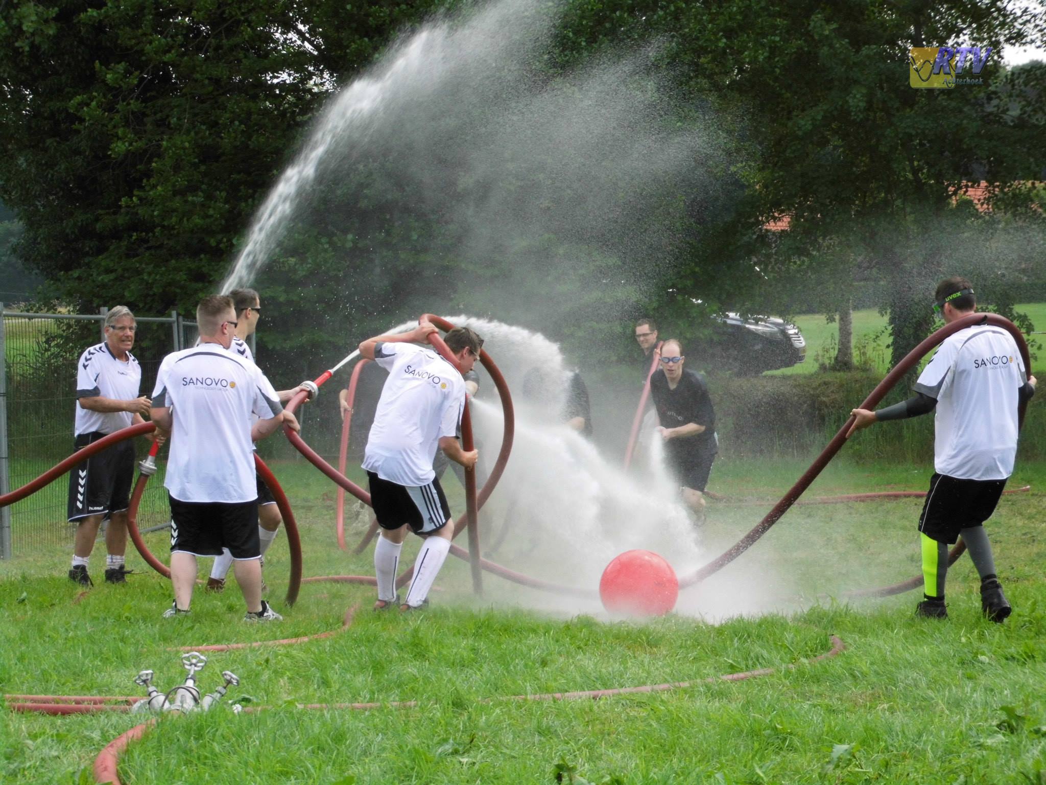
Spuitbal was an annual recurring event organised by the Aalten Fire Brigade from 1981 to 2016. Each year, this water-filled spectacle attracted many participants and spectators.
Game Setup
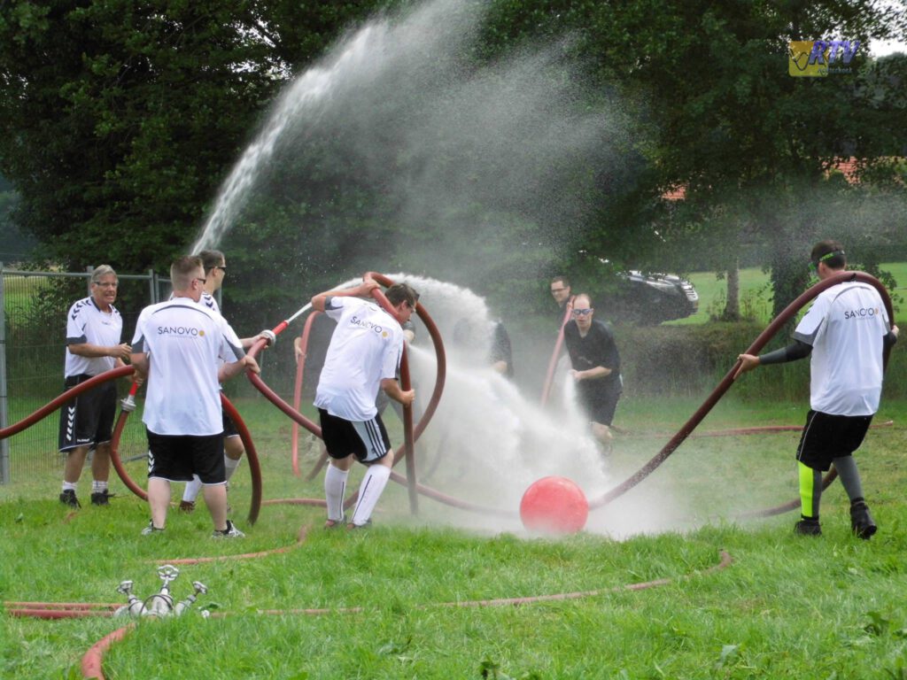
In Spuitbal, two teams of six people competed against each other. Each team operated three fire hoses and tried to push a large ball into the opponents’ goal using powerful jets of water. Each hose was operated by a pair: the front player aimed the jet at the ball, while the rear player had to ensure there were no kinks in the hose. The team that scored the most goals in six minutes won.
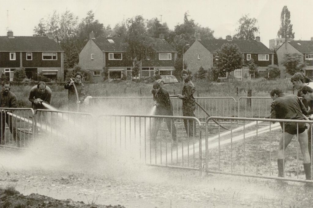
In the early years, the Spuitbal tournament was organised at various locations, including at De Ahof. In later years, the event took place at Camping Lansbulten on the Eskesweg. The necessary water was pumped from the nearby stream.
In 2008, no fewer than six women’s teams and thirty men’s teams took part. Many teams returned every year, such as De Flippers, De Pimpels, De Pollekes, Atlantic, Schiller, ’t Noorden, and Jong Gelre.
The 36th (and, as of yet, final) edition took place in 2016. In 2017, the event was cancelled due to insufficient interest, and it has not returned since.
Spuitbal tournament at De Ahof (photo: Colenbrander family, via Leo van der Linde)
Video
On YouTube, various videos can be found of Spuitbal in Aalten, such as the video below from Jong Gelre from 2012.
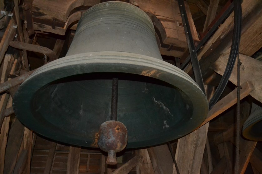
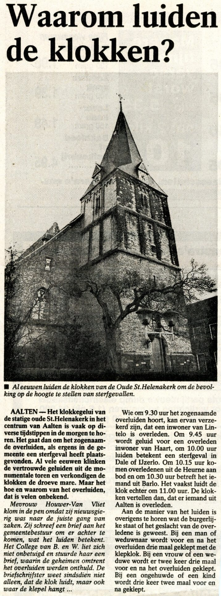
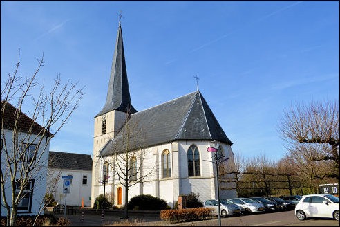
For centuries, the bells of the Oude Sint Helenakerk in Aalten have tolled to inform the population of deaths, the so-called ‘overluiden’.
It frequently occurs that the bells of the Oude Helenakerk are tolled at various times in the morning. In the past, this happened more often than it does today. In former times, almost everyone knew what this signified. Based on the time and the number of strokes, people could deduce in which rural district someone had died, as well as whether it was a child, a woman, or a man, and whether the deceased was married or unmarried.
The custom of tolling the bells when a death has occurred is called ‘overluiden’. For many centuries, the sound of bells has emanated from the monumental tower of the church on weekdays. Many people pause for a moment and think: memento mori.
The bells of the Oude Helenakerk on the Market Square in Aalten are still used for this solemn moment, always in consultation with the next of kin. The ‘overluiden’ can be performed for all deceased persons, not just for members of the Protestant Congregation.
Meaning
If the bells are tolled at 9:30 AM, it concerns a resident of the rural district of Lintelo. If it occurs at 9:45 AM, someone from de Haart has passed away. At 10:00 AM, the bells toll for a death in Dale or IJzerlo, and at 10:15 AM for someone from the Aaltense Heurne. If it concerns someone from Barlo, the time is 10:30 AM. Often the bells toll at 11:00 AM, which signifies the ‘overluiden’ of a deceased person from the village of Aalten.
For a man or widower, the clapper bell is struck three times before and after the tolling. For a woman or widow, the clapper bell is struck twice three times before and after the tolling. For an unmarried person or a child, this occurs three times twice before and after the tolling.
In 2011, Aalten made national headlines due to a remarkable story: a small religious community had settled at the Rensink farm in Lintelo, awaiting the Apocalypse. They called themselves the ‘Wachters van de Nacht’ (Watchers of the Night).
At their farm, they were preparing for survival during the end times. According to them, the Apocalypse would soon arrive with a tsunami, causing large parts of the Netherlands to be submerged underwater. Higher-lying Aalten would, as a result, find itself located on the coast.
Jokers posted satirical videos on YouTube in which Aalten-on-Sea was presented as a sunny seaside resort, where the local retail sector had effortlessly adapted to the demand for beach entertainment. However, according to the Watchers themselves, anyone who ignored their warnings would have to face the consequences. A drowning death awaited them. In the meantime, the Watchers stocked up on large food supplies for the refugees they expected to arrive from the Randstad (the major urban area in the west of the Netherlands).
On 11 April 1996, Aalten was briefly global news. At the Kropveld-Schipstal Aalten (KSA) abattoir, 64,000 British calves were to be culled. This was carried out by order of the Ministry of Agriculture due to the potential contamination with ‘mad cow disease’, or BSE.
Never before in Dutch history had calves been transported to the abattoir with such spectacle as the first 108 head of cattle brought to Aalten from the Veluwe that day. The operation, which was to last six weeks, caused a great stir in the Netherlands and beyond.
For KSA, the slaughter of the 64,000 calves was a massive, and certainly financially attractive, job. The company normally slaughtered 2,000 calves weekly for the Japanese market. Those operations were suspended for six weeks for this special commission, during which approximately 10,000 calves had to be slaughtered per week.
Image: KesselsKramer, Amsterdam
Demonstrations
The lorries in which the animals made their way to the slaughterhouse were escorted by two riot police control vehicles. Upon arrival at KSA, they were met by a crowd of activists and curious onlookers. Members of animal welfare organisations, such as the Vegetarian Association, Lekker Dier, and PETA, had taken up positions at the abattoir fence with banners and sandwich boards. A funeral wreath hung on the metal gate, wooden crosses lay on the street, and the protesters wore black clothing.
As the first three lorry combinations carrying calves approached the iron gate of KSA, the jeering of the crowd swelled. “Murderers, murderers”, chanted a motley mixture of animal rights activists and local teenagers towards the drivers. Half a minute later, the gate slammed shut again. The slaughter could begin.
The private security service hired by the KSA management after a bomb threat had been received at the company the day before ensured that none of the protesters could enter the abattoir grounds. When the gate was closed again, a young PETA sympathiser collapsed and gave free rein to her tears. A group of locals reacted indifferently to the silent grief. Pointing at the piercing the girl had had placed through her lower lip, a corpulent Aalten resident lisped: “A piece of rope through that ring and she wouldn’t look out of place among those calves…”
Press conference
On the day of the arrival of the first British calves, a press centre was set up in café De Driesprong. Mayor Tijme Bouwers presided over the press conference. The municipality of Aalten provided logistical measures to clear the way for the dozens of lorries delivering thousands of calves daily. KSA director H. Swinkels emphasised that stringent safety measures had been taken regarding the potential risks of contamination.
To see for themselves that the slaughter was painless for the animals and, due to the measures taken, risk-free for the staff, journalists were allowed a look inside the abattoir later that afternoon. Wearing special overalls that were destroyed after use, the tour led past the slaughter hall and the specially refrigerated storage silos for the blood. This viscous mass—a total of 450,000 litres—was transported by tanker to Rotterdam to be incinerated. The carcasses were sent daily in sealed containers to companies in Son and the Frisian town of Bergum.
After a number of hectic days, peace returned to Aalten.
The old house in Prinsenstraat, next to the building of the Dutch Protestant Union (Nederlandse Protestantenbond), has been demolished. It was a very old house that had seen a great deal of joy and sorrow. It stood somewhat askew in relation to the street. One corner of the property stood more than half a metre closer to the street than the corner opposite it.
The old house was later extended with an additional storey and demolished in 1989. (Photo: H. ten Dam).
Now, a new building has taken its place. The street has undoubtedly taken on a more attractive appearance due to this redevelopment. The old house was in a state of severe disrepair. It must have stood there for around two centuries and was occupied by the Manschot blacksmith family from the end of the eighteenth century onwards.
Jacob Manschot and his family lived there in Achterstraat, which was then number 193. His wife, Elizabet Arentzen, was a sister of Roelof Arentzen, who later became the assessor of Aalten. Their son Gerrit Willem, born in 1802 and addressed in daily life by his second name, learned the blacksmith’s trade from his father at an early age and subsequently joined his father in the smithy. An older son in the family, Hendrik Jan, who was also a blacksmith, had a smithy elsewhere in the village.1 Then there was also a daughter named Elisabeth.
Double wedding
On 17 December 1833, celebrations took place in the house. Son Willem married Johanna Geertruijt Becking, known simply as Janna. Elisabeth also entered into marriage on that same day, wedding B.D.G. Muller. Muller was a merchant, and his trade was extensive. In addition to drapery and haberdashery, it encompassed grain, paint, hardware, religious books, musical instruments, hay, and straw.
Apart from the Manschot family, the Beckings and Mullers were also related to the most prominent residents, who, as assessors, municipal tax collectors, or “co-judges”, were able to exert a great deal of influence.
Schaars’s inn
Elisabeth left the house on Achterstraat, and Janna moved in with her parents-in-law. It was then number 228. Janna Becking was born on 24 November 1809. She was a daughter of Lourens Becking, a farmer originally from Varsseveld, and Willemina Geertruijd Schaars, the daughter of an Aalten innkeeper. Following his marriage in 1799, Lourens Becking had become the innkeeper there.
Schaars’s inn was located at the beginning of Peperstraat, on the corner of the Markt. It was run by a member of the Schaars family as early as 1748 and currently, after nearly two hundred and fifty years, still serves the very same purpose. Janna grew up there. She would have attended the village school next to the church, where schoolmaster Schotman taught.
Church organists
As mentioned, Jacob Manschot was a blacksmith, but on Sundays, he played the organ during services in the church on the Markt. When the Zelhem congregation had to appoint a new organist in 1829, Jacob was appointed to act as a judge. He had to assess the playing of the three applicants. In his report on the matter, he wrote: “…having given each of them the same Psalm and hymn, it appeared to me that the last to play possesses the greatest aptitude. Done at Zelhem the 24th of July 1829. J. Manschot”.
However, by 1842, he wished to step down, being 73 years old by then. In a petition to King Willem II, he requested that his son Gerrit Willem succeed him as organist. From that time onward, Willem Manschot served as the organist.
The family
Joy and sorrow alternated in the lives of Willem and Janna. Their eldest infant son, Jacob, passed away at the age of two. Their eldest daughter, Louiza, had been born in 1836. Elisabeth (Betje) followed in 1838. Two years later, Willemina Geertruijda (Mina) saw the light of day, and in 1842, a son followed who was again given the name Jacob. In 1844, Hendrika Johanna (Heintje) was born, and in 1847, Hendrik Jan, who was addressed by his second name. The youngest was Barend Johannis in 1850, or Bernard in daily life. Janna’s father had already passed away in 1830, prior to her marriage. Her mother survived her husband by twelve years and died in 1842.
When grandfather Jacob turned 78, his ten-year-old granddaughter Louiza came to him with a poem: “To greet you with my prayers, On this joyful day of today. Day on which it is your birthday, Grandfather, to me so dear and valued! Day on which I must reflect, What Heaven continued to grant me In possessing you, who always Stands by my side so affectionately.” The verse continued for a bit longer, followed by the signature: “Your loving Granddaughter Louiza”.
The girl also composed a poem on the occasion of her mother’s birthday: “Oh what a joy, dear Mother, Since today is your birthday. Grateful to the Preserver of All, I am gladdened on this day.” This daughter also knew how to express her wishes in poetic form for the New Year, composing a “New Year’s Wish to our highly esteemed Grandfather and dear Parents”. She decorated her wishes with borders of vines, flowers, garlands, or ornaments.
The elderly Jacob Manschot passed away in 1850 at the age of 82, after having been a widower for six years. Willem’s brother had also died by that time.
At the time the Manschots lived in Achterstraat, the house had a pointed roof. (Collection: E.M. Smilda).
Willem’s smithy
Willem Manschot dedicated himself diligently to his work in the smithy. For Kobus Prins, he made “a blade for the hoe”. He forged a “haar”, which is a small anvil used to sharpen a scythe or sickle, known as a haarspit. He made a “grepe” (manure fork), repaired the “rear axle of a wagon”, and fitted iron bands around the rims of wagon wheels. He delivered a “knife for cutting bread”, riveted “an iron onto a plate at the hearth”, and manufactured “an oven door” for L. Prins.
In between all these blacksmith duties, Willem also managed his property portfolio of lands and farms, which he leased out. Repairs had to be carried out there from time to time as well. In one place, “4 brass handles with their fittings” were installed; in another, the “latch was repaired, and a new plate bolt with a new catch” was made for the windows.
Sometimes customers paid him in kind, such as Kobus Prins who, for the benefit of Willem’s livestock, collected a few loads of hay from the Ruiterij, the pasture near De Pol. Others transported the harvested rye “from the Esch”. For Willem also ran a small farming operation of his own and owned a barn for his livestock on the opposite side of the street. Like every resident, he kept one or two cows; those of lesser means kept a goat, ‘the poor man’s cow’. In the slaughter month, a home-fattened pig would be hung on a ladder, which a day later was cut into pieces and placed into the salting tub, and even later hung from the kitchen ceiling, the ‘wieme’ (bacon rack). For the daily chores associated with this, he likely employed a farmhand or day labourer. Well-to-do citizens also kept a horse and had a carriage as a means of transport when going visiting.
Horses were no strangers to Willem either. How many had he not provided with new horseshoes in his smithy. Yet on one occasion, this proved fatal to him when he was kicked by a horse. The blow hit very hard. Severely injured, he was placed into his box bed in an unconscious state. His wife nursed him for two weeks, after which he died. Janna had become a widow, the children fatherless, and the church council had to look for a new organist.
The blacksmith and church organist G. Willem Manschot, who died in 1853 following a blow from a horse. (Collection: H. ten Dam).
J.G. (Janna) Manschot-Becking (1809-1892) lived in Achterstraat for nearly sixty years. (Collection: H. ten Dam).
Extensive possessions
Now Janna suddenly stood alone with her seven, still young children. The eldest daughter, Louiza, was only seventeen years old, and little Bernard was just three. Initially, attempts were made to keep the business running with the help of a journeyman, but this proved impossible. Janna was forced to close the smithy.
It was fortunate that there were substantial property holdings. This enabled her to provide for her livelihood from the income they generated, and furthermore, to pay for her children’s education. None of the boys had been in a position to learn the blacksmith’s trade from their father. Consequently, this profession never occurred in the family again.
Since the passing of her husband, Janna kept the accounts for the leased lands and smallholdings. She maintained these records in a folio-sized “Land Lease” (Landhuur) book. In it, the lands were categorised into garden land, arable land, pasture, and uncultivated plots.
Garden land for vegetable plots
By garden land (hofland), Janna meant the relatively small plots situated close to the village that were used as vegetable gardens. In her accounts, she notes the names of plots, some of which are still known today. Most pieces of the garden land were divided into various parcels, and each parcel had its tenant.
There were four parcels on the “Boskerhof”. This may have been near ’t Boske, at the end of Richterinkstraat and on Varsseveldsestraatweg. The plot in “den Kraayenboom” likewise consisted of four parcels. That name is still known today for the land opposite the agricultural school on Lijsterbeslaan. Hendrik Jan Meinen was a tenant for ƒ 3.50, as was Lammert Prange. Willem Kasseler and Lammert Klompenhouwer clearly had a smaller piece, as they paid ƒ 2.00 and ƒ 1.50 respectively. Later, Janna used a garden there herself, as did Willem Huls, Mrs Hoftijzer, and Abraham ten Dam.
Then mention is made of the Knibbelweide, which must have been located on the Kemena. There were six parcels there. The total yield from this was ƒ 14.20 per year, though this had risen to ƒ 19.70 after 1883. Furthermore, there was a parcel in the Paardeweide leased by a man named Laak. The Paardeweide was also located on the Kemena, where the building of the Christian Comprehensive School stands today.
Finally, Janna’s bookkeeping records thirteen parcels of garden land on Het Smees. Gardening there were, among others, Berend Prins, Jan Kappers nicknamed “Hompele”, and Hendrik-Jan Schaapveld. Later tenants included Jan de Wikker, Kris Veldboom, Jan te Hoonte, and “the wife of the Wildeboer”.
The gardens on Het Smees frequently changed tenants. The names of Willem Walvoort, Jan Neerhof, and H.H. ter Beest also appear, the latter later leased to Fles, as well as D.J. Hoitink, G.J. Rots, and Hendrikus te Hennepe.
Until 1862, the garden land generated an annual rental income of ƒ 81.70. From 1863 to 1882, this was leased out through the mediation of notary B.A. Roelvink. The yield was then significantly higher, namely ƒ 98.05. When this notary passed away in 1882, he was succeeded by notary Maitland, but from then on, Janna made the lease agreements herself again. However, the income was then a few guilders less per year.
Not everyone paid their rent on time. It had been agreed that payment would be made on St Martin’s Day, which is 11 November, but some did not bring the money until the following year. Janna sometimes had to wait until May. In a number of cases, when the rental debt kept mounting, the tenancies of those involved were terminated. Some were three years in arrears.
The leased arable land
In addition to garden land, Janna also owned arable land that she leased out. These were often plots of one or more schepelzaad (an old unit of land area) in size. This arable land was located “at the front of the Esch”, by which is meant the plot where the Sonoco factory stands today on Damstraat. On the Smees lay 64.50 ares, and on the Boskeres 55.10 ares. In the Giezenbos “a molderszaad” (another old land measure), furthermore 50.90 ares were located there; the Draaiom arable land was 28.70 ares, which she sold in 1872 to the “Reformed Poor” (Hervormde Armen); the Holland 58 ares; the Neerhoffer Delle 42.50 ares; Smachtschot 65.10 ares, as well as another “molderszaad”. Then mention was made of Langevoren, nine schepelzaad in size, or 1.27.70 ha. Behind the Linde, Janna held more arable land, as well as the Peereboom piece, measuring 38.40 ares, and four pieces of Kempink, five schepelzaad on Prinsenkamp, and another plot located “on the Nes”.
Janna owned several of these lands jointly with her two brothers. Most plots were leased for a sum of money, but a few were also leased against the “third sheaf” (derde garf). This meant that the tenant owed a third of the yield as rent in kind. For the tenant, this had the advantage that if the harvest yielded little, the rent was also less.
The third sheaf concerned the rye crop, while sometimes the landlord/landlady (lessor) was entitled to some fruit from the orchard. In later years, the third sheaf was abolished on “Smachtschot”, which had been leased under those conditions by Lievers. The latter subsequently “bought the sheaves for 8 guilders”.
Janna also made use of services in return on multiple occasions. In 1880, “Derk Hoftijzer brought back a new water bucket from Bocholt”, and a year later, he sowed for her “a schepelzaad of spurrey … a schepelzaad of turnip seed… two schepelzaad of rye… carted soil for a day and two carts”. For all that work, ƒ 7.77 was deducted from the rent.
A certain Heuzinkveld manufactured 23 ells of coarse linen cloth for Janna in 1866. She had likely supplied the flax (or yarn). The service was worth ƒ 2.75, so Heuzinkveld still had to pay the remainder of the rent, being ƒ 1.75.
Pastures
As previously noted, a pasture behind the Pol, called Ruiterij, belonged to the assets of the Manschots. Janna also owned 1.14.84 ha of pasture on the Smees, which was (probably) sold in 1870 for ƒ 1390.00. Another pasture measuring 1.82.40 ha was located on Boterdijk in the Goor, which was also sold in 1870. The proceeds from this were considerably less, namely ƒ 600.00. From the estate of her brother Jan, Janna obtained a pasture “on the Broek”, while she also owned pasture and woodland in the Giezenbos.
Turf and peat land
The woodland and peat lands were not leased out. However, the produce from them could be sold privately or by public tender, such as standing timber. This also occurred with peat lands. The field would first be mown, and the top sod containing reed stubble and roots cut away. These were schadden (peat sods), which were dried and used as fuel. Turf (plaggen) was also cut from the heath-covered plots, which often ended up in the deep litter barn or stable and, mixed with animal excrement, was used as manure on the fields.
Janna owned woodland in the Goor, half of which was owned by her sister-in-law Elisabeth, who was married to Muller. Later, following the death of these parents, the half-ownership passed to the five children, the Muller Heirs.
Then mention is made of two pieces of woodland in the Schaarsheide, of woodland on the Kieftsheide, on the Hollenberg, near the Smeesweide (pine forest, coppice, and heath), and “copses in the Barloschen Esch”, peat land in Varsseveld, and peat sod land in ’t Goor, as well as in “Stapelkamps Bosch”, which she had inherited from her late brother Jan and had to share with her brother H.J. Becking.
In the year 1880, Janna sold ƒ 17.90 worth of turf and peat sods. Shortly beforehand, she had “sold wood to the Prange from Lintelo for 260 Guilders” from one of her smallholdings.
The smallholdings
The property of Janna and partners also included a number of smallholdings. The first mentioned is the Neerhof in Dale, of which D.J. Neerhof was the tenant. The tenancy was terminated in 1866 when the farm was sold.
Then there is the Lubbers smallholding in Barlo (Meinenweg), which was initially leased to J.H. Lubbers, but from 1867 to G.J. Mierdink for “sixty guilders and 96 eggs”. In 1877, the farm was sold to the tenant for ƒ 13,370.00.
Next is the Pennings smallholding (Hofstedeweg). Gerrit Jan Pennings is the tenant, who must yield annually for it “the sum of 48 guilders, 8 rent chickens, 96 eggs, and 4 pounds of flax”. In 1872, Pennings “departed for America”, and the farm was leased to Roelof Somsen for “56 guilders and 96 eggs”. Every now and then, Somsen performed services in return by collecting peat sods for Johanna, earning him ƒ 7.65, which was deducted from the rent.
The Slaa in the Heurne was also, together with her brothers, part of Janna’s property. Until 1868, G.J. Huitink was the tenant, followed by Jan de Breukelaar “Who must pay annually 40 Guilders and 60 eggs”. From 1880, the Slaa was leased to Wensink, who had to put down ƒ 48.00 and sixty eggs for it. In those years, Janna also notes: “sold a calf to Wensink for ƒ 5.50”.
Then there is the Slaa Schoppe, which was leased from 1852 to 1867 by J. Weggelaar, and thereafter by Evert Jan Beernink. The rent was ƒ 20.00. In 1874, Beernink scutched flax for Janna, which earned him 75 cents.
When her brother Jan died childless, he left Janna shares in three smallholdings, namely “Brijzak”, leased by farmer Smees, and “De Scheper” on the Haart, which was leased to Hendrik Jan Rensink for ƒ 65.00. This farm was sold in 1890, however. The third smallholding is Bekker on the Haart, which was leased for ƒ 40.00. This farm was also sold and, together with De Scheper, fetched ƒ 12,600.00. Finally, the Grevengoed in Barlo is mentioned, which consisted mainly of arable land. It must have been a large estate, located “next to Zwietink” and “near Wolterink“, thus on the Markerinkdijk.
In conclusion
Finally, a few notes on Janna’s children. Mina married J.G.H. Martens in Eibergen. She was widowed early and later, with those of her children who were still at home, moved back in with her mother on Achterstraat, after recovering over a period of six years from a nervous breakdown brought on by the death of her husband followed by that of her two youngest children.
After her mother’s passing, she moved to a property on the Markt, currently number 12. Louiza married Hendrik Beukenhorst, a goldsmith and silversmith in Winterswijk. At the same time, Betje also entered into marriage, wedding Abraham ten Dam, who later became a comb manufacturer. Her son Jacob suffered a very deep depression, presumably as a result of unrequited love, for which he had to be admitted to an institution in Zutphen for many years. He died unmarried in 1873. His brother Jan became a doctor in Winterswijk and married A.G. Tenkink of “Meenk” in Miste. Daughter Heintje became the wife of her second cousin B.H. Becking, who owned a ham smokery and wholesaled salt. He was consequently known as “Salt-Becking”.
The youngest son, Bernard, managed the Ten Dam & Manschot comb factory alongside his brother-in-law. He had a house built on Bredevoortsestraat, currently number 51. The Ten Dams lived across the street at number 40.
Janna continued to live on Achterstraat until her death and passed away on 22 January 1892. She was 82 years old.
The above is a summary adaptation of a family chronicle, derived in large part from the “Land Lease Book”, compiled by Henk ten Dam in Zwolle, entitled “Johanna Geertruyt Manschot-Beckings Landhuurboek vertelt (1799-1892)”, volumes I and II, 1985, available for consultation in the archives of the municipality of Aalten.
This appears to be incorrect. Gerrit Willem’s older brother Hendrik Jan (*1799) did indeed also become a blacksmith, but he died a bachelor in 1839 in the house on Prinsenstraat, which was then number 228 (sources: ecal.nu and wiewaswie.nl). There was, however, another blacksmith named Hendrik Jan Manschot who lived on Kerkstraat, but he was a brother of Jacob and thus an uncle of Gerrit Willem. ↩︎
Colossal pillars support the vault of the Dutch Reformed St. Helena Church in Aalten, which effortlessly dominates the village center with its gigantic size. Sexton A.J. Heusinkveld leads me to the choir section and points to the ceiling paintings high above him. I see Mary with the Child, the head of Christ, angels, kings, and a representation of the Holy Spirit. They do not connect seamlessly.
Large patches of white interrupt the paintings, which were discovered and exposed around 1900 and, according to Heusinkveld, were applied in 1471. He points upward again: “Look, it may say 1411 there, but do not let that mislead you. The man who painted that was probably drunk at the time and painted a ‘1’ instead of a ‘7’. At least, that is what my predecessor always used to say.”
Old St. Helena Church, Aalten
Last Judgment
At the end of November last year, the centuries-old paintings on the wall of the Consistory were also uncovered and restored. They depict the Last Judgment, and it is quite a sight: angels lead the righteous to Jerusalem, while the wicked among us are taken to purgatory. Some are already sweating there in enormous iron cooking pots.
The church, featuring beautiful chandeliers, is packed with pews. “On Sundays — when we have three services — these are often all occupied,” says the sexton. “There is room for 1,000 people. Indeed, with three Reformed churches, one Roman Catholic church, our Dutch Reformed church, and a synagogue, many believers live in Aalten. Our village is also known as the Jerusalem of the Achterhoek.”“It is sometimes more than full here,” agrees Evert Smilda, chairman of the Aalten Antiquities Society, who is showing me around. “I was once running a bit late and asked the man by the aisle to move over a little. He did so, but with reluctance. ‘We are frugal with shifting,’ he said.”
Calling the sexton
The building, founded in 1100 and later altered in Gothic style, is open for viewing. Anyone who calls the sexton — 05437-72896 — or knocks on his door at Kerkstraat 2, will be assisted. “As long as people do not call me during dinner.” Aalten (11,000 inhabitants) is quite a pleasant village, with a Market square crowded with cars that was the first in Gelderland to be declared a protected village view. The square owes this primarily to the St. Helena Church and two old buildings that now form the town hall, with a rather unexciting piece of new construction next to it.
Old in years is Restaurant Stegers across the street. A centuries-old stone, originally part of the facade, is built into the terrace wall by the sidewalk. A deer can be vaguely seen standing on its hind legs. A word of 26 letters accompanies it. No one knows what it means. “We are facing the mystery of Aalten here,” says Smilda. “We do know, however, that such a standing deer was a symbol for the administration of justice. Well, justice may have been administered here in the inn in the past.” We continue through the village (a true regional center) with several old buildings such as Huize Ahof and the beautiful 19th-century mansion (now a guesthouse) Beekhuize.
The 18th-century Freriksschure behind the Frerikshuus museum is one of the few preserved farmhouses in the center of Aalten. Those who walk past it will soon find themselves on the car-plagued Market square, with the impressive Dutch Reformed St. Helena Church. (Photo Peter Drent bv)
Frerikshuus
Finally, we arrive at the fascinating Frerikshuus museum on the Market square, which is filled with everyday objects: costumes, silverware, porcelain, and much more. One room is entirely dedicated to the horn industry, which occupied a unique position here for a century until the 1970s. Beautiful pipes, combs, and whatever else could be made from buffalo horns can be seen there.
In the large barn behind the beautiful house, various crafts are depicted, such as wheel-making. The museum is currently open on Mondays, Wednesdays, and Fridays from 2:00 PM to 5:00 PM. From March 31 to May 12, there is a special exhibition about the occupation and the liberation. Many people in hiding successfully sought refuge here in Aalten during World War II.
The village lies within the eternal charm of the Gelderse Achterhoek, with plenty of woods, thickets, enclosed fields and meadows, and quiet lanes.
Bredevoort
Two kilometers from Aalten lies the thousand times more beautiful town of Bredevoort, with its tower mill beckoning from afar, its ancient St. George’s Church, its quiet streets, its endearing old buildings, and its sense of nostalgia. At the last moment, I renew my acquaintance with baker Ben Helmink, the chairman of the local tourist office (VVV), who tells me that restoration work is still ongoing. “Huize St. Bernardus”, he says, “that large building from 1764 on our square ‘t Zand, has just been completed. You won’t believe your eyes. It is truly beautiful now. And so dignified! Bredevoort becomes more beautiful every year. That is it.”
Aalten has a large number of farms with their own names. In the 1967 address book of the municipality of Aalten, about 480 are mentioned. Almost all of these names are unique. To avoid confusion, it was logical to give a farm a name that did not yet exist. However, one finds, for example, the Oude Loo and the Nieuwe Loo, Groot Kampe and Klein Kampe, even ‘t Paske, Groot Paske, Klein Paske and Nieuw Paske. These are often farms that previously formed a single homestead but were split into parts during division among children. Names with “Olde” or “Oude” then point to the original house.
When one examines those names, an interesting discovery is made. They can be divided into different groups. For instance, there is a group of names from which one can deduce what the vegetation around the yard used to be like and in what kind of environment the farm was established. Another group points to the trade that was practiced there in the past alongside agriculture and livestock farming. Many farmers, and especially the small-scale ones, had enough time to do something on the side to earn a bit extra, which was often necessary.
The practice of giving names to farms is very old. In the verpondingskohier (tax register) of 1647/50, the persons who had to pay the ‘verponding’ (a land tax) are recorded under Aalten, as well as under Bredevoort. But under the rural districts, the names of the farms are mentioned, followed by the names of the residents. Thus, we have a list of homesteads that existed at that time. Many of the current names already appear in it.
One must possess a very great imagination to be able to picture what the Aalten landscape looked like centuries ago. Nine-tenths of the land consisted of heath, forest, and swamp. The cultivable area was small and was only used for growing vegetables and a few cereal crops. Most farms were small: ‘stedekes’. Division of the common lands, artificial fertilizer, and better drainage put an end to the ‘prange’ and ‘marode’ (hardship and misery) of the farmer.
The following names require an explanation: Bokkel, called Buclo in 1284, beech forest. The Walfort was previously called the Waldenvort, a ford (through the Slinge) near the Wald (the forest). Similarly, Walvoort on the Haart, with a ford through the Keizersbeek.
’t Olde Brusse, Lintelo
The name Voorst (from forestis) was used for a forest in which hunting was not allowed; it was the private hunting ground of the king or the lord. The site of the Snoeijenbos was cleared in the forest. Brusse is formed from: Brusch, brushwood, ‘t Hagt and the Heegt: forest of low wood, perhaps consisting of hawthorn bushes.
The Slehegge may recall the blackthorn, ‘t Heggeltje: a small ‘hagt’. The Hakstege was located on a narrow path (stege) through the ‘hagt’. The Rieste owes its name to the brushwood (rijshout). The Heisterkamp was established on a site where much brushwood grew.
In 1386, the name Varenvelde appears, and later also the Verrevelt, which is now the Vervelde. The Veernhof also originated in a field full of ferns. The Tente owes its name to the ‘tente’, the common tansy. The Greute recalls the ‘gruit’, the bog myrtle, with which beer was fermented and which grew on marshy ground, as did the reed, which is found in the name the Riete. Waste uncultivated land, ‘vage’, is found in Vaags.
One should not have a grand conception of these heights. An elevation of half a meter was already called a ‘bult’, a ‘horst’, or a ‘heuvel’. These heights offered no protection whatsoever against the damp environment. The houses were very damp.
Names like De Bulte, Bultink and De Heuvel speak for themselves. De Brink (brinc) was a grass-covered elevation. De Bree (from bride) is considered a field on the ‘es’ (open field). Drenthel (originally Drenthelo): forest on an elevation. Haartman and Haartelink: a ‘haart’ is a high-lying heathland. Hengeveld (heng, slope), Hillen (hil, hill), Hoopman, the Klinke (hilly heathland with puddles and pools here and there).
De Horst (an elevation covered with low wood), Leemhorst, Seinhorst, Stokhorst and Winkelhorst. Leeland (lee, hill, also a place of judgment), the Limbarg (loam mountain?). De Pol: a small sand hill that stood out like an island above the surroundings. Pikpolle (pec, poverty): a meager hut on a ‘pol’.
Tammel (in 1384 Tanbulen): pine forest on a ‘bult’? Hondorp: village, mound, elevation the size of a ‘hont’, a unit of area. The Westendorp also points to an elevation. Wierkamp: ‘wier’, ‘wierde’, elevation protruding above a wet environment.
Farms located in or near a swamp
The largest part of the municipality of Aalten used to be swamp. Only the Bocholt–Vragender ridge protruded above the marshes. These ‘broeken’ (marshlands) were created because the small rivers the Slinge, the Zilverbeekje, and the Keizersbeek could not sufficiently drain the water. That is why so many farms have a swamp name, such as Goorhuis, Goorman, Goorzicht, Moorveld, the Stroete (marshy wasteland), Veenemaat, Groot and Klein Veenhuis, ‘t Veentje, Wijnveen (‘winne’ farm, farm in the peat), Hagenbroek (a marshland with hawthorn bushes), Kortenbroek (a marshland with short grass and therefore infertile land), the Woerd (woert, low-lying land).
Bolandsweide (bol, soft, marshy, mud). The Nonhof (in 1281 den Honhof) and the Hennepe (in 1284 Honepe), both names formed from “hoen” and “huun”. Luiten, popularly Luten, was low-lying poor land, ‘lute’, while Maris represented much the same: swamp. Glieuwe: ‘gliede’, black shiny soil, peat. Somsenhuus: ‘somp’, marshy land. Pietenpol (in 1640 Pytenpoel): ‘pitte’, pit, hollow, thus a pool in a low place, De Put (hollow, pool. ‘t Slaa: ‘slade’, heath pool, swamp. Te Sligte (in 1384 Schlichte): flat swamp. Mager: poor, meager land. The Navis possessed a damp meadow; ‘nate’, wet and ‘vis’, Wisch, ‘wiese’, meadow. Near Amerongen, the medieval residential tower the Matewisch still stands.
Pietenpol, Haart
Camp names
Stapelkamp, Heurne
A number of names end in -kamp. Originally, the ‘kampen’ were small pieces of land that had been cleared of brushwood and trees in the forests, thus reclaimed forest. Later, the word ‘kamp’ acquired the meaning of field.
Only a few names recall the reclamation of wastelands. Nijland, Nijveld, Nijhof, Nieuwkamp, Nieuwe Weide. The Bijvanck, what was ‘caught’ or taken additionally. Te Brake also points to reclamation, the ‘breaking’ of the wasteland. Ruwhof: ‘rude’, ‘rode’, reclaimed land.
Farms that recall passes, gates, tolls, etc.
A ‘pas’ is a passage in a ‘landweer’ (defensive earthwork), a wooded bank. The resident of the nearby farm had to ‘oppassen’ (watch out), supervise the persons entering. Such a farm sometimes bore the name “Pasop”. Along the Romienendiek, for example, lie the Paske, the Pasop and the Paskerhut: the residents had to keep an eye on the persons who entered the ‘marke’ (common land) through the Wolboom and the Zwarte Veen. On the border with the Varsseveld area near the Varsseveldseweg, there is also a Pas. On the Varsseveld side, the Loerdijk and the Kijkuit are located here. The ‘marken’ were well protected.
Among those who also had to take the ‘marke’ under their care was the resident of the Markerink, formerly called March-ward-inck. A ‘werde’ was a watch post, a place where one had to supervise the intruding unsavory elements. A similar activity was expected of the Ligterink, which in 1435 was called Licht-werd-inck: the watching apparently felt rather light there. The duty of keeping watch also lay with the Kuier and the Kuierman: ‘koeren’, ‘kuren’ meant “looking out”.
Did the ‘schutte’, who had to seize (schutten) the livestock from another ‘marke’ that had intruded into their own ‘marke’, live on the Schuttenkamp, and did such a person also live on the Man-schot-weide? Recalling the tolls are Slotboom, the Stokkert, ‘t Bonte Hek, Klaphekke, ‘t Tolhuis, Tolkamp and Tolder (toll collector).
Memories of the church
De Pater, ‘t Klooster (named after the Schaer monastery), Kerkhof (a farm of the church), Kerkkamp, Neerhof (den Heerhof, inhabited by the monks), De Kloeze, hermit, perhaps also Klaus. Kosters custerie: the proceeds of this property were for the sexton.
Beestman (herdsman), the Scheper (shepherd), Sweenen (swineherd), Fukker (breeder), Peerdeboer (horse farmer), ‘t Villeken (where dead animals were skinned and the hides were tanned), Baten (‘beten’, the tanning of hides). The Brasse (brewery), Pakkebier (‘backe’, also brewery), Schenk (public house, tavern) and Slikkertap (a tap in the ‘slik’, swamp).
Brethouwer (should we interpret ‘bret’ here in the sense of board, thus someone who made boards?), the Klumper and Klompenhouwer (‘houwen’ is chopping or carving), Kolstee (place where charcoal was burned), Kuiper (cooper), Draaijer (turner), Kappers, Kleuver (recalling the chopping and splitting of wood), the Smid and ‘t Smees (formerly Smedeserve). Papiermolen, the Olde Mölle, ‘t Olde Mulder, the Görter (groat-maker, hulling miller), Te Roele (in 1640 ten Rule – ‘rullen’, hulling of grain, hulling mill).
Bouwhuis Wever, ‘t Klooster
Den Blauwen (blue-dyeing of linen), the Wever (weaver), Bouwhuis Wever, Weversborg, the Pellewever (weaver who wove finer goods, such as damask and table linen), Schreurs, Snieder and Snijdershuis (tailors). Kremer (peddler) and Klodde (ragman). Speelman (someone who cheered up the parties with a musical instrument) and the Piepert (piper, flute player). Krieger (inhabited by a soldier? In 1640, a soldaetencamp also occurred in Barlo).
Farm names ending in -ink etc.
About forty farm names end in -ink. These largely point to the possession, to the estate of a certain person. They are mainly composed of a personal name + -ink. Lists of proper names that occurred in the Middle Ages have been compiled from all possible archival documents, and based on these lists, a number of farm names can be explained.
Hoenink, Huinink and Hunink were located in a ‘hoen’, a ‘huun’, a swamp. Another explanation that we must take into account, according to the CBG Center for Family History, is that names like Hoenink and Huinink go back to the Germanic personal name Huno.
However, there are a number of names that cannot be traced back to personal names. They clearly refer to something else. These are: Bekink (located near a brook), Bultink (located on a ‘bult’), Doornink (located in or near a thorn forest), Eekink (located on a site with oaks), Essink (located on an ‘Es’), Heijink (located on the heath), Kempink (located near or in a ‘kamp’), Haartelink (located on a ‘Haart’). Rengelink can indicate a “rinc”, which was a place of judgment. On the Borninckhof, the Haartse Wetering originates, so there are springs there. On the former Richterink, the judge held his proceedings.
There was a time when the meaning of the suffix -ink was no longer understood. People then began to form names with “stedeke” and “goet”. Thus we find, for example, Heijnengoet, Goossenstedeke, etc. In later usage, the words ‘stedeken’ and ‘goet’ were omitted. Freriksgoet became Freriks, Rutgerstedeken became Rutgers. Here again many farm names formed from personal names: Freers, Freriks, Bullens (from Bullo), Ebbers (from Ebbo), Goosen (Goosen, Goos), Heinen (Hein), Lammers (Lammo), Lievers (Lieven), Lindert (Lindert), Lubbers (Lubbert), Reinders (Reinder), Rutgers (Rutger), Wiggers and Wiechers (from Wigger), Wubbels (from Wubbel), Wolters (Wolter) and Rikkert (Rico).
In addition to the farms classified in the groups above, there are a few others that deserve special mention: the Tuunte was surrounded by a ‘tuun’, a woven fence, as were the Vreman and the Vreveld. The Zigtvrede had some preferential rights in the annual distribution of the ‘marke’ lands. One of these farms was called Seegvreden in 1640, named after the ‘seege’, the goat. The Hegge was surrounded by a hedge. The Sonderen also had rights; a part of the common land could be used for private use. That part was separated (afgezonderd) from the ‘marke’. The Meijnen was also part of the common ‘marke’.
The Haverland and the Haverkamp had the duty to supply oats (haver) to the lord or church, etc. On the Hemelmaat, justice was administered; a ‘hegemael’, a ‘heimael’, was a space surrounded by a hedge where a ‘mael’, a court session, was held. The Akkermaat owes its name to a meadow that could be mown in one day, and the Maandag to the piece of land that could be plowed in one day with the shared livestock. A former name would therefore have been: Mendag. The Hogewind should actually have been called the Hogewend, because this was the high end of the land where the plow was turned (gewend).
The Grotenhuis provides information about the size of the house and the Nieuwenhuis (in 1640 Nijenhuis) points to a then newly built dwelling, just like Nijboer. The Lankhof and Scheel indicate the shape of the land: long and crooked. The Korten (in 1640 Kortenstedeken) had only a short piece of land. The Heurne had the shape of a horn, a tapering piece of land, as did the Timp and the Timpert. Sad was the state of the Prange, the Marode and the Drommelder, which three names can all be translated as misery.
The Smol was “small and insignificant”. Could the Huikert have been a hay meadow or is it a distortion of the popular name Huik for Hugo? The Botervat: butter meadow? The Westendorp, the Oosterbosch, the Oosterhoeve and the Oosterman derive their names from the cardinal directions towards which they are oriented. Agriculture is indicated by: Bouwlust, Bouwhuis and the Bovelt (building field). Is the Hillo (Heiligelo?) a memory of paganism or was it a ‘lo’ on a ‘hil’ (hill)? The Leste Stuver was formerly an inn near Bredevoort where traveling people could squander their last penny.
Boerkoel, G.A.W., The names of the Aalten farms, published in the Oostgelders Tijdschrift voor Genealogie en Boerderijonderzoek (1984, no. 2, p. 1), edited and supplemented by Remco Neerhof (Old Aalten). Some farm names occur multiple times in the municipality of Aalten; the added hyperlink in those cases usually refers to the oldest known farm.
In the early 1980s, Poland was in the midst of a severe economic crisis. There were great shortages, and many basic necessities were rationed. Under the motto ‘Help the Poles through the winter’, aid campaigns were set up throughout the Netherlands. One of these was the ‘Pak van je hart’ (A Load off your Mind) solidarity campaign, in which lorry drivers collaborated with churches to provide the Polish population with food and clothing parcels. Aalten was not to be left behind and organised several aid shipments to the small town of Koronowo.
The Aalten team that travelled to Poland, photographed at the side of a road in the snowy landscape. From left to right: Mrs De Bruijne, T. Westerveld, H. Neerhof, J. Epema, D. Kuiperij; P. van Meggelen, and Rev. C. Gros. The photo was taken by Mr W. Hofs.
In December 1981, the following article appeared in a newspaper:
Tonny Westerveld, of Bevrijding 49, was one of the people who took part in the transport to Poland as a relief driver. The drivers of the first two lorries were Dick Kuiperij and Henk Neerhof. For Tonny Westerveld, who despite having ten years of experience as an international haulage driver, it was the first time he had driven to Poland.
On Saturday 18 December, the convoy departed at three o’clock in the morning, and seven hours later, they arrived at Helmstedt at the border between the Federal Republic of Germany and the GDR (East Germany). The formalities there took quite some time, as it was about two o’clock in the afternoon before they were able to leave.
Approximately three hours later, they reached the Polish border. Things went much faster there. The officials were required to open parcels, which they did with a few, but otherwise they finished very quickly—perhaps partly due to the many official documents with municipal stamps that could be shown, as Westerveld surmised.
The journey through Poland was hindered by heavy snowfall during the final few hundred kilometres. About 50 kilometres across the border in Łagów, they stayed overnight, but not at the location previously agreed upon; when they reported to the police, they were told they could spend the night at a different establishment.
On Sunday afternoon at around half past four, the convoy arrived in Bydgoszcz, where they were joined by a female guide, Mirca. The committee members had already been in contact with her a few weeks earlier, and she was well-informed about the situation.
In Koronowo
It was around eight o’clock on Sunday evening when they arrived in Koronowo. The priest they reported to was stunned when he saw the two large lorries; he could hardly believe his eyes, thinking that no one was allowed to enter the country.
The Aalteners requested help for the following morning. “You do wonder how long it will take to unload,” says Westerveld. Both vehicles were carrying 34 tonnes of cargo: 12 tonnes of clothing and 22 tonnes of foodstuffs. Of this, 28 to 29 tonnes were to be unloaded in Koronowo. The remainder was to be unloaded in Bydgoszcz. However, by the next morning, 12 Poles were ready to help, and by ten o’clock, that number had grown to about thirty.
Residents of Koronowo help unload the lorries. The goods were stored in a church building, and the priest would personally oversee the distribution.
“The people there were busy with something they didn’t quite understand,” as Westerveld put it. They were utterly amazed. By twelve o’clock, the goods destined for Koronowo had been unloaded, and the return journey via Bydgoszcz could begin. There, they met the minister of the Evangelical congregation, who looked at the Aalteners with no less astonishment than the priest from Koronowo. He had not yet expected any aid, and with increasingly bewildered looks, he watched the items being removed from the vehicles and piled up before his eyes. Finally, the medicines and syringes they had brought were delivered to the Warminsky Hospital in Bydgozcz.
The Return Journey
For the drivers, the question now was: how do we get out of the city as quickly as possible? But hospital staff were already waiting with a car to guide the Aalteners along the shortest route out of the city towards Poznań. They spent the night in their vehicles at a car park somewhere. It was very cold—about 23 to 24 degrees below zero.
On Tuesday morning, the journey continued after breakfast. They had brought various food supplies for the road. When visiting the homes of Polish residents, the meals they brought were heated up, but they could also fry an egg or make coffee themselves along the way if necessary.
About eighty kilometres from the border, they discovered an English motorist whose car had broken down. However, the Aalteners were unable to help him. To their great surprise, they saw a vehicle from the Dutch roadside assistance (ANWB) passing by. The situation was explained to the occupants, and the problem was subsequently resolved. The roadside assistance officers belonged to the large convoy that had returned to the Netherlands earlier, but they had been in Poland for about nine days because some had lost their passports and had travelled to Warsaw to make arrangements.
When asked: “What is the atmosphere like in Poland?” the answer was: “Fearful.” The people are unimaginably afraid. But it was immediately added: “They are also exceptionally hospitable.” On Wednesday 23 December at one o’clock in the afternoon, the two lorries and their occupants arrived safely back in Aalten.
Replica of the burial vault in St Helen’s Church in Aalten, photo: Aalten Vooruit, 4 October 2024
In 1973, during restoration and maintenance work at St Helen’s Church in Aalten, carpenter Henk Heijnen stumbled upon a burial vault beneath the choir containing three coffins with human remains. At the order of the church board, the vault was swiftly resealed. However, before this happened, Heijnen had already climbed inside to meticulously measure and photograph everything. In 2019, Heijnen completed a wooden replica of the burial vault.
The Discovery in 1973
On 16 October 1973, the then 23-year-old carpenter Henk Heijnen was involved in restoration work at St Helen’s Church. The floor of the choir had been removed, leaving only sand. During the work, he was visited by Jan Tinnevelt from the Kattenberg, who asked if they were searching for the golden chalice. According to legend, this chalice was buried alongside the last priest of St Helen’s Church. Heijnen’s boss at the time ushered Tinnevelt out.
However, Tinnevelt was persistent, returning at least three more times to ask if anything had been found. This prompted Heijnen to start digging at the spot under the choir that Tinnevelt had pointed out. He soon struck a brick vault. Together with his boss, he used a sledgehammer to create a hole in the structure. Heijnen enlarged the opening until he could descend into the space using a ladder. Below, he found a burial vault containing three partially decayed coffins. Of the deceased, only dust and hair remained. He did not find a golden chalice…
Measured and Resealed
As always, Heijnen had a folding rule, a carpenter’s pencil, and paper with him. Before the vault was closed again, he measured the space precisely, noted the dimensions and initials, and made sketches and photographs of the vault, the inscriptions, and the dates. On the wall of the vault were the initials IHW with the year 1746, GWA with the year 1815, and DR, without a date. He preserved all these notes and images.
Meanwhile, his employer had informed the church council. Around ten o’clock that evening, the members of the church board arrived at the church, accompanied by the Reverend Van der Heiden. The minister pointed out that no one should descend into the vault as it would constitute grave robbery. Because the restoration was being carried out without the involvement of the National Heritage Agency (Monumentenzorg) and there were fears that the work would be halted, Heijnen was sworn to strict secrecy. At the request of the church board, he had to seal the manhole with concrete as soon as possible.
While he was closing the opening, Jan Tinnevelt entered the church once more. Upon realising what had been found, he was again politely requested to leave.
Dagblad Tubantia, 2 March 1974
In the week following the discovery, work began on laying the new natural stone floor in the choir, permanently sealing the access to the burial vault. Only Heijnen’s notes and his employer’s photographs remained as a source. Shortly after the completion of the choir, national news channels reported the discovery of a burial vault in St Helen’s Church; it is not known who leaked this information.
Research and Replica
It was only years later, during a trip to Israel with his wife, that Henk Heijnen visited a burial vault in Jerusalem. This gave him the idea to build a replica of the vault in St Helen’s Church.
The portraits of Lambert Joost van Hambroick and his wife Mechteld Anna Bentinck-Van Diepenheim, photo: Lydia ter Welle
He produced new construction drawings and came into contact with Herbert Welling from Bocholt and Thaddeus van Eijck from Bredevoort, both of whom were interested in cultural heritage. The trio hit it off, and their combined research led them to the historian J. Grooteboer from Borne.
They discovered that Lambert Joost von Hambroick and his wife Mechteld Anna Bentinck van Diepenheim were closely connected to St Helen’s Church. In 1706, they donated two silver communion cups to the Aalten church, which were later found in a safe within the church.
Who Was Buried in the Vault?
Based on the research, it was determined that the following individuals were buried in the vault:
Judith Hambroick Welvelde († 1746) The connection to the Welvelde and Hambroick families is still visible in the church via the Welvelde coat of arms, which features a wolf’s head.
Gerharda Wilhelmina Arentsen (1777–1815) She had purchased the burial vault at a later date. She was the daughter of the sister of Mayor Christiaan Caspar Stumph and the granddaughter of Roelof Arentsen, the scholte (local official) of De Ahof.
Rev. De Roy († 1762/1785) Uncertainty remains regarding the initials DR. They were linked to a Reverend De Roy. However, in the second half of the 18th century, there were two ministers of that name: Philippus de Roy (1733–1762) and his son Adrianus Rudolphus de Roy (1762–1785). Which of the two might be buried in the vault remains unknown for now.
Completion of the Replica
In 2019, Heijnen completed a wooden replica of the burial vault. Two employees from Broekhout used his drawings to recreate the frame exactly. Heijnen personally handled the painting, including the initials and other details. The replica was later put on public display in the Helenahuis, opposite the church on Landstraat.
Thaddeus van Eijck produced a film titled “Verscholen erfgoed in beeld” (Hidden Heritage Portrayed), which documents the entire process surrounding the replica: from the initial notes and research to the craftsmanship with which the burial vault was reconstructed.
At the presentation of the replica in 2019, Heijnen mentioned that he still always carried his folding rule, even when sitting in church on Sundays, and that he felt nervous if he did not have it on him. That habit led to an extraordinary result: a booklet, a film, the recovery of two silver communion cups, and a skilfully and accurately crafted replica of the burial vault in St Helen’s Church. Hidden heritage, beautifully brought to light.
A report on the presentation of the replica of the St Helen’s Church burial vault on the Market Square in Aalten. Video: RTV Slingeland / Henk Nijenhuis
The textile industry in Aalten was deeply rooted in the centuries-old tradition of domestic weaving and flax processing. In the 19th century, this craft grew into a flourishing industry, partly thanks to the establishment of German textile families such as the Driessens.
For centuries, flax was cultivated in the Achterhoek and the adjacent Westphalia region, from which linen was woven on farms. This cottage industry led to a lively cross-border trade in woven fabrics.
Numerous farm and street names in Aalten still recall this era, for example: de Weversborg, de Pellewever, de Bleeke, the Vlasspreideweg, and—due to the pure water—the Zilverbekendijk.
The arrival of the Driessens
Import duties on foreign fabrics were increased in 1823 to protect Dutch industry. German textile companies, including the firms Gebrüder Driessen and Peter Driessen & Sohn in Bocholt, moved to the Achterhoek. In 1826, they established themselves in Aalten.
With their arrival in 1826, 56 looms and approximately twenty families from Prussia also came to Aalten. Most of them settled here permanently.
Spinning flax on the spinning wheel
Growth of employment
The number of domestic weavers grew steadily. While the number was 292 in 1828, it had risen to 352 a year later, and in 1833 it was reported: ‘The fustian factories continued strongly, with the factories in Aalten typically employing approximately 630 weavers according to records. Both in this and in the surrounding municipalities of Winterswijk, Dinxperlo, Varsseveld, Lichtenvoorde, etc.’
The first factories
In 1829, there were two cotton mills in Aalten ‘which provide work for about 40 people’, including that of the Driessen brothers. In 1830, there were three, with approximately sixty employees.
On August 15, 1829, Jan Gerard Kraak ten Houten, ‘licensed shopkeeper and merchant in Aalten’, informed the Governor of Gelderland of his wish to establish ‘a fustian factory, spinning mill, dye works, and bleachery’ in his hometown, for which he requested permission. The municipal council had no objections to this establishment, ‘considering that the petitioner’s intention is only to have fustian manufactured by weavers at their homes, without erecting a spinning mill, bleachery, or dye works. This ensures sufficient work for the craftsman’, while no other interests are harmed. Ultimately, the King had to decide on the matter. Favorable advice was given by all advisors. It is not known how long this company existed or where it was located.
Sources
Geweven goed, the textile history of Aalten and Bredevoort H. de Beukelaer, J.G. ter Horst – Fagus, 1992
Beheer toestemming
Deze website gebruikt cookies voor een optimale ervaring en analyse van bezoekgegevens. Ga je hiermee akkoord? Zonder toestemming werken sommige onderdelen van de site mogelijk minder goed.
Functioneel
Always active
De technische opslag of toegang is strikt noodzakelijk voor het legitieme doel het gebruik mogelijk te maken van een specifieke dienst waarom de abonnee of gebruiker uitdrukkelijk heeft gevraagd, of met als enig doel de uitvoering van de transmissie van een communicatie over een elektronisch communicatienetwerk.
Voorkeuren
De technische opslag of toegang is noodzakelijk voor het legitieme doel voorkeuren op te slaan die niet door de abonnee of gebruiker zijn aangevraagd.
Statistieken
De technische opslag of toegang die uitsluitend voor statistische doeleinden wordt gebruikt.De technische opslag of toegang die uitsluitend wordt gebruikt voor anonieme statistische doeleinden. Zonder dagvaarding, vrijwillige naleving door je Internet Service Provider, of aanvullende gegevens van een derde partij, kan informatie die alleen voor dit doel wordt opgeslagen of opgehaald gewoonlijk niet worden gebruikt om je te identificeren.
Marketing
De technische opslag of toegang is nodig om gebruikersprofielen op te stellen voor het verzenden van reclame, of om de gebruiker op een site of over verschillende sites te volgen voor soortgelijke marketingdoeleinden.