
Aaltensche Courant, 29 September 1933
At the municipal council meeting of Thursday, 28 September 1933, the boundaries of the built-up areas of Aalten and Bredevoort were established. At the same time, the Mayor and Aldermen presented a proposal for more than 100 street names, both for existing streets and for streets that had yet to be built. Apart from a few amendments, the proposals were approved by the municipal council.
Below is an almost verbatim rendering of the council report. Those familiar with Aalten and Bredevoort will notice that a considerable number of the proposed street names were ultimately never adopted. This may be because the streets were never built, or because a different name was chosen later.
Proposal to establish the boundaries of the villages of Aalten and Bredevoort for house numbering purposes and to assign names to the streets in those villages.
The Mayor and Aldermen state: In choosing the street names proposed to you, we have been guided by several considerations.
- As a general rule, names should end in weg (‘road’) as little as possible, especially for streets leading towards a village of the same name. Outside the built-up area, such a name is also commonly used, while the house numbering does not continue beyond the boundary, which can cause confusion. For that reason, the Bredevoortschestraat has been extended in name to the boundary of the built-up area. For the same reason, the name Lichtenvoordsche weg has been dropped and the name Kattenberg has also been given to the section of the road towards Lichtenvoorde extending to the boundary of the built-up area;
- As far as possible, names have not been assigned to very short sections of street. For example, the Kosterbult, where there is only one house, has been incorporated into the Markt. In this way an occasional name now in popular use has disappeared, but mistakes are also avoided. We believe, for example, that the two streets leading towards Varsseveld should be called Hoogestraat and Kerkhofstraat along their entire length, rather than calling their outer sections Rusthuisweg and Hooge grintweg respectively;
- Within the built-up area of Aalten, the sparse and widely scattered development has made it necessary in three places to give an entire area a group name: Kemena, ’t Dal and ’t Smees. If these areas become more regularly developed in the future, these names can be replaced by street names;
- Where possible, we have tried to create distinct neighbourhoods through groups of related names. The plans accompanying this proposal show, for Aalten, a tree district; a naval heroes district; a district named after Christian missionaries; a district with names from early Dutch history and the Middle Ages; and a district with names from local and regional history, around the manor ‘De Pol’. Several projected streets near the land designated for factories in the Broek area have been given names connected with industry and trade;
- Not all new streets projected in the expansion plan have been named in our proposal. Where development is not expected until the distant future, we have left them unnamed for the time being.
It seems desirable to us that you leave the date on which both the village boundaries and the street names are to take effect to us to determine. Once your decision has been taken, considerable work will still be required on the house numbering.
Draft decision on the boundaries of the built-up areas:
The boundary of the built-up area of the village of Aalten, beginning at the ‘Piepersbrug’ on the road to Dinxperlo, runs north-east along the south side of the Keizersbeek to the weir in ‘t Geurken;
- from there in a straight line to the ‘Jachtpaal’ on the road from Aalten to Bredevoort, near the point where this road meets the Ringweg;
- from this point westwards along the north side of the Ringweg to the Koningsweg, and then along the north side of the Koningsweg to the point where it joins the road from Aalten to Zelhem;
- it then follows the road connecting this point south-westwards with the road through ‘t Grevink, and then turns west, following that road to the south-west corner of plot municipality of Aalten, Section C, no. 4288;
- it then runs in a straight line to the point where the road coming from the Richterinkbrug reaches the road from Aalten to Varsseveld;
- from there in a straight line to the point where the Sondernweg crosses the railway;
- it then follows the railway line to the connecting road through the Aalter Broek by plot Section I 4112, and turns south, following that connecting road until it reaches the Piepersbrug.
The boundary of the built-up area of the village of Bredevoort, beginning at the boundary of the municipality of Winterswijk, runs along the Schaarsbeek in a generally westerly direction, then along part of the Bredevoort–Domme Aanleg road to plot Section A 1050, then south along the road where the caravan site is situated to the Aalten–Bredevoort road; it then turns north-east for a short distance along the road from Aalten to Bredevoort, after which it runs south and subsequently coincides with the boundary of the cadastral municipality of Bredevoort back to the starting point described above.
Draft decision on street names within the built-up area of Aalten:
- Markt, as already existing.
- Kerkstraat, as already existing.
- Dijkstraat, as already existing.
- Landstraat, as already existing as far as the Veemarkt.
- Kattenberg, running from the northern end of the Landstraat (Veemarkt) northwards to the boundary of the built-up area at café ‘Het Noorden’.
- Berkenhovestraat, as already existing.
- Bredevoortschestraat, running from the north-east corner of the Markt north-eastwards past the Groen van Prinstererschool and the gasworks to the boundary of the built-up area.
- Peperstraat, as already existing.
- Ringweg, running from the Grevinkbrug north-eastwards to the eastern end of the Bredevoortschestraat at the boundary of the built-up area, crossing the Berkenhovestraat and Kattenberg.
- Hoogebruglaan, Pieperslaan and Eerste Broekdijk, running from the southern end of the Dijkstraat south-eastwards to the boundary of the built-up area.
- The Tweede Broekdijk and Derde Broekdijk, as already existing.
- Koopmanstraat (partly still projected), running from the Pieperslaan generally north-eastwards to the weir in ‘t Geurken.
- Zuiderlaan, running from the Pieperslaan to the Hoogebrug at the end of the Hoogebruglaan.
- Nijverheidsstraat (projected), running south-west from the Koopmanstraat to the boundary of the built-up area and crossing the Zuiderlaan.
- Handelsstraat (projected), running south from the Koopmanstraat, between the Hoogebruglaan and Bodendijk, towards the Keizersbeek.
- Keizersweg, running north-east from the end of the Bodendijk along the south side of the Keizersbeek to the railway at the boundary of the built-up area.
- Parallelweg, as already existing.
- Boomkampstraat, running east from the Dijkstraat along the north side of the railway, then curving north and joining the Ludgerstraat mentioned under no. 19.
- Ludgerstraat (partly still projected), running east from the Dijkstraat near hotel ‘De Kroon’ to the weir in ‘t Geurken.
- Wehmerstraat (partly still projected), running south-east from the Dijkstraat at the Wehmerbrug to De Pol (see no. 24).
- Servatiusstraat, Willebrordstraat and Bonifaciusstraat, forming, from west to east, northbound connections between Ludgerstraat and Wehmerstraat, although Bonifaciusstraat ends at the Polbrug.
- Eligiusstraat, forming the connection between Willebrordstraat and Bonifaciusstraat.
- Gasthuisstraat, as already existing, but extending as far as the homes of the Association for the Improvement of Housing on the road from Aalten to the Haart.
- De Pol, running south-east from the Gasthuisstraat near plot Section I 4806 to the Polbrug and then to the Keizersweg at the stone bridge.
- ’t Blik, as already existing.
- Whemervoetpad, a connecting footpath between ’t Blik and Wehmerstraat.
- Heerenstraat and Ormelstraat, as already existing.
- Wilhelminastraat, running south from the Bredevoortschestraat near ‘Zonneheuvel’ to the first Haartbrug.
- Nassaustraat, running east from De Pol past the Feestgebouw to the Wilhelminastraat at the first Haartbrug.
- Dillenburgstraat, forming the connection between Nassaustraat and Gasthuisstraat.
- Ahavestraat (projected), running from the Polbrug eastwards along the north side of the Slingerbeek to the first Haartbrug.
- Hofstraat (projected), running from De Pol, at the end of ’t Blik, to the Ahavestraat.
- ’t Geurken, running from the first Haartbrug to the boundary of the built-up area, forming part of the road from Aalten to the Haart.
- Singel (projected), running along the south side of the Slingerbeek and forming a direct connection between De Pol and ’t Geurken, ending at the first Haartbrug.
- Hansegraafstraat (projected), running north-east from the De Pol/Ludgerstraat junction to the road ’t Geurken (no. 33).
- Molenkampstraat, running from De Pol, at the beginning of the Singel, to the weir in ’t Geurken.
- Tegenerstraat (projected), lying almost parallel between Molenkampstraat and ’t Geurken, running from the Singel to the Hoorigenweg (see no. 38).
- Hoorigenweg (projected), running north from the end of the Molenkampstraat at the weir in ’t Geurken to the road ’t Geurken (see no. 33).
- Juliana van Stolbergstraat (projected), running north-east from the first Haartbrug, parallel with and on both sides of the Slingerbeek, to the boundary of the built-up area.
- Markerichterstraat (projected), running east from the end of the Hansegraafstraat at the road ’t Geurken (no. 33) to the boundary of the built-up area.
- Hessenweg, running south-east from the Ringweg to the boundary of the built-up area.
- Oostenrijkschestraat (projected), running south-east from the Ringweg to the boundary of the built-up area.
- Bodenvoor, Lankhofstraat and Patrimoniumstraat, as already existing.
- Julianastraat (partly projected), running from the Patrimoniumstraat past ‘Zonneheuvel’ generally eastwards to the Oostenrijkschestraat.
- Emmastraat, as already existing.
- Oranjelaan (partly projected), running north-east from the eastern end of the Gasthuisstraat to the Hessenweg.
- Prins Hendrikstraat (projected), running north-east from the first Haartbrug to the Oranjelaan.
- Prinsenstraat, the existing Achterstraat, but extending to the Gasthuisstraat at the northern end of the Heerenstraat.
- Damstraat, running from the Bredevoortsche straat to the Ringweg.
- Oosterkerkstraat, running west from the Bredevoortsche straat to the Kattenberg.
- Meiberg (partly projected), running from the Bredevoortsche straat first north-west and then north to the Ringweg, ending there at the Koningsweg.
- Hollandschestraat and Henegouwschestraat (projected), forming, from south to north, eastward connections between Meiberg and Damstraat, with the Henegouwschestraat continuing eastwards to the Oostenrijkschestraat.
- Beierschestraat (projected), continuing the line of Wilhelminastraat from the Bredevoortschestraat north-westwards to the Henegouwschestraat.
- Bourgondischestraat (projected), running south-west from the Hessenweg near the Ringweg to the Oostenrijksche straat.
- Koningsweg, running from the road from Aalten to Zelhem generally eastwards along the boundary of the built-up area to the Ringweg.
- Brukterenstraat, Chamavenstraat (projected) and Saksenstraat (projected), forming, from south to north, westward connections between Kattenberg and Berkenhovestraat south of the Ringweg, with Saksenstraat continuing eastwards to the bend in the Meiberg.
- Batavierenstraat (projected), forming a northbound connection between Ringweg and Koningsweg east of the Berkenhovestraat.
- Frankenstraat (projected), forming a connection between Batavierenstraat and Kattenberg.
- Romienendiek, running north-west from ‘De Linde’ to the western end of the Koningsweg.
- Kerkhofstraat, running west from the Kattenberg/Landstraat/Achterstraat junction to the Ringweg at café ‘’t Tolhuis’.
- Hoogestraat, running generally west from the Landstraat south-west of the Dutch Reformed Church to the Ringweg at café ‘t Tolhuis.
- Willemstraat, as already existing.
- ’t Boschke, running from the Grevinkbrug in continuation of the Ringweg to the boundary of the built-up area.
- Richterinkstraat, running west from the Richterinkbrug to a western endpoint of ’t Boschke.
- Hoekstraat, curving from the Landstraat north-west of the Dutch Reformed Church to the Kerkhofstraat, joining it east of the Dutch Reformed school.
- Molenstraat, forming a northbound connecting road between Kerkhofstraat and Berkenhovestraat along the east side of the ‘Hoopmolen’.
- Lindelaan (projected), running north-east from the Richterinkbrug to the Berkenhovestraat.
- Beukenlaan (projected), running west from the corner of Berkenhovestraat/Molenstraat to the Lindelaan.
- Acacialaan (projected) and Eikenlaan (projected), forming, from east to west, northbound connections between Kerkhofstraat and Beukenlaan.
- Eschdoornlaan (projected), running north-west from the Lindelaan to the boundary of the built-up area and crossing the Ringweg.
- Berkenlaan (projected), forming a south-west connection from the Romienendiek to the Ringweg.
- Kastanjelaan (projected) and Meidoornlaan (projected), forming, from south to north, north-west connections between Berkenlaan and the boundary of the built-up area.
- Grevinkweg, running first north-west and then west from café ’t Tolhuis to the boundary of the built-up area.
- Stationsstraat, as already existing as far as the Netherlands Railways station, and from there eastwards to the Dijkstraat at hotel De Kroon.
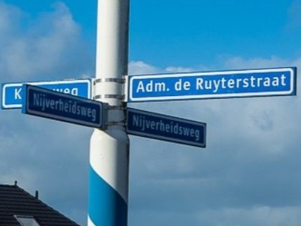
- Admiraal de Ruyterstraat, running south-west from the Koembrug to the boundary of the built-up area at the railway crossing.
- Trompstraat, running from the Admiraal de Ruyterstraat near the so-called ‘Tuindorp’, curving south to the Eerste Broekdijk, and south of the railway forming part of the boundary of the built-up area.
- Landbouwstraat (partly projected), running west from the Netherlands Railways station along the north side of the railway to the Trompstraat.
- Jan van Galenstraat (projected), running south from the northern end of the Trompstraat to the Landbouwstraat.
- Piet Heinstraat (partly projected), running east from the Jan van Galenstraat to the Stationsstraat, with a branch from the Christian ULO school to the Netherlands Railways station.
- Jacob van Heemskerkstraat (projected) and Jan Evertsenstraat (projected), forming northbound connections between Piet Heinstraat and Admiraal de Ruyterstraat, with Jan Evertsenstraat being the easternmost.
- Industriestraat, running west from the Dijkstraat south of the railway and then alongside the abattoir, before continuing south-east to the Eerste Broekdijk.
For house-numbering purposes, the following districts of scattered houses are to be formed:
- De Kemena, comprising the land bounded by the section of Admiraal de Ruyterstraat from the railway to the so-called ‘Tuindorp’ (which is deemed not to belong to Kemena), from there by a short straight line drawn northwards to the stream, then by the Slingerbeek to the Richterinkbrug, by the Richterinkweg to its western end, and on the west by the boundary of the built-up area.
- ’t Dal, comprising the land bounded on the north by the southern boundaries of plots Section I, nos. 6261, 635, 638, 5752, 4524, 5467, 5468, 2906, 2909, 2910, 4964, 4965, 5310, 1335, 5106 and 3557, situated south of the Hoogestraat; on the east by an imaginary straight line from the south-east corner of plot 3557 to the Koembrug; and on the south and west by the Slingerbeek.
- ’t Smees, comprising the land enclosed by Prins Hendrikstraat, part of Oranjelaan, part of Oostenrijkschestraat and Juliana van Stolbergstraat.
To determine that this decision shall take effect on a date to be set later by the Mayor and Aldermen.
Draft decision on street names within the built-up area of Bredevoort:
- Koppeldijk, running from the junction of the old road to Bredevoort and the road to Aalten to the beginning of the road to Bredevoort railway station.
- Koppelstraat, running from the northern end of Koppeldijk to the point where the streets mentioned under no. 3 meet.
- Achterstraat, Kerkstraat and Officierstraat, forming respectively the western, middle and eastern of three streets running generally north from the northern end of Koppelstraat to the Landstraat mentioned under no. 4.
- Landstraat, running east from the culvert between the so-called small and large town moats to the Munsterbrug over the Slingerbeek.
- Tramstraat (projected), running north from the Koppeldijk near plot Section A no. 1312 along the present tram line to the culvert mentioned under no. 4.
- Singel, running generally north from the Landstraat at the culvert mentioned under no. 4 to where the surfaced road towards Lichtenvoorde bends west, near plot Section A 1133.
- Tolhuisweg, running west from the northern end of the Singel and then generally south to the southern end of Koppeldijk.
- Schoolstraat, running generally north from Koppelstraat to Tramstraat.
- Stationsweg, running generally south from the northern end of Koppeldijk to the boundary of the village of Bredevoort.
- Molenpad, running north-east from Stationsweg between plots Section B nos. 744 and 758 to the corn mill on Section B 738.
- ’t Walletje, running first south-east and then north-east from the northern end of Koppelstraat to the Vischmarkt (see no. 12).
- Vischmarkt, situated east of Officierstraat and running south-west from Landstraat to plot Section B 725, with a western branch to ’t Walletje.
- Munsterweg, running east from the Munsterbrug to the boundary of Winterswijk.
- Kerkhofstraat, running north-east from Stationsweg at plot Section A 1527 to Munsterweg.
- Prinsenstraat, running north-east in continuation of Achterstraat between Landstraat and ’t Zand.
- Markt, east of Prinsenstraat and running in roughly the same direction between Landstraat and ’t Zand.
- Boterstraat, running generally south-east from the Markt along the south side of the Dutch Reformed Church to plot Section B 619, with a branch south to plot Section B 747.
- Muizenstraat, running north-west from the Markt to plot Section B 790.
- Ambthuiswal, running north from Landstraat, beginning between plots Section B 561 and 849, to the southern bend in Hozenstraat.
- Gasthuisstraat, running south-east from the southernmost point of ’t Zand to Ambthuiswal.
- ’t Zand, comprising the area around the school building, Section B 642, and formed by plots Section B 13, 644 and 874 up to the line connecting plots Section B 855 and 875.
- Kruittorenstraat, running north-east from the northernmost point of ’t Zand, past the moat, to the crossroad in the Broek.
- Hozenstraat, running south-east from ’t Zand near plot Section B 498 to the northern end of Ambthuiswal, and from there roughly north to plot Section B 631, with a westward branch to plot Section B 680.
- De IJzerman (projected), running south-east from Kruittorenstraat at the moat to the street projected at right angles to Hozenstraat.
- Oranjestraat, beginning between plots Section A 1411 and 1418 and running north from Munsterweg to the Slingerbeek.
- Ganzenpoelendijk, running south-east from Munsterweg at plot Section A 302 to the boundary of Winterswijk.
To determine that this decision shall take effect on a date to be set later by the Mayor and Aldermen.
Comments and amendments
The CHAIRMAN explains the approach followed by the Mayor and Aldermen. Mr PENNINGS considers it much more practical to call the Hoogebruglaan and Pieperslaan the Bocholtschestraat and Dinxperloschestraat. Mr WIELAND also thinks this would be better for strangers looking for the right road. The CHAIRMAN: If the Council feels that way, I have no objection. The Council decides. Alderman SOMSEN defends the proposal. Mr WIELAND is not in favour of it. Mr HUININK says he can fully support Mr Pennings’s suggestion.
Mr TE GUSSINKLO objects to extending the name Kattenberg: the cats would have to walk much too far. He proposes also calling it Lichtenvoordschestraat. The CHAIRMAN: Then Kattenberg would become very small. That was our objection. Mr WIELAND would much prefer the road to be called Lichtenvoordschestraat from the Veemarkt onwards. The CHAIRMAN can agree to this. The small square by the pump will then be called Kattenberg.
The CHAIRMAN: Residents of Gasthuisstraat have requested that the street be called Dillenburgstraat. However, there is already a Dillenburgstraat. Mr WIELAND: Then let us call that street Haartschestraat. The CHAIRMAN: Then we would have to alter Wilhelminastraat and make it shorter. Mr ROTS: The name Gasthuis does not evoke pleasant memories. Conditions there were not good at the time. The CHAIRMAN: Haartschestraat seems best to me. Mr TE GUSSINKLO would like to call the section as far as Wentink Burgemeester Tackstraat and the remainder Haartschestraat. The CHAIRMAN: We have very deliberately refrained from using personal names. It is decided to call the street Haartschestraat.
It is proposed to abolish the name ’t Blik. From the Kerkstraat to the Haartsche bridge, the road will become Hofstraat, the final section still being projected. Mr TE GUSSINKLO regrets that the name ’t Blik is to disappear. It is a genuinely historical name, referring to low-lying ground; the same name is also found in Drenthe.
The CHAIRMAN: The Mayor and Aldermen now propose calling Achterstraat Prinsenstraat, following a request that has been received. Agreed accordingly.
Mr TE GUSSINKLO proposes changing the name Kerkhofstraat to Varsseveldschestraat, which would be consistent with the other streets leading towards surrounding towns and villages. Mr JANSEN considers it entirely possible to have the Ringweg end at café ’t Tolhuis and then have Varsseveldschestraat run from the Veemarkt to the boundary of the built-up area on the road to Varsseveld. Mr ROTS turns this into a formal proposal: replace Kerkhofstraat and Hoogegrindweg with Varsseveldschestraat. The proposal of the Mayor and Aldermen is rejected, so Varsseveldschestraat will run from the Veemarkt to the Grevinkbrug. The remainder of the draft for the village of Aalten is adopted unchanged.
The village of Bredevoort is then considered. Mr ROTS wants Koppelstraat to continue as far as Landstraat, so that Achterstraat disappears. Winterswijkscheweg becomes Winterswijkschestraat. Mr ROTS wants to change Kerkhofstraat to Prins Mauritsstraat, because Prince Maurice played an important role in the history of Bredevoort. It is decided to adopt this name, running from Huisman to Winterswijkschestraat. The remainder of this draft is also adopted.
In 1955, several new street names were again proposed for the village of Aalten. Further reading >