Category: Area

  • The Hessenwegen in Aalten and Bredevoort

    The Hessenwegen in Aalten and Bredevoort

    Ancient trade routes as lifelines of the Achterhoek

    De Hessenwegen in de Achterhoek en de Veluwe

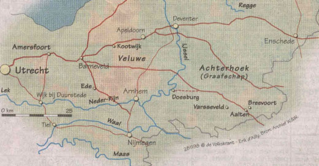
    For centuries, German merchants traveled through the Achterhoek with their heavy carts via the so-called Hessenwegen: ancient trade routes that connected the region with Germany and the Dutch trading cities. One of these roads ran from Bocholt via Aalten towards Zutphen and Doesburg. The Hessenwegen were of great importance for early modern trade in this region.

    The term Hessenweg has been used since the 17th century. The traditional explanation refers to the merchants who came from the Landgraviate of Hesse-Kassel and the surrounding area. Within etymology, however, the name is explained differently: it is said to be a corruption of hers, meaning horse. These roads usually ran over high, dry sandy soils and along ridges.

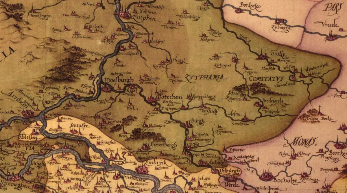
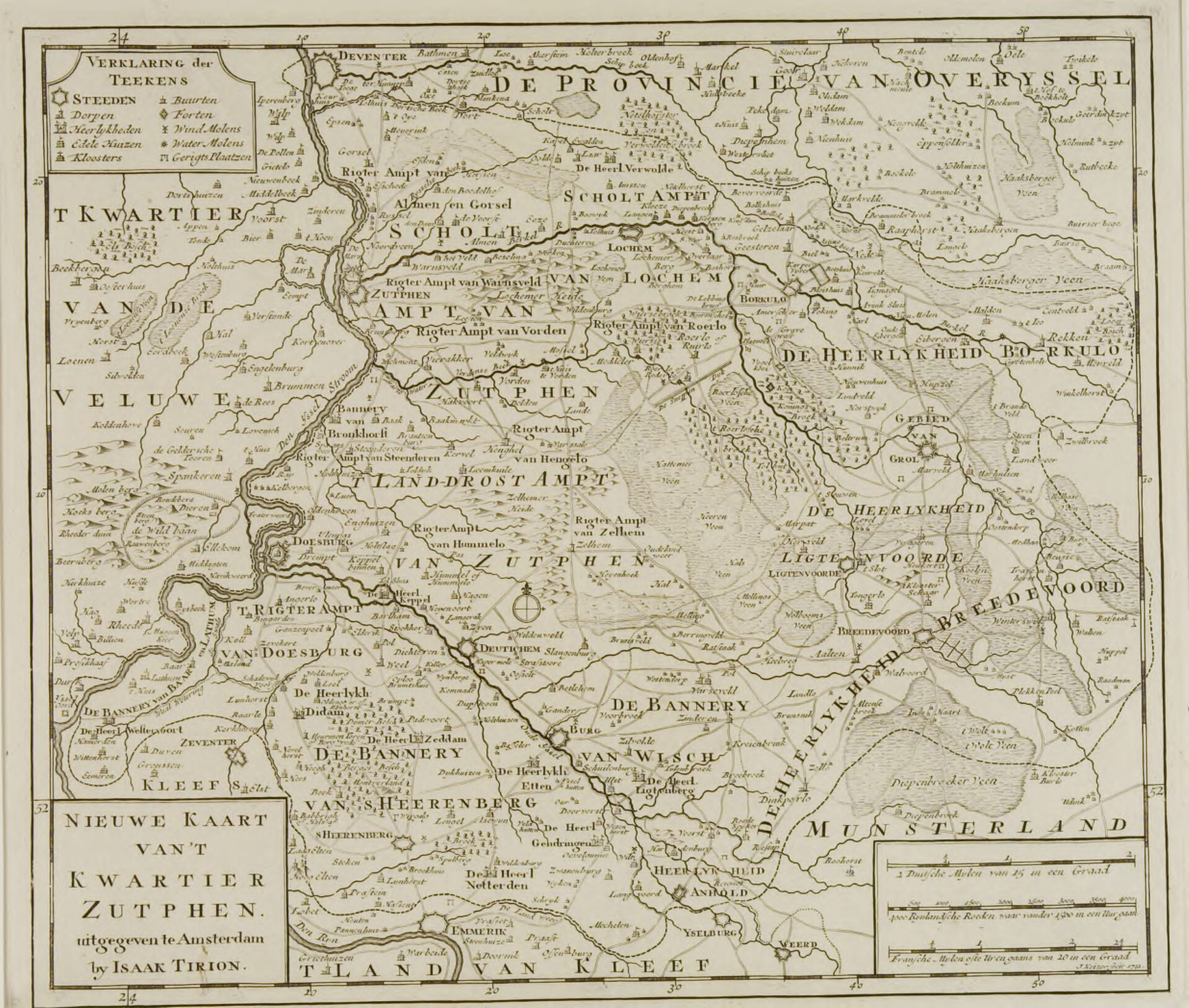
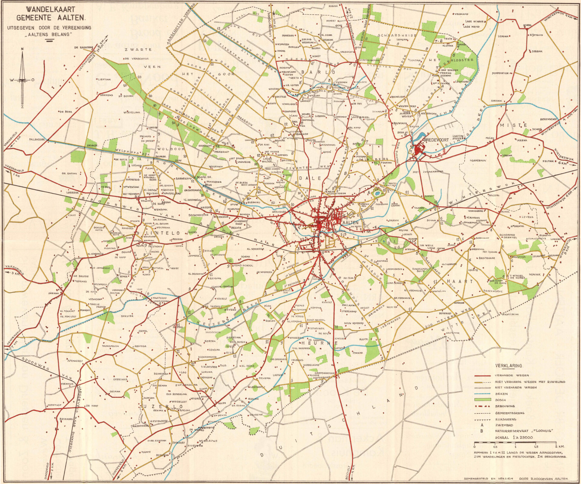
    Four major Hessenwegen ran through the Achterhoek. Three of them followed a northern route, from Vreden and Ammeloe via Groenlo, Rekken, and Neede, among others, to Deventer or Zutphen.

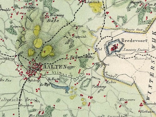
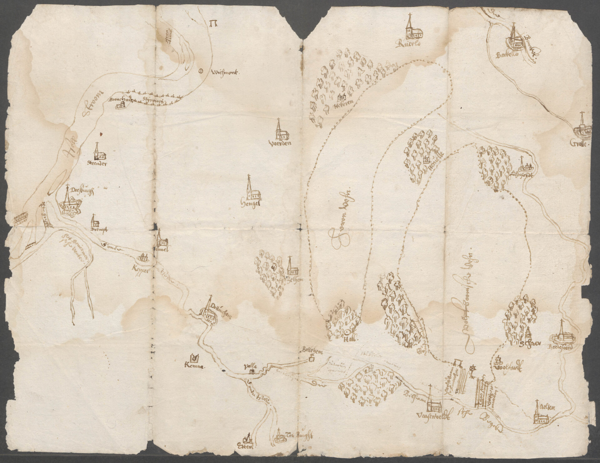
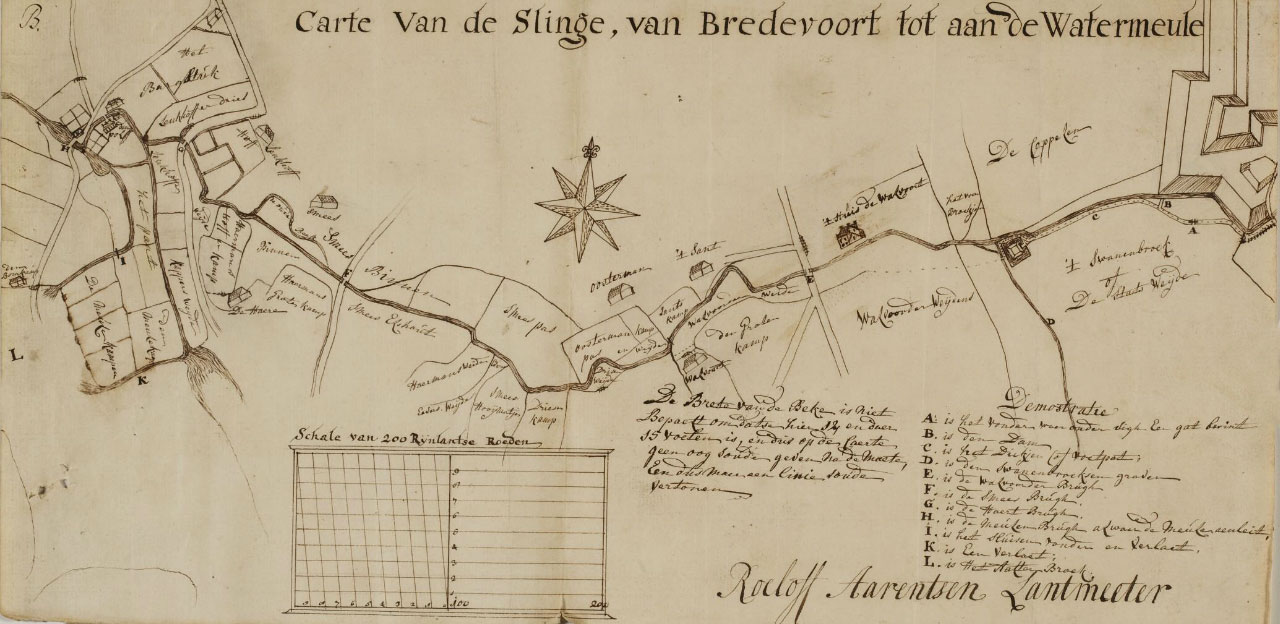
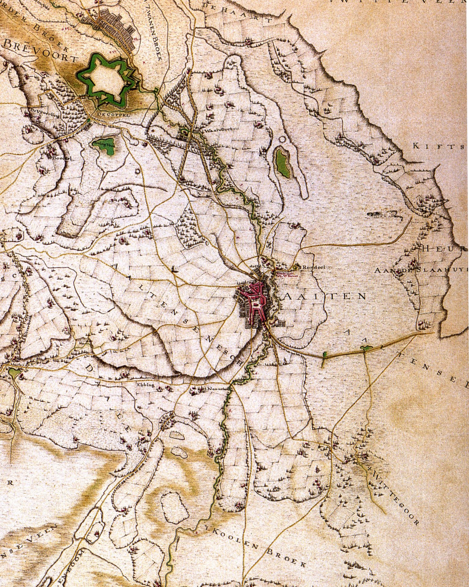
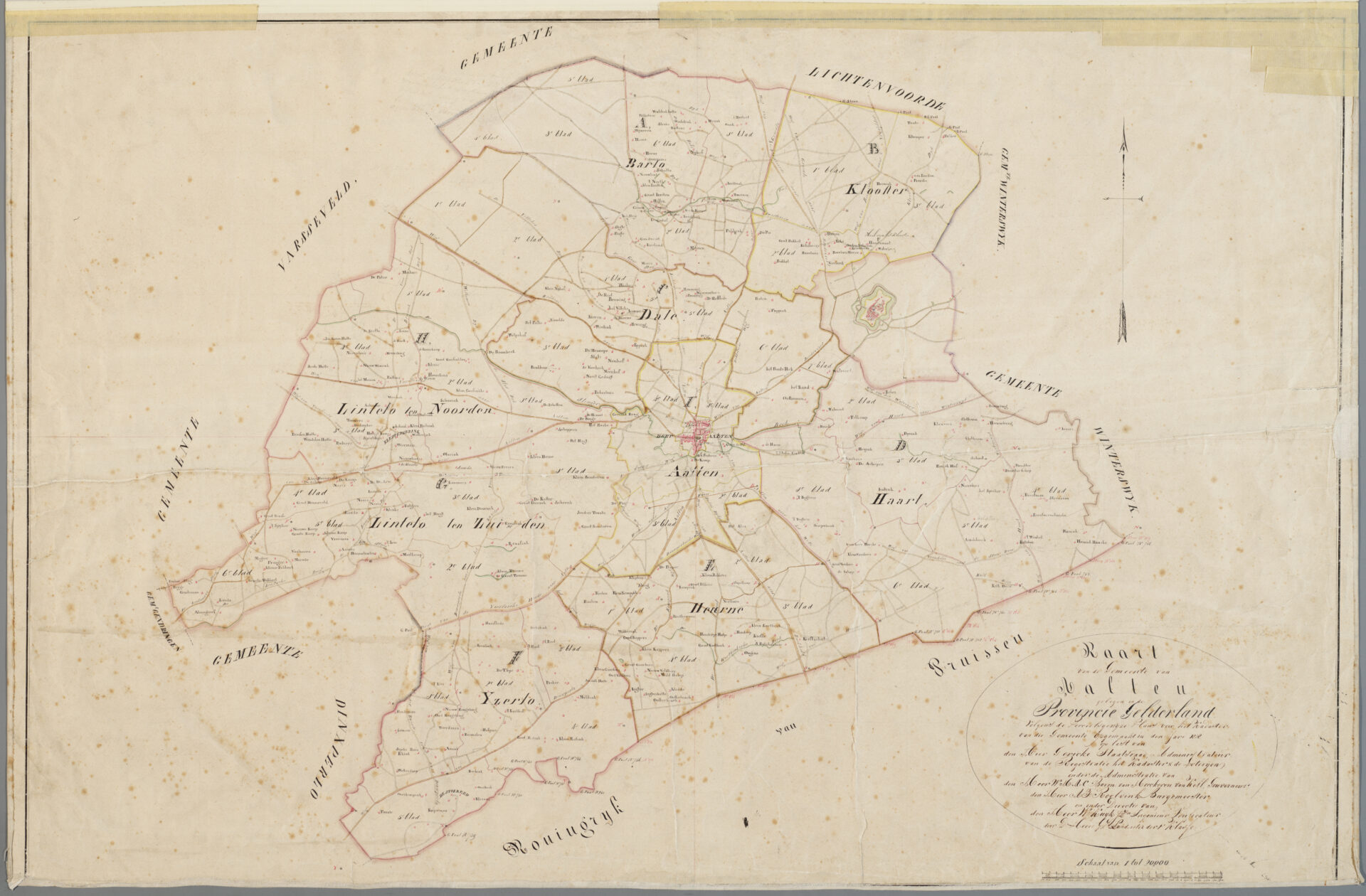
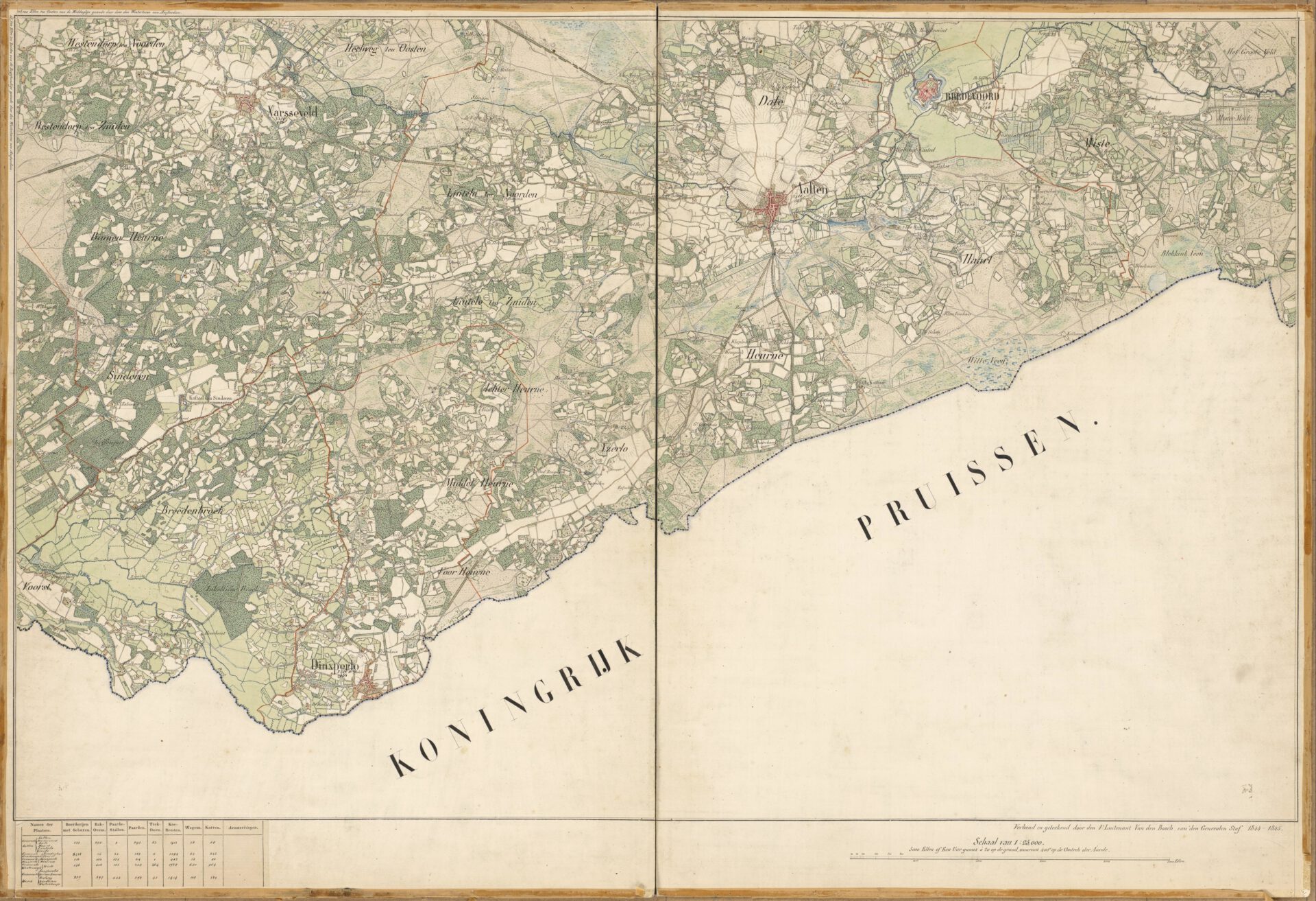
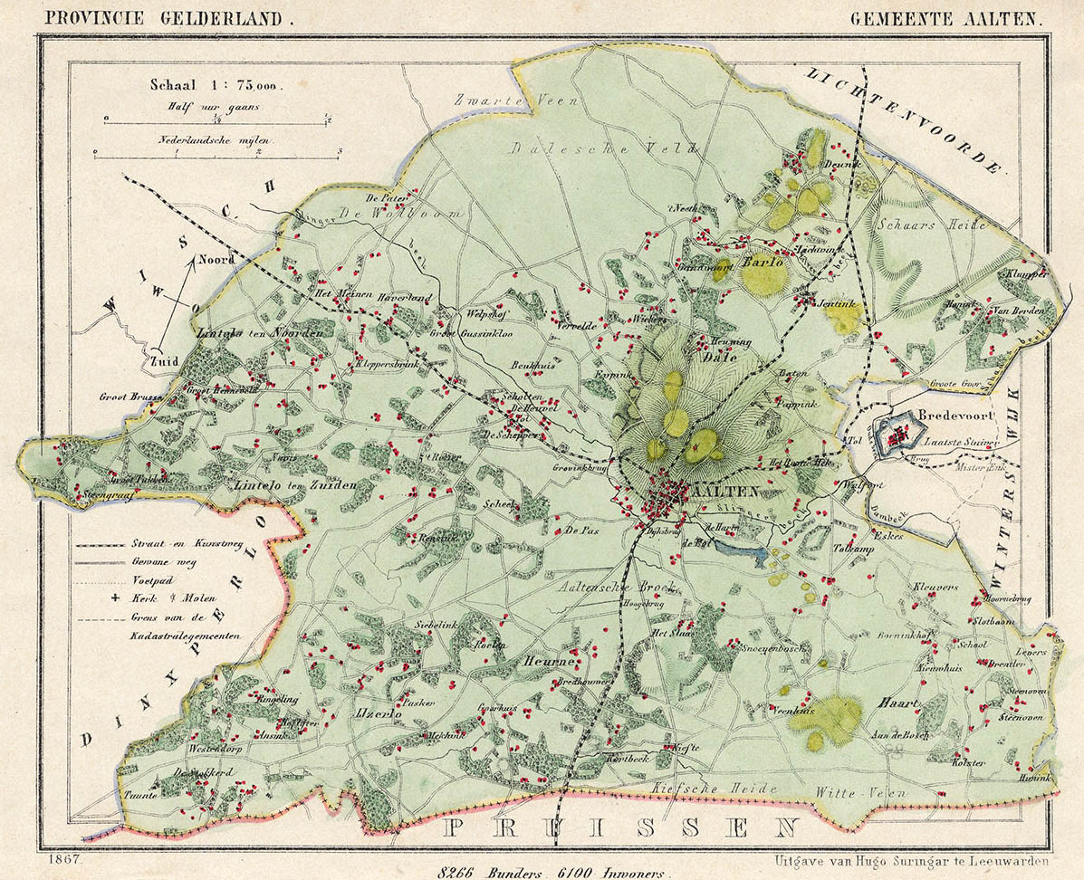
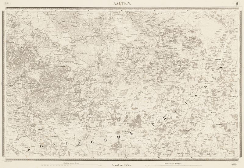
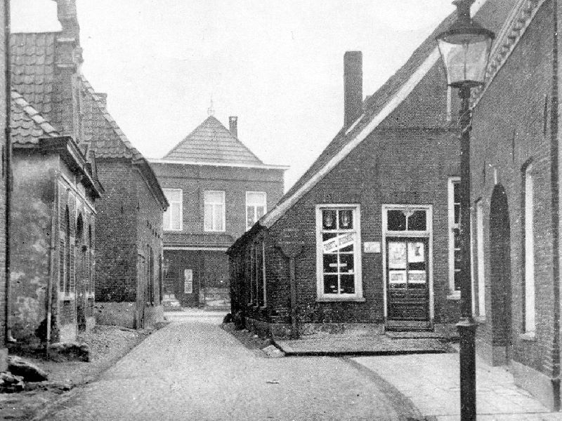
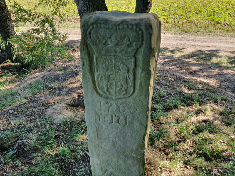
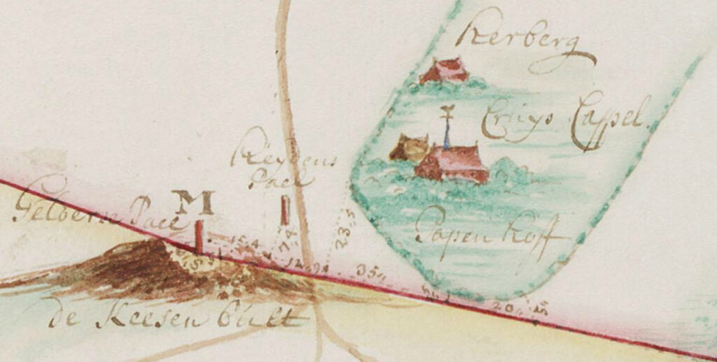
    In the southern Achterhoek, a Hessenweg ran past Aalten. From Bocholt, this route crossed the current border at the Kesenbulte and continued via the Bodendijk, Dijkstraat, Landstraat, Berkenhovestraat, and the Romienendiek to De Radstake. From there, the road continued past Zutphen and Barneveld, with a branch between Halle and Zelhem towards Doesburg.

    From the IJssel cities, the Hessenwegen crossed the Veluwe, converged in the Gooi, and continued to Amsterdam. The Hessenwegen had numerous branches. One of these ran near Aalten from the Romienendiek, via the Koningsweg, Hessenweg, past the Walfort, via Bredevoort and Winterswijk to Vreden.

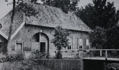
    The Hessians stayed overnight in inns along the road, such as De Radstake and the Slikkertap. In Aalten, there were lodgings such as De Leeuw, De Roskam, De Landman, and Stad Munster. In Bredevoort, De Zwaan and, just outside the town, De Leste Stuver were well-known stopping places.

    Hessenkeerls

    For those living along a Hessenweg in the 19th century, the arrival of the Hessenkeerls was quite an event. On the windward side of the procession walked men with heavy clubs, dressed in their characteristic blue Hessenkiel: a shirt of fine linen, closed with copper hooks in the shape of lion heads and three small bone buttons. Decorated facings were applied to the chest and shoulders.

    On the road, donkeys trudged through the loose sand, with a basket of woven willow twigs full of merchandise on either side. Once they arrived in a village, the men tied their donkeys near an inn or on the village square. The animals were fed and watered, while the men refreshed themselves at the village pump.

    Afterward, the baskets were opened and the Hessians went from house to house peddling. Their merchandise included light glassware and soft straw hats. These hats were in high demand: as soon as the Hessians arrived, customers were already waiting for them to buy a new summer hat. The hats were elastic and therefore almost always fit. After a few hours, the Hessians moved on.

    Pottenkeerls, musicians, and hannekemaaiers

    In addition to the Hessenkeerls, pottenkeerls also appeared on the Hessenwegen. They used heavy covered wagons that stood high on their wheels, the so-called Hessenkaoren, pulled by sturdy Holsteiner horses. The carts were full of Cologne pottery: gray or yellow-brown pots with blue decoration. The horses wore richly decorated harnesses, fitted and hung with copper decorations, so that their arrival could be heard from afar.

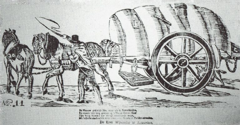
    An image of a carter with his Hessenkar from around 1830, from the Popular Prints collection of Museum ‘t Oude Slot in Veldhoven, with the text:

    The blue-smocked Hessian travels from the Uplands,
    And guides his long team with ‘Hu’ and ‘Hot’ and ‘Haar’.
    His high-laden cart brings many kinds of wares,
    Which the Dutch ship carries again to North and South shores.

    In the spring, groups of German musicians traveled over the Hessenwegen to the Netherlands. Some bands were very well known in Amsterdam, Rotterdam, and The Hague. Although they presumably came from the same region, they were not called Hessians because they did not wear the Hessenkiel.

    In addition, the hannekemaaiers came by in the summer: seasonal workers from Westphalia who helped in Holland with mowing grass and during the harvest. Women and children stayed behind at home to work on the land, while the men earned money elsewhere for the winter.

    The end of the Hessenwegen

    In the course of the 19th century, the significance of the Hessenwegen declined. In 1875, the last Hessians were seen near Zelhem, a meager group compared to former times. The Franco-Prussian War of 1870 and the subsequent industrial boom in the Ruhr area provided the Germans with a livelihood closer to home. Even many young people from the Achterhoek went that way to earn good money. With that, the Hessenwegen had had their day.

    Older origins

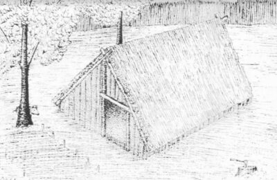
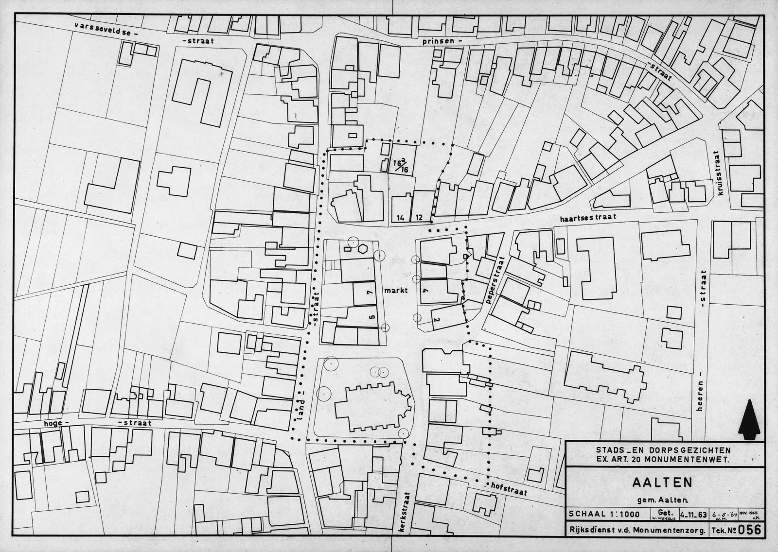
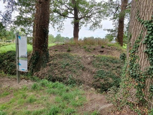
    Although the term Hessenweg was used from the 17th century, archaeological finds along these roads indicate that they had been in use for much longer. For example, in Aalten, at De Hoven near the Landstraat, traces of an 8th-century settlement have been found, including remains of sunken-floor huts, refuse pits, and spindle whorls. This is a strong indication that the later Hessenwegen built upon much older traffic routes, the so-called volkerenwegen (peoples’ roads).

    It is therefore logical to assume that the village of Aalten partly owes its origin to this ancient peoples’ road. De Hoven was a favorable spot, because in the middle of the wild landscape of forest, heath, and marshes, there was a hill here, high and dry, directly on a through road. Moreover, a stream flowed at the bottom of the hill, providing fresh water.

    Hessentocht

    The memory of the Hessians still lives on. In 2011, a Hessentocht (Hessian Trek) was organized for the second time in the vicinity of Bredevoort and Aalten. During this trek, in which a historical caravan was simulated, an impressive ox cart took part: 2.60 meters wide, six meters long, and four meters high. In addition, three wagons participated, each pulled by three horses. Jan Oberink captured the trek on film and created the atmospheric impression below.

    Acknowledgements

    The content of this article is largely based on the article by G.J. Klokman (Zelhem, 1864), published in 1937. There are numerous other publications about Hessenwegen that present a different picture on some points. For this article, Klokman’s description was primarily chosen because his memories and observations specifically relate to the Hessenweg near Zelhem, the same route that also ran through Aalten.

    Sources

    1. G.J. Klokman, De Hessenwegen, in: Eigen Volk. Algemeen tijdschrift voor volkskunde (folklore) en dialect, 1937. National Library of the Netherlands
    2. G.J. Klokman, De Achterhoekers, in: De Nederlandse volkskarakters, 1938. DBNL
    3. Wikipedia, Hessenweg
    4. Hummelo.nl, Hessenwegen, Hanzewegen en Koningswegen (RdH004-27-2-2007). Hummelo History
    5. De Veluwenaar, Hessenwegen
    6. Oud Aalten, Traces of 1100-year-old settlement in Aalten
    7. YouTube, Hessentocht travels through the municipality of Aalten, 2011
  • Traces of 1100-year-old settlement in Aalten

    Traces of 1100-year-old settlement in Aalten

    In August 2024, archaeological research was carried out on a site at De Hoven in Aalten, shortly before apartments are built. This research, carried out by members of the antiquities association ADW led by archaeologist Willem Doodeheefver, provided valuable insights into the early medieval history of Aalten.

    The finds, which include remains of hut bowls, waste pits and metal objects, offer a unique insight into life around the year 900 AD. Previous excavations in this area, in 1982 and 1892, had already found traces of a so-called Frankish-Merovingian settlement.

    Hut bowls

    The most striking finds during the excavations in 2024 are the remains of some hut bowls, which became visible due to dark discolorations in the soil. A hut bowl was a half-buried, rectangular building, about three meters wide and four meters long. The pit was 0.5 to 1 meter deep and had no above-ground walls; The roof construction rested partly on ground level. This construction method provided shelter from the summer heat and provided relative warmth in winter.

    Hut bowls served as craft rooms, usually on a farmyard. They were used for activities such as weaving, woodworking, metalworking or working bone. Slag was found at one of the hut bowls found at De Hoven, remnants of molten rock. This may indicate that the hut may have served as a blacksmith’s shop.

    Waste pits

    Several waste pits have been found scattered around the site. The waste left behind by the residents at the time provides valuable information about their daily lives, utensils and the dating of the hut bowls. Among other things, shards of pottery were found in the waste pits, dated around the year 900 AD.

    1100 years of habitation

    The finds give a picture of the landscape as it looked more than 1100 years ago. A favorable circumstance is that the soil of De Hoven has remained largely untouched during the past thousand years. The name ‘De Hoven’ refers to the gardens that were here for centuries, and the area has remained largely undeveloped to this day.

    This and earlier archaeological finds on De Hoven, but also on the Damstraat, confirm that people were already living in Aalten 1100 years ago. This period coincides with a mention of a place that was mentioned in a document from 828 Aladna .

    Why this place?

    The choice of this place of residence in the early Middle Ages is easy to explain. Aalten is located on seven slopes that were formed in the ice age. De Hoven is located on one of the higher, dry and safe parts. For the residents, it was only a short walk to the Slingebeek, where they could get water and fish. De Hoven is also a stone’s throw from the Landstraat. It is possible that this was already an important traffic route in the Achterhoek at that time, an area that was still quite empty and largely unexplored at the time.

  • Land consolidation in Aalten

    Land consolidation in Aalten

    In the second half of the 20th century, a large-scale land consolidation process took place in the municipality of Aalten. During this radical process, agricultural lands were reorganized to enable more efficient operations. The objective was to create larger and more accessible plots for farmers, with less fragmentation and improved infrastructure. However, this change also had significant consequences for the landscape and nature.

    Why was land consolidation necessary?

    Due to inheritance divisions and changes in ownership over the centuries, agricultural plots had become increasingly smaller and more irregular. It became progressively difficult for farmers to work efficiently. The solution was land consolidation. This involved merging and reorganizing plots so that agricultural businesses could operate more effectively. This was achieved through:

    • Enlargement and reorganization of agricultural plots;
    • Improved accessibility via paved roads;
    • Adjustment of water management systems;
    • Reduction of old legal restrictions such as easements.

    Effects on the landscape

    The traditional Achterhoek ‘coulisse’ landscape, with its alternation of small fields, meadows, and hedgerows, was affected in many places by land consolidation. This varied and small-scale landscape, which gave the area its picturesque character, gave way to larger, more efficiently designed agricultural plots. As a result, many hedgerows, copses, and dirt tracks disappeared.

    This reorganization allowed farmers to work more easily with modern machinery, but it also made the landscape more open and uniform. Roads such as the Eskesweg and the Aladnaweg were constructed to make agricultural lands more accessible, but this came at the expense of old dirt tracks and characteristic plot boundaries.

    Consequences for water and nature

    In addition to the changes in the landscape, water management was also adjusted. Streams and ditches were straightened and deepened to drain water more quickly. While this prevented flooding, it led to drought issues in some areas. Much of the wetland nature disappeared, which had consequences for biodiversity.

    Despite the benefits for agriculture, part of Aalten’s traditional landscape was lost. The small-scale and varied character of the region gave way to larger-scale agricultural lands with less room for nature and historical landscape elements.

  • Public Housing Association

    Public Housing Association

    ‘Vereniging tot Verbetering der Volkshuisvesting’

    In the 19th and early 20th centuries, many Dutch people lived in appalling conditions. During the course of the 19th century, this prompted citizens and workers to establish public housing associations.

    In 1912, a committee was formed in Aalten under the leadership of Mayor Monnik to establish an association for the improvement of public housing. The establishment took place the following year.

    Celebrations at Volkshuisvesting

    In 1981, the Wisselink textile factory on the Dijkstraat moved to the industrial estate. On the vacated site, 120 homes were built, the current Driessenshof. However, before the former weaving mill was demolished, the ”Vereniging tot Verbetering der Volkshuisvesting’ (Association for the Improvement of Public Housing) organised an extensive programme of festivities there for the people of Aalten:

    De Woonplaats

    In 1995, the associations in Aalten, Groenlo, and Winterswijk, which together owned 6,700 homes, decided to merge under the name De Woonplaats. A few years later, a merger followed with De Volkswoning in Enschede (5,100 homes). Two years later, the head office moved from Groenlo to Enschede. In 2022, De Woonplaats owned almost 17,000 homes, of which approximately 2,300 were in the municipality of Aalten.

  • Transformer substations in Aalten

    Transformer substations in Aalten

    Dozens of transformer substations, also known as ‘trafohuisjes’, are spread across the municipality of Aalten. These substations are designed to convert (transform) high voltage (10,000 Volts) into a lower voltage (230/400 Volts) that can be used in our homes and businesses.

    The first transformer substations were built in the early 1920s by the Provinciale Gelderse Electriciteits Maatschappij (PGEM). In 1994, PGEM merged into Nuon and was split up in 2009. The current grid operator is called Liander.

    Design

    The oldest transformer substations were designed by Gerrit Versteeg (1872-1938), who was the in-house architect of PGEM at the time. They incorporate influences from the Hague School, the Amsterdam School, and Frank Lloyd Wright.

    The buildings are often distinctive brick structures, usually with a rectangular floor plan and a single story with a hip roof, gable roof, or flat roof. The doors are frequently made of green-painted steel. The substations feature an inlaid nameplate made of concrete or tiles (from the Goedewaagen company in Gouda).

    Cultural-historical value

    The older transformer substations have a significant visual value. From a cultural-historical perspective, the buildings commemorate the electrification of the municipality of Aalten. Newer substations (from approximately the early 1980s onwards) usually have a purely functional design and are therefore not of interest from a cultural-historical point of view.

    Many historical transformer substations in the Netherlands have been designated as (municipal) monuments. As of yet, no transformer substation is included on the monument list of the municipality of Aalten.

    List of transformer substations in Aalten

    Below is a list of all transformer substations in the municipality of Aalten, as far as we are aware (April 2025). A number of older substations may be of cultural-historical value and could potentially qualify for protected status. Substations built up to and including 1980 are also displayed on the map.

    AdresKern/BuurtschapBouwjaar
    Admiraal de Ruyterstraat 1 TRAalten1978
    Ambachtsstraat 1 TRAalten1982
    Andromeda 32 TRAalten1972
    Bevrijding 1 TRAalten1977
    Bodendijk 54 TRAalten1975
    Boomkampstraat 1 TRAalten1966
    Bredevoortsestraatweg 65 TRAalten1978
    Bredevoortsestraatweg 94 TRAalten1939
    Bredevoortsestraatweg 118 TRAalten1976
    Broekstraat 17 TRAalten1988
    De Hare 5 TRAalten1981
    Dennenoord 7 TRAalten1970
    Dinxperlosestraatweg 44 TRAalten1964
    Dinxperlosestraatweg 54 TRAalten1980
    Dinxperlosestraatweg 62 TRAalten1971
    Dinxperlosestraatweg 79 TRAalten1930
    Frankenstraat 6 TRAalten1966
    Grevinkweg 2 TRAalten1975
    Grote Maote 170 TRAalten1983
    Haartsestraat 6 TRAalten1923
    Het Verzet 28 TRAalten1981
    Karel Doormanstraat 14 TRAalten1969
    Keizersweg 51 TRAalten1963
    Kemenaweg 50 TRAalten1972
    Koopmanstraat 85 TRAalten1984
    Lage Blik 26 TRAalten1983
    Lage Veld 32 TRAalten1974
    Meiberg 23 TRAalten1960
    Mercurius 5 TRAalten2011
    Mercurius 7 TRAalten1972
    Molenkamp bij 35Aalten1963
    Neptunus 16 TRAalten1972
    Nijverheidsweg 42 TRAalten2011
    Nijverheidsweg 61 TRAalten1985
    Nijverheidsweg 87 TRAalten1966
    Oranjelaan 7 TRAalten1940
    Orion 31 TRAalten1971
    Piet Heinstraat 46 TRAalten1927
    Prinsenstraat 31 TRAalten1966
    Ringweg 19 TRAalten1952
    Rondweg Zuid 1 TRAalten2011
    Stationsstraat 8 TRAalten1974
    ’t Slaa 31 TRAalten1990
    Tramstraat 1 TRAalten1968
    Tubantenstraat 2 TRAalten1971
    Varsseveldsestraatweg 82 TRAalten1965
    Vierde Broekdijk 19 TRAalten1997
    Vlierbeslaan 22 TRAalten1979
    Vondelstraat 11 TRAalten1968
    Barloseweg 6 TRBarlo1977
    Lichtenvoordsestraatweg 83 TRBarlo1934
    ’t Villeken 9 TRBarlo1952
    Bekendijk 12 TRBredevoort2011
    Izermanstraat 2 TRBredevoort1972
    Kleine Gracht 1 TRBredevoort1950
    Landstraat 1 TRBredevoort1952
    Prins Mauritsstraat 13 TRBredevoort1925
    Stadsbroek 71 TRBredevoort1994
    Boterdijk 7 TRDale1970
    Romienendiek 7 TRDale2018
    Buninkdijk 4Haart1967
    Griesdijk 2Heurne1960
    Hondorpweg 7 TRHeurne1967
    Dinxperlosestraatweg 102 TRIJzerlo1966
    Dinxperlosestraatweg 122IJzerlo1970
    Klokkemakersweg bij 1IJzerlo1980
    Kruisdijk 35 TRIJzerlo1940
    Gendringseweg 4Lintelo1980
    Gendringseweg 23 TRLintelo1950
    Heuvelweg 1 TRLintelo1933
    Kolenbroekweg 1Lintelo1950
    Schooldijk 7 TRLintelo1950
    Sondernweg 21 TRLintelo1952
    Varsseveldsestraatweg 126 TRLintelo1931
    Brussendijk 2 TRDe Heurne1939
    Caspersstraat 10 TRDe Heurne1965
    Giebinkslat 6 TRDe Heurne1966
    Lage Heurnseweg 29 TRDe Heurne1980
    Aaldersbeeklaan 53 TRDinxperlo1970
    Aaldershuuslaan 2 TRDinxperlo1972
    Aaldershuuslaan 56 TRDinxperlo2011
    Aaltenseweg 61 TRDinxperlo1973
    Alfred Mozerhof 7 TRDinxperlo1966
    Anholtseweg 6 TRDinxperlo1952
    Anholtseweg 38 TRDinxperlo1993
    Beggelderdijk 16 TRDinxperlo2011
    Bernard IJzerdraatstraat 30 TRDinxperlo1973
    De Klumpender 10 TRDinxperlo1982
    De Maten 9 TRDinxperlo1979
    De Ruiterij 20 TRDinxperlo1975
    Ds. van Dijkstraat 15 TRDinxperlo1968
    Europastraat 2 TRDinxperlo1971
    Helmkamp 25 TRDinxperlo1988
    Het Slat 5 TRDinxperlo1966
    Hogestraat 32 TRDinxperlo1950
    Industriestraat 1 TRDinxperlo1951
    Industriestraat 3 TRDinxperlo1958
    Industriestraat 8 TRDinxperlo1957
    Industriestraat 12 TRDinxperlo1978
    Julianastraat 43 TRDinxperlo1966
    Keminksweide 68 TRDinxperlo1972
    Kerkhofplein 3 TRDinxperlo1939
    Keupenstraat 17 TRDinxperlo1972
    Meniststraat 7 TRDinxperlo1971
    Nassaustraat 20 TRDinxperlo1970
    Nieuwstraat 8 TRDinxperlo1980
    Nieuwstraat 52 TRDinxperlo1979
    Terborgseweg 94 TRDinxperlo1970
    Welinkweg 39 TRDinxperlo1957
    Weversstraat 3 TRDinxperlo1939
  • Maps

    Maps

    Here you will find a collection of various historical maps of—or featuring—Aalten and Bredevoort, dating from the 16th to the 20th century. Click on an image to enlarge it.

    Topographical and military map of the Kingdom of the Netherlands, Aalten, 1874
    Topographical and military map of the Kingdom of the Netherlands, Aalten, 1874 (Source: Gelderland in beeld)
  • Fallen in the organized resistance

    Fallen in the organized resistance

    Köstersbulte, Aalten

    On the lawn of the Old Helena Church on the Markt in Aalten is a special memorial stone. The bronze plaque on the stone mentions the names of seven resistance fighters within the organized resistance in Aalten.

    The resistance during the Second World War (1940-1945) only developed in the course of the war. As the measures of the German occupying forces became stricter, small groups arose that resisted the occupation, initially with limited resources. As the war progressed, more and more people got into trouble. The small resistance groups grew in strength due to the increase in the number of members, but also due to the networks that arose between the various resistance groups.

    Within the resistance, two main currents could be distinguished. The first group was the National Organization for Help to People in Hiding (LO). This group organized hiding places for Jews, for men who refused to work for the enemy in Germany, and for resistance fighters who had to go into hiding. The LO was dependent on sufficient ration coupons for the food supply to the people in hiding . The second group, the Knokploegen (KP), took care of that. This armed group carried out raids on distribution offices, tried to sabotage the enemy at vital points and in the last phase of the war prepared to assist the Allied troops in the liberation of the Netherlands.

    In the Achterhoek, especially in the region of Aalten, Lichtenvoorde and Winterswijk, the resistance was particularly active. Some of the resistance fighters lost their lives during the war. Those who survived the harsh time did not feel like heroes. Many testified to the fear they would carry with them for the rest of their lives. The courageous acts of the resistance are recorded in several books.

    The names of the fallen (click on the links for more information):

  • Traveller Caravans

    Traveller Caravans

    Your contribution is welcome! We would appreciate receiving more (historical) information and photographs regarding traveller caravans, families, residential sites, and related matters within the municipality of Aalten. Can you help us? Please comment below or send us a message!

    In 1928, the municipality of Aalten published an ‘Ordinance on Caravans’. This designated a site on Tolhuisweg as the only location where caravans were permitted to park.

    World Travellers in Bredevoort

    De Graafschapbode, 22 February 1935:

    “Our Gelderland Achterhoek region is currently enjoying the honour of a visit from two ‘world travellers’, who are housed in the pictured, very practically and efficiently equipped caravan. In the front section is the sleeping area for the pair, as is understandable primitive in design, yet just sufficient. They provide for their livelihood by selling postcards.

    From a chat with the travellers, it emerged that they originate from South Slavia, one of the Balkan states. Since 1928, they have been busy completing their ‘Journey Around the World’. A large part of the mainland of the European continent has already been ‘covered’, while currently, the Dutch—in this case, Achterhoek—soil is the focus of their visit.

    The living area in the wagon contains ‘furniture’ of, believe it or not, a table and two chairs. The wall decoration consists of an extensive and certainly noteworthy collection of postcards from almost most countries and larger cities in Europe. To the question: ‘How is travelling here in Holland?’ we received the reply in broken Dutch that it is far preferable here to most other countries. A police officer might come to your bedside at night, but they have had almost no trouble with raids by rowdy youths or, as sometimes happens, from bandits trying to make their move. We also learned that another four years will be needed before the trip can be considered finished as a whole.”

    What to do with Travellers?

    Traveller site Bredevoort – Graafschapbode, 15 October 1937
    Graafschapbode, 15 October 1937
    What to do with Travellers? – Nieuwe Winterswijksche Courant, 21 October 1964
    Nieuwe Winterswijksche Courant, 21 October 1964

    1968 Caravan Act

    In 1968, the national government prohibited the nomadic lifestyle of the Traveller community as a result of a new Caravan Act (Woonwagenwet). They were forced to relocate to large, regional caravan sites. On 1 May 1970, the regional camp ‘Dennenoord’ was opened in Winterswijk.

    All Traveller families, from Winterswijk to Zevenaar, were obliged to live at this site. The site featured a primary school, a clubhouse, and a scrapyard. There were paved roads, and every caravan had its own toilet.

    With the abolition of the Caravan Act in 1999, housing policy for Traveller communities became the responsibility of local municipalities. In the municipality of Aalten, there are currently only a few residential sites for caravans remaining on the Singelweg.

    Newspaper clippings

    Whenever Traveller families were mentioned in the Aalten news, it was often in a negative context. A search on Delpher yielded, among other things, the following reports:

  • Old Cemetery Bredevoort

    Old Cemetery Bredevoort

    Prins Mauritsstraat, Bredevoort

    The Old Cemetery on Prins Mauritsstraat in Bredevoort was established around 1830, concurrently with the adjacent Jewish Cemetery. The site became available following the dismantling of the fortifications on the eastern side of the town.

    The cemetery is characterised by an irregular floor plan, surrounded by beech hedges and tall trees. The oldest section is situated directly along Prins Mauritsstraat. In 1925, the southernmost strip was added to the cemetery. At the same time, a new entrance gate was installed, and a mortuary was built a few years later.

    Features


    Cadastral no.A-1144/1648
    FunctionCemetery
    Establishmentc. 1830
    ListedMunicipal
    monument

    Sources


    View the graves on Findagrave.

  • Kloosterhof Cemetery

    Kloosterhof Cemetery

    Kloosterdijk, Bredevoort

    The Kloosterhof Cemetery on the Kloosterdijk in Bredevoort was laid out in 1862–1863 and originally served as a Roman Catholic cemetery.

    The oldest, centrally located section features a symmetrical layout with a distinctive entrance gate, a mortuary that also functions as a workshop, and rows of graves facing a Calvary Cross at the rear of the site.

    In the 1980s, the cemetery was extended with a general section. In 1989, a mortuary building was also erected, providing facilities for the deceased to lie in state, for families to pay their last respects, and for offering condolences.

    In 2024, the Municipality of Aalten announced that part of the cemetery would be designated as a natural burial ground. This development aligns with modern wishes and needs regarding burial.

    Features


    Cadastral no.O-549/1146
    FunctionCemetery
    ListedMunicipal
    monument

    Sources


    View the graves on Findagrave.

  • Jewish Cemetery Bredevoort

    Jewish Cemetery Bredevoort

    Prins Mauritsstraat, Bredevoort

    The Jewish Cemetery on Prins Mauritsstraat in Bredevoort was established around 1830, concurrently with the adjacent general cemetery. The site became available following the dismantling of the fortifications on the eastern side of the town.

    The last Jews from Bredevoort to be interred at this cemetery were siblings Levi and Sara Sander. Both passed away in 1938, shortly after one another. The cemetery is not open to the public.

    Two Jewish cemeteries

    Bredevoort once had two Jewish cemeteries. The oldest was located on the former castle grounds behind Hozenstraat 5. In 1953, this site was sold to the municipality of Aalten for housing construction. The remains and tombstones were then transferred to the second cemetery on the Prins Mauritsstraat.

    Maintenance and Restoration

    Initially, the cemetery was maintained by the municipality. Since 2018, volunteers from the Bredevoorts Belang association have been responsible for mowing the grass and keeping the walls and the 12 gravestones free of climbing plants. In 2022, restoration work began to repair cracks in the walls, renew the pointing, and refurbish the gate.

    Features


    Cadastral no.A-1143
    FunctionCemetery
    Establishmentc. 1830
    ListedMunicipal
    monument

    View the graves on Findagrave.

  • Jewish Cemetery Aalten

    Jewish Cemetery Aalten

    Haartsestraat 150, Aalten

    The Jewish cemetery of Aalten, located on Haartsestraat, has a rich history dating back to the beginning of the 19th century. Although the site officially became the property of the Jewish community in 1852, there are indications that the cemetery had been in use since approximately 1820.

    The cemetery is situated in a wooded area and is enclosed by sturdy fencing. The older section consists of a low, densely wooded hill with scattered funerary monuments. To the east lies the newer section, which is characterized by an orthogonal layout.

    There are approximately seventy gravestones on the grounds, varying in age and design. At the entrance on Haartsestraat stands a metaheerhuis (mortuary), a ritual building used for the purification of the deceased according to Jewish traditions.

    During World War II, the cemetery was damaged, but it was restored after the war. In memory of the Jewish children from the municipality who were deported and killed during the war, a plaque has been placed on the facade of the metaheerhuis.

    Features


    Cadastral no.D-4461
    FunctionCemetery
    Establishmentca. 1820
    ListedMunicipal
    monument

    View the graves on Findagrave.

  • Old General Cemetery Aalten

    Old General Cemetery Aalten

    Varsseveldsestraatweg 21, Aalten

    In 1827, King Willem I decreed by law that, as of 1829, cemeteries had to be established outside built-up areas. In Aalten, a site was designated for this purpose on Varsseveldsestraatweg, then known as Melkersweg.

    The cemetery was later extended to the west. The oldest section is characterised by relatively empty lawns with scattered old funerary monuments and a small lychgate (baarhuisje). The western part has a more structured, orthogonal layout.

    By the beginning of the 20th century, the Old Cemetery became increasingly enclosed by the village’s expanding built-up area. This led to the need for a new cemetery. In 1923, the Berkenhove cemetery on Romienendiek was put into use.

    Although the Old Cemetery has since taken on the function of a ‘tranquillity park’, it is still sporadically used for interring the deceased in existing family graves.

    A map is available providing an overview of all graves and those interred from circa 1921; click the thumbnail below for a large, legible version (PDF):

    Old General Cemetery Aalten, 1921
    Old General Cemetery Aalten, 1921

    Commemorative Column

    In 2015, as part of the commemorations for 70 years of liberation, a commemorative column was placed at the Old Cemetery to honour all soldiers from Aalten who fought on and around the Grebbeberg in May 1940. Seven servicemen from Aalten lost their lives there. Their names and photographs are immortalised on the column.

    Roman Catholic Cemetery

    When the cemetery on Varsseveldsestraatweg was established, the Catholic community in Aalten insisted that a separate section be designated and consecrated for them. The municipality purchased a piece of land for this purpose across the street, on the corner with Molenstraat.

    However, this small Catholic cemetery became full after only thirty years. In 1868, a new R.C. cemetery on Piet Heinstraat was opened. The former Catholic burial ground on Varsseveldsestraatweg later became a public green space. The graves of at least 50 Aalten Catholics, however, were never cleared.

    In 2015, the site was redesigned at the initiative of local residents to better reflect its historical significance. An information panel has been placed at the location highlighting the history of the cemetery.


    Owners

    Overview is incomplete.

    YearPlotOwnerDescription
    1832I-1409
    I-1436
    The Municipality of Aalten4.430 m² (Protestant) churchyard
    720 m² (R.C.) churchyard

    Features


    Cadastral no.K-466
    FunctionCemetery
    ListedMunicipal
    monument

    View the graves on Findagrave.

  • Roman Catholic Cemetery Aalten

    Roman Catholic Cemetery Aalten

    Piet Heinstraat, Aalten

    In the late 1860s, the small Roman Catholic cemetery on the corner of Varsseveldsestraatweg and Molenstraat reached its capacity. This created a need for a new cemetery for the Catholic community in Aalten.

    In 1868, Anton Driessen, a textile manufacturer in Aalten, donated a plot of land on what is now Piet Heinstraat to the church to be established as a cemetery. In addition to the land, he donated an iron Calvary cross and an iron gate, both of which still stand today. Anton also stipulated that his family be buried in a contiguous plot next to the cross. The mortuary on the cemetery grounds dates from 1888.

    Lack of space and closure

    A century later, this cemetery also became full, and there was no room for expansion. From 1960 onwards, Catholic deceased were therefore buried in the new Roman Catholic section of the Berkenhove cemetery.

    In the early 1970s, the cemetery on Piet Heinstraat was officially closed. The site was transferred to the municipality of Aalten for the symbolic amount of one guilder.

    Notable graves

    Several prominent Catholic former residents of Aalten rest in this cemetery, including various members of the Driessen textile family. This family is inextricably linked to the textile history of Aalten and had a major influence on the emancipation of the Roman Catholic population in the municipality.

    The grave of Pastor Van Rooijen, who died on January 23, 1945, during a bombardment of Dijkstraat, is also located here. Additionally, there are graves of the sisters from the former Saint Elizabeth Convent on Dijkstraat. They provided primary education at the Saint Joseph School and nursed the sick of all faiths.

    Features


    Cadastral no.K-711
    FunctionCemetery
    Establishment1868
    ListedMunicipal
    monument

    View the graves, as far as they are known, on Findagrave.

  • Grebbeberg Commemorative Column

    Grebbeberg Commemorative Column

    In 2015, as part of the commemorations for 70 years of liberation, a commemorative column was placed at the Old General Cemetery in Aalten to honour all local soldiers who fought on and around the Grebbeberg in May 1940. Seven servicemen from Aalten lost their lives during the conflict. Their names and photographs have been immortalised on the column.

    The text on the column reads:

    Soldiers from Aalten in May 1940

    In the early morning of 10 May 1940, German troops invaded the neutral Netherlands. For our country, this marked the beginning of World War II. Mobilised Dutch soldiers took up positions in several lines of defence, including the Grebbe Line. Fierce fighting took place in the main resistance strip on and around the Grebbeberg near Rhenen.

    Most soldiers survived the battle and were able to return to Aalten, often after a brief period as prisoners of war. Seven families remained in a state of uncertainty for some time. Eventually, they received the tragic news that their sons would not be returning; they had fallen in battle. Their lives were devastated by this great loss. At this site, all Aalten soldiers who fought in May 1940 are remembered.

    Many residents of the Achterhoek, including a considerable number of young men from Aalten, were assigned to the 8th Infantry Regiment (8 R.I.). This unit played a vital role in the defence of the Grebbeberg. The poorly trained and equipped soldiers fought an unequal battle against an overwhelming enemy. Bravely, they attempted to hold their ground for as long as possible. The Germans, with awe, referred to the hill as ‘Der Teufelsberg’ (The Devil’s Mountain). Nevertheless, our country was forced to capitulate on 14 May 1940.

    Fallen for the Fatherland on 12 and 13 May 1940:

    More information: Nationaal Onderduikmuseum

  • Stolpersteine (stumbling stones)

    Stolpersteine (stumbling stones)

    In Aalten, 34 Stolpersteine (stumbling stones) are laid across twelve addresses. A Stolperstein is a memorial stone placed in the pavement in front of the house from which people were deported by the Nazis to extermination camps during World War II. When you see such a stone—usually unexpectedly—with the name of a victim, you are momentarily reminded of how millions became victims of systematic murder during that war.

    The stones have a surface area of 10 by 10 cm. A brass plate is affixed to the top, into which the name, year of birth, date of deportation, and the place and date of death are stamped. Each stone serves as a memorial to a single victim: a person who lived in that very spot and was deported from there, never to return.

    Originator

    The Stolpersteine project was conceived by the German artist Gunter Demnig. He deliberately kept the size of these ‘stones of offence’ small, requiring one to bow down to read the inscriptions.

    Demnig began laying the first Stolperstein in 1997 in the Berlin district of Kreuzberg. Today, Stolpersteine can be found in many countries. Gunter Demnig thus gives every victim their own individual monument. His motto is: “A person is only forgotten when his or her name is forgotten.”

    Initially, he made all the stones himself, as he felt mass production conflicted with the project’s ethos. However, forced by the project’s rapid growth, he is now assisted by an artist friend. He insists on personally laying the first stones in any given location. The remaining stones are now usually installed by municipal pavers.

    Stolpersteine in Aalten

    In Aalten, 34 Stolpersteine have been laid at the following addresses:

    • ’t Dal 1: Levi Salomon Schaap, Ella Schaap-Philips, Eliazar Hars Schaap, Frits Landau, Amalia Landau-Lorch
    • Dijkstraat 10a: Levie van Gelder, Jula van Gelder-Landau, Arnold van Gelder
    • Eerste Broekdijk 51: Roberth Fuldauer, Rozetta Fuldauer-van Gelder, Lina Sara Fuldauer, Sara Fuldauer, Meijer David Fuldauer, Cato Konijn
    • Grevinkweg 5: Sally Fuldauer, Regina Fuldauer-de Jong
    • Haartsestraat 64: Wijnand Andriesse
    • Hogestraat 3: Jacob ten Bosch en Jansje ten Bosch-Bouwman
    • Hogestraat 13: Moritz Cohen, Bernhard Cohen, Karoline Japhet-Eppstein
    • Hogestraat 55/1: Albert Lewy, Friederika Lewy-ten Bosch, Berta Mathilde Lewy
    • Hogestraat 94: Salomon Goedhart, Philippina Lea Goedhart-Rosenburg
    • Landstraat 41: Johannes der Weduwen
    • Lichtenvoordsestraatweg 17: Philip van Gelder, Elise van Gelder-Cohen, Jozef Backs
    • Stationsstraat 24: Abraham van Gelder, Reintjen van Gelder-de Jong
    • Vellegendijk 17: Hendrik Wiggers

    In one instance, the stone could not be placed in front of the victim’s residence because the building (Industriestraat 4) no longer exists, nor is there a pavement where it could be installed. Therefore, this stone was laid in front of the synagogue.

  • Airmen’s Monument IJzerlo

    Airmen’s Monument IJzerlo

    Huisstededijk, IJzerlo (just before the Keizersbeek bridge)

    The ‘Flying for Peace’ (Vliegen voor de Vrede) monument is a commemorative memorial located on Huisstededijk in the Aalten hamlet of IJzerlo. The monument was erected in memory of the crash of a British bomber during the Second World War, which came down in a nearby potato field on the night of 26 June 1943.

    On that particular night, over 400 British bombers flew over the Achterhoek on a mission to bomb the petrochemical industry in Gelsenkirchen. One of these aircraft, a Short Stirling BK767 of 214 Squadron, Royal Air Force, with seven crew members on board, had taken off just before midnight on 25 June.

    At approximately 01:20, the aircraft was set ablaze by night fighter pilot Oberleutnant Ludwig Meister, flying a Messerschmitt Bf 110 G-4 that had recently scrambled from Venlo airfield. The Stirling crashed into a potato field between the farms of the Van Lochem family on Huisstededijk and the Ter Horst family on Veldweg.

    Of the seven crew members, only two survived the crash. They were later captured near Hemden and spent the remainder of the war in German prisoner-of-war camps. The other five crew members perished and were buried following a brief ceremony on 29 June 1943 at Berkenhove Cemetery in Aalten.

    The following day, many Aalten residents flocked to the cemetery. On the middle grave, members of the underground resistance laid a wreath with ribbons bearing the text: “Gebroken vleugels, onsterfelijke roem” (Broken wings, immortal fame). By order of the occupying forces, these words had to be removed, but they live on through the monument today.

    The fallen crew members were:
    F/O B.H. Church , 21
    Sgt W. Th. Davis , 21
    Sgt F. Mills , 20
    Sgt W.H. Thompson , 21
    F/O J.F. Tritton , 28

    Survivors (taken prisoner):
    • F/O K.A. Nielson
    • Sgt E.G. Taylor

    The Monument

    In 2003, a monument was unveiled at the spot where one of the crew members’ bodies was found, near the cycle bridge over the stream on Huisstededijk. The creator, Wim Westerveld, gave it the name ‘Flying for Peace’ and designed an artwork containing multiple layers of symbolism.

    The monument consists of a white stone sphere topped with a metal sculpture that, from certain angles, represents a dove and, from others, flames. The sphere rests on a metal pipe angled into the ground, to which a plaque is attached. One of the two survivors, navigator Edwin Taylor (born 1922), was present at the unveiling of the monument.

    Significance

    The sculpture represents the Earth with a dove of peace on top, symbolising the desire for peace. However, from certain viewpoints, the dove transforms into flames, symbolising the tragic event of the crash and the fiery dedication of the crew to their mission. The flames also refer to the fire of the bomb load the aircraft was carrying. The broken wings on the monument are a symbol of the crew’s abruptly ended mission.

    The monument serves not only as a memorial to the crew of Stirling BK767 but also conveys a broader message. It acts as a warning against war and reminds us of the freedom we enjoy today. It calls upon us to cherish this freedom and to grant it to others as well.

  • Farm and Field Names in Aalten

    Farm and Field Names in Aalten

    A highly valuable source of information for Oud Aalten is the publication Boerderij- en Veldnamen in Aalten (Farm and Field Names in Aalten). It is an important reference work of toponyms in the municipality of Aalten, prior to the municipal reorganization with Dinxperlo in 2005.1 It provides insight into the names of farms and parcels as they were often used for centuries, before land consolidation and modernization left their mark on the landscape.

    Objective and Content

    The primary goal of this edition was to record historical farm and field names for posterity. This reference work contains a register with approximately 750 farm names and more than 1,650 field names. Additionally, it features numerous photographs, explanations of the naming conventions, and topographical maps.

    The information was collected by the Oudheidkundige Werkgemeenschap Aalten-Dinxperlo-Wisch (ADW), under the coordination of B.J. Dorrestijn. The final compilation was established under the editorship of Loes Maas and Mr. A.H.G. Schaars of the Staring Instituut in Doetinchem, which later merged into the Erfgoedcentrum Achterhoek & Liemers (ECAL).

    Historical Significance

    The farm and field names reveal much about the history of the agricultural landscape in Aalten. They often refer to the location or use of the parcel, the families who lived there, or the professions practiced. For farmers, it was practical to use a single name to indicate where the laborer, farmhand, or smallholder (katerboer) needed to plow, harrow, or sow.

    Many of these names were mentioned in archives and documents centuries ago, for example, to record ownership and occupancy. However, since the land consolidation, field names have fallen into disuse, and the introduction of street names in 1967 also reduced the use of farm names. For genealogists and local historians, however, they remain important starting points for genealogical research and the study of regional history. 2

    Availability

    Although the publication is no longer available as new, second-hand copies can still be found through antiquarian bookstores and private sellers.

    Extent: 112 pages

    Format: 297×210 mm (A4), landscape

    Compilers: B.J. Dorrestijn (coordination); Loes H. Maas, A.H.G. Schaars (editing)

    Publisher: Staring Instituut / Mr. H.J. Steenbergen-Stichting / Oudheidkundige Werkgemeenschap ADW, 2002

    ISBN: 90-73667-53-4

    Footnotes


    1. In 2024, Boerderij- en Veldnamen in Dinxperlo (Farm and Field Names in Dinxperlo) was published (source) ↩︎
    2. See also: Aaltense boerderijnamen verklaard (Aalten Farm Names Explained) ↩︎
  • Aalten farm names explained

    Aalten farm names explained

    Aalten has a large number of farms with their own names. In the 1967 address book of the municipality of Aalten, about 480 are mentioned. Almost all of these names are unique. To avoid confusion, it was logical to give a farm a name that did not yet exist. However, one finds, for example, the Oude Loo and the Nieuwe Loo, Groot Kampe and Klein Kampe, even ‘t Paske, Groot Paske, Klein Paske and Nieuw Paske. These are often farms that previously formed a single homestead but were split into parts during division among children. Names with “Olde” or “Oude” then point to the original house.

    When one examines those names, an interesting discovery is made. They can be divided into different groups. For instance, there is a group of names from which one can deduce what the vegetation around the yard used to be like and in what kind of environment the farm was established. Another group points to the trade that was practiced there in the past alongside agriculture and livestock farming. Many farmers, and especially the small-scale ones, had enough time to do something on the side to earn a bit extra, which was often necessary.

    The practice of giving names to farms is very old. In the verpondingskohier (tax register) of 1647/50, the persons who had to pay the ‘verponding’ (a land tax) are recorded under Aalten, as well as under Bredevoort. But under the rural districts, the names of the farms are mentioned, followed by the names of the residents. Thus, we have a list of homesteads that existed at that time. Many of the current names already appear in it.

    From various archives of churches, monasteries, and the like, an even earlier list, from before 1500, can be compiled. For example, it appears that the Kurtebeke in de Heurne was already mentioned in 1200. Before 1500, we find, among others, the Ahof (Huis de Pol), the Honhof (Nonhof), Buclo (Bokkel), Marchwardinck (Markerink), Welinch, Hengevelt, Ruwenhove, ten Westendorpe, de Boegel (now Smees), Lohues, Lichtwerdinck (Ligterink), Meijnencamp, Snoeijenbuijsch, and many others. In total, 72 farm names are known from that period.

    Bolwerkweg 7, Barlo (Het Bokkel)
    ’t Bokkel, Barlo

    One must possess a very great imagination to be able to picture what the Aalten landscape looked like centuries ago. Nine-tenths of the land consisted of heath, forest, and swamp. The cultivable area was small and was only used for growing vegetables and a few cereal crops. Most farms were small: ‘stedekes’. Division of the common lands, artificial fertilizer, and better drainage put an end to the ‘prange’ and ‘marode’ (hardship and misery) of the farmer.

    Farms named after the surrounding vegetation

    Names that speak for themselves are: Heidekamp, Heidelust, Heidehof and Heideman. The Neeth (den Heet): heath. By ‘t Veld, one understood wasteland, mainly the heathland; see also Veldhuis. ‘t Boske, den Bosch, Bosvliet, Giezenbosch, Boschhoeve, Oosterbosch, Paskerbosch, Scholtenbosch and the Boskerslag (a piece of forest that was withdrawn from the common land), ‘t Loo, ‘t Loohuis, Looman, the Oude and Nieuwe Loo.

    The following names require an explanation: Bokkel, called Buclo in 1284, beech forest. The Walfort was previously called the Waldenvort, a ford (through the Slinge) near the Wald (the forest). Similarly, Walvoort on the Haart, with a ford through the Keizersbeek.

    Gendringseweg 44, Lintelo (Olde Brusse)
    ’t Olde Brusse, Lintelo

    The name Voorst (from forestis) was used for a forest in which hunting was not allowed; it was the private hunting ground of the king or the lord. The site of the Snoeijenbos was cleared in the forest. Brusse is formed from: Brusch, brushwood, ‘t Hagt and the Heegt: forest of low wood, perhaps consisting of hawthorn bushes.

    The Slehegge may recall the blackthorn, ‘t Heggeltje: a small ‘hagt’. The Hakstege was located on a narrow path (stege) through the ‘hagt’. The Rieste owes its name to the brushwood (rijshout). The Heisterkamp was established on a site where much brushwood grew.

    In 1386, the name Varenvelde appears, and later also the Verrevelt, which is now the Vervelde. The Veernhof also originated in a field full of ferns. The Tente owes its name to the ‘tente’, the common tansy. The Greute recalls the ‘gruit’, the bog myrtle, with which beer was fermented and which grew on marshy ground, as did the reed, which is found in the name the Riete. Waste uncultivated land, ‘vage’, is found in Vaags.

    Farms named after animals

    The Kiefte (Lapwing), the Kikvorsch (Frog), Welpshof (Whimbrel), Nachtegaal (Nightingale), Koekoek (Cuckoo), Vossebult, Vosheurne, Gantvoort, named after the goose. The former Grevink was named after the badger, the ‘greving’, which is so good at digging burrows.

    Farms located on an elevation

    One should not have a grand conception of these heights. An elevation of half a meter was already called a ‘bult’, a ‘horst’, or a ‘heuvel’. These heights offered no protection whatsoever against the damp environment. The houses were very damp.

    Names like De Bulte, Bultink and De Heuvel speak for themselves. De Brink (brinc) was a grass-covered elevation. De Bree (from bride) is considered a field on the ‘es’ (open field). Drenthel (originally Drenthelo): forest on an elevation. Haartman and Haartelink: a ‘haart’ is a high-lying heathland. Hengeveld (heng, slope), Hillen (hil, hill), Hoopman, the Klinke (hilly heathland with puddles and pools here and there).

    De Horst (an elevation covered with low wood), Leemhorst, Seinhorst, Stokhorst and Winkelhorst. Leeland (lee, hill, also a place of judgment), the Limbarg (loam mountain?). De Pol: a small sand hill that stood out like an island above the surroundings. Pikpolle (pec, poverty): a meager hut on a ‘pol’.

    Tammel (in 1384 Tanbulen): pine forest on a ‘bult’? Hondorp: village, mound, elevation the size of a ‘hont’, a unit of area. The Westendorp also points to an elevation. Wierkamp: ‘wier’, ‘wierde’, elevation protruding above a wet environment.

    Farms located in or near a swamp

    The largest part of the municipality of Aalten used to be swamp. Only the Bocholt–Vragender ridge protruded above the marshes. These ‘broeken’ (marshlands) were created because the small rivers the Slinge, the Zilverbeekje, and the Keizersbeek could not sufficiently drain the water. That is why so many farms have a swamp name, such as Goorhuis, Goorman, Goorzicht, Moorveld, the Stroete (marshy wasteland), Veenemaat, Groot and Klein Veenhuis, ‘t Veentje, Wijnveen (‘winne’ farm, farm in the peat), Hagenbroek (a marshland with hawthorn bushes), Kortenbroek (a marshland with short grass and therefore infertile land), the Woerd (woert, low-lying land).

    Bolandsweide (bol, soft, marshy, mud). The Nonhof (in 1281 den Honhof) and the Hennepe (in 1284 Honepe), both names formed from “hoen” and “huun”. Luiten, popularly Luten, was low-lying poor land, ‘lute’, while Maris represented much the same: swamp. Glieuwe: ‘gliede’, black shiny soil, peat. Somsenhuus: ‘somp’, marshy land. Pietenpol (in 1640 Pytenpoel): ‘pitte’, pit, hollow, thus a pool in a low place, De Put (hollow, pool. ‘t Slaa: ‘slade’, heath pool, swamp. Te Sligte (in 1384 Schlichte): flat swamp. Mager: poor, meager land. The Navis possessed a damp meadow; ‘nate’, wet and ‘vis’, Wisch, ‘wiese’, meadow. Near Amerongen, the medieval residential tower the Matewisch still stands.

    Pietenpol, Lieversdijk 4, Haart
    Pietenpol, Haart

    Camp names

    Kiefteweg 4, Heurne (Stapelkamp)
    Stapelkamp, Heurne

    A number of names end in -kamp. Originally, the ‘kampen’ were small pieces of land that had been cleared of brushwood and trees in the forests, thus reclaimed forest. Later, the word ‘kamp’ acquired the meaning of field.

    De Kamp, Grote and Kleine Kampe, Barnekamp (a site created by burning down forest), Boomkamp, Graaskamp, Haverkamp, Heidekamp, Heisterkamp, Langenkamp, Leemkamp, Maatkamp, Middelkamp, Nieuwkamp, Schuttenkamp (a farm that lay somewhat hidden, concealed in the land?), Stapelkamp (a place where a ‘stapel’, a jurisdictional post stood, thus a place of judgment), Tolkamp, Wierkamp. Furthermore, also the names Oud, Nieuw and Klein Kempink, Kemper and Overkempink.

    Reclamation names

    Only a few names recall the reclamation of wastelands. Nijland, Nijveld, Nijhof, Nieuwkamp, Nieuwe Weide. The Bijvanck, what was ‘caught’ or taken additionally. Te Brake also points to reclamation, the ‘breaking’ of the wasteland. Ruwhof: ‘rude’, ‘rode’, reclaimed land.

    Farms that recall passes, gates, tolls, etc.

    A ‘pas’ is a passage in a ‘landweer’ (defensive earthwork), a wooded bank. The resident of the nearby farm had to ‘oppassen’ (watch out), supervise the persons entering. Such a farm sometimes bore the name “Pasop”. Along the Romienendiek, for example, lie the Paske, the Pasop and the Paskerhut: the residents had to keep an eye on the persons who entered the ‘marke’ (common land) through the Wolboom and the Zwarte Veen. On the border with the Varsseveld area near the Varsseveldseweg, there is also a Pas. On the Varsseveld side, the Loerdijk and the Kijkuit are located here. The ‘marken’ were well protected.

    ‘t Pashuus, the Nieuwe Pas, Oude and Nieuwe Pasop, Nieuw, Groot and Klein Paske. The Fort must also be included in this group: ‘furt’, a passage through a ‘landweer’. The residents of Straks (strang, strict) and Ongena were certainly uncomfortable masters for the incoming strangers!

    Among those who also had to take the ‘marke’ under their care was the resident of the Markerink, formerly called March-ward-inck. A ‘werde’ was a watch post, a place where one had to supervise the intruding unsavory elements. A similar activity was expected of the Ligterink, which in 1435 was called Licht-werd-inck: the watching apparently felt rather light there. The duty of keeping watch also lay with the Kuier and the Kuierman: ‘koeren’, ‘kuren’ meant “looking out”.

    Did the ‘schutte’, who had to seize (schutten) the livestock from another ‘marke’ that had intruded into their own ‘marke’, live on the Schuttenkamp, and did such a person also live on the Man-schot-weide? Recalling the tolls are Slotboom, the Stokkert, ‘t Bonte Hek, Klaphekke, ‘t Tolhuis, Tolkamp and Tolder (toll collector).

    Memories of the church

    De Pater, ‘t Klooster (named after the Schaer monastery), Kerkhof (a farm of the church), Kerkkamp, Neerhof (den Heerhof, inhabited by the monks), De Kloeze, hermit, perhaps also Klaus. Kosters custerie: the proceeds of this property were for the sexton.

    Small dwellings

    Small dwellings were given the name of ‘hutte’: de Hutte, Bazenhutte, Bramer Hutte, Brassenhutte, Bruggenhutte, Jacobshutte, Paskerhut, Wendelenhutte, Stronkshutte. Sometimes a small dwelling was partitioned off in a barn, a ‘schoppe’: the Schoppert, Drenthelschoppe, Freriksschure, Kortenschoppe, Reinders Schoppe, Schurink, Slaa Schoppe. A ‘spieker’ (grain storage) was also sometimes furnished as a dwelling: Brussen Spieker, Drenthel Spieker, Spiekershof, ‘t Ni-je Spieker. Koskamp (from ‘kotkaap’, ‘cote’, hut).

    Farms where a side business was practiced

    Beestman (herdsman), the Scheper (shepherd), Sweenen (swineherd), Fukker (breeder), Peerdeboer (horse farmer), ‘t Villeken (where dead animals were skinned and the hides were tanned), Baten (‘beten’, the tanning of hides). The Brasse (brewery), Pakkebier (‘backe’, also brewery), Schenk (public house, tavern) and Slikkertap (a tap in the ‘slik’, swamp).

    Brethouwer (should we interpret ‘bret’ here in the sense of board, thus someone who made boards?), the Klumper and Klompenhouwer (‘houwen’ is chopping or carving), Kolstee (place where charcoal was burned), Kuiper (cooper), Draaijer (turner), Kappers, Kleuver (recalling the chopping and splitting of wood), the Smid and ‘t Smees (formerly Smedeserve). Papiermolen, the Olde Mölle, ‘t Olde Mulder, the Görter (groat-maker, hulling miller), Te Roele (in 1640 ten Rule – ‘rullen’, hulling of grain, hulling mill).

    Bouwhuis Wever, Kloosterdijk 9, 't Klooster (2009)
    Bouwhuis Wever, ‘t Klooster

    Den Blauwen (blue-dyeing of linen), the Wever (weaver), Bouwhuis Wever, Weversborg, the Pellewever (weaver who wove finer goods, such as damask and table linen), Schreurs, Snieder and Snijdershuis (tailors). Kremer (peddler) and Klodde (ragman). Speelman (someone who cheered up the parties with a musical instrument) and the Piepert (piper, flute player). Krieger (inhabited by a soldier? In 1640, a soldaetencamp also occurred in Barlo).

    Farm names ending in -ink etc.

    About forty farm names end in -ink. These largely point to the possession, to the estate of a certain person. They are mainly composed of a personal name + -ink. Lists of proper names that occurred in the Middle Ages have been compiled from all possible archival documents, and based on these lists, a number of farm names can be explained.

    Eppink, Romienendiek 4, Dale
    Eppink, Dale

    These are, for example, Ansink (from Anso), Beusink and Bussink (from Buse), Bulsink (from Bule), Beunk (in 1640 Bo-ynck-mate), Buunkmate (Bonninckmate) and Bunink (1248 Bonninck), all three from Bono. Perhaps Bongen is also derived from Bono), Bijnen (1284 Benninck, from Benno), Deunk (in 1366 Dudinc? from Dudo), Elferink (from Alfhard), Eppink (Eppo), Mekkink (Menko), Pennings (Pinno), Pöppink (Poppo), Wensink (Wenzo), Wesselink (Wezilo), Wikkerink (Wikko), Obeling and Oberink (Obo), Lurvink (Lurvo), Rensink (Rinzo), Lensink (Landso), Siebelink (Siebo), Swietink and Swijtink (Swid), Welink (Willo), Wennink (Wanno). Oonk must also be included here; 1366 Odino (Odo), Gussinklo: forest on the estate of Godso.

    Hoenink, Huinink and Hunink were located in a ‘hoen’, a ‘huun’, a swamp. Another explanation that we must take into account, according to the CBG Center for Family History, is that names like Hoenink and Huinink go back to the Germanic personal name Huno.

    However, there are a number of names that cannot be traced back to personal names. They clearly refer to something else. These are: Bekink (located near a brook), Bultink (located on a ‘bult’), Doornink (located in or near a thorn forest), Eekink (located on a site with oaks), Essink (located on an ‘Es’), Heijink (located on the heath), Kempink (located near or in a ‘kamp’), Haartelink (located on a ‘Haart’). Rengelink can indicate a “rinc”, which was a place of judgment. On the Borninckhof, the Haartse Wetering originates, so there are springs there. On the former Richterink, the judge held his proceedings.

    There was a time when the meaning of the suffix -ink was no longer understood. People then began to form names with “stedeke” and “goet”. Thus we find, for example, Heijnengoet, Goossenstedeke, etc. In later usage, the words ‘stedeken’ and ‘goet’ were omitted. Freriksgoet became Freriks, Rutgerstedeken became Rutgers. Here again many farm names formed from personal names: Freers, Freriks, Bullens (from Bullo), Ebbers (from Ebbo), Goosen (Goosen, Goos), Heinen (Hein), Lammers (Lammo), Lievers (Lieven), Lindert (Lindert), Lubbers (Lubbert), Reinders (Reinder), Rutgers (Rutger), Wiggers and Wiechers (from Wigger), Wubbels (from Wubbel), Wolters (Wolter) and Rikkert (Rico).

    Names ending in -huis (-huus in the dialect) are Bartshuis, Devenhuus, Dorushuus, Japikshuus, Kobushuus, Matthijsenhuus, Luuksenhuus (popular name for Lucas). Farms with only a proper name: Maas (popular name of Thomas), Thijs (Matthew), Jonen (John), Liezen (Elizabeth), Wendelenhutte (Wendelin), Karsjes (Christina), Koop (Jacob).

    Special mention

    In addition to the farms classified in the groups above, there are a few others that deserve special mention: the Tuunte was surrounded by a ‘tuun’, a woven fence, as were the Vreman and the Vreveld. The Zigtvrede had some preferential rights in the annual distribution of the ‘marke’ lands. One of these farms was called Seegvreden in 1640, named after the ‘seege’, the goat. The Hegge was surrounded by a hedge. The Sonderen also had rights; a part of the common land could be used for private use. That part was separated (afgezonderd) from the ‘marke’. The Meijnen was also part of the common ‘marke’.

    The Haverland and the Haverkamp had the duty to supply oats (haver) to the lord or church, etc. On the Hemelmaat, justice was administered; a ‘hegemael’, a ‘heimael’, was a space surrounded by a hedge where a ‘mael’, a court session, was held. The Akkermaat owes its name to a meadow that could be mown in one day, and the Maandag to the piece of land that could be plowed in one day with the shared livestock. A former name would therefore have been: Mendag. The Hogewind should actually have been called the Hogewend, because this was the high end of the land where the plow was turned (gewend).

    The Grotenhuis provides information about the size of the house and the Nieuwenhuis (in 1640 Nijenhuis) points to a then newly built dwelling, just like Nijboer. The Lankhof and Scheel indicate the shape of the land: long and crooked. The Korten (in 1640 Kortenstedeken) had only a short piece of land. The Heurne had the shape of a horn, a tapering piece of land, as did the Timp and the Timpert. Sad was the state of the Prange, the Marode and the Drommelder, which three names can all be translated as misery.

    The Smol was “small and insignificant”. Could the Huikert have been a hay meadow or is it a distortion of the popular name Huik for Hugo? The Botervat: butter meadow? The Westendorp, the Oosterbosch, the Oosterhoeve and the Oosterman derive their names from the cardinal directions towards which they are oriented. Agriculture is indicated by: Bouwlust, Bouwhuis and the Bovelt (building field). Is the Hillo (Heiligelo?) a memory of paganism or was it a ‘lo’ on a ‘hil’ (hill)? The Leste Stuver was formerly an inn near Bredevoort where traveling people could squander their last penny.

    Hessenweg 18, Dale (Grotenhuis)
    ‘t Grotenhuis, Dale

    Imaginative persons certainly lived at Avondrood, Morgenrood, Bestevaer (‘grandfather’), Driekleur, Midden in ‘t Land, Nooitgedacht and the Vlijt. And the creators of the names Meihof and Meihuis certainly had an eye for the beautiful green and the colorful flowers in the month of May.

    Source


  • War Memorial

    War Memorial

    Whemerstraat, Aalten

    The war memorial on the Wheme was erected in memory of all fellow citizens who died during the occupation years as a result of acts of war. The memorial also commemorates the liberation.

    The establishment of the memorial was an initiative of the Monument Foundation 1940-1945 committee. Immediately after the liberation, the population of Aalten felt the need to honour the war victims with a monument.

    The monument consists of a statue of a male figure with a woman and child. The sculpture of French limestone is placed on a terrace. The pedestal consists of masonry, concrete and natural stone. The memorial is 1 meter 31 high, 1 meter 43 wide and 90 centimeters deep.

    The monument was unveiled on 16 June 1956 by Hendrik Jan (Uncle Jan) Wikkerink, leader of the former resistance movement in Aalten.

    The text on the pedestal reads:

    OM TE DOEN
    GEDENKEN
    1940 1945

    (‘TO COMMEMORATE’)

    The group faces south from where the tribulation, but also the deliverance, came. Artist Bé Thoden van Velzen described the sculpture as follows: “… representing man, woman and child, as a symbol of the entire Dutch people, expectantly looking forward to liberation, unbowed and unweakened.”

    Features


    FunctionMonument
    Disclosure1956

    Sources