Archives: Plaatsen

  • De Halve Maone

    De Halve Maone

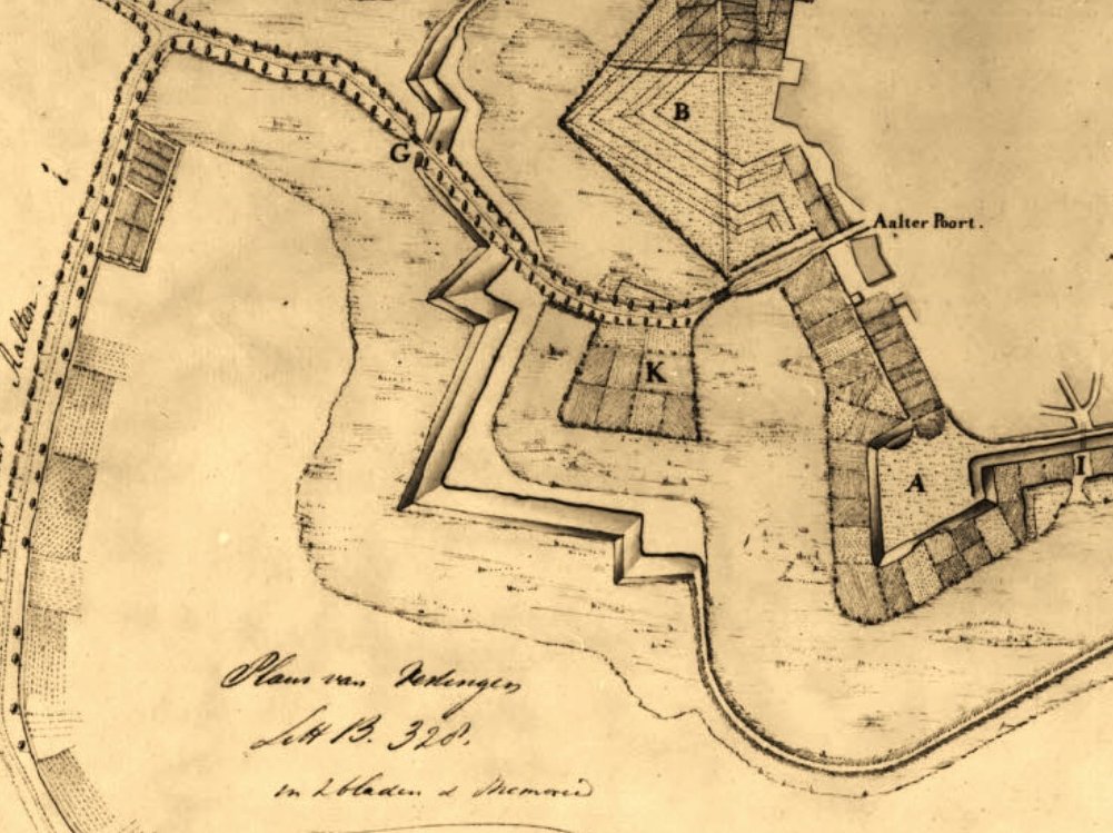
    De Halve Maone (The Half Moon) is a former ravelin and historical fortification in the small Gelderland fortified town of Bredevoort. The fortified, pentagonal island was situated on the western side of the town in the town moat, directly in front of the Aalterpoort (Aalten Gate). Together with the surrounding field of fire, ‘de Koppele’, the complex forms an important cultural-historical element, recalling the strategic significance of Bredevoort during the Eighty Years’ War and the centuries that followed.

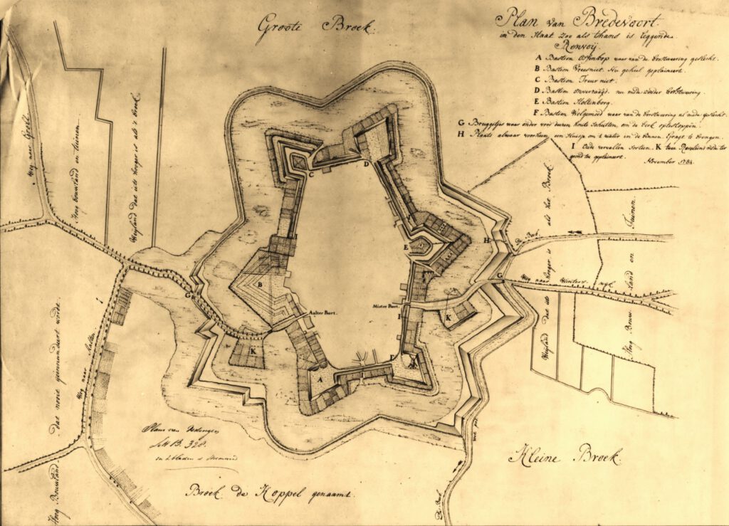
    A ravelin is an outwork of a fortification that primarily served to protect vulnerable town gates and the curtain wall behind them against enemy fire and assaults. De Halve Maone was constructed as a pentagonal island and was situated between the Ossenkop (Ox Head) and Vreesniet (Fear Not) bastions. The island was surrounded by an additional moat (the ravelin moat).

    Access to the town via the western side was divided at the time: travellers coming from the old road to Aalten crossed a first bridge over the outer moat onto the ravelin. From the ravelin, a second bridge, designed as a drawbridge, led across the town moat to the Aalterpoort. On the eastern side of Bredevoort, in front of the Misterpoort, a similar defensive work was situated at the time.

    History and Development

    The Middle Ages and the early ‘half moon’ (until 1606)

    Although it is not known when the first Aalterpoort was built, accounts from the year 1500 show that maintenance work was already being carried out on the town gates around that time. The foundation for the later ravelin was presumably laid between 1545 and 1555, when the Gelderland warlord Maarten van Rossum was appointed drossard (bailiff) of Bredevoort. Van Rossum had the medieval fortification radically modernised to render it resistant to the rise of cannon fire; he widened the moats, threw up earthen ramparts, and placed an early ‘half moon’ in front of the Aalterpoort.

    A map by the cartographer Jacob van Deventer from circa 1560 still shows the Aalterpoort as a heavy tower with an outlying roundel or barbican. On later siege maps from 1597 onwards – the year in which Maurice of Orange captured the town after a fierce siege – the gate is depicted with a drawbridge and the characteristic crescent-shaped advance fortification.

    Modernisation to the Old Dutch fortification system

    After the States forces gained control of the town and Frederick Henry of Orange successfully relieved the fortress in 1606, it was decided to thoroughly renew the medieval fortifications. The old medieval Aalterpoort was demolished in 1606. In its place, a new, brick-built gate arose that lay recessed into the main rampart. On this occasion, Van Rossum’s relatively simple ‘half moon’ made way for a larger, pentagonal ravelin.
    Decay and the Fortifications Act (19th century)

    With the introduction of the Vestingwet (Fortifications Act) in 1874, Bredevoort officially lost its military status. To save on high maintenance costs, the inhabitants of the town decided to dismantle the Aalterpoort. The wooden bridges over the moats were replaced by a permanent, earthen embankment.

    Cadastral maps from 1828 reveal that the fortifications were already in decay at that time, yet the contours of De Halve Maone and the Aalterpoort were still prominently recognisable. The maps also show the historical water management system: at the time, the Slingebeek still flowed on the eastern side of the town around the eastern ravelin. To the north and north-east of the small town, the moat around De Halve Maone was fed by the Schaersbeek, which merged into the low-lying lands and flowed on towards a weir near the former Fort Oranje. Following the dismantling, the culverted moats and the levelled ramparts on the northern side were largely put to use as allotments.

    Landscape context: ‘De Koppele’ field of fire

    Directly adjacent to De Halve Maone lies de Koppele (historically also referred to on maps as the Kleine Broek). This characteristic lowland peat area extends between the historical town centre and the current Bolwerkweg and Tolhuisweg, over which the old connecting road to Aalten used to run.

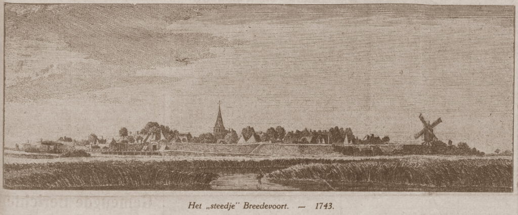
    In military terms, this open, marshy terrain functioned as the field of fire. It offered the defenders on the ramparts a clear and unobstructed view of approaching enemies. The artist Jan de Beijer captured this open landscape in 1743 in a well-known drawing from the Tolhuisweg. In the foreground of his work, a portion of the ‘voorde’ (a ford) is visible – the landscape element to which Bredevoort owes its name (‘broad ford’). Today, de Koppele is the only remaining area around Bredevoort that recalls this original, strategic setting.
    Recent Situation and Archaeology

    Culverting in the 20th century

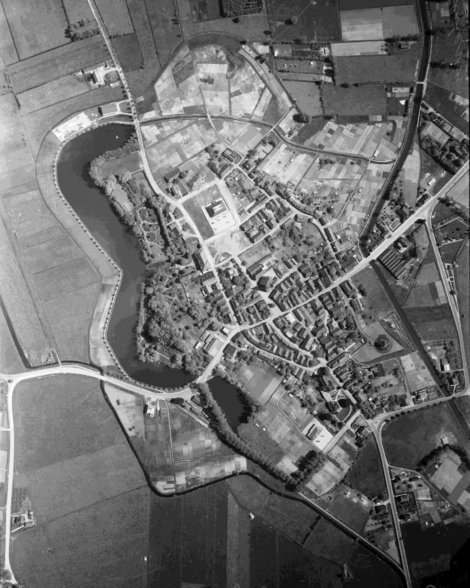
    In the course of the 20th century, the historical structure became largely hidden from view. In 1972, the ravelin moat – which formed the course of the Schaersbeek right alongside the Tramstraat – was culverted and filled in. Further down into the de Koppele area, the brook was straightened towards the weir. The island of the former ravelin itself was transformed into an allotment complex with 40 plots, causing the historical layers to disappear from sight.

    Archaeological discoveries

    In 2022, at the instigation of the local interest group Bredevoorts Belang, an archaeological investigation took place during excavation works by grid operator Liander near the entrance to Bredevoort on the Landstraat. On this occasion, various monumental remains were encountered in the soil, including a section of brickwork that structurally belonged to the ravelin De Halve Maone.

    Future Plans and Redevelopment

    As the historical fortification structure is barely recognisable to visitors and residents in the current situation, Bredevoorts Belang presented proposals in 2025 to make this ‘veiled heritage’ more visible and accessible.

    One of the proposals is the removal of the current dam and the culvert that separate the so-called Kleine Gracht and Grote Gracht (Small Moat and Large Moat). By replacing this barrier with a new bridge in the Landstraat, the moats will once again be brought into open connection with each other.

    Regarding the status and progress of these plans, nothing is currently known to us (as of June 2026).
    Sources


  • The Cross Chapel (Kruiskapel)

    The Cross Chapel (Kruiskapel)

    Hemden, Bocholt (Germany)

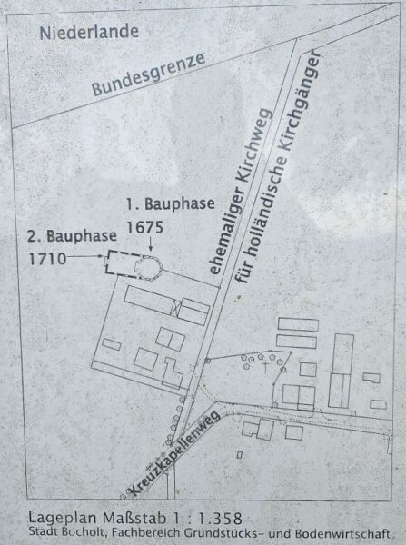
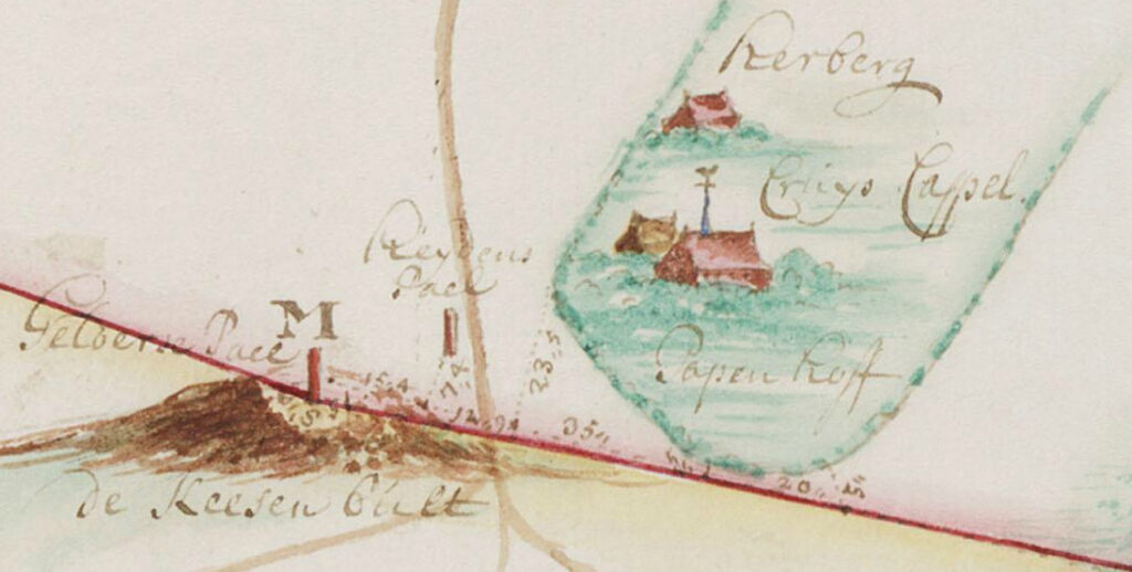
    De Kruiskapel (Kreuzkapelle) in Hemden was een vluchtkapel voor de katholieken van Aalten en Bredevoort. Tijdens de hoogtijdagen van het calvinisme (1675-1821) mochten zij hun geloof niet meer uitoefenen. De kapel stond in het Duitse Hemden, tweehonderd meter voorbij de huidige groene grens bij de Kesenbult, aan het einde van de Kiefteweg.

    Missionary Outpost

    From 1672 to 1674, Christoph Bernhard von Galen, the Prince-Bishop of Münster (1650–1678), waged war against the Dutch Republic, supported by King Louis XIV of France. Von Galen, nicknamed ‘Bommen Berend’ (‘Bombing Bernard’), was forced to withdraw from Dutch territories following the Peace of Cologne in April 1674. However, the Catholics remaining in the area were still prohibited from owning their own churches or holding religious services. To provide the Catholics of Aalten and Bredevoort with the opportunity to practise their faith, Von Galen ordered the construction of nine missionary outposts along the border, one of which was the Cross Chapel in Hemden.

    Construction of the Cross Chapel

    Initially, Catholic services in Hemden were held in a barn on the Leicking estate, which had been converted into a house of prayer. In 1675, by order of Von Galen, the Cross Chapel was built on the Reyerding estate. The chapel, dedicated to the Holy Cross, was constructed under the leadership of Jesuit Father Ernst Ignatius Busch, who served as the parish priest for the Aalten and Bredevoort congregations from 1672 to 1674.

    The chapel was an octagonal, largely wooden structure and became the religious centre for the exiled Catholics of Aalten and Bredevoort. Between 1710 and 1714, the chapel was restored and enlarged into a rectangular shape.

    The ‘Kruisberg’ (Cross Hill)

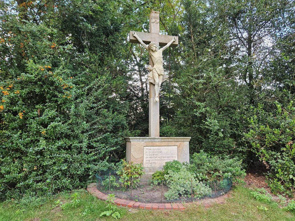
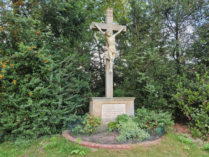
    Around the same time, the ‘Kruisberg’—a small hill—was created near the chapel, upon which a cross was placed. This cross faced the chapel and stood on a pedestal bearing the following inscription (translated from the Middle Dutch):

    What you see here is an image of Christ and not He Himself,
    therefore, worship neither wood nor stone,
    but direct your heart only to Christ.

    This inscription was intended to refute the Protestant accusations of the Reformation era that Catholics were worshipping idols through their figurative representations of Christ and the saints.

    Church Life

    In 1751 telde de parochie van de Kruiskapel ongeveer 27 Duitse en 451 Nederlandse katholieken. Iedere zondag, op katholieke feestdagen en bij familiegebeurtenissen zoals dopen en huwelijken, maakten de katholieken uit Aalten en Bredevoort de tocht naar de kapel, vaak via de huidige Bodendijk en Veenhuisweg. Volgens overlevering gingen de gelovigen in werkkleding en met hun werktuigen naar de kapel, zodat ze niet zouden opvallen als kerkgangers.

    Transcriptions of the baptismal and marriage registers of the Cross Chapel are available on the Genealogiedomein website and are valuable sources for genealogical research.

    The Restoration of Catholicism in the Netherlands

    Vanaf 1798 kregen de Bredevoorters en vanaf 1799 de Aaltenaren weer het recht om in eigen land het katholieke geloof in vrijheid te praktiseren. Zij richtten weer eigen kerken op in Bredevoort en Aalten. Hierdoor daalde het aantal Nederlandse bezoekers van de Kruiskapel. Rond 1800 waren er nog maar enkele Duitse gelovigen die de kapel bezochten, voornamelijk op zon- en feestdagen.

    In 1821, Pope Pius VII decreed that the parishes of Aalten, Bredevoort, and other surrounding areas were to be assigned to the ‘Dutch Mission’. As a result, only five German families remained as members of the Hemden parish. The Cross Chapel had thereby lost its original purpose.

    The End of the Cross Chapel

    On 16 July 1821, Pope Pius VII formally declared the separation of the Dutch Catholics. Two years later, in 1823, the Cross Chapel was demolished. The parish was dissolved and relocated to the nearby Bocholt rural district of Barlo, a few kilometres south-east of Hemden. All that remains today to commemorate the chapel is the Kruisberg, with its Baroque cross and a stone memorial plaque.

    In total, seven parish priests served at the Cross Chapel. Although the chapel itself has vanished, the Kruisberg and its cross remain as a reminder of the religious life of the Catholics from Aalten and Bredevoort during a time of oppression and persecution.

    Features


    FunctionRoman Catholic refuge chapel
    Year of construction1675
    Demolition1823

    Sources


    • Information panel on the Kruisberg in Hemden
    • Wikipedia
  • Slicher van Bathstraat 7-9

    Slicher van Bathstraat 7-9

    Aalten

    Residents

    Address directory 1967

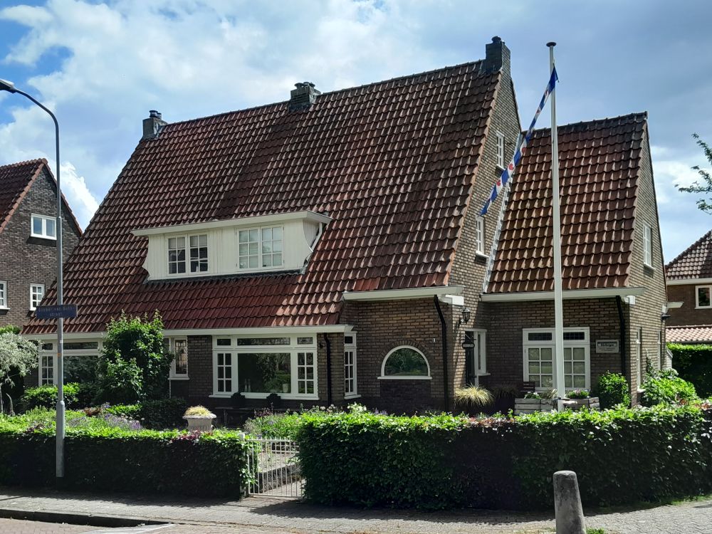
    Slicher van Bathstraat 7

    Mrs. A. Knuivers-Oosterbeek
    A. Zijlstra
    E. Morsink

    Slicher van Bathstraat 9

    W. van Essen

    Features


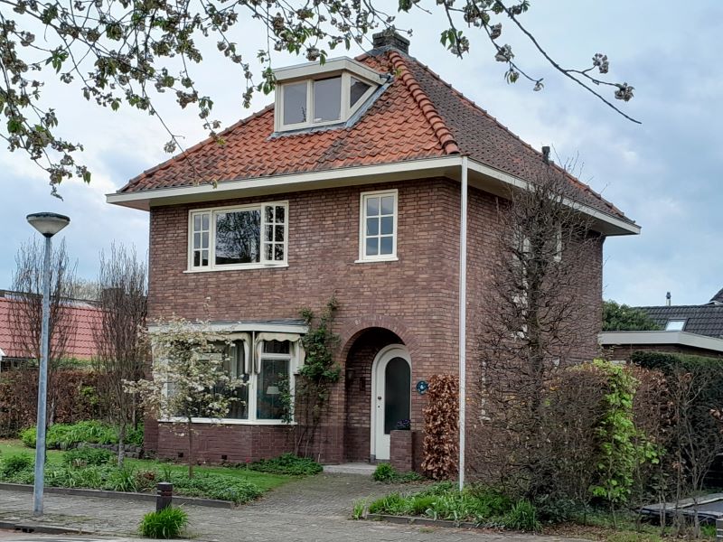
    Cadastral no.I-8552/8553
    FunctionHouse
    Year of construction1938
    Listedno
  • Streets in Heurne

    Streets in Heurne

    This page is still under construction. Other districts will follow later.

    No posts found.
  • Roman Catholic Church Dijkstraat (1859-1893)

    Roman Catholic Church Dijkstraat (1859-1893)

    Aalten

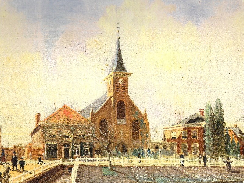
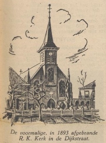
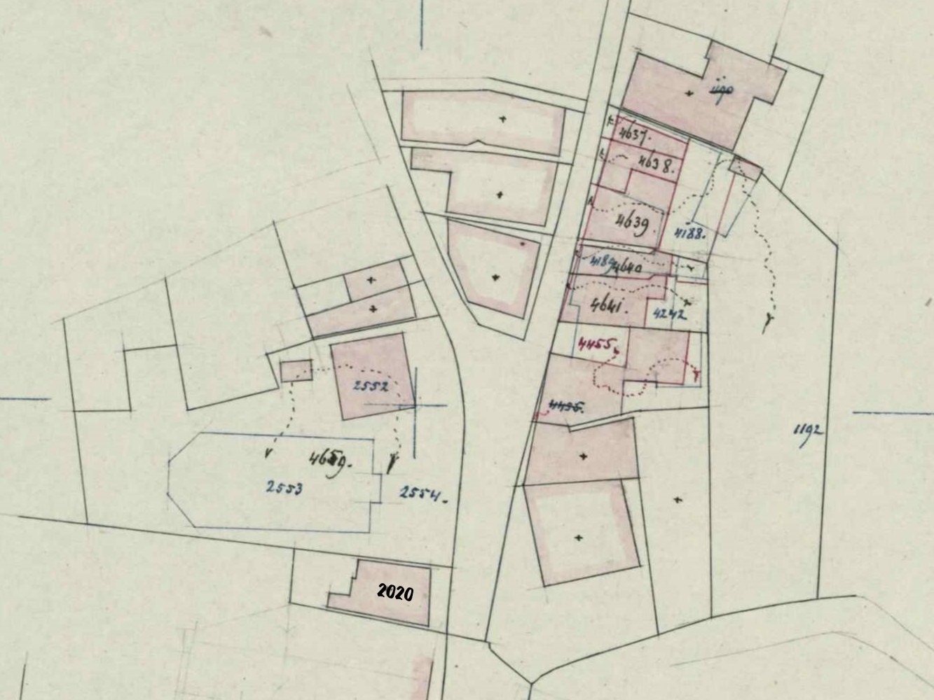
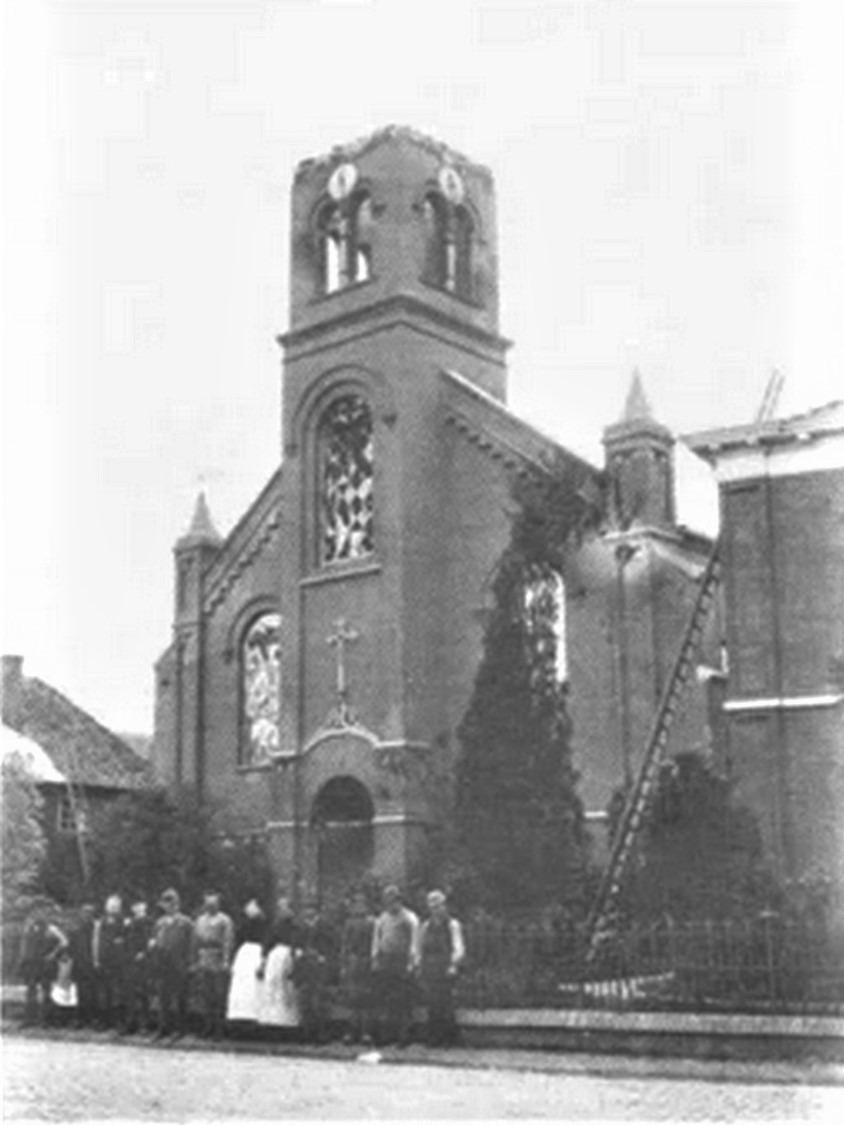
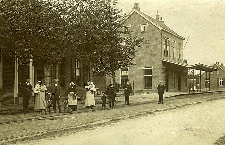
    Between the current addresses of Dijkstraat 2 and 4, there was originally a house occupied by two families. This house was presumably demolished around 1857, after which a Catholic church was built on this location in 1859. This church was destroyed by fire in 1893 and was not rebuilt. Today, a garden is located here, belonging to the former rectory.

    Previously, a house occupied by two families stood at this location. In 1859, a Catholic church was built here. This church was destroyed by fire in 1893 and was not rebuilt. Today, a garden is located at this site.

    Since 1800, the Roman Catholics of Aalten worshipped in a barn church in the Kerkstraat. After five decades, this church proved too small for the growing parish. During the Saint Nicholas market, which began with a church service, the attendance was sometimes so large that people attended the service outside in the bitter cold. A site for a new church was sought and found at the beginning of the Dijkstraat.

    Construction of the Roman Catholic Church on the Dijkstraat (1859–1893)

    Funds were raised for the construction of a church with a rectory, and on May 4, 1859, the new Waterstaatskerk was consecrated. The church stood between the current addresses Dijkstraat 2 (former RC rectory) and Dijkstraat 4 (where the Van den Dobbelsteen bakery was located until 2022).
    Fire

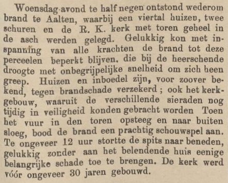
    On May 10, 1893, a fire broke out diagonally opposite the church, in houses on the Kerkstraat. The firefighters’ attention was entirely focused on extinguishing this fire. Orders were given to the firefighters, and they labored at the pumps. The wind was north-easterly, and the buildings close to the burning plots, which were downwind, were kept well-watered. However, the church, which was further away, was ignored until smoke clouds suddenly rose from the roof and tower.
    The word spread from mouth to mouth: “the church is on fire.” Great consternation took hold of the population, the Catholics in particular. The church treasures had to be moved to safety, and they succeeded in doing so. The fire brigade was powerless. They had to keep the nearby plots wet, and now that the church was added to the blaze, they no longer knew how to act. It was a fantastic spectacle in the evening. The entire population of Aalten had flocked together to watch the drama unfold.

    The last strikes heard from the tower clock were at half past eleven. Then the spire collapsed and a sea of sparks swirled through the sky. It was over. Nothing but ruins remained. Fortunately, the rectory was spared.

    New Construction

    What now? The adjacent school, to which a shed was added, was set up as a church, and means had to be sought to build a new church. The bitter pill was somewhat sweetened because the insurance was generous with the compensation. No less than approximately 26,000 guilders was paid out.

    Since a new building had to be constructed anyway, a larger site was sought. This was found a little further along, on the other side of the Dijkstraat. There, the new RC church was built.


    Earlier buildings

    Before the construction of the church in 1859, a house stood on this location, occupied by two families. This house was demolished around 1857 (?).


    Owners

    Overview is incomplete.

    YearPlotOwnerDescription
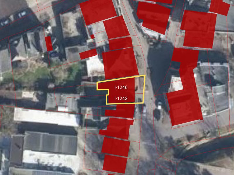
    1832I-1243
    I-1246
    Berend Wevers
    Gerrit Jan Scholten
    64 m² house & yard
    133 m² house & yard

    Residents

    1813

    Aalten 50

    Half house and garden

    Jan Willem Duenk (Barlo, 1751-02-10), day laborer
    Berent Wevers (Aalten, 1785-02-06), son, tailor
    Gradus Wevers (Aalten, 1799), son

    2 males
    2 females
    1 son

    Aalten 51

    Half house and garden

    Gerrit Jan Scholten (Lintelo, 1764-07-29), day laborer

    1 male
    1 female
    2 sons
    2 daughters

    Population register 1823-1838

    Aalten 50

    Berend Wevers (Aalten, 1785-02-06), laborer
    Johanna Catharina Roerdinkveldboom (Winterswijk, 1789-02-02)

    Aalten 51

    Gerrit Jan Scholten (Lintelo, 1764-07-29), laborer
    Willemina Sluiskes (Aalten, 1775-08-31)

    Population register 1838-1850

    Aalten 48

    Berend Wevers (Aalten, 1785-02-06), laborer
    Johanna Catharina Roerdinkveldboom (Winterswijk, 1789-02-02)

    Aalten 49

    Gerrit Jan Scholten (Lintelo, 1764-07-29), laborer
    Willemina Sluiskes (Aalten, 1775-08-31)

    Population register 1850-1860

    Aalten 48

    Jan Hendrik Wevers (Aalten, 1816-11-12), weaver
    Christina Aleida Winkelhorst (Aalten, 1804-02-14)

    Aalten 49

    Derk Antonij Doornink (Aalten, 1809-11-14), farmer
    Antonetta Willemina Scholten (Aalten, 1813-01-29)

    Features


    Cadastral no.I-11435
    FunctionChurch
    Year of construction1859
    Burned down1893

    Afbeeldingen

  • Patrimoniumstraat 33

    Patrimoniumstraat 33

    Aalten

    Owners

    This overview is incomplete.

    YearPlotOwnerDescription

    Residents

    Address directory 1967

    Patrimoniumstraat 33

    H.J. te Brake

    Features


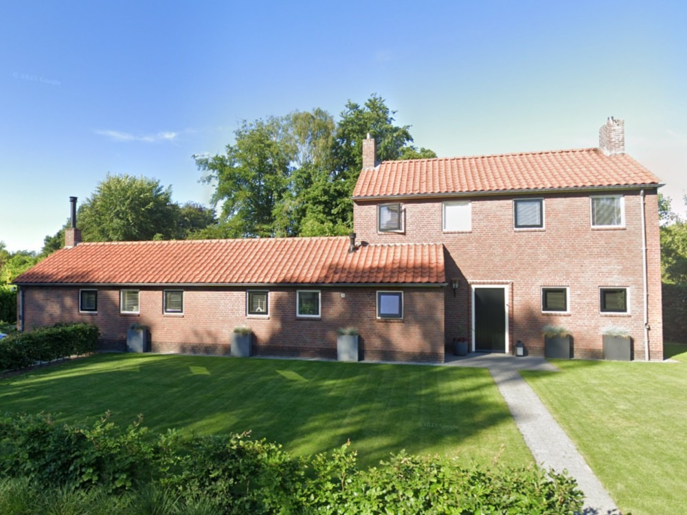
    Cadastral no.I-13290
    FunctionHouse
    Year of construction1920
    Listedno
  • Kruisdijk 16

    Kruisdijk 16

    IJzerlo

    A former freezer building of approximately 50 m² is also located on the plot, currently in use as a storage shed.


    Owners

    This overview is incomplete.

    YearPlotOwnerDescription

    Residents

    Address directory 1967

    IJzerlo 112/1 > Kruisdijk 16

    J.C. Tolkamp

    Features


    Cadastral no.S-128
    FunctionHouse
    Year of construction1954
    Listedno
  • De Meiberg

    De Meiberg

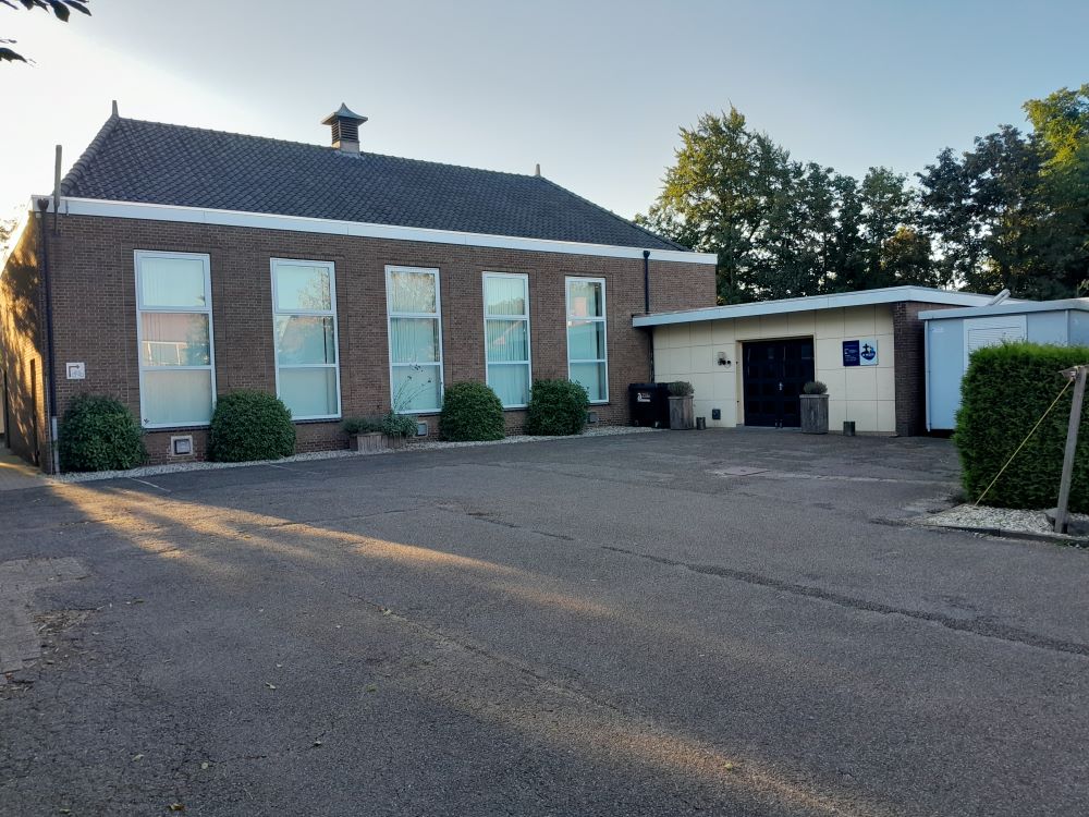
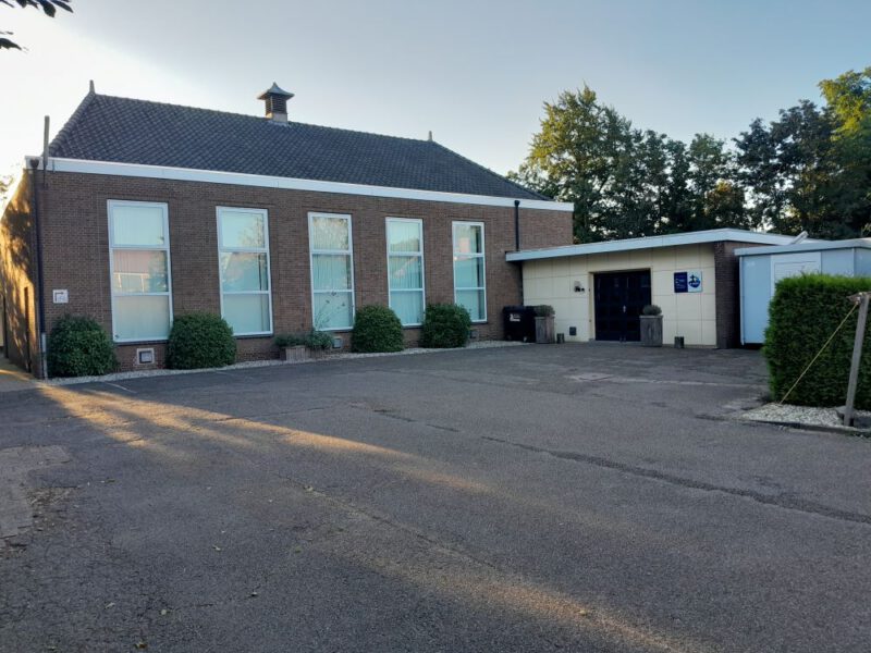
    Meiberg 23/1, Aalten

    Meiberg 23/1, Aalten (Congregation of Christians)
    Photo: G. Schreurs (2024)

    Meeting hall of the Congregation of Christians.


    Address directory 1967

    Meiberg 23/1

    Meeting hall of the Assembly of Believers

    Features


    Cadastral no.I-9434
    FunctionMeeting hall
    Year of construction1965
    Listedno
  • Ringkampsbulten

    Ringkampsbulten

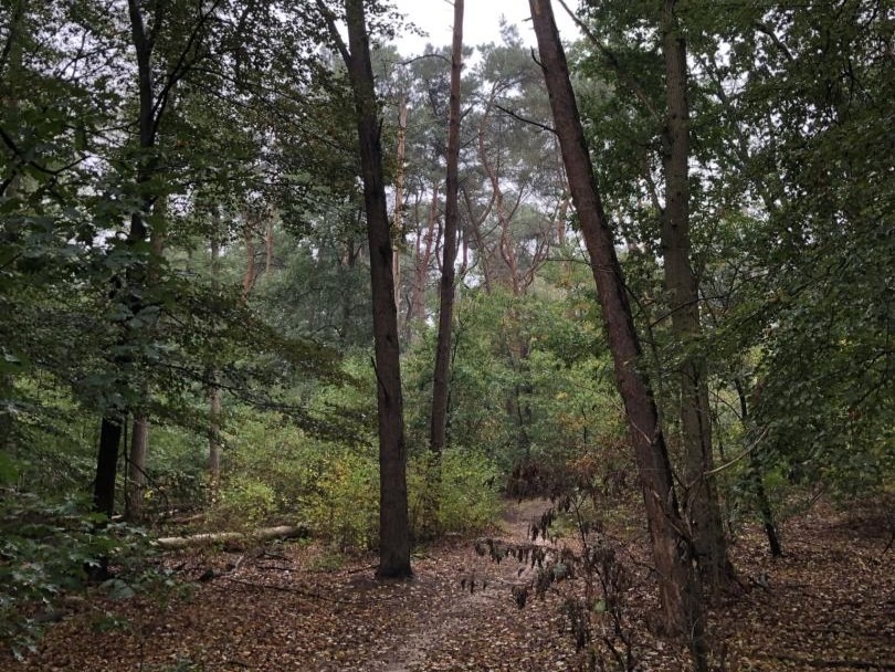
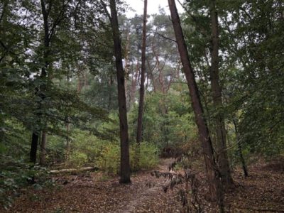
    The Ringkampsbulten is a small nature reserve in the Aalten hamlet of Haart, situated between Kriegerdijk and Huiskermatedijk. The area consists of mixed woodland on partly hilly terrain. The cover-sand ridge within the forest sits at 41 metres above NAP (Normal Amsterdam Peil), making it the highest point in the municipality of Aalten.

    In 1932 werd gedacht dat het een grafheuvel was, maar uit een kleine testopgraving bleek het om een natuurlijke heuvel te gaan. Buiten de heuvel werd echter wel een urn uit de IJzertijd (tot Vroeg-Romeins) gevonden, waardoor de naamgeving niet geheel onterecht is.

    The cover-sand ridge consists of mixed forest with a high percentage of conifers. The lower, damper section to the south of the ridge primarily contains deciduous trees, including many alders. Along the walking path on the southern side, there is avenue planting in the form of pedunculate oaks.

    The Ringkampsbulten is part of the Gelders Natuurnetwerk (Nature Network of Gelderland). The area is surrounded by agricultural land, making it a unique oasis for both flora and fauna. Measures have been taken to develop the woodland into a ‘natural stepping stone’, with the aim of promoting high biodiversity. This involves pursuing a varied forest structure with edges rich in texture and open clearings. Species that benefit from such a stepping stone include the White Admiral and the Purple Emperor butterflies.

    The site has developed into a valuable piece of nature where rare plants and animals can flourish. For walkers and nature enthusiasts, De Ringkampsbulten offers a peaceful spot to enjoy the landscape, featuring beautiful views and varied vegetation. It is a lesser-known but cherished piece of nature among local residents, partly due to its tranquillity and small scale.

  • Cattle Weighbridge

    Cattle Weighbridge

    Stationsstraat, Aalten

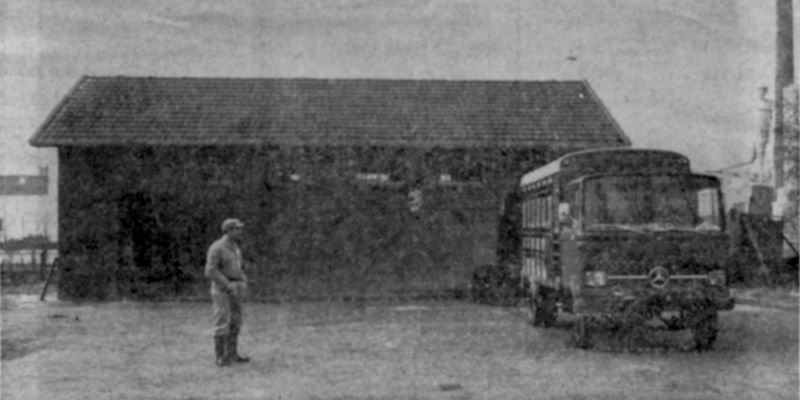
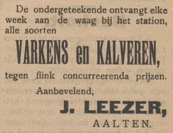
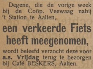
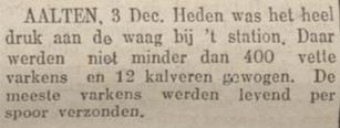
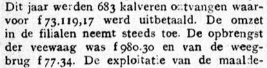
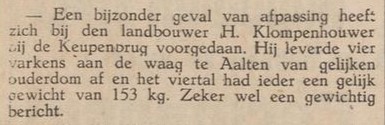
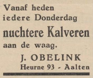
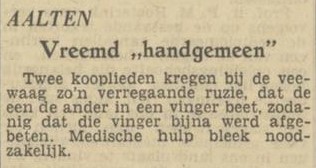
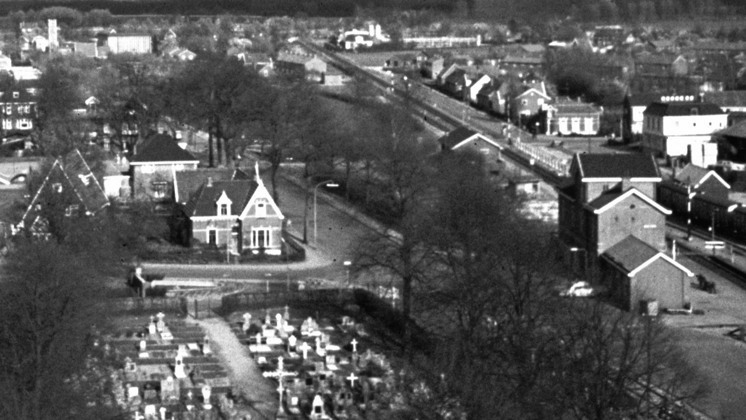
    Next to Aalten railway station, diagonally opposite Hotel De Besker, a cattle weighbridge stood until the mid-1960s or even 1970s (?). The weighbridge was part of the Agricultural Cooperative Society and served for the inspection and weighing of livestock intended for slaughter.

    After inspection, the livestock was transported to its final destination by road or rail. That destination could, in fact, be very close by, namely the municipal slaughterhouse (later KSA) on the other side of the railway line.


    Owners

    This list is incomplete.

    YearPlotOwnerDescription
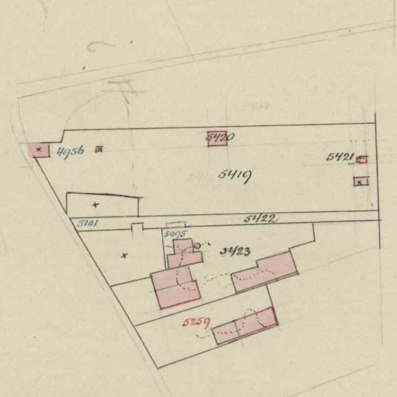
    1910I-4956Geldersch Overijsselsche
    Locaal Spoorwegmij.
    4,765 m² cattle weighbridge and railway
    1911I-5420Geldersch Overijsselsche
    Locaal Spoorwegmij.
    48 m² cattle weighbridge
    1921I-5420Hollandsche IJzeren
    Spoorweg Maatschappij
    48 m² cattle weighbridge
    1938I-5420N.V. Nederlandse Spoorwegen48 m² cattle weighbridge
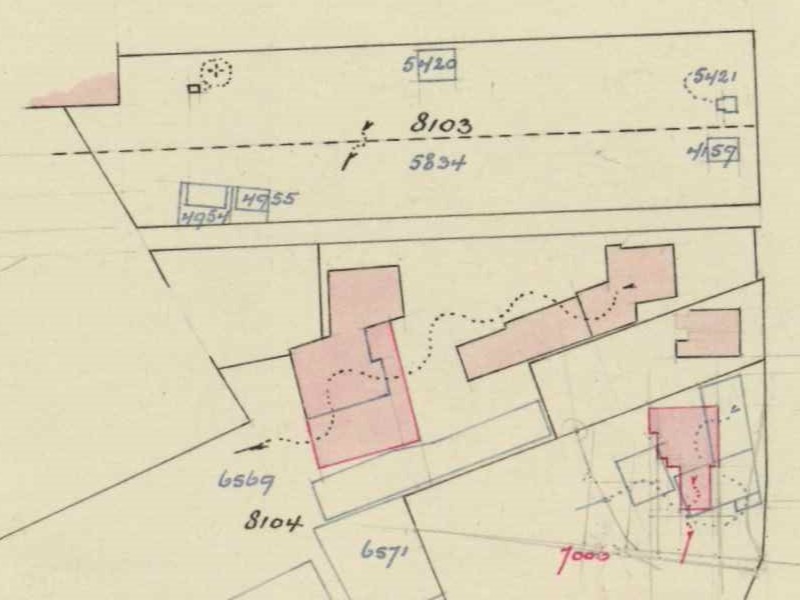
    1957I-8103N.V. Nederlandse Spoorwegen5,033 m² railway line, sheds,
    cattle weighbridge
    1963I-8954N.V. Nederlandse Spoorwegen24,340 m² station, warehouse,
    sheds, cattle weighbridge, railway

    Newspaper reports

    Features


    Cadastral no.K-2785
    FunctionCattle Weighbridge
    Year of constructionca. 1910
    Demolitionca. 1963–1975

    Afbeeldingen

  • Albert Heijn

    Albert Heijn

    Overview

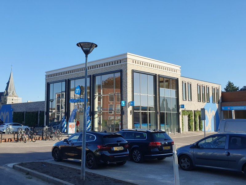
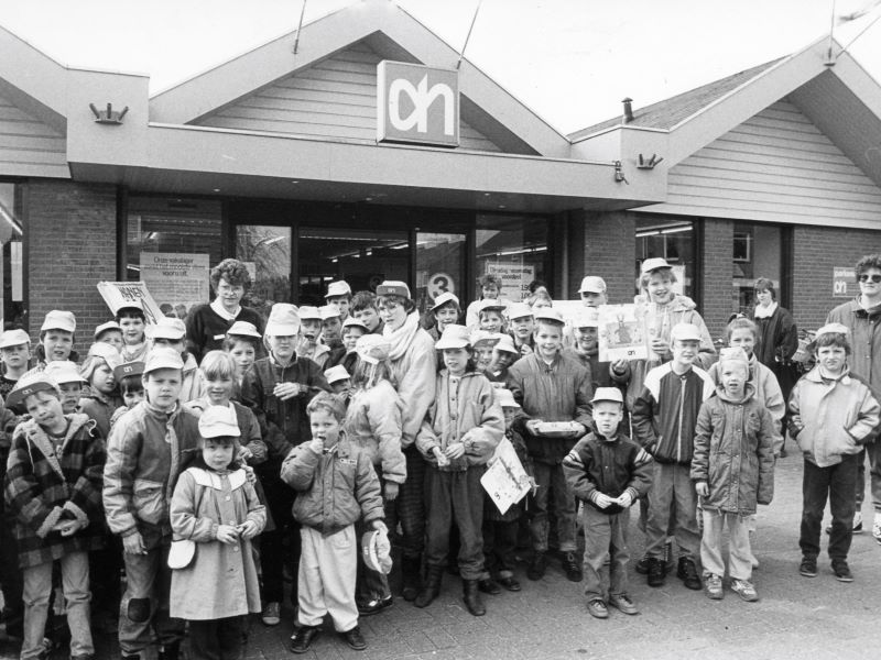
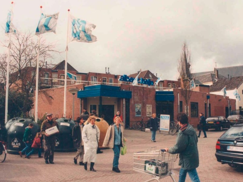
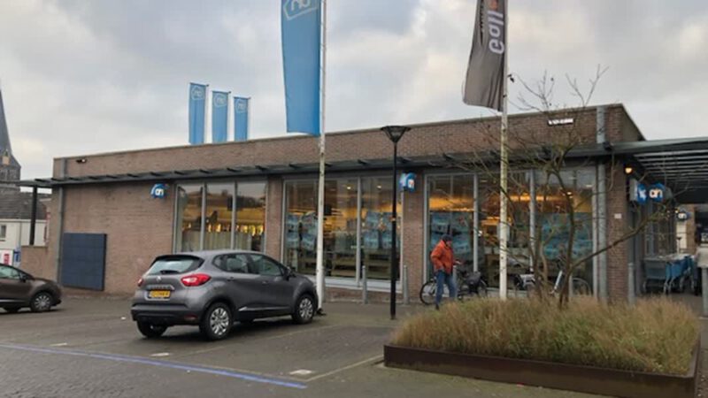
    Albert Heijn has been a household name in Aalten for decades, but the supermarket has occupied several locations over the years. The first Albert Heijn branch in Aalten was situated on Bodendijk. Later, ‘Appie’ moved to Lage Blik. The premises on Bodendijk were subsequently occupied by the footwear and sportswear retailer Scapino.

    On Wednesday 2 July 2008, Albert Heijn opened a new branch at De Hoven, on the site previously occupied by Edah (from 1993) and later Golff (2007–2008). The building on Lage Blik was later taken over by the retail chain Action.

    The Albert Heijn at De Hoven was located above the library. Due to the differences in elevation in Aalten’s town centre, both the supermarket and the library were able to have their entrances at street level, with the latter situated on the lower-lying Hogestraat.

    In 2023, the Albert Heijn at De Hoven underwent a major expansion and transformation. The shop floor grew from 1,300 to 2,800 square metres. The library below moved to Lage Blik, after which the vacated space was converted into a multi-storey car park. Three apartments were also created above the supermarket.

    The new premises also house a Gall & Gall off-licence and a patisserie with a coffee corner by Kasper Paul.

    Images

    Albert Heijn in Aalten through the years:

  • Streets in Barlo

    Streets in Barlo

    This page is still under construction. Other districts will follow later.

    No posts found.
  • Streets in Dale

    Streets in Dale

    This page is still under construction. Other districts will follow later.

  • Hollenberg

    Hollenberg

    Dale

    From door to door

    Error: View 1efdd0c6fl may not exist
  • Border Office & Tram Station Heurne

    Border Office & Tram Station Heurne

    Hamelandroute 91, Heurne (vanished)

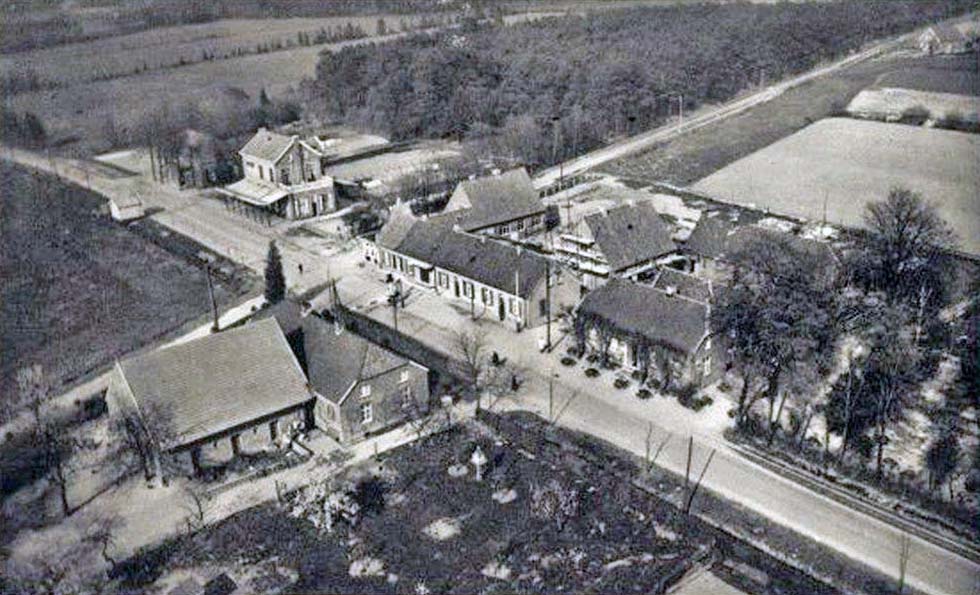
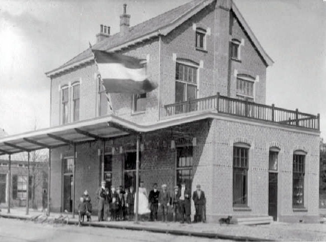
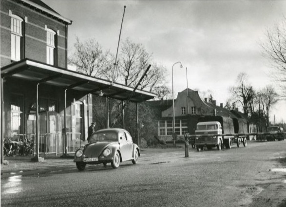
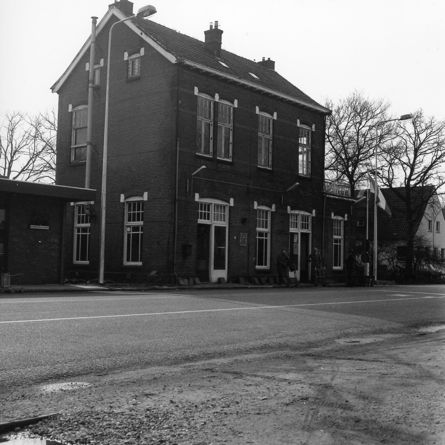
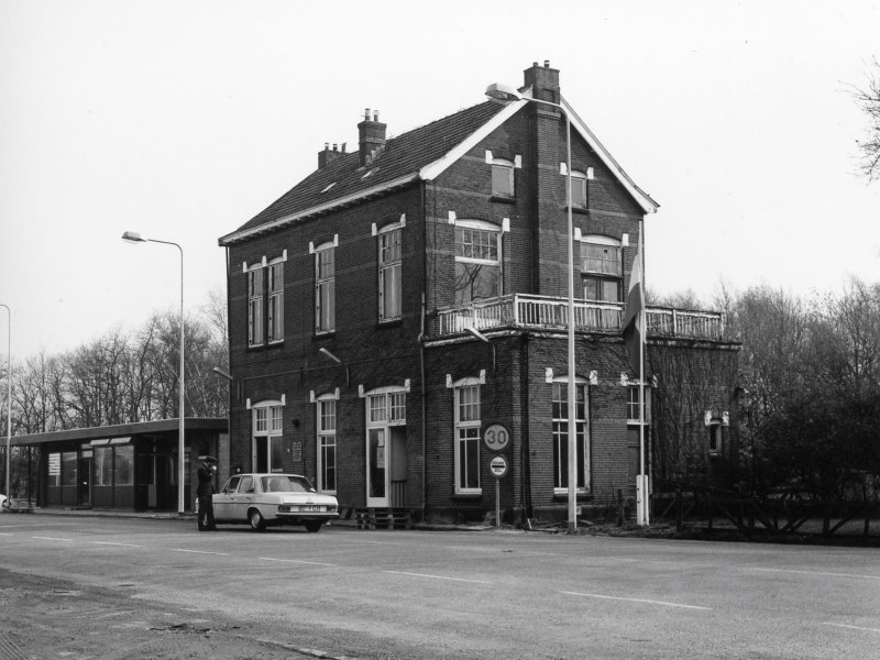
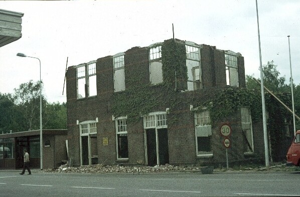
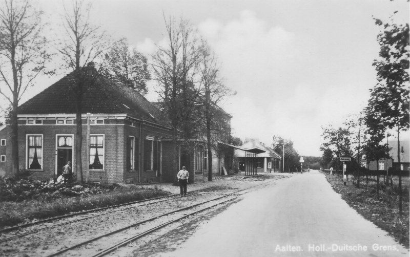
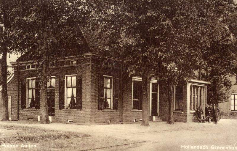
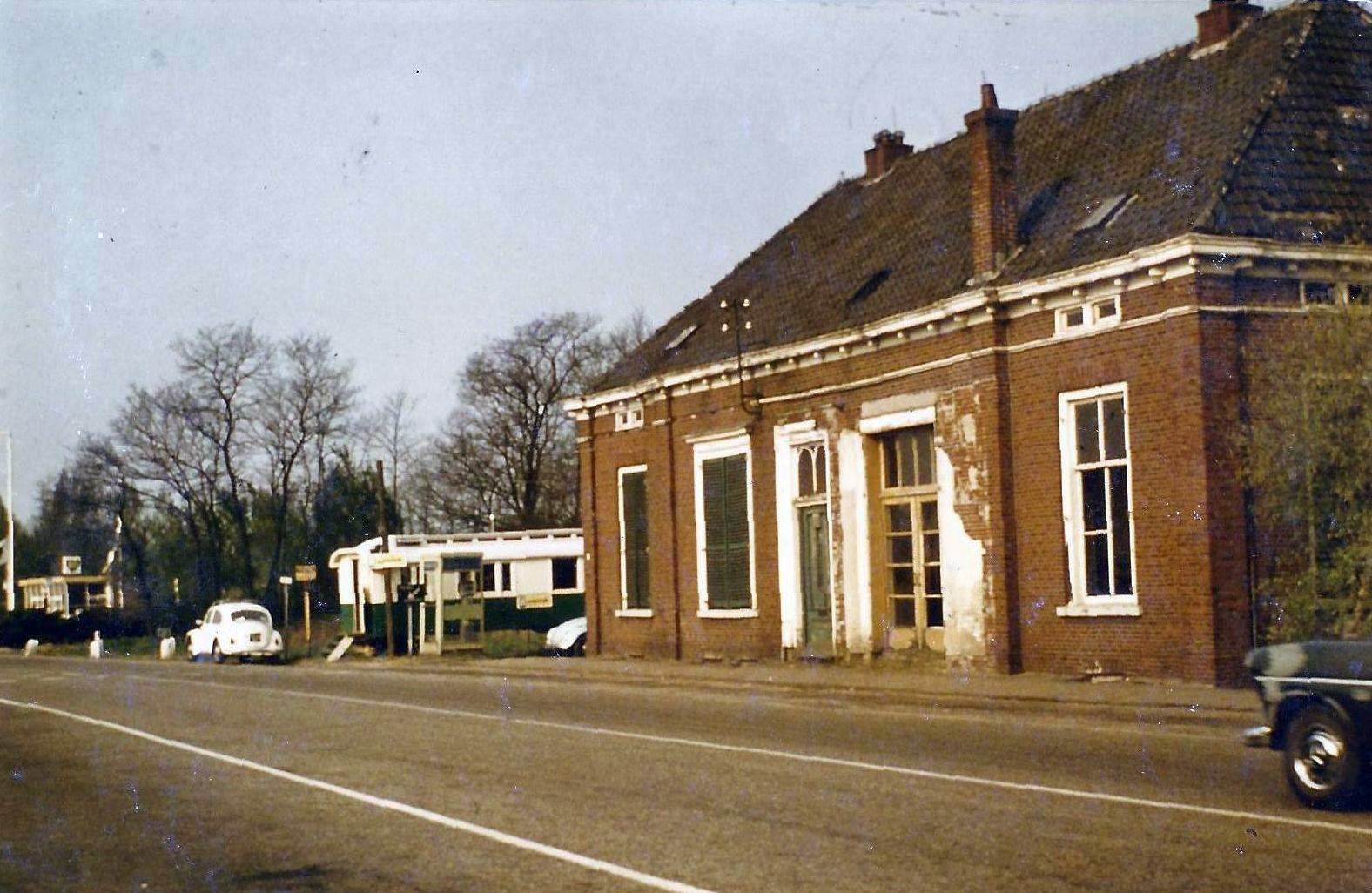
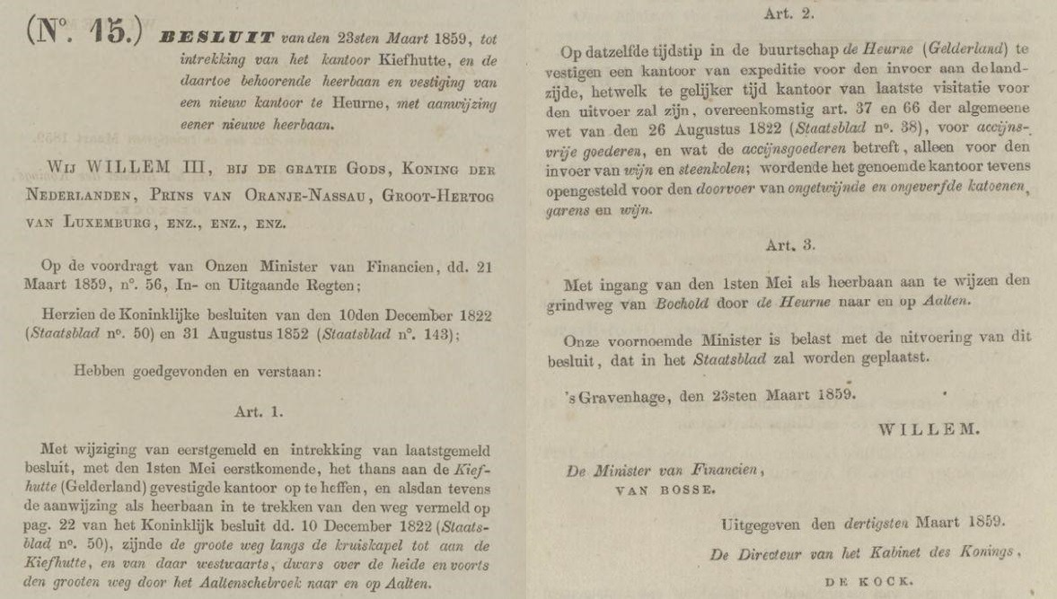
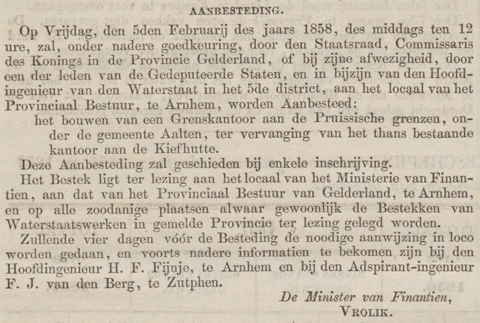
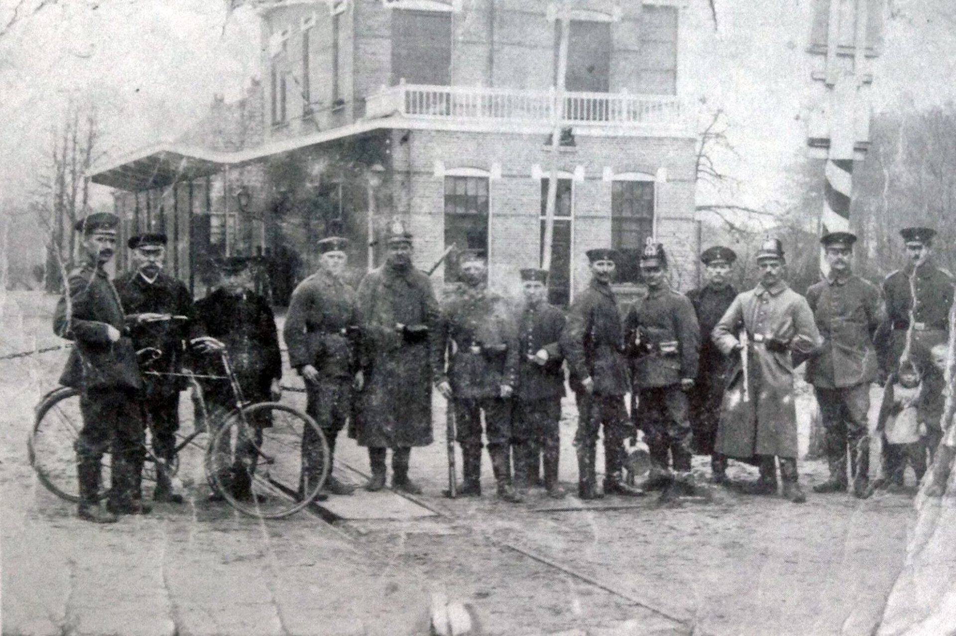
    In 1859, the border office in the Aalten Heurne was moved from the Bodendijk (now Kiefteweg) to the former Bocholtscheweg, the current Hamelandroute. This was the building on the left in the photo above.

    Tram and marechaussee

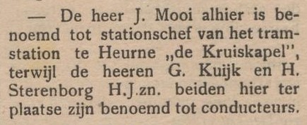
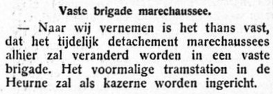
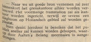
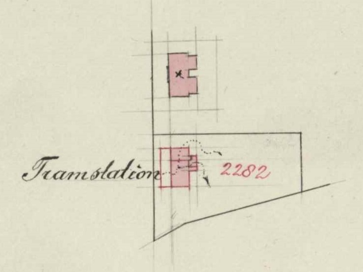
    In 1910, a station for the steam tram on the Bocholt-Aalten-Lichtenvoorde line was erected next to the border office (the building with the veranda, on the right in the photo above). In 1932, this tram station was converted into a marechaussee barracks. In the late 1930s, the marechaussee moved to a new barracks on the Ringweg. The former tram station was converted into a border office. Around 1960, the ‘new’ border office was stripped of its characteristic veranda.

    Border Office

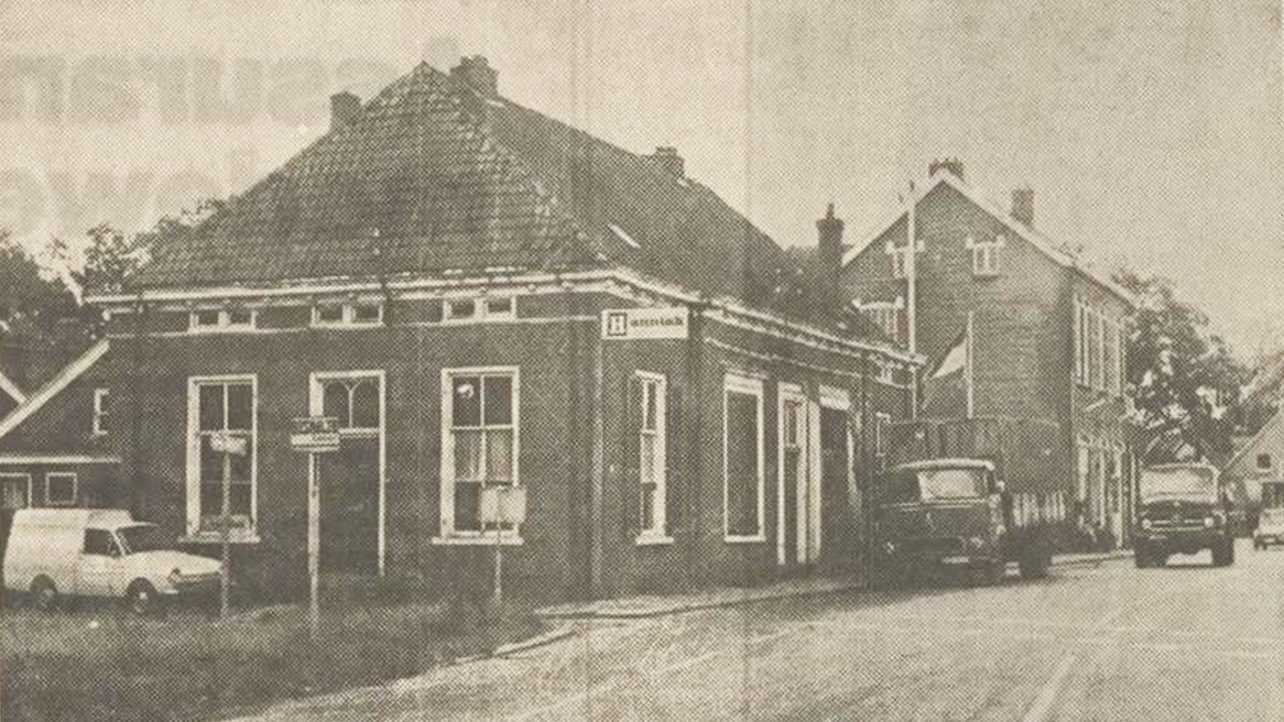
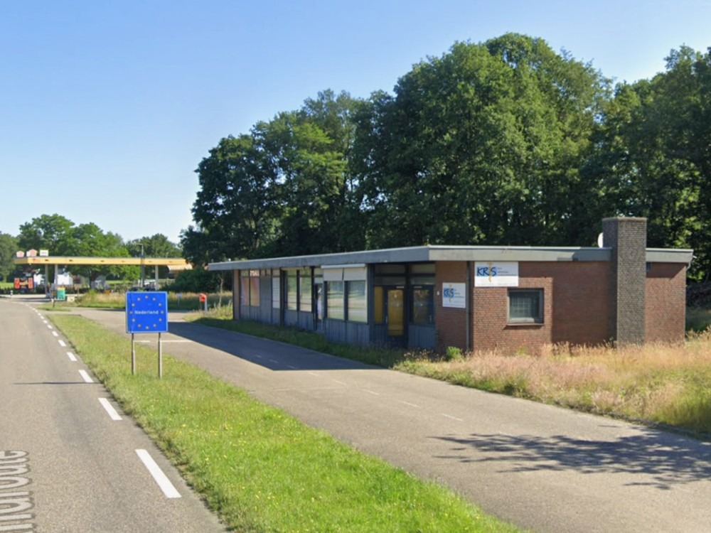
    In the mid-1970s, the old border office from 1859 was demolished. Subsequently, a modern single-storey office was built on the same site. After this new building was completed, the former tram station was also demolished.

    It was a busy border crossing. The customs post was manned 24 hours a day. During peak periods, fifty to sixty customs officers sometimes worked there. Following the establishment of the Schengen Agreement, the customs post was permanently closed on December 31, 1992. The office remained in use for years afterward by various small businesses. It was demolished in 2024.

    Features


    Cadastral no.R-689
    Old border office
    FunctionBorder Office
    Year of construction1859
    Demolitionca. 1975
    Old tram station
    FunctionsTram station,
    Marechaussee barracks, Border office
    Year of construction1910
    Renovation1932 and 1939
    Demolitionca. 1975

    Photo album


    Newspaper reports


    Owners

    This overview is incomplete.

    YearPlotOwnerDescription
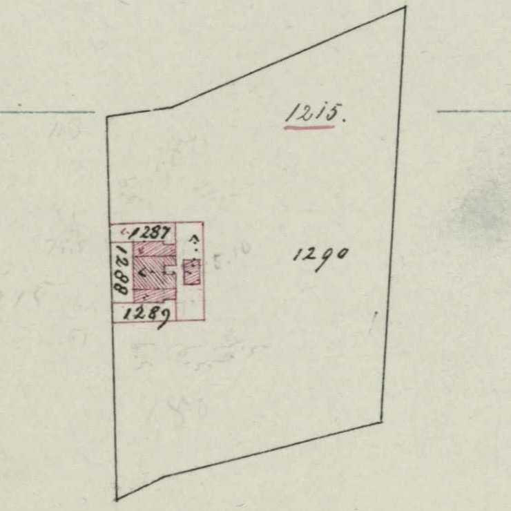
    1861E-1287State Domains180 m² house, yard
    1883E-1287
    E-1288
    E-1289
    The State180 m² house, yard (Heurne 18)
    510 m² house, yard (Heurne 19)
    180 m² house, yard (Heurne 20)
    1911E-2282The State1,950 m² tram station, arable land, heath & pines
    1933E-2282The State1,950 m² tram station, national office, arable land, heath & pines
    1965E-2603The State1,837 m² national office, house, arable land
    1985R-264The State9.660 m² building, yard

    Residents

    Population register 1860-1870

    Heurne 15a

    Willem Baerts (The Hague, 07-01-1832), collector
    Frederica Jacomina Johanna Jacoba Cats (Groede, 08-26-1836)

    Subsequent residents (1862-1874):

    Gerrit Jan van Soest (Tiel, 11-05-1802), national collector
    Agatha Margaretha Woudenberg (Boxtel, 11-05-1809)

    Heurne 15b

    Cornelus Johannes Josias Morin (Venlo, 12-10-1819), clerk
    Geertruida van Heel (Nijmegen, 12-24-1833)

    Next residents:

    Jan Xavier Hoff (Clemency/L, 11-04-1807), clerk
    Lotta Antonetta Alberdina van der Beesten (Maasweil, 08-24-1836)

    Next residents:

    Jan Poppe Terweel (Blesse, 06-24-1828), clerk
    Anna Sophia Jacoba Zintgraaf (Amsterdam, 11-12-1832)

    Population register 1870-1880

    Heurne 18

    Gerrit Jan van Soest (Tiel, 11-05-1802), national collector
    Agatha Margaretha Woudenberg (Boxtel, 11-05-1809)

    Subsequent residents (1874):

    Franciscus van de Voort (Hunsel, 05-10-1832), clerk collector
    Barbara Hentjens (Landeken, 09-12-1835)

    Subsequent residents (1874-1881):

    Adrianus van der Kruk (The Hague, 03-05-1821), collector
    Hendrika Willemina Meijer (Zutphen, 07-25-1812)

    Heurne 19

    Paulus Zijser (The Hague, 12-28-1836), clerk
    Theodora Cornelia Janssen (Aardenburg, 05-10-1846)

    Subsequent resident (1873-1874):

    Hendrik Matthijs Hubert Bruls (Orsbeek, 12-02-1847), clerk

    Subsequent residents (1870-1871):

    Mattheus van Kooij (Wijhe, 10-28-1840), clerk
    Berendina Remmiggina Hoetjen (Deventer, 05-15-1838)

    Subsequent residents (1871-1873):

    Antonius Höfkens (Nijmegen, 03-26-1837), clerk
    Wilhelmina Jacoba Huberta Huibers (Nijmegen, 07-19-1843)

    Heurne 20

    Jan Poppe Terweel (Blesse, 06-24-1828), clerk
    Anna Sophia Jacoba Zintgraaf (Amsterdam, 11-12-1832)

    Subsequent residents (1870):

    Adriaan Arnold den Hartogh (Budel, 04-13-1843), clerk

    Subsequent residents (1870-1873):

    Johannes Hendrikus Krijlen (Nijmegen, 06-26-1835), official
    Johanna Hermina Buijnink (Lichtenvoorde, 10-23-1843)

    Subsequent residents (1872-1873):

    Herman Lodewijk Joseph de Leur (Well, 04-11-1849), clerk

    Subsequent residents (1876-1877):

    Heurne 20

    Hermanus Franciscus Wolfs (Maastricht, 11-22-1841), national official
    Gerritjen Boland (Wisch, 10-20-1841)

    Subsequent residents (-1880):

    Gerard Herman Filet (Amsterdam, 12-08-1842), national official
    Berendina Neerhof (Aalten, 08-21-1855)

    Heurne 20

    Johannes Matheus Sluijtman (Nijmegen, 07-31-1832), clerk
    Petronella Barnauw (Nijmegen, 05-29-1830)

    Population register 1880-1890

    Heurne 18

    Adrianus van der Kruk (The Hague, 03-05-1821), national collector
    Hendrika Willemina Meijer (Zutphen, 07-25-1812)

    Subsequent residents (1881-1893):

    Casper Hendrik Klinge (Amsterdam, 06-17-1828), national collector
    Johanna Wilhelmina Burgers (Den Helder, 03-19-1843)

    Heurne 19

    Gerard Herman Filet (Amsterdam, 12-08-1842), national official
    Berendina Neerhof (Aalten, 08-21-1855)

    Next residents:

    Jan Langendoen (Oudenhoorn, 04-10-1850), national official

    Next residents:

    Hendrik Gerrit te Vaanholt (Exel, 11-08-1851), national official
    Reintjen Toorneman (Bathmen, 03-08-1850)

    Next residents:

    Johannes Idarus Dorgelo (Den Ham, 02-01-1859), clerk at National Taxes
    Geertruida Willemina Toebes (Winterswijk, 11-14-1861)

    Heurne 20

    Johannes Matheus Sluijtman (Nijmegen, 07-31-1832), national official
    Petronella Barnauw (Nijmegen, 05-29-1830)

    Subsequent residents (1880):

    Benjamin Driessen (Aalten, 05-19-1853), clerk

    Subsequent residents (1880):

    Johannes Josephus Blomesath (Aalten, 07-27-1850), clerk
    Maria Hendrika Willemina Vultink (Aalten, 09-08-1855)

    Subsequent residents (1888):

    Jan Bloten (Ommen, 06-02-1856), clerk
    Mina Aleida Weggelaar (Bredevoort, 12-17-1859)

    Subsequent residents (1889):

    Herman Neeuwveld (Diepenveen, 11-27-1857), clerk
    Petronella Geertruida Catharina van Heuven (Angerlo, 06-11-1862)

    Next residents:

    Heurne 20

    Hendrik Godron (Appeltern, 09-27-1855), clerk
    Elisabeth Hendrina Haertzdorf (Aerdt, 02-26-1863)

    Population register 1890-1900

    Heurne 20

    Casper Hendrik Klinge (Amsterdam, 06-17-1828), clerk collector
    Johanna Wilhelmina Burgers (Den Helder, 03-19-1843)

    Subsequent residents (1894-1895):

    Henri Hubert Maes (Ixelles/B, 03-04-1841), clerk collector
    Susanna Frederika Muller (Lobith, 08-03-1851)

    Subsequent residents (1895-1897):

    Jan Roemeling (Winschoten, 11-24-1848), clerk collector
    Hindertje Wiertsema (Nieuweschans, 08-08-1855)

    Subsequent residents (1897-1907):

    Teije Jacobus Aukes (Vledder, 02-11-1843), clerk collector
    Geertruida Georgina Becht (Bergen op Zoom, 12-15-1845)

    Heurne 21

    Johannes Idarus Dorgelo (Den Ham, 02-01-1859), clerk
    Geertruida Willemina Toebes (Winterswijk, 11-14-1861)

    Next residents:

    Berend van Klinken (Onstwedde, 10-25-1854), clerk
    Geessien Toorman (Nieuwe Pekela, 12-09-1857)

    Next residents:

    Pieter van Goor (Zuidwolde, 02-22-1865), clerk
    Wilhelmina Magdalena Spekking (Bijland, 11-09-1865)

    Next residents:

    Eiko Harmen van Driessen (Zwolle, 01-13-1845), clerk
    Grada Johanna Vaags (Aalten, 04-27-1857)

    Heurne 22

    Hendrik Godron (Appeltern, 09-27-1855), clerk
    Elisabeth Hendrina Haertzdorf (Aerdt, 02-26-1863)

    Albert van der Werf (Texel, 07-29-1864), clerk
    Anna van der Wiele (Den Helder, 03-30-1867)

    Johannes Cornelis Janknegt (Rotterdam, 09-16-1859), national official
    Hetje Kasander (Gorinchem, 04-05-1869)

    Berend Jan Broekhuizen (Lochem, 09-19-1869), clerk
    Johanna Maria Albers (Aalten, 03-01-1869)

    Population register 1900-1910

    Heurne 29

    Teije Jacobus Aukes (Vledder, 02-11-1843), clerk collector
    Geertruida Georgina Becht (Bergen op Zoom, 12-15-1845)

    Subsequent residents (1907-1908):

    Heurne 46 > 33

    Klaas Jans Smeding (Oostdongeradeel, 07-06-1855), clerk collector
    Grietje Luitjen Feensma (Schiermonnikoog, 09-23-1865)

    Subsequent residents (1909-1911):

    Johannes Jacobus Brauers (Middelburg, 01-27-1853), clerk collector
    Elisabeth Jongepier (Middelburg, 11-22-1847)

    Subsequent residents (1911-1921):

    Heurne 29a

    Eiko Harmen van Driessen (Zwolle, 01-13-1845), clerk
    Grada Johanna Vaags (Aalten, 04-27-1857)

    Next residents:

    Johannes Albertus Schrijver (Hellevoetsluis, 07-01-1872), clerk
    Susanna Hendrikse (Woudenberg, 01-29-1867)

    Next residents:

    Wilhelmus Theodorus ter Beek (Rheden, 01-20-1876), national official

    Next residents:

    Jacob Weijenberg (Apeldoorn, 02-26-1877), clerk
    Heintje Lieferink (Lochem, 12-18-1879)

    Heurne 29b

    Berend Jan Broekhuizen (Lochem, 09-19-1869), clerk
    Johanna Maria Albers (Aalten, 03-01-1869)

    Adam Kersten (Beilen, 10-12-1869), national official
    Johanna Gertruida Maatjes (Hoogeveen, 09-19-1871)

    Paulus Datema (Leeuwarden, 10-25-1875), clerk
    Doumina Graalman (Borger Compagnie, 10-05-1875)

    Willem van Hoboken (Hellevoetsluis, 04-08-1878), national official
    Barbara Johanna Harmina van der Moolen (Arnhem, 05-27-1878)

    Heurne 46b > 32

    Willem van Hoboken (Hellevoetsluis, 04-08-1878), national official
    Barbara Johanna Harmina van der Moolen (Arnhem, 05-27-1878)

    Population register 1910-1920

    Heurne 33 > 40

    Benjamin Driessen (Aalten, 05-19-1853), clerk collector
    Johanna Prinsen (Aalten, 07-16-1855)

    Heurne 40 is no (longer) mentioned.

    Heurne 32

    Willem van Hoboken (Hellevoetsluis, 04-08-1878), national official
    Barbara Johanna Harmina van der Moolen (Arnhem, 05-27-1878)

    Subsequent residents (1911-1913):

    Heurne 32

    Hendrik Wessels (Tholen, 03-12-1880), national official
    Mijntje van Beerschoten (Maartensdijk, 05-22-1878)

    Next residents:

    Heurne 32 > 38

    Bernardus Jacobus de Vries (Dalen, 01-05-1881), national official
    Klazina Klein (Avereest, 12-16-1884)

    Population register 1920-1930

    Heurne 38

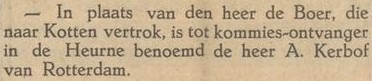
    Albert Kerbof (Termunterzijl, 01-21-1893)
    Elizabeth de Vries (Lekkerkerk, 05-11-1890)

    Address directory 1934

    Heurne 39a > 61

    Marechaussee barracks

    Heurne 39 > 61a

    H. de Wilde

    Heurne 38 > 62

    A. Kerbof

    Address directory 1967

    Heurne 61 > Hamelandroute 91

    Border Office

  • Warenhuis Geling

    Warenhuis Geling

    Landstraat 5, Aalten

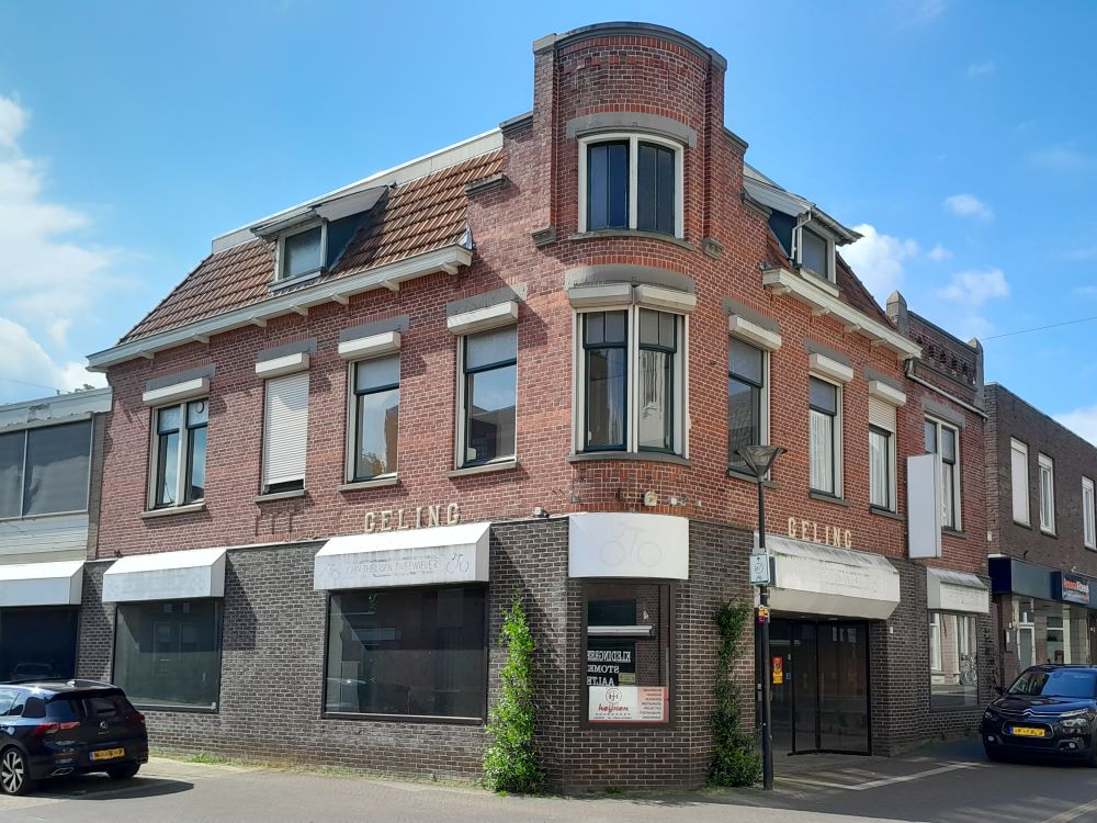
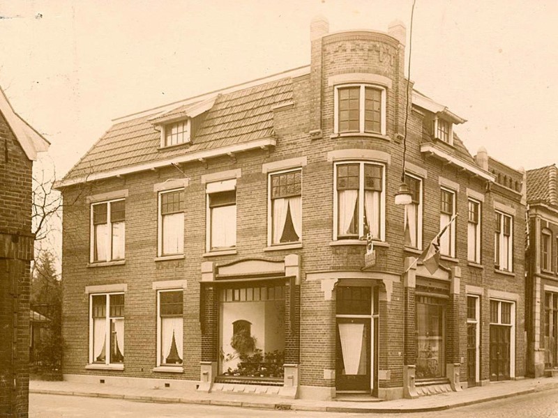
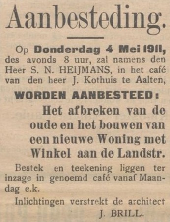
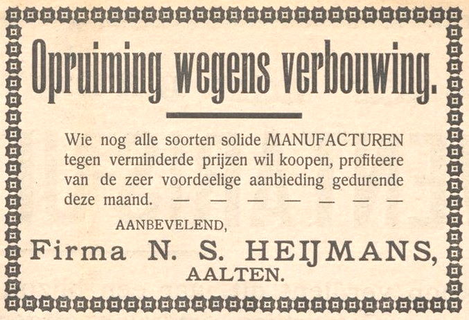
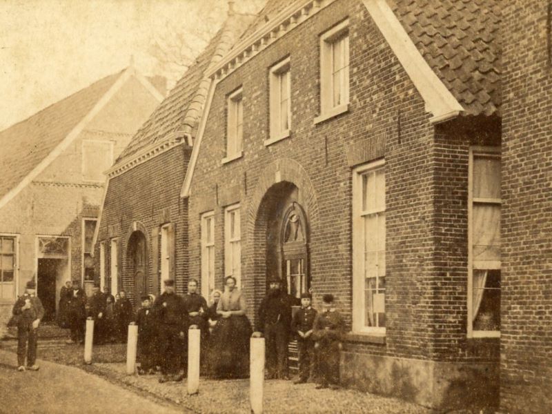
    Landstraat 5 in Aalten is a characteristic residential and commercial building dating from 1911, built for the Heijmans firm, drapers and cloth merchants. The new building replaced an older house on the same site. The Aalten architect Jan Brill was responsible for the design.

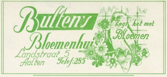
    In the 1930s, Bulten’s Bloemenhuis (flower shop) established itself here, and two greenhouses were erected at the rear of the property. In 1947, the narrow northern section of the building—originally consisting of a room, kitchen, and upper room—was incorporated into the business. The ground floor then housed a garage/workshop, a florist’s workshop, a small kitchen, and an office, with a storage attic above.

    Geling’s Department Store

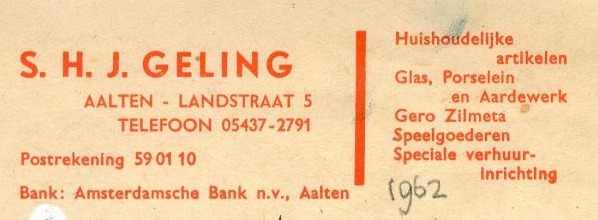
    In the late 1950s, S.H.J. Geling established a department store here, specialising in household goods and toys. Under his instruction, the building underwent extensive renovations in 1960, based on a design by H.A. and J.L.F. Waalders. During this project, the building was fitted with new shopfronts and a modernised layout.

    Three years later, in 1963, a significant expansion followed on the western side, including additional shop and warehouse space, also designed by the Waalders architectural firm from Winterswijk. In the following decades (1960s and 1970s), the shop and its facade were further modernised, and the workshop was integrated into the retail area.

    Following the closure of Geling’s department store, Theissen Tweewielers (a bicycle shop) occupied the premises for some time. Currently (2025), the building has been vacant for many years.


    Owners

    Overview is incomplete.

    YearPlotOwnerDescription
    1832I-1269
    I-1270
    I-1271
    I-1272
    widow of Jan Hendrik Brethouwer 38 m² house & yard
    51 m² house & yard
    192 m² house & yard
    350 m² garden

    Residents

    1813

    Aalten 63

    Jan Hendrik Brethouwer (Aalten, 14-06-1761), cloth merchant

    1 man
    1 woman

    Population register 1823-1838

    Aalten 63

    Harmina (Hendrika) Manschot (Aalten, 21-12-1766), shopkeeper
    widow of Jan Hendrik Brethouwer

    Next residents:

    Joseph Wilhelm Stephan Blomesath (Bocholt, 26-12-1806), weaver
    Johanna Magdalena Vultink (Aalten, 21-03-1811)

    Population register 1838-1850

    Aalten 60

    Joseph Wilhelm Stephan Blomesath (Bocholt, 26-12-1806), weaver
    Johanna Magdalena Vultink (Aalten, 21-03-1811)

    Next residents:

    Derk Prins (Aalten, 09-09-1794), farmer
    Willemina Aleida Freriks (Aalten, 30-11-1801)

    Next residents:

    Johan Henrich Geuting (Bocholt, 06-03-1808), cotton spinner
    Johanna Hafkenscheid (Ulft, 23-08-1803)

    Next residents:

    Derk Hendrik Gerhardus Brethouwer (Aalten, 25-02-1794), farmer
    Johanna te Bokkel (Aalten, 15-02-1807)

    Population register 1850-1860

    Aalten 60

    Derk Hendrik Gerhardus Brethouwer (Aalten, 25-02-1794), farmer
    Johanna te Bokkel (Aalten, 15-02-1807)

    Next residents:

    Johan Wilhelm Carl Schmeinck (Bocholt, 26-02-1803), office clerk
    Antonetta Kramer (Aalten, 16-08-1816)

    Next residents:

    Population register 1860-1870

    Aalten 60

    Hendrikus Brethouwer (Aalten, 06-08-1823), grocer
    Everdina Wilhelmina Margaretha Smits (Winterswijk, 18-07-1834)

    Next residents:

    Population register 1870-1880

    Aalten 75

    Maria Adriana Ledeboer (Oud Beijerland, 04-09-1815)

    Next residents:

    Nathan Salomon Heijmans (Groenlo, 14-11-1826), merchant
    Bettij van Oss (Emden/D, 12-01-1847)

    Population register 1880-1890

    Aalten 83

    Nathan Salomon Heijmans (Groenlo, 14-11-1826), merchant
    Bettij van Oss (Emden/D, 12-01-1847)

    Population register 1890-1900

    Aalten 79

    Nathan Salomon Heijmans (Groenlo, 14-11-1826), clothier
    Bettij van Oss (Emden/D, 12-01-1847)

    Population register 1900-1910

    Aalten A101 > A130

    Nathan Salomon Heijmans (Groenlo, 14-11-1826), clothier
    Bettij van Oss (Emden/D, 12-01-1847)

    Next (head) resident, son:

    Simon Nathan Heijmans (Aalten, 01-11-1877), clothier

    Population register 1910-1920

    Aalten A130 > 131

    Simon Nathan Heijmans (Aalten, 01-11-1877), clothier

    Address directory 1934

    Aalten A131 > Landstraat 5

    N.S. Heijmans

    Address directory 1967

    Landstraat 5

    S.H.J. Geling

    Features


    Cadastral no.I-8118
    FunctionResidential house,
    Shop
    ArchitectJan Brill
    Year of construction1911
    ListedGemeentelijk
    monument

    Sources


    Afbeeldingen

  • Kingdom Hall

    Kingdom Hall

    Slaadreef 4, Aalten

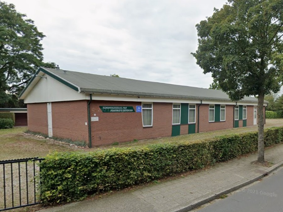
    The Kingdom Hall is the meeting place of the Jehovah’s Witnesses.


    Owners

    Overview is incomplete.

    YearPlotOwnerDescription
    1976I-9835Foundation for the Construction and Operation of
    Kingdom Halls in Winterswijk and surrounding areas
    2,005 m² of pasture

    Features


    Cadastral no.I-11608
    FunctionPlace of worship
    Year of construction1975 (?)
    Listedno
  • Van Herwaarden Coppersmith Workshop

    Van Herwaarden Coppersmith Workshop

    Peperstraat 4 (a), Aalten

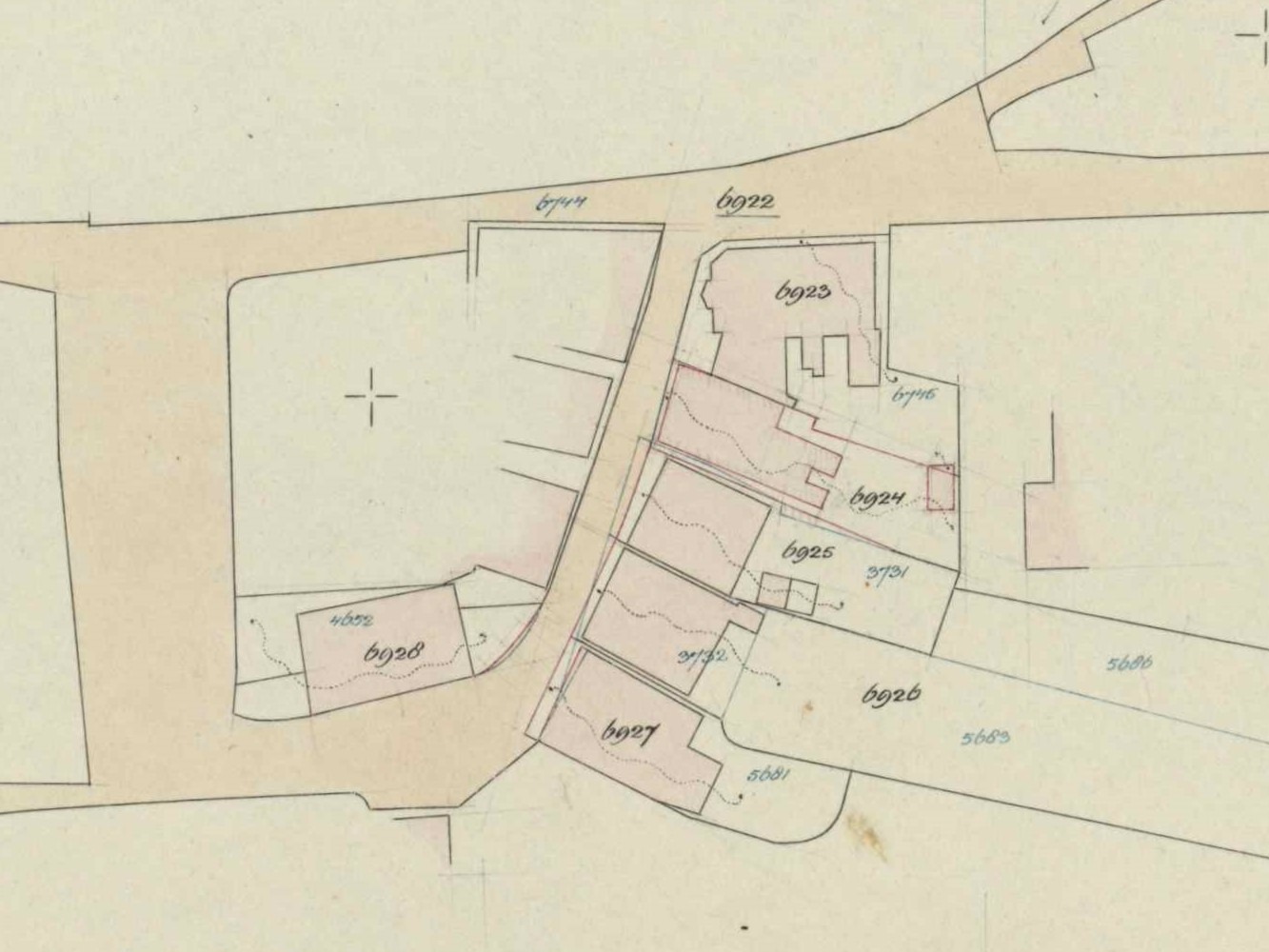
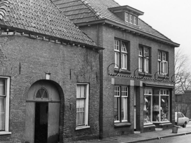
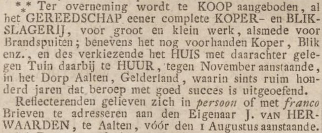
    At this location once lived the Van Herwaarden family, a lineage of coppersmiths who operated a workshop here for approximately 125 years until 1850. Around 1725, the couple Everhard van Herwaarden and Berendina van Isendoorn settled in Aalten, initially living with Berendina’s father, Abraham van Isendoorn, a man of high social standing. They subsequently established a coppersmith workshop on the small street that later became known as Peperstraat.

    Generations later, their children and grandchildren also lived in Weesp, Naarden, and Amsterdam, including Jacobus Hendricus van Herwaarden. He was born in 1817 in Weesp, as the son of coppersmith Jacobus Everhardus van Herwaarden and Anna Catharina Berner, a ‘coppersmith-trader’. Jacobus Hendricus moved in with his grandfather Jacob(us), who had taken over the coppersmith workshop in Aalten and saw in him a successor.

    However, this succession in Aalten never came to fruition. In 1837, the twenty-year-old Jacobus Hendricus left for Amsterdam and from there departed for Suriname. In 1848, Jacobus, nearly 89 years old, returned to his city of birth, Amsterdam. This marked the end of the Van Herwaarden coppersmith workshop in Peperstraat.


    Owners

    Overview is incomplete.

    YearPlotOwnerDescription
    1832I-1148Jacobus van Herwaarde240 m² house & yard

    Residents

    Jacobus van Herwaarden (Amsterdam, 21-10-1759 – Amsterdam, 05-01-1854)
    married on 22-03-1789 in Aalten to
    Mette te Kulve (Winterswijk, 23-09-1763 – Aalten, 27-02-1844)

    Jacobus became a church member in Aalten on 07-04-1779.

    Jacobus is mentioned in 1813 as a ‘garçon de chaudronnier’ (coppersmith’s assistant) in the Register Civique of Aalten.

    Population register 1823-1838

    Aalten 254

    Jacobus van Herwaarden (Amsterdam, 21-10-1759 – Amsterdam, 05-01-1854), coppersmith
    Mette te Kulve (Winterswijk, 23-09-1763 – Aalten, 27-02-1844)

    Population register 1838-1850

    Aalten 269

    Jacobus van Herwaarden (Amsterdam, 21-10-1759 – Amsterdam, 05-01-1854), coppersmith
    Mette te Kulve (Winterswijk, 23-09-1763 – Aalten, 27-02-1844)

    Next residents:

    Jacob Simon Schaap (Aalten, 02-02-1813), merchant
    married on 04-02-1836 in Aalten to
    Rebecca van Gelder (Winterswijk, 10-12-1812)

    Population register 1850-1860

    Aalten 269

    Jacob Simon Schaap (Aalten, 02-02-1813), merchant
    Rebecca van Gelder (Winterswijk, 10-12-1812)

    Next residents:

    Cornelis Philippus Jacobus Penning (Zutphen, 04-01-1818), registrar
    married on 18-09-1857 in Aalten to
    Maria Jacoba Bekink (Amsterdam, 24-06-1821)

    Population register 1860-1870

    Aalten 269

    Cornelis Philippus Jacobus Penning (Zutphen, 04-01-1818), registrar
    Maria Jacoba Bekink (Amsterdam, 24-06-1821)

    Population register 1870-1880

    Aalten 346

    Cornelis Philippus Jacobus Penning (Zutphen, 04-01-1818), registrar
    Maria Jacoba Bekink (Amsterdam, 24-06-1821)

    Population register 1880-1890

    Aalten 390

    Cornelis Philippus Jacobus Penning (Zutphen, 04-01-1818), former registrar
    Maria Jacoba Bekink (Amsterdam, 24-06-1821)

    Next residents:

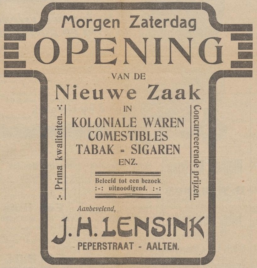
    Jan Hendrik Lensink (Aalten, 05-11-1833), tailor
    married on 05-11-1870 in Aalten to
    Helena Kloss (Wertherbruch/D, 21-04-1839)

    Population register 1890-1900

    Aalten 384

    Jan Hendrik Lensink (Aalten, 05-11-1833), tailor
    Helena Kloss (Wertherbruch/D, 21-04-1839)

    Population register 1900-1910

    Aalten 454 > 509

    Jan Hendrik Lensink (Aalten, 05-11-1833), tailor
    Helena Kloss (Wertherbruch/D, 21-04-1839)

    Next residents, son and daughter-in-law:

    Herman Lensink (Aalten, 21-04-1873), tailor
    married on 03-08-1899 in Aalten to
    Josina Johanna Hoftijzer (Aalten, 28-09-1870)

    Population register 1910-1920

    Aalten C509 > D562

    Herman Lensink (Aalten, 21-04-1873), tailor
    Josina Johanna Hoftijzer (Aalten, 28-09-1870)

    Address directory 1934

    Aalten D562 > Peperstraat 4a

    H. Lensink

    Aalten D562a > Peperstraat 4

    J.H. Lensink

    Address directory 1967

    Peperstraat 4a

    A.A.J. Driessen

    Peperstraat 4

    H. Luimes

    Afbeeldingen

  • Fatih Mosque Aalten

    Fatih Mosque Aalten

    Bodendijk 12, Aalten

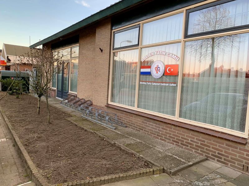
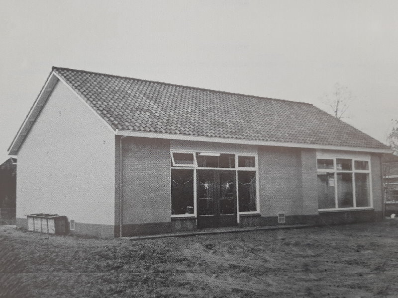
    The Fatih Mosque on Bodendijk in Aalten has been used as a house of worship for the Turkish Islamic community since 2009. The building previously served as a Reformed Youth Centre and later as a nursery school, before being acquired by the Fatih Aalten Foundation. The mosque is also known by its Turkish name, Fatih Camii.

    Name and Meaning

    The name Fatih Camii literally means “Mosque of the Conqueror”. Fatih refers to the Ottoman Sultan Mehmed II Fatih (1432–1481), nicknamed the Conqueror, who captured Constantinople (present-day Istanbul) in 1453. Camii is the Turkish word for mosque, derived from the Arabic jāmiʿ (جامع), meaning “gathering place”. Many Turkish mosques, including those outside Turkey, bear this name.

    History

    The first gatherings of the Turkish community in Aalten took place in smaller premises, but with the establishment of the Fatih Aalten Foundation, they gained the opportunity to create their own prayer space. In 2009, the building at Bodendijk 12 was officially inaugurated as a mosque.

    Since then, the premises have been adapted to function as an Islamic house of worship. Traditional decorative elements, such as handmade tiles from Turkey, have been installed inside. The building has no minaret or dome, but is recognisable as a mosque by its interior and the layout of the prayer hall, with a mihrab and minbar.

    Function and Activities

    The Fatih Mosque primarily serves as a house of worship, with Friday prayers being the most important weekly gathering. In addition, the mosque plays a broader role in community life:

    • Religious and Quranic lessons are held.
    • The mosque has facilities for Islamic funeral rites (djanazah).
    • Open days and bazaars are regularly organised to introduce local residents to the mosque and Turkish culture.

    The mosque explicitly welcomes the entire Aalten community. On its website, the mosque is described as both a religious and social centre — a place of peace, hospitality, and solidarity, where everyone is welcome for encounters, dialogue, or simply a cup of tea.

    Features


    Cadastral no.K-908
    FunctionYouth Centre,
    Nursery School,
    Mosque
    Year of construction1972
    Listedno

    Afbeeldingen

  • Police Station

    Police Station

    Polstraat 36, Aalten (relocated)

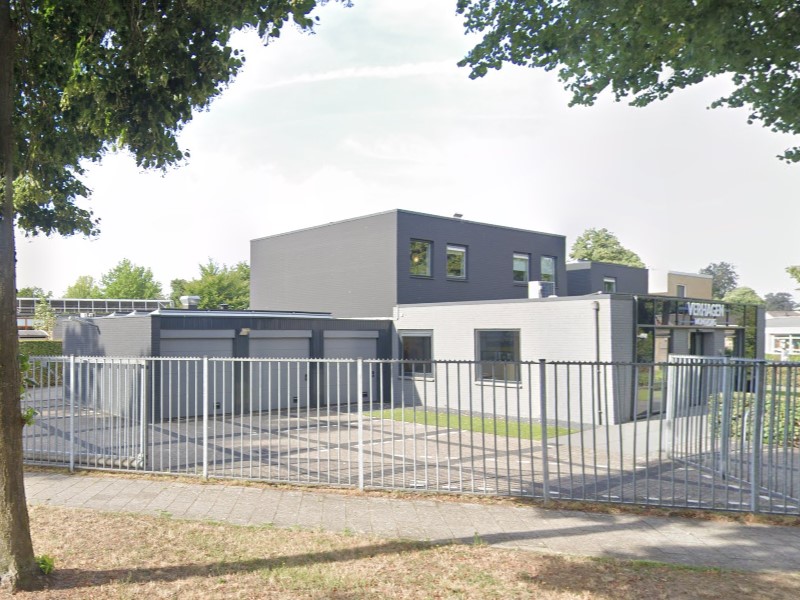
    The local police station was based here until 2018. Today, the building houses a dental practice.

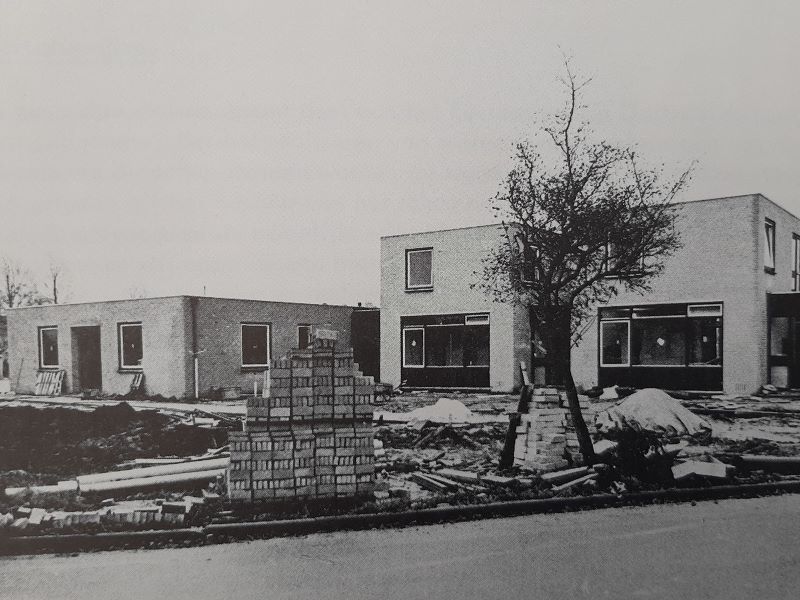
    In February 1963, the Municipality of Aalten purchased the land on the corner of Polstraat and Bonifaciusstraat, which at the time occupied a small farm belonging to the widow Scholten. It is likely that the intention was already to demolish the farm and develop a new police station and a number of houses on the site.

    In 1965, the Aalten municipal council discussed the private sale of a section of the building plot, measuring 1,500 square metres, for the construction of a group and district office for the National Police (Rijkspolitie) in Aalten.

    It was not until the early 1970s that the new police station was completed. The Aalten police remained at this location until 2018, when they moved to the Köstersbulte.

    Features


    Cadastral no.I-11909
    FunctionHouse
    Year of construction1971
    Listedno

    Afbeeldingen