Old Aalten

Blog

  • Sunday school Lintelo Veur

    Sunday school Lintelo Veur

    Sondernweg 9, Lintelo
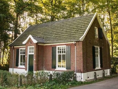
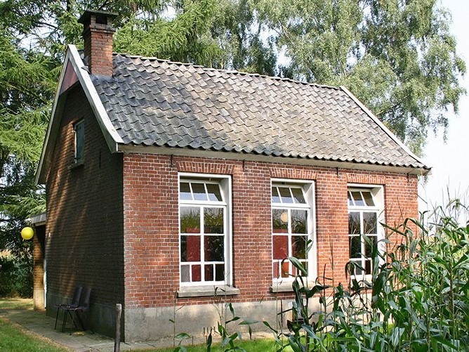
    Former Sunday school dating from the early 20th century, restored and converted into a vacation rental.

    In de negentiende eeuw had dominee Breukelaar er voor gezorgd dat er zondagsscholen kwamen in Aalten. Voor kinderen in de omliggende buurtschappen werd de zondagsschool bij iemand thuis op een boerderij gehouden, zodat de kinderen niet helemaal naar het dorp hoefden te gaan. Allengs ontstond in de buurtschappen de behoefte om hiervoor een lokaal of zondagsschoolhuuske te bouwen. Er verschenen in totaal negen zondagsschooltjes, waarvan er slechts enkele bewaard zijn gebleven.

    In de buurtschap Lintelo waren vroeger twee zondagscholen. In de kern van Lintelo was een zondagsschooltje aan de Schooldijk, maar deze is al rond 1950 gesloopt. De zondagsschool ‘Lintelo Veur’ is in 1924 gebouwd. Het schooltje had oorspronkelijk twee lokalen en is behoorlijk ruimer van opzet dan de meeste zondagsscholen in de gemeente Aalten.

    Foundation

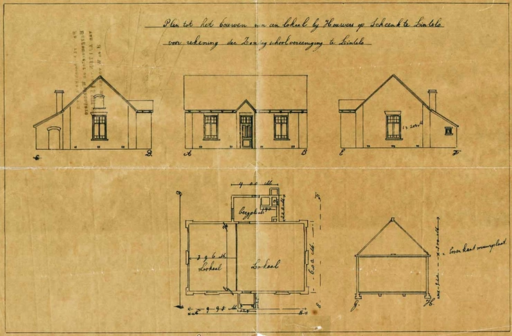
    That the plans in Lintelo were serious was evidenced by the official publication in the Staatscourant (Government Gazette) regarding the establishment of the ‘Zondagschoolvereniging te Vóór Lintelo’ (Sunday School Association for Vóór Lintelo). At a meeting in May 1924, the 17 members present decided that a ‘hall’ should be built to be used as a Sunday school for children from Lintelo.

    To build the hall, money and land were required. To raise funds, a collection was held in Lintelo as well as in the surrounding hamlets. Quotes were requested from various contractors. Initially, they considered a building with one large room measuring eight by five metres. Eventually, they decided the building should be larger—albeit more expensive—but, as the reasoning went, cheaper per square metre.

    Het gebouw zou twee lokalen krijgen en een aparte berging. Men hield een tweede collecte om extra geld op te halen. Ook vond men de benodigde grond. Voor een symbolisch bedrag werd een stukje land overgenomen van de voormalige boerderij Schenk, op de hoek van de Veldweg en Sondernweg.

    From 1925 onwards, the children came to ‘Lintelo Veur’ every Sunday. Each year at Easter, there was a larger children’s party. This continued until the war. During the war, the occupying forces confiscated the Sunday school for use as storage. The Sunday school was forced to be held on a farm again. Immediately after the war, the Sunday school was designated as emergency housing.

    It took until the end of 1950 for the association to regain the building following a lawsuit. The building was refurbished and was ready just before Christmas. It was returned to use with a festive Christmas celebration. With this Christmas party, a new tradition was born that continued until the mid-90s: every child received a book annually during the Christmas party. A small notebook was kept to meticulously record which child had received which book and when.

    Gradually, the number of children attending Sunday school declined. Over seventy years after the founding of the ‘Zondagschoolvereniging te Vóór Lintelo’, the decision was made to dissolve it at the end of 1995. The property was sold.

    Listed

    Five years later, in 2000, the Sunday school was placed on the municipal monument list because “it is a good example of a traditional school from the early 20th century. With its prominent location, it is of particular importance for the original character of the area. It is important for keeping the development of education in the municipality of Aalten in the twentieth century visible.”

    The small building was subsequently used regularly for parties and as a rehearsal space for a band. However, the condition of the building gradually deteriorated.

    Vacation rental

    In 2008, the current owners began making plans. After consultation with the municipality, it turned out that a vacation rental was the most achievable scenario. However, the building was not insulated, and there was no upper floor. A thorough and sustainable approach was required. Work began in early 2012. Gradually, unexpected old elements reappeared, such as old doors with their characteristic green colour, the frames around the doors and windows, and the dark oak ceiling.

    Today, the little school looks beautiful again and is available for overnight stays.
    Features


    Cadastral no.L-822
    FunctionSunday school
    Year of construction1924
    ListedGemeentelijk
    monument
  • Sunday school Haart

    Sunday school Haart

    Kriegerdijk 10, Aalten

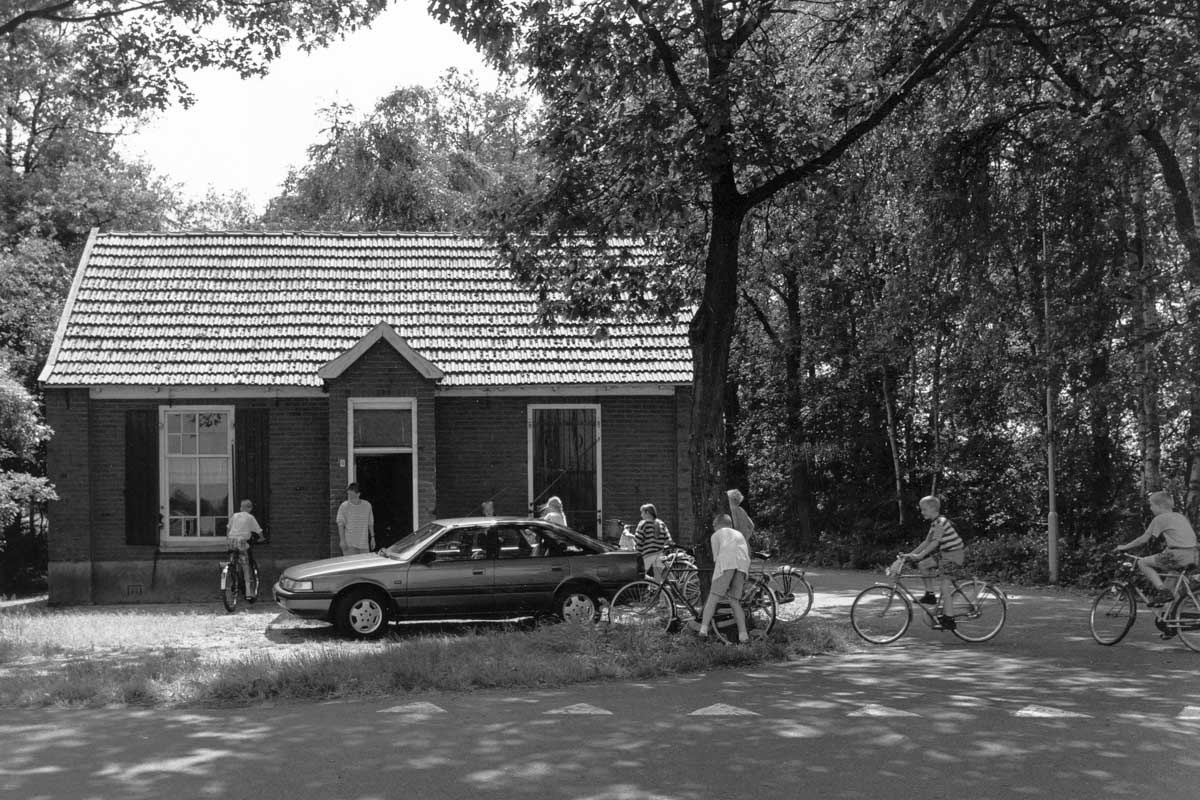
    The small, single-classroom schoolhouse in the rural area between Aalten and the German border was built in 1924 on the initiative of the Reformed Church council.

    This type of one- or two-classroom Sunday school building could be found in various hamlets throughout the Achterhoek region. In those days, the roads from these areas to the villages were often little more than simple cart tracks. Particularly in winter, these became nearly impassable dirt roads. Much of the land in this area had only recently been cleared for cultivation.

    The plot of land on which the building stands was once part of a patch of forest (wasteland) that local farmers were in the process of reclaiming. An association of parents with school-age children purchased this piece of land and built the small schoolhouse using their own contributions.

    In deze zondagsschool werd door een aantal ouders bij toerbeurt uit de Bijbel verteld en werden christelijke liederen geleerd en gezongen. Het aantal kinderen varieerde van 12 tot 30. Ds. D. Breukelaar uit Aalten en ds. J. van Dijk uit Doetinchem, hebben op dit werk veel invloed gehad.

    Around 1925–1930, partly due to the emancipation movement, a girls’ association and a women’s association were founded. The girls’ association met there weekly, and the women’s association met once a month. At these meetings, the Bible was studied, but social topics were also discussed, such as the position of women in the church and in politics.

    From 1945 until 1997, boys’ and girls’ clubs met here, discussing the Bible and/or themes relevant to young people. Both the Sunday school and the clubs operated under a Parents’ Association, which maintained the building. Due to various societal changes, all these associations eventually ceased to exist.

    In 2005, the Geldersch Landschap & Kasteelen foundation received the Sunday schoolhouse as a donation from the Haart-Heurne Parents’ Association. In order to preserve the small building, a suitable new purpose was sought. Since 2009, it has been available for rent as a holiday home.


    Owners

    Overview is incomplete.

    YearPlotOwnerDescription

    Address history

    Address directory 1934

    Haart 113

    Sunday school hall

    Address directory 1967

    Haart 113 > Kriegerdijk 13

    Sunday school hall

    Features


    Cadastral no.R-543
    FunctionSunday school,
    Vacation rental
    Year of construction1924
    ListedGemeentelijk
    monument
  • Hendrickje Stoffels

    Hendrickje Stoffels

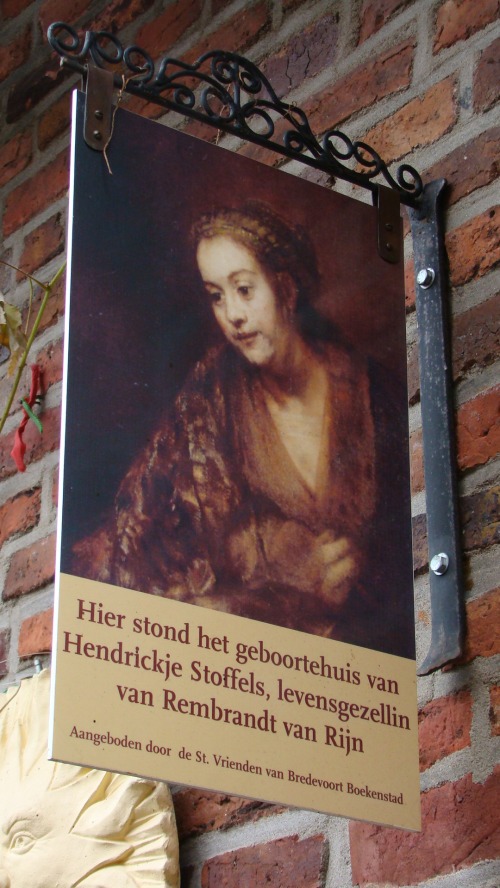
    Hendrickje Stoffels or Hendrickje Jegers (Bredevoort, 1626 – Amsterdam, July 1663) was a domestic servant and art dealer. For a period, she was the official employer of the Dutch painter Rembrandt van Rijn. She was also Rembrandt’s romantic partner, the mother of one of his three daughters (all of whom were named Cornelia), and possibly one of his models.

    Hendrickje Stoffels was born in Bredevoort in 1626 as the daughter of Stoffel Stoffelse and Mechteld Lamberts and grew up in the Muizenstraat. Her father was a sergeant under a captain from the Ploos van Amstel family. Stoffel was also a hunter for the castle at Bredevoort and was therefore also called Jeger. In common parlance, his children were called ‘Jegers’, but in official documents they were always referred to as ‘Stoffels’ (meaning son or daughter of Stoffel).

    Hendrickje had one sister and three brothers: Martijne Jegers, Hermen, Berent, and Frerick. She may also have had a sister named Margriete.

    Hendrickje’s father almost certainly passed away in July 1646, possibly as an unidentified victim of the gunpowder tower explosion in Bredevoort. It was likely due to this event that Hendrickje left for Amsterdam.

    Rembrandt’s beloved

    From that time on, Hendrickje entered service as a maid for the already famous painter Rembrandt van Rijn, in what is now the Rembrandt House on Jodenbreestraat in Amsterdam. On July 16, 1649, Hendrickje was back in Bredevoort; she is mentioned as a baptismal witness in the Bredevoort Baptismal Register. It is possible that Rembrandt made the journey to Bredevoort with her. This may be evidenced by several etchings by Rembrandt from 1649 and 1650, the locations of which are unknown.

    Later, Hendrickje became Rembrandt’s partner, and in 1654 they had a daughter together, Cornelia. In 1658, she started an art shop together with Titus, Rembrandt’s son from his earlier marriage to Saskia van Uylenburgh, where they sold paintings, drawings, copper engravings, woodcuts, and curiosities.

    There are several paintings and prints by Rembrandt in which Hendrickje Stoffels is recognized. However, there is no single documented image of her. Furthermore, some experts believe that the portraits identified as Stoffels exhibit a wide variety of facial features. In any case, there are a number of works by Rembrandt from the period in which Stoffels lived with him that possibly depict the same woman.

    In 1663, a plague epidemic struck Amsterdam. Hendrickje Stoffels was likely also fatally affected by this disease, as she died in July of that year. She was buried on July 24, 1663, in a rented grave in the Westerkerk in Amsterdam.

    Statue on ‘t Zand

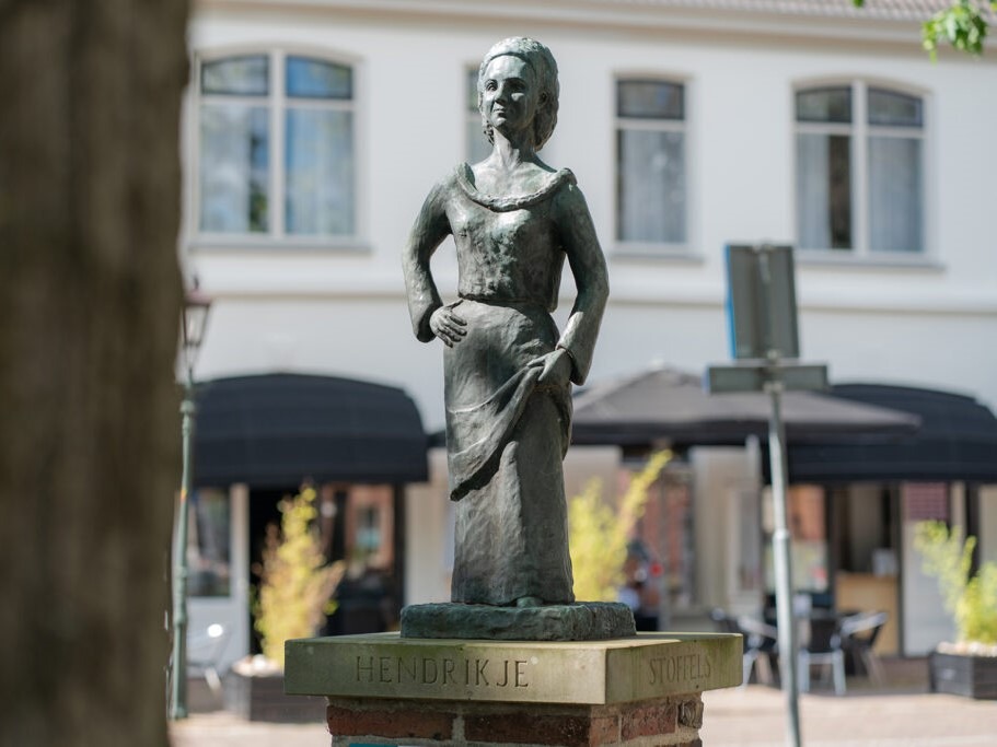
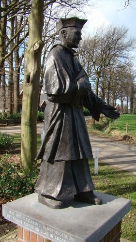
    On ‘t Zand in Bredevoort stands a statue of Hendrickje Stoffels, created by sculptor G.J.F. (Truus) Doodeheefver-Kremer. Before creating the statue on ‘t Zand, the artist conducted research, including at the Rijksmuseum, and chose to depict Hendrickje around the age of twenty, the period when she left Bredevoort for Amsterdam. The statue was unveiled on July 7, 1977.

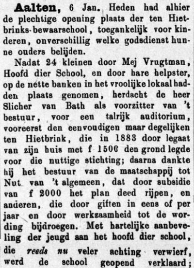
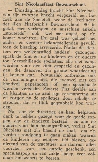
  • Ten Hietbrinks Bewaarschool

    Ten Hietbrinks Bewaarschool

    Prinsenstraat 27, Aalten

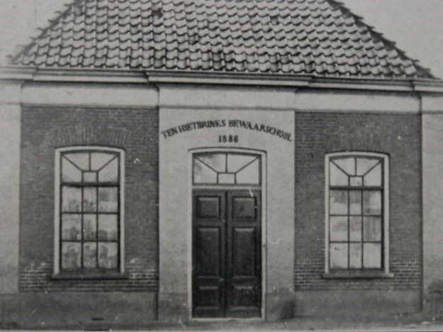
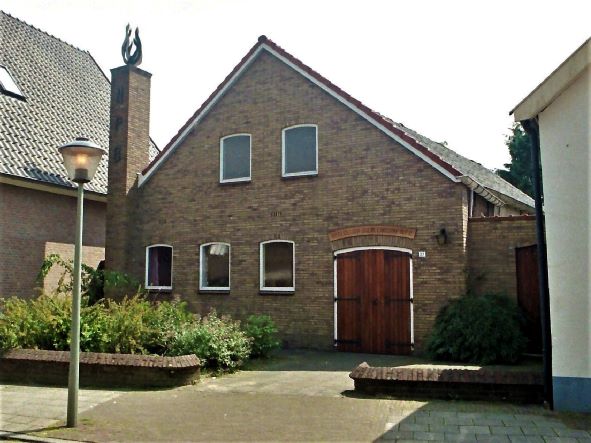
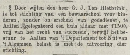
    The Ten Hietbrink Bewaarschool was a nursery school in Prinsenstraat in Aalten. The school was named after the Ten Hietbrink family, who were closely involved in its inception and management. Later, the Nederlandse Protestantenbond (Dutch Association of Protestants) held its church services here. Today, the address houses the Euregional Historical Documentation Centre.

    The nursery school was opened on 6 January 1887, at a time when the first forms of early childhood education were increasingly gaining ground in the Netherlands. Before then, children were often not admitted to primary school until they reached the age of six.

    The little school possessed one large classroom with a wooden floor, a sandpit behind the building, and simple play materials, such as car tyres. Behind the school stood a shed which also formed part of the play area.

    War Years

    During the years of the German occupation (1940–1945), the measures taken against Jewish residents also affected the Ten Hietbrink Bewaarschool. Jewish children attended the school until 1941, but from 1 September 1941, they were compulsorily expelled, in line with the anti-Jewish decrees.

    School Life

    Memories from former pupils provide a picture of school life during the 1940s and 1950s:

    • The head of the school was Miss Stokreef; alongside her, Miss Annie is also mentioned.
    • Strict discipline prevailed, described by former pupils as “potty-discipline”.
    • In addition to learning and playing, school trips were also organised, for instance in 1946 to the Loohuisbos.

    Owners

    Overview is incomplete.

    YearPlotOwnerDescription
    1832I-1059
    I-1060
    Hermanus Hietbrink, labourer148 m² house & yard
    17 m² house
    1882I-3714Gerrit Jan ten Hietbrink, merchant185 m² house & yard
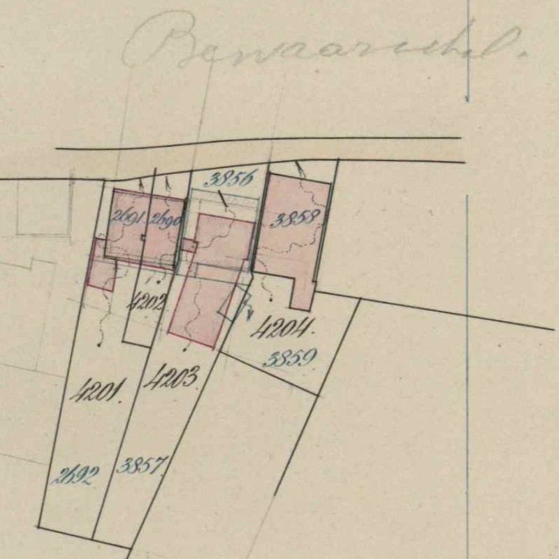
    1888I-4203The Departmental Nursery School of the
    Departement tot Nut van ‘t Algemeen
    565 m² nursery school, garden
    1963I-4203Nederlandse Protestantenbond565 m² kerk, garden

    Residents

    Population register 1838-1850

    Aalten 229

    Harmanus Hiebering / ten Hietbrink (Aalten, 22-09-1791 – Aalten, 21-06-1844), labourer
    Berendina ter Horst (Aalten, 29-06-1794 – Aalten, 19-12-1847)

    Son:

    Gerrit Jan ten Hietbrink (Aalten, 01-11-1834 – Aalten, 04-04-1883)

    Harmen Jan Honders (Winterswijk, 16-11-1792 – Aalten, 13-02-1873), farmer
    (1) Berendina ter Horst (Aalten, 29-06-1794 – Aalten, 19-12-1847)
    (2) Antonetta Villekes (Aalten, 30-08-1803 – Aalten, 02-10-1885)

    Population register 1850-1860

    Aalten 229

    “Achterstraat”

    Harmen Jan Honders (Winterswijk, 16-11-1792 – Aalten, 13-02-1873), farmer
    Antonetta Villekes (Aalten, 30-08-1803 – Aalten, 02-10-1885)

    Stepson:

    Gerrit Jan ten Hietbrink (Aalten, 01-11-1834 – Aalten, 04-04-1883)

    Population register 1860-1870

    Aalten 229

    Harmen Jan Honders (Winterswijk, 16-11-1792 – Aalten, 13-02-1873)
    Antonetta Villekes (Aalten, 30-08-1803 – Aalten, 02-10-1885)

    Stepson:

    Gerrit Jan ten Hietbrink (Aalten, 01-11-1834 – Aalten, 04-04-1883), clog maker

    Population register 1870-1880

    Aalten 301

    Harmen Jan Honders (Winterswijk, 16-11-1792 – Aalten, 13-02-1873)
    Antonetta Villekes (Aalten, 30-08-1803 – Aalten, 02-10-1885)

    Population register 1880-1890

    Aalten 345

    Gerrit Jan ten Hietbrink (Aalten, 01-11-1834 – Aalten, 04-04-1883), merchant

    Nursery School

    Population register 1900-1910

    409 > 481

    Population register 1910-1920

    481 > C535

    Address directory 1934

    Aalten C535 > Prinsenstraat 27

    Nursery School

    Address directory 1967

    Prinsenstraat 27

    Geb. Ned. Prot. Bond

    Features


    Cadastral no.I-10937
    FunctionDwelling house,
    Nursery school,
    Church
    Year of construction1949
    ListedMunicipal
    monument
  • Koppelkerk

    Koppelkerk

    Koppelstraat 35, Bredevoort

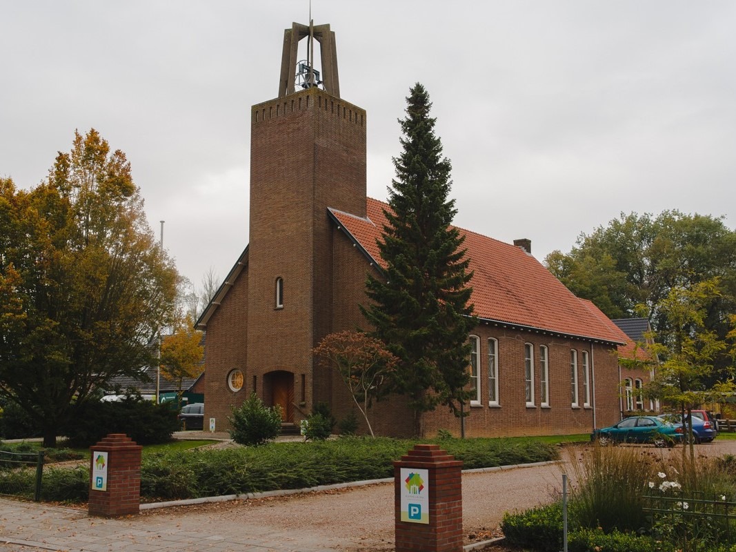
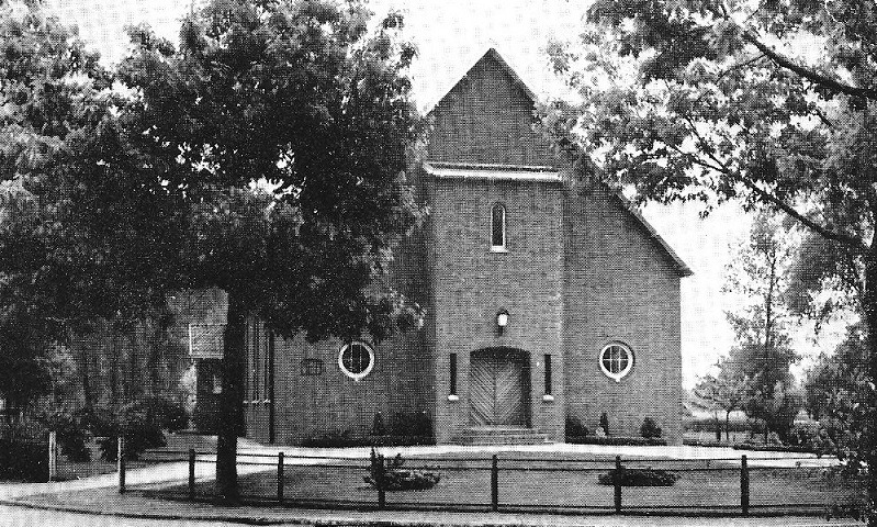
    The Koppelkerk is a landmark, former Reformed church in Bredevoort, situated on the corner of Koppelstraat and Prins Mauritsstraat. Built in the austere style of the Delft School, the building was constructed between 1947 and 1948 and currently serves as a centre for arts and culture.

    Until World War II, the Reformed congregation of Bredevoort had to travel to Aalten to attend church services. After the war, the congregation acquired its own land on the site known as De Koppele. Located near the filled-in moat, the ground first had to be raised because it was low-lying and often marshy. The name Koppelkerk refers to this area.

    The church was designed by architect W. Geels. The foundation stone was laid in 1947, and the building was officially opened in 1948.

    Extensions and Tower

    Over time, several extensions were added to the original church:

    • In 1956, the tower was built clandestinely, initially without planning permission.
    • In 1958, architect W. van der Zee from Aalten added the concrete tower crown, which increased the tower’s height by approximately five metres.
    • In 1966–1967, architect Willem Hebly, also from Aalten, designed an extension at the rear to accommodate meeting rooms.
    • In 1988, the tower was fitted with a church bell, cast by the De Klok bell foundry in Aarle-Rixtel.

    Architecture

    The Koppelkerk is set back within a spacious garden and stands out due to its simple yet powerful design. The church provides a clear example of Protestant church architecture from the immediate post-Second World War period. Its authentic character has been well preserved in both its main structure and its detailing.

    New Purpose

    In 2013, the building was designated a municipal monument (locally listed building). Shortly afterwards, the church lost its original function. Following consultations, the church council granted permission for the building to be repurposed. In 2015, the former church was converted into a multi-purpose centre for arts and culture.

    Today, the Koppelkerk plays a prominent role in the cultural life of Bredevoort:

    • Arts are showcased through rotating exhibitions and concerts.
    • Intellectual depth is offered via lectures, debate evenings, and talks.
    • In the book café, styled as a living room lined with bookshelves, monthly literary cafés are held.

    Features


    Cadastral no.B-1943
    FunctionChurch
    Year of construction1948
    ListedMunicipal
    monument
  • St George’s Church

    St George’s Church

    Kerkstraat 16, Bredevoort

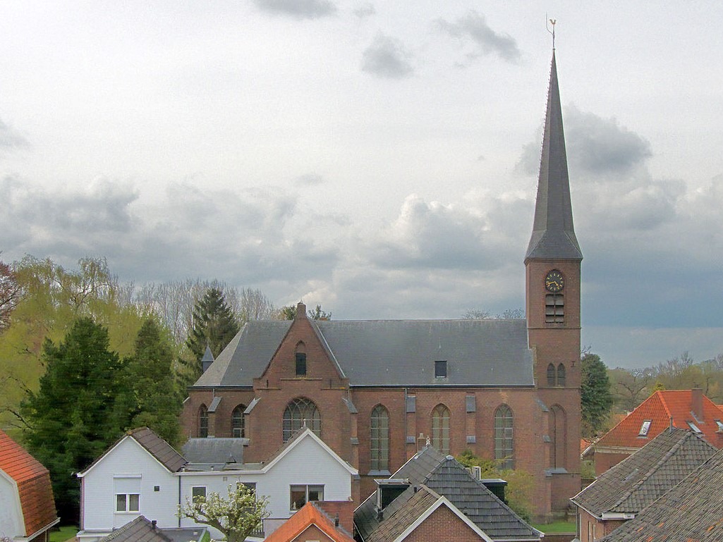
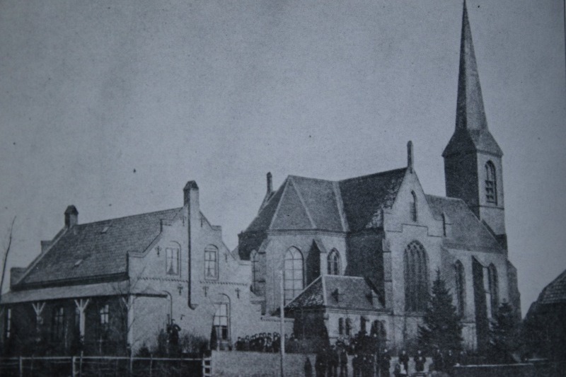
    The Catholic Church of the Sacred Heart and Saint George (H. Hart en H. Georgiuskerk) has stood on the old Ossenkop bastion in Bredevoort since 1876. Designed by architect Alfred Tepe, it is a single-nave, Neo-Gothic church and is designated a municipal monument (locally listed building).

    Until the end of the 16th century, the Roman Catholics of Bredevoort worshipped in the old St George’s Church (Sint Joriskerk) on the Markt. Following the siege of Bredevoort and the introduction of the Reformation in 1597, they were forbidden from holding church services. For a long period, they used the Kruiskapel (Cross Chapel), located just across the border in Germany.

    In 1798, a Roman Catholic church was established once again in Bredevoort. This first small church stood opposite the current building, on the plot now known as Koppelstraat 9. It consisted of two knocked-together houses whose roofs had been removed and walls raised. The altar was made of brick, and the walls were painted white to give the building an ecclesiastical appearance. In 1855, the church was elevated to the status of a parish.

    The Current Church

    In 1871, A.E. Smorenburg became the parish priest in the fortified town and was tasked by the bishop with building a new church. After the fortifications of Bredevoort were largely dismantled during the nineteenth century, Saint George’s Church (Sint-Georgiuskerk) was built on the curtain wall between two bastions. As a result, the church still stands slightly higher than the surrounding streets.

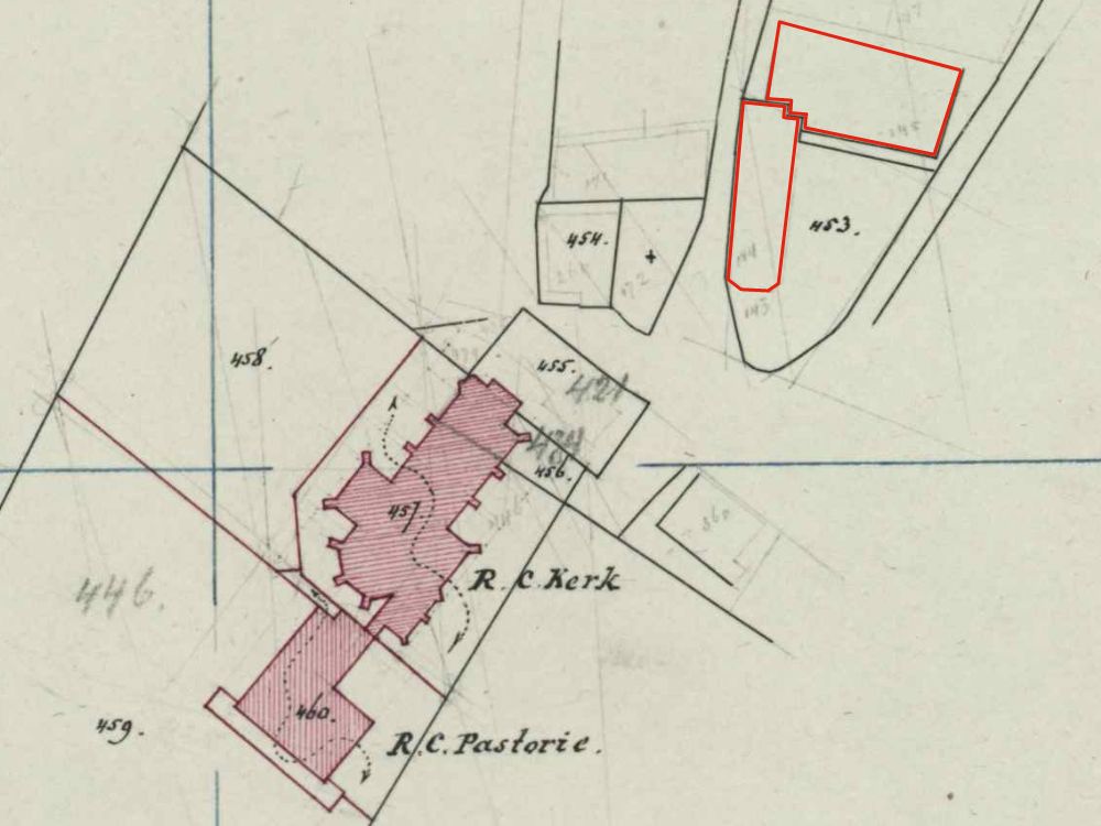
    The parish received part of the Ossenkop bastion (1,420 m²) from the municipality of Aalten for free, including the surrounding section of the moat and quay. The remaining 1,420 m² was purchased for 795.20 guilders. The initial design for Bredevoort was drawn up by Pierre Cuypers, modelled on the church in Ruurlo. Ultimately, Alfred Tepe’s 1874 design was executed instead, with A. Ubbink serving as the building contractor.

    The construction of the church required 230,000 bricks and 150 mud (hectolitre) of lime. The first 100,000 bricks were brought in on wheelbarrows by parishioners from Barlo in Germany, who wished to demonstrate their solidarity with Dutch Catholics in this way. The remaining bricks were presumably fired in the brick kiln on the Haart. Construction began in 1875, and the church was consecrated by Father Smorenburg as early as 3 October 1876. The old church was subsequently demolished and the land sold.

    Renovation and Extension

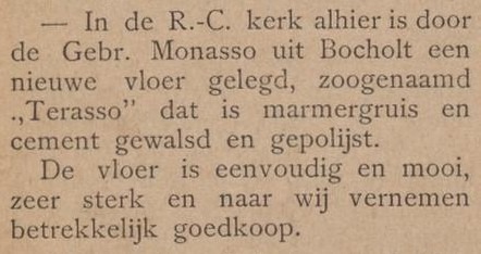
    In 1897, under Father Mulder, the church was renovated and expanded with a clock and three bells. A year later, a terrazzo floor was laid by Felice Monasso from Bocholt, and the walls were painted by Muermans and Son from Roermond, including a depiction of Christ and the Apostles in the Garden of Olives.

    Closure for Worship

    Saint George’s Church was closed for worship (deconsecrated) in the spring of 2021 and sold to a social entrepreneur.

    Features


    Cadastral no.B-457
    FunctionChurch
    Year of construction1876
    ListedMunicipal
    monument

    Sources


  • Darbistenkerkje

    Darbistenkerkje

    Meiberg 13, Aalten (demolished)

    The Plymouth Brethren (the Assembly of Believers), also locally known as the Darbisten (Darbyites), held their first meetings in Aalten in 1882. In the early years, the believers gathered in a residential house on the Bodenvoor.

    In 1902, a simple meeting hall was built on a connecting path between Oosterkerkstraat and Meiberg. The small building served as the congregation’s place of assembly for decades.

    Relocation and Demolition

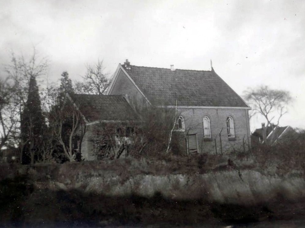
    In 1968, shortly before its demolition, the old little church was documented in photographs. A few years later, in 1974, the congregation moved into a new building, which was also located on Meiberg.

    Following its sale, the old meeting hall became the property of Spinkat and was ultimately demolished. With its removal, a piece of early 20th-century church history vanished from the Aalten streetscape.


    Owners

    This list is incomplete.

    YearPlotOwnerDescription
    1904I-5059Bernadus Hermanus Brethouwer
    e.c., shopkeeper & farmer
    185 m² meeting hall & yard
    1958I-8442Stichting “Ons Vergaderlokaal”,
    Aalten
    840 m² house, meeting hall,
    garden
    1974I-8442N.V. “van Katwijk’s Industrieën”,
    Aalten
    840 m² house, meeting hall,
    garden, sheds & yard

    Features


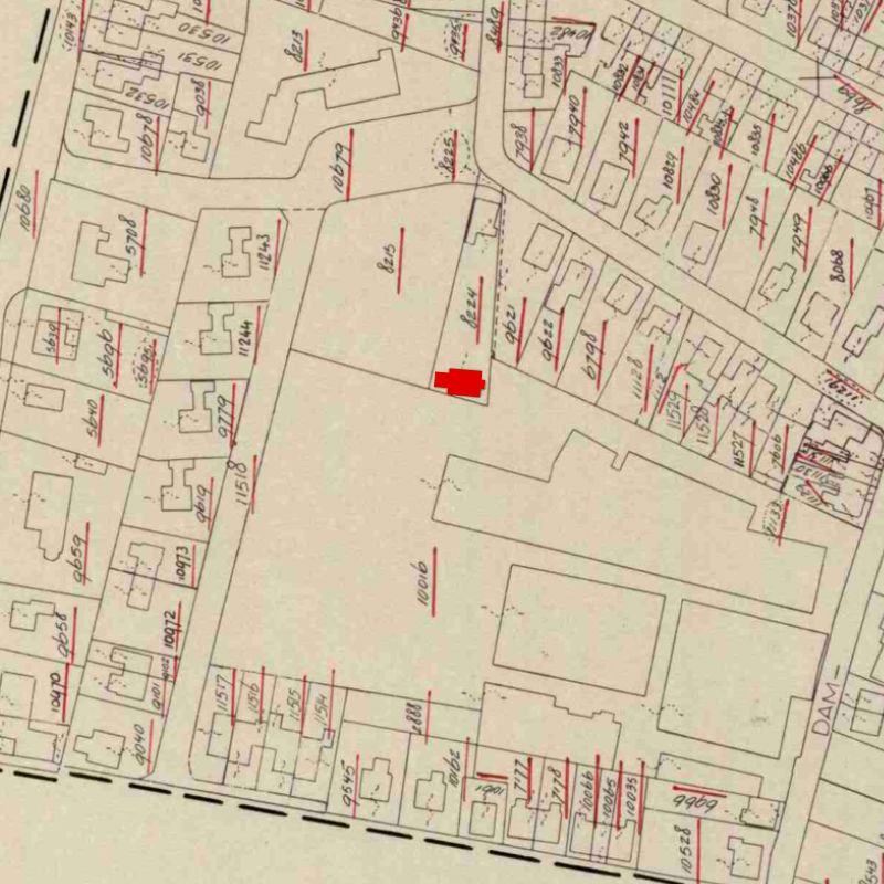
    Cadastral no.I-11924
    FunctionMeeting hall
    Year of construction1902
  • Schaer Monastery

    Schaer Monastery

    Kloosterdijk, Aalten

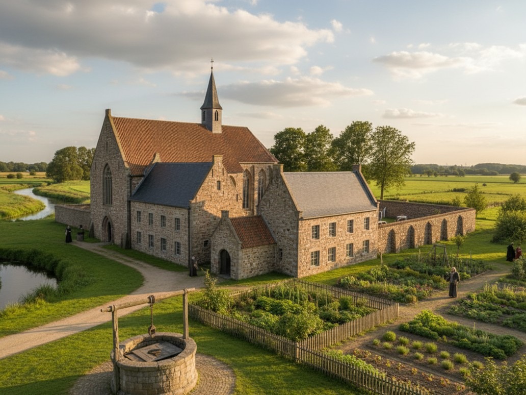
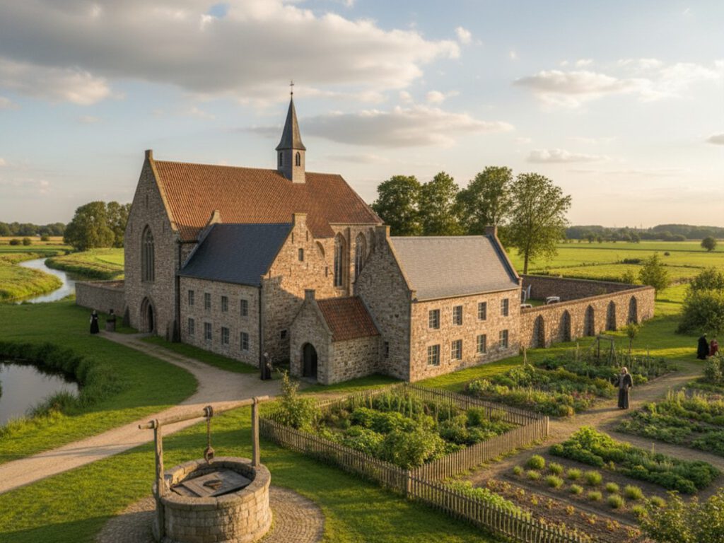
    Schaer Monastery was a monastic house near Bredevoort, founded in 1429 and belonging to the order of the Modern Devotion. It was located in the hamlet of ’t Klooster, approximately two kilometres north of Bredevoort, on the left bank of the Schaarsbeek.

    The pious nobleman Derck van Lintelo and Conraedt Slindewater, clerk to the Drost of Zutphen and originating from a prominent patrician family from the Hanseatic city, donated land and farms in 1429 to displaced monks from Windesheim, near Zwolle.

    The Windesheimers belonged to the late-medieval movement of the Modern Devotion, which had emerged under the leadership of Geert Grote (1340–1384) in Deventer. From the IJssel cities, this reform movement spread across Western Europe and led to the founding of more than a hundred monasteries. The Modern Devotion strove for the renewal of church and society, forming a transition between the Middle Ages and the early modern period.

    Foundation

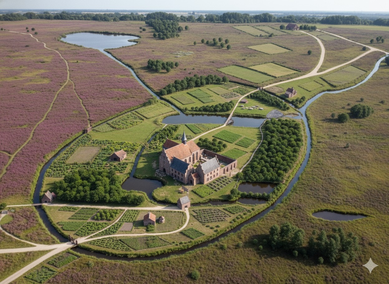
    The Windesheimers preferred to settle in remote locations. The donation of land near the Schaersvoorde—in the current hamlet of ’t Klooster—in 1429 fitted this preference well. It was a high-lying area on the edge of the vast Schaersheide, bordering the low-lying and marshy Bredevoortse Broek. Using the clay present just below the surface, the monks baked their own ‘kloostermoppen’ (monastic bricks).

    The monastery, Domus Beatae Mariae in Nazareth (House of the Blessed Mary in Nazareth), rose shortly thereafter. It was popularly known as Schaer Monastery, named after the heath on which it was situated. The residents were soon actively involved in the care of young students and the improvement of the living conditions of the local population.

    Prayer and work defined daily life for the Windesheimers. Through diligent labour, the monks managed to reclaim the immediate surroundings of the monastery. By 1500, it was a fertile, egg-shaped oasis in the wilderness, with Nazareth as its centre, surrounded by an outer moat.

    In 1522, several improvements were made. The monastery’s clockwork and chiming bell were transferred to the Saint George’s Church in Bredevoort in 1596—where the bell still hangs today.

    Legend and Gold Treasure

    In 1597, when the army of Prince Maurice was on its way to Bredevoort, the last prior of Schaer Monastery fled. The remaining monks also found it safer to seek refuge elsewhere. Shortly thereafter, the abandoned monastery was destroyed by marauding soldiers.

    Since then, the story has circulated that the fleeing monks hid a treasure in the ground—under the third holly bush behind the sheepfold. However, no one remembers exactly where that sheepfold once stood. According to legend, the treasure will one day be found again, indicated by ‘heavenly signs’: a strange light will appear in the sky until a black rooster crows.

    On the night of 13 to 14 September 1943, an unusual light was indeed observed: a moonbow. There were many bombers in the air that night, meaning many people were awake to witness this rare phenomenon. Whether a black rooster also crowed that night is unknown.

    Size

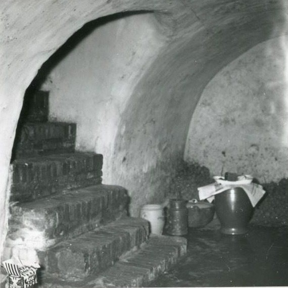
    Field and archival research shows that Schaer Monastery was of modest size. The perimeter of the monastery grounds is easily traceable: field names are still recognisable, and remains can be found on a farmyard. At the beginning of the twentieth century, a crucifix and a skull were discovered during excavation work. Furthermore, the so-called Kloosterschans (Monastery Redoubt) is still located on the site. In 1978, the last above-ground wall remains were demolished, but a monastery cellar with a barrel vault still exists beneath the local farmhouse.

    The oval monastery area—also called the corpus—covered approximately 118 hectares and showed a height difference of over ten metres from west to east. The monks made optimal use of the relief, the water, and the soil conditions. Seepage and rainwater, as well as water flowing from the high Schaerheide, moved just below the surface over impermeable clay layers towards the Bredevoortse Broek. The monks threw up a dyke straight through the area to dam the water and utilise it to power a corn and oil mill.

    With a system of interconnected waterways and ponds, the monks kept their feet dry and prevented the water from flowing unused into the low marshlands. On the east side of the monastery complex, they created a remarkable piece of earthwork: the Eremus in Aquis—literally ‘the wilderness in the waters’—a hermitage on the edge of the marshy Bredevoortse Broek. The moats around this hermitage served as water storage.

    Remains

    After the destruction of the monastery in 1597, the lands became overgrown with heath and coppice. The monastic bricks from the complex were partly reused for the repair of fortifications and houses in Bredevoort. The monastery’s possessions were confiscated by the Duchy of Guelders. The Eremus in Aquis may have been used as a redoubt during military operations around Bredevoort in later years. In 1672, the west wing of the rectangular monastery complex was still standing.

    With the seizure of the monastery area, the landscape took on a second historical layer: the planting of timber plantations. Guelders leased the lands for the production of oak wood. Around 1700, work began on the necessary drainage. Straight channels drained water quickly into the Schaarsbeek, and the same stream—once part of the outer moat—was straightened towards Bredevoort to supply the town’s moats with water. The waterways near the Eremus in Aquis silted up, and so-called rabatten (narrow raised beds) were laid out on the former monastery grounds to plant young oaks.

    Due to several very harsh winters, the first plantings failed. Guelders then decided to sell the monastery area. The new owners continued the forestry following the same system of rabatten and drainage. The current 25-hectare Kloosterbos (Monastery Forest) still preserves the traces of the late-medieval water management system once laid out by the monks of Schaer.


    Archives

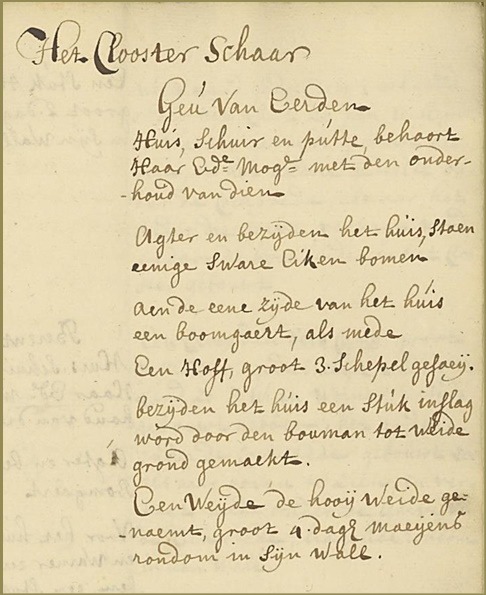
    Verpondingskohier (tax register), 1647

    t’Clooster te Schaer en sijn becirck?, Geestl.
    2 Huisen, met etlicke koolhoven, 3 sch.
    Boulant 27 mdr., 3de gerve 225 – 0 -.
    Inslagh en hoeijmate van 4 daghen meijens, slechten waterigen gront.

    Features


    FunctionMonastery
    Foundation1429
    Destruction1597
  • Stad Munster Lodging House

    Stad Munster Lodging House

    Peperstraat, Aalten (no longer extant)

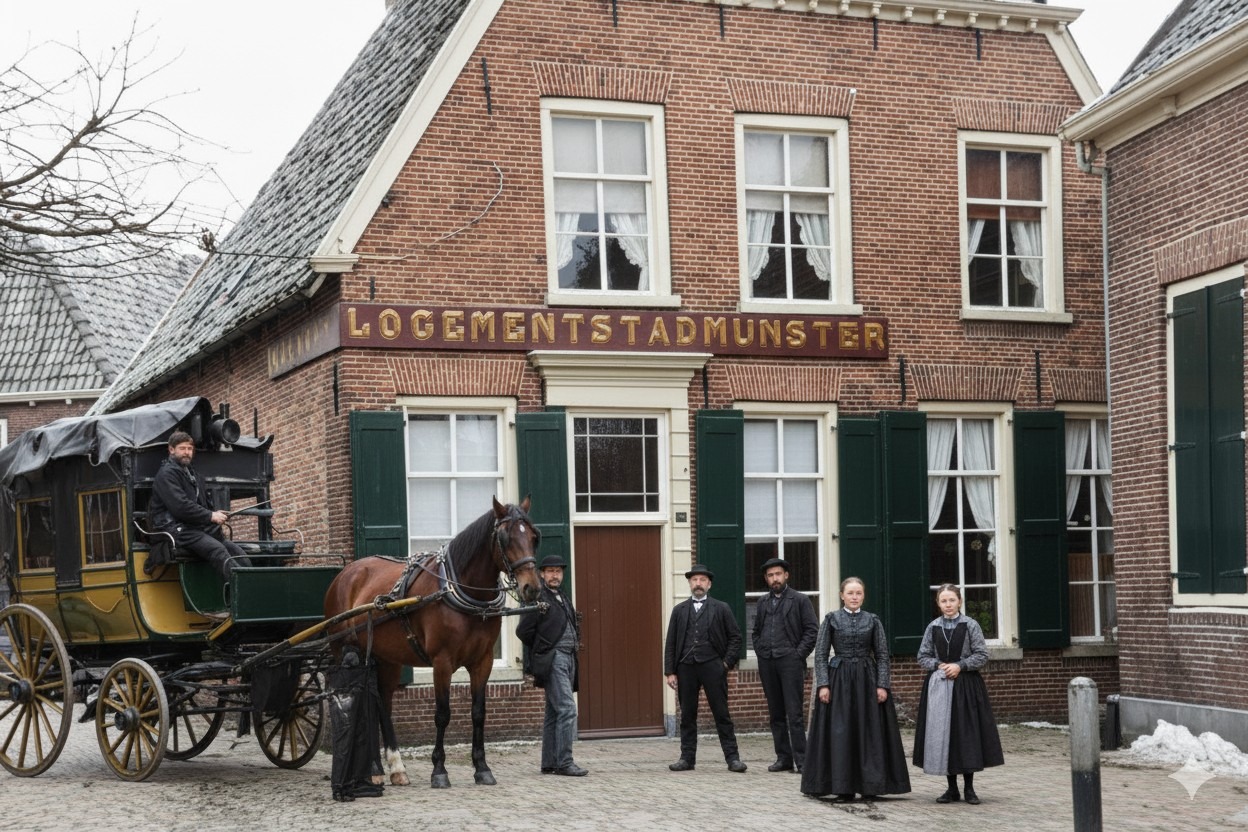
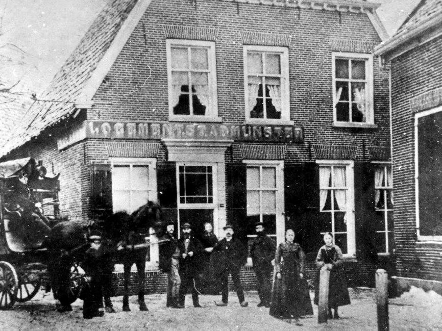
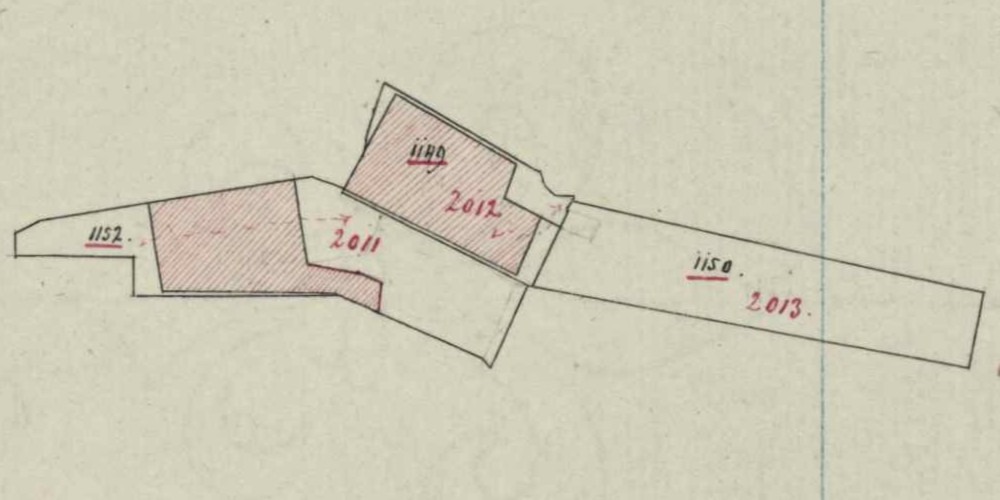
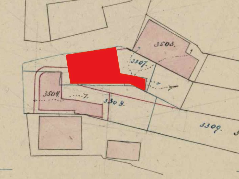
    Stad Munster Lodging House was once an important rest stop for travellers and mail coaches. It stood in Peperstraat, situated between the former post office and ‘De Postiljon’, opposite Stegers. Following the municipal reorganisation of 1816, it briefly served as a courthouse (Rechthuis). In 1873, the building was completely destroyed by fire and was never rebuilt.

    A Coaching Inn for the Diligence

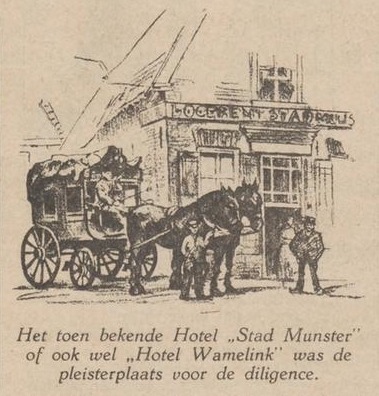
    In previous centuries, when the mail coach—or diligence—was the official mode of transport, ‘Logement Stad Munster’ (also known as ‘Hotel Wamelink’) functioned as a coaching inn for the diligence and a place of rest for weary travellers. Those embarking on a long journey who could afford it would board at Hotel Wamelink, after which the journey continued, jolting and bumping towards its destination. Those with less to spend put on their ‘steffels’ (boots) and undertook the journey on foot; a walk to Arnhem or Zutphen was no rarity in those days. People had the time. Stad Munster welcomed travellers of all kinds, such as a manufacturer from Armentières in France, a merchant from Stadlohn, and a clerk on foot from Oosterwijk. Three English factory workers from Manchester, Ashton, and Oldham once stayed there for two months.
    In 1823, Johanna Maria Martha Mensinck was registered at this address as the lodging house keeper. She was the widow of Gerrit Jan Wamelink, who had passed away in 1822. Johanna died in 1854. Their son, Lambertus Hermanus Wamelink, continued the business. In 1852, at the age of 39, he had married Johanna Catharina Heming. After her death in 1854, he remarried Wilhelmina Louisa Hendrina Meijrink in 1856.
    Fire

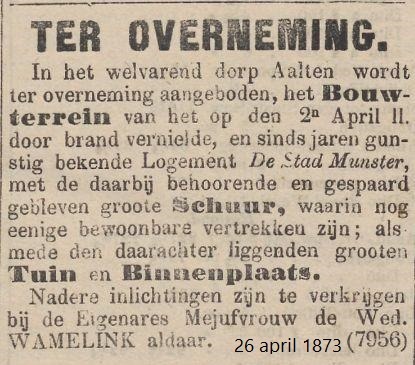
    On 2 April 1873, a violent thunderstorm broke out over Aalten. Labourers in the fields fled into barns and garden sheds. Thunder rolled incessantly and lightning filled the sky. Suddenly, a loud crack was heard, and shortly thereafter, everyone could hear the tolling of the fire bell in the church tower above the sound of the rain. A lightning strike had hit the building next to the lodging house, which was occupied by Mr Van Eerden and the national tax collector, Mr Boudewijn.

    By the time the fire wardens arrived, both buildings were engulfed in flames. The fire engines could do little against such a blaze. The old lodging house—the pride of the Wamelinks, who had lived there since the beginning of the 18th century—burnt to the ground, as did the adjacent house on the corner of Kerkstraat. The lodging house was never rebuilt, and the site has remained an open passage between Peperstraat and Het Hoge Blik ever since.


    Owners

    This overview is incomplete.

    YearPlotOwnerDescription
    1832I-1152widow of Gerrit Jan Wamelink 490 m² house, barn
    1858I-2011
    I-2012
    widow of Gerrit Jan Wamelink
    heirs of Lambertus Hermanus Wamelink
    490 m² house, yard
    260 m² barn, stabling
    1863I-2011
    I-2012
    Wilhelmina Louisa Hendrina Meijerink,
    lodging house keeper
    490 m² house, yard
    260 m² barn, stabling

    Residents

    Population register 1823-1838

    Aalten 256

    Johanna Maria Martha Mensinck (Winterswijk, 16-08-1788), lodging house keeper

    Widow of Gerrit Jan Wamelink.

    Population register 1838-1850

    Aalten 271

    Johanna Maria Martha Mensinck (Winterswijk, 16-08-1788), lodging house keeper

    Population register 1850-1860

    Aalten 271

    Johanna Maria Martha Mensinck (Winterswijk, 16-08-1788), lodging house keeper

    Next residents, son and daughter in law:

    Lambertus Hermanus Wamelink (Aalten, 18-02-1813)
    (1) Johanna Catharina Heming (Vreden/D, 02-07-1822)
    (2) Wilhelmina Louisa Hendrina Meijerink (Aalten, 06-11-1823)

    Population register 1860-1870

    Aalten 271

    Wilhelmina Louisa Hendrina Meijerink (Aalten, 06-11-1823), lodging house keeper

    Population register 1870-1880

    Aalten 348

    Wilhelmina Louisa Hendrina Meijerink (Aalten, 06-11-1823), lodging house keeper

    Features


    Cadastral no.I-11441
    FunctionLodging house
    Year of constructionunknown
    Burned down1873

    Sources


  • Arent Jan te Slaa

    Arent Jan te Slaa

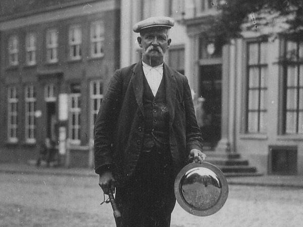
    Town crier, better known as ‘Jan met de panne’ (Jan with the Pan)

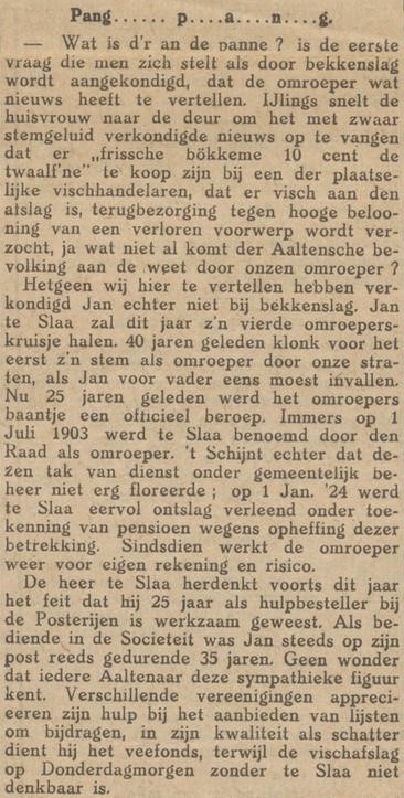
    Arent Jan te Slaa (known as Jan) was born on 22 March 1870 in Aalten, at house number 152 (Varsseveldsestraat 3), the son of Derk Hendrik te Slaa (a night watchman) and Janna Willemina te Brake. On 29 August 1895, he married Dina Geertruida Klein Hesselink (from IJzerlo, 13 September 1871) in Aalten. The couple went to live at Hofstraat 3. They had six children.

    The latest news

    In the 19th century, very few residents of Aalten could afford to have a newspaper at home. Those wealthy enough to do so could almost every evening count on neighbours dropping by to hear the latest news. This visit did not have to be for nothing, however: guests would usually leave a block of peat under their chair as a token of appreciation.

    As was common in many places, upcoming auctions were announced outside the church on Sunday mornings following the service. Usually, the schoolmaster would do this, standing on a small bench or a large stone. For official announcements from the municipality, a large noticeboard stood on the Market Square (Markt) in Aalten. For many years, new public notices were heralded by the tolling of the church bell, but this practice was abolished in 1901.

    Town crier

    Meanwhile, the first town crier was already doing his rounds in the village. In 1868, this was D.H. te Slaa, who, together with B.H. Wieskamp, fulfilled the role of night watchman. That they also acted as criers is evident from a note by the Mayor and Aldermen (B&W) dated 19 February 1876, in which the gentlemen were reprimanded for not going far enough. Aalten was growing, but the criers’ routes were failing to expand alongside it.

    When Te Slaa passed away in 1903, he was succeeded as night watchman by his son Jan. At the time, the role of crier was not yet an official appointment, although he did already act as such. Jan te Slaa did not receive this official appointment until 1 January 1915, “and this at an annual salary of 10 guilders”.

    Jan met de Panne

    Through his manner of performing his duties, he acquired an almost legendary fame. To capture the public’s attention, he would strike a copper basin vigorously several times with a wooden clapper; this basin earned him the nickname ‘Jan met de Panne’ (Jan with the Pan). When the local residents came outside to hear ‘what was on the pan’, he would proudly deliver his message standing up straight.

    At regular intervals, he made his rounds through the village to cry out the joys and sorrows of Aalten. He also announced the sale of meat from emergency slaughterings, made public the notices of the notary, and much else besides. He even proclaimed retailers’ special offers, such as a local fishmonger selling twelve kippers for 10 cents. He was, in a sense, a walking edition of the local Aalten Vooruit newspaper.

    In early 1918, the municipal council was requested to have the crier “proclaim the news of the day in the outlying districts as well”. Crier Te Slaa stated in response that for his meagre fee of 30 cents per proclamation, he could not venture into the outlying areas, “as Aalten continues to expand, and he would very gladly satisfy all who wish to hear, provided his fee is doubled”.

    On 9 November 1924, the Mayor and Aldermen of Aalten decided to abolish the position of town crier. With the dismissal of Jan te Slaa—who “owing to the abolition of the post was granted an honourable discharge as crier in Aalten”—a striking figure vanished from the village streetscape, and a characteristic piece of village life was lost.

    Following his discharge, Te Slaa did continue to cry on behalf of private individuals, and this practice—though carried on by his successors—continued until after World War II.

    The original pan has been given an honoured place in the Nationaal Onderduikmuseum on the Market Square in Aalten. ‘De Panne’ is also the name of the museum’s biannual magazine, named after the illustrious town crier.

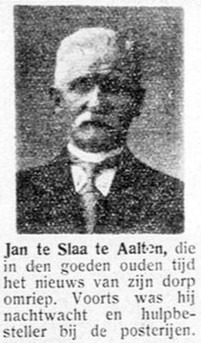
    ‘Those who left us in 1935.’ – De Graafschapbode, 30 December 1935
    ‘Those who left us in 1935.’ – De Graafschapbode, 30 December 1935

    Death

    Jan te Slaa passed away on 6 August 1935 and is buried at the Old Cemetery on Varsseveldsestraatweg in Aalten.

    Following his death, the Aaltensche Courant wrote:

    Jan te Slaa †

    On Tuesday afternoon, Mr A.J. te Slaa passed away here at the age of 65. With the passing of Jan te Slaa, a well-known figure leaves our community. Older residents will surely still remember Jan as he walked through the village, armed with pan and clapper, crying out the news. To the question: “Jan, what is amiss with the pan?” he always gave a kindly reply.

    He also rendered his services to our municipality for many years as a night watchman. At New Year, the inhabitants were offered a Zutphen Almanac for sale along with the best seasonal wishes; through the price one chose to pay for this, one could simultaneously express appreciation for the work of the night watchmen.

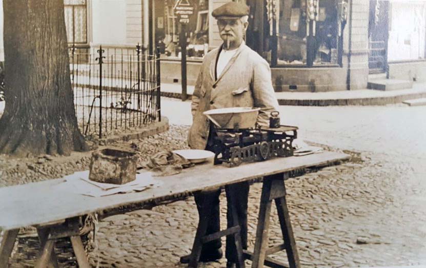
    The scope of Te Slaa’s activities was highly varied. For instance, until a few years ago, the deceased also functioned as a gravedigger and was an auxiliary postal delivery man. His role as a fish auctioneer, dating from the years of wartime mobilisation, was later continued by him in the form of a fish stall at the Thursday morning market.

    Various local societies availed themselves of his services as a messenger or debt collector, whilst at important celebrations, particularly at the Sociëteit club, Jan was always the most popular waiter. For many years, he held a position on the board of the Aalten Cattle Fund (Veefonds). Since his fall from a bicycle a few years ago, Jan was never quite his old self again, and thus a well-known Aalten resident has now departed from us.

    Sources


  • Old Cemetery Bredevoort

    Old Cemetery Bredevoort

    Prins Mauritsstraat, Bredevoort

    De Oude Begraafplaats aan de Prins Mauritsstraat in Bredevoort werd rond 1830 aangelegd, gelijktijdig met de naastgelegen Joodse Begraafplaats. Het terrein kwam beschikbaar na de ontmanteling van de vestingwerken aan de oostzijde van het stadje.

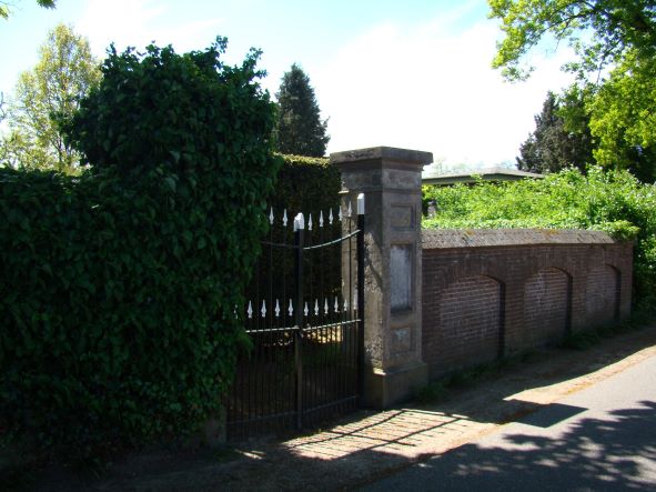
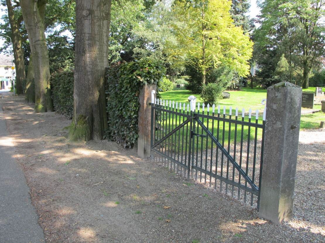
    The cemetery is characterised by an irregular floor plan, surrounded by beech hedges and tall trees. The oldest section is situated directly along Prins Mauritsstraat. In 1925, the southernmost strip was added to the cemetery. At the same time, a new entrance gate was installed, and a mortuary was built a few years later.

    Features


    Cadastral no.A-1144/1648
    FunctionCemetery
    Establishmentc. 1830
    ListedGemeentelijk
    monument

    Sources


    View the graves on Findagrave.

  • Kloosterhof Cemetery

    Kloosterhof Cemetery

    Kloosterdijk, Bredevoort

    The Kloosterhof Cemetery on the Kloosterdijk in Bredevoort was laid out in 1862–1863 and originally served as a Roman Catholic cemetery.

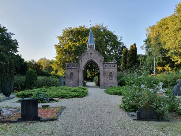
    The oldest, centrally located section features a symmetrical layout with a distinctive entrance gate, a mortuary that also functions as a workshop, and rows of graves facing a Calvary Cross at the rear of the site.

    In the 1980s, the cemetery was extended with a general section. In 1989, a mortuary building was also erected, providing facilities for the deceased to lie in state, for families to pay their last respects, and for offering condolences.

    In 2024, the Municipality of Aalten announced that part of the cemetery would be designated as a natural burial ground. This development aligns with modern wishes and needs regarding burial.

    Features


    Cadastral no.O-549/1146
    FunctionCemetery
    ListedGemeentelijk
    monument

    Sources


    View the graves on Findagrave.

  • Jewish Cemetery Bredevoort

    Jewish Cemetery Bredevoort

    Prins Mauritsstraat, Bredevoort

    De Joodse Begraafplaats aan de Prins Mauritsstraat in Bredevoort werd rond 1830 aangelegd, gelijktijdig met de naastgelegen algemene begraafplaats. Het terrein kwam beschikbaar na de ontmanteling van de vestingwerken aan de oostzijde van het stadje.

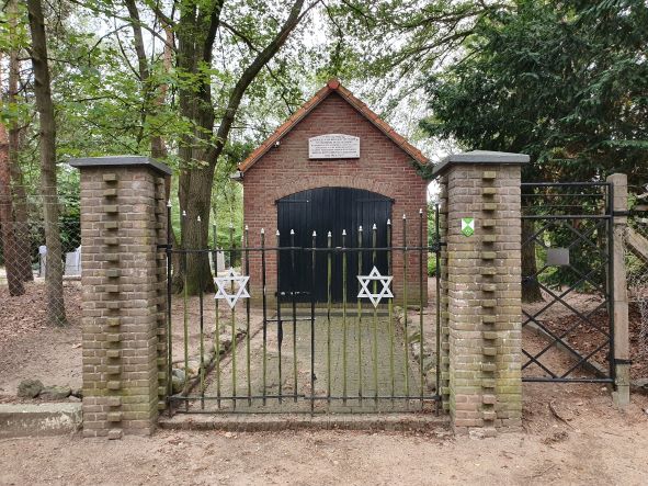
    The last Jews from Bredevoort to be interred at this cemetery were siblings Levi and Sara Sander. Both passed away in 1938, shortly after one another. The cemetery is not open to the public.

    Two Jewish cemeteries

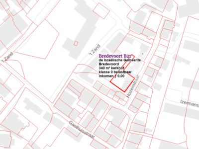
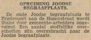
    Bredevoort had ooit twee Joodse begraafplaatsen. De oudste was gelegen op het voormalige kasteelterrein achter Hozenstraat 5. In 1953 werd dit terrein verkocht aan de gemeente Aalten ten behoeve van woningbouw. De stoffelijke resten en grafzerken werden toen overgebracht naar de tweede begraafplaats aan de Prins Mauritsstraat.

    Maintenance and Restoration

    Initially, the cemetery was maintained by the municipality. Since 2018, volunteers from the Bredevoorts Belang association have been responsible for mowing the grass and keeping the walls and the 12 gravestones free of climbing plants. In 2022, restoration work began to repair cracks in the walls, renew the pointing, and refurbish the gate.

    Features


    Cadastral no.A-1143
    FunctionCemetery
    Establishmentc. 1830
    ListedGemeentelijk
    monument

    View the graves on Findagrave.

  • Jewish Cemetery Aalten

    Jewish Cemetery Aalten

    Haartsestraat 150, Aalten

    The Jewish cemetery of Aalten, located on Haartsestraat, has a rich history dating back to the beginning of the 19th century. Although the site officially became the property of the Jewish community in 1852, there are indications that the cemetery had been in use since approximately 1820.

    The cemetery is situated in a wooded area and is enclosed by sturdy fencing. The older section consists of a low, densely wooded hill with scattered funerary monuments. To the east lies the newer section, which is characterized by an orthogonal layout.

    There are approximately seventy gravestones on the grounds, varying in age and design. At the entrance on Haartsestraat stands a metaheerhuis (mortuary), a ritual building used for the purification of the deceased according to Jewish traditions.

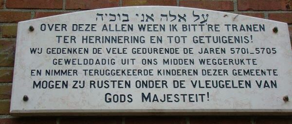
    During World War II, the cemetery was damaged, but it was restored after the war. In memory of the Jewish children from the municipality who were deported and killed during the war, a plaque has been placed on the facade of the metaheerhuis.

    Features


    Cadastral no.D-4461
    FunctionCemetery
    Establishmentca. 1820
    ListedGemeentelijk
    monument

    View the graves on Findagrave.

  • Berkenhove Cemetery

    Berkenhove Cemetery

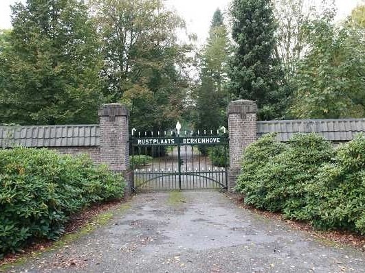
    Romienendiek 2a, Aalten

    Begin 20e eeuw raakte de Oude Begraafplaats aan de Varsseveldsestraatweg steeds meer omsloten door de oprukkende bebouwing van het dorp Aalten. Dit maakte de aanleg van een nieuwe algemene begraafplaats noodzakelijk.

    In 1920, the municipality purchased the Oosterman farm near ’t Walfort with the intention of creating a new general cemetery there. This plan ultimately did not proceed. Instead, a suitable site was found on the Romienendiek, where the ‘Berkenhove’ cemetery was brought into use in 1923.

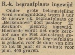
    Het oorspronkelijke gedeelte van Berkenhove ligt ingesloten tussen de Romienendiek, de Barloseweg en de Koningsweg. Door de jaren heen is de begraafplaats regelmatig uitgebreid. In 1960 werd een katholiek gedeelte toegevoegd, omdat de RK-begraafplaats aan de Piet Heinstraat vol was. De nieuwe RK begraafplaats werd ingewijd door pastoor Kerkhofs. De pastoor vond er in 1964 zelf zijn laatste rustplaats.

    The oldest part of Berkenhove features an orthogonal layout, with rows of graves along a central path, surrounded by a rich variety of trees and shrubs. The cemetery was later extended to the northern side of the Koningsweg.

    Funeral Centre and Crematorium

    Located at Berkenhove is a modern funeral centre and crematorium, managed by GUV. In 2015, a scattering field called ‘De Akker’ (The Field) was established adjacent to the cemetery, providing space for the scattering of ashes, urn graves, and a columbarium wall.

    War Victims

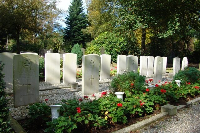
    Een blijvende herinnering aan hun offer voor onze herkregen vrijheid zijn de 18 uniforme grafstenen op deze begraafplaats voor vijf Britse vliegers die in IJzerlo zijn neergestort en 12 Britse militairen van de grondtroepen die sneuvelden bij de bevrijding van Aalten in april 1945. Bij de graven van de Britse oorlogsslachtoffers bevindt zich ook het graf van verzetsstrijder Cornelis (Kees) Ruizendaal.

    Furthermore, dozens of other graves of war victims can be found at Berkenhove. Many of these graves are marked as such.

    Features


    Cadastral no.L-1938/O-45
    FunctionCemetery
    ListedGemeentelijk
    monument

    View the graves on Findagrave.

  • Burial mound Nannielaantje

    Burial mound Nannielaantje

    Nannielaantje, Aalten

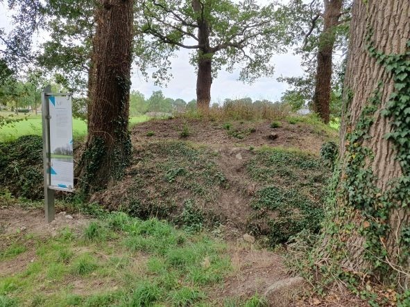
    Located on the former ‘t Smees estate at the Nannielaantje is a unique burial mound. The estate was once owned by Christiaan Caspar Stumph and his wife Jeanne Lesturgeon. Stumph served as the first mayor of Aalten from 1811 to 1818. The municipal secretary’s office was also situated on the estate.

    It was Stumph’s wish to find his final resting place here. He was frustrated by the poor conditions of burials within or near churches. In 1818, during the Romantic era, he arranged a ‘private outdoor cemetery’ for himself and his relatives.

    His last will and testament read as follows:

    “After my death, I wish and desire to be of no harm to my fellow man. As our national government remains backward in putting an end to burials inside churches and in churchyards within towns—as is done in France, Germany, Italy, and elsewhere—and in directing them to spacious burial grounds outside, I have (…) caused a site to be prepared in one of the Smees meadows, specifically the one adjacent to Smees Hoflanden. This small plot of land, my property, I will and desire to be respected and honoured as a sanctuary after my passing.”

    Those Buried Here

    On 28 July 1818, at 5 o’clock in the morning, son Abraham Antonij Stumph was buried at this outdoor cemetery. He was 34 years old and a notary by profession. He had drowned in the Slingebeek stream. Local legend suggested his death was linked to a broken heart. A year later, the 74-year-old Christiaan Caspar Stumph married 30-year-old Caatje Weversborg, the daughter of the tenant farmer at ‘t Smees. In January 1820, eight months after this marriage, Stumph himself was buried at ‘t Smees in accordance with his will.

    Following them, several others were interred in this meadow location: friend and VOC (Dutch East India Company) captain Johan Christiaan Rost with his wife (a daughter of Stumph from Bredevoort), their young daughter, and two grandsons. The last known owner of the mound passed away in 1913. The Municipality of Aalten has arranged for the Stichting Vrijwillig Landschapsbeheer Achterhoek (Achterhoek Voluntary Landscape Management Foundation) to maintain the burial mound.

    Features


    Cadastral no.D-5280
    FunctionCemetery
    Established1818
    Listedno

    Sources


    • Aaltensche Courant, 1 June 1948 (Delpher)
    • ‘Bloemlezing uit de historie der gemeenten Aalten – Dinxperlo – Wisch’, D.W. Kobes (Hilversum, 1966)
    • Dagblad Tubantia, 13 January 1960 (Delpher)
    • Erfgoedcentrum Achterhoek & Liemers: stichtingsakte en wilsbeschikking (2.5), 1818
    • Cadastral map
    • ‘Wortels in de Achterhoek’, Henk Harmsen

    For an overview of the individuals buried in the mound, please visit Findagrave.

    The Aaltensche Courant wrote on 1 June 1948:

    The history of the old burial mound at the Nannielaantje in Aalten

    Walking into the „Nannielaantje” from the Haartsestraat (known to older residents of Aalten as „Smeeslaantje”) and crossing the narrow bridge, one sees on the left, roughly opposite the „Aalten’s Belang” bench in the meadow, a square mound. It is overgrown with several heavy oaks and surrounded by ditches, which have gradually become almost level with the surrounding land.

    Most residents of Aalten will not know what this square mound actually is, and few are aware that it is an old burial mound, let alone any further details.

    Having happened upon the „Deed of Foundation” for this cemetery recently, it seemed interesting to share some information with readers, for the well-known „hump” in the Nannielaantje is indeed a burial ground.

    A former mayor of Aalten, C. C. Stumph, strongly disagreed with the continued practice of burying people in and around churches. Consequently, he created his own burial place in the „Smees meadows”. In the „Deed of Foundation”, dated 2 May 1818, everything is precisely described. The maintenance of this cemetery was arranged and the compensation for it established.

    Including the entire „Deed of Foundation” would require too much space. A few passages follow here:

    „After my death, I wish and desire to be of no harm to my fellow man. However, as our National Government remains backward in—as in Germany, France, Italy, and elsewhere—ceasing burials within Churches and in Churchyards within towns and referring them to more spacious burial grounds outside: I have, so that my earthly remains may be entrusted to the Earth undisturbed! and my Bones may rest in Peace, already for several years, caused a Private Outdoor Cemetery to be prepared for myself in one of the Smees meadows, specifically the one against Smees Hoflanden.

    This small plot of ground, my property, I will and desire that after my death, it shall be respected and honoured as a Sanctuary in a certain respect, by whomsoever, be it my Heir or Heirs, or legal successor! Declaring the same hereby as forever inalienable and untransferable.

    And so that this Cemetery, in the order it currently is, or shall be at my passing, be continuously maintained annually in the future, I attach and bind to it (for and to settle the costs of that maintenance) that dagmat [day’s mowing] of land in which it is situated.

    With the maintenance and upkeep after my death, the resident or residents of the dwelling house standing on Smees shall be and remain charged! who shall also for this purpose enjoy the annual proceeds of that dagmat of land or the (…), and the meadow on both sides along the ditches belonging to that dagmat and along the stream growing soft-wood timber, free of charge; also with the promise to be allowed to cut and use the grass on that Cemetery, and also of the ditches belonging thereto and to that dagmat, twice a year, however, sparing the

    weeping willows or other shrubs or flowers thereon, these being an exception to the aforementioned soft-wood timber, and furthermore the right to allow two cows to graze in that meadow after the grass has been mown, in the aftermath or late grass, with the Beasts brought therein by or on behalf of the Owner of that meadow, also to be grazed free of charge.”

    In the remainder of the document, the minister of the Reformed Church was charged with supervision. „The Minister or Ministers of the Reformed Congregation of Aalten at the time are invited and urgently requested to kindly take upon themselves the Supervisions! Granting for that purpose the faculty, in the event of no proper maintenance and supervision: without any consultation or notice, to entrust that maintenance with the attached enjoyment thereof to a more diligent and vigilant subject!”

    After several further provisions, the deed ends as follows: „Thus disposed and drawn up this second of May 1818, following his signature, was signed: C. C. Stumph.” This Mayor Stumph, who passed away a few years later, is not the only person buried here.

    Information regarding this was received from a relative who still possesses the old Bible and other family papers:

    A sister of Mayor Stumph, Christina Petronella, born in 1786, was married to one Johan Christiaan Rost, born 15-12-1766. (This Rost originally came from Germany. He lived at „’t Smees”, which was later sold to Mr Slicher van Bath). They died in 1827 and 1835 respectively and were both buried at „’t Smees”.

    The Rost-Stumph couple had 4 children:

    1. Henriette Willemina Christina Theodora, born 21-6-1817 (she later married Dr Servaas van Leuven, the father of the late Dr Adriaan van Leuven).
    2. Willemina Johanna, born 11-06-1819
    3. Louisa Benjamina
    4. Elisa Charlotte, born 13-03-1823

    Two of these children, namely Willemina Johanna and Elisa Charlotte, died in 1835 and 1826 respectively and were both buried at „’t Smees”. Dr Servaas van Leuven had 10 children. He lived in the building on Bredevoortsestraat where the Volksslagerij (People’s Butchery) is now located. Of these 10 children, two died at a very young age and were also buried at „’t Smees”. These were:

    1. Johannes Adrianes, born 23-03-1839 and died 06-04-1840
    2. Karel, born 10-01-1861 and died 18-08-1862

    These were therefore two brothers of Dr Adriaan van Leuven.

    It is therefore known with certainty that 7 people are buried at the „’t Smees” cemetery. It is understood that there are plans to provide a fence for this old burial mound, which is now often used as a playground by the youth.

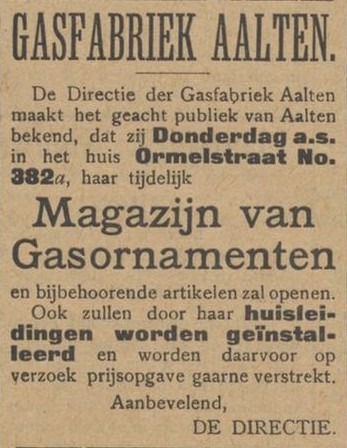
  • Gasworks

    Gasworks

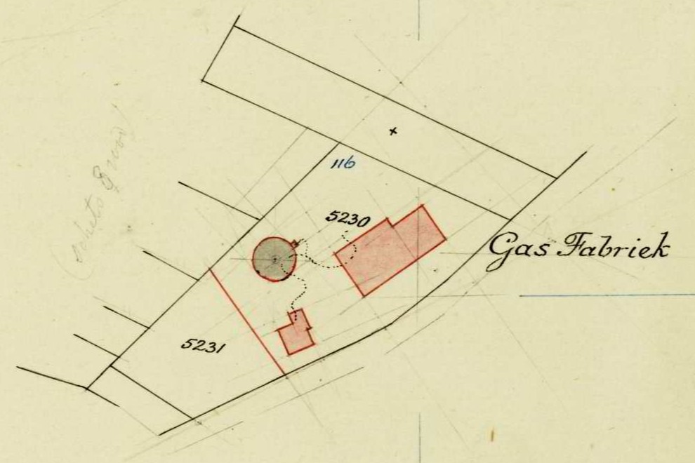
    Bredevoortsestraatweg 109, Aalten (no longer extant)

    At the beginning of the twentieth century, there was a growing demand for modern energy supplies in the Netherlands. Until then, many households and businesses relied on oil and paraffin lamps for lighting, and on wood or coal for heating and cooking. Gas lighting was seen as a major advancement.

    As in many other places, it was decided to build a gasworks in Aalten to provide households, businesses, and street lighting with gas. The arrival of the plant marked a significant step in the modernisation of local infrastructure, though it also brought its share of challenges.

    The Production Process

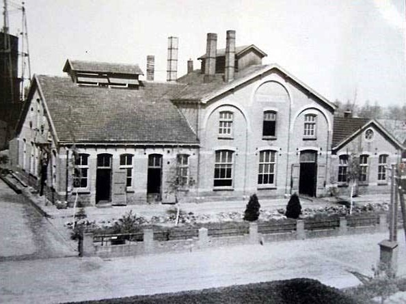
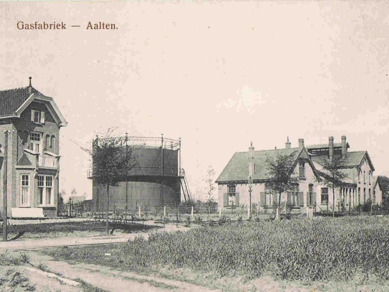
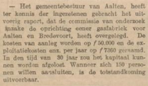
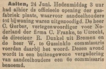
    In 1905, the decision was made to build a ‘coal gas plant’ in Aalten. Two years later, in 1907, it was put into operation. The plant produced gas through the dry distillation of coal. This process involved heating coal in the absence of oxygen, releasing gas that could be captured for distribution.

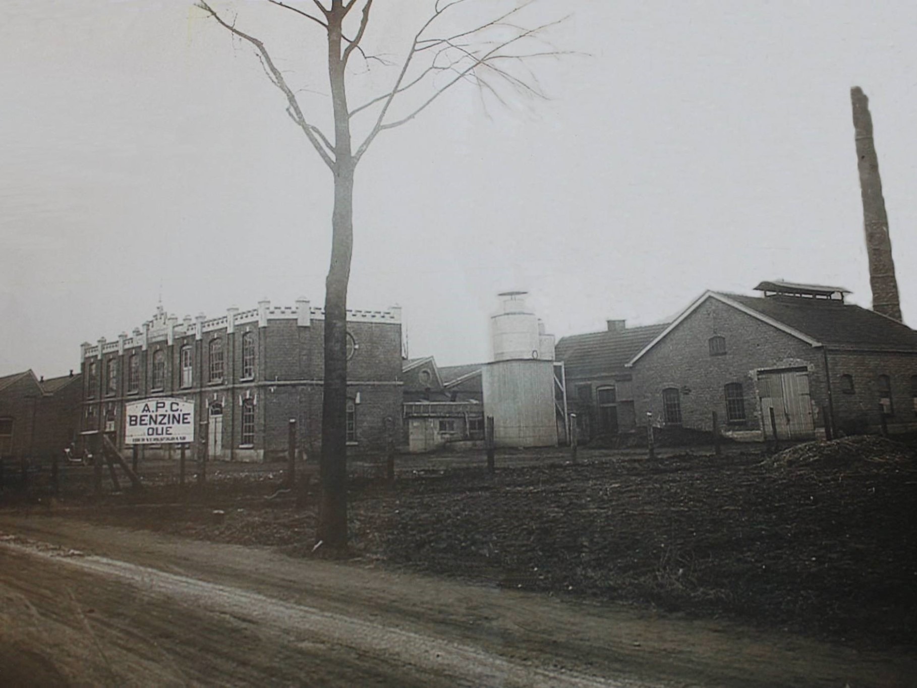
    The raw gas contained various impurities, such as tar, ammonia, and sulphur compounds. These were removed through condensation and chemical purification. The purified gas was then stored in a large gas holder (gasometer) and guided through a network of underground pipes to homes and businesses, where it was used for lighting, cooking, and heating.

    Installation of the Gas Grid

    The installation of the gas grid caused considerable disruption. Streets frequently had to be dug up to lay the pipes, leading to many complaints from residents.

    Until the end of 1908, people complained about the poor state of the roads and the inconvenience caused by the works. Nevertheless, the use of gas quickly became popular, and the gasworks grew into an essential utility within the municipality.

    In 1919, the municipality of Aalten took over the gasworks for a sum of ƒ 115,000, plus ƒ 29,602.87 for infrastructure such as piping and gas meters.

    Gas Tokens

    Until the 1950s, some households had a gas meter that operated with special gas tokens. This system, intended to prevent payment arrears, was also used in Winterswijk. The Aalten gas token was a zinc coin with a value of 10 cents. When the gas ran out, a new token had to be inserted into the meter.

    With the arrival of the geyser (water heater), this system fell into disuse. The pilot light of these appliances had to burn continuously, which was not permitted in combination with a coin meter. Around 1955–1958, gas tokens disappeared completely, partly due to the introduction of the national natural gas grid.

    The End of the Gasworks

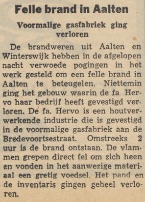
    The discovery of the natural gas field in Slochteren marked the end of local gasworks, including the one in Aalten. The building subsequently served various temporary functions, such as a technical school and later a furniture factory (Fa. Hervo), until the premises were destroyed by fire in 1964.

    After its closure, the soil was found to be severely contaminated with hazardous substances such as sulphur and cyanide. The remediation of the site was only fully completed decades later, in 2009.

    Tram Stop

    There used to be a tram stop at the gasworks on the Lichtenvoorde-Bocholt line.


    Owners

    Overview is incomplete.

    YearPlotOwnerDescription

    Archives

    Address directory 1934

    Aalten C429 > Bredevoortschestraat 109

    Gasworks

    Features


    Cadastral no.I-12882/13058
    FunctionGasworks
    Year of construction1907
    Destroyed by fire1964

    Sources


  • Dutch Button Works

    Dutch Button Works

    Misterstraat 39, Bredevoort (repurposed)

    Dutch Button Works was a button factory in Bredevoort that existed from 1884 until 1976. During its heyday, approximately 270 people were employed by the company; at the time of its closure, the workforce numbered about 44.

    The Horn Industry

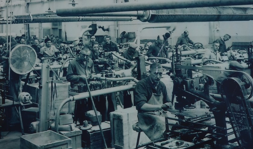
    In Nederland bestonden in de 19e eeuw al enkele knopenindustrieën. De oudste op dit gebied ontstond in 1815, maar dat betrof voornamelijk stofknopen, in het bijzonder van linnen. In Duitsland en Engeland waren rond 1900 bedrijven ontstaan die uit hoorn knopen produceerden. Met dat voorbeeld voor ogen begon Willem te Gussinklo in het jaar 1905 met het maken van hoornen knopen. Dat was een primeur voor Nederland, de eerste fabriek van buffelhoornen knopen. Al snel kwam zoon Willem te Gussinklo jr. (Piepkes Willem) in de firma, die zich ontwikkelde als innovatief ondernemer.

    De eerste fabriek van Te Gussinklo stond aan ‘t Dal in Aalten, de tegenwoordige Willemstraat. De productie was aanvankelijk uitsluitend handwerk en de knopen werden één voor één gemaakt. Vanwege de toenemende vraag naar knopen kocht hij in 1924 de oude weverij van Van Eijck in Bredevoort. Daar ging de productie van knopen van start.

    Bredevoort had toen ook nog een station. Zo nu en dan arriveerde daar een wagonlading horens, afkomstig uit India en bestemd voor de Bredevoortse knopenindustrie. Naarmate de jaren verstreken werd de fabricage van knopen steeds meer gemechaniseerd. Met door eigen technici vervaardigde machines werd het product toen ten dele of geheel automatisch vervaardigd. Van het hoorn zaagde men schijfjes, rondellen genoemd. Hiervoor werd zowel het hoorn uit de massieve punten van buffelhoorn gebruikt, alsook de holle gedeelten ervan.

    Export

    The export of buttons was of great importance. Trade was primarily focused on English-speaking countries—England, Ireland, and North America—where Dutch Button Works enjoyed a fine reputation. Until the 1920s, the buttons produced were exclusively intended for men’s suits. However, when demand fell during the crisis of the early 1930s, ladies’ buttons were put into production as compensation, almost simultaneously with the manufacture of bone buttons. Bone buttons were intended for undergarments. Besides buttons, the factory in Bredevoort also manufactured walking sticks—specifically, the knob or handle and the tip were crafted from horn.

    Een aantal jaren nadat de kammenfabriek Ten Dam & Manschot uit Aalten was opgeheven nam DBW ook de productie van kammen ter hand. In de Tweede Wereldoorlog is men ook overgegaan op het verwerken van inlands hoorn. Behalve knopen waren asbakken en vogels favoriete werkstukken. Van hertshoorn vervaardigde men knopen voor de zogenaamde jagersjassen en van schijven hertshoorn maakte men kleine asbakjes of kaarsenstandaards op een voet van palissanderhout.

    Before the war, DBW also had branches in Germany: in Berlin and Bocholt. After 1945, the company experienced a peak period. The third generation, W.A. te Gussinklo, joined the management. Demand for buttons was high. Many home workers were occupied with sewing buttons onto cards. The horn buttons found their way to garment factories. Sales representatives would travel with a “model jacket” made of various pieces of fabric sewn together—a multicoloured patchwork. On each piece of fabric, the most suitable buttons for that specific material were sewn.

    In 1959, the company celebrated its 75th anniversary. At that time, there were over a hundred employees, excluding home workers. Due to increasing automation, the company achieved high turnover with fewer staff. In the second half of the 1950s, horn was largely superseded by plastics. In 1963, the management of DBW, together with an English button factory, took over the largest button factory in Germany.

    Decline

    The company suffered a heavy blow in 1968 when the director, W.A. te Gussinklo, died at the age of 51, just six months before his father. He was succeeded by his wife, B.A. te Gussinklo-Zandbergen. When her son H.J. Gussinklo Ohmann completed his studies at the technical university in Eindhoven a year later, he also joined the management. By then, the production system was entirely focused on plastic buttons (polyester), which the company had started producing itself around 1960. In the long run, however, it proved extremely difficult to remain competitive. Despite great efforts to keep the company running, they were forced to close DBW in 1976.

    De gemeente Aalten kocht het complex in 1977 en het werd doorverkocht aan de firma’s Van Wezel en Voltman-Riviera. Later was hier vele jaren lang autobedrijf Albert ten Bruin gevestigd.

    Repurposing

    At a municipal information evening in July 2008, the Vereniging Bredevoorts Belang (Bredevoort Interest Association) made a plea for the preservation and restoration of this characteristic building. They stated: “This building is the only remaining, tangible, and visible intact industrial heritage that Bredevoort still possesses, providing residents with a link to its extensive textile history. The factory building, still in its original state, has a striking, beautiful facade featuring the typical elements of an industrial building built in the third quarter of the nineteenth century.” The non-monumental parts were demolished in 2019. The monumental building has since been repurposed to house apartments and a supermarket.

    Features


    Cadastral no.A-2623
    FunctionButton factory
    Foundation1884
    Discontinuation1976
    ListedGemeentelijk
    monument
  • Beukenhof

    Beukenhof

    Hofstraat 12, Aalten

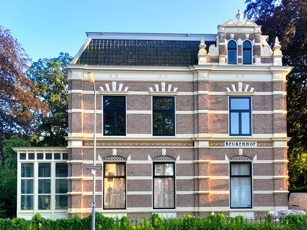
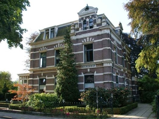
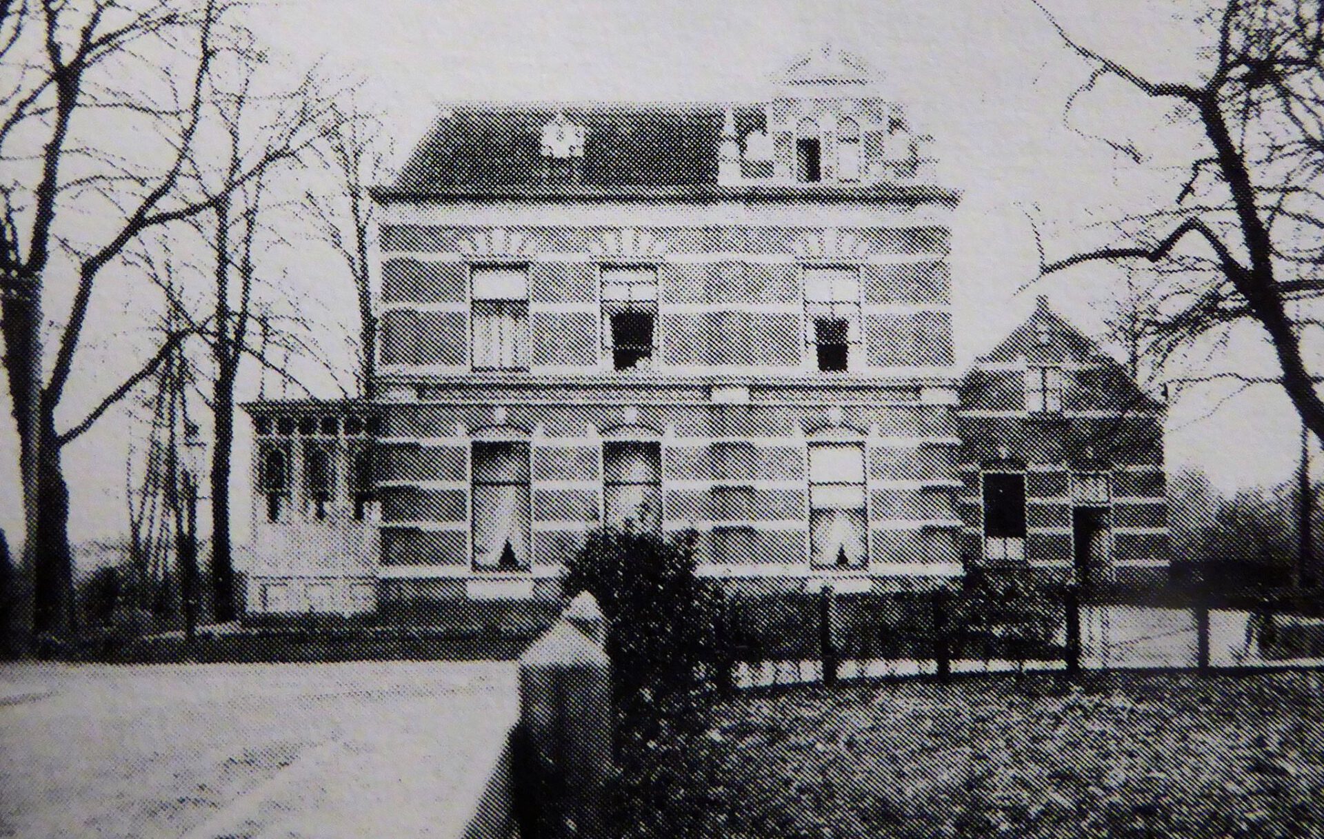
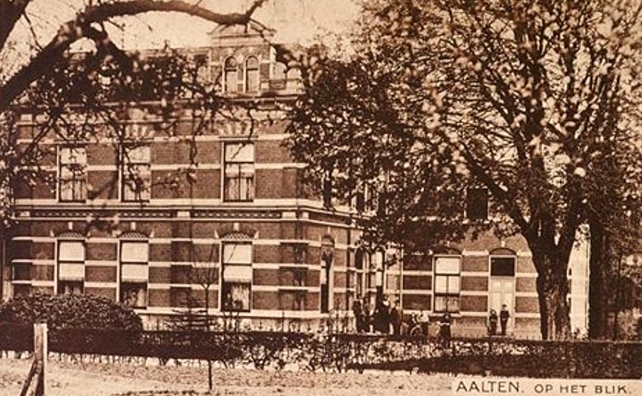
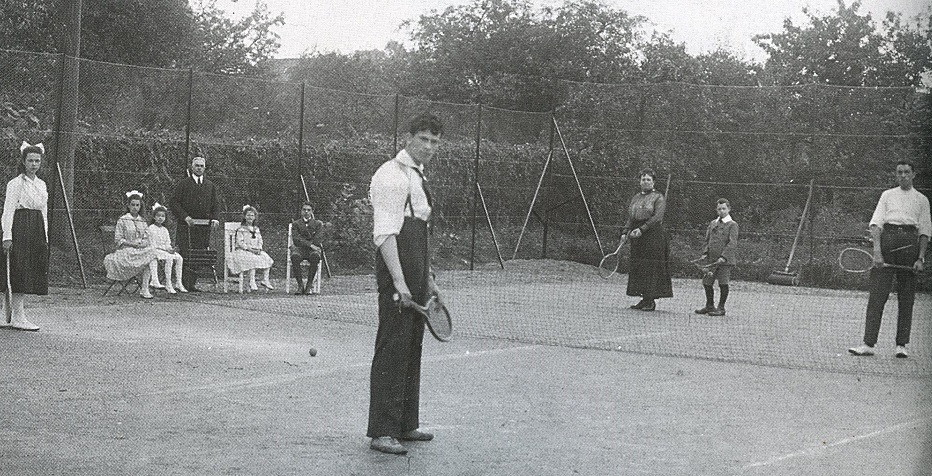
    This director’s villa was built in 1893–1894 by textile manufacturer Herman Driessen, concurrently with the former steam weaving mill situated next door. In later years, the stately villa served as a foster home for Estinea for a long time. Behind the house once lay what was likely the first tennis court in Aalten.

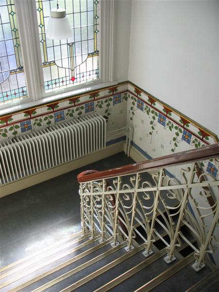
    The villa is constructed in a Neo-Renaissance style and features 10 bedrooms across the first and second floors. It is a national monument and retains many monumental details, including a very fine staircase with original Art Nouveau-patterned tiles and various original stained-glass windows. This characteristic property is currently in private hands and is undergoing restoration.

    In 2015, Jalf Flach wrote to Old Aalten:

    “I recently rediscovered a text I wrote 25 years ago following an interview with Mrs Bella Driessen. In 1893, the Hofstraat was still called ‘Het Blik’, and in that year, a steam weaving mill and a house were erected there, which would be occupied by members of the Driessen family for the next 75 years. It was not until 1953 that the house was named ‘Beukenhof’ by one of its residents. But by then, the house already had an eventful history behind it.

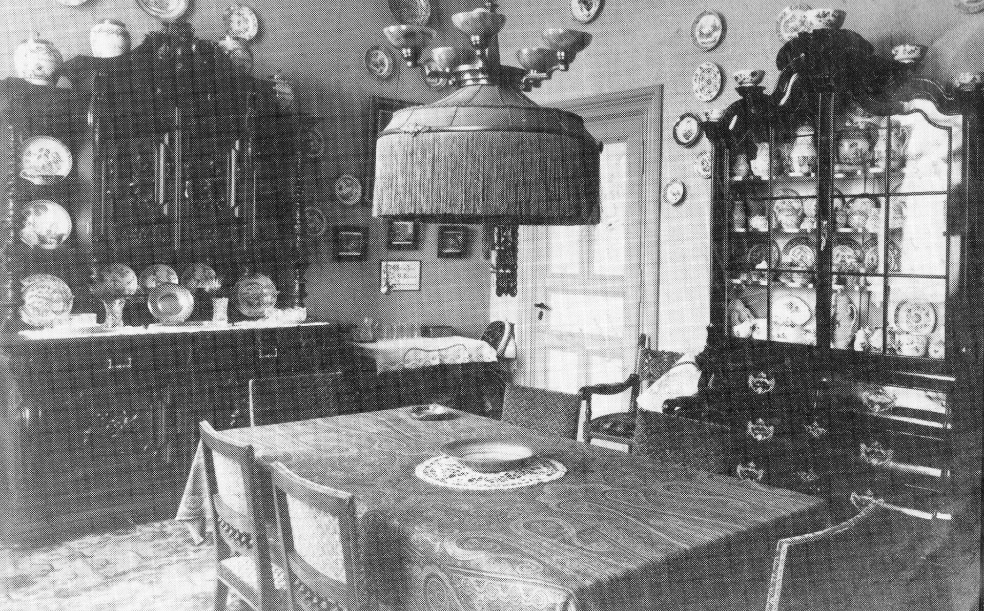
    Bella Driessen lived in the house from her early childhood until 1969, when the factory closed and the house changed hands. That is a period of over 60 years. In those days, the Beukenhof was a true patrician residence, as is evident from the interior photograph she kindly lent me. In later years, she occupied the small house that had been built onto the main building, which, much to her sorrow, was demolished in 1976 when the house was converted into a foster home. That brought an end to what was colloquially and irreverently referred to as ‘Bella’s pimple’.

    Mrs Driessen’s stories about the war years were fascinating. There were a couple of magnificent stained-glass windows in the stairwell. One depicted the weir on the Smees, and the other, the cathedral of Malmédy, from where her mother originated. After a German soldier had first shot through them because of a breach of blackout regulations, they were completely destroyed during a bombing raid on Aalten. For the remainder of the war, planks were nailed over them, and the residents, billeted German soldiers, and evacuees had to find their way in the dark.

    After the war, simpler stained-glass windows were installed, which still adorn the staircase in an Art Nouveau style today and, together with the beautiful tiles and wrought-iron bannisters, give the building a unique character.”


    Owners

    Overview is incomplete.

    YearPlotOwnerDescription

    Residents

    Population register 1890-1900

    Aalten 20

    Herman Anton Frans Carel Maria Driessen (Aalten, 22-09-1831), manufacturer
    Anna Maria Theodora Mühren (Neuenkirchen/D, 14-10-1840)

    Population register 1900-1910

    Aalten 23 > C584

    Herman Anton Frans Carel Maria Driessen (Aalten, 22-09-1831), manufacturer
    Anna Maria Theodora Mühren (Neuenkirchen/D, 14-10-1840)

    Population register 1910-1920

    Aalten C584 > D691

    Josephus Walter Julius Driessen (Aalten, 07-01-1870), manufacturer
    Maria Anna Elisa Josepha Beckmann (Malmédy, 12-05-1872)

    Address directory 1934

    D691 > Hofstraat 12

    J.W.J. Driessen

    Address directory 1967

    Hofstraat 12

    Mevr. I.M.E.B.G. Driessen-Smeets

    Features


    Cadastral no.I-12941
    FunctionHouse
    Year of construction1893
    ListedNational monument
  • Ambthuis (Administrative House)

    Ambthuis (Administrative House)

    Landstraat 17, Bredevoort

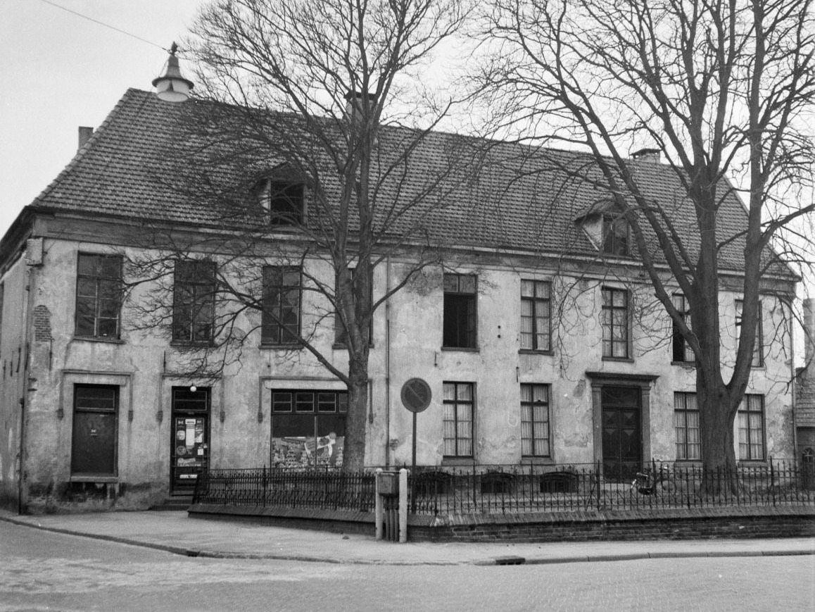
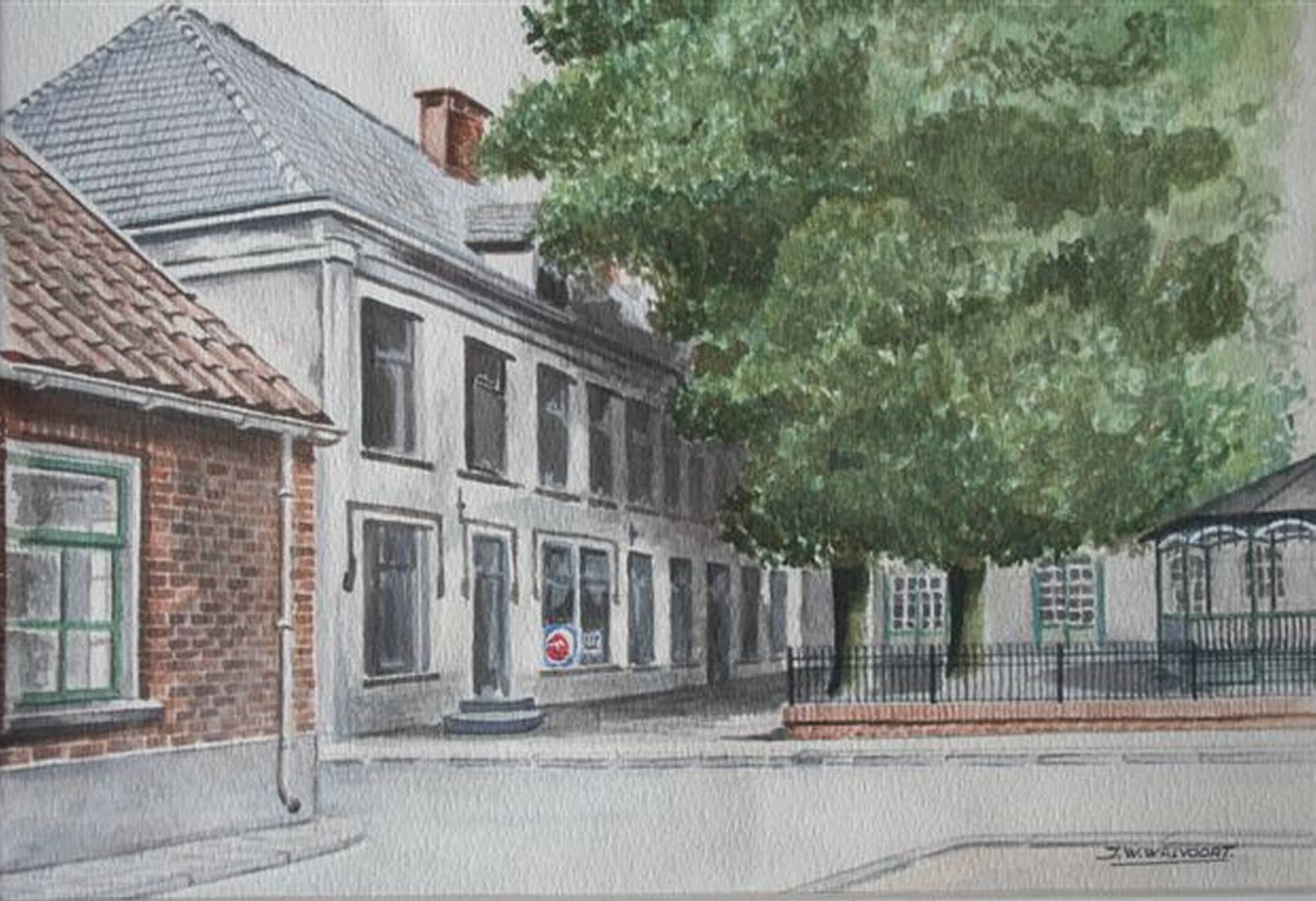
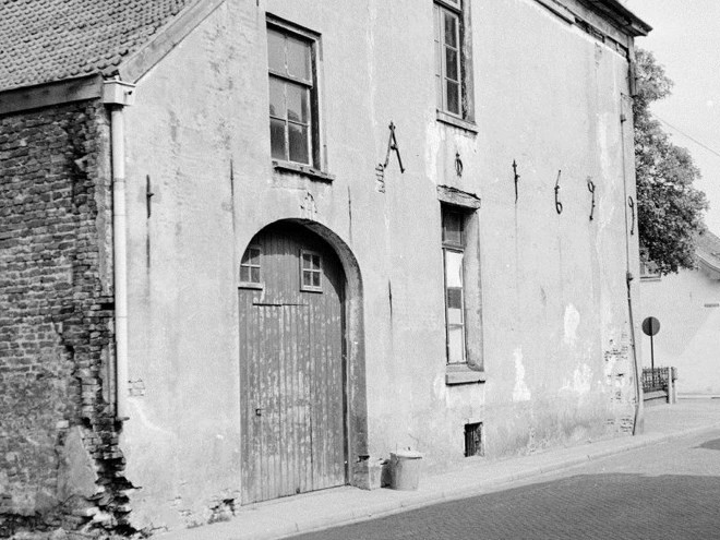
    According to its wall anchors, the original Ambthuis (Administrative House) dated from 1699. For a century, it served as the centre of power for the Heerlijkheid (Lordship) of Bredevoort. The Ambthuis was also known as the Mauritshuis, as Prince Maurice had clearly left an unforgettable impression on the local inhabitants.

    Chief Court

    Following the gunpowder tower disaster of 1646, the town and lordship of Bredevoort had been left without an ambthuis (a building combining a courthouse and a town hall). It would take over fifty years before a new one was constructed. The building was likely connected to the Misterpoort, the city gate situated opposite the house.
    The building also served as the hoofdgerecht (chief court) of the lordship. While courts existed in Aalten and Winterswijk as well, serious offences were always tried in Bredevoort, with the drost (bailiff) presiding as judge.

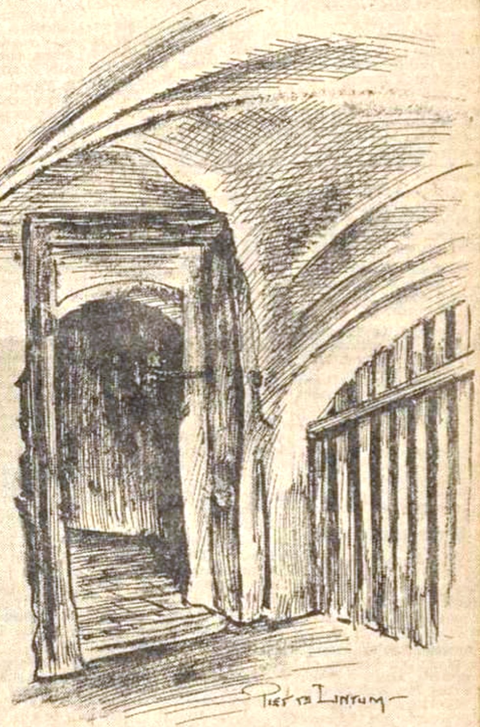
    The cellars contained several dungeons (cachots), cells, and a torture chamber equipped with the necessary implements. Those sentenced to death were held in a cell devoid of daylight and fresh air. If a suspect refused to confess, the threat of the torture chamber was often enough to secure a plea of guilt. Sentences were traditionally pronounced on ’t Zand. In the case of a death sentence, the condemned was immediately taken to the Galgenbulte (Gallows Hill) on the Hollenberg for execution. Usually, this meant hanging from the gallows that had stood there for centuries, waiting for its victims. It is said that the gallows could be seen from the Aalterpoort. For the local population, such executions were a sensation, and people from all over Bredevoort and Aalten would turn out to witness the event.

    Other Functions

    After the French period, the building lost its original function and was used for various purposes, including as a shop for the Catholic cooperative. This cooperative was founded by the workers’ association in 1920. In the past, Catholics would frequent this shop, while those of other faiths would go to the other cooperative further down Landstraat.

    The Ambthuis was demolished around 1963. The cellars of the Ambthuis, which included two prison cells, were still located beneath the shop. In 1964, the foundation stone was laid for the construction of the Betting furniture store on this site. This building was in turn demolished in 2009, after Betting moved to new premises on Prins Mauritsstraat.

    New Construction

    Today, the site of the old Ambthuis is occupied by a care apartment complex consisting of twenty apartments and a restaurant. The new building was again given the name ‘Ambthuis’. In terms of its exterior, the new building bears many similarities to its illustrious predecessor. A replica of the historic sundial was attached to the building, and a replica of the bandstand was placed in front of it. An original gable stone from the old Ambthuis was built into the front facade, bearing the inscription: “Die kan lide haet en nijt, die overwint in korten tijd” (He who can endure hate and envy, shall overcome in a short time).


    Owners

    This overview is incomplete.

    YearPlotOwnerDescription
    1832B-104Jan Barend Top, bleacher390 m² house & yard

    Residents

    Population register 1823-1838

    Bredevoort 16

    Johannes Bernadus Top (Weseke/D, 28-07-1749)
    Hermina Legeschaar (Kruiskapel/D, 28-11-1789)

    Population register 1838-1850

    Bredevoort 8

    Johannes Bernadus Top (Weseke/D, 28-07-1749)
    Hermina Legeschaar (Kruiskapel/D, 28-11-1789)

    Population register 1850-1870

    There’s still a gap in our information here…

    Population register 1870-1880

    Bredevoort 10

    Jean Leander van Eijck (Sint-Niklaas/B, 25-11-1808 – Bredevoort, 25-02-1888)

    Population register 1880-1890

    Bredevoort 17

    Jean Leander van Eijck (Sint-Niklaas/B, 25-11-1808 – Bredevoort, 25-02-1888)

    Next (head) resident, daughter:

    Johanna Christina Theodora van Eijck (Bredevoort, 18-06-1848)

    Population register 1890-1900

    Bredevoort 11

    Johanna Christina Theodora van Eijck (Bredevoort, 18-06-1848)

    Population register 1900-1910

    Bredevoort 9 > 9

    Johanna Christina Theodora van Eijck (Bredevoort, 18-06-1848)

    Population register 1910-1920

    Bredevoort 9

    Johanna Christina Theodora van Eijck (Bredevoort, 18-06-1848)

    Next residents (1918-1922):

    Bredevoort 9 > 225

    Carl Rotthoff (Castrop/D, 24-12-1872), engineer
    Antonia Johanna Josepha Maria Sevink (Bredevoort, 05-07-1879)

    Address directory 1934

    Bredevoort 225 > Landstraat 17

    Co-op Shop “Eigen Hulp”

    Address directory 1967

    Landstraat 17

    W.H. Betting
    Mej. J.W. Betting

    Features


    Cadastral no.B-1824
    FunctionGovernment building,
    Residential house,
    Shop
    Year of construction1699
    Demolitionca. 1963
    Year of
    current building
    2010