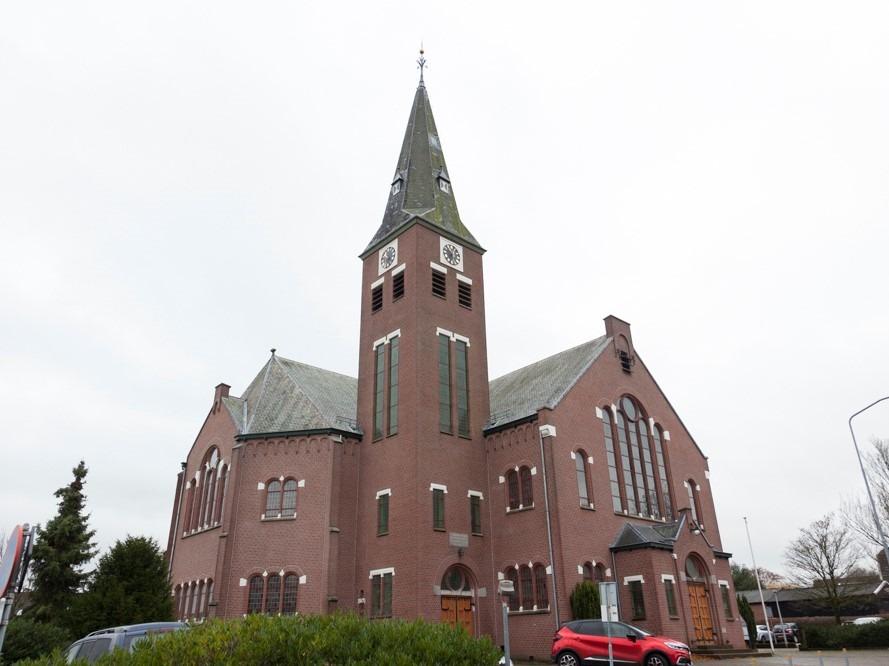
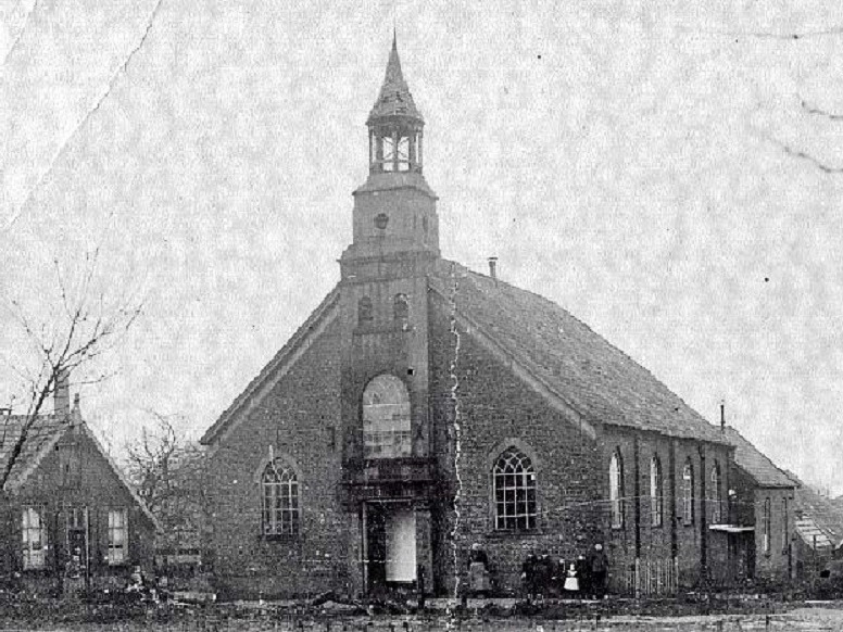
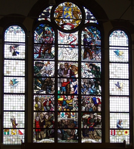
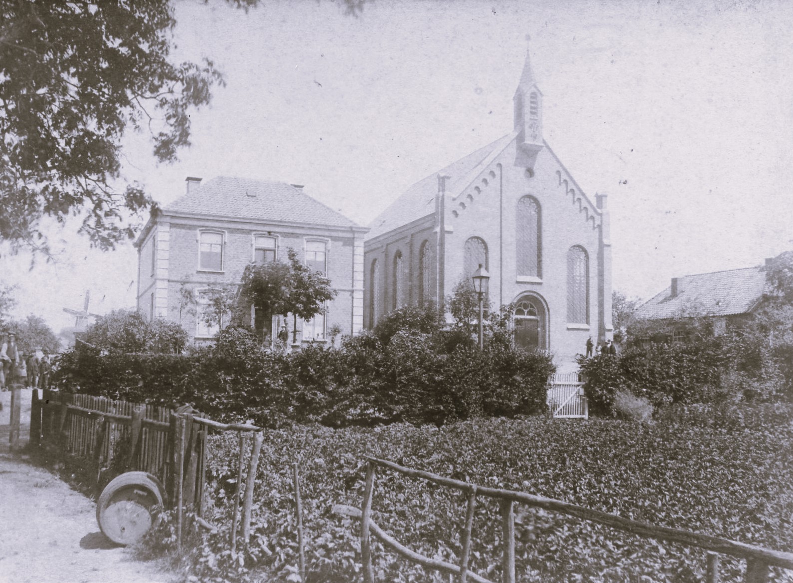
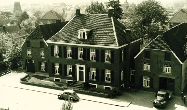
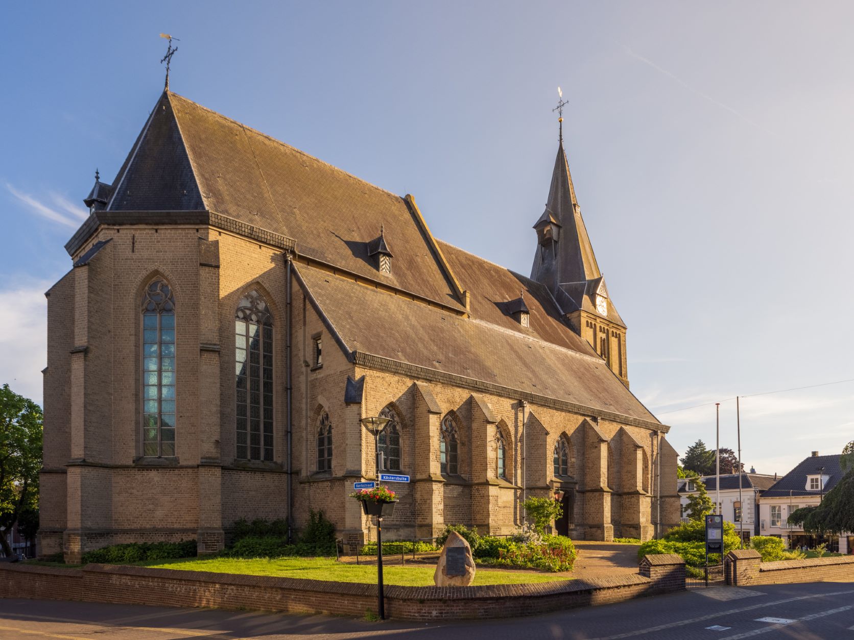
The Oosterkerk (East Church) is a former Reformed church in Aalten. It replaced the first ‘Seceded Church’ (Afgescheiden Kerk) from 1844 in 1913 and was expanded several times over the years. The building contains a unique memorial window from 1946, which was gifted in gratitude for the aid Aalten provided during World War II. Today, the building has been repurposed as a residential care facility.
In 1834, a group of believers broke away from the Dutch Reformed Church and established the Christian Reformed Church (Afgescheiden Kerk). A seceded congregation emerged in Aalten as well. Initially, the congregation gathered in private homes. In 1844, they built their own church, the Afgescheiden Kerk, on the site where the Oosterkerk stands today. The first minister was the Rev. Breukelaar.
Construction and Architecture
After the first Oosterkerk became too small, the current church was erected in 1913, designed by architect Ane Nauta from Holwerd. The building contractor was D.J. te Mebel. The construction costs, including the demolition of the old church, amounted to approximately 30,000 guilders. The church was also referred to as ‘Church A‘, while the Westerkerk was known as ‘Church B’.
An expansion followed in 1931 because the number of seats still proved insufficient. In his design, Nauta drew inspiration from the Neo-Renaissance, with influences from Hendrik Petrus Berlage.
The church features a T-shaped floor plan. The front façade, which has a gabled wall, was given an entrance with its own small gable and a window framework above it. There are several round-arched windows and, in the centre, a triforium with stained glass. Towers stand on both sides of the front façade, the left one being the largest; both are topped with a needle spire. Leadlight windows have been used in all façades.
Memorial Window
In 1946, the Oosterkerk was fitted with an eight-metre-high memorial window, gifted by a committee from the Reformed Church of Kralingen on behalf of the churches and the Jewish community of Rotterdam. The window was an expression of gratitude to the people of Aalten for sheltering and aiding people in hiding (onderduikers), Jewish citizens, those suffering from starvation, and the many children from Rotterdam who were taken in here during the war.
Repurposing
The final church service in the Oosterkerk took place on Sunday, 27 June 2021. The building was subsequently repurposed as the Oosterkerkhuis, housing twenty studio apartments for residents with dementia. The purchase agreement stipulates that the unique memorial window and the organ must be preserved.
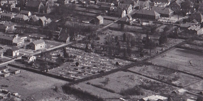
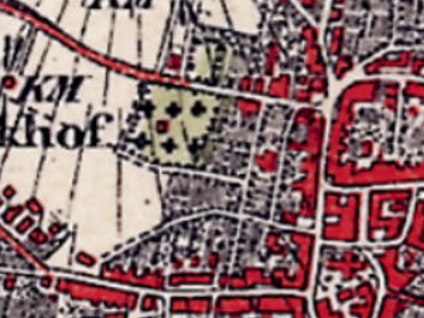
In 1827, King Willem I decreed by law that, as of 1829, cemeteries had to be established outside built-up areas. In Aalten, a site was designated for this purpose on Varsseveldsestraatweg, then known as Melkersweg.
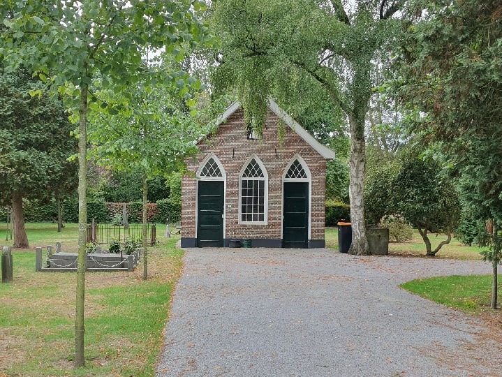
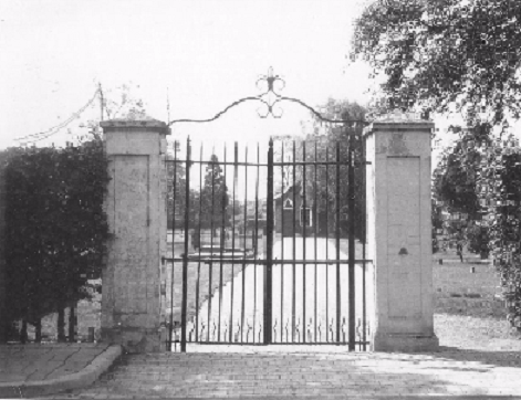
The cemetery was later extended to the west. The oldest section is characterised by relatively empty lawns with scattered old funerary monuments and a small lychgate (baarhuisje). The western part has a more structured, orthogonal layout.
At the start of the 20th century, the Old Cemetery became increasingly enclosed by the village’s encroaching urban development. This led to the need for a new cemetery. In 1923, the Berkenhove cemetery on Romienendiek was opened.
Although the Old Cemetery has since taken on the function of a ‘tranquillity park’, it is still sporadically used for interring the deceased in existing family graves.
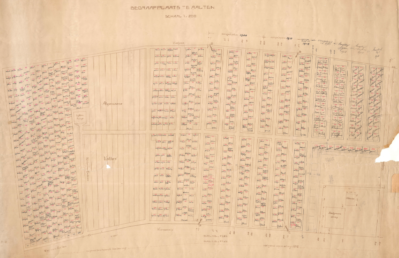
A map is available, dating from about 1921, providing an overview of all graves and those interred; click the thumbnail below for a large, legible version (PDF):
Old General Cemetery Aalten, 1921
Commemorative Column
As part of the 70th anniversary of the liberation, a commemorative column was placed in the Old Cemetery in 2015 to commemorate all soldiers from Aalten who fought on and around the Grebbeberg in May 1940. Seven servicemen from Aalten lost their lives there. Their names and photographs are immortalised on the commemorative column.
Roman Catholic Cemetery
When the cemetery on Varsseveldsestraatweg was established, the Catholic community in Aalten insisted that a separate section be designated and consecrated for them. The municipality purchased a piece of land for this purpose across the street, on the corner with Molenstraat.
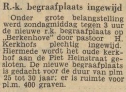
However, this small Catholic cemetery became full after only thirty years. In 1868, a new R.C. cemetery on Piet Heinstraat was opened. The former small Catholic cemetery on Varsseveldsestraatweg later became a public garden. However, the graves of at least 50 Catholics from Aalten have never been cleared.
In 2015, the site was redesigned at the initiative of local residents to better reflect its historical significance. An information panel has been placed at the location highlighting the history of the cemetery.
Owners
This list is incomplete.
Year
Plot
Owner
Description
1832
I-1409 I-1436
the Municipality of Aalten
4.430 m² (protestant) cemetery 720 m² (catholic) cemetery
In the late 1860s, the small Roman Catholic cemetery on the corner of Varsseveldsestraatweg and Molenstraat reached its capacity. This created a need for a new cemetery for the Catholic community in Aalten.
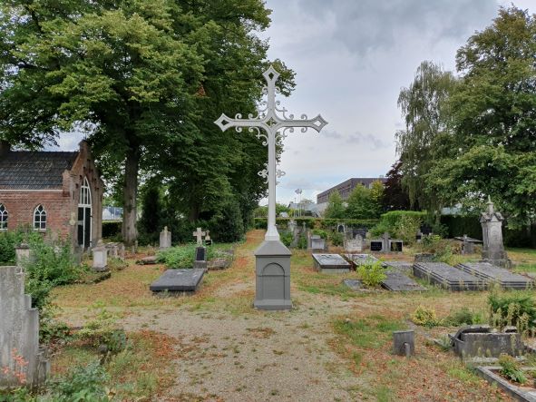
In 1868, Anton Driessen, a textile manufacturer in Aalten, donated a plot of land on what is now Piet Heinstraat to the church to be established as a cemetery. In addition to the land, he donated an iron Calvary cross and an iron gate, both of which still stand today. Anton also stipulated that his family be buried in a contiguous plot next to the cross. The mortuary on the cemetery grounds dates from 1888.
Lack of space and closure
A century later, this cemetery also became full, and there was no room for expansion. From 1960 onwards, Catholic deceased were therefore buried in the new Roman Catholic section of the Berkenhove cemetery.
In the early 1970s, the cemetery on Piet Heinstraat was officially closed. The site was transferred to the municipality of Aalten for the symbolic amount of one guilder.
Notable graves
Several prominent Catholic former residents of Aalten rest in this cemetery, including various members of the Driessen textile family. This family is inextricably linked to the textile history of Aalten and had a major influence on the emancipation of the Roman Catholic population in the municipality.
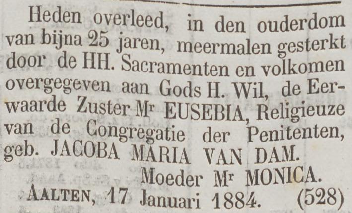
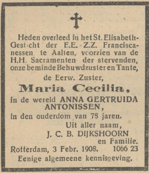
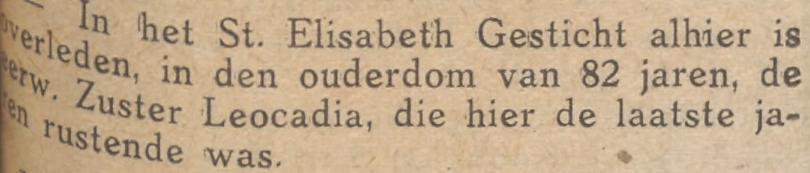
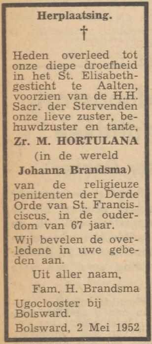
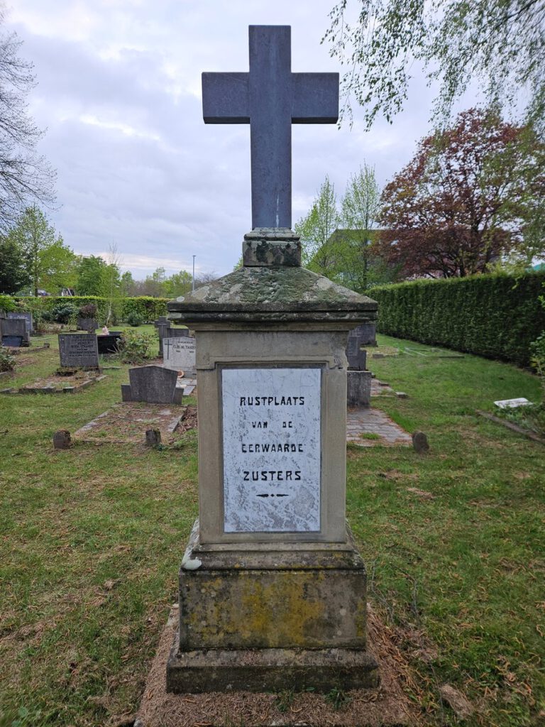
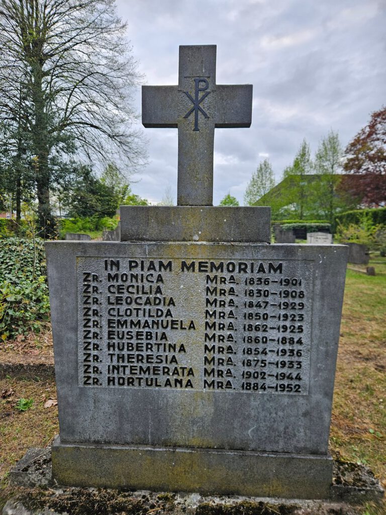
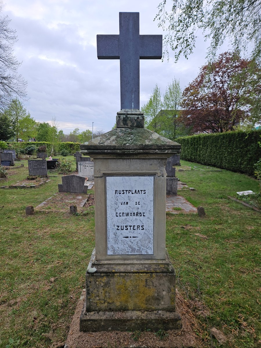
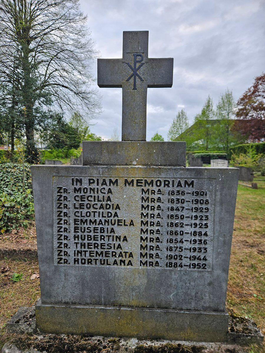
The grave of Pastor Van Rooijen, who died on January 23, 1945, during a bombardment of Dijkstraat, is also located here. Additionally, there are graves of the sisters from the former Saint Elizabeth Convent on Dijkstraat. They provided primary education at the Saint Joseph School and nursed the sick of all faiths.
De Tijd, 22 January 1884De Maasbode, 7 February 1908Aaltensche Courant, 24 July 1925Aaltensche Courant, 31 May 1929De Amstelbode, 13 May 1931De Maasbode, 16 May 1931
De Graafschapbode, 29 August 1932Aaltensche Courant, 5 May 1933Ons Noorden, 8 May 1952
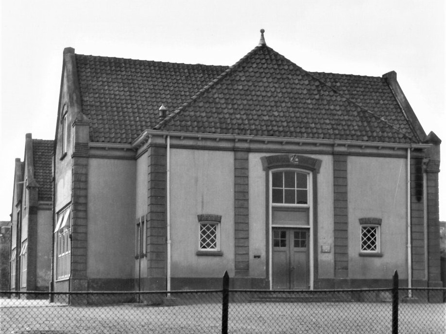
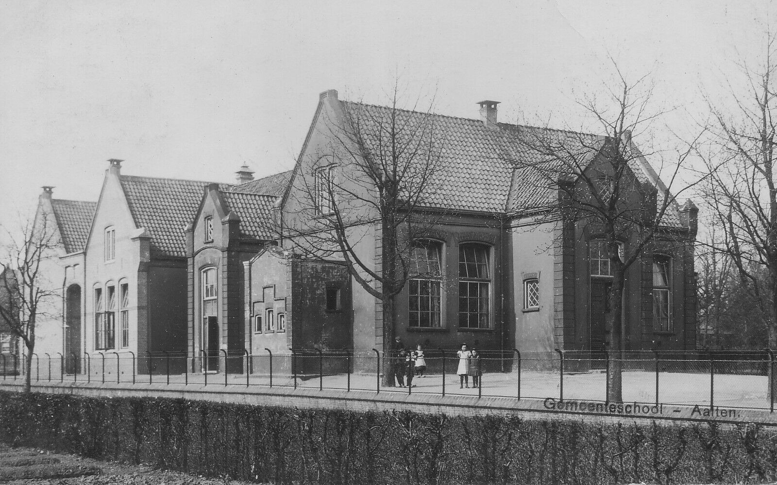
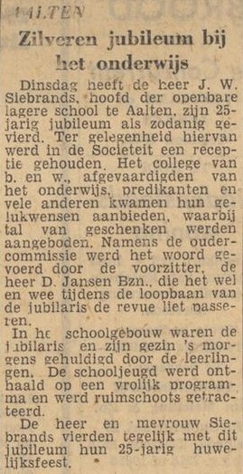
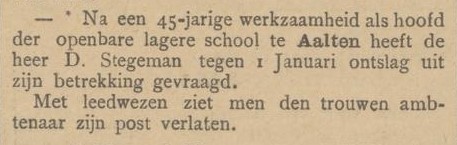
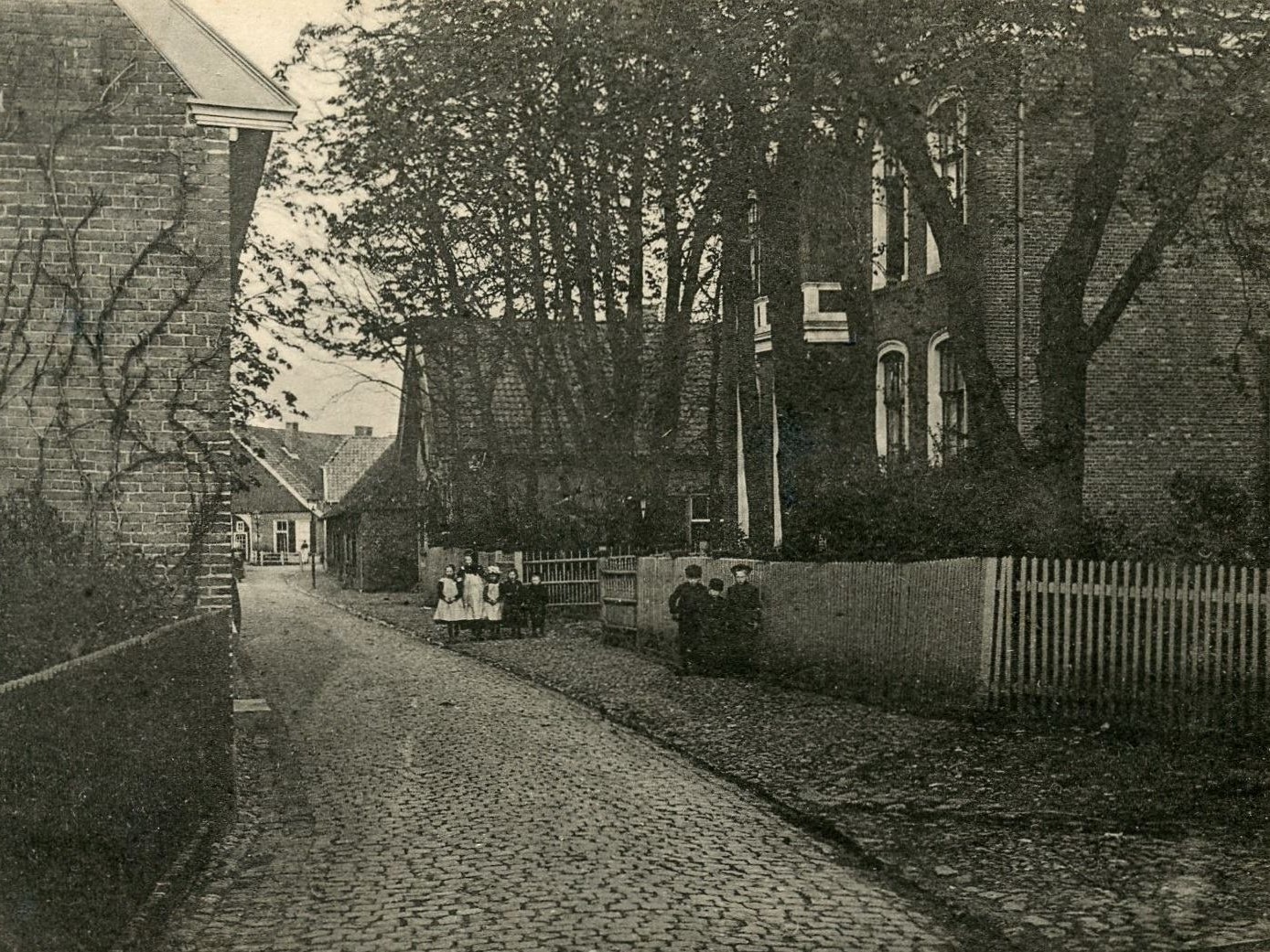
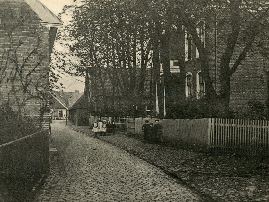
The Public Primary School on Herenstraat in Aalten was established in 1884. The new school replaced the ancient village school on Landstraat. Over the years, the headteachers included Messrs Stegeman, Veenstra, Bennink, de Lange, van Rugge, Brunt, Siebrands, van Zeijl, and Leferink.
During the occupation years, the school was briefly used as a ‘Fallschirm-Armee Waffenschule’ (Paratrooper Army Weapon School).
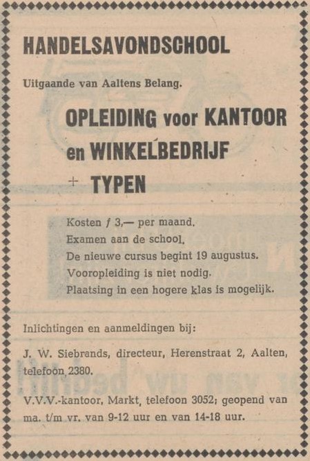
In the 1960s, classes from the Commercial Evening School were also held here three nights a week.
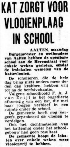
In October 1974, the school had to temporarily close its doors due to a flea infestation. The cause was discovered to be a litter of cats living underneath the school building.
Closure
In 1976, a new public primary school was opened in Aalten on Wehmerstraat. This school was later named ‘Openbare Basisschool De Slinger’.
Upon leaving the old building, the schoolchildren sang the following lines during a noisy parade to the tune of ‘Yellow Submarine’: “Where we’re going is the new school, on Wehmerstraat, where it looks so grand. Ninety years old is our school on Herenstraat, in a tumbledown state, etc.”
In 1977, the old school on Herenstraat was demolished, and the site was converted into a car park, known today as ’t Hoge Blik.
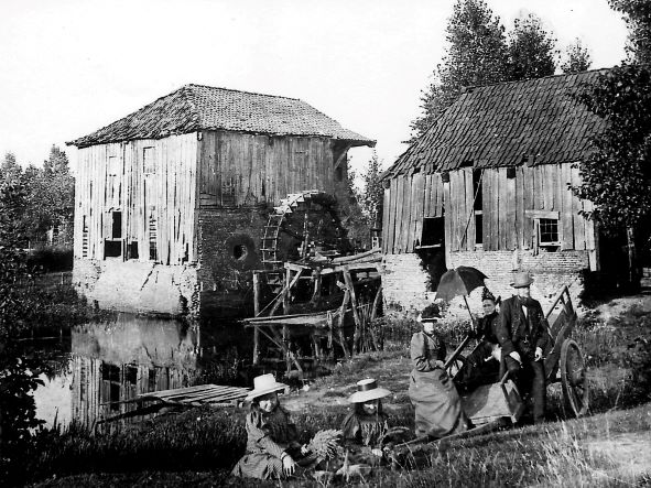
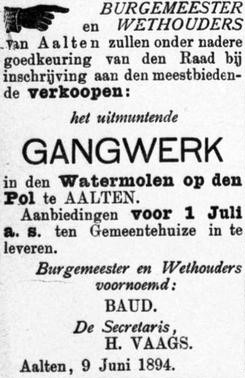
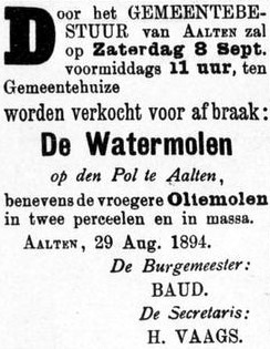
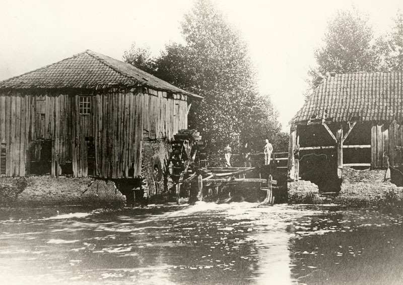
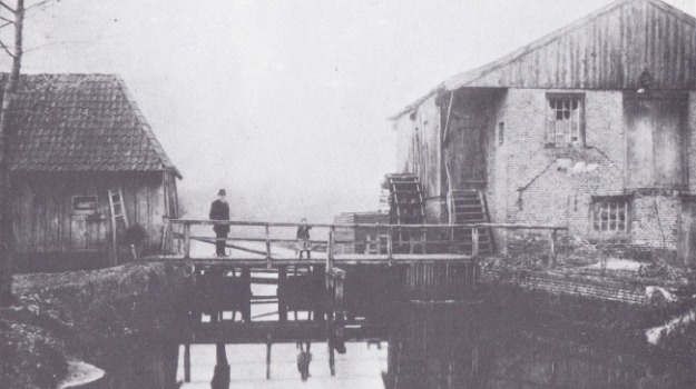
For centuries, a watermill stood on the Slingebeek stream near the De Ahof manor, approximately at the location of the current stone bench erected by Aaltens Belang. At the beginning of the 20th century, the dilapidated mill was demolished. The mill featured wheels on both sides of the stream: on the south bank stood the oil mill (with a wheel of 4.42 m Ø) and on the north bank was the bark mill (with a wheel of 4.66 m Ø), with the corn mill situated above it.
The watermill was likely built shortly after 1500, possibly due to a transfer of manorial milling rights from the Grevinkhof in Dale to De Ahof, which later also came into the possession of the Grevink family. The first mentions of the mill date from 1502, including records concerning income for the steward.
In 1562, the mill was described as a ruin, yet it repeatedly appears in the archives in later years. B.D. Rots writes in his book ‘Aalten en Bredevoort in vervlogen tijden’ that around 1700, the watermill was owned by the House of Orange, who leased it to a miller. On 9 February 1707, De Ahof, along with “the hereditary lease of the Aalten Watermill”, passed into the hands of the Arentsen/Arentzen family.
In 1739, the owners Bernardus Arentzen and Gerrit Jan Heusinkveld complained about competition from the numerous horse mills around Aalten, while they constantly incurred costs to keep the watermill in good repair. In 1758, it is noted that the city council of Bredevoort had the right, in the event of flooding, to raise the sluice gates at De Ahof and take them to their city.
Around 1830, the corn mill had two undershot wheels and three sets of millstones, while the oil mill had one wheel and three stampers. During water shortages, the mills could also be driven by horses. Although the mill had three undershot wheels, a small overshot wheel with a separate leat could be deployed for the corn mill during low water levels from 1840 onwards.
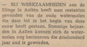
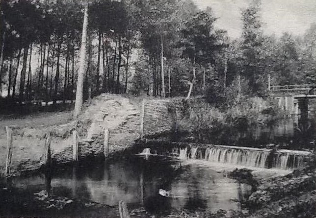
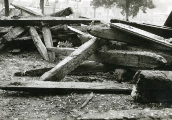
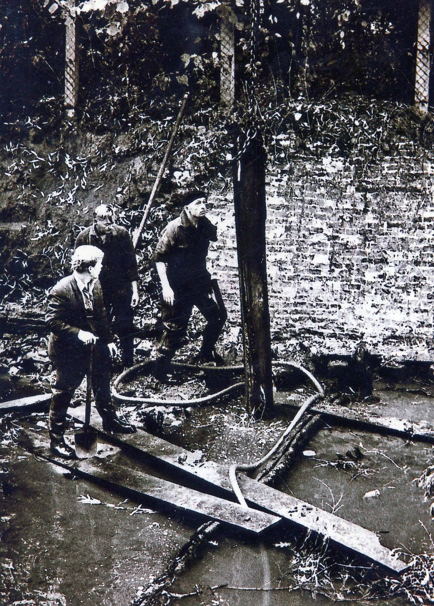
The mill finally disappeared around 1900; only the wheel of the corn mill remained at that time. Photographs from that era show that the entire complex had fallen into decay. During works on the Slinge in 1969, approximately 200 foundation piles were removed. Today, only a remnant of a wall serves as a reminder of the watermill.
Owners
Overview is incomplete.
Year
Plot
Owner
Description
1832
I-182 I-228
Roelof Arentzen, assessor
470 m² mill & yard 920 m² mill & yard
1851
I-182 I-228
Engelbarta Hendrica Arendsen and Gezina Arendsen, widow of J.W. te Gussinklo
470 m² mill & yard 920 m² mill & yard
1854
I-1918 I-1968
Engelbarta Hendrica Arendsen and Gezina Arendsen, widow of J.W. te Gussinklo
470 m² grain mill & yard 178 m² mill & yard
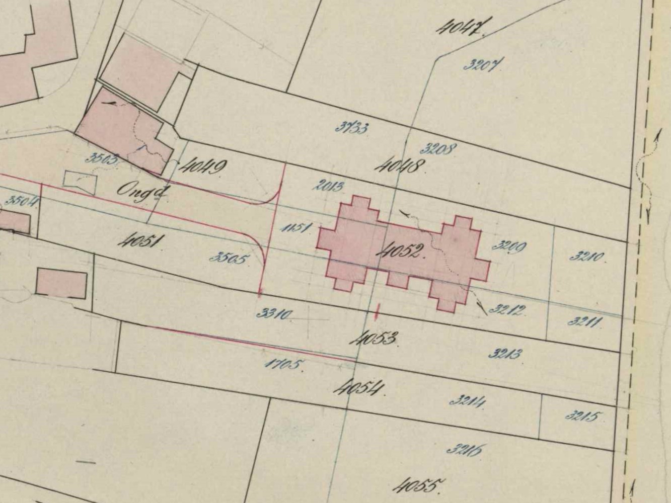
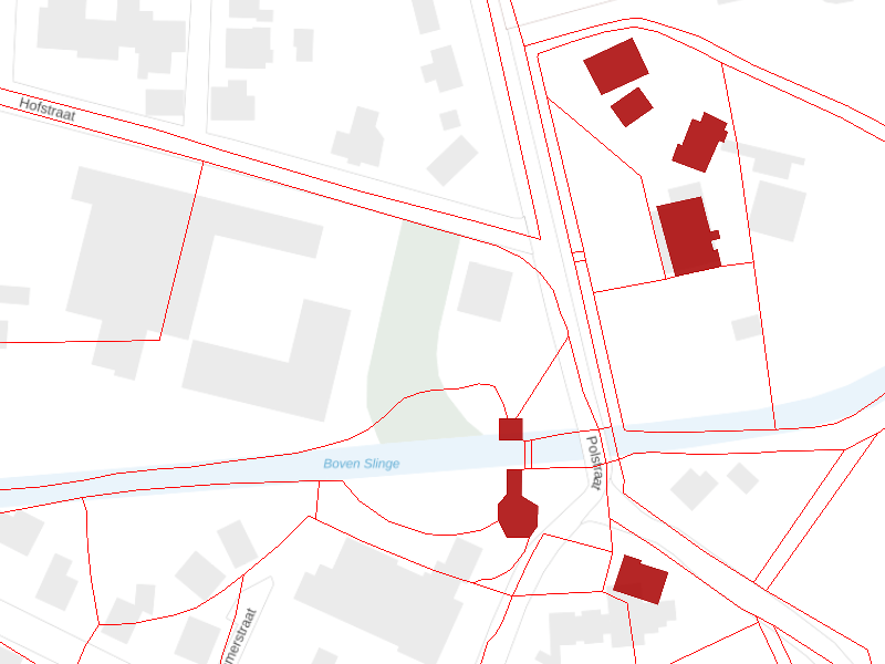
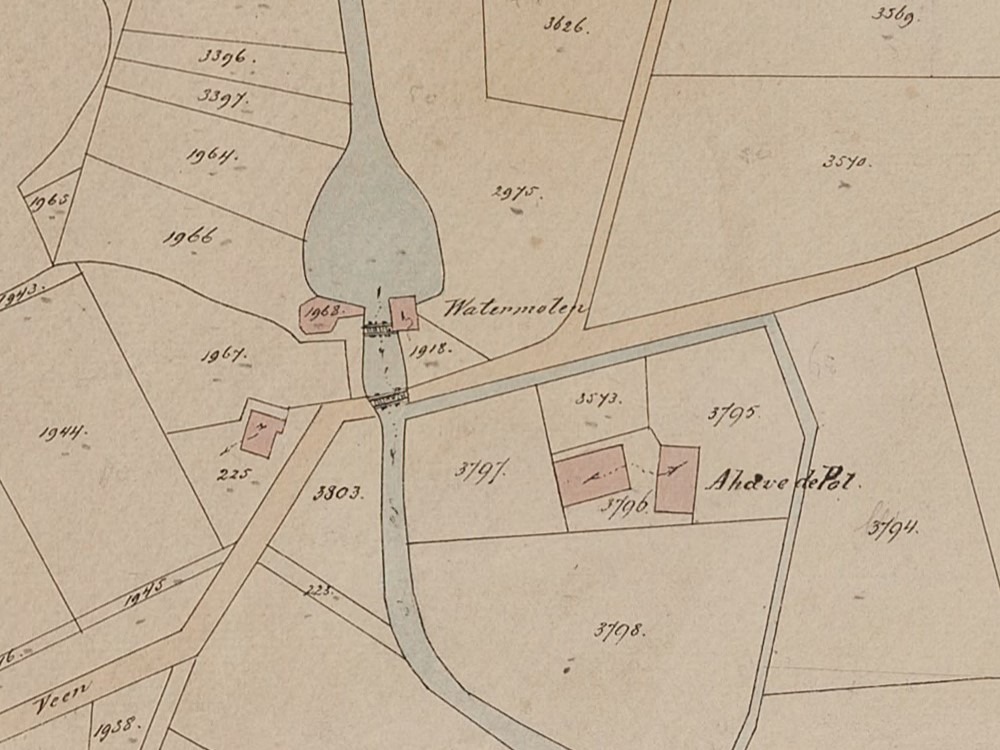
Location of the watermill, with De Ahof at the top right. All red buildings on this map were, according to 1832 land registry data, owned by Roelof Arentzen, assessor in Aalten. The red lines represent the plot boundaries at the time, which also clearly show the course of the former moat around De Ahof.
Newspaper reports
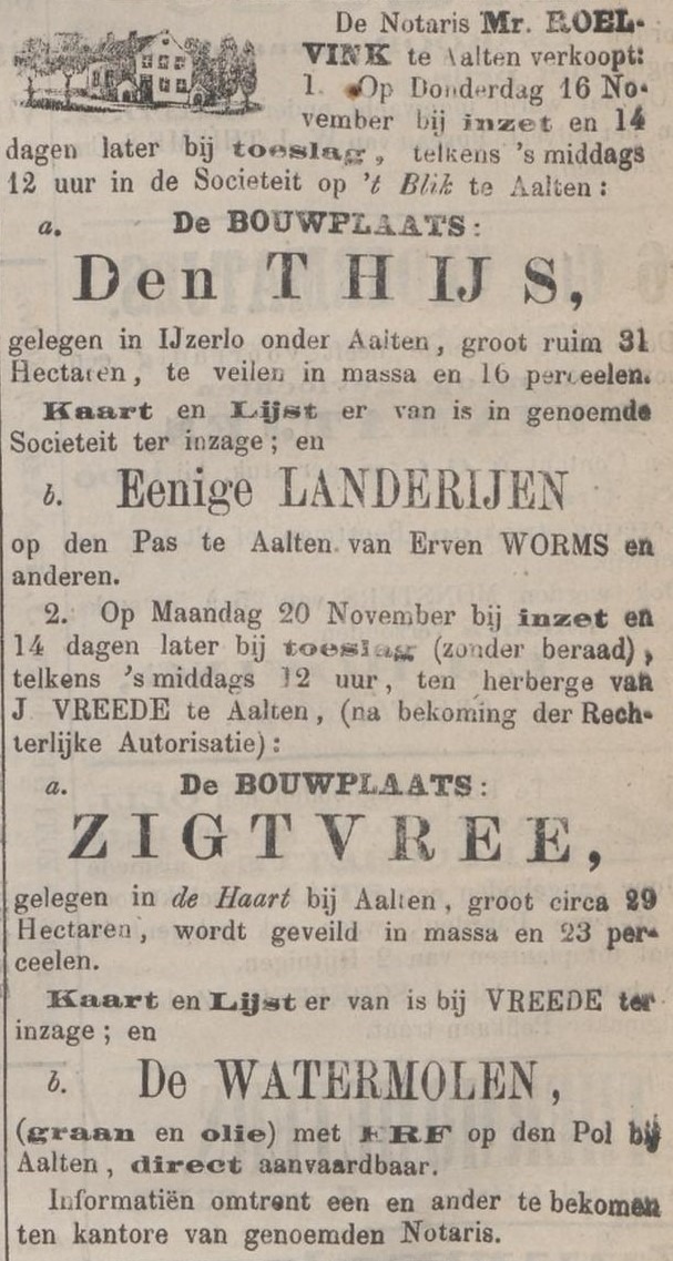
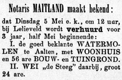
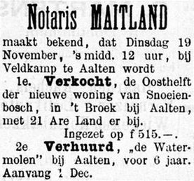
Zutphensche Courant, 11 November 1876Graafschapbode, 2 May 1885
Graafschapbode, 16 November 1889Graafschapbode, 20 June 1894
Graafschapbode, 5 September 1894Nieuwe Winterswijksche Courant, 31 October 1969
Fragment of the cadastral map, 1883 (North is to the right)Remnants of the watermill on the Pol, 1906Remnants of the watermill, found around 1970Remnants of the watermill being cleared away
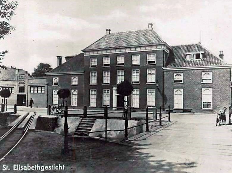
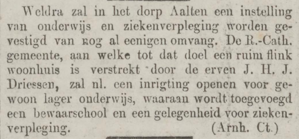
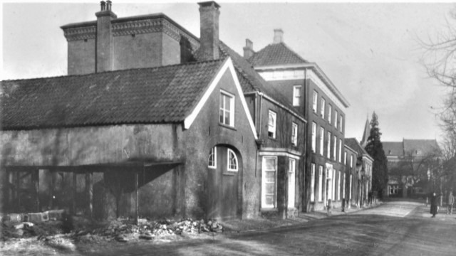
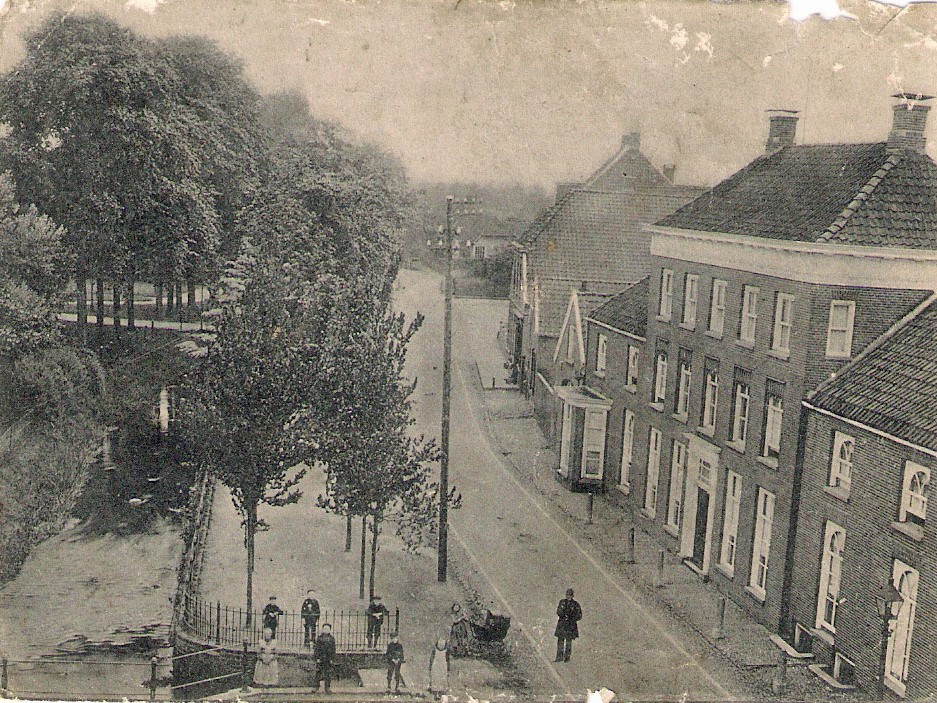
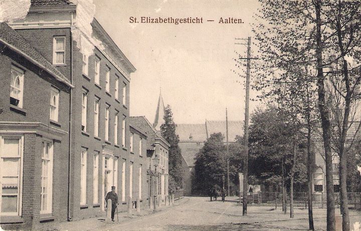
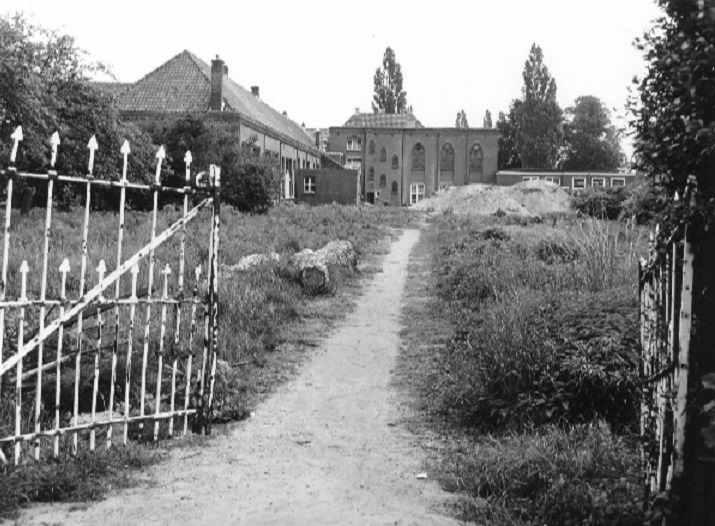
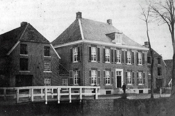
The Elisabeth Monastery in Aalten was originally the residence of textile manufacturer Johann Heinrich Joseph (Heinrich) Driessen (Bocholt, 10/07/1794 – Aalten, 04/07/1879). On 29 June 1837, his eldest son Theodoor laid the foundation stone.
Heinrich was also known as “Den veursten Driessen” (The front Driessen); his cousin Anton also lived on what was then Landstraat, in Villa Beekhuize, slightly further south of the town centre, and was therefore known as “d’n achtersten Dreessen” (The rear Driessen).
Business premises were also established on the property, which served primarily as storage for yarns and woven fabrics. These fabrics were transported by wagon, usually pulled by an ox, to the bleachery in Dale. The driver carried the fitting nickname ‘Ossen Willem’ (Ox Willem).
After Heinrich’s death, the house came into the possession of the Roman Catholic Church, after which it was put into use as a convent for nuns. On 30 May 1882, six sisters were brought to Aalten from Lichtenvoorde-Groenlo station in a carriage drawn by four horses. The convent was named after Heinrich’s wife, Elisabeth. Locally, it was also referred to as the St Elisabeth Institute.
Education and Nursing
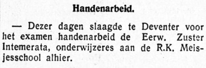
For eighty years, the sisters provided education here to the Catholic school children of Aalten. The sisters’ ‘sewing and knitting school’ was also based there. Not everyone held pleasant memories of the nuns. The sewing and knitting school, later the Fashion Vocational School, was highly regarded. Partly for this reason, it was not only Catholics who knitted there, but people of all denominations.
On 23 December 1962, the last sisters left for a convent in Bennebroek. Later, the convent served as accommodation for guest workers.
On 20 December 1980, a small fire broke out in the completely boarded-up building. Just as a ‘foundation stone’ had once been laid, the last stone was removed shortly after the fire. The building made way for the Parish Centre. This has since disappeared as well and has been replaced by an apartment building named ‘Kloosterhof’ (Convent Court).
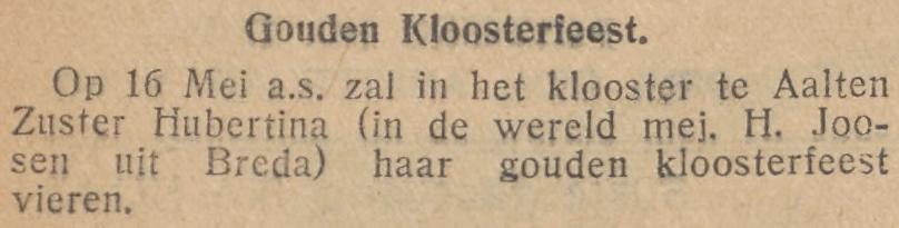
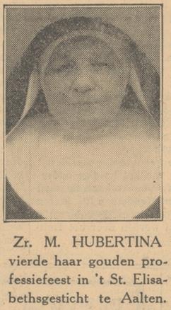
AALTEN, 29 May – Tomorrow, the 30th, will mark 50 years since the Franciscan Sisters of St. Lucia, Rotterdam (now the Motherhouse Bennebroek) arrived in Aalten. This event will be solemnly commemorated. Following Holy Mass, a large general reception will be held starting from 10 o’clock. On 30 May 1882, the sisters were met in Lichtenvoorde by Parish Priest P. Bosman and Mr Eduard Driessen. The procession was conducted in carriages drawn by pairs of horses. The J. H. J. Driessen family made their house and grounds available to the sisters. A nursery and sewing school were established here immediately. On 1 August 1884, primary education for girls commenced, followed by education for boys in July 1886. The school currently has 258 pupils, and the nursery school has 68. In the fashion vocational school, newly built in 1928, instruction is given to 30 girls in summer and 60 in winter. One of the sisters, namely Sister Hubertina, has been here in Aalten since 30 June 1884.
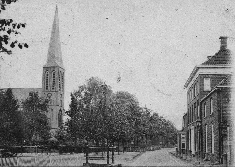
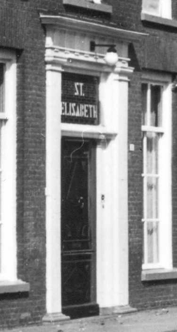
Arnhemsche Courant, 3 January 1882St Elisabeth’s Convent, Dijkstraat, Aalten St Elisabeth’s Institute, Aalten Front door of St Elisabeth’s Convent, Aalten Rear entrance of St Elisabeth’s Convent and St Jozef’s School, c.1975 Roman Catholic cemetery Piet Heinstraat, Aalten – Sisters St Elisabeth’s Convent (1) Roman Catholic cemetery Piet Heinstraat, Aalten – Sisters St Elisabeth’s Convent (2)
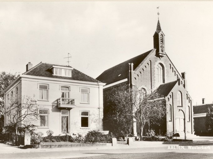
The Westerkerk (West Church) in Aalten was built in 1891, a few years after the Doleantie (the Reformed church schism) of 1886. The building served as a Reformed church and was known as ‘Church B’, whilst the Oosterkerk (East Church) was designated ‘Church A’. The church was designed by architect H. van der Brand, who created what is known as a schuurkerk (barn church): a simple, functional church building.
In 1928, a porch was added to the street side because space inside the church had become insufficient. The church was built in a neoclassical style, featuring several round-arched windows in its front façade. A small spire sits atop the roof.
War Years
On 30 January 1944, German SS officers carried out a raid (razzia) on two churches in Aalten, including the Westerkerk. The occupying forces knew that church services were well attended, including by young men and people in hiding (onderduikers) who were evading forced labour (Arbeitseinsatz) or who had failed to return from leave. More than forty men were arrested during the raid.
Later History
In 1999, the Westerkerk was sold to the Euregio Christengemeente Aalten-Bocholt (Euregio Christian Congregation), which has used the building ever since. The Westerkerk has been designated a municipal monument (locally listed building).
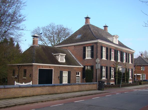
Villa Beekhuize serves as a reminder of the heyday of the textile industry in the village of Aalten.
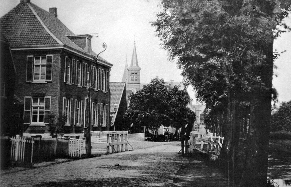
Textile manufacturer Anton Driessen initially lived with the Meijerink family on Kerkstraat upon his arrival in Aalten. Later, he purchased a property on Landstraat. In 1833, Anton Driessen wished to build a new residence. To this end, he had purchased a house from the Degenaar estate at the end of Landstraat—the present-day Dijkstraat. He intended to demolish that house and construct a new, modern home on the site, complete with a warehouse, barn, and stables. However, he required more space than the existing plot provided. Anton Driessen subsequently submitted a proposal to the municipal authorities.
This plan necessitated the diversion of both the stream and the street. Furthermore, a new bridge was required. Because the piles of the old bridge had nearly rotted away, the construction of a new bridge was not only highly necessary but, according to Driessen, the relocation would also be less costly. In addition to diverting the stream and building a new bridge, Driessen also required land for his plans. To this end, he exchanged a plot of land with the municipality. Negotiations regarding the aforementioned matters lasted several years. Construction finally commenced in March 1835.
In addition to Anton Driessen, his nephew Heinrich also built a house on what was then Landstraat. Heinrich Driessen positioned a generous residence closer to the town centre, for which his eldest son, Theodoor, laid the foundation stone on 29 June 1837. Ever since, locals have referred to the two properties as ‘d’n veursten’ (the front) and ‘d’n achtersten Dreessen’ (the rear Driessen).
Owners
Overview is incomplete.
Year
Plot
Owner
Description
1832
I-1231 I-1233
Jan Berend Lohuis
199 m² house & yard 2.250 m² garden
Residents
1813
Aalten 37
Johannes Degenaar (Aalten, 25-10-1779), weaver son Evert Degenaar (Aalten, 10-05-1744), weaver father
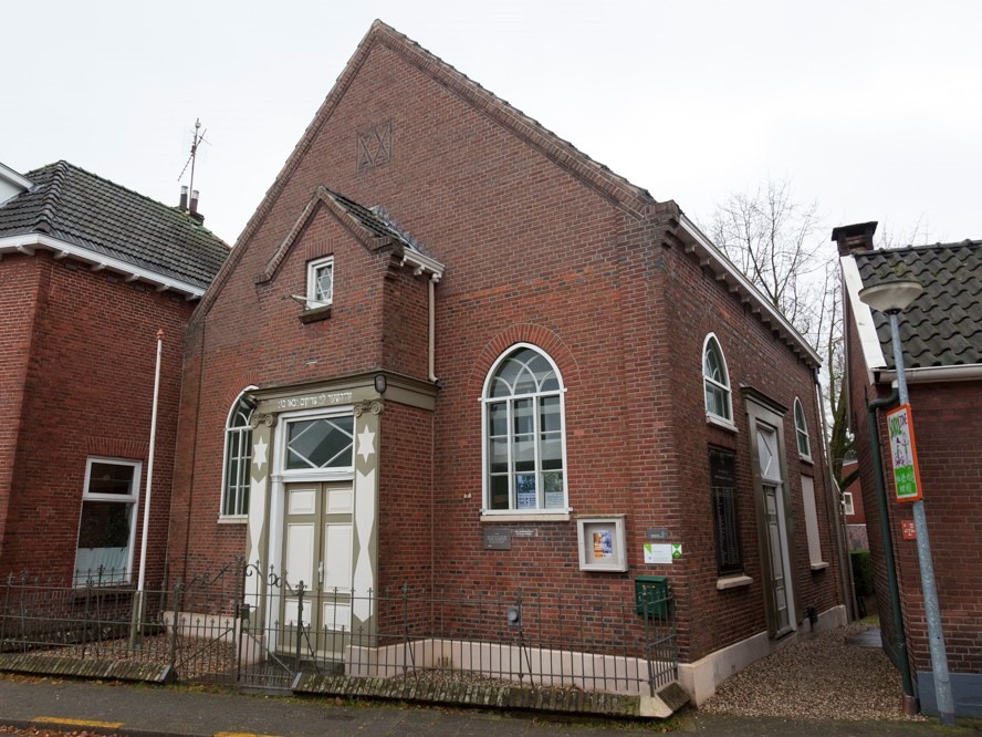
In the centre of Aalten is a small, well-restored, and beautifully furnished synagogue, which formed the centre of Jewish life in this Achterhoek municipality for nearly a century. The building is currently owned by a foundation, the Friends of the Aalten Synagogue.
By the mid-19th century, the Jewish congregation in Aalten had grown so much in number that a residential house became too small for the weekly Sabbath services. The community wanted their own shul, not only for religious services but also for the education of the youth. Consequently, a synagogue was built in 1857. It was a simple rectangular building with no architectural distinction, yet functional for the Jewish congregation in Aalten, which was still far from wealthy but strictly Orthodox. Nothing is known about the architect.
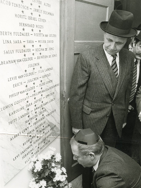
The synagogue became the centre of a lively community life, which lasted until the catastrophe that befell all Jewish communities during the years of the German occupation. The members of the congregation who were unable to go into hiding in time were deported and murdered.
World War II
During the occupation, two attempts were made to set fire to the synagogue. The synagogue was largely plundered and gutted to convert the building for ammunition storage. While the interior of the building was destroyed, the Torah scrolls and ritual objects were hidden in time and thus preserved. After the war, the scrolls of the law were returned to the building. The synagogue was repaired, funded by the proceeds from the sale of the chazzan’s house (since 1948, the congregation could no longer afford the salary for a cantor).
However, a large proportion of the congregation members who survived the war moved elsewhere, meaning the Jewish community had no chance to flourish again. Increasingly, they failed to achieve the required number of men (minyan) to hold services. The synagogue fell into disuse and was in danger of falling into decay.
Restoration
In 1984, the building was sold to the Friends of the Aalten Synagogue Foundation (Stichting Vrienden van de Aaltense Synagoge). This foundation took on the responsibility for a thorough restoration. On 29 December 1986, the synagogue was rededicated with a solemn Hanukkah celebration.
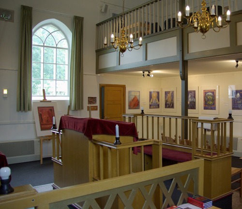
There are features well worth seeing on both the interior and the exterior. Inside, these include the Holy Ark, four Torah scrolls, the Tablets of the Law, the ner tamid, the menorah, the hanukkiah, the bimah, the women’s gallery, and the mikveh. On the exterior, these comprise the inscription above the door, the mezuzah, and the plaque on the right-hand side of the outer wall.
The Aalten synagogue can be visited regularly during the summer months.
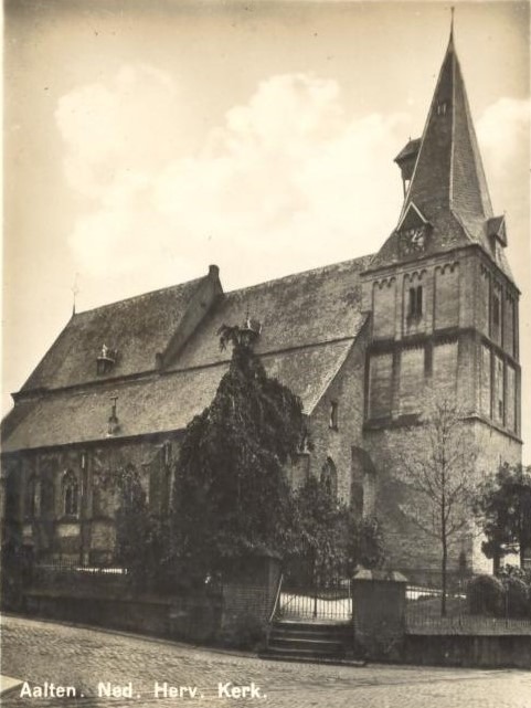
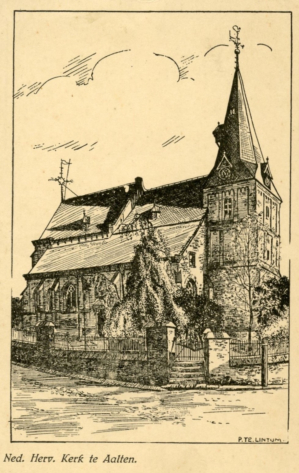
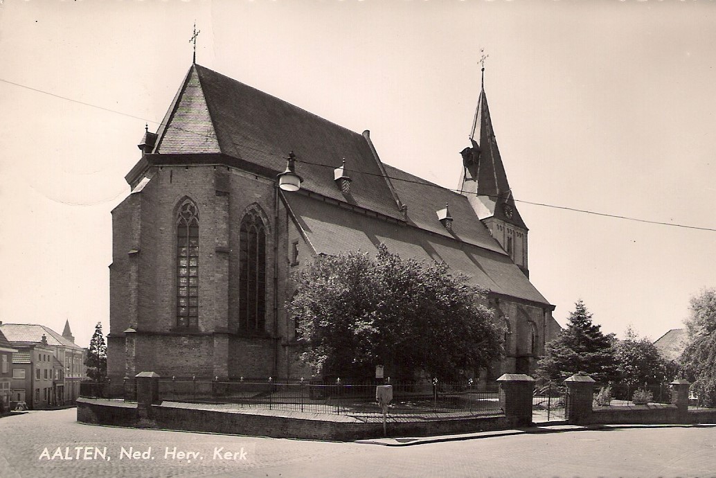
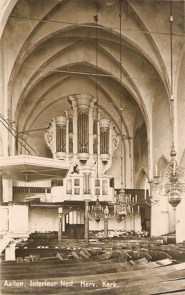
In the centre of Aalten, St Helen’s Church has stood for centuries as the oldest and most distinctive building in the town. This Late Gothic pseudo-basilica with its Romanesque tower is a monument of immeasurable historical and emotional significance. Countless residents of Aalten have been baptised and married here, found solace within its walls, and have been laid to rest from this church.
History
Around the year 800, when the Saxons were subjugated by Charlemagne, he decreed that every community should provide a so-called ‘hoofdhof’ (head court) for the construction of a church. In the settlement of Aladna, the ancient name for Aalten, this was likely a piece of land belonging to the later Havezate de Ahof.
The first small church on this site was presumably built in the Carolingian style, a precursor to Romanesque architecture. The church was dedicated to Saint Helen, the mother of the Roman Emperor Constantine the Great, who converted to Christianity.
In the 12th century, a Late Romanesque tower was added to this first church. The Romanesque architectural style is characterized by heavy, massive walls with small round-arched windows. In contrast to the later Gothic style, Romanesque architecture features little ornamentation. The tower is constructed entirely of tuff, a soft volcanic stone that was widely used in these regions at the time for building churches and castles. The spire takes the form of a so-called constricted needle spire.
Between 1470 and 1483, the three-aisled nave of the church was built, also from tuff. This part of the church was executed in the Late Gothic style, characteristic of the 15th century, with large windows featuring pointed arches that point, as it were, toward heaven. The higher choir on the east side of the church dates from the period between 1440 and 1450. In the late 15th and early 16th centuries, murals were applied to the vaults and walls.
Reformation
Until the end of the 16th century, the parish of Aalten fell under the Diocese of Münster. With the conquest of Bredevoort—the administrative center of the lordship of the same name to which Aalten belonged—by Prince Maurice on October 8, 1597, the Reformation also reached this region.
At that time, Pastor Theunissen, a native of Bocholt, served the Aalten church. He fiercely resisted the reform. According to tradition, however, he had to flee in 1601 to the Burlo monastery, or according to others, to Rhede. He later died in Warendorf, where the small but valuable monstrance he had taken from Aalten reportedly remained until the middle of the 19th century.
Presumably, shortly after 1597, the stone Stations of the Cross depicting the Passion of Christ were also removed. The stations, likely created around 1530 by the Westphalian sculptor Heinrich Brabender, disappeared but were rediscovered in the 19th century. Today, they can be admired in the Museum Catharijneconvent in Utrecht.
The then-chaplain of Aalten, Anthonius van Keppel, originally from Doetinchem, was mentioned in 1602 as the first minister of the Aalten church community, which had recently converted to Protestantism. How did this come about? To expand the Reformation to the countryside, the cooperation of the local Roman Catholic clergy was required. In 1598, many of them were summoned to appear at the classical assembly in Zutphen. The clergy from Aalten were also present. At this meeting, the attending pastors and vicars were required to renounce the Catholic religion and profess that the Reformed religion was the true one.
In the classical assembly of 1603 in Zutphen, the participants from Aalten, Winterswijk, and Zeddam declared their willingness to conform to the conditions set for them. By 1633, the number of members was sufficient to proceed with the establishment of a church council.
Shared use
After the conquest of the Achterhoek in 1672 by troops of the Bishop of Münster, the churches of Aalten, Winterswijk, and Dinxperlo were given to the Minorite fathers by the episcopal commissioner. The Reformed congregation in Aalten reached an agreement with the occupiers. This arrangement meant that Catholics and Protestants could use the church in Aalten alternately. However, a short time later, the use of the church building was forbidden to the Protestants. This situation did not last long. At Pentecost 1674, the Münster troops left Aalten and the church became available to the Reformed congregation once again.
Disturbances
In early 1750, the quiet town of Aalten was shaken by a series of striking religious phenomena. During church services, people burst into tears, sighed loudly, or collapsed as if they had lost consciousness. Some even spoke of encounters with angels or attacks by the devil. These events drew national attention and would go down in history as the Aaltense beroeringen (Aalten disturbances).
Doleantie (Schism)
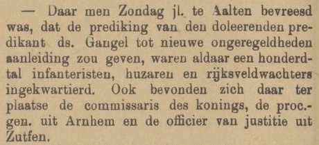
In 1834, the movement of the so-called ‘Afscheiding’ (Secession)—manifesting through the departure of Rev. H. de Cock and the church council of Ulrum (Gr) from the Dutch Reformed Church—gained some following in Aalten. By 1840, the circle in Aalten had grown sufficiently to found a congregation. A few decades later, the movement of the so-called Doleantie emerged within the Dutch Reformed Church.
Restorations
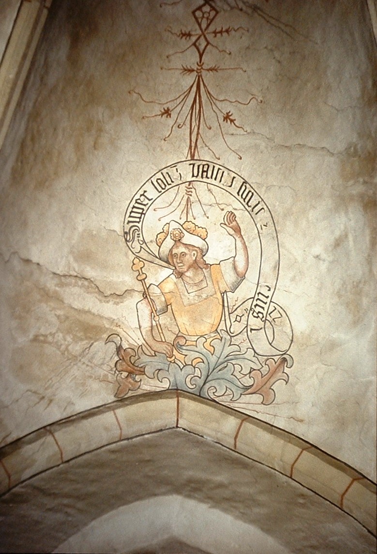
In 1973, the plaster layer in the church was restored. Beneath the six to seven layers of whitewash, exceptional paintings were discovered. These murals include depictions of the twelve apostles, a representation of the Last Judgment, the Coronation of Mary, and—highly unique in Western Europe—an image of Emperor Constantine the Great together with his mother Helena, the namesake of the church. The paintings were subsequently restored.
Burial vault
Also in 1973, carpenter Henk Heijnen discovered a burial vault under the choir during work, containing three coffins with human remains. The vault was quickly resealed by order of the church board, but before that happened, Heijnen had already climbed inside and accurately measured and photographed everything. In 2019, he completed a wooden replica of the burial vault.
Death knell
For centuries, the bells of the Oude Sint Helenakerk in Aalten have tolled at set times to inform the population of deaths, a practice known as ‘overluiden‘.
Owners
This overview is incomplete.
Year
Plot
Owner
Description
1832
I-1498
the Reformed Church of Aalten
3,060 m² church & yard
1862
I-2640
the Reformed Church of Aalten
2,966 m² church & yard
1882
I-3735
the Reformed Church of Aalten
2,924 m² church & yard
1911
I-5447
the Reformed Church of Aalten
2,938 m² church, catechism room & yard
1914
I-5613
the Reformed Church of Aalten
2,720 m² church & garden
1959
I-8339
the Reformed Church of Aalten
3,085 m² church, house & yard
1963
I-8941
the Reformed Church of Aalten
2,925 m² church, house, yard, park, part. community center, road
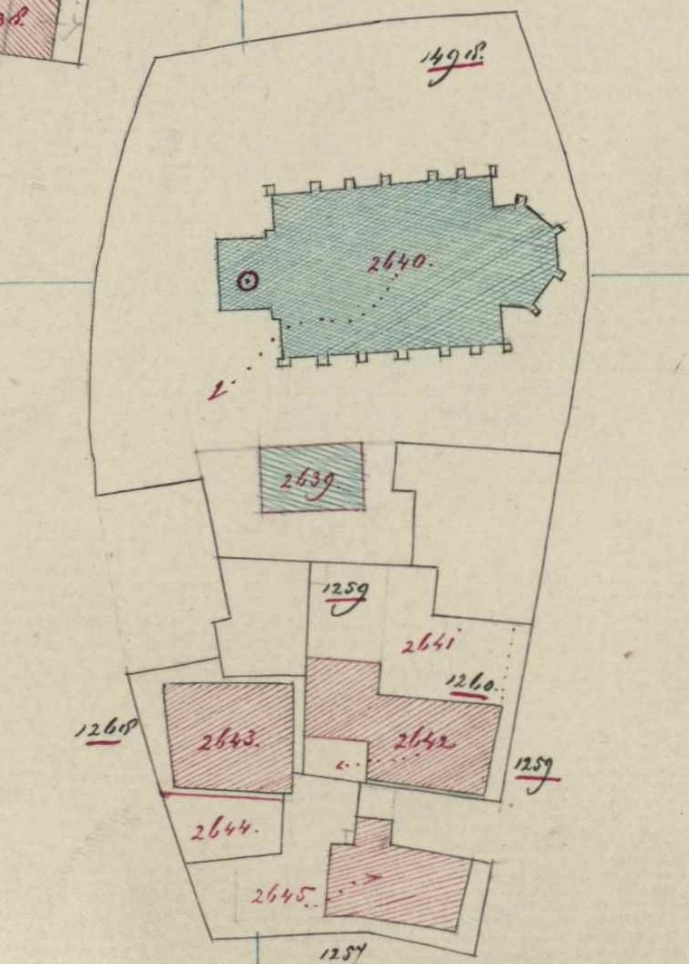
Fragment of cadastral map, 1862Tubantia, 16 March 1887Oude Helenakerk, Aalten, tekening door Piet te LintumInterior Old St Helen’s Church, AaltenMural in the Old St Helen’s Church
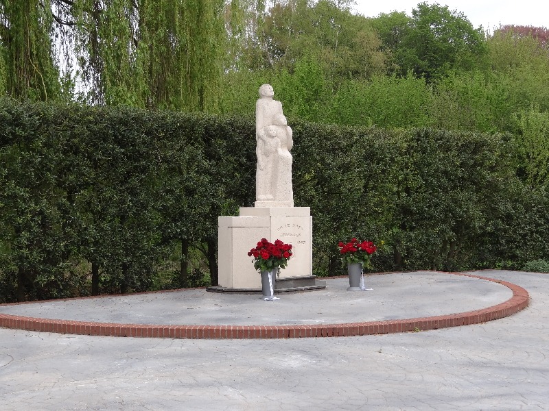
The war memorial on the Wheme was erected in memory of all fellow citizens who died during the occupation years as a result of acts of war. The memorial also commemorates the liberation.
The establishment of the memorial was an initiative of the Monument Foundation 1940-1945 committee. Immediately after the liberation, the population of Aalten felt the need to honour the war victims with a monument.
The monument consists of a statue of a male figure with a woman and child. The sculpture of French limestone is placed on a terrace. The pedestal consists of masonry, concrete and natural stone. The memorial is 1 meter 31 high, 1 meter 43 wide and 90 centimeters deep.
The group faces south from where the tribulation, but also the deliverance, came. Artist Bé Thoden van Velzen described the sculpture as follows: “… representing man, woman and child, as a symbol of the entire Dutch people, expectantly looking forward to liberation, unbowed and unweakened.”
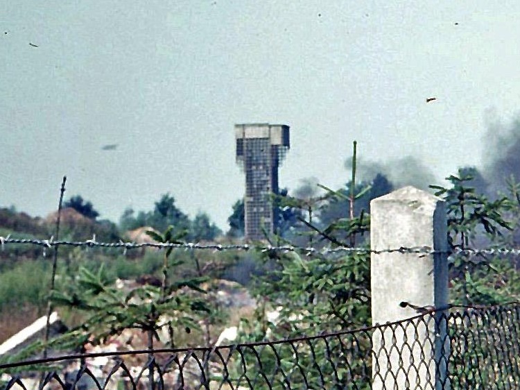
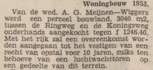
The Air Watchtower in Aalten was a concrete watchtower that was part of the national network of air watchtowers that was established in the Netherlands during the Cold War. The tower was located on the Koningsweg, on the outskirts of the village, and was intended to detect enemy aircraft flying lower than the radar systems could detect.
The Aalten air watchtower was a so-called ‘honeycomb construction tower’, recognizable by its characteristic honeycomb structure, a construction that offered both stability and strength. The tower, built of reinforced concrete, was fourteen meters high and the head of the tower was an open observation cabin with a hiding corner to protect against shrapnel. Neighboring municipalities such as Varsseveld and Winterswijk also had high lookouts, but not as characteristic as those in Aalten.
Searching for the enemy
The air watchtower in Aalten, codenamed ‘Isaac 1’, was inaugurated in 1953, at a time when the tension of the Cold War led to heightened preparedness. The tower was part of a network of 276 lookouts spread throughout the Netherlands and fell under the Air Guard Service Corps (KLD), a part of the Royal Netherlands Air Force that was under the Air Defense command. The Aalten tower was part of the command center KLD Deventer.
The purpose of the towers was to visually detect enemy, especially Russian, aircraft that flew below 200 meters and therefore remained out of range of radar equipment.
Crew and equipment
The crew of the tower consisted of two men who, regardless of the weather conditions, observed the airspace. Women were excluded from these tasks at the time. The crew members wore uniforms and were equipped with headphones and a mouth microphone. The observation was done with the help of a tripod equipped with a scope and a pointing needle. The ranks in the Aalten air guard consisted of soldier, soldier first class, corporal and sergeant. Mr. H.J. Prinzen from Aalten was local commander for a while.
The crew was trained to warn the surrounding towers in case of emergency and via a hotline also the command center. The staff was in an underground, nuclear-free bunker in Deventer. The tower was not continuously manned; only during exercises. Every two weeks there was a theory evening for aircraft recognition at a location in Aalten or Winterswijk.
Recruitment of volunteers
On May 20, 1953, a recruitment meeting was held by the Air Guard Service in the Society on the Hofstraat in Aalten. Commander Ruseler from Deventer provided information to the men who had been called up for this purpose. As an incentive to sign up, exemption from military service or participation in the Population Protection was offered. A number of men volunteered and joined the KLD.
Removal and demolition
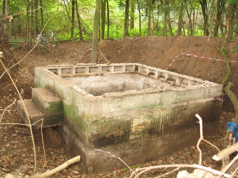
With the advent of more modern control systems and improved radar equipment, the need for visual perception became smaller and smaller in the 1960s. This eventually led to the dissolution of the Air Guard Service. The Aalten air watchtower was demolished in 1970, a spectacle that attracted a lot of interest from the local population. The heavy concrete foundation of the tower is still hidden underground and is a silent reminder of this chapter in history.
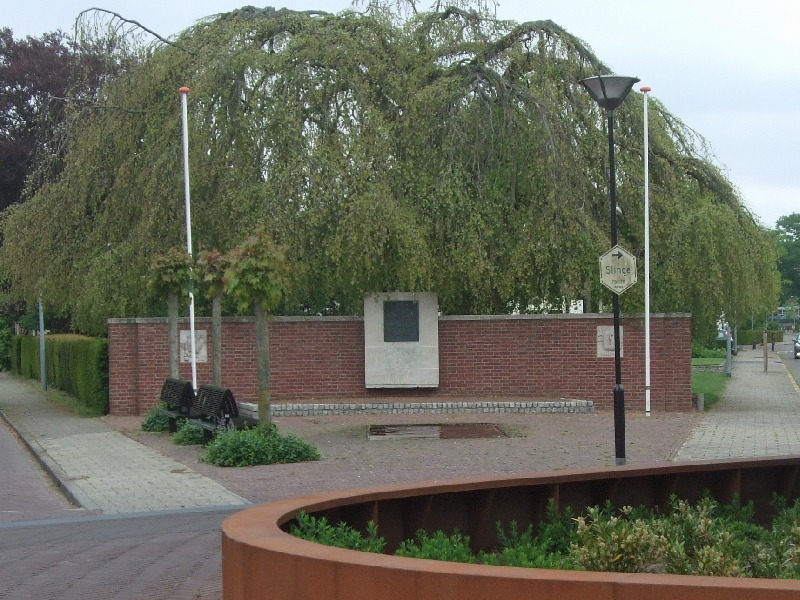
The memorial for people in hiding (Onderduikersmonument) on Stationsstraat is an expression of gratitude from those who were once in hiding to the people of Aalten for their hospitality, and to the members of the Resistance who were the driving force behind finding accommodation for them.
The monument consists of a brick memorial wall with a fountain. A bronze plaque and two sculpted fragments of natural stone are set into the memorial wall.
The monument was unveiled on 4 October 1947 by Mrs D.G. Wikkerink-Eppink, the wife of Resistance leader Hendrik Jan (Ome Jan) Wikkerink.
The text on the plaque reads (translated from Dutch):
PRESENTED TO THE MUNICIPALITY OF AALTEN BY PERSONS IN HIDING WHO DURING THE YEARS OF OCCUPATION 1940-1945 FOUND A SAFE HAVEN HERE.
The sculpted fragments bear the text of Psalm 91:5 and 6.
The text of the left fragment reads:
THOU SHALT NOT BE AFRAID FOR THE TERROR BY NIGHT, NOR FOR THE ARROW THAT FLIETH BY DAY; NOR FOR THE PESTILENCE THAT WALKETH IN DARKNESS, NOR FOR THE DESTRUCTION THAT WASTETH AT NOONDAY.
The text of the right fragment reads:
FOR HE SHALL COVER THEE WITH HIS FEATHERS, AND UNDER HIS WINGS SHALT THOU TRUST.
The sculpture on the left depicts three studded boots belonging to the barbarian horde, threatening to trample a young, sprouting fruit. This symbolises the overwhelming force and occupation, portraying the vulnerability of young life that continues to germinate despite the danger. The fragment on the right depicts a pelican with outspread wings, protecting its nest and young. The pelican is a Christian symbol of total self-sacrifice; according to legend, the bird feeds its young with its own blood. It symbolises the contribution of the resistance in the struggle against the occupier. The waning swastika in the background represents the transience of the threat.
Tijdens de bezettingsjaren was er korte tijd een ‘Fallschirm-Armee Waffenschule’ gevestigd in de Openbare Lagere School aan de Herenstraat in Aalten.
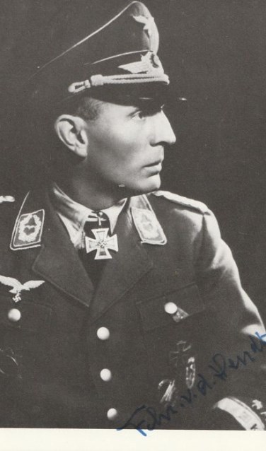
After the Normandy landings, Hitler wanted to launch a large-scale counterattack on the Western Front as soon as possible. With this he wanted to bring the Allies to a standstill. This should give Germany time to complete their “secret project,” which is the development of weapons of mass destruction.
The Germans made preparations in a very tactical manner and the necessary combat units were assembled. This is also the case in Aalten. Here, Freiherr Von der Heydte had to put together a Kampfgruppe in preparation for a special deployment in this new offensive. In these months, Aalten was overrun by German troops. They requisitioned almost all school buildings for the quartering of these troops.
School for paratroopers
The so-called ‘Fallschirm-Armee Waffenschule’ (October 1944 – February 1945) was established in the public school on the Herenstraat. The majority of the Germans were also billeted here. Non-commissioned officers and officers were billeted with civilians in Aalten.
The school was intended to train aspiring officers of the German paratroopers in practice and prepare them for work at the front. In addition, experienced instructors gave courses on how to disable the enemy’s armored vehicles with the resources and weapons that the Germans had at the time. And finally, a special Kampfgruppe (combat unit) was formed. He was going to receive a special assignment, namely an in-force parachute jump behind Allied lines during the Ardennes Offensive. At its peak, about 1200 German paratroopers were gathered in Aalten. They formed the so-called ‘Kampfgruppe Von der Heydte’.
German paratroopers were billeted everywhere in Aalten and surrounding villages. Not only in large school buildings but also privately in people’s homes. The soldiers had to go to the district office that was located in the town hall. Here they received a certificate of quartering, as they called it at the time, and continued their way to the address where they were allowed to stay. In addition, almost all cafes in Aalten were used by the German troops and converted into so-called kasinos. Not to watch films here, but to entertain the soldiers in their spare time with fun and trinkets.
Strict regime
There was a strict regime among the German troops. Valuable time was efficiently used to turn this mixed group into a real Kampfgruppe as soon as possible. Every morning the troops were expected to complete a march of about 10 km on an empty stomach. Furthermore, shooting exercises were held on some training grounds around Aalten and the battle groups were trained in fighting in wooded areas.
Een ooggetuige heeft Duitse parachutisten in sporttenue gezien, op weg naar zwembad ‘t Walfort. Hier sprongen de parachutisten van een verhoging in het mulle zand. Bij het in contact komen met het zand maakten zij een zogenaamde para-rol om de val te breken. Ze moesten deze manoeuvre beheersen voordat ze een parachutesprong gingen maken om zo blessures te voorkomen.
After Von der Heydte had left the so-called Kampfgruppe, Hauptmann Von Hütz took over command of the Waffenschule in Aalten. During the remaining period, this new battle group deployed a number of operations. These were described as very harsh by both the Allies and the Germans themselves.
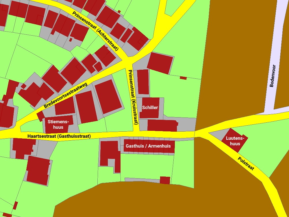
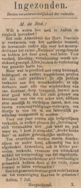
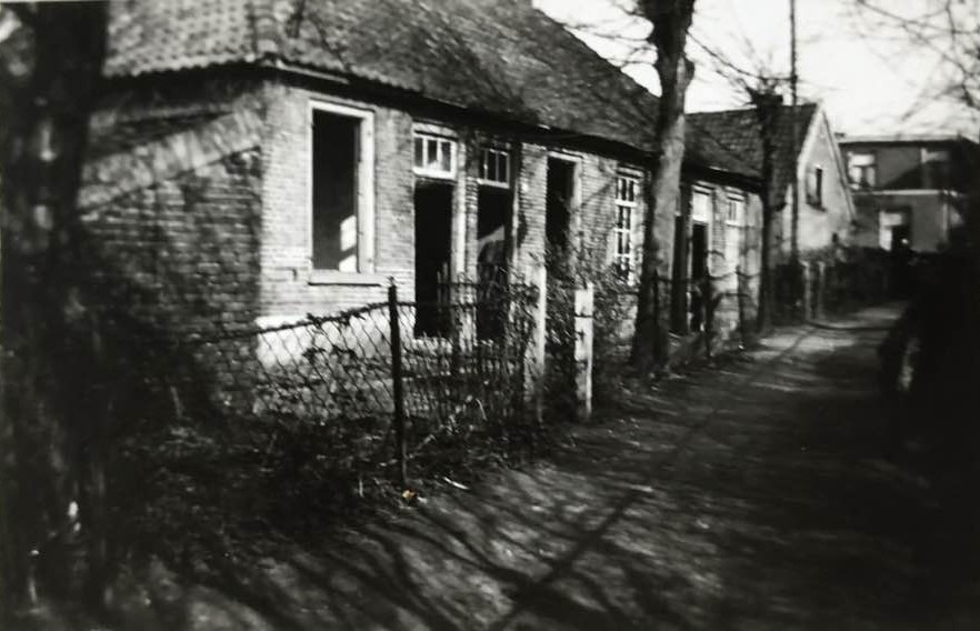
The Almshouse (‘Gasthuis’) was an institution run by the Reformed diaconate (charitable board) located on what was then Gasthuisstraat, now known as Haartsestraat, in Aalten.
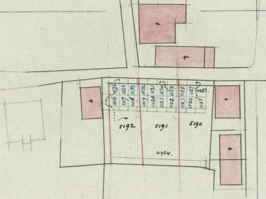
On the 1832 land registry map (cadastre) shown on the right, the exact location is visible, situated approximately where Haartsestraat 14 to 18 stands today.
Bovenstaande foto toont de Gasthuisstraat rond 1900. Rechts, voorbij de burgemeesterswoning – het latere postkantoor – zien we nog net een gedeelte van het Gasthuis. Helemaal achteraan zien we ook nog net het Luutenshuus.
The Almshouse contained ten rooms on the street side and ten on the garden side, each with a floor area of 17 to 22 m². Each room was equipped with two box-beds (bedsteden). Occupants shared a privaat (toilet) between several rooms. In the garden, many residents also kept a ‘sikkestal’ (a small shed for a goat).
The residents were not only among the poorest members of the population but were also generally the least educated. Consequently, the Almshouse and its surroundings were frequently the scene of shouting matches and petty quarrels. The residents were often the targets of harassment by the local youth of Aalten.
One of the residents would deliver wheelbarrows of fine white sand door-to-door for a penny, which people used to strew across their stone floors. Once he had earned a few pence, he would quickly spend it on a borrel (a small glass of gin) before starting to ‘save up’ for the next one.
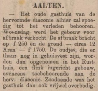
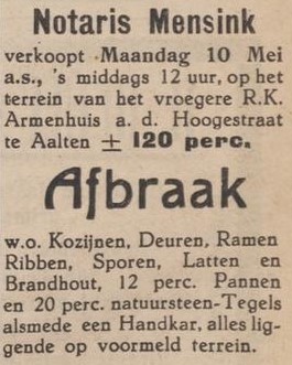
In 1904 werd het Gasthuis afgebroken. De oudjes er op dat moment nog woonden verhuisden naar het Rusthuis aan de Hogestraat.
Owners
This overview is incomplete.
Year
Plot
Owner
Description
1832
I1116 – I1135
the Reformed Poor of Aalten
House Numbering
In the population register, every room or household is listed on a separate family card. The overview below provides links to the first family card in the population register for each period that corresponds to the almshouse on Haartsestraat. From there, one can browse further to find all residents for that specific timeframe.
An extensive table listing all residents is planned for the future to assist genealogists in identifying former occupants. Please note: records may contain errors.
Aalten had vroeger ook nog een katholiek gasthuis. Het Armenpad tussen de Hogestraat en de Stationsstraat, één van de typisch Aaltense Gängeskes, herinnert hier nog aan.
Features
Cadastral no.
I-8761/8762/ 13144/13140
Function
Almshouse
Year of construction
unknown
Demolition
1904
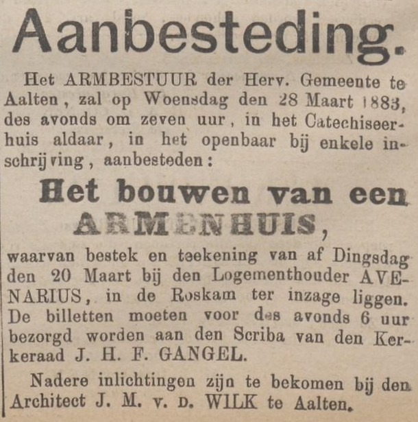
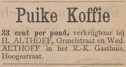
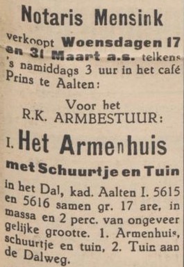
Land Registry 1832, Source: hisgis.nlFragment cadastral map, 1905Zutphensche Courant, 19 March 1883Nieuwe Winterswijksche Courant, 25 May 1904Aaltensche Courant, 9 July 1904
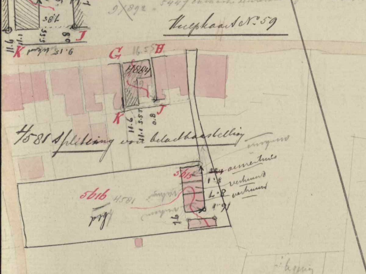
Het Armenpad, dat de Hogestraat en de Stationsstraat met elkaar verbindt, is één van de typisch Aaltense Gängeskes. De naam herinnert aan het rooms-katholieke gasthuis (armenhuis) dat hier ooit stond.
Dit armenhuis bestond uit acht kamers van elk 4 bij 4 meter en stond op grond van Dr. Hartman. De bewoners ontvingen steun van de Rooms-Katholieke Kerk, die hen voorzag van kleding en voedsel. Daarnaast hadden ze een klein tuintje, waarin ze bijvoorbeeld een geit konden houden. In 1937 kwam er een einde aan het gasthuis, toen de familie Hartman besloot de bewoners niet langer op hun grond te laten wonen.1
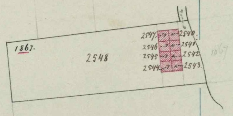
Around 1912, the eight dwellings were reconfigured into four dwellings.
Behalve het katholieke gasthuis had Aalten vroeger ook een hervormd gasthuis aan de huidige Haartsestraat.
14 m² house & yard (8x) including house numbers, between brackets after plot number)
1894
I-4581
the Roman Cath. poor of Aalten
1.600 m² almshouse, barn & yard
1913
I-4581
the Roman Cath. poor of Aalten
1,700 m² house, almshouse, barn and yard
1914
I-5615 I-5616
the Roman Cath. poor of Aalten
40 m² almshouse 1.660 m² house, barn and farmland
Residents
The overview below contains a link to the corresponding family card in the population register for each period and room/household from 1860 to 1910.56 What we noticed: it appears that residents occasionally changed rooms; the residents were mostly single women (widows); and many had Bocholt as their place of birth. Our research is still ongoing, errors excepted!
Deze website gebruikt cookies voor een optimale ervaring en analyse van bezoekgegevens. Ga je hiermee akkoord? Zonder toestemming werken sommige onderdelen van de site mogelijk minder goed.
Functioneel
Always active
De technische opslag of toegang is strikt noodzakelijk voor het legitieme doel het gebruik mogelijk te maken van een specifieke dienst waarom de abonnee of gebruiker uitdrukkelijk heeft gevraagd, of met als enig doel de uitvoering van de transmissie van een communicatie over een elektronisch communicatienetwerk.
Voorkeuren
De technische opslag of toegang is noodzakelijk voor het legitieme doel voorkeuren op te slaan die niet door de abonnee of gebruiker zijn aangevraagd.
Statistieken
De technische opslag of toegang die uitsluitend voor statistische doeleinden wordt gebruikt.De technische opslag of toegang die uitsluitend wordt gebruikt voor anonieme statistische doeleinden. Zonder dagvaarding, vrijwillige naleving door je Internet Service Provider, of aanvullende gegevens van een derde partij, kan informatie die alleen voor dit doel wordt opgeslagen of opgehaald gewoonlijk niet worden gebruikt om je te identificeren.
Marketing
De technische opslag of toegang is nodig om gebruikersprofielen op te stellen voor het verzenden van reclame, of om de gebruiker op een site of over verschillende sites te volgen voor soortgelijke marketingdoeleinden.