In 1932, there was excitement among historians regarding a potential “find of prehistoric value” in the Ringkampsbulten near Aalten. The presence of 2,000-year-old vaulted dome-shaped graves was suspected within an artificial mound there. Excavations were to provide clarity, with unexpected results.
Mysteries
On 9 March 1932, the Graafschapbode reported:
Mr Beernink from Aalten, a member of “de Graafschap”, approached the secretary, Dr Westerbeek van Eerten from Hummelo, with the request to come and conduct an investigation in a heathland area on the German border to the south-east of Aalten. Situated there was a small artificial mound with ramparts where, according to the local residents, things were not quite right. They spoke of pixies, ghosts, ulkenpötte (hobgoblins), and further mysteries.
The Aaltensche Courant wrote on 11 March 1932:
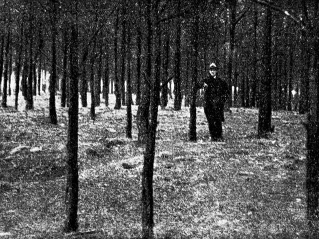
Along the historical road leading from neighbouring Barlo in Germany to the old fortress town of Bredevoort lies, on the right-hand side as one travels in the direction of Germany, a small pine wood, ostensibly identical to several of these woodland plots still to be found on the Haart.
For the historian, particularly the researcher of prehistory, this wood signifies more than just a plot of woodland. For him, the lines and contours of the soil are a page of history – history from thousands of years ago. To the layman, it is a bumpy plot of pines, featuring first a rampart about 1 metre high, then a slight depression, followed once more by a rise in the centre of which is a bowl-shaped hollow.
Upon closer inspection, it appears that the outermost rampart follows a roughly egg-shaped course, with a length of about 100 metres and a width of approximately 50 metres. Within this enclosure sits the aforementioned elevation with its characteristic bowl-shaped hollow, which immediately leads the connoisseur to suspect a “tumulus” or barrow from prehistoric times. At the thickest end of this egg shape (the pointed end lies on the eastern side), we encounter the mound with its bowl-shaped hollow.
Standing upon this mound and looking eastwards, it becomes apparent that this elevation in the terrain – which locally consists predominantly of light yellow fine sand – directly borders a plain which, as far as the eye can see, formerly consisted of marshy ground, but has been converted into agricultural land over the past forty years through effective drainage. Further north, the terrain remains fairly undulating and mainly sandy. A few lower-lying plots have already been brought into cultivation here as well.
The outermost ring or rampart (the site derives its name of “Ringkampsbulte” from this ring) has partially fallen into decay on the western side due to a cart track, whilst a woodland path also intersects the ring in two places. However, when standing on the mound, the characteristic shape of the ring is clearly delineated. The terrain is entirely overgrown with pines, the falling needles forming a soft carpet over the firm ground into which our feet sink. Rabbits, burrowing their holes into the mound, have brought the pure sand to the surface here and there.
Pixies
In popular folklore, it is said that “eerdmannekes” (pixies) have been seen playing on the rampart; furthermore, the mound was reputedly haunted, while older folk recall tales of urns that are supposedly present there. According to the scholars, one is dealing here with a barrow from the Neolithic period – that is to say, from the third or indeed the final period of the Stone Age. The outermost ring, however, is unique.
Mr A.J.G. Beernink of this town, who had been aware of these conditions for years and sensed the history of this piece of nature, informed the government commissioner for the detection of historically valuable monuments of this some years ago, because so much of value had already been lost on the Haart. This warning, however, yielded no result. To prevent unskilful digging and searching, Mr Beernink did not publicise the matter. Fortunately, the land, which is municipal property, remained intact.
In August 1930, the aforementioned gentleman informed Mr Hoefer in Hattem, chairman of the prehistoric society, of his suspicion that a grave or cremation site of the ancient Germanic peoples was to be found here. Initially, nothing was heard in response to this either, but after Mr Beernink had once again pressed the matter with the society, Mr Westerbeek van Eerten came here as the plenipotentiary of the “Foundation for the Protection of Prehistoric Monuments in Gelderland”. Then the ball was set rolling.
Scientific investigation
Shortly, a systematic scientific investigation will begin under the direction of Dr van Giffen. Dr van Giffen considers the find highly important, all the more so since traces of timber construction have been found and the dimensions are unique. The excavation, which must of course be carried out with the necessary caution and usually consists of hoeing away the soil layer by layer in thin slices, will commence before long. This will be done from the south-western side towards the centre, because experience has shown that over such a vast span of time, the topsoil shifts somewhat in a north-easterly direction due to weather influences. With this method, one therefore stands the best chance of finding the actual dome-shaped graves as quickly as possible.
What will be found? Perhaps interesting discoveries will be made even for a layman, in the form of urns and stone objects. The urns, if found, are extremely fragile upon discovery because, being mostly fashioned from clay, they were dried in the sun. Baked urns, which are consequently stronger, invariably dated from a later period. If dried urns are found and are handled and dried carefully, they can sometimes still be saved. For the expert, however, every non-natural modification in the strata provides an invaluable clue.
Thus, for example, dark round spots in the excavation point to a post that was driven in previously, whilst in this manner it has been possible to establish the site where a hut stood thousands of years ago. A ring-shaped site, for instance, enclosed by round dark spots in the lighter-coloured soil, indicates the posts that propped up the hut. Inside such a ring, one then sometimes finds remnants of ash and occasionally prehistoric objects as well.
All objects that are found will be handed over to the local Oudheidkamer (historical museum). When presently the hoe is thrust into the soil, when the scanning eye of the historian searchingly contemplates the exposed earth and finds what is presumed to be found, then this find will prove to be one such as has not been made in the Netherlands, indeed perhaps in Europe, to date. May it be so.
Unexpected result
On 25 July 1933, the Zutphensche Courant reported:
In its annual report for 1932, the board of the Foundation for the Protection of Prehistoric Cultural Monuments in Gelderland states, among other things, the following: At the general meeting of 26 February 1932, a commission was granted to Dr van Giffen to carry out an excavation on the Ringkampsbulte near Aalten, after which Dr van Giffen made a start on the investigation at the beginning of April. Just a few days later, the excavation was halted, as to the astonishment of Dr van Giffen and his staff, it had become apparent that one was dealing here with a natural ring dyke (ringwal), the highly peculiar shape of which had misled the experts.
Close to the ring dyke, however, lies a grave from the La Tène period, and Dr van Giffen suspects the presence of a necropolis there, for which further investigation would undoubtedly be rewarding. This investigation, however, was impossible for the moment due to the condition of the land, so that we hope to be able to return to this later.
Whether any matters of interest have been found in the Ringkampsbulten (since then) remains unknown to us for the time being.
Do you have more information? We would love to hear from you!