Archives: Adressen

  • Memorial for People in Hiding

    Memorial for People in Hiding

    Stationsstraat, Aalten
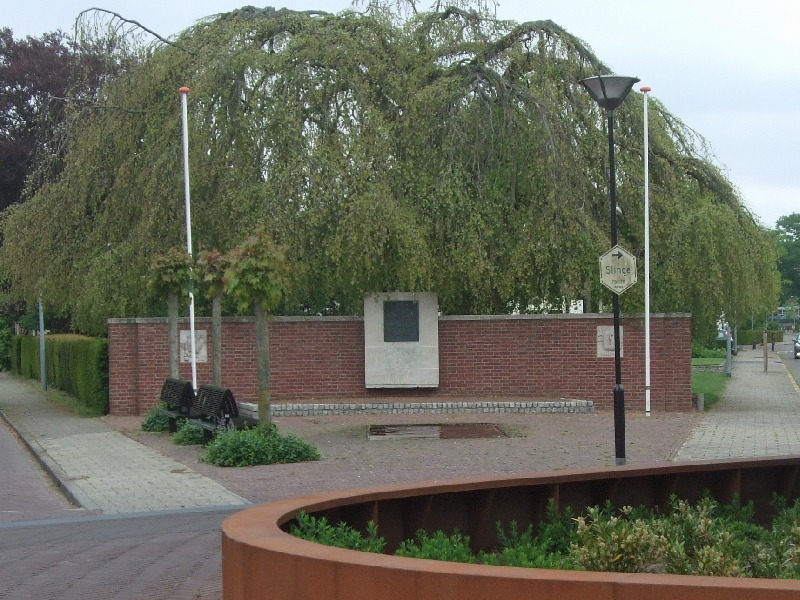
    The memorial for people in hiding (Onderduikersmonument) on Stationsstraat is an expression of gratitude from those who were once in hiding to the people of Aalten for their hospitality, and to the members of the Resistance who were the driving force behind finding accommodation for them.

    The monument consists of a brick memorial wall with a fountain. A bronze plaque and two sculpted fragments of natural stone are set into the memorial wall.

    The monument was unveiled on 4 October 1947 by Mrs D.G. Wikkerink-Eppink, the wife of Resistance leader Hendrik Jan (Ome Jan) Wikkerink.

    The text on the plaque reads (translated from Dutch):

    PRESENTED TO THE MUNICIPALITY OF AALTEN BY PERSONS IN HIDING
    WHO DURING THE YEARS OF OCCUPATION 1940-1945
    FOUND A SAFE HAVEN HERE.

    The sculpted fragments bear the text of Psalm 91:5 and 6.

    The text of the left fragment reads:

    THOU SHALT NOT BE AFRAID FOR THE TERROR BY NIGHT,
    NOR FOR THE ARROW THAT FLIETH BY DAY;
    NOR FOR THE PESTILENCE THAT WALKETH IN DARKNESS,
    NOR FOR THE DESTRUCTION THAT WASTETH AT NOONDAY.

    The text of the right fragment reads:

    FOR HE SHALL COVER THEE WITH HIS FEATHERS, AND
    UNDER HIS WINGS SHALT THOU TRUST.

    The sculpture on the left depicts three studded boots belonging to the barbarian horde, threatening to trample a young, sprouting fruit. This symbolises the overwhelming force and occupation, portraying the vulnerability of young life that continues to germinate despite the danger.
    The fragment on the right depicts a pelican with outspread wings, protecting its nest and young. The pelican is a Christian symbol of total self-sacrifice; according to legend, the bird feeds its young with its own blood. It symbolises the contribution of the resistance in the struggle against the occupier. The waning swastika in the background represents the transience of the threat.

    Sources


  • Fallschirm-Armee Waffenschule

    Fallschirm-Armee Waffenschule

    Herenstraat 4, Aalten (Oct 1944 – Feb 1945)

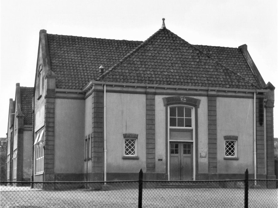
    Tijdens de bezettingsjaren was er korte tijd een ‘Fallschirm-Armee Waffenschule’ gevestigd in de Openbare Lagere School aan de Herenstraat in Aalten.

    After the Normandy landings, Hitler wanted to launch a large-scale counterattack on the Western Front as soon as possible. With this he wanted to bring the Allies to a standstill. This should give Germany time to complete their “secret project,” which is the development of weapons of mass destruction.

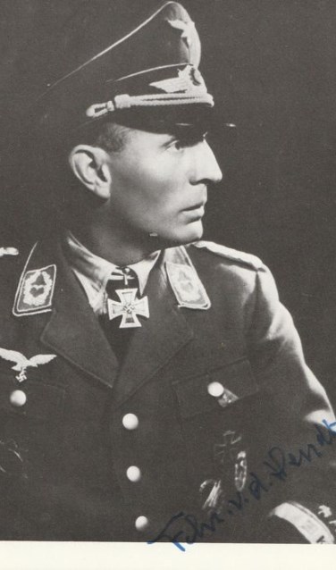
    The Germans made preparations in a very tactical manner and the necessary combat units were assembled. This is also the case in Aalten. Here, Freiherr Von der Heydte had to put together a Kampfgruppe in preparation for a special deployment in this new offensive. In these months, Aalten was overrun by German troops. They requisitioned almost all school buildings for the quartering of these troops.

    School for paratroopers

    The so-called ‘Fallschirm-Armee Waffenschule’ (October 1944 – February 1945) was established in the public school on the Herenstraat. The majority of the Germans were also billeted here. Non-commissioned officers and officers were billeted with civilians in Aalten.

    The school was intended to train aspiring officers of the German paratroopers in practice and prepare them for work at the front. In addition, experienced instructors gave courses on how to disable the enemy’s armored vehicles with the resources and weapons that the Germans had at the time. And finally, a special Kampfgruppe (combat unit) was formed. He was going to receive a special assignment, namely an in-force parachute jump behind Allied lines during the Ardennes Offensive. At its peak, about 1200 German paratroopers were gathered in Aalten. They formed the so-called ‘Kampfgruppe Von der Heydte’.

    German paratroopers were billeted everywhere in Aalten and surrounding villages. Not only in large school buildings but also privately in people’s homes. The soldiers had to go to the district office that was located in the town hall. Here they received a certificate of quartering, as they called it at the time, and continued their way to the address where they were allowed to stay. In addition, almost all cafes in Aalten were used by the German troops and converted into so-called kasinos. Not to watch films here, but to entertain the soldiers in their spare time with fun and trinkets.

    Strict regime

    There was a strict regime among the German troops. Valuable time was efficiently used to turn this mixed group into a real Kampfgruppe as soon as possible. Every morning the troops were expected to complete a march of about 10 km on an empty stomach. Furthermore, shooting exercises were held on some training grounds around Aalten and the battle groups were trained in fighting in wooded areas.

    Een ooggetuige heeft Duitse parachutisten in sporttenue gezien, op weg naar zwembad ‘t Walfort. Hier sprongen de parachutisten van een verhoging in het mulle zand. Bij het in contact komen met het zand maakten zij een zogenaamde para-rol om de val te breken. Ze moesten deze manoeuvre beheersen voordat ze een parachutesprong gingen maken om zo blessures te voorkomen.

    After Von der Heydte had left the so-called Kampfgruppe, Hauptmann Von Hütz took over command of the Waffenschule in Aalten. During the remaining period, this new battle group deployed a number of operations. These were described as very harsh by both the Allies and the Germans themselves.

  • Roman Catholic Almshouse

    Roman Catholic Almshouse

    Armenpad / Hogestraat, Aalten

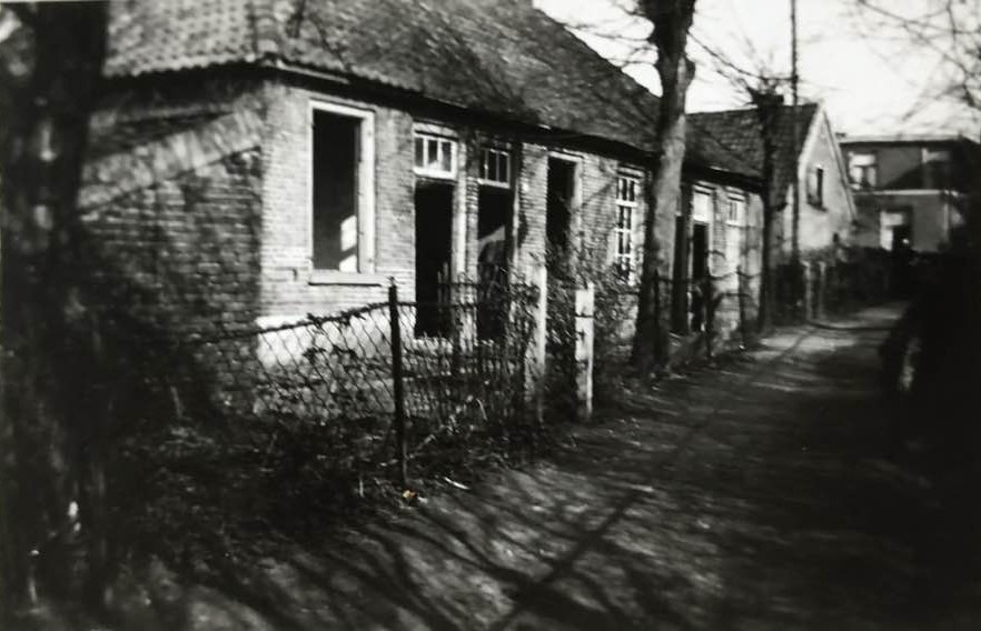
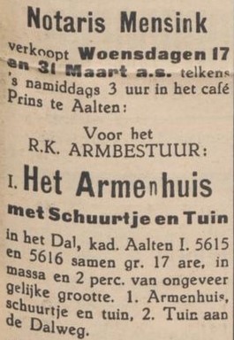
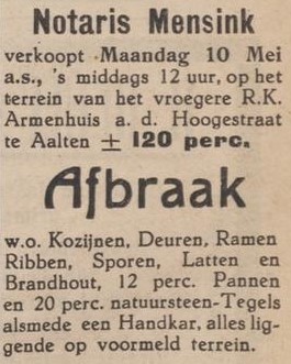
    Het Armenpad, dat de Hogestraat en de Stationsstraat met elkaar verbindt, is één van de typisch Aaltense Gängeskes. De naam herinnert aan het rooms-katholieke gasthuis (armenhuis) dat hier ooit stond.

    Dit armenhuis bestond uit acht kamers van elk 4 bij 4 meter en stond op grond van Dr. Hartman. De bewoners ontvingen steun van de Rooms-Katholieke Kerk, die hen voorzag van kleding en voedsel. Daarnaast hadden ze een klein tuintje, waarin ze bijvoorbeeld een geit konden houden. In 1937 kwam er een einde aan het gasthuis, toen de familie Hartman besloot de bewoners niet langer op hun grond te laten wonen.1

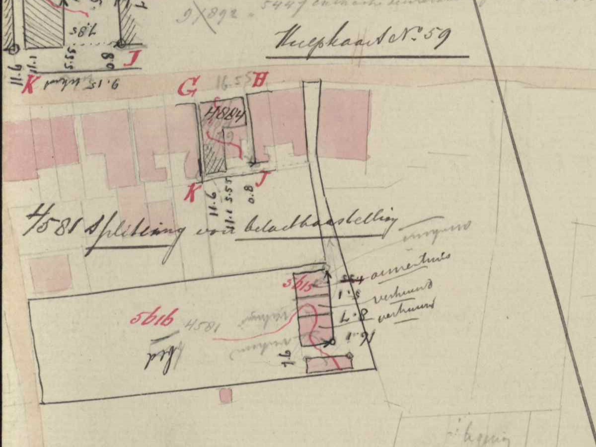
    Around 1912, the eight dwellings were reconfigured into four dwellings.

    Behalve het katholieke gasthuis had Aalten vroeger ook een hervormd gasthuis aan de huidige Haartsestraat.


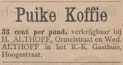
    Newspaper reports 2

    Features


    Cadastral No.3I-11345
    FunctionAlmshouse
    Year of construction1860
    Demolition1937

    Owners

    Overview is incomplete.

    YearPlotOwnerDescription
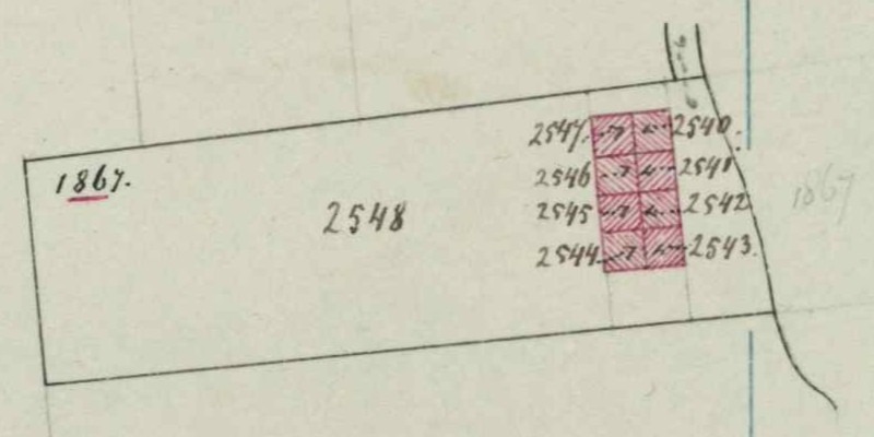
    1860I-2540-2547the Roman Cath.
    poor of Aalten
    14 m² house-yard (8x)
    1883I-2540 (87)
    I-2541 (87a)
    I-2542 (87b)
    I-2543 (87c)
    I-2544 (87d)
    I-2545 (87e)
    I-2546 (87f)
    I-2547 (87g)
    the Roman Cath.
    poor of Aalten
    14 m² house & yard (8x)
    including house numbers,
    between brackets after
    plot number)
    1894I-4581the Roman Cath.
    poor of Aalten
    1.600 m² almshouse, barn & yard
    1913I-4581the Roman Cath.
    poor of Aalten
    1,700 m² house, almshouse, barn and yard
    1914I-5615
    I-5616
    the Roman Cath.
    poor of Aalten
    40 m² almshouse
    1.660 m² house, barn and farmland

    Residents

    The overview below contains a link to the corresponding family card in the population register for each period and room/household from 1860 to 1910.5 6 What we noticed: it appears that residents occasionally changed rooms; the residents were mostly single women (widows); and many had Bocholt as their place of birth. Our research is still ongoing, errors excepted!

    1860Resident(s)1870Resident(s)1880Resident(s)1890Resident(s)1900Resident(s)1910Resident(s)1934Resident(s)
    88M. Kalb,
    A. Huls
    87/1A. Huls97/1A. Bekink,
    J.A.H. Bloemers
    90/1J.A.H. Bloemer,
    J.G. Stritholt,
    B.J.M. Berendsen
    & 5 kinderen
    112/1J.A.H. BloemerA142/1A143a
    87/2A.H. Huitink97/2A.H. Huitink90/2J.A.H. Bloemer112/2E. GeuringA142/2A.J. HubersA143bA.J. Hubers
    88H. Buiel,
    G. Veenhuis
    87/3G. Veenhuis,
    J.A.H. Bloemers
    97/3W. Jansen90/3J. Stöckert,
    J.C. Antink
    112/3J.G. StritholtA142/3M.M. BoekwinkelA143cWed. A.H. Sauer
    89H. Unland87/4H. Unland97/4H. Unland90/4P. Lorijn,
    J.G. Stritholt
    112/4T. HulsA142/4A143dWed. J.G. Albers
    89L. ten Haken87/5L. ten Haken,
    A. Bekink
    97/5Harmina Bennink90/5H. Bennink,
    T. Huls
    112/5No mention
    (found).
    A142/5
    89J.E. Benning87/6J.E. Benning,
    J.E. Bokkers
    97/6J.A.H. Bloemer90/6C. Bartholomeus,
    E. Geuring
    112/6A.E. Doinck,
    A.J. Hubers
    & W.G. Hubers
    A142/6
    97/7J.E. Bokkers90/7No mention
    (found).
    112/7Harm Bakker
    87/6A.H.E. Gintherr97/8A.H.E. Gintherr90/8A.E. Doinck112/8No mention
    (found).
  • Gallows Hill

    Gallows Hill

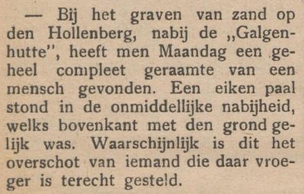
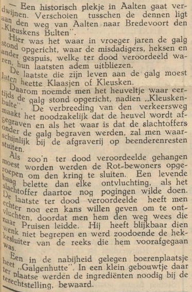
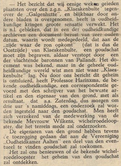
    The Galgenbulte (Gallows Hill) on the Hollenberg, also known as Klaeskesbulte, was formerly the site where the gallows were erected. This was where condemned criminals, witches, and other scum drew their final breath.

    The execution site was strategically located along the road from Aalten to Bredevoort. The hill was excavated in 1939 to widen the main road.

    Approximate location

    Vehmic Court

    During the medieval period, a veemgericht (Vehmic court) was established on the Hollenberg, near the ’t Walfort manor. This was a special court whose sessions were held in the open air near a thicket known as ‘Sleehegge’. Four times a year, justice was administered here at sunrise. A nearby small farmstead is called Galgenhutte. It is said that the equipment for the executions was stored there in a small building. According to local lore, those sentenced to death were permitted to eat their final meal there.

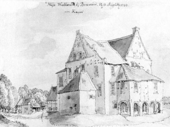
    Havezathe 't Walfort, Jan de Beijer, 1743
    Havezathe ‘t Walfort, Jan de Beijer, 1743

    Berend de Dücker

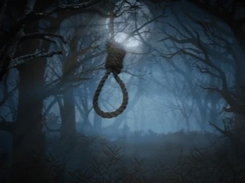
    In 1430, Free Count Berend de Dücker, then the mayor of Bocholt, presided over the court here. He led the Vehmic court for 60 years. This Berend was notorious for his severe sentencing, frequently condemning individuals to hanging. The condemned person was hanged with a noose made of willow withes by three anonymous veemschepenen (Vehmic jurors).

    A well-known threat used by parents for disobedient children, which persisted until the 20th century, was: ‘De Düker zal ow halen‘ (The Dücker will get you).

    Records from the ‘Administrative Organisation of the Lordship of Bredevoort’ indicate that the residents of Kempink and Goorhuis in Heurne were responsible for transporting the convicted criminal to the Hollenberg after the sentence had been read at ’t Zand in Bredevoort. By order of the officer, they were also required, without exception, to transport the gallows, wheel, cross, and other instruments of execution to the site.

    By the end of the sixteenth century, the Vehmic court at ’t Walfort had disappeared. It is the only location in the Netherlands where the existence of a Vehmic court has been proven.

    Klaas Nijman

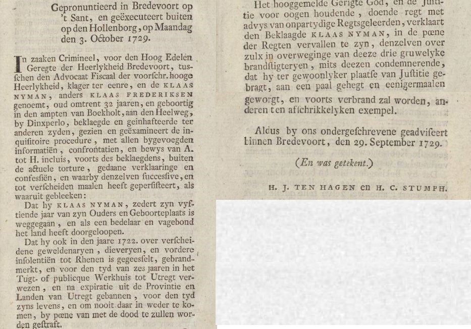
    On 3 October 1729, following a trial in Bredevoort and sentencing at ’t Zand, Klaas Nijman—32 years old and born in the district of Bocholt—was executed on the Hollenberg. He was a ‘beggar and vagabond’ accused of violent theft, arson, and other offences. Although he had been banished from various places, he continually returned. As a deterrent to others, he was strangled on the Hollenberg and subsequently set on fire.

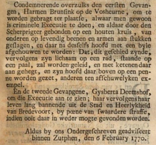
    Harmen Brunsink

    On 12 February 1770, Harmen Brunsink was executed on the Hollenberg. He lived at the Vosheurne farm in Lintelo and had murdered ‘Aunt’ Hendersken Tannemaat. Harmen did not get along with this live-in aunt of his wife. He claimed to alerted neighbours that she had fallen, but the number and nature of the injuries made his story unbelievable.

    Harmen was sentenced to death. The executioner bound him to a wooden cross; first his legs and then his arms were broken. He was subsequently beheaded with an axe. His body was placed on a wheel atop a pole and secured with chains. His head was placed on a stake above it to deter others.

    Verdict of Herman Brunsink, 6 February 1770
    Verdict Herman Brunsink

    The Last Execution

    In 1938, G.H. Rots wrote:

    “The fact that death sentences were carried out even after the time of the Vehmic court proves that the end came for many a condemned soul in the vicinity of ’t Walfort. To the right of the road to Bredevoort, hidden under brushwood and trees, is a small mound. That is where the gallows were erected. When someone was to be executed, a number of men were officially summoned to form a circle around the place of execution. This was in case the noose should break or the condemned should break free; the circle of men stood hand-in-hand to prevent escape.

    After a long period in which no more death sentences were passed, the last gallows is said to have been erected at the beginning of the last [19th] century. The condemned man was named Klaësken, and surrounded by the circle-closers, he went in procession to the gallows. It seems, however, that they wanted to give the man a chance to flee, for when they reached the Walfortallee, they said to him: ‘That is the road to Prussia.’ The man did not take the hint, and on the hill, as the last in a line of condemned men, he met his end on the gallows. That is why that small mound is still called the Klaëskesbulte.”

    Other references

    Sources


  • Bredevoort Castle

    Bredevoort Castle

    Bredevoort Castle, 3D impression by Paul van Druten

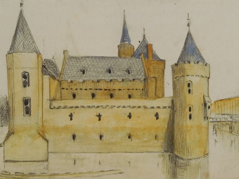
    Bredevoort Castle was a fortress in the heart of the eponymous town and former Lordship of Bredevoort in the County of Zutphen within the Duchy of Guelders. It was one of the most significant castles in Gelderland. During the 13th and 14th centuries, Bredevoort Castle played a major role in the struggle between Guelders and Münsterland.

    The castle was first mentioned in 1188 on a list of properties belonging to the Diocese of Cologne as “Castrum Breidervort“. At that time, the castle was a site of contention. Consequently, it had multiple owners, leading to a centuries-long struggle for control. In 1238, the castle came into the hands of Ludolf van Steinfurt and Herman van Lohn as a shared inheritance. The castle was to be fortified, with both parties sharing the costs. In 1278, the fortress was destroyed by Count Everhard I von der Mark during an act of revenge. Following this, the castle remained a ruin for 23 years. A deed of sale from 1284 refers to the “area castri Bredevort”.

    After years of conflict over Bredevoort between Münster and Guelders, the castle eventually returned to the hands of Count Herman van Lohn II in 1301. In that year, the bishops of Münster and Cologne pledged to assist Herman van Lohn with the restoration of the fortress. In the turbulent times that followed, the fortress frequently changed hands between Münster and Guelders through combat or sale. The bishops of Münster and Cologne were required to jointly fund the reconstruction of Bredevoort Castle.

    After centuries of fighting over the castle, the Bishop of Münster abandoned the struggle and sought peace negotiations. Following years of negotiation, peace was finally signed on June 28, 1326, with the Treaty of Wesel. This significant treaty was also signed by the cities of Zutphen, Groenlo, Emmerich, and Arnhem. As a result, Reinoud II of Guelders acquired the pledge of the jurisdictions in Winterswijk, Aalten, and Dinxperlo, as well as the County of Bredevoort. This move definitively incorporated the area into Gelderland.

    Floor plan

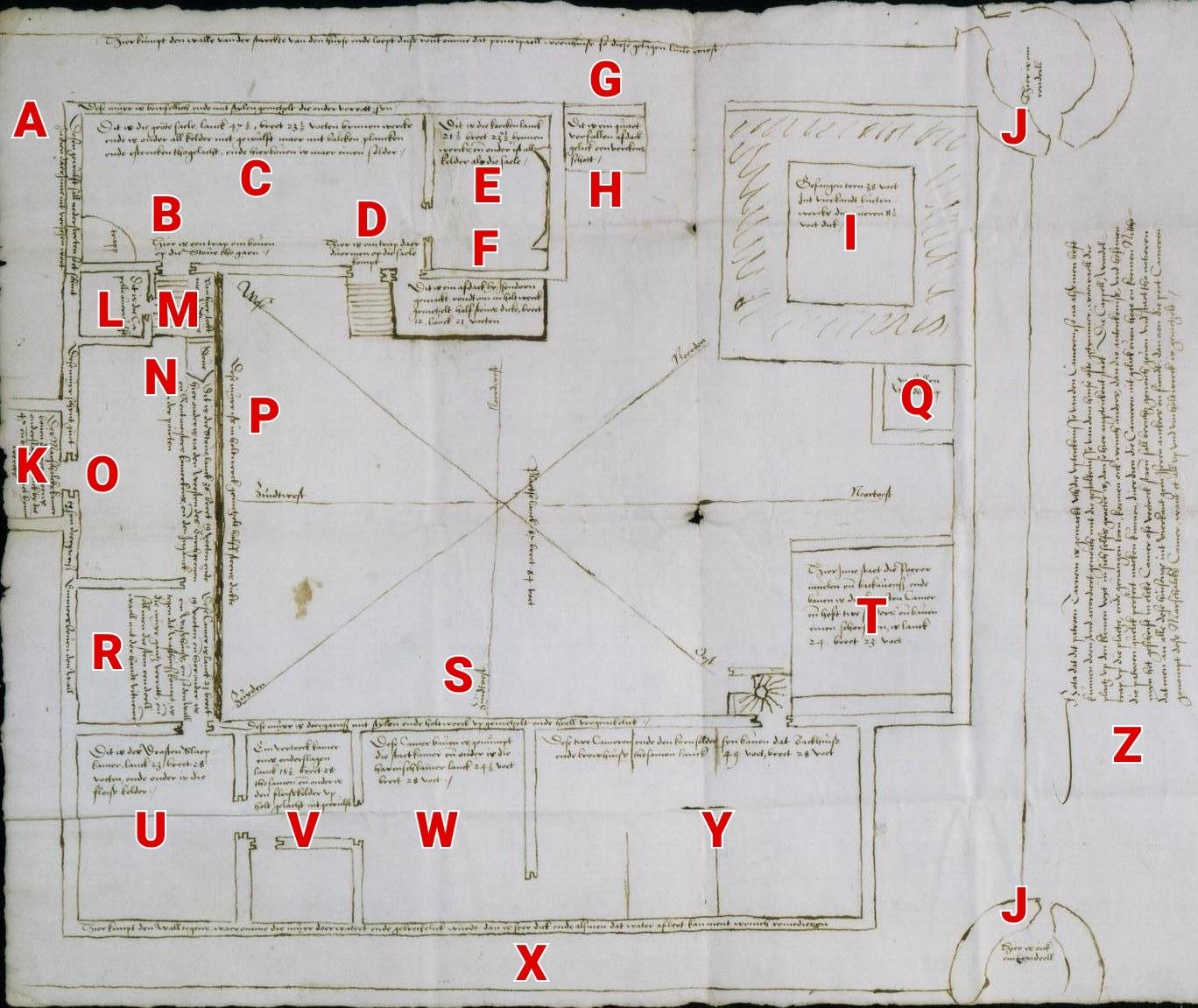
    In 1562, the lord of the manor of Bredevoort, Diederik van Bronckhorst-Batenburg, Lord of Anholt, commissioned a floor plan of the castle at Bredevoort. This plan also described the functions and structural condition of the various components. Measurements were recorded in Rhineland feet. A Rhineland foot is over 31 cm long. The castle was a rectangle measuring 42 m long and 36 m wide. The walls were approximately 65 cm thick. An earthen rampart surrounded the castle, with roundels at the corners. The rampart was approximately 2 m wide.

    Explanations of the descriptions on the floor plan (translated from old script):

    1. This vault will collapse if it is not repaired soon.
    2. Here is the staircase leading to the knights’ hall.
    3. This wall is dilapidated. The vertical beams are rotted at the bottom. This is a large hall: 47 feet long and 23 feet wide, measured from the inside. Beneath it is a cellar. The floor consists of beams and planks and is finished with floor tiles. There is only one attic above the hall.
    4. This is a staircase to enter the large hall.
    5. This is the kitchen, 21 feet long and 23 feet wide. Beneath it is a cellar of the same size as the cellar under the large hall.
    6. This shed was built by Drost Isendoorn. The walls are masonry set between beams.
    7. This is the rampart that runs around the castle.
    8. This is a very dilapidated shed, much like a pigsty.
    9. The prison tower. It is 38 feet square (measured from the outside). The walls are 8½ feet thick. [This tower was likely used later as a powder tower, Ed.]
    10. Here are two roundels.
    11. The Drost’s chamber (Maarschalcksekamer) above the gate. [The name ‘Maarschalckse kamer’ dates from the period 1534-1555 when Marshal Maarten van Rossum was Drost of Bredevoort, Ed.]
    12. This is the chapel.
    13. From here, the hearth of the knights’ hall is stoked.
    14. This is the knights’ hall. The room is 36 feet long and 19 feet wide. Below this are the rooms of the burgrave (castle warden) and the steward. The gate entrance is also located below here.
    15. This wall is in good condition, as far as it can be seen above the rampart.
    16. This wall is built between wooden beams and has a thickness of half a brick. [The bricks used were ‘kloostermoppen’ of approximately 14 cm in width, Ed.]
    17. A dilapidated spiral staircase.
    18. Another room. Below this is a laundry room. Because the rampart rests against the laundry room, the wall is rotted. The stones are loose.
    19. This wall is largely built between wooden beams and is very dilapidated.
    20. This contains the grain mill and the baking ovens. Above is the servant’s room, with two attics and a chimney.
    21. This is where the Drost sleeps. The room is 28 feet long and 23 feet wide. Beneath it is a meat cellar.
    22. This room is divided in two. The floor is made of wood. The meat cellar also lies beneath this area.
    23. This upper room is called the salon (state room, armory). Below it is the armor room.
    24. Here the rampart touches the wall, causing the wall to let in moisture and show defects. The wall is very thick, and if the water could be kept out, it would likely provide some improvement.
    25. These two rooms, as well as the granary, are located above the bakehouse and brewhouse.
    26. This drawing was made in Arnhem after everything was measured as accurately as possible. The drawing is fairly accurate. However, in reality, some parts are slightly larger than depicted here, such as the chapel, the spiral staircase in the courtyard, and the prison tower.

    External Appearance

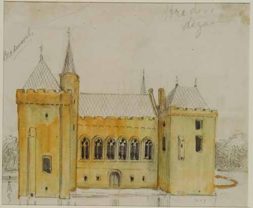
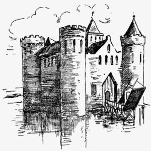
    Not much is known about exactly how Bredevoort Castle looked. While drawings of the castle exist, they are partly based on assumptions and imagination.

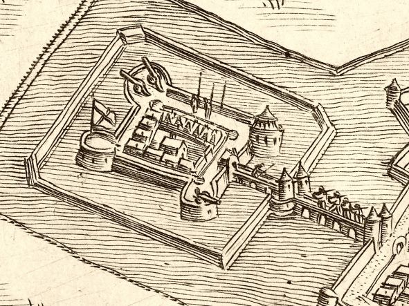
    The castle was built on a sandy ridge of approximately 42 x 26 meters, making it one of the larger castles in the Netherlands. Old maps show the main fortress to be a typical concentric castle, featuring double moats and a thick curtain wall. It included an outer bailey with heavy corner towers and a rectangular castle wall equipped with four corner towers, three of which were later lowered to become roundels.

    The castle and the town were separated by a double moat. Access to the castle from the town was via a bridge. One had to pass through two gates, the second of which was equipped with a barbican, and finally a gatehouse in the curtain wall before reaching the inner courtyard. Within the fortress, various buildings stood around a spacious inner court. These depictions changed over time, and the appearance and stature of the castle would have been altered frequently throughout the centuries due to conflict, war, city fires, and other causes.

    Destroyed

    The castle was heavily damaged by the Gunpowder Tower Disaster in 1646. Following this, the castle dominated the cityscape as a ruin for over 150 years until around the end of the 18th century. The last known mention of a visible ruin dates to 1791, recorded in the Bredevoort church council minutes when William V viewed the remains during his visit to Bredevoort. The main building (excluding the outer bailey, roundels, and curtain wall) had dimensions of approximately 42 x 36 meters. This made it one of the larger castles in the Netherlands.

    Remains

    Today, the remains of the castle—in the form of foundations, vaults, tunnels, and rubble—lie beneath and around the ‘t Zand square and the Hozenstraat in the heart of the town. In the spring of 2009, during archaeological research around the former school on ‘t Zand, part of the foundations was uncovered. Wall remains between 2.5 and 4 meters thick were found. On ‘t Zand square, foundations of the barbican were discovered. The contours of this gatehouse have been made visible in the paving with brass-colored bands.

    Sources