Inhoudstype: Story

  • Bridges in Aalten, Bredevoort and buurtschappen

    Bridges in Aalten, Bredevoort and buurtschappen

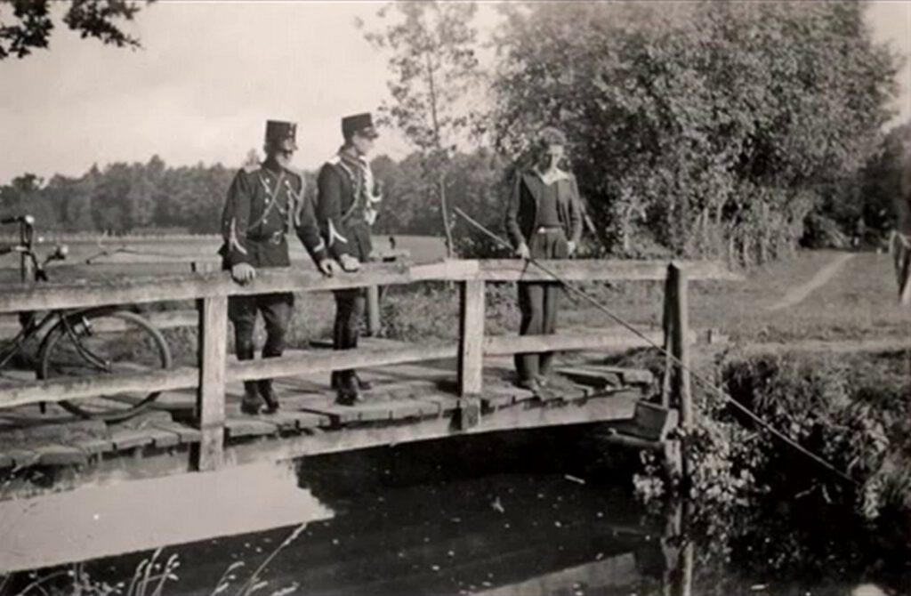
    Nannielaantje, brug over de Slingebeek

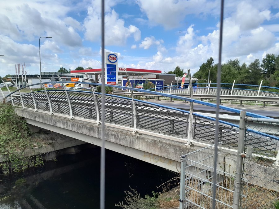
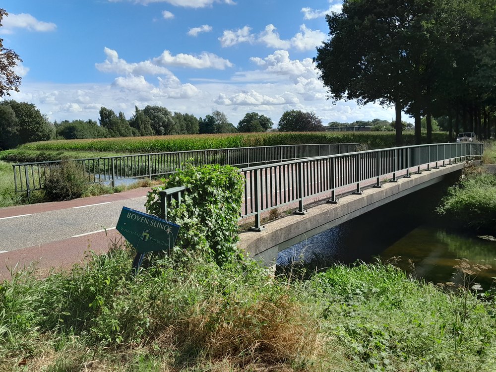
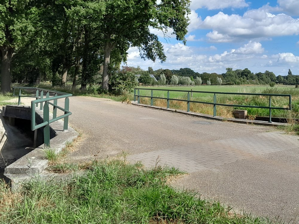
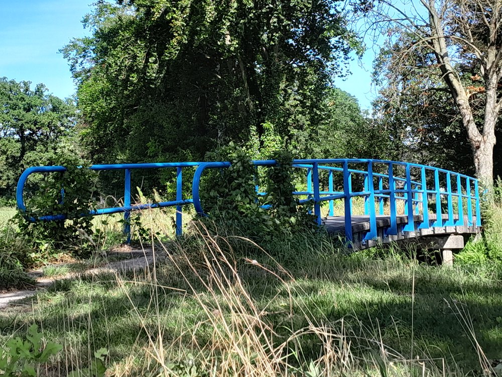
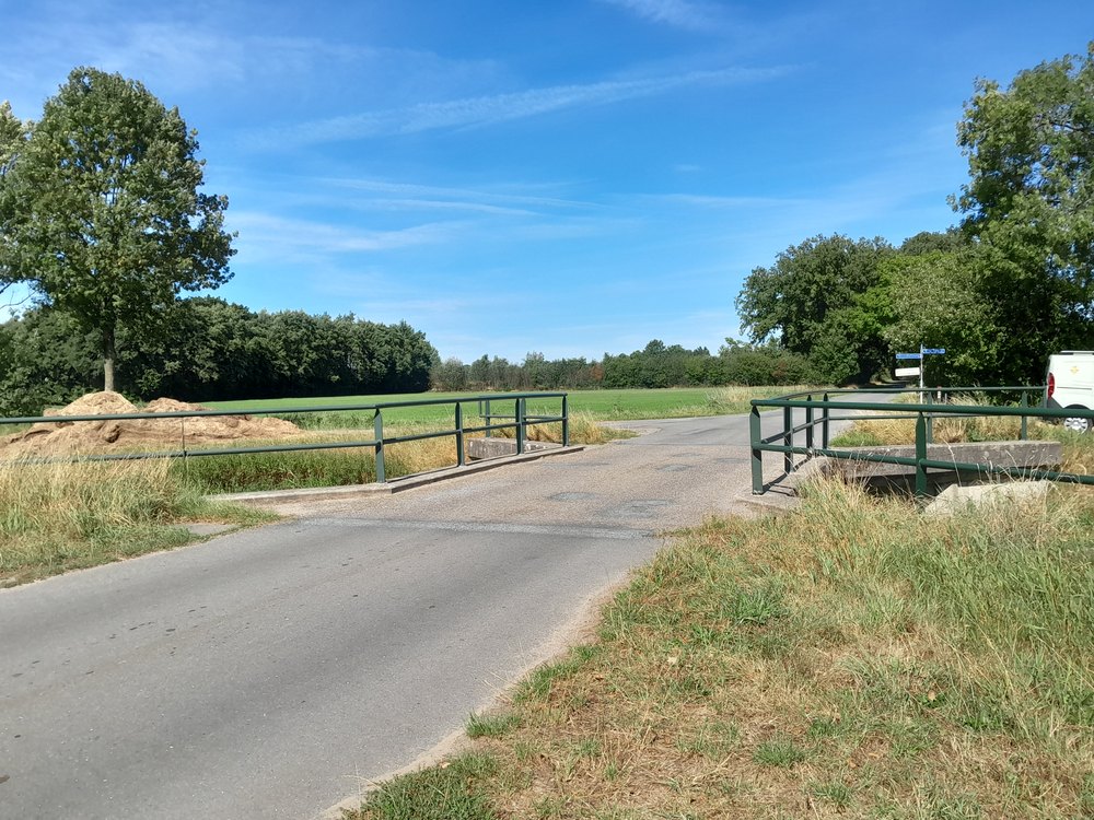
    Aalten, Bredevoort and the surrounding buurtschappen have various bridges, including a large number of spans over streams, several railway bridges and two viaducts. Some of these bridges have a name. The tables below show, among others, the bridges over the Slingebeek and the Keizersbeek, arranged from (north)east to (south)west. This overview is not yet complete; additions are therefore very welcome.

    Photos: G. Schreurs, Google Streetview, Meerdink Bruggen, R. Neerhof.

    Slingebeek

    Object (name)Year of constructionLocationCoordinatesImage
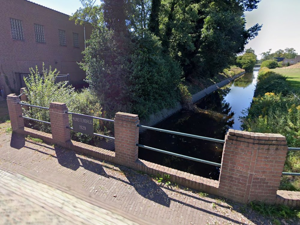
    Munsterbrug1929Landstraat/Misterstraat51°56’31.0″N,
    6°37’07.4″E
    Munsterbrug - Misterstraat, Bredevoort
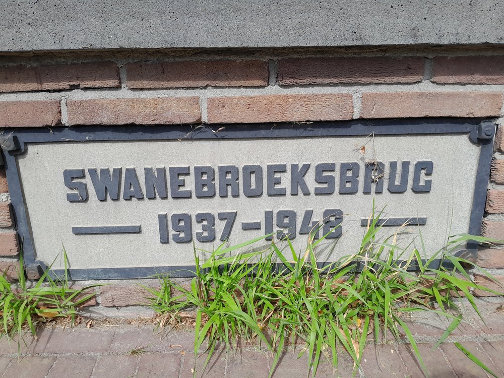
    Swanebroeksbrug1937-1948Winterswijksestraat51°56’24.8″N,
    6°36’58.2″E
    Swanebroeksbrug - Winterswijksestraat, Bredevoort
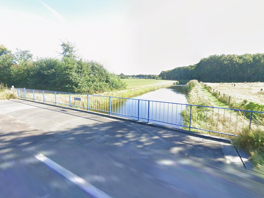
    SlingebrugHamelandroute51°55’41.4″N,
    6°36’02.1″E
    Slingebrug - Hamelandroute, Aalten
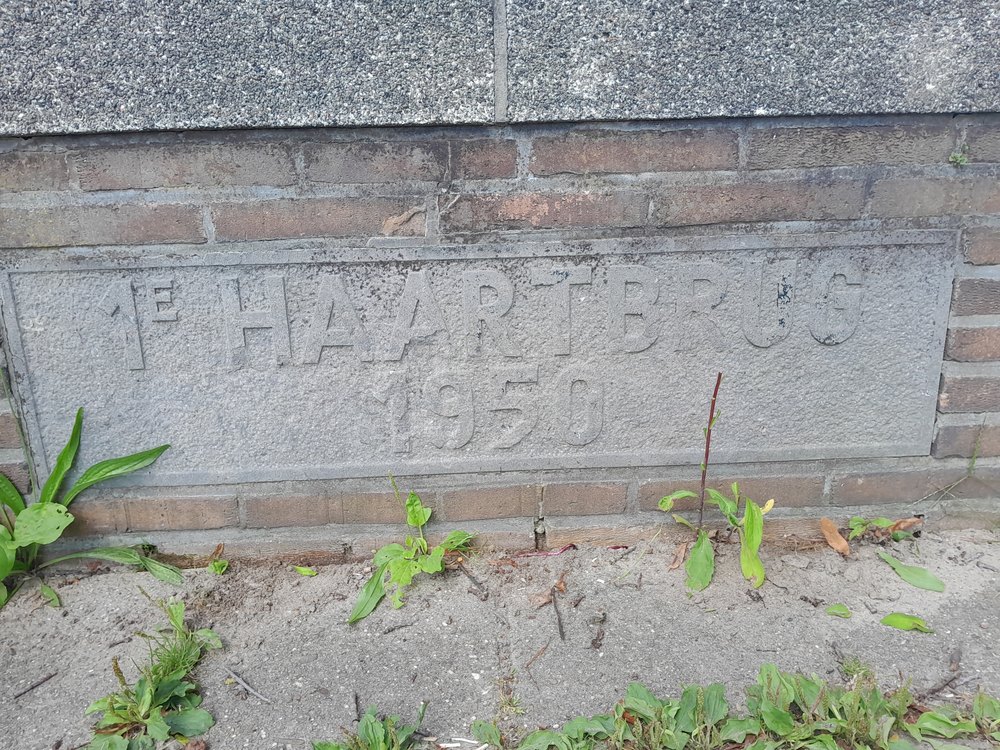
    1e Haartbrug1950Haartsestraat51°55’35.9″N,
    6°35’19.8″E
    1e Haartbrug - Haartsestraat, Aalten
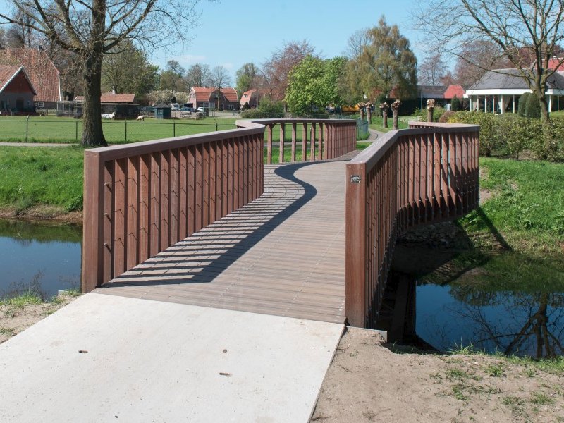
    Balkonbrug2015Ahavestraat51°55’33.8″N,
    6°35’18.1″E
    Balkonbrug - Ahavestraat, Aalten
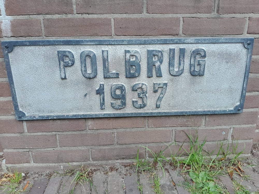
    Polbrug1937Polstraat51°55’30.5″N,
    6°35’10.9″E
    Polbrug - Polstraat, Aalten
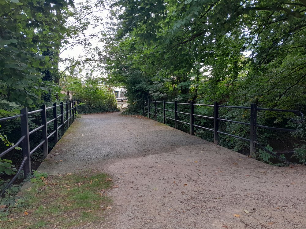
    Bonifaciusstraat/
    Hofstraat
    51°55’30.2″N,
    6°35’06.6″E
    Brug over Slingebeek achter Openbare School, Aalten
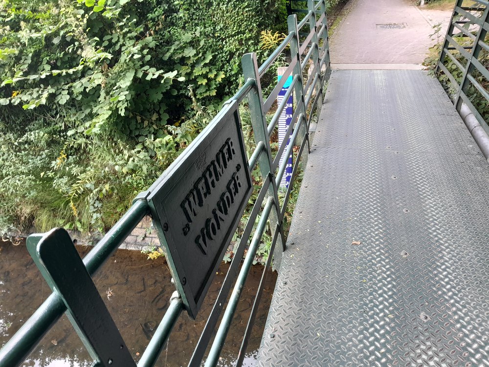
    Wehmervonder1931Wehmerpad51°55’29.9″N,
    6°34’59.5″E
    Whemervonder - Wehmerpad, Aalten
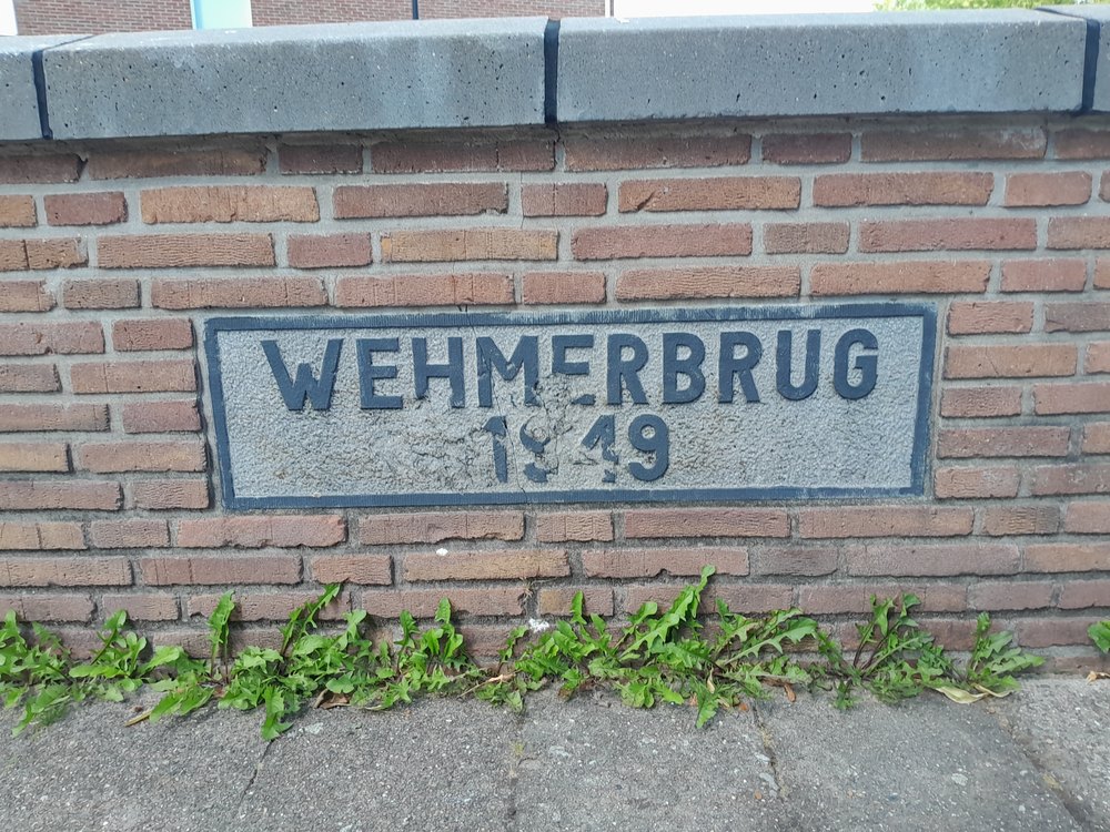
    Wehmerbrug1949Wehmerstraat51°55’30.7″N,
    6°34’52.9″E
    Wehmerbrug - Wehmerstraat, Aalten
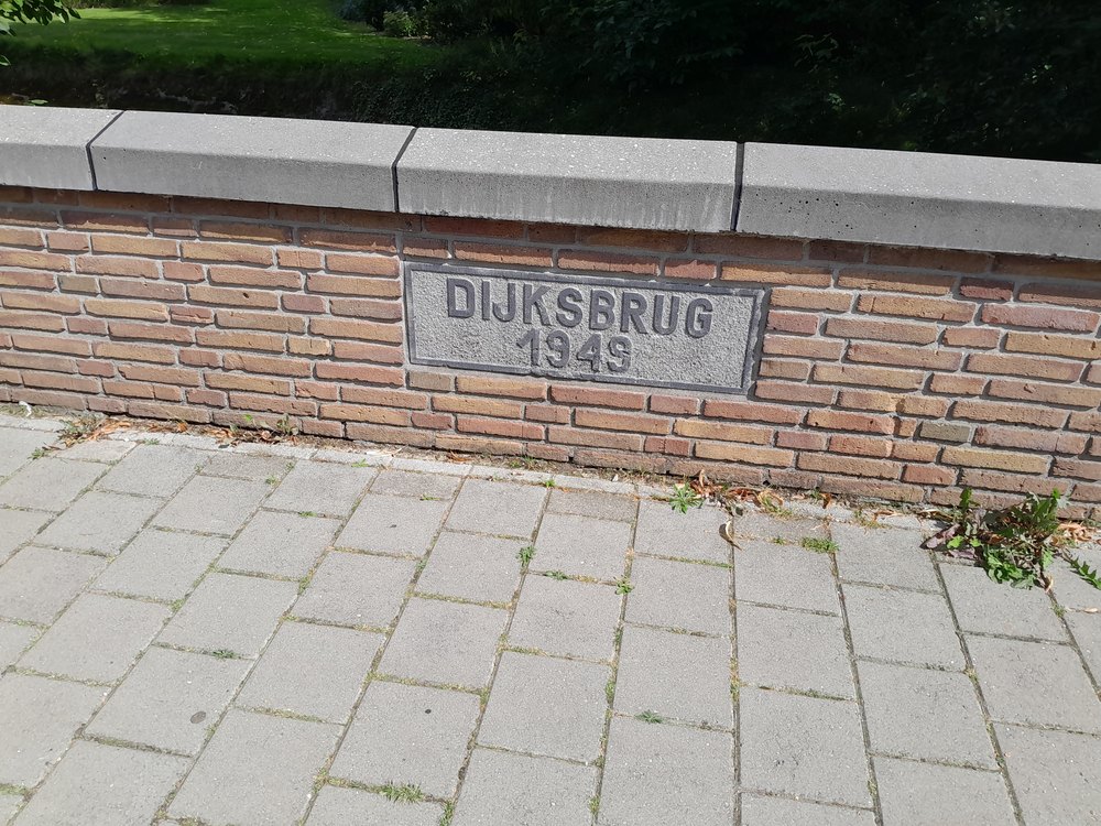
    Dijksbrug1949Dijkstraat51°55’27.1″N,
    6°34’50.7″E
    Dijksbrug - Dijkstraat, Aalten
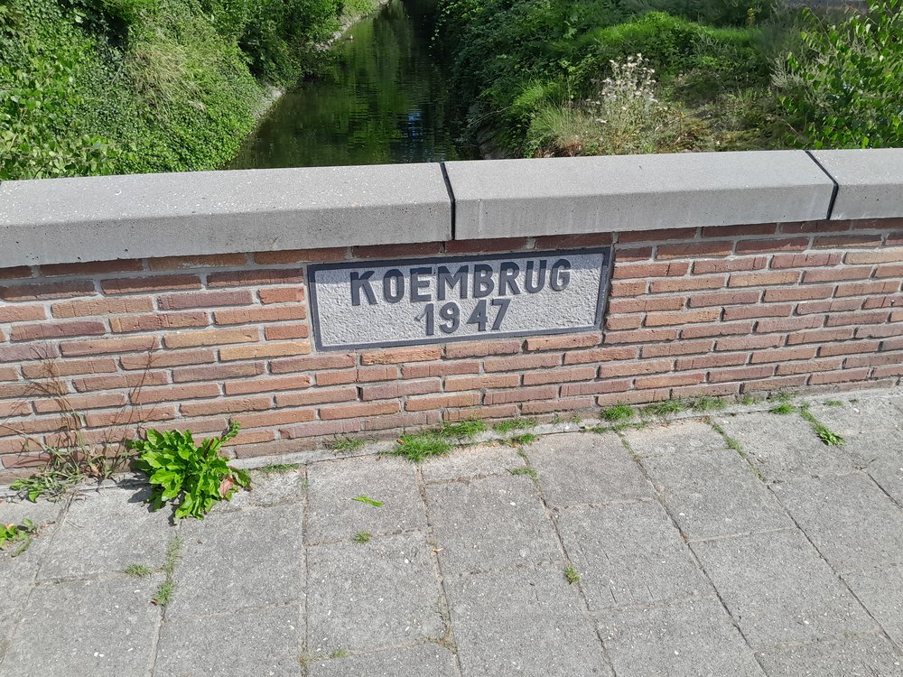
    Koembrug1947Stationsstraat51°55’28.0″N,
    6°34’45.2″E
    Koembrug - Stationsstraat, Aalten
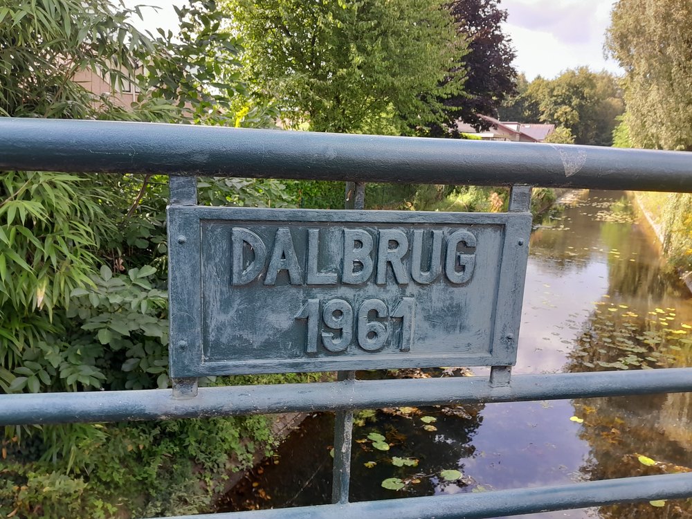
    Dalbrug1961Van Heemskerckstraat51°55’28.8″N,
    6°34’27.3″E
    Dalbrug - Beeklaan, Aalten
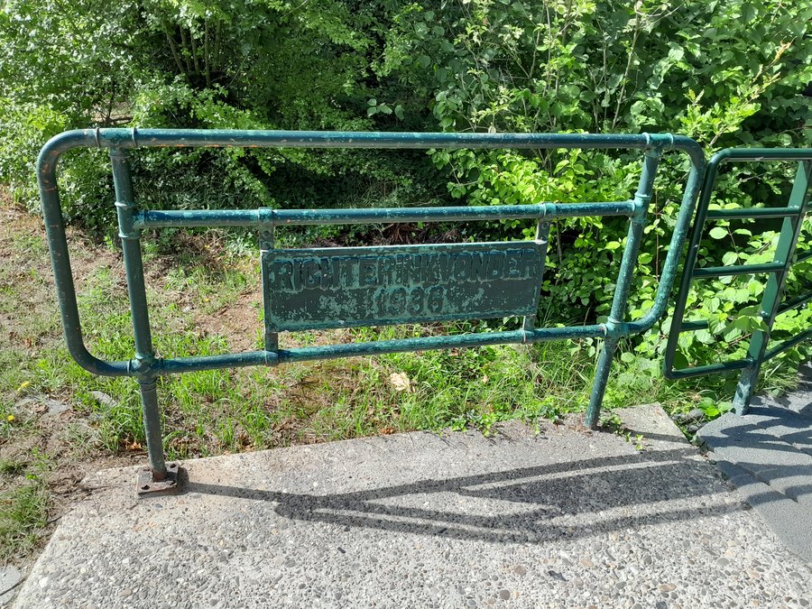
    Richterinkvonder1936Slingelaan51°55’34.1″N,
    6°34’18.9″E
    Richterinkvonder - Slingelaan, Aalten
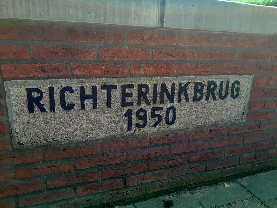
    Richterinkbrug1950Richterinkstraat51°55’37.7″N,
    6°34’16.6″E
    Richterinkbrug - Richterinkstraat, Aalten
    GrevinkbrugVarsseveldsestraatweg51°55’47.4″N,
    6°34’12.0″E
    Grevinkbrug - Ringweg, Aalten
    Aladnaweg51°55’50.4″N,
    6°33’37.3″E
    Brug over Slingebeek - Aladnaweg, Dale
    BleekbrugSlatdijk51°55’54.9″N,
    6°33’11.6″E
    Bleekbrug - Slatdijk, Dale
    PakkebierbrugPakkebierweg51°56’08.6″N,
    6°32’23.1″E
    Pakkebierbrug - Pakkebierweg, Lintelo
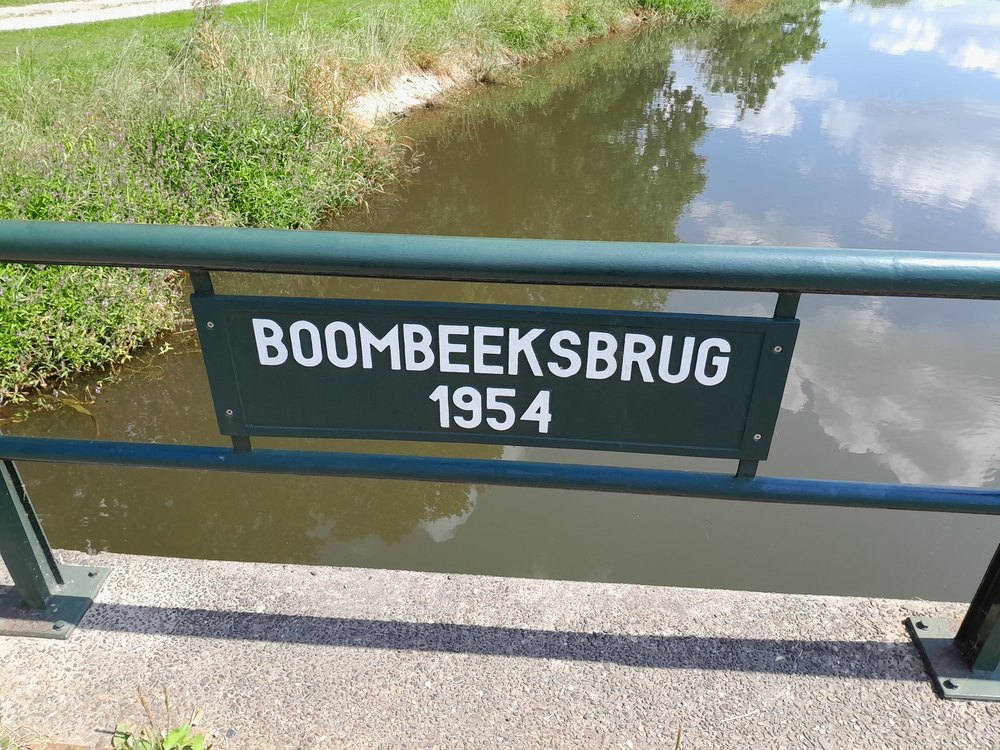
    Boombeeksbrug1954Vellegendijk/Boterdijk51°56’17.1″N,
    6°32’10.8″E
    Boombeeksbrug - Vellegendijk, Lintelo
    BeunkbrugBeunkdijk51°56’31.8″N,
    6°31’20.5″E
    Beunkbrug - Beunkdijk, Lintelo

    Keizersbeek

    Object (name)Year of constructionLocationCoordinatesImage
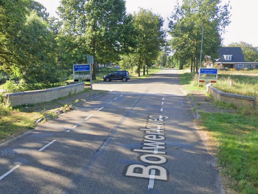
    SchaarsbrugBolwerkweg51°56’41.0″N,
    6°36’52.5″E
    Schaarsbrug - Bolwerkweg, Bredevoort
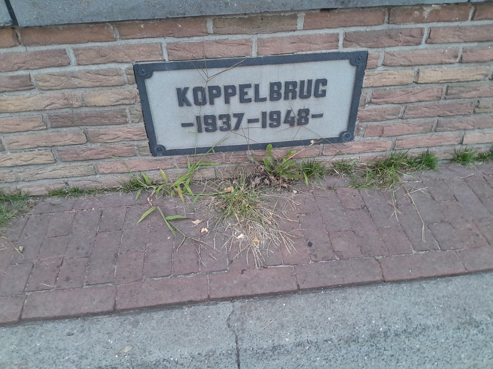
    Koppelbrug1937-1948Winterswijksestraat51°56’24.7″N,
    6°36’46.7″E
    Koppelbrug - Winterswijksestraat, Bredevoort
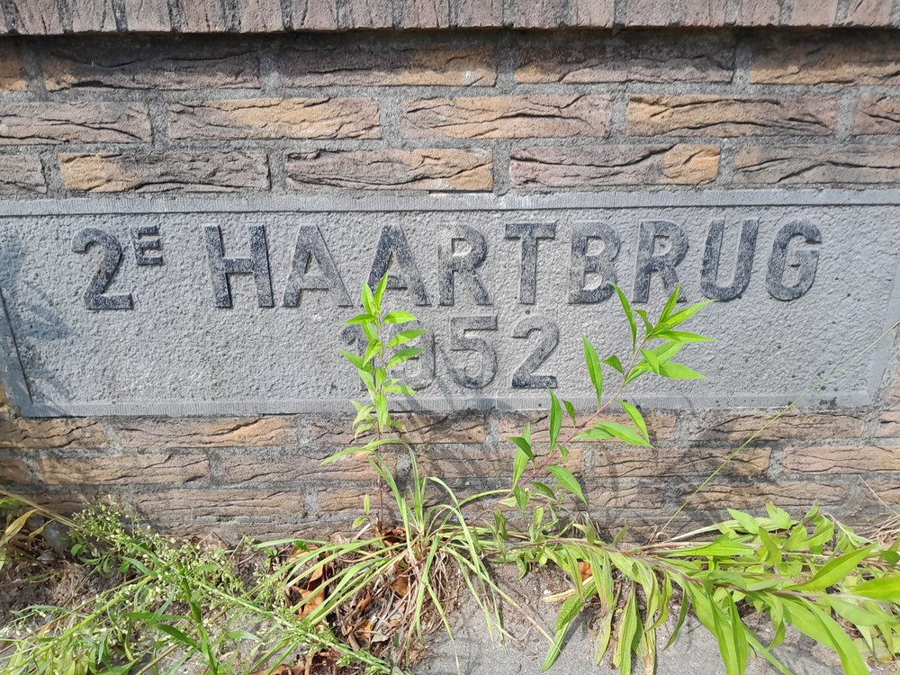
    2e Haartbrug1952Haartseweg51°55’32.6″N,
    6°36’10.4″E
    2e Haartbrug - Haartsestraat, Aalten
    Molenkampsdijk51°55’24.4″N,
    6°35’42.1″E
    Brug Keizersbeek - Molenkampsdijk, Aalten
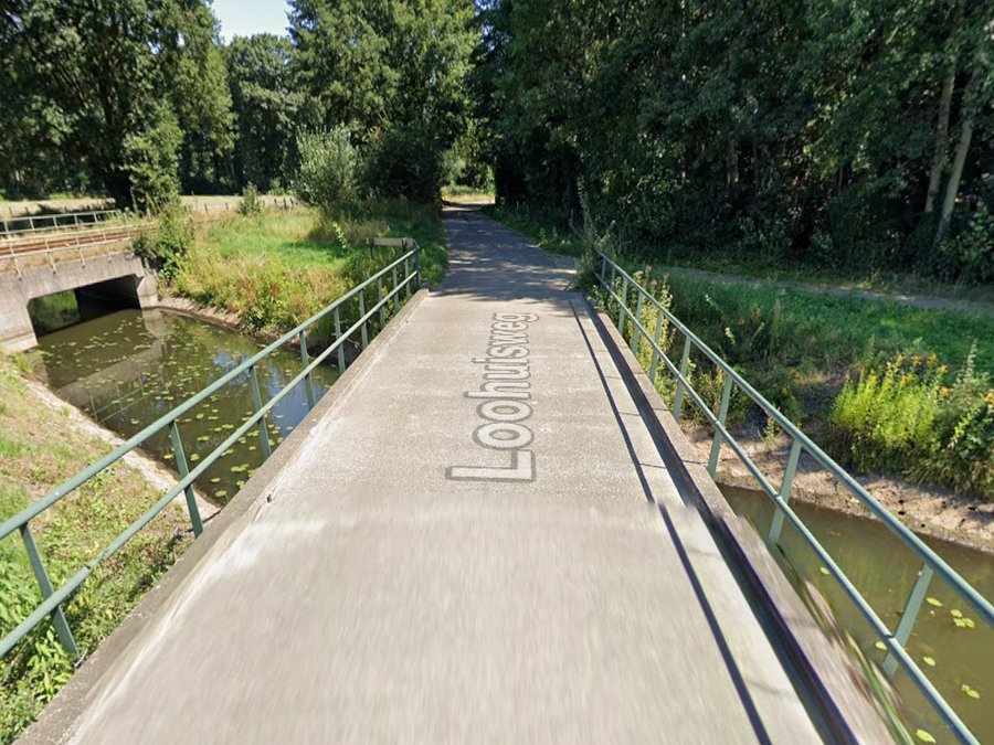
    Loohuisweg51°55’19.5″N,
    6°35’41.2″E
    Brug Keizersbeek - Loohuisweg, Aalten
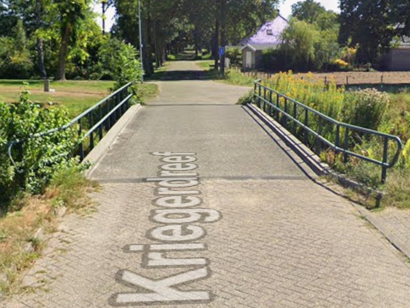
    Kriegerdreef51°55’14.6″N,
    6°35’38.9″E
    Brug Keizersbeek - Kriegerdreef, Aalten
    Slaadreef51°55’11.1″N,
    6°35’35.6″E
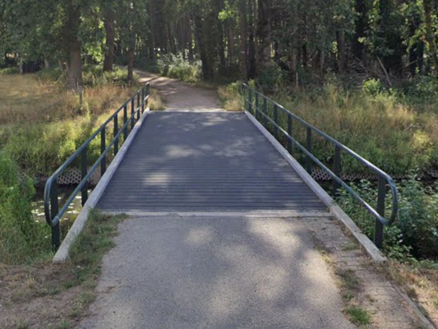
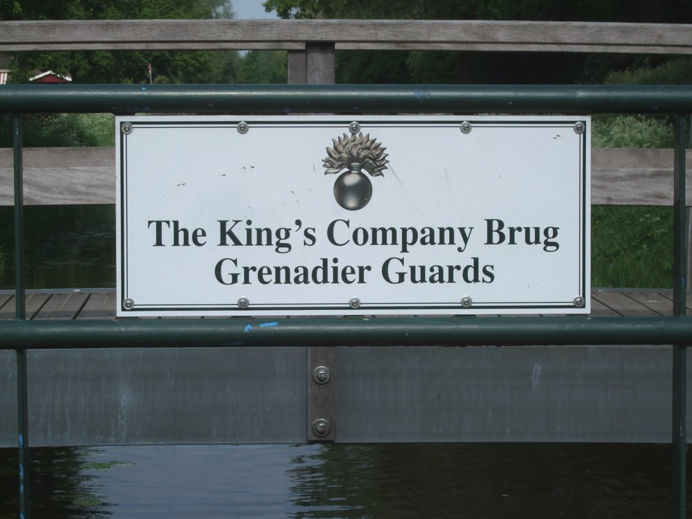
    King’s Company BridgeBodendijk51°54’59.2″N,
    6°35’07.2″E
    King's Company Bridge - Bodendijk, Aalten
    Hoge BrugBocholtsestraatweg51°54’53.7″N,
    6°34’53.2″E
    Hoge Brug - Bocholtsestraatweg, Aalten
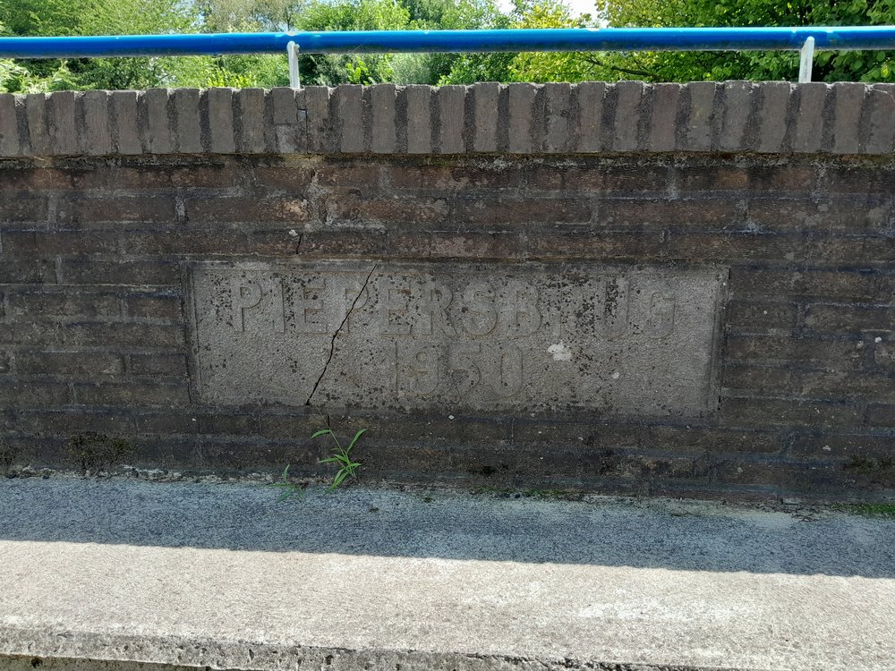
    Piepersbrug1950Dinxperlosestraatweg51°54’45.6″N,
    6°34’28.2″E
    Piepersbrug - Bocholtsestraatweg, Aalten
    Roelendijk51°54’34.5″N,
    6°33’32.4″E
    Roelendijk, Lintelo
    (Mr.) Weversbrug Veldweg51°54’28.2″N,
    6°33’10.8″E
    Weversbrug - Veldweg, Lintelo
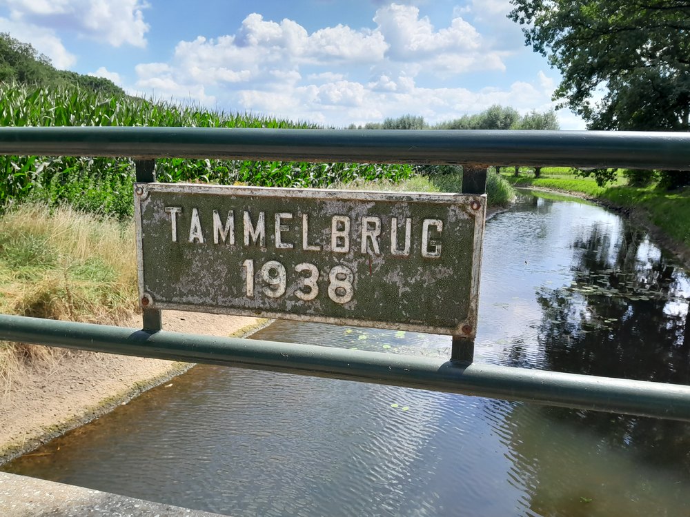
    Tammelbrug1938Tammeldijk51°54’25.1″N,
    6°31’58.9″E
    Tammelbrug - Tammeldijk, Lintelo
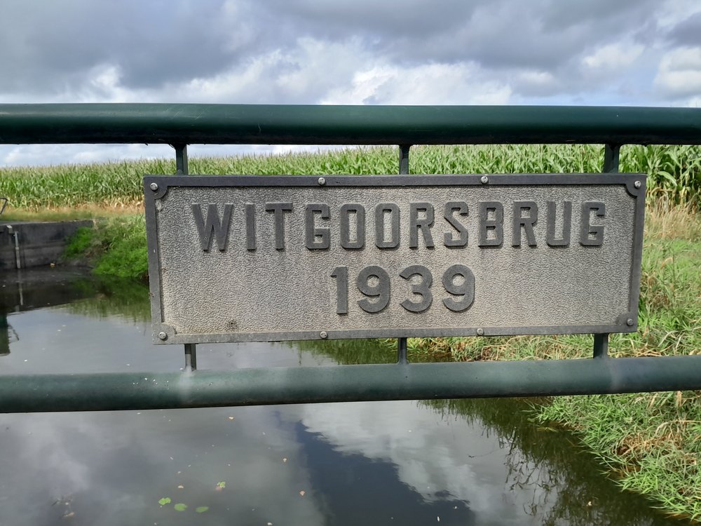
    Witgoorsbrug1939Sondernweg51°54’41.7″N,
    6°31’49.8″E
    Witgoorsbrug - Sondernweg, Lintelo
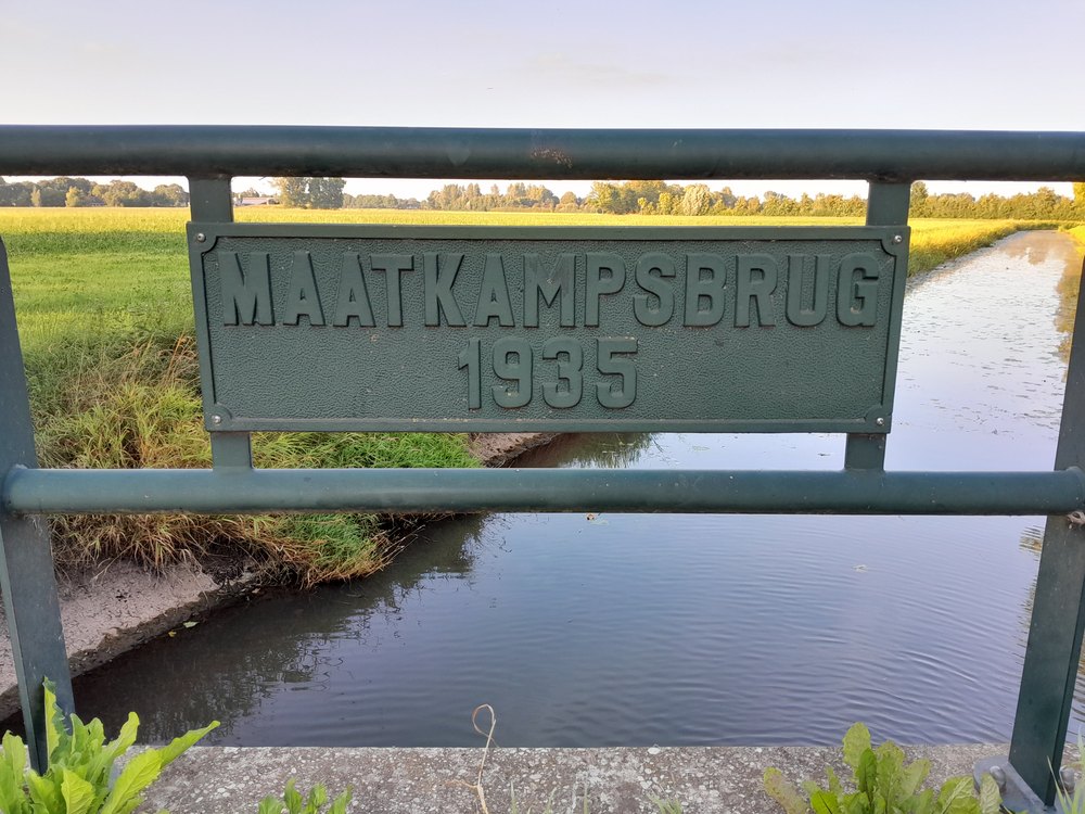
    Maatkampsbrug1935Brakenweg51°54’42.2″N,
    6°31’08.6″E
    Maatkampsbrug - Brakenweg, Lintelo
    VeenbrugVeenweg51°54’31.3″N,
    6°30’18.6″E
    Veenbrug - Veenweg, Lintelo
    VriezenbrugDe Heurnseweg51°54’15.7″N,
    6°29’15.3″E
    Vriezenbrug - De Heurnseweg, Lintelo

    Other bridges

    Object (name)Year of constructionLocationCoordinatesImage
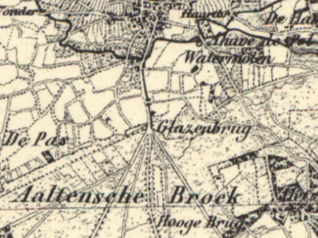
    Glazenbrugunknown
    (no longer extant)
    Dijkstraat/
    Plein Zuid
    51°55’17.1″N,
    6°34’51.9″E
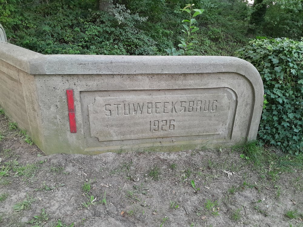
    Stuwbeeksbrug1926Stationsweg/
    Buninkdijk
    51°55’49.3″N,
    6°37’24.4″E
    Stuwbeeksbrug - Buninkdijk, Haart

    Glazenbrug

    More than a century ago, a ditch ran parallel to the east side of the Dijkstraat from or to the Aaltense Broek. Near the current level crossing at Plein Zuid, there was a bridge called the “Glazenbrug”. The ditch was still there in the 1960s. There were several small bridges up to the Hoge Brug in the Bocholtsestraatweg.

    If you have more information about this bridge, we would be pleased to hear from you.

  • Interactive route ‘Dwars door Barlo’ brings wartime stories to life

    Interactive route ‘Dwars door Barlo’ brings wartime stories to life

    A 19-kilometre journey past eleven historical locations

    Dwars door Barlo
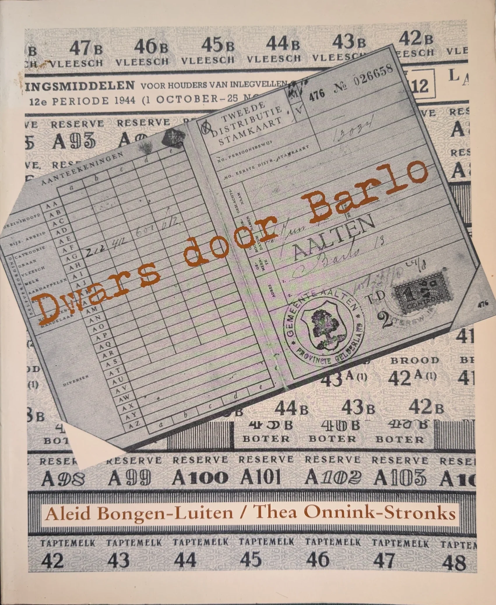
    Book cover ‘Dwars door Barlo’, 1995

    What was daily life like in Barlo during the war years? To keep the memories of this poignant time alive, the ‘Dwars door Barlo’ (National Museum of Hiding and Resistance) committee has launched a special interactive route. Using QR codes, walkers, cyclists, and motorists can listen to and watch stories from World War II at various locations via their smartphones.

    The foundations of this project were laid back in 1994. To safeguard the memories of the war years in Barlo for the future, the former ‘Dwars Door Barlo’ (National Museum of Hiding and Resistance) foundation interviewed numerous local residents. These conversations, recorded on over seventy cassette tapes, provided the source material for the book ‘Dwars door Barlo’ (1995) at the time.

    More than thirty years later, these stories have been brought to life once again. Not just on paper, but in the heart of the landscape where these events actually took place.

    The route

    The foundation has compiled a unique route that leads past the locations described so extensively in the book. The route is 19 kilometres long in total and passes eleven historical sites in Barlo. The journey can be completed on foot, by bicycle, or by car. The start and end points are located at pancake restaurant De Neeth (Neethweg 6).

    How does it work?

    Green posts with a number and a name are situated along the route. Each post features a QR code. By scanning this code with a smartphone, the story of that specific location appears instantly on the screen. There is also an audio button to have the story read aloud, allowing everyone to listen to the events of the past on-site.

    Navigation is straightforward: a link to Google Maps is provided below each story to guide the visitor to the next point.

    View from home

    Those who prefer to view the route at home first or wish to listen to the stories beforehand can visit the website:

  • The rat-catcher of Aalten

    The rat-catcher of Aalten

    On July 19, 1963, the Tubantia newspaper reported:

    Brown rat
    Brown rat, photo for illustrative purposes

    “Today, Mr. S. Douma officially retires from the public works department in Aalten. Thus far, Mr. Douma has been unwilling to be ‘persuaded’ to appear at the customary farewell gathering of the staff association. Out of modesty. With Mr. Douma, one of the most striking figures of the street scene is disappearing. He is particularly well-liked by the farming community. It was he, after all, who served the municipality of Aalten in the profession of rat-catcher.

    However, this departure does not mean that the Aalten rats now have free rein. On the contrary, Mr. Douma is leaving everything behind except for the rats. For the time being, he will continue to handle this part of his duties at the request of the municipality. The hunt will likely become even more intensive, as the time is now available for it. The ‘rat-catcher’, who was in municipal service for over 30 years, has handled 1,172 pest control cases since the rat hunt began. How many rats he has killed is difficult to estimate, but it is certain that there are thousands. Mr. Douma hopes to add many more to that number.”

    On Thursday, October 22, 1964, Douma, ‘the retired rat-catcher from Aalten’, was a guest on the NCRV radio program ‘Samen uit samen thuis’.

    If you have more information or photos to supplement this article, please respond below or send us a message.

    Sources


    • Dagblad Tubantia, 19 July 1963 (Delpher)
    • De Nieuwe Limburger, 19 October 1964 (Delpher)
  • The Thomson-van Hopbergen family

    The Thomson-van Hopbergen family

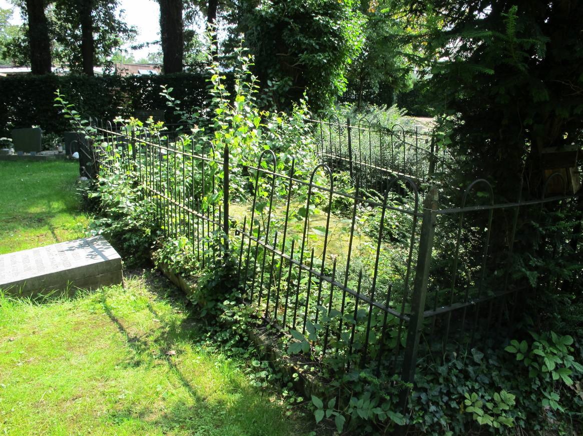
    The family grave of the Thomson-van Hopbergen family is located at the General Cemetery on the Prins Mauritsstraat in Bredevoort. Although the tombstone has been marked by erosion, the monument is a reminder of a family that played a prominent role in Dutch military history, national politics and literature.

    The legacy of the Scottish Brigade

    The family’s roots lie in the Scottish Brigade, a unit of British soldiers hired by the United Provinces in the 17th and 18th centuries. After their military service, many of them settled permanently in the Netherlands, including James Thomson. He was married to Mary Rinck; their children were baptized in Tournai and Breda at the beginning of the 18th century. The military tradition in the family continued into the 20th century.

    Location in Bredevoort

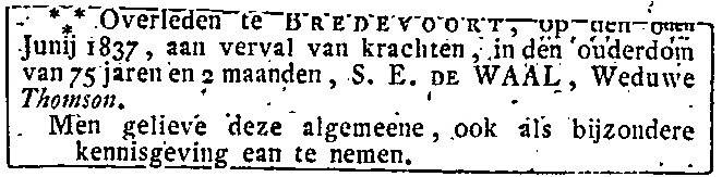
    The bond with Bredevoort arose in the early nineteenth century through a grandson of the ancestor, also named James . This retired captain, born in 1759 in Nijmegen, lived there on the Prinsenstraat with his wife Susanna Elisabeth de Waal. James died in 1828 and Susanna in 1837. The house with its contents was valued at ƒ 3,805,-.

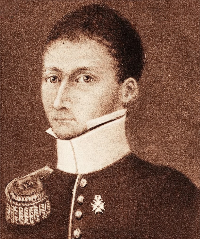
    Their son, Jan Jacob Thomson (1784–1858), born in Maastricht and living with his family in Fort Crèvecoeur near ‘s-Hertogenbosch, was the sole heir. Jan Jacob was a lieutenant colonel and had made a career during the Napoleonic Wars. For his efforts during the Battle of Waterloo in 1815, in which he was wounded, he was made a knight in the Military Order of William.

    In 1837 Jan Jacob entered into a second marriage with the 26 years younger Louiza Wilhelmina van Hopbergen (1810–1906) from Bredevoort. She was a daughter of the retired lieutenant Diederik Christoffel Hendricus van Hopbergen, also living on the Prinsenstraat. The family settled in Bredevoort.

    Jan Jacob Thomson died on 11 October 1858 and was buried in the family grave in Bredevoort. Louise also found her final resting place there.

    Louise’s brother Jacobus Wilhelmus van Hopbergen was also a lieutenant colonel and lived at Markt 18 in Aalten after his retirement.

    Offspring and social functions

    Several family members born in Bredevoort held social functions:

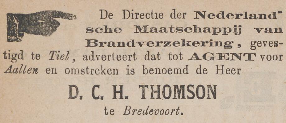
    Diderik Christoffer Hendrikus Thomson (1840–1891) became a letter collector (holder of the local post office) in Bredevoort and will also have been buried in the family grave.

    His son Jan Jacob Thomson (1882–1961) gained fame as a ‘poet-minister’. He was a pastor at the Dutch Protestant Union in Varsseveld and left behind an extensive oeuvre of poetry collections and literary-historical studies. After a turbulent and poetic life, he died in Baarn in 1961 and was buried there.

    Jacque Willem Lodewijk Thomson (1846–1914) was mayor of the municipality of Appeltern from 1877 until his death.

    Louis Thomson: Soldier and statesman

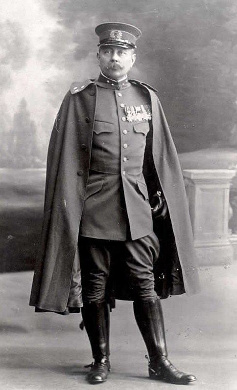
    One of the most striking descendants of the family is Lodewijk Willem Johan Karel Thomson (1869–1914), a grandson of Lieutenant Colonel Jan Jacob. Lodewijk was a military cartographer, was sent to Batavia and Aceh, was a military attaché during the Boer War in South Africa and a member of the House of Representatives.

    In 1914 he was sent to Albania, where he was killed in action in Durrës on 15 June 1914. Thomson was the first Dutch soldier to die during a peacekeeping mission. He was buried in Groningen.

    Heritage in decline

    Today, the funerary monument on the Prins Mauritsstraat is in a state of disrepair. Due to erosion and overdue maintenance, the inscriptions on the stone are becoming increasingly difficult to read. However, the grave is a monument to the connection of small Bredevoort with the great world history.

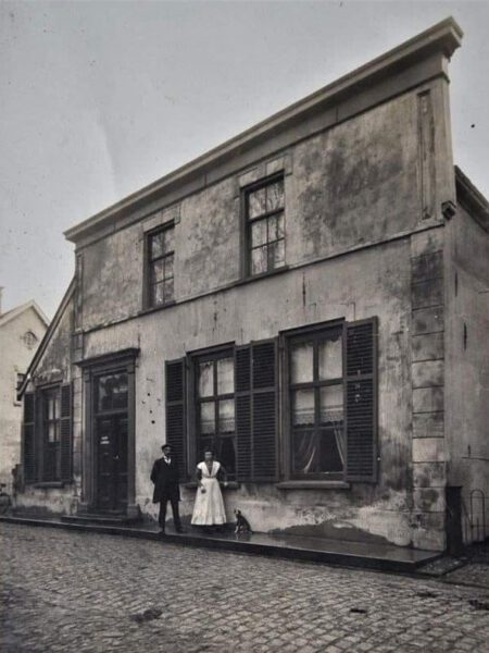
    Post Office Bredevoort, 1918, with Hendrik Christiaan den Hartogh and Antonia Theodora Krosenbrink
    Post office Bredevoort, 1918

    Sources


  • Discobar Fly-In

    Discobar Fly-In

    Barlo (1969-1974)

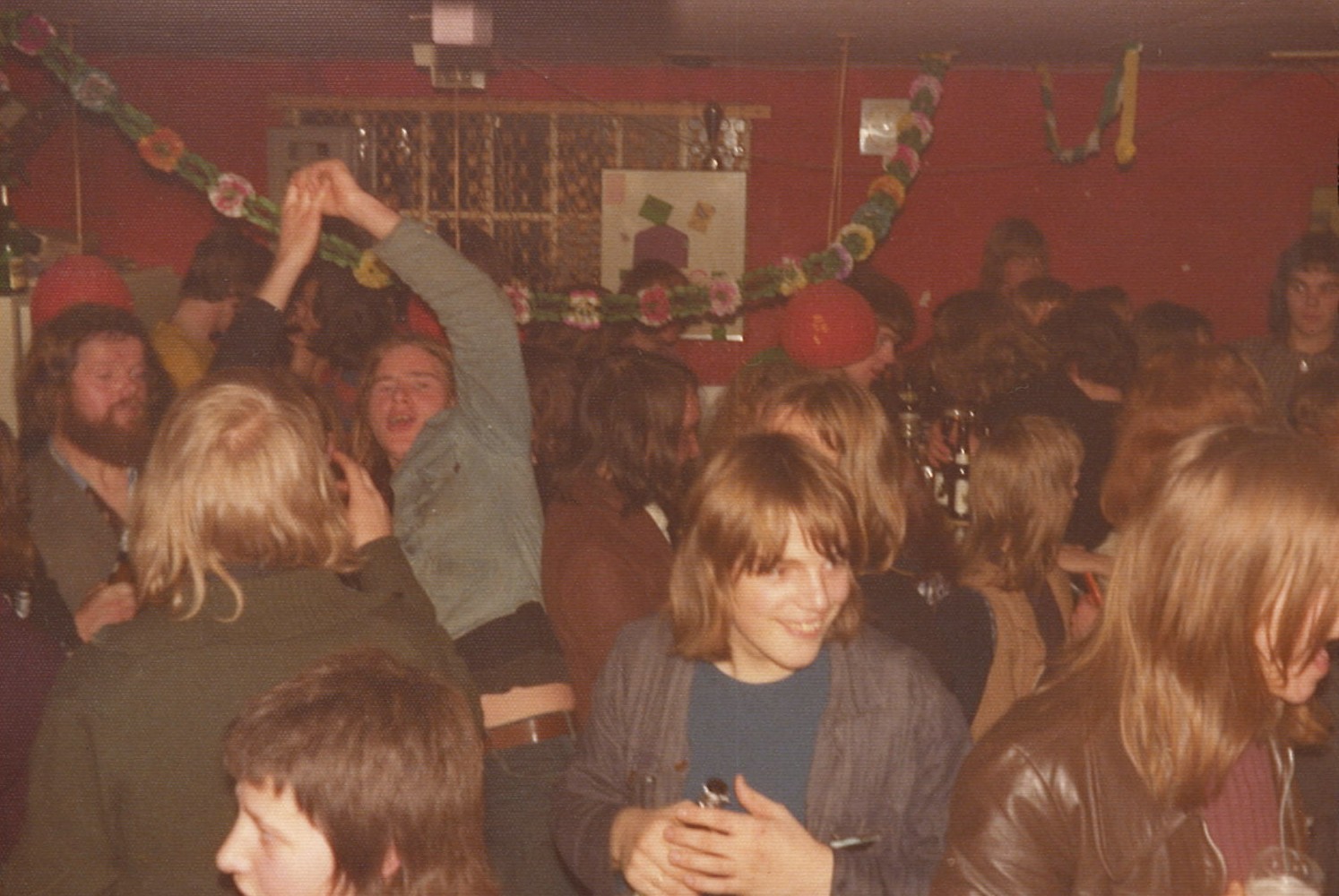
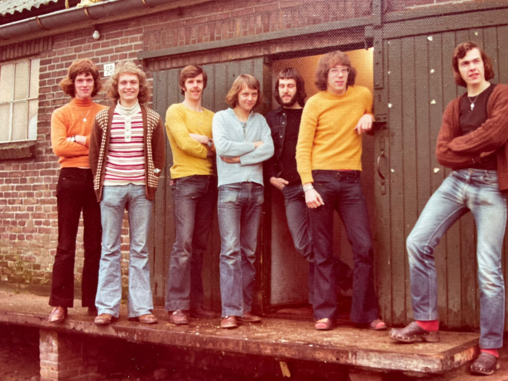
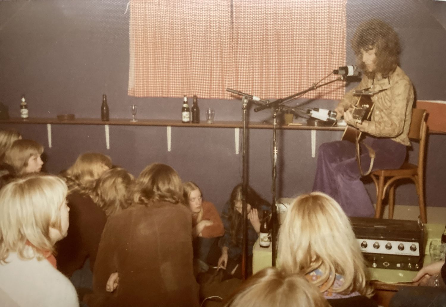
    Discobar Fly-In in Barlo opened in 1969 in a vacant chicken coop on Barloseweg. The discobar was run by a group of young volunteers and quickly grew into a popular nightlife venue. In 1972, a new location was put into use. Many musicians and bands performed there, and music events were organized. At the end of 1974, Fly-In ceased to exist and continued as De Loods.

    The origins of Fly-In lie in 1968, when various parties were held in Barlo. For these parties, part of a barn or farmhouse was partitioned off with black agricultural plastic and furnished with a record player, amplifier, and colored lights. Because this had to be reinstalled at a different location every time, a number of young people came up with the idea for a permanent venue.

    First accommodation was a chicken coop

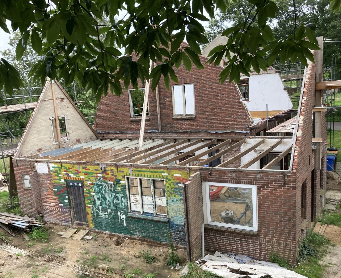
    The first location of Fly-In was a vacant chicken coop behind Derk Ebbers’ grocery store on Barloseweg. After cleaning and pouring a concrete floor, discobar Fly-In opened on December 13, 1969. The words ‘Fly In’ were painted in large letters on an interior wall. During a renovation of the building in 2024, it turned out that these letters were still on the wall.

    The original idea to use the space occasionally was quickly replaced by the plan to open every two weeks on Saturday. The evenings at Fly-In were concluded at 11:30 PM with a fixed closing tune — initially Comin’ Home Baby by Casey & the Pressure Group, later Time Is Tight by Booker T. & the MG’s.

    Problems and drive-in shows

    It soon became clear that the accommodation was not ideal: the space was too small (approximately 25 m²) and the furnishings were very simple; there was no cloakroom and no private toilet. Girls were allowed to use ‘Uncle Derk’s’ private toilet, while the boys could pick out a tree outside.

    If a group of young people were still chatting on the road after the disco evening, Uncle Derk would come outside and shout: “staot neet op de weg te dralliën, maor gaot naor huus!” (don’t loiter on the road, go home!). After about a year, Fly-In stopped at this location and continued by providing drive-in shows in the wider area.

    Fly-In Board, Barlo
    Fly-In board in front of the former warehouse

    New location

    After about a year, a new location was found in the vacant warehouse of the machinery association on Lichtenvoordsestraatweg in Barlo, directly opposite café Domme Aanleg. The former agricultural warehouse was renovated with a bar, a turntable, a cloakroom, and a toilet. Benches and tables were made from oak planks.

    The official opening took place on Saturday, March 11, 1972. From that moment on, Fly-In was open on Wednesdays, Fridays, and Saturdays for members (membership card at ƒ 2.50).

    Renovation and celebration

    Due to the great interest, a renovation followed in the summer of 1972, during which the floor area was almost doubled. In 1974, the cloakroom was enlarged and extra toilets were installed.

    On Saturday, December 15, 1972, the renovation was celebrated with over 800 guests in the Community Hall in Aalten with Earth & Fire, Mr. Albert Show, and Alquin. During the breaks, films were shown and records were played. The admission price was ƒ 6.50.

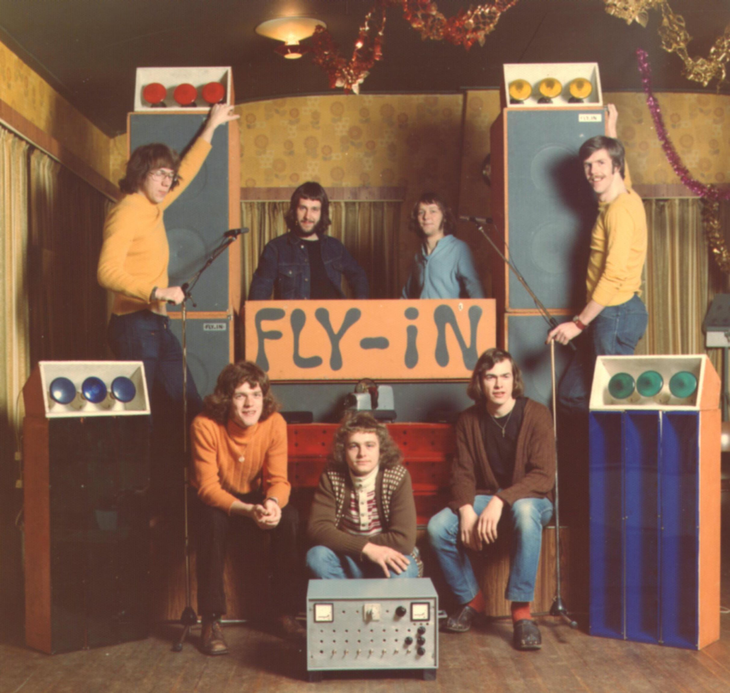
    Board of the Fly-In Barlo Foundation, 1973
    Board of the Fly-In Barlo Foundation, 1973

    Fly-In Foundation

    To prevent being held personally liable for any damages, the board decided in 1973 to establish a foundation.

    After at least four board members had reached the age of majority (21 at the time), the ‘Fly-In Foundation’ was established at notary Obbink in Aalten. The foundation had a starting capital of one hundred guilders and aimed to organize and provide cultural and creative activities.

    Performances and film screenings

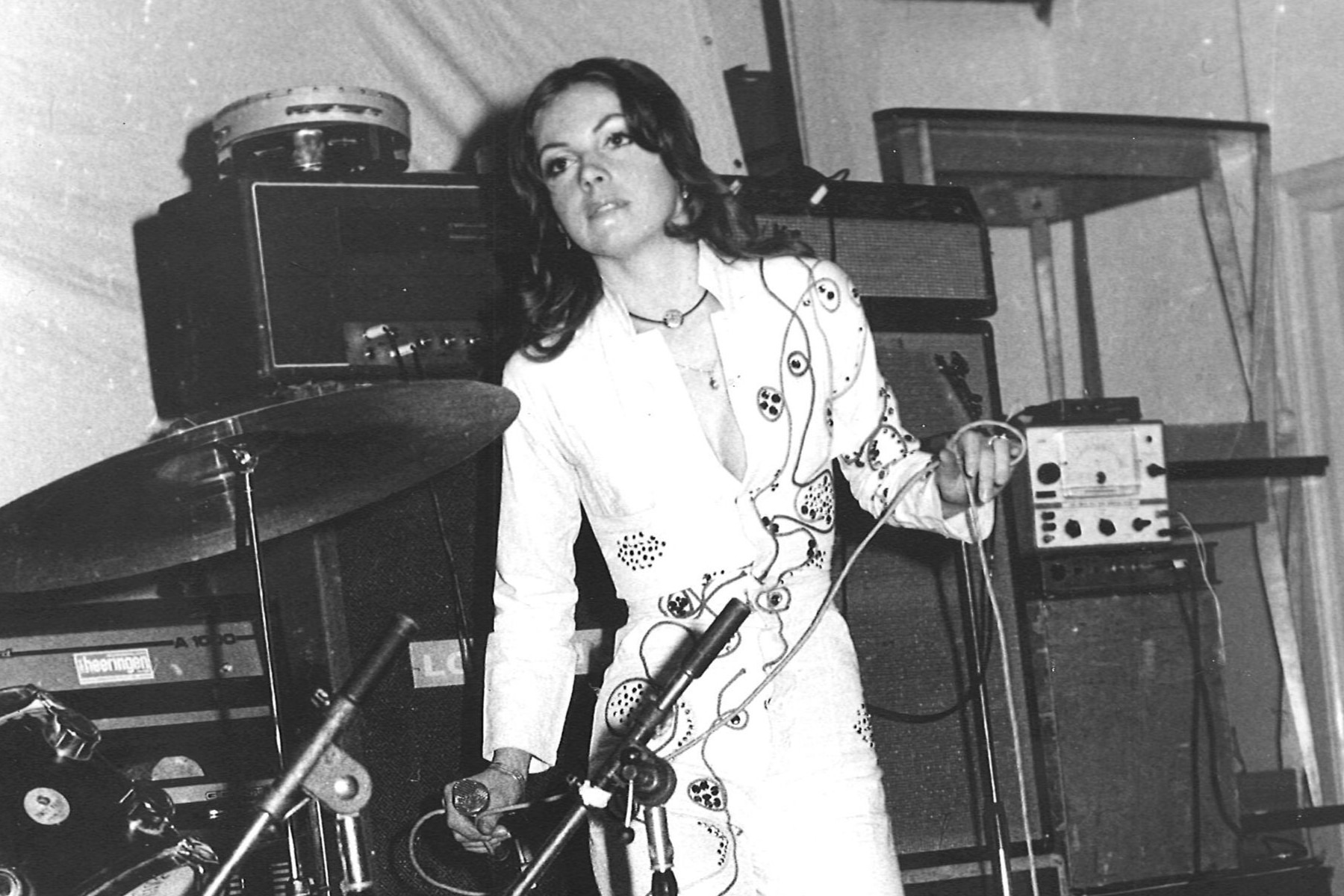
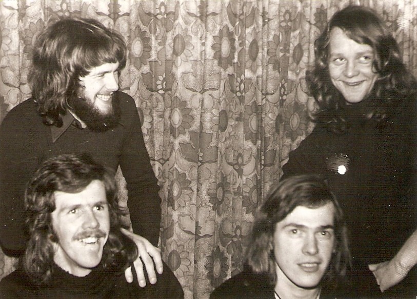
    During Fly-In’s existence, many performances took place by bands and artists, including Kaz Lux, Kraayeveld, Tom Haket, Dimitri van Toren (Hé kom aan), Armand (Ben ik te min), and Shepstone & Dibbens.

    Concerts were also regularly organized in the Community Hall, featuring performances by the Bintangs, Chicory Tip, Dizzy Man’s Band, Earth & Fire, Long Tall Ernie, Mayfly, Plastic Feet, Q65, and Solar Plexus, among others.

    Paaspop 1974

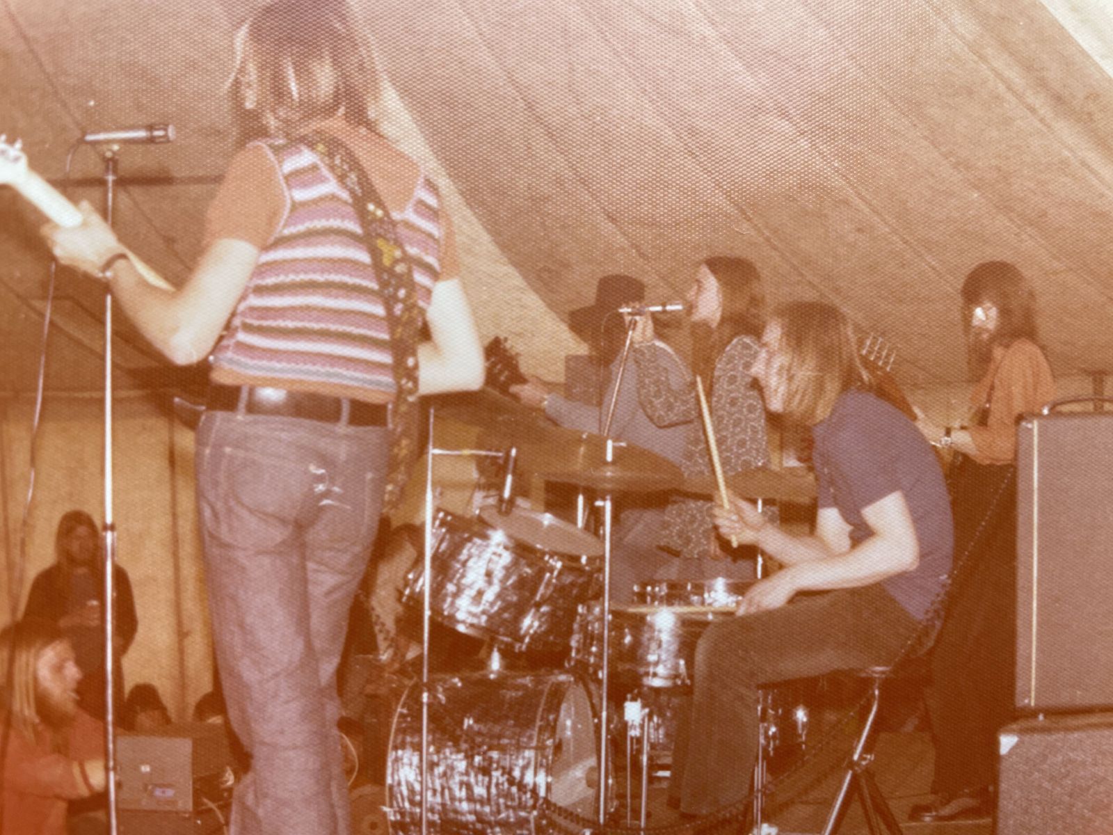
    On April 15, 1974 (Easter Monday), Fly-In organized a festival under the name Paaspop. It took place in a festival tent on the grounds of AD’69 on Bocholtsestraatweg. The program included performances by Puddingh, Hobo String Band, Livin’ Blues, Kayak, Bronco, and Shakin’ Stevens & the Sunsets.

    Two stages were built in the festival tent so that the bands could alternate, but due to trouble with Livin’ Blues’ van, this did not go entirely smoothly. Approximately 1,500 visitors attended the festival.

    Closing party and poem

    The closing party of Fly-In took place on December 13, 1974. The discobar would continue under the name De Loods.

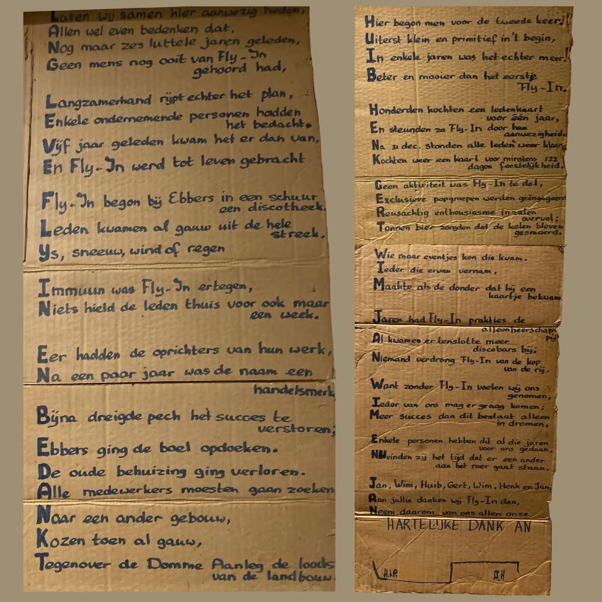
    At the closing party, the board was presented with a poem on a large piece of cardboard — an acrostic of 48 lines, of which the first letters together formed the following sentence:

    “Long live Fly-In and thanks Huib, Henk, Gert, Wim, Jan, Wim and Jan.”

    The poem is signed with the initials H.t.P. and B.H., but to date, it has not been possible to find out who these unknown poets were. If you happen to know, please respond at the bottom of this page!

    Source


    • ‘FLY-IN’ 1969-1974: The FLY-IN archive, Wim Simmelink
  • TB Reclining Pavilions in Bredevoort

    TB Reclining Pavilions in Bredevoort

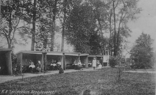
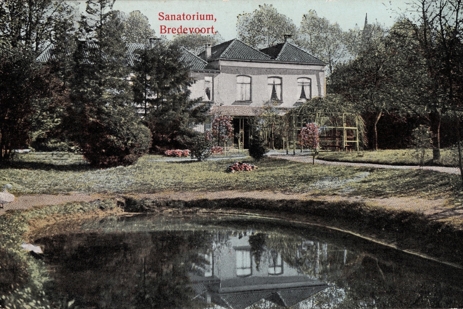
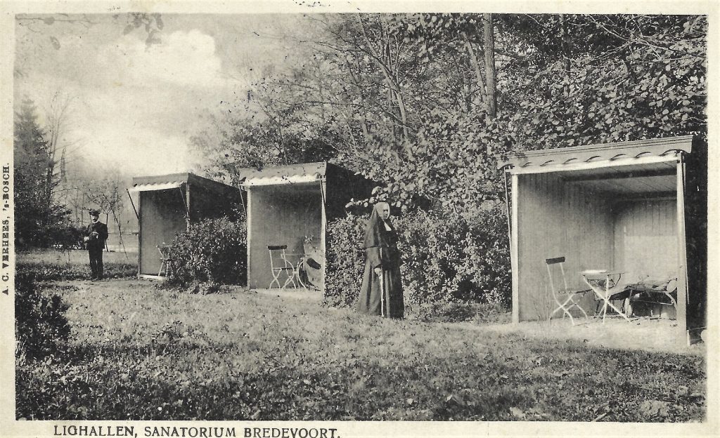
    Located in the Vestingpark in Bredevoort are two so-called TB reclining pavilions (lighallen) dating from the early 20th century. They belonged to the former St Bernardus Roman Catholic Sanatorium, where tuberculosis patients were treated from 1907 to 1933.

    Tuberculosis, commonly known at the time as “consumption”, was one of the leading causes of death in the Netherlands during the 19th and early 20th centuries. The disease was infectious, often fatal, and responsible for approximately a quarter of all deaths. Since no medication yet existed, treatment consisted primarily of rest, a healthy diet, fresh air, and sunlight.

    Sanatoria—rest homes for long-term care—were established all over the Netherlands. A key component of the treatment was the use of reclining pavilions: wooden structures with one open side facing the sun, where patients spent hours or even the entire day in bed—often wrapped in blankets against the cold.

    St Bernardus Sanatorium

    the St Bernardus Roman Catholic Sanatorium was founded in 1897 on the initiative of Father Bernardus Mulders. Using his own capital, he purchased the former estate manager’s house of the Roelvink family and had it converted into a convent and care facility. The nursing care was entrusted to the Franciscan Sisters of Thuine.

    From 1907 onwards, patients from across the country came to Bredevoort. In the large garden behind the building, now the Vestingpark, at least ten wooden reclining pavilions were erected, each with its open side facing south. Patients lay in these pavilions during the day, even in winter, as evidenced by the text on a postcard from 1909. Each pavilion contained two couches, a table, and a chair.

    Sanatorium archives show that between 1907 and 1916, an average of about twenty patients were present annually. In some years, more than 7,000 nursing days per year were recorded.

    Two Pavilions Preserved

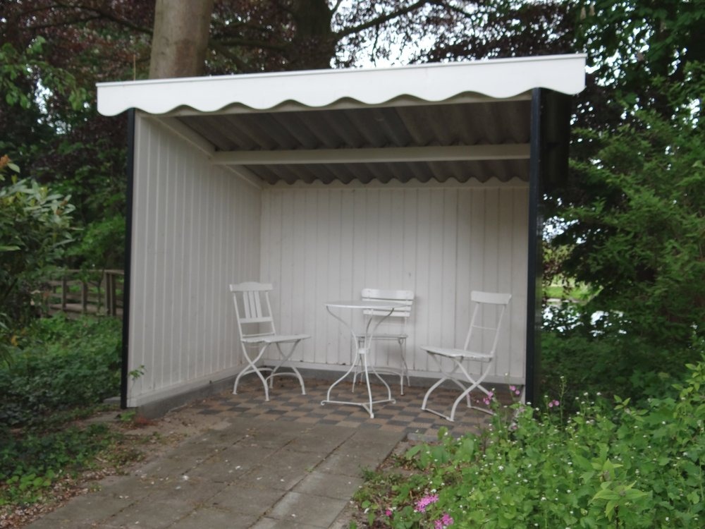
    Of the original pavilions, only two have survived. Due to their historical significance as examples of a building type that has almost entirely vanished—owing to the fragility of the materials and the obsolescence of the sanatoria—they have been designated as a Rijksmonument (National Monument).

    The structures are simple wooden buildings with a mono-pitched roof, three closed sides, and an open front. Both pavilions feature a tiled floor consisting of black and beige tiles in a random pattern with a geometric motif. Decorative bargeboards are fitted to the front: the eastern pavilion has an ornately carved trim, while the other features a simpler wave pattern.

    Restoration & Accessibility

    The small halls were reconstructed in 2025. The original halls were in poor condition. The carpentry for the reconstruction was carried out by two students from the restoration carpentry program at the Gelderland Restoration Center in Velp. Volunteers and local businesses handled the rebuilding and finishing. The paintwork was executed in a historically accurate color scheme.

    The pavilions can be viewed freely in the Vestingpark, directly behind the former St Bernardus sanatorium at ’t Zand in Bredevoort. The park is open to the public from sunrise to sunset.

  • The Hessenwegen in Aalten and Bredevoort

    The Hessenwegen in Aalten and Bredevoort

    For centuries, German merchants traveled through the Achterhoek with their heavy carts via the so-called Hessenwegen: ancient trade routes that connected the region with Germany and the Dutch trading cities. One of these roads ran from Bocholt via Aalten towards Zutphen and Doesburg. The Hessenwegen were of great importance for early modern trade in this region.

    The term Hessenweg has been used since the 17th century. The traditional explanation refers to the merchants who came from the Landgraviate of Hesse-Kassel and the surrounding area. Within etymology, however, the name is explained differently: it is said to be a corruption of hers, meaning horse. These roads usually ran over high, dry sandy soils and along ridges.

    Four major Hessenwegen ran through the Achterhoek. Three of them followed a northern route, from Vreden and Ammeloe via Groenlo, Rekken, and Neede, among others, to Deventer or Zutphen.

    In the southern Achterhoek, a Hessenweg ran past Aalten. From Bocholt, this route crossed the current border at the Kesenbulte and continued via the Bodendijk, Dijkstraat, Landstraat, Berkenhovestraat, and the Romienendiek to De Radstake. From there, the road continued past Zutphen and Barneveld, with a branch between Halle and Zelhem towards Doesburg.

    From the IJssel cities, the Hessenwegen crossed the Veluwe, converged in the Gooi, and continued to Amsterdam. The Hessenwegen had numerous branches. One of these ran near Aalten from the Romienendiek, via the Koningsweg, Hessenweg, past the Walfort, via Bredevoort and Winterswijk to Vreden.

    The Hessians stayed overnight in inns along the road, such as De Radstake and the Slikkertap. In Aalten, there were lodgings such as De Leeuw, De Roskam, De Landman, and Stad Munster. In Bredevoort, De Zwaan and, just outside the town, De Leste Stuver were well-known stopping places.

    Hessenkeerls

    For those living along a Hessenweg in the 19th century, the arrival of the Hessenkeerls was quite an event. On the windward side of the procession walked men with heavy clubs, dressed in their characteristic blue Hessenkiel: a shirt of fine linen, closed with copper hooks in the shape of lion heads and three small bone buttons. Decorated facings were applied to the chest and shoulders.

    On the road, donkeys trudged through the loose sand, with a basket of woven willow twigs full of merchandise on either side. Once they arrived in a village, the men tied their donkeys near an inn or on the village square. The animals were fed and watered, while the men refreshed themselves at the village pump.

    Afterward, the baskets were opened and the Hessians went from house to house peddling. Their merchandise included light glassware and soft straw hats. These hats were in high demand: as soon as the Hessians arrived, customers were already waiting for them to buy a new summer hat. The hats were elastic and therefore almost always fit. After a few hours, the Hessians moved on.

    Pottenkeerls, musicians, and hannekemaaiers

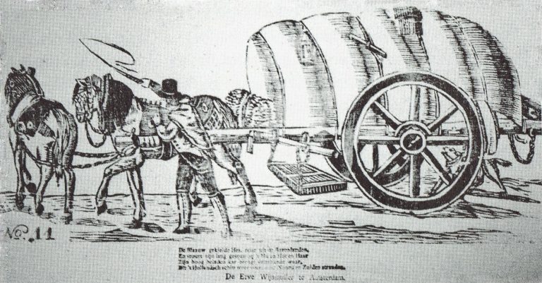
    In addition to the Hessenkeerls, pottenkeerls also appeared on the Hessenwegen. They used heavy covered wagons that stood high on their wheels, the so-called Hessenkaoren, pulled by sturdy Holsteiner horses. The carts were full of Cologne pottery: gray or yellow-brown pots with blue decoration. The horses wore richly decorated harnesses, fitted and hung with copper decorations, so that their arrival could be heard from afar.

    An image of a carter with his Hessenkar from around 1830, from the Popular Prints collection of Museum ‘t Oude Slot in Veldhoven, with the text:

    The blue-smocked Hessian travels from the Uplands,
    And guides his long team with ‘Hu’ and ‘Hot’ and ‘Haar’.
    His high-laden cart brings many kinds of wares,
    Which the Dutch ship carries again to North and South shores.

    In the spring, groups of German musicians traveled over the Hessenwegen to the Netherlands. Some bands were very well known in Amsterdam, Rotterdam, and The Hague. Although they presumably came from the same region, they were not called Hessians because they did not wear the Hessenkiel.

    In addition, the hannekemaaiers came by in the summer: seasonal workers from Westphalia who helped in Holland with mowing grass and during the harvest. Women and children stayed behind at home to work on the land, while the men earned money elsewhere for the winter.

    The end of the Hessenwegen

    In the course of the 19th century, the significance of the Hessenwegen declined. In 1875, the last Hessians were seen near Zelhem, a meager group compared to former times. The Franco-Prussian War of 1870 and the subsequent industrial boom in the Ruhr area provided the Germans with a livelihood closer to home. Even many young people from the Achterhoek went that way to earn good money. With that, the Hessenwegen had had their day.

    Older origins

    Although the term Hessenweg was used from the 17th century, archaeological finds along these roads indicate that they had been in use for much longer. For example, in Aalten, at De Hoven near the Landstraat, traces of an 8th-century settlement have been found, including remains of sunken-floor huts, refuse pits, and spindle whorls. This is a strong indication that the later Hessenwegen built upon much older traffic routes, the so-called volkerenwegen (peoples’ roads).

    It is therefore logical to assume that the village of Aalten partly owes its origin to this ancient peoples’ road. De Hoven was a favorable spot, because in the middle of the wild landscape of forest, heath, and marshes, there was a hill here, high and dry, directly on a through road. Moreover, a stream flowed at the bottom of the hill, providing fresh water.

    Hessentocht

    The memory of the Hessians still lives on. In 2011, a Hessentocht (Hessian Trek) was organized for the second time in the vicinity of Bredevoort and Aalten. During this trek, in which a historical caravan was simulated, an impressive ox cart took part: 2.60 meters wide, six meters long, and four meters high. In addition, three wagons participated, each pulled by three horses. Jan Oberink captured the trek on film and created the atmospheric impression below.

    Acknowledgements

    The content of this article is largely based on the article by G.J. Klokman (Zelhem, 1864), published in 1937. There are numerous other publications about Hessenwegen that present a different picture on some points. For this article, Klokman’s description was primarily chosen because his memories and observations specifically relate to the Hessenweg near Zelhem, the same route that also ran through Aalten.

    Sources


    1. G.J. Klokman, De Hessenwegen, in: Eigen Volk. Algemeen tijdschrift voor volkskunde (folklore) en dialect, 1937. National Library of the Netherlands
    2. G.J. Klokman, De Achterhoekers, in: De Nederlandse volkskarakters, 1938. DBNL
    3. Wikipedia, Hessenweg
    4. Hummelo.nl, Hessenwegen, Hanzewegen en Koningswegen (RdH004-27-2-2007). Hummelo History
    5. De Veluwenaar, Hessenwegen
    6. Old Aalten, Traces of 1100-year-old settlement in Aalten
    7. YouTube, Hessentocht travels through the municipality of Aalten, 2011
  • The Driessen Textile Family

    The Driessen Textile Family

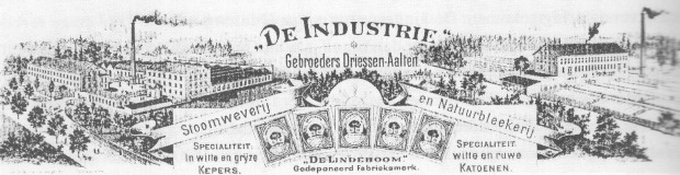
    Gebroeders Driessen, Aalten – Steam Weaving Mill and Natural Bleachery

    The Driessen family is a lineage of textile entrepreneurs, originally from Bocholt, just across the border in Germany. Members of the family were active as textile manufacturers in Bocholt, Aalten, and Leiden. It is a Catholic family, which was included in the Nederland’s Patriciaat (Blue Book) in 1961.

    The recorded lineage begins with Rutger Driessen, a weaver in Bocholt. In 1667, he paid taxes, but by 1672 he was considered too poor to be subject to taxation. Little is known about his son Johann Driessen (1663–after 1713) and grandson Gerard Driessen (1702–after 1738).

    The family’s social ascent began with Gerard’s son Bernard Driessen (1731–1772). He traded in textiles, which he purchased from home-weaving farmers around Bocholt and sold in Holland. The family likely owes its rise to the fact that, due to their poverty, they could not become members of the Boomsidenambt, the guild of cotton weavers. Guild members were prohibited from trading fabrics that had not been woven by fellow members. As the Driessens were not part of the guild, they were not bound by this rule and could trade freely in cotton produced by home-weavers.

    Thanks to this trade, Bernard became so prosperous that he was appointed schepen (alderman) of Bocholt, marking the family’s entry into the urban patriciate. However, he died at the age of 41 during a business trip to The Hague, before he could further strengthen his position.

    Expansion of the Textile Trade

    Two of Bernard’s sons continued the trade and expanded it significantly by employing hundreds of home-weavers: Peter Driessen (1756–1843) and Hermann Driessen (1765–1817). Initially, they worked together, but they later went their separate ways. Both brothers became very wealthy.

    Both married daughters of Johann Jacob Hölscher, a member of the cotton weavers’ guild and also an alderman of Bocholt. Peter married Elisabeth Hölscher, and Hermann married her sister Gertrud. These marriages demonstrated that the Driessen family had by then integrated into the local elite. Consequently, Peter Driessen served as the second mayor of Bocholt for fourteen years (1797–1811) and, in 1813, he was a member of the council of the Rees district during the Napoleonic era. In 1841, in his advanced years, he received a Prussian distinction: the Ritter des Roten Adlerordens (Knight of the Order of the Red Eagle), 4th class.

    From Trade to Manufacture

    Peter Driessen had approximately 500 home-weavers working for him around Bocholt. These weavers were formally independent but reliant on the ‘reder’ (merchant-manufacturer) who supplied the yarn and financed the loom. The rise of centralised workshops—precursors to factories—made it possible to exercise greater supervision over production. Looms could henceforth be used continuously. In this way, the merchant became a manufacturer or ‘fabriqueur’.

    Settling in Aalten

    To protect Dutch industry from British imports, King William I introduced an import duty of 25% to 45% on cotton fabrics in 1823. This made exports from Bocholt to the Netherlands virtually impossible. To circumvent this levy, two Driessen cousins settled in Aalten, just across the border: Heinrich Driessen (1794–1879, son of Mayor Peter) and Anton Driessen (1797–1879, son of Hermann). In Aalten, they established various textile enterprises, including a steam weaving mill and a bleachery.

    Over a period of more than 140 years (1826–1969), the Driessen manufacturers developed into the most significant employers in Aalten and the surrounding area. The factory buildings and private residences of the Driessens defined the village’s appearance. Until the second half of the 20th century, these manufacturers left a significant mark on the social and economic life of Aalten.

    Sources


    • ‘Geweven goed. De textielgeschiedenis van Aalten en Bredevoort’, H. de Beukelaer and J.G. ter Horst
    • Wikipedia
  • Communal Freezers in Aalten

    Communal Freezers in Aalten

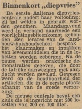
    In the 1950s and 60s, so-called communal freezers emerged in the Netherlands, particularly in rural areas. These were facilities, often established on a cooperative basis, where residents of villages or rural districts could rent one or more lockers to freeze food.

    The communal freezers provided a solution at a time when most households did not yet have their own freezer. Home-grown vegetables and fruit, or meat from home slaughtering, were primarily stored there.

    In 1962, the Netherlands had approximately 700 of these communal freezers. However, their use declined rapidly in the 1970s, when the freezer became a common household appliance.

    Locations

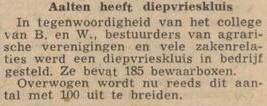
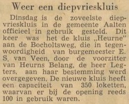
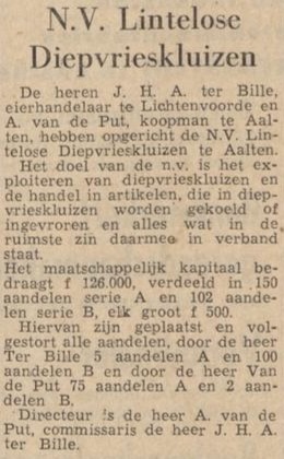
    There were also communal freezers in the municipality of Aalten. Some well-known examples (provisional list, April 2025):

    Do you have any additions or corrections to this list, or photos of (vanished) communal freezers in Aalten? Do you know if anything has been preserved? Please let us know!

    Newspaper reports

  • Where did your ancestors live?

    Where did your ancestors live?

    Do you have family history in Aalten or Bredevoort? Are you curious about the address where your ancestors lived, were born or died? With the help of old archives and handy search methods, you can link historic house numbers to contemporary addresses. We’ve put together a step-by-step guide to help you get started!

    In some old archives, the addresses of people were recorded. In the past, addresses consisted of the name of the core or rural district, followed by a house number. Partly because these house numbers have been changed several times over time, they cannot be directly compared with the current street name-house number combinations. 1

    Below we explain step by step how you can trace an old address and how you can then trace it back to a contemporary location. Success not guaranteed!

    Step 1: Find the old address

    There are various (online) sources in which you can find out where a person lived, where he or she was born and where the death took place. Please note that some data is not yet public due to privacy laws. 2

    WieWasWie.nl

    The website WieWasWie.nl (‘Who Was Who’) contains information about births, marriages and deaths, among other things. But did you know that the search results often also contain a link to a scan of the original deed, including the address at the time?

    1. Go to: WieWasWie.
    2. Search by name and filter the results if necessary.
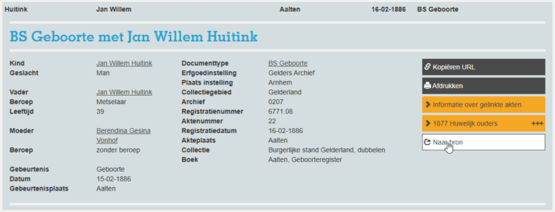
    3. Click a relevant result, and then click Go to source on the right.

      WieWasWie.nl
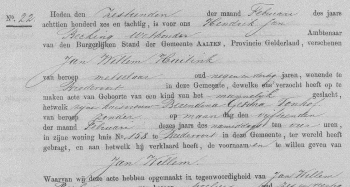
    4. View the scan and note the house number.
    5. Sometimes a series of scans will be displayed and you will have to look up the correct record in them. At the top of your screen is the Deed Number. Search the scans for the relevant deed and write down the house number.
    6. Continue to Step 2.

    Heritage Centre Achterhoek and Liemers (ECAL)

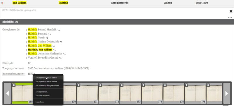
    On the ECAL website you can find scans of family cards from population registers in the Achterhoek. The public archive contains scans from the period from around 1823 to 1910.

    1. Go to ecal.nu.
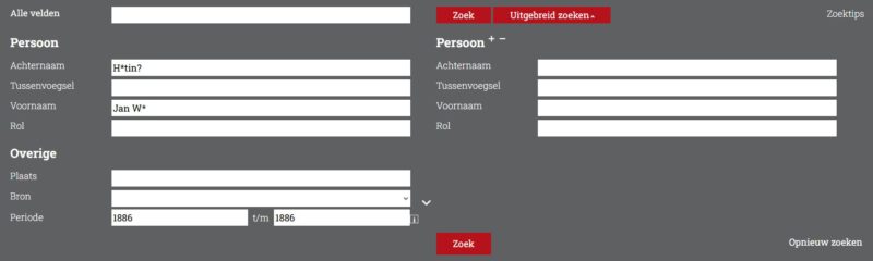
    2. Enter the Last Name and First Name . Tip: Use wildcards to find any spelling variants as well. 3
    3. Enter the year of birth in both fields under Period and click on ‘Search’.
    4. If necessary, filter by Plaats (note: Aalten, Bredevoort and rural districts fall under ‘Aalten’).
    5. The right-hand column shows the period to which the family card relates. This is important because house numbers can vary from period to period.
    6. Also check which core or hamlet the map relates to: Click on the relevant line and then on the Inventarisnummer (right mouse button, new tab). Remember the place and close the tab.

      ECAL search (2)
    7. Open the family card scan.
    8. Write down the house number and proceed to Step 2.

    Régistre Civique (1811–1813)

    During the French period, the Régistre Civique was introduced as a precursor to the population register. 4 Many persons included in this register also had their address (house number) mentioned.

    1. Go to hdcaalten.nl/digitaal-archief
    2. Download the index of the Régistre Civique Aalten 1811-1813 (pdf).
    3. Look in the PDF file to see if your ancestor is listed and if there is a house number.
    4. If so, make a note of the house number and proceed to Step 2.

    Older archives

    Older sources, such as the Verpondingskohier from 1650 and the Liberale Gifte from 1748, often mention not only the names of the residents, but – if they lived on a farm – also the name of the farm. Many of these farms still exist today and can be found at oldaalten.nl/boerderijen.

    Step 2: Find the current address

    1. Go to oldaalten.nl/huisnummering.
    2. Choose the relevant place or rural district.
    3. Search the table for the correct house number. To make it easier to search, you can sort the table by the relevant year/period.
    4. If the house number appears, you will find the current address there. If not, the house probably no longer exists. Surrounding house numbers may give you an idea of the approximate location.

    The above methods are not exhaustive, because in the archive world several roads lead to Old Aalten. For the overview, we have outlined the most important steps and done our best to explain everything as clearly as possible. We hope this helps you further. Good luck with your search!

  • Moving house

    Moving house

    In 1937, G.H. Rots described in a series of articles how things were done in Aalten in former times. Among other things, he wrote about the customs when a farmer moved:

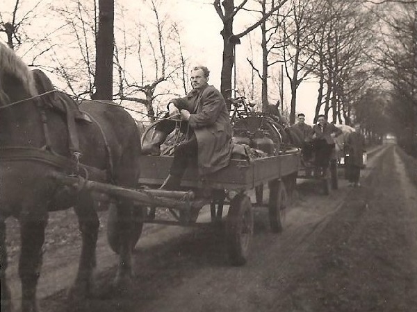
    “On the rare occasion that a farmer moved, this took place on ‘Saint Peter’s Day,’ February 22nd. All belongings were loaded onto the neighbors’ wagons, and the entire procession moved from the old house to the new or different farmstead. The neighbor women had already gone ahead to the new home, had cleaned it, and had lit the fire. In the local dialect, this was called ‘vuur beün’ (preparing the fire).”

    When the new residents arrived, the coffee had already been brewed, and the newcomers could immediately refresh themselves with a nice cup of coffee. The neighbors helped that day; one person would put something here, another there—it was a scene of immense activity. To top it all off, the ‘housewarming meal’ followed later, where there was certainly no shortage of spirited drinks.”

    Source


    • ‘From Aalten’s verleden’, by G.H. Rots, Aaltensche Courant, 12 & 19 November 1937 (via Delpher: part IV)
  • Origin of the place name Aalten

    Origin of the place name Aalten

    Several theories circulate regarding the origin of the name Aalten. But what are they based on and how credible are they? Old Aalten delved into history to discover more about this.

    We begin with the oldest historical mentions of Aalten, as these may contain clues about the origin of the name. Next, we examine what toponomy (the study of place names) can teach us about this. We then discuss several theories regarding the origin and meaning of the name Aalten and conclude with our findings.

    Earliest mentions

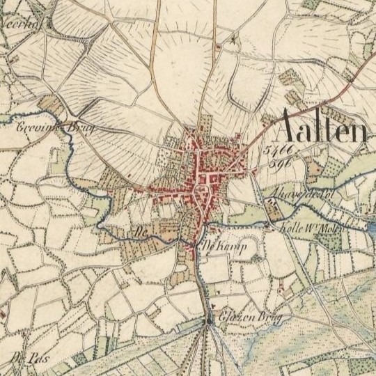
    There are several medieval documents containing a reference to Aalten, with varying spellings. The best-known mentions are Aladna and Aladon, after which the Aladnaweg and a school are named. Below is an overview of historical mentions, including a reference to the oldest known source.

    828A charter from 828 describes how a certain Geroward donated all his possessions, including those in Aladna, to the St. Martin’s Church in Utrecht on February 7 of that year. Little is known about Geroward’s identity, but he was presumably a Frankish nobleman in the service of the Carolingian Emperor Louis the Pious, son of Charlemagne.1
    1138/
    1139
    In 1138 or 1139, Godschalk of Versnevelde (Varsseveld), with the consent of his brother Count Gerhard (II) of Lohn, enters into an exchange agreement with the canons of the St. Mary’s Church in Rees. He transfers an estate in Megchelen near Gendringen, including associated hunting rights, two fields, a meadow, and nine serfs of both sexes. In exchange, he receives a property in Alethnin, with all yields and seven serfs.2
    1152In 1152, Count Godschalk (II) of Lohn, son of Gerhard II, reached a settlement with Bishop Frederick II of Münster. Godschalk claimed authority over the parishes of Lon, Winethereswik, Aladon, Versnevelde, Selehem, and Hengelo on the basis of his comital title. The bishop held a different view, after which it was formally established that Godschalk did not hold these territories in his own right, but was to administer them as a liegeman of the bishop.3
    1188In 1188, during the reign of the Holy Roman Emperor Frederick I, priest Everhardus, chaplain to Count Henry of Dalen and Diepenheim, compiled an inventory of Henry’s feudal (vassal) and allodial (free) possessions. The feudal properties were recorded under the parishes to which they belonged, including Ecberghe, Gronlo, Winterswic, Nehde, Ghesterne, Lochem, Almen, Dotinchem, Zelhem, and Althen.4
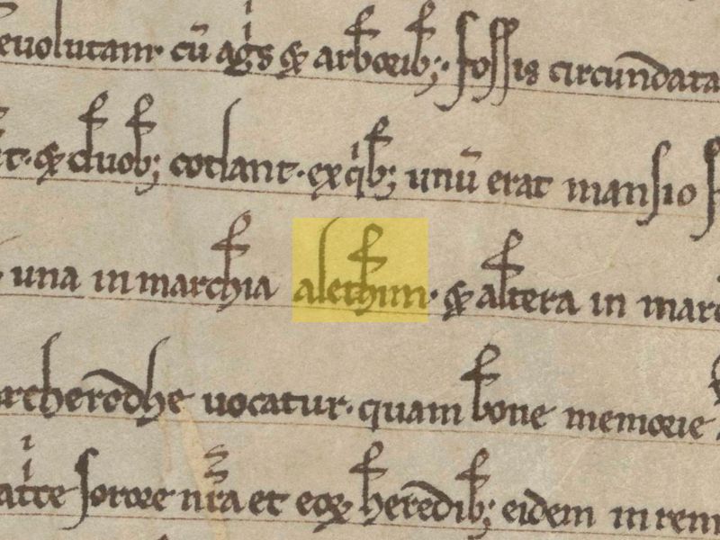
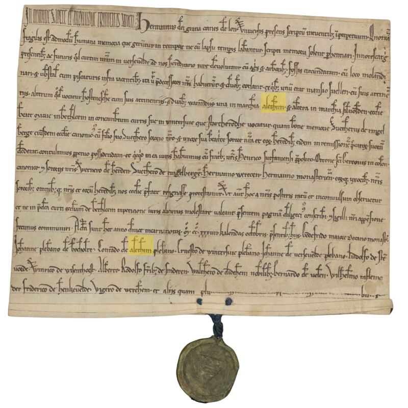
    1234In 1234, Count Herman (I) of Lohn, Lord of Bredevoort, together with his brothers Henry, provost of Zutphen, and Otto, canon of St. Gereon in Cologne, as well as his brothers-in-law Werner van Herden, Sweder van Ringelberg, Herman Werecen, Herman van Munster and their spouses, and all their further heirs, entered into an exchange with the Bethlehem Monastery. In this agreement, the monastery receives from the count, among other things: duabus warandiis, una in marchia Alethim et altera in marchia Silvolden (two hunting grounds; one in the mark of Aalten and the other in the mark of Silvolde). Witnesses include the parish priests Johannes from Bocholte, Conradus from Alethim, Ernestus from Winterswic, and Johannes from Versevelde.5
    1254In 1254, mention is made of the “curtis Grevinkhof sita in parochia Alethe (the estate Grevinkhof, situated in the parish of Aalten): Gotscalco de Reme receives from Otto van Loon in castle-fief the curtis Grevinkhof in Aalten, with the mill and further appurtenances, with the exception of the timber court. Present here Gerardus Canoninicus “frater domini G. de Reme”.6
    1313In a register of churches belonging to the Diocese of Münster from the year 1313, the following parishes, currently located in the Netherlands, are mentioned: Alten, Dinxperle, Eiberghe, Gheesteren, Grolle, Hengelo, Neede, Seelfwalde, Selehem, Versevelde and Wynterswik.7
    1386Derich Willemssoen van Lyntloe has been granted Varenvelde in parish Alten, sabbato na Briccii ep. (17 November) 1386.7
    1409Derk van Linteloe and his children Derk and Herman, declare to have sold to Johan Rensynck the estate ten Nygenhues, located in the hamlet of Lynteloe under Aelten and held in fief from the Lordship of Borculo, 1409 July 24 (in vigilia beati Jacobi apostoli maioris).8

    Toponymy and sound development

    Toponymy, or the study of place names, is a branch of linguistics that studies place names and seeks to explain their origins.9 A generally accepted principle within toponymy is that the sound development of a name is more reliable than its spelling, as written mentions in pre-modern times were inconsistent and influenced by scribes, dialects, and time-bound conventions. The sound of a name, by contrast, usually remains more consistent and therefore offers better insight into the original pronunciation and meaning.

    Now, we are not toponymists, but when we view the sound development of the earliest mentions of Aalten chronologically, we believe we recognize a pattern:

    Aladna → Alethnin → Aladon → Althen → Alethim → Alethe → Alten → Aelten → Aalten

    For a period of four centuries (9th-13th century), these mentions consist of three syllables, starting with ‘ala’ or ‘ale’, followed by a d or t, and in most cases ending with an n. Although the spelling varies, the sound structure remains largely consistent. From the 13th/14th century onwards, we see that the second syllable gradually disappears and that the name corrupts into Althen/Alten/Aelten/Aalten.

    Theories on origin and meaning

    Below we discuss the best-known theories regarding the origin and meaning of the name Aalten.

    Place on a hill

    A frequently cited theory states that the name Aalten is derived from the Latin altus, meaning ‘height’. This explanation seems primarily based on the fact that Aalten originated on a hill and the phonetic similarity between altus and Aalten. However, there is no historical or linguistic evidence for this theory. Furthermore, this explanation does not take into account the sound development in the oldest known mentions of the name.

    Homestead by the altar

    Another theory suggests that Aalten was inhabited around 150 BC by Angles from the area that is now Berkelland. According to this explanation, the name is derived from the Anglian ael (altar, place of sacrifice) and thun (garden, enclosed yard). This would lead to Aelthun, or ‘homestead by the altar.’10 This explanation is also speculative and does not fit the sound pattern of the medieval mentions of the name.

    Plant or tree name

    In Gelderse plaatsnamen verklaard, Gerald van Berkel states that the name Aalten may be related to a plant or tree name and refers to the Old Norse alað (nourishment, food), aldin (edible tree fruit), or alda (fruit-bearing oak).11 Although there is no direct evidence for this explanation, it does fit the sound pattern of the medieval mentions.

    Place by the water

    In Prehistorische waternamen Maurits Gysseling suggests that the name Aalten is derived from the Indo-European Alatanā, meaning “situated in a bend of a stream”.12 In the case of Aalten, this would refer to the Slingebeek. Van Berkel, however, calls this theory far-fetched in Gelderse plaatsnamen verklaard.

    Place name researcher Bas Kloens disagrees. In his study on place names and their origins, Valkuilen in de Plaatsnaamkunde, he states that it is actually “abundantly clear” that Aalten, like many other similar place names, owes its name to its location on a watercourse or stream.13

    Conclusion

    No single theory regarding the origin of the place name Aalten can be supported with hard evidence or completely ruled out. It remains, therefore, largely a matter of speculation. Nevertheless, we lean towards the theories of Gysseling and Kloens, who state that Aalten owes its name to its location on a watercourse, namely the Slingebeek.

    Furthermore, despite Van Berkel’s skepticism, a connection with the Indo-European Alatanâ, which bears a strong resemblance to Aladna, seems plausible to us.

    In short, although not scientifically proven, our nomination for the most plausible explanation for the origin and meaning of the name Aalten goes to Place by the water / situated in a bend of a stream.

  • Burials in Aalten

    Burials in Aalten

    Around 800 AD

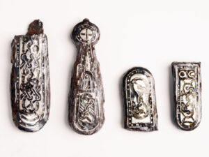
    Archaeological finds indicate that the early inhabitants of Aalten were already burying their dead around 800 AD in a burial field on the current Damstraat. During excavation work in the late 19th and early 20th centuries, traces of a Merovingian-Frankish burial field were discovered there. Notable finds, such as spearheads, stirrups, a shield boss, and silver belt links, suggest that a warrior may have been buried here.

    On De Hoven, traces of habitation from the same period have been found, consisting of various so-called sunken huts – rectangular pits that served as work or storage spaces. Pottery fragments found here correspond with the finds from the burial field on the Damstraat.

    The Christianization of Aalten

    Following the subjugation of the Saxons by Charlemagne around 785, the Christianization of Aalten and the surrounding area began. Missionary Liudger, later Bishop of Münster, played a significant role in the founding of churches in the region, presumably including the first church in Aalten.

    This church, originally likely a simple wooden chapel, was founded on a strategic and symbolic site: the elevated location where the current Old St Helen’s Church stands today. This site became the religious and social center of the community.

    Archaeological research has shown that the residents of De Hoven abandoned that site around the year 1000. It is possible that, after converting to Christianity, they decided to live closer to the recently founded church to enjoy the protection of the faith. From that time on, the deceased were also presumably buried in and around the church.

    Churchyard

    A churchyard developed around the church, which played an important role in the life of the community during the Middle Ages. The churchyard in Aalten was originally much larger than the current plot surrounding the Old St Helen’s Church. It served not only as a burial ground but also as a place for social and religious gatherings. In those days, people even lived around or on the churchyard, often officials such as sextons or clergy who were directly involved with the church.

    In recent centuries, skeletal remains have been frequently encountered during excavation work in the ground around the church, such as on the Köstersbulte, the path along Elim, and also on the Kerkstraat, where buildings now stand. The original burial ground around the church was therefore much larger than the current site on which the church stands.

    Until the 19th century, the deceased were primarily buried in and around the church. Burial inside the church itself was reserved for people of status, such as clergy, nobles, and benefactors. It was believed that a grave within the church guaranteed a better position in the afterlife. However, most people were buried in the churchyard surrounding the church. Individual tombstones were rare in the Middle Ages; many people were buried in unmarked graves.

    Health Risks

    However, burial inside the church brought significant problems. A lack of space and the decomposition of bodies led to health risks; churchyards became overcrowded, and the situation became untenable.

    Subsidence in the floor occurred regularly within the church, and the owners of the respective graves often failed to carry out the necessary repairs. The odor of decay in the pews near the hole in question was sometimes unbearable for weeks, especially during the summer months.

    Epidemics such as the plague exacerbated this problem. Consequently, a regulation was established stating that churchwardens, in cases of negligence, were permitted to contract out the necessary repairs, whereby the respective plot would revert to the church.

    The condition of the burial ground around the church was also often poor. Because burials had not been conducted at a sufficient depth for a long time, bones frequently came to the surface. A bone collector would gather these remains from time to time, for two bushels of rye per year, and cast them into the bone hall (also known as a charnel house), a small building in the churchyard on the Market side. When the supply became too large, it was cleared away.

    Royal Decree of 1827

    In 1827, King William I decreed by law that, from 1829, cemeteries had to be established outside built-up areas. For many people, this was a major step—to break with all traditions and leave the dead outside the village “just anywhere in the ground.”

    The practice of burial in and around the church symbolized an era in which religion, death, and community were closely intertwined. The ban on this practice was a turning point that not only benefited public health but also marked a shift in how death was handled: individual graves were given more space, more funerary monuments appeared, and cemeteries were landscaped.

    Cemeteries in Aalten

    Burial mound Nannielaantje

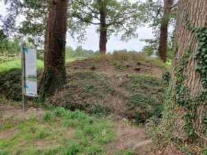
    Christiaan Caspar Stumph, Mayor of Aalten since 1811, was annoyed by burials within the village. In 1818, he therefore had an ‘outside cemetery’ created for himself and his family on his estate, Het Smees. His son Abraham Anthony was the first to be buried here, followed by Stumph himself in 1820. In total, seven people rest on this unusual burial mound, which is still visible on the Nannielaantje in Aalten.

    Old Cemetery

    Following the royal decree of 1827, a site on the Varsseveldsestraatweg in Aalten was designated as a cemetery. Due to the growth of the village, this cemetery became increasingly enclosed by the early 20th century. In 1923, the Berkenhove cemetery was put into use. Although the Old Cemetery has since taken on the function of a memorial park, it is still sporadically used for the interment of the deceased in existing graves.

    Old Catholic Cemetery Varsseveldsestraatweg

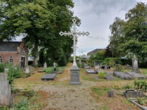
    When the cemetery on the Varsseveldsestraatweg was established, the Catholic community was given its own section across the street, on the corner with the Molenstraat. This cemetery became full after only thirty years, after which a new Roman Catholic cemetery on the Piet Heinstraat was put into use in 1868. The small old cemetery later took on the function of a public green space.

    Jewish Cemetery

    On the Haartsestraat in Aalten, just outside the village, lies the Jewish cemetery of Aalten. Although the site officially became the property of the Jewish community in 1852, there are indications that the cemetery had been in use since approximately 1820. There are about seventy tombstones on the site, varying in age and design. At the entrance on the Haartsestraat stands a metaheer house, a ritual building used for the cleansing of the deceased according to Jewish traditions.

    Catholic Cemetery Piet Heinstraat

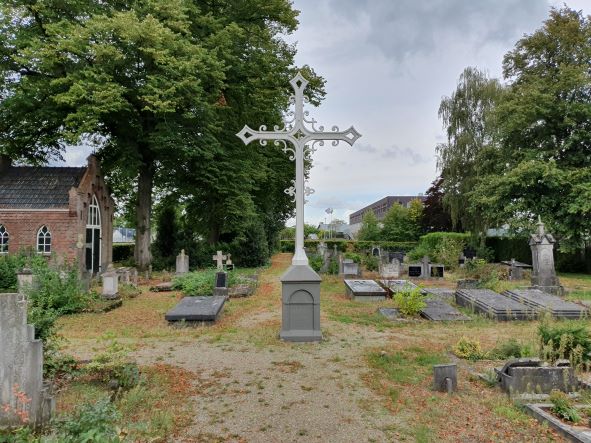
    When the Catholic cemetery on the Varsseveldsestraatweg became full, textile manufacturer Anton Driessen donated a piece of land on the current Piet Heinstraat in 1868 to be laid out as a cemetery. He also donated an iron Calvary cross and an iron gate. The bier house dates from 1888. A century later, this cemetery also became full. From 1960 onwards, Catholic deceased were therefore buried in the new Roman Catholic section of the Berkenhove cemetery.

    General Cemetery Berkenhove

    After the Old Cemetery on the Varsseveldsestraatweg became full, the ‘Berkenhove’ cemetery on the Romienendiek was put into use in 1923. The original section is enclosed between the Romienendiek, the Barloseweg, and the Koningsweg. Over the years, the cemetery has been regularly expanded. In 1960, a Catholic section was added because the Roman Catholic cemetery on the Piet Heinstraat was full. A modern funeral center and crematorium are located at Berkenhove.

    Cemeteries in Bredevoort

    Old Cemetery

    The Old Cemetery on the Prins Mauritsstraat was established around 1830, simultaneously with the adjacent Jewish Cemetery. The site became available after the dismantling of the fortifications on the eastern side of the town. In 1925, a new entrance gate was installed, and a bier house was built a few years later.

    Old Jewish Cemetery

    Bredevoort once had two Jewish cemeteries. The oldest was located on the former castle grounds behind Hozenstraat 5. In 1953, this site was sold to the municipality of Aalten for housing construction. The remains and tombstones were then transferred to the second cemetery on the Prins Mauritsstraat.

    Jewish Cemetery

    The Jewish Cemetery on the Prins Mauritsstraat was established around 1830, simultaneously with the adjacent general cemetery. The last Bredevoort Jews to be interred in this cemetery were brother and sister Levi and Sara Sander. Both died in 1938, shortly after one another. The cemetery is not accessible to the public.

    Kloosterhof Cemetery

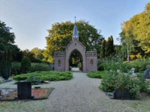
    The Kloosterhof cemetery on the Kloosterdijk in Bredevoort was established in 1862-1863 and originally served as a Roman Catholic cemetery. The oldest, centrally located part has a symmetrical layout with a characteristic entrance gate, a bier house, and a Calvary cross. In the 1980s, the cemetery was expanded with a general section. A mortuary was also erected in 1989.

  • Traces of 1100-year-old settlement in Aalten

    Traces of 1100-year-old settlement in Aalten

    In August 2024, archaeological research was carried out on a site at De Hoven in Aalten, shortly before apartments are built. This research, carried out by members of the antiquities association ADW led by archaeologist Willem Doodeheefver, provided valuable insights into the early medieval history of Aalten.

    The finds, which include remains of hut bowls, waste pits and metal objects, offer a unique insight into life around the year 900 AD. Previous excavations in this area, in 1982 and 1892, had already found traces of a so-called Frankish-Merovingian settlement.

    Hut bowls

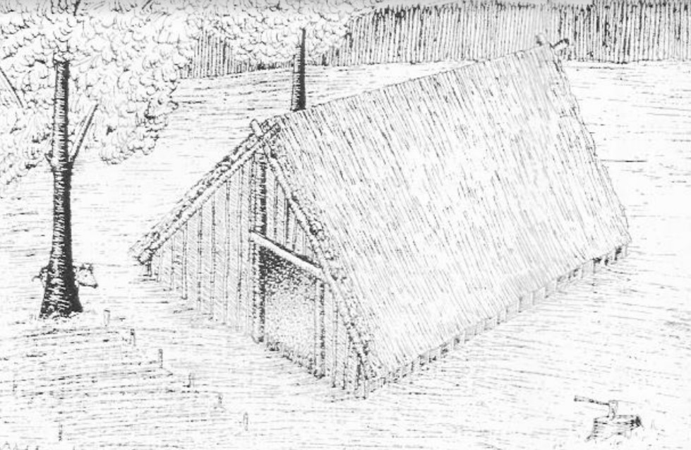
    The most striking finds during the excavations in 2024 are the remains of some hut bowls, which became visible due to dark discolorations in the soil. A hut bowl was a half-buried, rectangular building, about three meters wide and four meters long. The pit was 0.5 to 1 meter deep and had no above-ground walls; The roof construction rested partly on ground level. This construction method provided shelter from the summer heat and provided relative warmth in winter.

    Hut bowls served as craft rooms, usually on a farmyard. They were used for activities such as weaving, woodworking, metalworking or working bone. Slag was found at one of the hut bowls found at De Hoven, remnants of molten rock. This may indicate that the hut may have served as a blacksmith’s shop.

    Waste pits

    Several waste pits have been found scattered around the site. The waste left behind by the residents at the time provides valuable information about their daily lives, utensils and the dating of the hut bowls. Among other things, shards of pottery were found in the waste pits, dated around the year 900 AD.

    1100 years of habitation

    The finds give a picture of the landscape as it looked more than 1100 years ago. A favorable circumstance is that the soil of De Hoven has remained largely untouched during the past thousand years. The name ‘De Hoven’ refers to the gardens that were here for centuries, and the area has remained largely undeveloped to this day.

    This and earlier archaeological finds on De Hoven, but also on the Damstraat, confirm that people were already living in Aalten 1100 years ago. This period coincides with a mention of a place that was mentioned in a document from 828 Aladna .

    Why this place?

    The choice of this place of residence in the early Middle Ages is easy to explain. Aalten is located on seven slopes that were formed in the ice age. De Hoven is located on one of the higher, dry and safe parts. For the residents, it was only a short walk to the Slingebeek, where they could get water and fish. De Hoven is also a stone’s throw from the Landstraat. It is possible that this was already an important traffic route in the Achterhoek at that time, an area that was still quite empty and largely unexplored at the time.

  • Land consolidation in Aalten

    Land consolidation in Aalten

    In the second half of the 20th century, a large-scale land consolidation process took place in the municipality of Aalten. During this radical process, agricultural lands were reorganized to enable more efficient operations. The objective was to create larger and more accessible plots for farmers, with less fragmentation and improved infrastructure. However, this change also had significant consequences for the landscape and nature.

    Why was land consolidation necessary?

    Due to inheritance divisions and changes in ownership over the centuries, agricultural plots had become increasingly smaller and more irregular. It became progressively difficult for farmers to work efficiently. The solution was land consolidation. This involved merging and reorganizing plots so that agricultural businesses could operate more effectively. This was achieved through:

    • Enlargement and reorganization of agricultural plots;
    • Improved accessibility via paved roads;
    • Adjustment of water management systems;
    • Reduction of old legal restrictions such as easements.

    Effects on the landscape

    The traditional Achterhoek ‘coulisse’ landscape, with its alternation of small fields, meadows, and hedgerows, was affected in many places by land consolidation. This varied and small-scale landscape, which gave the area its picturesque character, gave way to larger, more efficiently designed agricultural plots. As a result, many hedgerows, copses, and dirt tracks disappeared.

    This reorganization allowed farmers to work more easily with modern machinery, but it also made the landscape more open and uniform. Roads such as the Eskesweg and the Aladnaweg were constructed to make agricultural lands more accessible, but this came at the expense of old dirt tracks and characteristic plot boundaries.

    Consequences for water and nature

    In addition to the changes in the landscape, water management was also adjusted. Streams and ditches were straightened and deepened to drain water more quickly. While this prevented flooding, it led to drought issues in some areas. Much of the wetland nature disappeared, which had consequences for biodiversity.

    Despite the benefits for agriculture, part of Aalten’s traditional landscape was lost. The small-scale and varied character of the region gave way to larger-scale agricultural lands with less room for nature and historical landscape elements.

  • Lordship of Bredevoort

    Lordship of Bredevoort

    This page is still ‘under construction’…

    County of Lohn

    De voormalige heerlijkheid Bredevoort maakte oorspronkelijk deel uit van het graafschap Lohn, dat vermoedelijk in de 11e eeuw is ontstaan. Dit graafschap omvatte in 1152 de kerspelen Lohn, Winterswijk, Aalten, Varsseveld, Zelhem en Hengelo (G). In hun streven naar onafhankelijkheid kwamen de graven van Lohn in conflict met de bisschop van Münster, wiens leenheerschappij zij in 1152 tenslotte moesten erkennen. De burcht Bredevoort was in 1246 voor de helft eigendom van graaf Herman van Lohn, die in dat jaar zijn deel in leen opdroeg aan graaf Otto van Gelre.

    Upon the death of the last Count of Lohn in 1316, his territory disintegrated. The parishes of Varsseveld and Silvolde went to the Lord of Wisch; the parishes of Zelhem and Hengelo had already been sold to Guelders. In 1316, the Bishop of Münster purchased half of Bredevoort Castle, along with its share of Lohnish rights, from Otto van Ahaus, one of the heirs. The other half of the castle had already been in episcopal possession since 1284.

    County of Guelders

    This purchase led to a dispute between Münster and Guelders, resulting in a war in 1324. Count Reinald of Guelders invaded the Bishopric of Münster and was defeated at Coesfeld, though he had already conquered Bredevoort. At the peace treaty concluded in Wesel in 1326, Reinald retained Bredevoort and received the jurisdictions of the surrounding parishes of Aalten, Dinxperlo, and Winterswijk as a pledge. The Bishop of Münster was entitled to redeem this pledge at any time for 3,500 gold marks, which, however, never occurred. From 1326 onwards, the area became an independent territory administered by a ducal official.

    Gemen and Steinfurt Pledge (1388-1526)

    In 1388, William of Jülich, as Duke of Guelders, pledged his castle, town, and the District of Bredevoort with its three parishes to Lord Henry III of Gemen in exchange for a substantial loan. Successive generations of this family remained pledge-holders of the lordship until 1492, when the pledge passed to his heirs and subsequently to the Counts of Bentheim-Steinfurt. It was not until 1526 that Duke Charles of Guelders redeemed the pledge and took the lordship back under his own administration. In 1534, he entrusted Bredevoort to his commander Marten van Rossum, who received the lordship as a pledge in 1545 from Emperor Charles V, the legal successor to the Dukes of Guelders.

    Anholt Pledge (1562-1612)

    When Van Rossum died in 1555, the pledge passed via Johan van Isendoorn to Hendrik van Isendoorn à Blois, who received the pledge sum back in 1562. King Philip II of Spain, acting as Duke of Guelders, then pledged the lordship for 50,000 Flemish shields to his vassal Dietrich van Bronckhorst-Batenburg. He was the Lord of neighboring Anholt in Westphalia, who already possessed many properties and rights within the Lordship of Bredevoort.

    After the Reformation, the Lords of Anholt remained Roman Catholic and aligned with the Spanish side. Consequently, Bredevoort was besieged and conquered by Prince Maurice of Nassau in 1597. Lady Gertrud von Milendonck, the widow of Jacob van Bronckhorst-Batenburg, had the lordship returned to her by the Republic in 1602. However, the pledge was redeemed by the States of Gelderland in 1612 and subsequently taken over by Prince Maurice.

    Many archival documents concerning the period 1526-1612 are located in the Bredevoort Collection within the Fürstlich Salm-Salmsches Archiv at the Wasserburg Anholt near Isselburg (D). Older documents from before 1562 were likely transferred to their house archive at the time by order of the Anholt pledge-holders as evidence of their rights. After the termination of the

    Pledge City of the House of Orange

    In 1697, Bredevoort was granted as a free lordship to King-Stadtholder William III, whose heirs possessed it until 1795.

    Van het Rijksarchief in Friesland werd in 1986 uit de collectie van het Fries Genootschap het reglement voor de poortwachters te Bredevoort van 1726 ontvangen.

    In het huisarchief van de voormalige herberg De Leste Stuver te Bredevoort, berustend te Aalten, bevindt zich o.a. een almanak, gebruikt door de Stadhouder of de Landschrijver als zakagenda in de periode 1737/38.

    In 1646 werd het kasteel te Bredevoort verwoest tengevolge van blikseminslag in de kruittoren. Het duurde ruim 50 jaar, eer nieuwe huisvesting werd gerealiseerd. In 1699 verrees aan de Landstraat te Bredevoort een nieuwe kanselarij, het Ambthuis.

    District of Bredevoort (1795-1811)

    After the Batavian Revolution in 1795, the possessions of the House of Orange were declared forfeit; the Lordship of Bredevoort was placed under civil administration. In 1798, the lordships were officially abolished. The former municipalities of Aalten, Bredevoort, Dinxperlo, and Winterswijk were established in 1795 and abolished in 1798. Following the abolition of the lordships in 1798, the former municipality of Lichtenvoorde was added to the District of Bredevoort and separated from it again in 1802.

    In 1994, Dr. G.J.H. Krosenbrink of Winterswijk donated a report concerning the administrative organization of the old District, prepared for the new District administration in the period 1798-1802, originating from the then-district board member H. Willink Azn. of Winterswijk.

    Het Ambt Bredevoort bleef als bestuurlijke eenheid in stand tot de Franse overheersing. In de jaren 1811 en 1812 werd het opgedeeld in de Mairieën Aalten, Bredevoort, Dinxperlo en Winterswijk.

    Het archief van het Ambt werd bewaard op de kanselarij, het Ambthuis te Bredevoort. In 1795 werd het op last van het Provisioneel Bewind in beslag genomen en geïnventariseerd, waarna het onder het beheer werd gesteld van de secretaris van de Municipaliteit van Aalten. Na de Franse overheersing werden bij het herstel van het Nederlands bestuur bescheiden uit het archief gelicht en overgedragen aan de nieuwe gemeenten Aalten, Dinxperlo en Winterswijk. Ook de voormalige rentmeester J.B. Roelvink van de Nassause Domeinen behield het kanselarij-archief onder zich, dat in 1985 helaas door een rechtsopvolger werd vernietigd.

    Administration

    Bredevoort was originally a small ‘borgman’ town based on the Westphalian model. The noble defenders of the castle lived in fortified houses on the outer bailey, which consequently took on the character of a fortress. In the neighboring Bishopric of Münster, such ‘borgmannen’ exercised authority and jurisdiction over their staff and the serf inhabitants of the castle complexes they managed in Horstmar and Nienborg.

    Upon the transfer of Bredevoort in 1326, the Bishop of Münster released his Bredevoort ‘borgmannen’ from their oath so they could enter Guelders’ service. In 1503, the Bredevoort ‘borgmannen’ obtained similar privileges from the then-pledge-holder, Everwijn van Steinfurt. However, no city rights for Bredevoort have survived. The military and administrative role of the ‘borgmannen’ ended after the defense was entrusted to a garrison during the 16th century.

    The daily administration of the Lordship of Bredevoort rested with the Drost (Bailiff). Following the Münster occupation during the war years 1672-1674, a separate urban administration of a stadtholder and regents of the city of Bredevoort existed briefly within the walls. The Drost often also served as the Richter (Judge). Jurisdiction was provided by the Richter with two ‘keurnoten’ (assessors). The court was held once every two weeks in Aalten, Bredevoort, and Winterswijk. Court days for Dinxperlo were held in Aalten.

    Jurisdiction in the city of Bredevoort was exercised by the Richter of the lordship with two ‘keurnoten’, as in the other parishes. Other officials at the court were the Land Scribe (secretary) and the Advocate-Fiscal (public prosecutor). The Land Scribe also served as the secretary to the Drost. Since the latter usually did not reside in the lordship, the Land Scribe often also acted as his deputy as acting-Drost or Stadtholder. Bredevoort had a fortress commander, the “Commandeur der Forteresse”. This position was often combined with that of acting-Drost in a single person. Furthermore, there was a whole series of lower officials, including a gauger, a tool sharpener, a surveyor, and armenjagers (rural constables).

    Due to the fact that members of the noble Van Pallandt family and the related families of Van Lintelo and Van Coeverden held the position of Drost of Bredevoort for a long time, a large number of documents concerning Bredevoort matters from the period 1638-1796 are also found in the archive of House Keppel, likewise held at the Gelders Archief in Arnhem.

    The last Drost of the District of Bredevoort, since the Batavian Revolution in 1795, was the Winterswijk citizen W. Paschen Gzn. of Winterswijk. His accounts for the period August 1808 – March 1811 were audited and deposited in Winterswijk on September 4, 1812, by the joint mayors of Aalten, Bredevoort, Dinxperlo, and Winterswijk. As early as 1811, Paschen, as temporary mayor of Winterswijk, requested the former Land Scribe to transfer documents concerning Winterswijk matters. According to a letter in the archive of the Municipality of Winterswijk, a chest of archival records was transported by wheelbarrow from Aalten to Winterswijk in 1813. The selection process at the time was somewhat arbitrary, so other Bredevoort documents also ended up in Winterswijk. Steward J.B. Roelvink also transferred Bredevoort documents to the Mayor of Winterswijk in 1815. Incidentally, Lichtenvoorde was only part of the District during the years 1798-1802.

    Since 1612, officials were appointed by the Nassau Domain Council. For appointment data, see the so-called ‘Ambtboek’, held in the archive of the aforementioned Domain Council at the National Archives in The Hague. Information on appointments in the District of Bredevoort can also be found in the archive of the Drost and Geërfden, inv. nos. 22-33, and in the archival collection Local Government Winterswijk, inv. no. 14. Through the Drosten, many personnel records also ended up in the Keppel house archive, held at the Gelders Archief in Arnhem.

    Besides the city of Bredevoort, the lordship consisted of three judicial districts, which coincided with the three parishes of Aalten, Dinxperlo, and Winterswijk. In each parish, a ‘voogd’ (warden) and one or two ‘ondervoogden’ (sub-wardens) were appointed, acting as intermediaries between the inhabitants of the parishes and the administration in Bredevoort. Each parish consisted of a village and a number of rural districts, called guilds, which were divided into wards. These were headed by ward and guild masters, who were responsible for the further dissemination of messages and the execution of orders. Additionally, each rural district had a messenger, an office tied to a specific farm.

    Financial matters were handled per parish by the local ‘geërfden’ (landed stakeholders). These representatives of the population were delegated per village and rural district and were accountable to the Drost. The town of Bredevoort had its own Steward, who acted on behalf of the local ‘geërfden’. Each parish had its own collector of the ‘verponding’ (land tax). In Bredevoort, the ward masters sometimes acted collectively as collectors of the ‘verponding’. The churchwardens in each parish, responsible for managing the capital and property of the local church, were elected from the ‘geërfden’ and had to provide accounts to the Drost and their fellow ‘geërfden’. Alongside the ‘diaconie’ as a church institution, there was also a secular institution for poor relief, the ‘provisorie’. Like the churchwardens, ‘provisoren’ were elected from the ‘geërfden’ and were required to account for their management in the same manner.

    Sources


  • Transformer substations in Aalten

    Transformer substations in Aalten

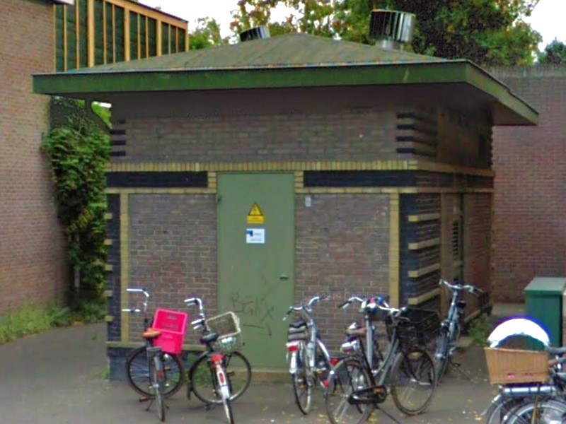
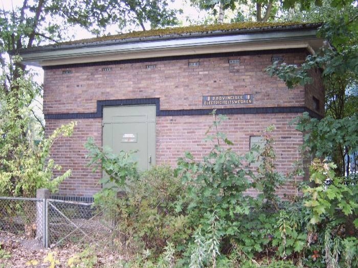
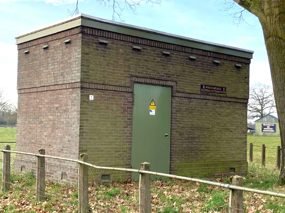
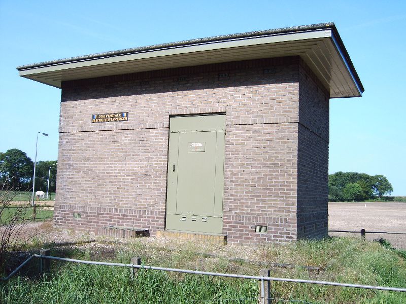
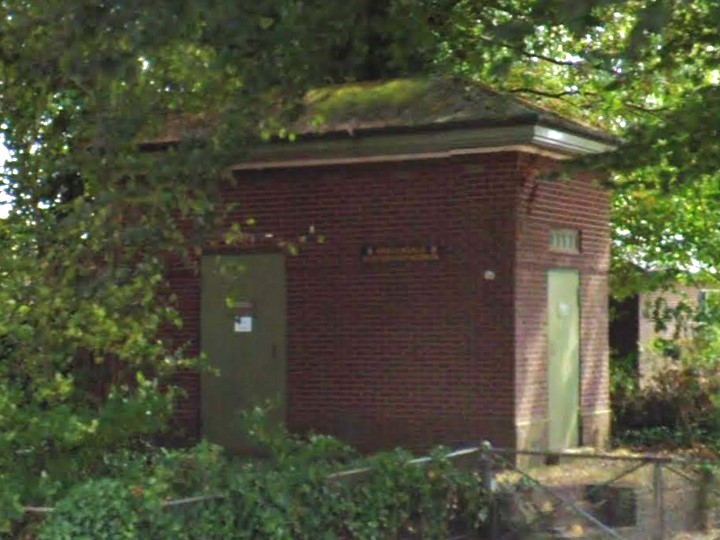
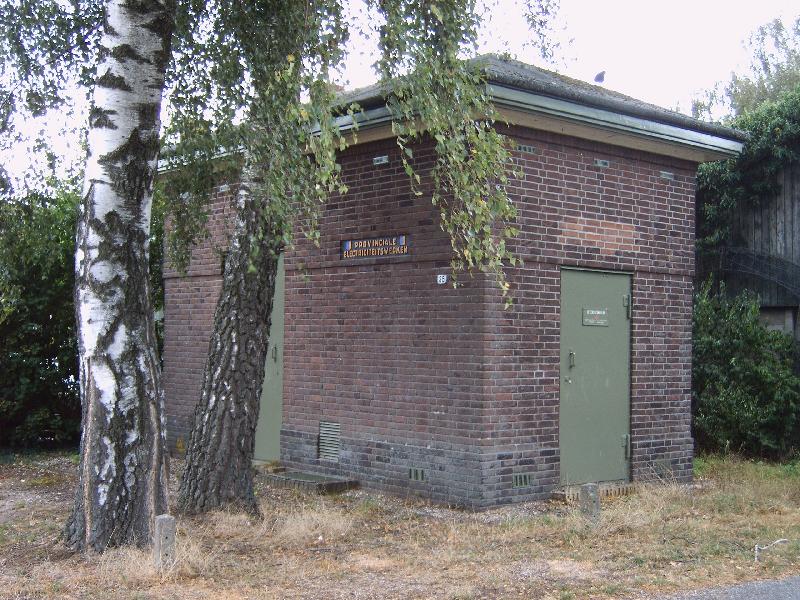
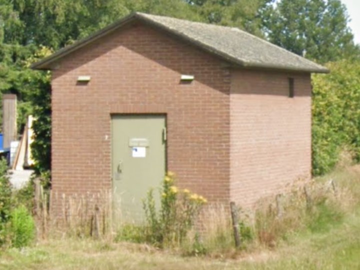
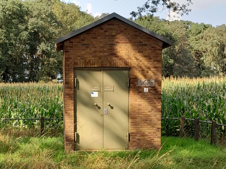
    Dozens of transformer substations, also known as ‘trafohuisjes’, are spread across the municipality of Aalten. These substations are designed to convert (transform) high voltage (10,000 Volts) into a lower voltage (230/400 Volts) that can be used in our homes and businesses.

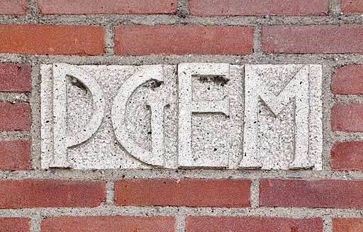
    The first transformer substations were built in the early 1920s by the Provinciale Gelderse Electriciteits Maatschappij (PGEM). In 1994, PGEM merged into Nuon and was split up in 2009. The current grid operator is called Liander.
    Design

    The oldest transformer substations were designed by Gerrit Versteeg (1872-1938), who was the in-house architect of PGEM at the time. They incorporate influences from the Hague School, the Amsterdam School, and Frank Lloyd Wright.

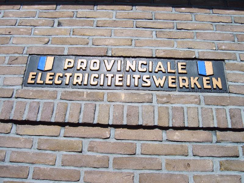
    The buildings are often distinctive brick structures, usually with a rectangular floor plan and a single story with a hip roof, gable roof, or flat roof. The doors are frequently made of green-painted steel. The substations feature an inlaid nameplate made of concrete or tiles (from the Goedewaagen company in Gouda).

    Cultural-historical value

    The older transformer substations have a significant visual value. From a cultural-historical perspective, the buildings commemorate the electrification of the municipality of Aalten. Newer substations (from approximately the early 1980s onwards) usually have a purely functional design and are therefore not of interest from a cultural-historical point of view.

    Many historical transformer substations in the Netherlands have been designated as (municipal) monuments. As of yet, no transformer substation is included on the monument list of the municipality of Aalten.

    List of transformer substations in Aalten

    Below is a list of all transformer substations in the municipality of Aalten, as far as we are aware (April 2025). A number of older substations may be of cultural-historical value and could potentially qualify for protected status. Substations built up to and including 1980 are also displayed on the map.

    AdresKern/BuurtschapBouwjaar
    Admiraal de Ruyterstraat 1 TRAalten1978
    Ambachtsstraat 1 TRAalten1982
    Andromeda 32 TRAalten1972
    Bevrijding 1 TRAalten1977
    Bodendijk 54 TRAalten1975
    Boomkampstraat 1 TRAalten1966
    Bredevoortsestraatweg 65 TRAalten1978
    Bredevoortsestraatweg 94 TRAalten1939
    Bredevoortsestraatweg 118 TRAalten1976
    Broekstraat 17 TRAalten1988
    De Hare 5 TRAalten1981
    Dennenoord 7 TRAalten1970
    Dinxperlosestraatweg 44 TRAalten1964
    Dinxperlosestraatweg 54 TRAalten1980
    Dinxperlosestraatweg 62 TRAalten1971
    Dinxperlosestraatweg 79 TRAalten1930
    Frankenstraat 6 TRAalten1966
    Grevinkweg 2 TRAalten1975
    Grote Maote 170 TRAalten1983
    Haartsestraat 6 TRAalten1923
    Het Verzet 28 TRAalten1981
    Karel Doormanstraat 14 TRAalten1969
    Keizersweg 51 TRAalten1963
    Kemenaweg 50 TRAalten1972
    Koopmanstraat 85 TRAalten1984
    Lage Blik 26 TRAalten1983
    Lage Veld 32 TRAalten1974
    Meiberg 23 TRAalten1960
    Mercurius 5 TRAalten2011
    Mercurius 7 TRAalten1972
    Molenkamp bij 35Aalten1963
    Neptunus 16 TRAalten1972
    Nijverheidsweg 42 TRAalten2011
    Nijverheidsweg 61 TRAalten1985
    Nijverheidsweg 87 TRAalten1966
    Oranjelaan 7 TRAalten1940
    Orion 31 TRAalten1971
    Piet Heinstraat 46 TRAalten1927
    Prinsenstraat 31 TRAalten1966
    Ringweg 19 TRAalten1952
    Rondweg Zuid 1 TRAalten2011
    Stationsstraat 8 TRAalten1974
    ’t Slaa 31 TRAalten1990
    Tramstraat 1 TRAalten1968
    Tubantenstraat 2 TRAalten1971
    Varsseveldsestraatweg 82 TRAalten1965
    Vierde Broekdijk 19 TRAalten1997
    Vlierbeslaan 22 TRAalten1979
    Vondelstraat 11 TRAalten1968
    Barloseweg 6 TRBarlo1977
    Lichtenvoordsestraatweg 83 TRBarlo1934
    ’t Villeken 9 TRBarlo1952
    Bekendijk 12 TRBredevoort2011
    Izermanstraat 2 TRBredevoort1972
    Kleine Gracht 1 TRBredevoort1950
    Landstraat 1 TRBredevoort1952
    Prins Mauritsstraat 13 TRBredevoort1925
    Stadsbroek 71 TRBredevoort1994
    Boterdijk 7 TRDale1970
    Romienendiek 7 TRDale2018
    Buninkdijk 4Haart1967
    Griesdijk 2Heurne1960
    Hondorpweg 7 TRHeurne1967
    Dinxperlosestraatweg 102 TRIJzerlo1966
    Dinxperlosestraatweg 122IJzerlo1970
    Klokkemakersweg bij 1IJzerlo1980
    Kruisdijk 35 TRIJzerlo1940
    Gendringseweg 4Lintelo1980
    Gendringseweg 23 TRLintelo1950
    Heuvelweg 1 TRLintelo1933
    Kolenbroekweg 1Lintelo1950
    Schooldijk 7 TRLintelo1950
    Sondernweg 21 TRLintelo1952
    Varsseveldsestraatweg 126 TRLintelo1931
    Brussendijk 2 TRDe Heurne1939
    Caspersstraat 10 TRDe Heurne1965
    Giebinkslat 6 TRDe Heurne1966
    Lage Heurnseweg 29 TRDe Heurne1980
    Aaldersbeeklaan 53 TRDinxperlo1970
    Aaldershuuslaan 2 TRDinxperlo1972
    Aaldershuuslaan 56 TRDinxperlo2011
    Aaltenseweg 61 TRDinxperlo1973
    Alfred Mozerhof 7 TRDinxperlo1966
    Anholtseweg 6 TRDinxperlo1952
    Anholtseweg 38 TRDinxperlo1993
    Beggelderdijk 16 TRDinxperlo2011
    Bernard IJzerdraatstraat 30 TRDinxperlo1973
    De Klumpender 10 TRDinxperlo1982
    De Maten 9 TRDinxperlo1979
    De Ruiterij 20 TRDinxperlo1975
    Ds. van Dijkstraat 15 TRDinxperlo1968
    Europastraat 2 TRDinxperlo1971
    Helmkamp 25 TRDinxperlo1988
    Het Slat 5 TRDinxperlo1966
    Hogestraat 32 TRDinxperlo1950
    Industriestraat 1 TRDinxperlo1951
    Industriestraat 3 TRDinxperlo1958
    Industriestraat 8 TRDinxperlo1957
    Industriestraat 12 TRDinxperlo1978
    Julianastraat 43 TRDinxperlo1966
    Keminksweide 68 TRDinxperlo1972
    Kerkhofplein 3 TRDinxperlo1939
    Keupenstraat 17 TRDinxperlo1972
    Meniststraat 7 TRDinxperlo1971
    Nassaustraat 20 TRDinxperlo1970
    Nieuwstraat 8 TRDinxperlo1980
    Nieuwstraat 52 TRDinxperlo1979
    Terborgseweg 94 TRDinxperlo1970
    Welinkweg 39 TRDinxperlo1957
    Weversstraat 3 TRDinxperlo1939
  • Fallen in the organized resistance

    Fallen in the organized resistance

    Köstersbulte, Aalten

    On the lawn of the Old St Helen’s Church on the Markt in Aalten stands a special memorial stone. The bronze plaque on the stone lists the names of seven resistance fighters within the organized resistance in Aalten.

    Resistance during World War II (1940-1945) only developed over the course of the war. As the German occupiers’ measures became stricter, small groups emerged that resisted the occupation, initially with limited means. As the war progressed, more and more people faced difficulties. These small resistance groups grew in strength due to increasing membership and the networks that formed between various resistance cells.
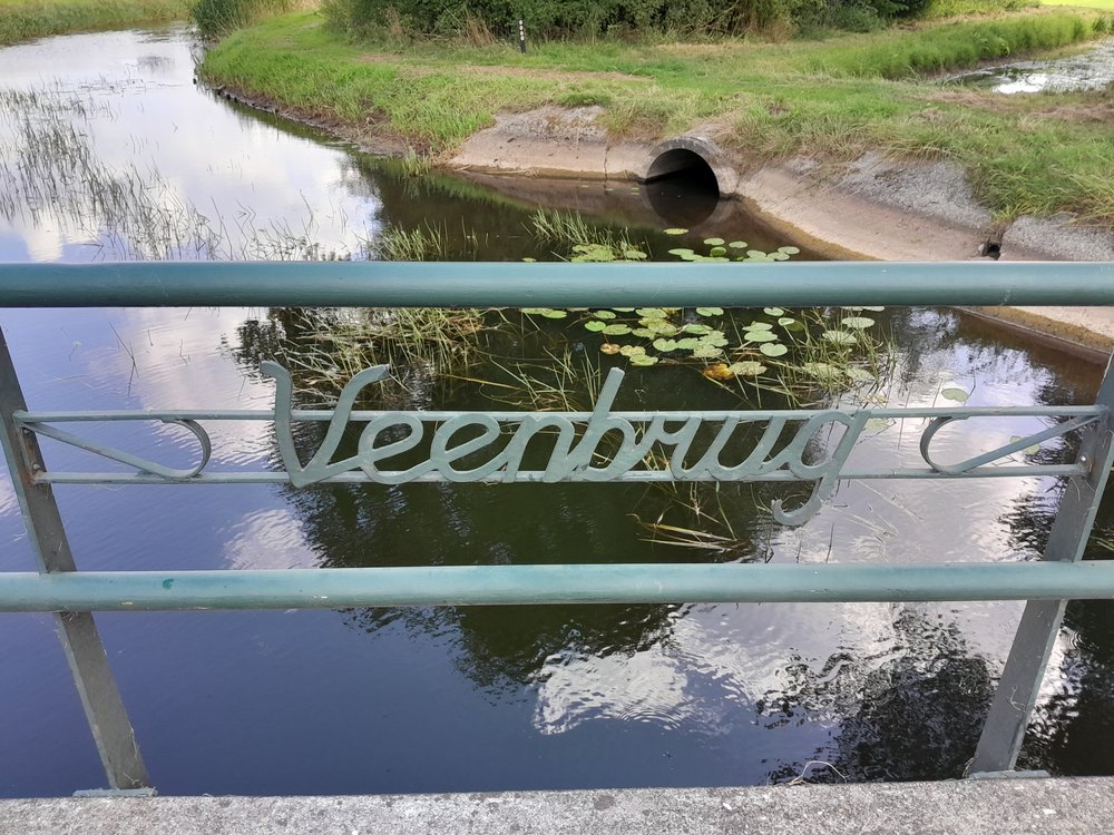
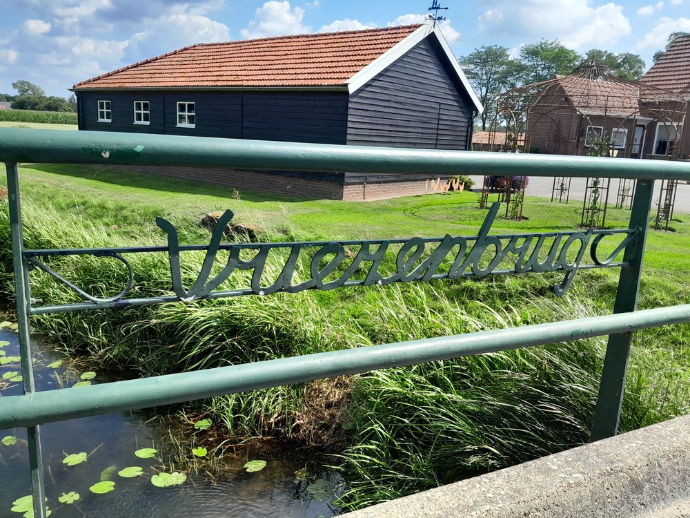
    Within the resistance, two main currents could be distinguished. The first group was the National Organization for Help to People in Hiding (LO). This group organized hiding places for Jews, for men who refused to work for the enemy in Germany, and for resistance fighters who had to go into hiding. The LO was dependent on sufficient ration coupons for the food supply to the people in hiding . The second group, the Knokploegen (KP), took care of that. This armed group carried out raids on distribution offices, tried to sabotage the enemy at vital points and in the last phase of the war prepared to assist the Allied troops in the liberation of the Netherlands.

    In the Achterhoek, especially in the region of Aalten, Lichtenvoorde and Winterswijk, the resistance was particularly active. Some of the resistance fighters lost their lives during the war. Those who survived the harsh time did not feel like heroes. Many testified to the fear they would carry with them for the rest of their lives. The courageous acts of the resistance are recorded in several books.

    The names of the fallen (click on the links for more information):

  • Secession and Doleantie

    Secession and Doleantie

    The nineteenth century was a turbulent period in Dutch church history. In 1834, the Secession (Afscheiding) from the Reformed Church took place in Ulrum. The seceders declared they were breaking with the Reformed Church, “until it returns to the true service of the Lord”. Besides the Ulrum congregation, many thousands of believers elsewhere in the country also left the ‘Dutch Reformed Church’. They no longer felt at home there, partly due to liberal preaching.

    Instead of going to church, the seceders began holding house meetings. There they read the Bible together, or sermons by very orthodox ministers from centuries past, sang psalms together, and questioned each other about their spiritual lives.

    Seceders in Aalten

    In Aalten, too, there were several Seceders at that time, as the Dutch Reformed church council minutes of November 1835 reflect: “In the months of September and October, several persons saw fit to secede from the existing church denomination”. Their names are also known: Lammert Geurink, Antonia Knuvers, Janna G.E. Navis, Derk Jan Klumpenhouwer, H. Wevers, B. Goorhuis, and Hendrik Jan te Kotte. In November 1836, the number of ‘aggrieved’ members stood at ten.

    In Aalten, during the first few years, the Seceders met for their religious services at the Bouhuis farm on Bolwerkweg, the Sondern farm on Sondernweg, and the Navis farm on Brakenweg. Rev. A. Brummelkamp (1811–1888) from Hattem, one of the first Seceded ministers in our country, often led these services, which usually took place during the week. These were long journeys for the minister, who nevertheless supported the Achterhoek Seceders with advice and action. Furthermore, he frequently had to pay a fine for breaking the law: without permission from the local authorities, it was forbidden to hold religious gatherings of more than twenty people.

    Christian Seceded Congregation

    The Christian Seceded Congregation in Aalten was presumably instituted in July 1843 with the confirmation of the office bearers. These were the elders G. Bouhuis and A.J. Pennings and the deacons F. Heijerman and J.H. Kappers.

    The young Seceded Congregation wished to call a minister. On the advice of Rev. Brummelkamp, the young Derk Breukelaar (1814-1891) from Varsseveld was asked if he would become the minister of Aalten. He agreed, after which he left post-haste for Ommen to study with Rev. A.C. van Raalte (1811-1876) – also one of the first Seceded ministers in our country. Meanwhile, in September 1843, the church council members asked the classis if the minister of Varsseveld, Rev. J. Wildenbeest (1808-1852), and the minister of Winterswijk, Rev. J.W. te Bokkel (1815-1888), could come to preach in Aalten and Bredevoort as often as possible.
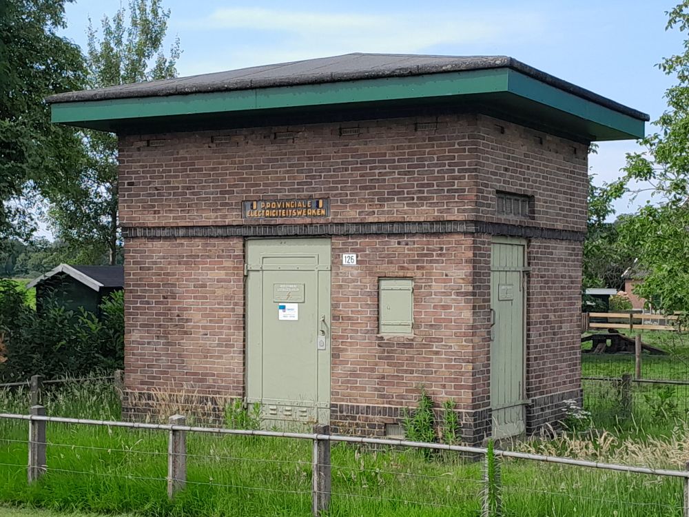
    The Aalten church council also took steps to be recognised by the government as a Seceded Congregation. Rev. Brummelkamp drafted a petition for this purpose, which was sent to King William II on 10 October 1843 (he was the head of the Dutch Reformed Church).

    In the letter, the King was informed that the Three Forms of Unity constituted the confessions of the Aalten congregation, and that the Utrecht Church Order of Rev. H.P. Scholte (1805–1868) served as its regulations. They further promised to make no claim to the funds and properties of the Reformed Church nor to funds from the State Treasury. They also reported that they would hold their church services in “a church building to be erected for that purpose on a piece of land on the Esch near the village of Aalten, specifically to the North East”. Thirty-five male members signed the petition.

    On 12 January 1844, King William II recognised the congregation as an independent Christian Seceded Congregation.

    Holding church services in the various farms of congregation members was a solution in the early days, but it was naturally not an ideal situation. Therefore, in 1844, the church council, together with the male members, decided to build their own church. The location chosen was the present-day Oosterkerkstraat, on the site where the (now decommissioned) Oosterkerk stands today. “With great sacrifices, one giving money, another their labour, a third both”, the church was finally completed and could be put into use.

    After Derk Breukelaar had finished his studies, he was inducted into the Seceded congregation of Aalten on 24 September 1846. It would remain his only congregation. He worked there for forty-four years until his retirement in 1888. When Rev. Wildenbeest of Varsseveld died suddenly in 1852, that congregation issued a call to him. Initially, he accepted it, but – realising that he was now the only Seceded minister in the Achterhoek – he ultimately declined and remained connected to the church in Aalten. However, he also worked extensively in the surrounding area.

    Rev. Breukelaar lived in a small farm (called ‘t Grotenhuis) on the present-day Hessenweg, just outside the village. Catechism classes were also held at ‘t Grotenhuis, as there was no space for them in the church. His wife, Janna Hendrika Pennings, also sometimes took the catechism classes when the minister himself had hardly any time for them during the harvest season.

    The Doleantie of 1886

    After the Secession in 1834 and subsequent years, many orthodox Reformed members had remained in the Dutch Reformed Church with the intention of ‘bringing the Reformed church back to the Reformed path of the Fathers’ from within, as it was called. In Amsterdam, however, this ‘struggle for Church Restoration’ eventually resulted in a schism in 1886, which took place under the leadership of, among others, Dr Abraham Kuyper (1837–1920).

    This conflict, known as the ‘Doleantie’ (from ‘dolere’ = to grieve), stemmed from the struggle that had been waged for years against the habit of the Reformed synod to grant as much freedom as possible to those who did not agree with the Church’s confession, in order to avoid any ecclesiastical conflict.

    Rev. J.H.F. Gangel was a fervent supporter of this movement in Aalten. Mutual tensions rose so high that the municipal authorities were forced to call in military assistance to maintain public order. Rev. Gangel had been removed from office by the classical board of the Dutch Reformed Church, which he initially refused to accept. Notable in this context is that the minutes of the church council from 26 November and 23 December 1885 have been removed from the register of church council minutes. However, lists of those who wished to remain members of the Dutch Reformed Church are found in the archives. These lists date from 1887.
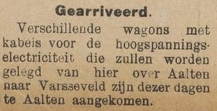
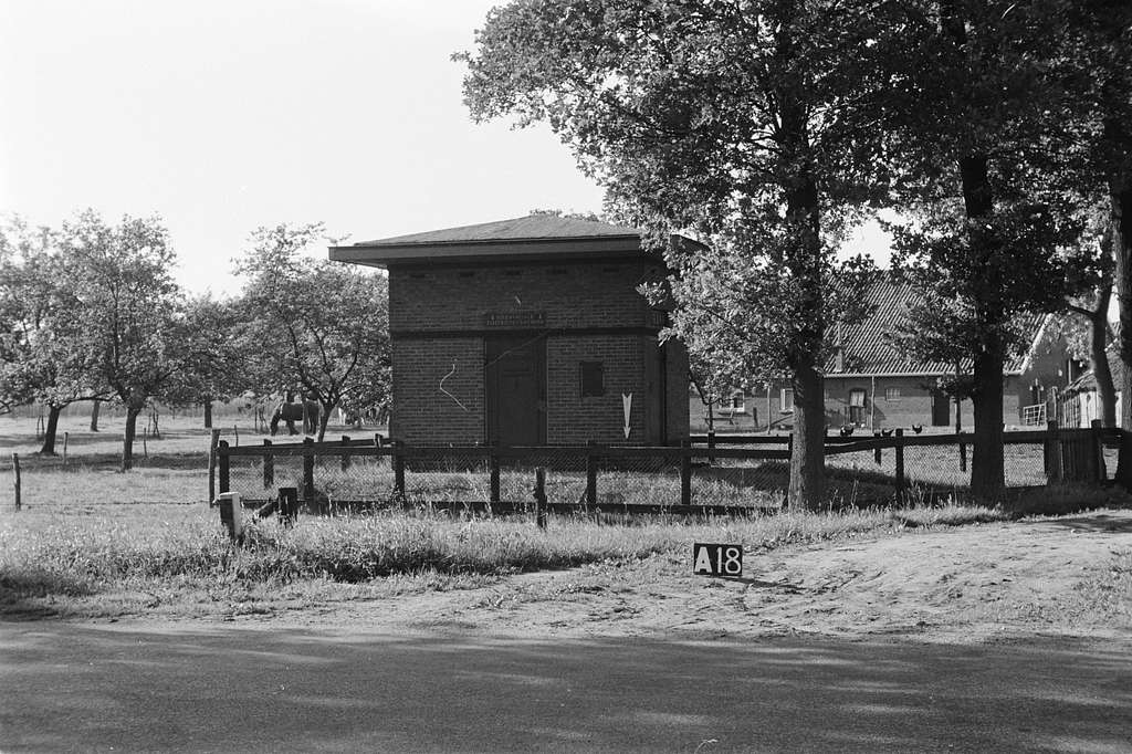
    The end result was that the ‘dolerenden’, like the seceders, had to leave the Dutch Reformed Church. In doing so, they also had to relinquish church property. The lawsuit brought by the ‘dolerenden’ against the Reformed congregation of Aalten regarding church possessions ended in 1888 to their disadvantage.

    By bailiff’s writ, Rev. Gangel and the former church council were forced in 1888 to hand over the financial administration of the rest home in Aalten to Rev. van Oostrum-Soede and the sitting church council. From the religious composition of the population of Aalten, one can deduce the scale the Doleantie had reached in 1885-1888: in 1901, the number of Dutch Reformed in Aalten was 3,560 souls, the number of Reformed (Gereformeerd) was 2,497, the number of Roman Catholics was 1,287, and the number of Christian Reformed was 118. This was out of a total population of 7,726 inhabitants.

  • Aalten Dialect

    Aalten Dialect

    “Elk dörpken hef zien eigen klinkers, zien eigen spreuken en woordenschat.” (Every village has its own vowels, its own sayings, and vocabulary). This sentence is displayed on the façade of the Aalten library. It is a line from the song “Hier in de Achterhoek” (Here in the Achterhoek), by Rocco Ostermann and Matthijs Stronks. And it is entirely accurate.

    The Achterhoek dialect, a variant of Low Saxon (Nedersaksisch), has traditionally been spoken in the north-east of the Netherlands and the north of Germany. Within the Achterhoek region, every municipality, and sometimes even every village, has its own nuances in the dialect, which is colloquially referred to as ‘plat’.

    “A’j plat könt praoten, mo’j ‘t neet laoten”

    Old Aalten | A'j plat könt praoten, mo'j 't neet laoten

    The Aalten dialect possesses many ancient words and expressions that do not exist in Standard Dutch.

    Dialect in daily life

    In Aalten, the dialect still plays an important role in the daily lives of many residents. You can still frequently hear Aalten dialect spoken at home, on the street, in shops, and during local events. Many Aalten residents were raised bilingually, speaking the dialect at home and Standard Dutch at school.

    Although the Aalten dialect is still spoken, younger generations are mastering it to a lesser degree. They often speak an ‘Achterhoek-flavoured’ version of Dutch, in which many of the typical old words and expressions used daily by their ancestors have disappeared. This development presents a challenge for the preservation of the dialect.

    Cultural Heritage

    The Aalten dialect is an important part of the local cultural heritage and forms a vivid link with the past. The history and daily life of Aalten are brought to life in stories, songs, and poems written in the dialect. The Aalten dialect thus contributes to the unique identity of the community.

    To prevent the Achterhoek dialect from fading away, efforts are being made to pass it on to new generations. This is done, for example, through regional language projects in schools and cultural associations. These initiatives are essential to keeping the dialect vibrant and ensuring that it does not disappear, despite the influence of Standard Dutch and other modern languages.