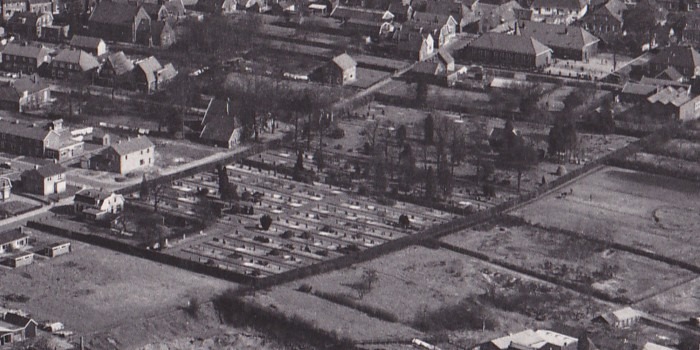
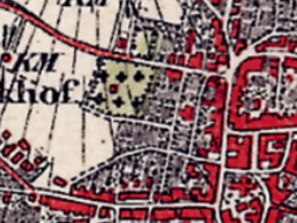
In 1827, King Willem I decreed by law that, as of 1829, cemeteries had to be established outside built-up areas. In Aalten, a site was designated for this purpose on Varsseveldsestraatweg, then known as Melkersweg.
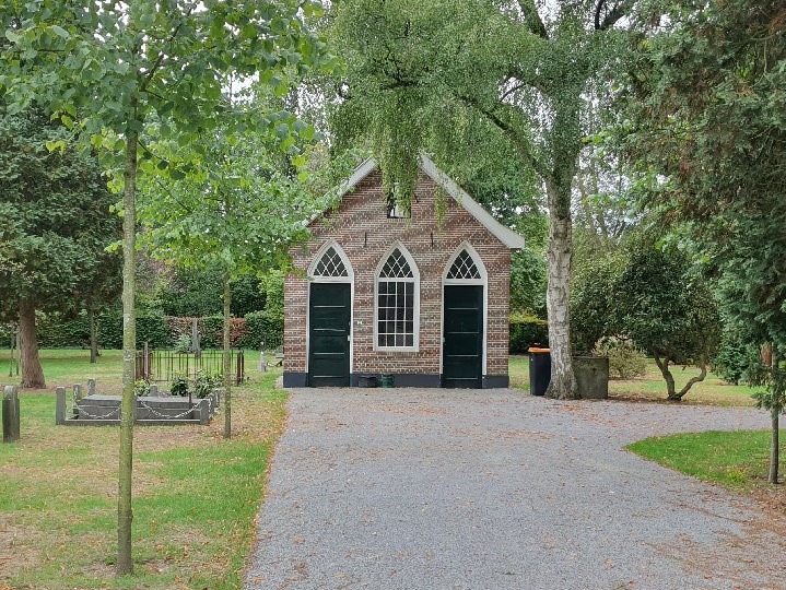
The cemetery was later extended to the west. The oldest section is characterised by relatively empty lawns with scattered old funerary monuments and a small lychgate (baarhuisje). The western part has a more structured, orthogonal layout.
At the start of the 20th century, the Old Cemetery became increasingly enclosed by the village’s encroaching urban development. This led to the need for a new cemetery. In 1923, the Berkenhove cemetery on Romienendiek was opened.
Although the Old Cemetery has since taken on the function of a ‘tranquillity park’, it is still sporadically used for interring the deceased in existing family graves.
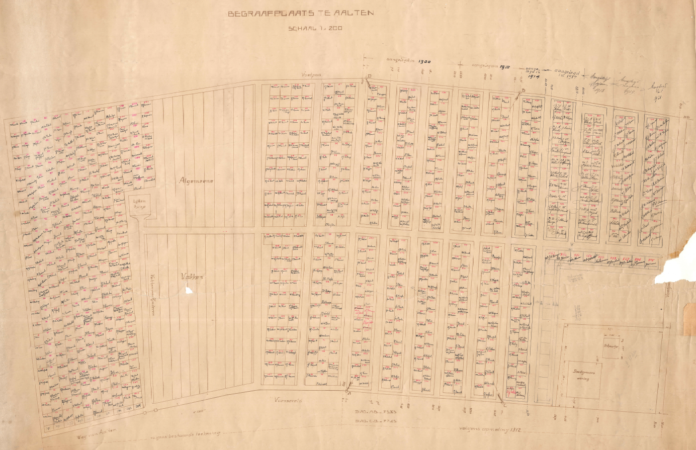
A map is available, dating from about 1921, providing an overview of all graves and those interred; click the thumbnail below for a large, legible version (PDF):
Old General Cemetery Aalten, 1921
Commemorative Column
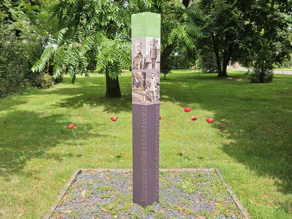
As part of the 70th anniversary of the liberation, a commemorative column was placed in the Old Cemetery in 2015 to commemorate all soldiers from Aalten who fought on and around the Grebbeberg in May 1940. Seven servicemen from Aalten lost their lives there. Their names and photographs are immortalised on the commemorative column.
Roman Catholic Cemetery
When the cemetery on Varsseveldsestraatweg was established, the Catholic community in Aalten insisted that a separate section be designated and consecrated for them. The municipality purchased a piece of land for this purpose across the street, on the corner with Molenstraat.
However, this small Catholic cemetery became full after only thirty years. In 1868, a new R.C. cemetery on Piet Heinstraat was opened. The former small Catholic cemetery on Varsseveldsestraatweg later became a public garden. However, the graves of at least 50 Catholics from Aalten have never been cleared.
In 2015, the site was redesigned at the initiative of local residents to better reflect its historical significance. An information panel has been placed at the location highlighting the history of the cemetery.
Owners
This list is incomplete.
Year
Plot
Owner
Description
1832
I-1409 I-1436
the Municipality of Aalten
4.430 m² (protestant) cemetery 720 m² (catholic) cemetery
In the late 1860s, the small Roman Catholic cemetery on the corner of Varsseveldsestraatweg and Molenstraat reached its capacity. This created a need for a new cemetery for the Catholic community in Aalten.
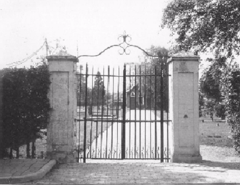
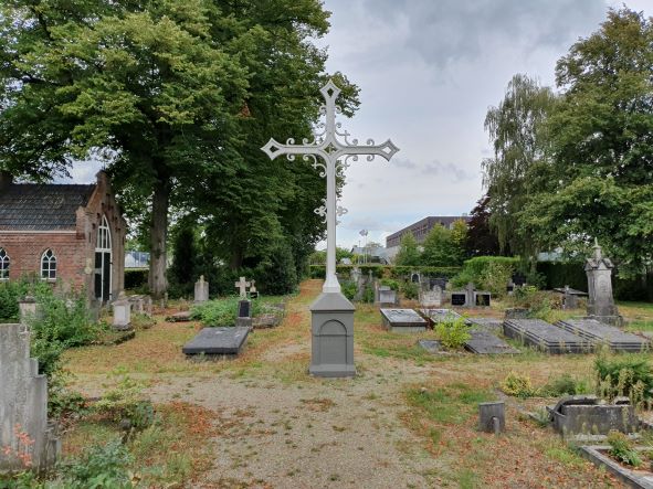
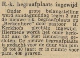
In 1868, Anton Driessen, a textile manufacturer in Aalten, donated a plot of land on what is now Piet Heinstraat to the church to be established as a cemetery. In addition to the land, he donated an iron Calvary cross and an iron gate, both of which still stand today. Anton also stipulated that his family be buried in a contiguous plot next to the cross. The mortuary on the cemetery grounds dates from 1888.
Lack of space and closure
A century later, this cemetery also became full, and there was no room for expansion. From 1960 onwards, Catholic deceased were therefore buried in the new Roman Catholic section of the Berkenhove cemetery.
In the early 1970s, the cemetery on Piet Heinstraat was officially closed. The site was transferred to the municipality of Aalten for the symbolic amount of one guilder.
Notable graves
Several prominent Catholic former residents of Aalten rest in this cemetery, including various members of the Driessen textile family. This family is inextricably linked to the textile history of Aalten and had a major influence on the emancipation of the Roman Catholic population in the municipality.
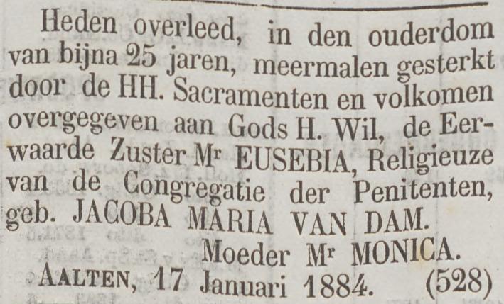
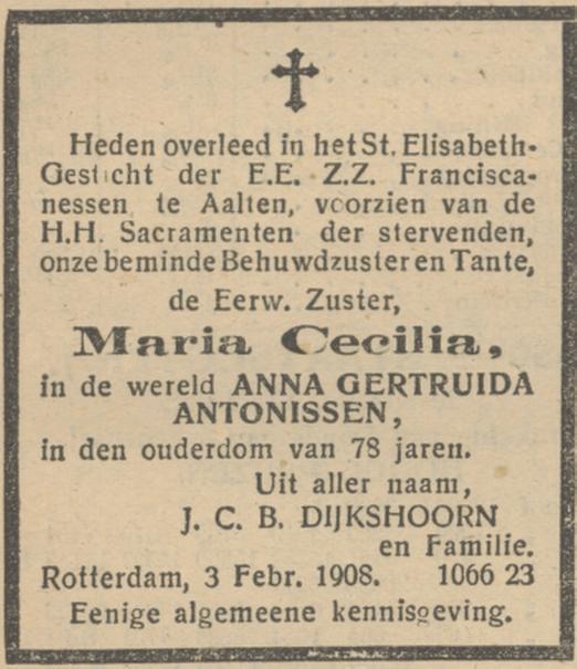
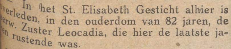
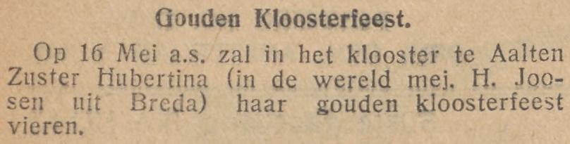
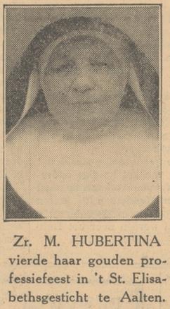
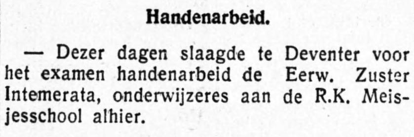
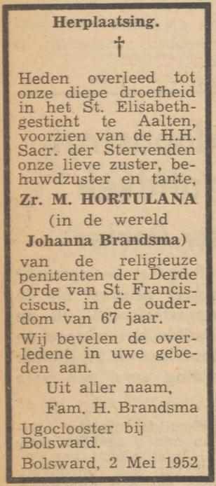
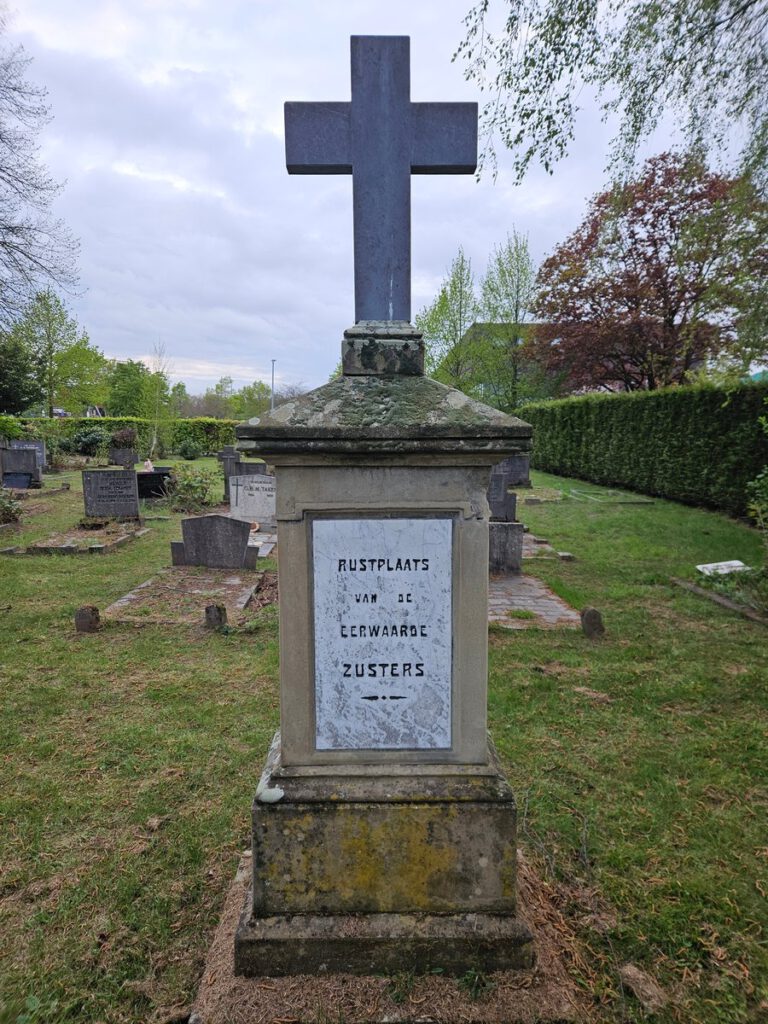
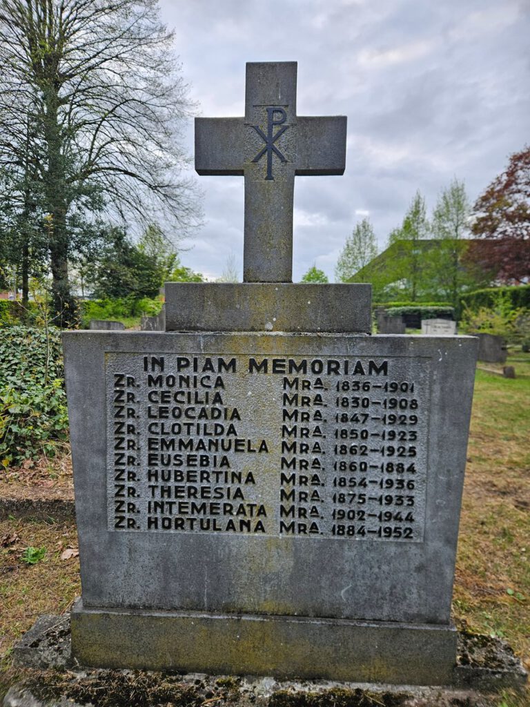
The grave of Pastor Van Rooijen, who died on January 23, 1945, during a bombardment of Dijkstraat, is also located here. Additionally, there are graves of the sisters from the former Saint Elizabeth Convent on Dijkstraat. They provided primary education at the Saint Joseph School and nursed the sick of all faiths.
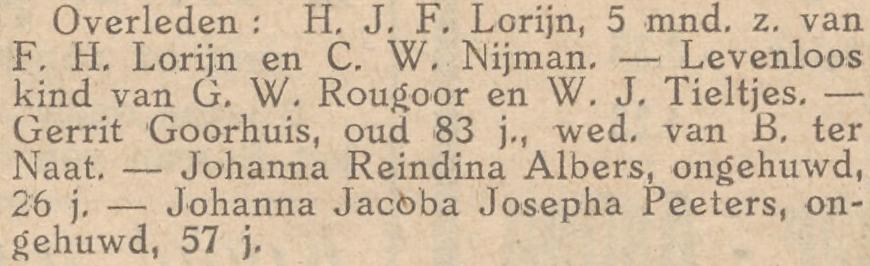
De Tijd, 22 January 1884De Maasbode, 7 February 1908Aaltensche Courant, 24 July 1925Aaltensche Courant, 31 May 1929De Amstelbode, 13 May 1931De Maasbode, 16 May 1931
De Graafschapbode, 29 August 1932Aaltensche Courant, 5 May 1933Ons Noorden, 8 May 1952
In 2015, as part of the commemorations for 70 years of liberation, a commemorative column was placed at the Old General Cemetery in Aalten to honour all local soldiers who fought on and around the Grebbeberg in May 1940. Seven servicemen from Aalten lost their lives during the conflict. Their names and photographs have been immortalised on the column.
The text on the column reads:
Soldiers from Aalten in May 1940
In the early morning of 10 May 1940, German troops invaded the neutral Netherlands. For our country, this marked the beginning of World War II. Mobilised Dutch soldiers took up positions in several lines of defence, including the Grebbe Line. Fierce fighting took place in the main resistance strip on and around the Grebbeberg near Rhenen.
Photo: R. Neerhof, 2025
Most soldiers survived the battle and were able to return to Aalten, often after a brief period as prisoners of war. Seven families remained in a state of uncertainty for some time. Eventually, they received the tragic news that their sons would not be returning; they had fallen in battle. Their lives were devastated by this great loss. At this site, all Aalten soldiers who fought in May 1940 are remembered.
Many residents of the Achterhoek, including a considerable number of young men from Aalten, were assigned to the 8th Infantry Regiment (8 R.I.). This unit played a vital role in the defence of the Grebbeberg. The poorly trained and equipped soldiers fought an unequal battle against an overwhelming enemy. Bravely, they attempted to hold their ground for as long as possible. The Germans, with awe, referred to the hill as ‘Der Teufelsberg’ (The Devil’s Mountain). Nevertheless, our country was forced to capitulate on 14 May 1940.
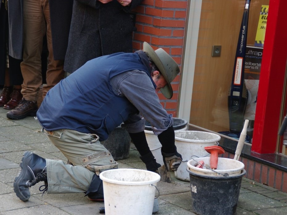
Gunter Demnig placing the first Stolpersteine in Aalten
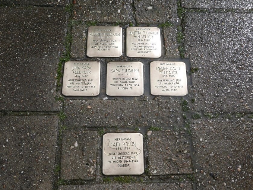
In Aalten, 34 Stolpersteine (stumbling stones) are laid across twelve addresses. A Stolperstein is a memorial stone placed in the pavement in front of the house from which people were deported by the Nazis to extermination camps during World War II. When you see such a stone—usually unexpectedly—with the name of a victim, you are momentarily reminded of how millions became victims of systematic murder during that war.
The stones have a surface area of 10 by 10 cm. A brass plate is affixed to the top, into which the name, year of birth, date of deportation, and the place and date of death are stamped. Each stone serves as a memorial to a single victim: a person who lived in that very spot and was deported from there, never to return.
Originator
The Stolpersteine project was conceived by the German artist Gunter Demnig. He deliberately kept the size of these ‘stones of offence’ small, requiring one to bow down to read the inscriptions.
Demnig began laying the first Stolperstein in 1997 in the Berlin district of Kreuzberg. Today, Stolpersteine can be found in many countries. Gunter Demnig thus gives every victim their own individual monument. His motto is: “A person is only forgotten when his or her name is forgotten.”
Initially, he made all the stones himself, as he felt mass production conflicted with the project’s ethos. However, forced by the project’s rapid growth, he is now assisted by an artist friend. He insists on personally laying the first stones in any given location. The remaining stones are now usually installed by municipal pavers.
Stolpersteine in Aalten
In Aalten, 34 Stolpersteine have been laid at the following addresses:
’t Dal 1: Levi Salomon Schaap, Ella Schaap-Philips, Eliazar Hars Schaap, Frits Landau, Amalia Landau-Lorch
Dijkstraat 10a: Levie van Gelder, Jula van Gelder-Landau, Arnold van Gelder
Eerste Broekdijk 51: Roberth Fuldauer, Rozetta Fuldauer-van Gelder, Lina Sara Fuldauer, Sara Fuldauer, Meijer David Fuldauer, Cato Konijn
Grevinkweg 5: Sally Fuldauer, Regina Fuldauer-de Jong
In one instance, the stone could not be placed in front of the victim’s residence because the building (Industriestraat 4) no longer exists, nor is there a pavement where it could be installed. Therefore, this stone was laid in front of the synagogue.
Huisstededijk, IJzerlo (just before the Keizersbeek bridge)
The ‘Flying for Peace’ (Vliegen voor de Vrede) monument is a commemorative memorial located on Huisstededijk in the Aalten rural district of IJzerlo. The monument was erected in memory of the crash of a British bomber during World War II, which came down in a nearby potato field on the night of 26 June 1943.
On that particular night, over 400 British bombers flew over the Achterhoek on a mission to bomb the petrochemical industry in Gelsenkirchen. One of these aircraft, a Short Stirling BK767 of 214 Squadron, Royal Air Force, with seven crew members on board, had taken off just before midnight on 25 June.
At approximately 01:20, the aircraft was set ablaze by night fighter pilot Oberleutnant Ludwig Meister, flying a Messerschmitt Bf 110 G-4 that had recently scrambled from Venlo airfield. The Stirling crashed into a potato field between the farms of the Van Lochem family on Huisstededijk and the Ter Horst family on Veldweg.
Of the seven crew members, only two survived the crash. They were later captured near Hemden and spent the remainder of the war in German prisoner-of-war camps. The other five crew members perished and were buried following a brief ceremony on 29 June 1943 at Berkenhove Cemetery in Aalten.
The following day, many Aalten residents flocked to the cemetery. On the middle grave, members of the underground resistance laid a wreath with ribbons bearing the text: “Gebroken vleugels, onsterfelijke roem” (Broken wings, immortal fame). By order of the occupying forces, these words had to be removed, but they live on through the monument today.
Survivors (taken prisoner): • F/O K.A. Nielson • Sgt E.G. Taylor
The Monument
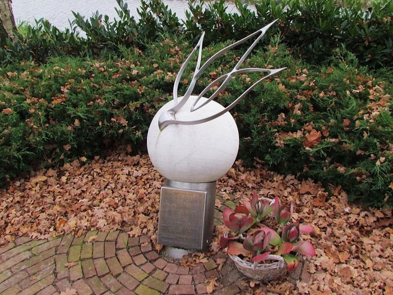
In 2003, a monument was unveiled at the spot where one of the crew members’ bodies was found, near the cycle bridge over the stream on Huisstededijk. The creator, Wim Westerveld, gave it the name ‘Flying for Peace’ and designed an artwork containing multiple layers of symbolism.
The monument consists of a white stone sphere topped with a metal sculpture that, from certain angles, represents a dove and, from others, flames. The sphere rests on a metal pipe angled into the ground, to which a plaque is attached. One of the two survivors, navigator Edwin Taylor (born 1922), was present at the unveiling of the monument.
Significance
The sculpture represents the Earth with a dove of peace on top, symbolising the desire for peace. However, from certain viewpoints, the dove transforms into flames, symbolising the tragic event of the crash and the fiery dedication of the crew to their mission. The flames also refer to the fire of the bomb load the aircraft was carrying. The broken wings on the monument are a symbol of the crew’s abruptly ended mission.
The monument serves not only as a memorial to the crew of Stirling BK767 but also conveys a broader message. It acts as a warning against war and reminds us of the freedom we enjoy today. It calls upon us to cherish this freedom and to grant it to others as well.
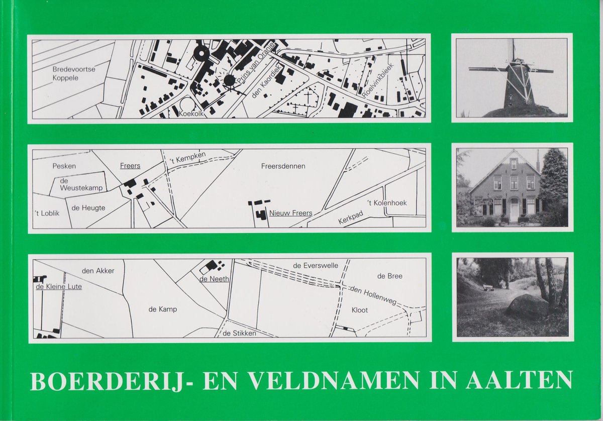
A highly valuable source of information for Old Aalten is the publication Boerderij- en Veldnamen in Aalten (Farm and Field Names in Aalten). It is an important reference work of toponyms in the municipality of Aalten, prior to the municipal reorganization with Dinxperlo in 2005.1 It provides insight into the names of farms and parcels as they were often used for centuries, before land consolidation and modernization left their mark on the landscape.
Objective and Content
The primary goal of this edition was to record historical farm and field names for posterity. This reference work contains a register with approximately 750 farm names and more than 1,650 field names. Additionally, it features numerous photographs, explanations of the naming conventions, and topographical maps.
The information was collected by the Oudheidkundige Werkgemeenschap Aalten-Dinxperlo-Wisch (ADW), under the coordination of B.J. Dorrestijn. The final compilation was established under the editorship of Loes Maas and Mr. A.H.G. Schaars of the Staring Instituut in Doetinchem, which later merged into the Erfgoedcentrum Achterhoek & Liemers (ECAL).
Historical Significance
The farm and field names reveal much about the history of the agricultural landscape in Aalten. They often refer to the location or use of the parcel, the families who lived there, or the professions practiced. For farmers, it was practical to use a single name to indicate where the laborer, farmhand, or smallholder (katerboer) needed to plow, harrow, or sow.
Many of these names were mentioned in archives and documents centuries ago, for example, to record ownership and occupancy. However, since the land consolidation, field names have fallen into disuse, and the introduction of street names in 1967 also reduced the use of farm names. For genealogists and local historians, however, they remain important starting points for genealogical research and the study of regional history. 2
Availability
Although the publication is no longer available as new, second-hand copies can still be found through antiquarian bookstores and private sellers.
Extent: 112 pages
Format: 297×210 mm (A4), landscape
Compilers: B.J. Dorrestijn (coordination); Loes H. Maas, A.H.G. Schaars (editing)
Publisher: Staring Instituut / Mr. H.J. Steenbergen-Stichting / Oudheidkundige Werkgemeenschap ADW, 2002
ISBN: 90-73667-53-4
Footnotes
In 2024, Boerderij- en Veldnamen in Dinxperlo (Farm and Field Names in Dinxperlo) was published (source) ↩︎
A new wandering editor encounters remnants of Achterhoek nationalism.
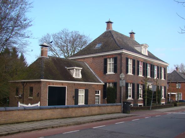
Villa ‘Beekhuize’, Aalten
By HENRI BEUNDERS — “The world ended at Arnhem! Long after we came to live here in 1969, friends who called to say they wanted to visit us would ask: ‘Can we bring anything for you?’” Mrs. Pruim says it with a mocking smile, but an indignation that has still not faded shines through.
For two months now, she and her husband—once a lawyer in The Hague and for many years a subdistrict judge in Terborg—have been running a guesthouse in their grand 1826 building “Beekhuize” in Aalten. They never want to return to the west. “The people of the Achterhoek are very tolerant, warm, and hospitable. Here, many cases end in a settlement,” says Pruim while serving breakfast.
Is the IJssel a greater barrier than the national border they live so close to? Anyone walking through the Heelweg in Dinxperlo for a while—left sidewalk Netherlands, right sidewalk Germany—would almost think so. People walk, cycle, and shop across the border as if it does not exist. Mrs. Pruim gets her small breakfast rolls in Bocholt. The customs officers hardly even come out of their booths for the passers-by anymore.
The subdistrict judge therefore never has to deal with border problems. “Well, never—recently a trunk had to be opened. There was a woman inside. ‘I always lie in the trunk when I go out for a drive with my husband,’ she had said. She simply didn’t have a passport. She certainly got a fine for that.”
Backward
However, people in Aalten do not have much regard for the Germans. The exchange of information does not amount to much. In Aalten, an advertising flyer from Bocholt drops through the letterbox; in the “Grenspost” corner, De Graafschapbode reports that the Anholt windmill has sails again. Whether this is because Aalten is Protestant-Reformed and Münsterland is Catholic? No one knows. Perhaps, as some Aalteners believe, it is the mentality reflected, for example, in the placard the Germans hung at the Heurne-Aalten border crossing before the football final in Mexico: “Jetzt betreten Sie das Land des Weltmeisters”. A Dutch customs official gleefully recounts how they were quick to scribble the word “vice” in between afterwards. “Everyone thought it was wonderful that they had lost.”
Except for those from the west, the IJssel also remains a border to another world for many residents of the Achterhoek. The appreciation for that other world has changed significantly lately. “In the past, everything that came from the west was beautiful. Without three apartment blocks, you were considered a backward village. Because of that, much beauty was destroyed,” Mrs. Pruim believes. That time seems to be over. The wave of nostalgia that hit the banks of the IJssel after the storm surge of modernization managed to save some old beauties just in time. Driving around here, you see how people everywhere are busy relaying winding and sloping streets with cobblestones in the village centers, and how the cultural regional renaissance is in full swing.
“We’ll put barbed wire by the IJssel. The people from the west aren’t coming in anymore!” Little more is heard from the Achterhoek “Nationalists” who uttered this threatening language a few years ago—it was the breeding ground for the success of the pop group Normaal. At the harvest festival in De Heurne, a hamlet between Aalten and Dinxperlo, an occasional individual nevertheless walks around with a “paspoart” issued by the Road voor Achterhooks Belang in their pocket. But for most, this disguised sense of inferiority seems to have long since given way to a firmly anchored pride in their own identity.
In the maize landscape, half a hectare of rye has been grown on the small field for demonstrations of mowing with a scythe, binding sheaves, flail threshing, plowing, and harrowing. People laugh and make jokes when even some elderly farmers appear to have almost forgotten these old techniques. Only the hands of the basket and cap maker still move quickly and routinely; they never gave up their craft. The countless telephoto lenses, video, and Super-8 cameras with which the more than 1,500 locals and tourists are filming each other suggest that the harvest festival in De Heurne is already in the dubious transition phase from genuine folk fun to tourist attraction.
Klootschieten
“One must watch out better when a throw is made, because a kloot can hit hard.” (Photo NRC Handelsblad/Vincent Mentzel)
Searching for an expression of revived folklore not yet discovered by the masses, one of the countless colorful tree posters (fair, motocross, variety show—you name it, it’s announced on a beech or oak) points to the border south of Winterswijk. There, almost the entire rural district, more than 80 men, women, and children, has turned out to participate in the klootschieten competitions.
Two teams of 5 or 6 members each try to complete the four-kilometer course through the beautiful ‘bocage landscape’ between Woold, Kotten, and Achterwoold in as few shots as possible. It is not difficult to see why ”t aole spel’ (the old game) is regaining popularity so quickly.
Anyone who can throw can play klootschieten. A rake is placed across the road, one takes a short run-up to that point, and throws the wooden, lead-weighted ‘tennis ball’ of about half a kilogram as far as possible down the street. The others run after it shouting “Astubleef” (if you please); one cheers over his throw of at least 80 meters. “You’re just throwing your hat at it,” calls another who has to search for his predecessor’s kloot in the maize on the other side of the ditch.
At the Esselinkhaar farm, the thermoses are ready on a kitchen table. They are halfway through, time for a break. Organizer Massop of the Winterswijk Klootschieters Association addresses the enthusiastic but inexperienced newcomers warningly once more. “This course is insured, but one must watch out better when a throw is made, because a kloot can hit hard.” As proof, he shows his shin where six months ago a kloot, bouncing over this same stretch of brick road, slammed into it. He is still troubled by it. That is why only coffee is served. “In the past, it was ‘boozing and more boozing,’ which invariably led to trouble.” That was also, he explains, the reason why this cheap entertainment of the ‘common folk’ was often banned in the past.
The fact that the word has since mainly provoked laughter—“there’s no balls to it” the subdistrict judge had assured—no longer bothers Massop. “It is a serious sport. Our federation therefore refused to give in to the Dutch Sports Federation, which wanted us to call it ‘shot put’.” And he presses a flyer and a sticker into one’s hand. ‘Klootschieters do it on the road’. Next year, the national championships, in the cradle of Twente, will be held in the Achterhoek for the first time. For the Kotten border residents, it is primarily a Sunday game. “The weather is nice, you see each other again, it’s sociable,” says one of the women serving coffee. “Next week we have horse teams here.”
Tyrolean Evening
The small amount of alcohol is more than made up for in the evening at the Tyrolean evening organized by the Winterswijk branch of “Jong Gelre” at camping Nieuw Beusink. A good 40 barrels of Grolsch, 200 glasses per barrel, have been brought in for the expected 800 visitors. People sit at long tables, they dance, they drink, the noise gradually swells, but it remains convivial. The Grensland Muzikanten play the Egerländer music by Ernst Mosch that is so popular here. Young and old dance to it. The Achterhoek formation Free Sense plays something more modern and louder for the second half of the evening. Shortly after midnight, the group starts Bob Marley’s “Stir It Up”. “The beer is gone! Oh, how I’m gutted, the beer is gone,” the singer sings. A normal summer weekend along the Achterhoek border is over.
“One must watch out better when a throw is made, because a kloot can hit hard.” (Photo NRC Handelsblad/Vincent Mentzel)
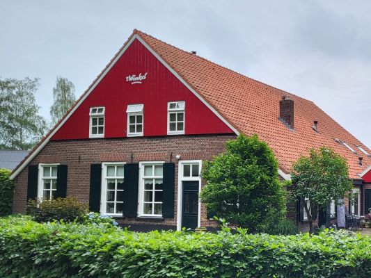
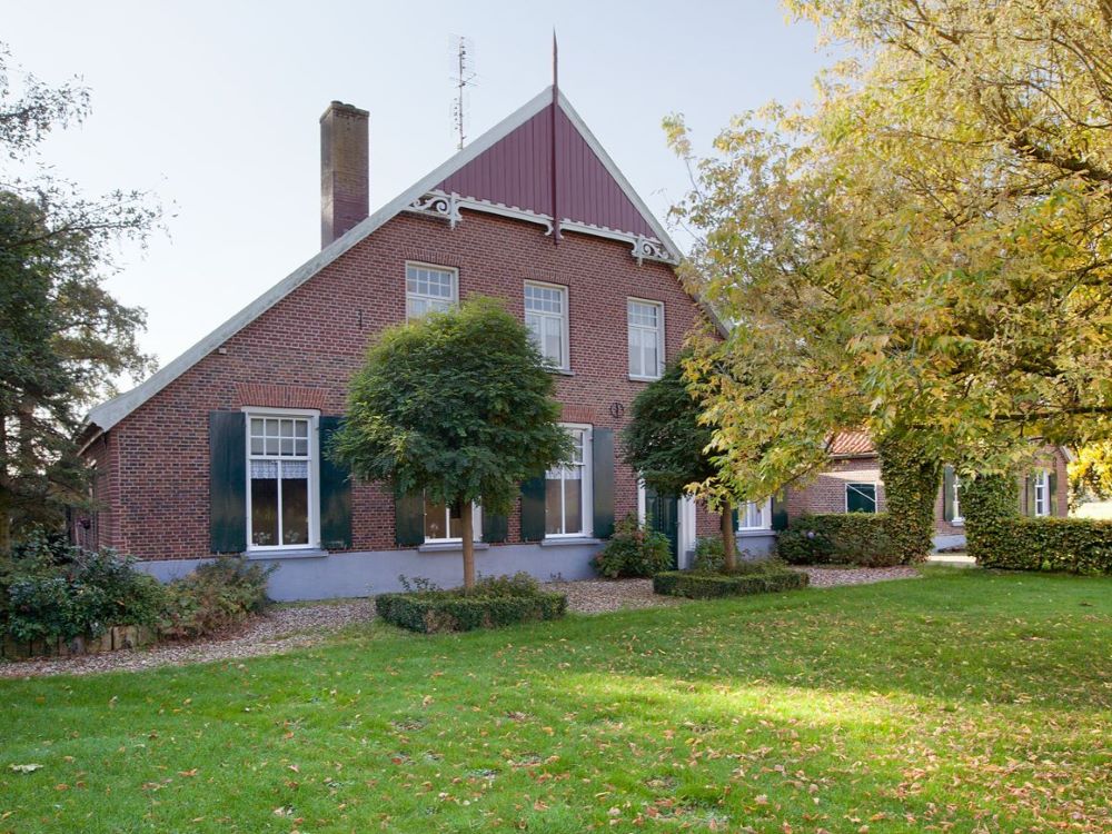
Aalten has a large number of farms with their own names. In the 1967 address book of the municipality of Aalten, about 480 are mentioned. Almost all of these names are unique. To avoid confusion, it was logical to give a farm a name that did not yet exist. However, one finds, for example, the Oude Loo and the Nieuwe Loo, Groot Kampe and Klein Kampe, even ‘t Paske, Groot Paske, Klein Paske and Nieuw Paske. These are often farms that previously formed a single homestead but were split into parts during division among children. Names with “Olde” or “Oude” then point to the original house.
When one examines those names, an interesting discovery is made. They can be divided into different groups. For instance, there is a group of names from which one can deduce what the vegetation around the yard used to be like and in what kind of environment the farm was established. Another group points to the trade that was practiced there in the past alongside agriculture and livestock farming. Many farmers, and especially the small-scale ones, had enough time to do something on the side to earn a bit extra, which was often necessary.
The practice of giving names to farms is very old. In the verpondingskohier (tax register) of 1647/50, the persons who had to pay the ‘verponding’ (a land tax) are recorded under Aalten, as well as under Bredevoort. But under the rural districts, the names of the farms are mentioned, followed by the names of the residents. Thus, we have a list of homesteads that existed at that time. Many of the current names already appear in it.
One must possess a very great imagination to be able to picture what the Aalten landscape looked like centuries ago. Nine-tenths of the land consisted of heath, forest, and swamp. The cultivable area was small and was only used for growing vegetables and a few cereal crops. Most farms were small: ‘stedekes’. Division of the common lands, artificial fertilizer, and better drainage put an end to the ‘prange’ and ‘marode’ (hardship and misery) of the farmer.
The following names require an explanation: Bokkel, called Buclo in 1284, beech forest. The Walfort was previously called the Waldenvort, a ford (through the Slinge) near the Wald (the forest). Similarly, Walvoort on the Haart, with a ford through the Keizersbeek.
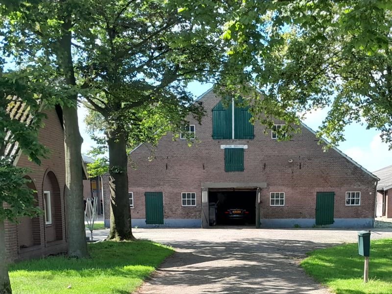
’t Olde Brusse, Lintelo
The name Voorst (from forestis) was used for a forest in which hunting was not allowed; it was the private hunting ground of the king or the lord. The site of the Snoeijenbos was cleared in the forest. Brusse is formed from: Brusch, brushwood, ‘t Hagt and the Heegt: forest of low wood, perhaps consisting of hawthorn bushes.
The Slehegge may recall the blackthorn, ‘t Heggeltje: a small ‘hagt’. The Hakstege was located on a narrow path (stege) through the ‘hagt’. The Rieste owes its name to the brushwood (rijshout). The Heisterkamp was established on a site where much brushwood grew.
In 1386, the name Varenvelde appears, and later also the Verrevelt, which is now the Vervelde. The Veernhof also originated in a field full of ferns. The Tente owes its name to the ‘tente’, the common tansy. The Greute recalls the ‘gruit’, the bog myrtle, with which beer was fermented and which grew on marshy ground, as did the reed, which is found in the name the Riete. Waste uncultivated land, ‘vage’, is found in Vaags.
One should not have a grand conception of these heights. An elevation of half a meter was already called a ‘bult’, a ‘horst’, or a ‘heuvel’. These heights offered no protection whatsoever against the damp environment. The houses were very damp.
Names like De Bulte, Bultink and De Heuvel speak for themselves. De Brink (brinc) was a grass-covered elevation. De Bree (from bride) is considered a field on the ‘es’ (open field). Drenthel (originally Drenthelo): forest on an elevation. Haartman and Haartelink: a ‘haart’ is a high-lying heathland. Hengeveld (heng, slope), Hillen (hil, hill), Hoopman, the Klinke (hilly heathland with puddles and pools here and there).
De Horst (an elevation covered with low wood), Leemhorst, Seinhorst, Stokhorst and Winkelhorst. Leeland (lee, hill, also a place of judgment), the Limbarg (loam mountain?). De Pol: a small sand hill that stood out like an island above the surroundings. Pikpolle (pec, poverty): a meager hut on a ‘pol’.
Tammel (in 1384 Tanbulen): pine forest on a ‘bult’? Hondorp: village, mound, elevation the size of a ‘hont’, a unit of area. The Westendorp also points to an elevation. Wierkamp: ‘wier’, ‘wierde’, elevation protruding above a wet environment.
Farms located in or near a swamp
The largest part of the municipality of Aalten used to be swamp. Only the Bocholt–Vragender ridge protruded above the marshes. These ‘broeken’ (marshlands) were created because the small rivers the Slinge, the Zilverbeekje, and the Keizersbeek could not sufficiently drain the water. That is why so many farms have a swamp name, such as Goorhuis, Goorman, Goorzicht, Moorveld, the Stroete (marshy wasteland), Veenemaat, Groot and Klein Veenhuis, ‘t Veentje, Wijnveen (‘winne’ farm, farm in the peat), Hagenbroek (a marshland with hawthorn bushes), Kortenbroek (a marshland with short grass and therefore infertile land), the Woerd (woert, low-lying land).
Bolandsweide (bol, soft, marshy, mud). The Nonhof (in 1281 den Honhof) and the Hennepe (in 1284 Honepe), both names formed from “hoen” and “huun”. Luiten, popularly Luten, was low-lying poor land, ‘lute’, while Maris represented much the same: swamp. Glieuwe: ‘gliede’, black shiny soil, peat. Somsenhuus: ‘somp’, marshy land. Pietenpol (in 1640 Pytenpoel): ‘pitte’, pit, hollow, thus a pool in a low place, De Put (hollow, pool. ‘t Slaa: ‘slade’, heath pool, swamp. Te Sligte (in 1384 Schlichte): flat swamp. Mager: poor, meager land. The Navis possessed a damp meadow; ‘nate’, wet and ‘vis’, Wisch, ‘wiese’, meadow. Near Amerongen, the medieval residential tower the Matewisch still stands.
Pietenpol, Haart
Camp names
Stapelkamp, Heurne
A number of names end in -kamp. Originally, the ‘kampen’ were small pieces of land that had been cleared of brushwood and trees in the forests, thus reclaimed forest. Later, the word ‘kamp’ acquired the meaning of field.
Only a few names recall the reclamation of wastelands. Nijland, Nijveld, Nijhof, Nieuwkamp, Nieuwe Weide. The Bijvanck, what was ‘caught’ or taken additionally. Te Brake also points to reclamation, the ‘breaking’ of the wasteland. Ruwhof: ‘rude’, ‘rode’, reclaimed land.
Farms that recall passes, gates, tolls, etc.
A ‘pas’ is a passage in a ‘landweer’ (defensive earthwork), a wooded bank. The resident of the nearby farm had to ‘oppassen’ (watch out), supervise the persons entering. Such a farm sometimes bore the name “Pasop”. Along the Romienendiek, for example, lie the Paske, the Pasop and the Paskerhut: the residents had to keep an eye on the persons who entered the ‘marke’ (common land) through the Wolboom and the Zwarte Veen. On the border with the Varsseveld area near the Varsseveldseweg, there is also a Pas. On the Varsseveld side, the Loerdijk and the Kijkuit are located here. The ‘marken’ were well protected.
Among those who also had to take the ‘marke’ under their care was the resident of the Markerink, formerly called March-ward-inck. A ‘werde’ was a watch post, a place where one had to supervise the intruding unsavory elements. A similar activity was expected of the Ligterink, which in 1435 was called Licht-werd-inck: the watching apparently felt rather light there. The duty of keeping watch also lay with the Kuier and the Kuierman: ‘koeren’, ‘kuren’ meant “looking out”.
Did the ‘schutte’, who had to seize (schutten) the livestock from another ‘marke’ that had intruded into their own ‘marke’, live on the Schuttenkamp, and did such a person also live on the Man-schot-weide? Recalling the tolls are Slotboom, the Stokkert, ‘t Bonte Hek, Klaphekke, ‘t Tolhuis, Tolkamp and Tolder (toll collector).
Memories of the church
De Pater, ‘t Klooster (named after the Schaer monastery), Kerkhof (a farm of the church), Kerkkamp, Neerhof (den Heerhof, inhabited by the monks), De Kloeze, hermit, perhaps also Klaus. Kosters custerie: the proceeds of this property were for the sexton.
Beestman (herdsman), the Scheper (shepherd), Sweenen (swineherd), Fukker (breeder), Peerdeboer (horse farmer), ‘t Villeken (where dead animals were skinned and the hides were tanned), Baten (‘beten’, the tanning of hides). The Brasse (brewery), Pakkebier (‘backe’, also brewery), Schenk (public house, tavern) and Slikkertap (a tap in the ‘slik’, swamp).
Brethouwer (should we interpret ‘bret’ here in the sense of board, thus someone who made boards?), the Klumper and Klompenhouwer (‘houwen’ is chopping or carving), Kolstee (place where charcoal was burned), Kuiper (cooper), Draaijer (turner), Kappers, Kleuver (recalling the chopping and splitting of wood), the Smid and ‘t Smees (formerly Smedeserve). Papiermolen, the Olde Mölle, ‘t Olde Mulder, the Görter (groat-maker, hulling miller), Te Roele (in 1640 ten Rule – ‘rullen’, hulling of grain, hulling mill).
Bouwhuis Wever, ‘t Klooster
Den Blauwen (blue-dyeing of linen), the Wever (weaver), Bouwhuis Wever, Weversborg, the Pellewever (weaver who wove finer goods, such as damask and table linen), Schreurs, Snieder and Snijdershuis (tailors). Kremer (peddler) and Klodde (ragman). Speelman (someone who cheered up the parties with a musical instrument) and the Piepert (piper, flute player). Krieger (inhabited by a soldier? In 1640, a soldaetencamp also occurred in Barlo).
Farm names ending in -ink etc.
About forty farm names end in -ink. These largely point to the possession, to the estate of a certain person. They are mainly composed of a personal name + -ink. Lists of proper names that occurred in the Middle Ages have been compiled from all possible archival documents, and based on these lists, a number of farm names can be explained.
Hoenink, Huinink and Hunink were located in a ‘hoen’, a ‘huun’, a swamp. Another explanation that we must take into account, according to the CBG Center for Family History, is that names like Hoenink and Huinink go back to the Germanic personal name Huno.
However, there are a number of names that cannot be traced back to personal names. They clearly refer to something else. These are: Bekink (located near a brook), Bultink (located on a ‘bult’), Doornink (located in or near a thorn forest), Eekink (located on a site with oaks), Essink (located on an ‘Es’), Heijink (located on the heath), Kempink (located near or in a ‘kamp’), Haartelink (located on a ‘Haart’). Rengelink can indicate a “rinc”, which was a place of judgment. On the Borninckhof, the Haartse Wetering originates, so there are springs there. On the former Richterink, the judge held his proceedings.
There was a time when the meaning of the suffix -ink was no longer understood. People then began to form names with “stedeke” and “goet”. Thus we find, for example, Heijnengoet, Goossenstedeke, etc. In later usage, the words ‘stedeken’ and ‘goet’ were omitted. Freriksgoet became Freriks, Rutgerstedeken became Rutgers. Here again many farm names formed from personal names: Freers, Freriks, Bullens (from Bullo), Ebbers (from Ebbo), Goosen (Goosen, Goos), Heinen (Hein), Lammers (Lammo), Lievers (Lieven), Lindert (Lindert), Lubbers (Lubbert), Reinders (Reinder), Rutgers (Rutger), Wiggers and Wiechers (from Wigger), Wubbels (from Wubbel), Wolters (Wolter) and Rikkert (Rico).
In addition to the farms classified in the groups above, there are a few others that deserve special mention: the Tuunte was surrounded by a ‘tuun’, a woven fence, as were the Vreman and the Vreveld. The Zigtvrede had some preferential rights in the annual distribution of the ‘marke’ lands. One of these farms was called Seegvreden in 1640, named after the ‘seege’, the goat. The Hegge was surrounded by a hedge. The Sonderen also had rights; a part of the common land could be used for private use. That part was separated (afgezonderd) from the ‘marke’. The Meijnen was also part of the common ‘marke’.
The Haverland and the Haverkamp had the duty to supply oats (haver) to the lord or church, etc. On the Hemelmaat, justice was administered; a ‘hegemael’, a ‘heimael’, was a space surrounded by a hedge where a ‘mael’, a court session, was held. The Akkermaat owes its name to a meadow that could be mown in one day, and the Maandag to the piece of land that could be plowed in one day with the shared livestock. A former name would therefore have been: Mendag. The Hogewind should actually have been called the Hogewend, because this was the high end of the land where the plow was turned (gewend).
The Grotenhuis provides information about the size of the house and the Nieuwenhuis (in 1640 Nijenhuis) points to a then newly built dwelling, just like Nijboer. The Lankhof and Scheel indicate the shape of the land: long and crooked. The Korten (in 1640 Kortenstedeken) had only a short piece of land. The Heurne had the shape of a horn, a tapering piece of land, as did the Timp and the Timpert. Sad was the state of the Prange, the Marode and the Drommelder, which three names can all be translated as misery.
The Smol was “small and insignificant”. Could the Huikert have been a hay meadow or is it a distortion of the popular name Huik for Hugo? The Botervat: butter meadow? The Westendorp, the Oosterbosch, the Oosterhoeve and the Oosterman derive their names from the cardinal directions towards which they are oriented. Agriculture is indicated by: Bouwlust, Bouwhuis and the Bovelt (building field). Is the Hillo (Heiligelo?) a memory of paganism or was it a ‘lo’ on a ‘hil’ (hill)? The Leste Stuver was formerly an inn near Bredevoort where traveling people could squander their last penny.
Boerkoel, G.A.W., The Names of Aalten’s Farms, published in the Oostgelders Tijdschrift voor Genealogie en Boerderijonderzoek (1984, nr. 2, pag. 1), edited and supplemented by Remco Neerhof (Old Aalten). Some farm names appear more than once in the municipality of Aalten; in such cases, the hyperlink provided usually refers to the oldest known farm.
An ‘oorman’, sometimes referred to as ‘oormenneke’, is a room that was built onto some (village) farmhouses, where the elderly parents of the residents lived out their final years. Today, one might use the term ‘granny annex’ or ‘sheltered housing’. Sometimes, an oorman was also rented by a single person. It was a small room measuring approximately two by two and a half metres, in which a box bed (alkoof) served as a sleeping area.
The last oorman in Aalten was located at numbers 38/40 Hogestraat.
Regarding the origin of the term oorman, E.M. Smilda writes the following in Aalten en Bredevoort in oude ansichten:
“In my view, the name oorman should certainly not be considered as being derived from the idea that ‘just as a person’s ears protrude, so an oorman is an extension protruding from the farmhouse’. On the contrary, it is named after the occupant, as is customary in this region. Spelt more accurately, the little dwelling is called an oirman. In one of his plays, [the famous Dutch poet] Vondel has a character ask: ‘Do you then have no oir?’ By oir, heir is meant. In the end-room built onto a farmhouse, the older man who did indeed have an oir could spend the final years of his life. He was the oirman, lived there, still helped out a bit here and there, and received free board and lodging. In the whole of the Netherlands, this original name oirman occurs exclusively in Aalten.”
The group keenly inspected the remains of the brick kiln.
Mr H. Hofs from Varsseveld described the uncovering of the remains of an old ticheloven (brick kiln) in the hamlet of ’t Klooster near Bredevoort as a unique find. The kiln dates from 1708. The archaeological fieldwork group of the Antiquarian Working Community of Aalten, Dinxperlo, and Wisch (ADW) has been working for quite some time to carefully uncover the remains of the brick kiln.
The site of the old brick kiln was found partly thanks to Mr W. Lobeek, who used to live on the Götter farmstead. It was this former resident of ’t Klooster who was able to welcome at least eighty interested visitors to the excavation site on Saturday morning. The level of interest was so high that another excursion to ’t Klooster will be organised this coming Saturday. Mr R. Wartena, the regional archivist and an ADW board member, gave an introductory talk on what is known about the brick kiln.
It is virtually certain that this concerns the kiln of Matthijs van ’t Waliën. In return for his services – the planting of a large forest – he received, among other things, approval to build and operate a brick kiln here. The clay was allowed to be dug on the grounds of the monastery. Matthijs, however, was unable to meet his obligations. Many trees died immediately, and the severe winter of 1709 ensured that a third of the trees bit the dust.
Without ceremony
He saw no way to replant the trees, and in those days, protecting employment was not a priority. In 1719, Matthijs was forced to demolish the brick kiln within six months and to remove the bricks within a year. According to the agreement, the waarmanshuis (a worker’s or overseer’s cottage) had to remain standing. No trace of this cottage has been found so far. It is possible, however, that the Götter farmstead is the former waarmanshuis.
The kiln was indeed demolished, but apparently no further than ground level. The floor, with a surface area of 9 by 11 metres, and some small walls have remained, and the clay pits are also still clearly recognisable. Mr Hofs shared some details about the excavations, which the working group has been engaged in since July 1979. The investigations have yielded good results so far, even though they had hoped to find a few more traces in the immediate vicinity of the kiln.
The working group has mapped the remains and will cover them up again shortly. If they were to remain exposed to the open air, not much of them would be left.
In the course of the last century, excavation work repeatedly led to the discovery of the mortal remains of old-time residents of Aalten.
A burial vault collapsed
Nieuwe Aaltensche Courant, 9 July 1920
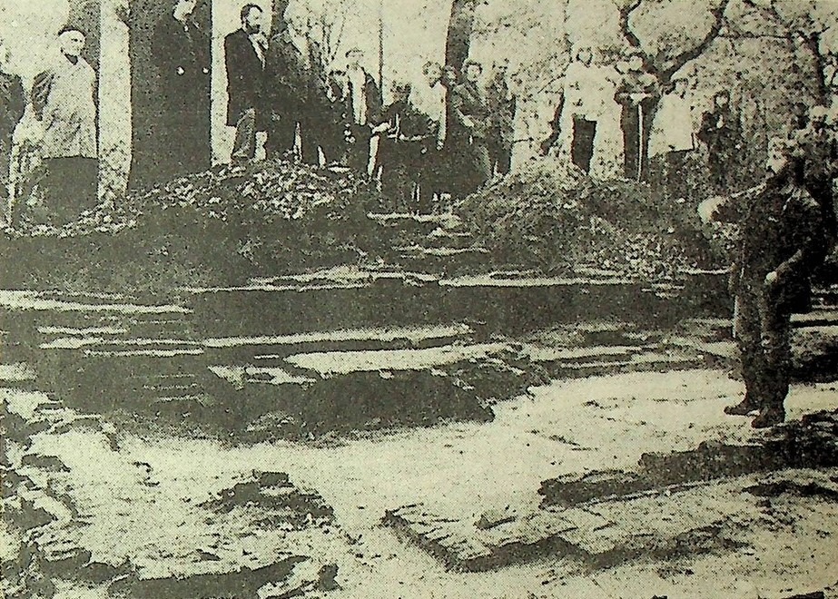
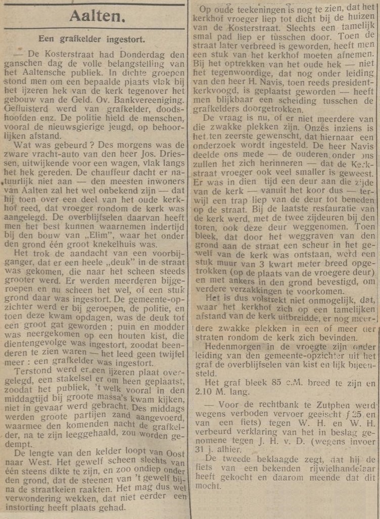
AALTEN – Throughout the whole of Thursday, Kosterstraat (= Köstersbulte, OA) held the full attention of the Aalten public. People stood in dense crowds around a particular spot close to the iron church gates, opposite the building of the Geld. Ov. Bankvereeniging. There were whispers of a burial vault, skulls, and so forth. The police kept the public, especially inquisitive youngsters, at a proper distance.
What had happened? In the morning, a heavy lorry belonging to Mr Jos. Driessen had driven right alongside the gates whilst swerving to avoid another cart. The driver naturally had no idea – as will indeed be the case for most inhabitants of Aalten – that he was driving over a section of the old churchyard that had formerly been laid out around the church. The remains of this churchyard were most clearly observable at the time “Elim” was built, where it was one vast charnel house beneath the ground.
It caught the attention of a passer-by that a sizeable “dent” had appeared in the street, which seemed to be growing steadily larger. Others were called over, and it now appeared as though a section of the ground had caved in. The municipal surveyor was summoned, as was the police, and by the time they turned up, the dent had become a large hole; rubble and mud had fallen onto a wooden coffin, which had collapsed as a result, revealing bones – there was no longer any room for doubt: a burial vault had collapsed.
Nieuwe Aaltensche Courant, 9 July 1920
An iron plate was immediately placed over it, and a hoarding erected around it, so that the public, who came to look in great numbers particularly during the afternoon, were not put in danger. During the afternoon, large quantities of sand were brought in, with which the burial vault was to be filled in during the coming night, after having been emptied.
The length of the vault runs from east to west. The brick arch appeared to be only a single brick thick, and so shallowly subterranean that the bricks of the arch almost touched the cobblestones of the street. It may therefore give cause for wonder that a collapse had not occurred sooner.
Old drawings still show that the churchyard used to extend close to the houses on Kosterstraat. Only a fairly narrow path ran between them. When the street was widened later on, a piece of the churchyard had to be taken away. When the old gates were erected – not the current ones, which were installed under the supervision of Mr H. Navis, who was already president-churchwarden at the time – a division was apparently driven straight through the burial vaults.
The question now is whether there might be more of these weak spots. In our view, it is highly desirable that an investigation be launched into this. Mr Navis informed us – as the older ones among us will remember – that Kerkstraat also used to be much narrower.
In those days, there was a door on that side of the church – that is to say, leading from the chancel – while a flight of steps ran from the door down to the street. During the last restoration of the church, this door was removed along with the two side doors near the tower. When it became apparent that digging away the ground by the street had caused a crack to form in the vaulting of the church, a section of wall three quarters of a metre wide was erected (on the site of the former door) and secured into the ground with anchors to prevent further subsidence.
It is therefore by no means impossible that, given the churchyard extended a considerable distance from the church, further weak spots exist in one or more of the streets surrounding the church.
Early this morning, under the direction of the municipal surveyor, the remains of the coffin and the corpse were gathered from the grave. The grave proved to be 85 cm wide and 2.10 m long.
Urns containing cremated human bones
De Grondwet, 21 October 1884
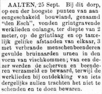
AALTEN, 25 Sept. Near this village, on one of the highest points of a continuous stretch of arable land known as “den Esch”, workmen digging for gravel recently found, at a depth of 2 metres upon the gravel bed and at fairly equal distances from one another, 3 brown earthenware urns in the shape of fishbowls, filled with cremated human bones; the shards and bones of one of these were collected and preserved, whilst the workmen, upon discovering anything similar, will endeavour to leave it undamaged and have it preserved.
Skeletons found at ’t Blik
Graafschapbode, 14 July 1925
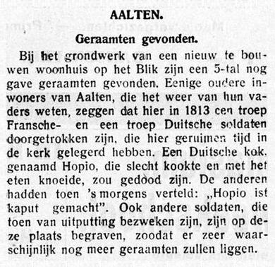
AALTEN – During the groundwork for a newly to be constructed dwelling at ’t Blik, some 5 fully intact skeletons have been found. Some older inhabitants of Aalten, who know of it from their fathers, say that a troop of French and a troop of German soldiers passed through here in 1813, having been quartered in the church here for a considerable time.
A German cook named Hopio, who cooked poorly and meddled with the food, is said to have been killed. The others had then recounted the next morning: “Hopio ist kaput gemacht” (Hopio has been done for). Other soldiers who succumbed to exhaustion at the time were also buried at this spot, so it is highly probable that further skeletons lie there.
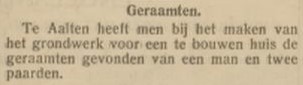
In Aalten, whilst laying the foundations for a house to be built, the skeletons of a man and two horses have been found.
Petrified human head in Barlo
Aaltensche Courant, 21 April 1939
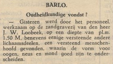
Yesterday, the personnel working at the sand quarry of Mr J.W. Loobeek found, at a depth of approx. 1.50 m, a petrified human head along with several other petrified body parts, in which the shapes for the eyes, nose, and mouth can be clearly distinguished.
Urn found
Aaltensche Courant, 16 October 1945
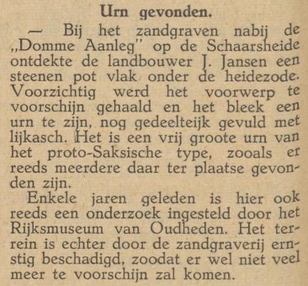
Whilst digging for sand near the „Domme Aanleg” on the Schaarsheide, the farmer J. Jansen discovered a stone pot just beneath the heather turf. The object was carefully extracted and proved to be an urn, still partially filled with funeral ashes. It is a fairly large urn of the Proto-Saxon type, several of which have already been found at that location.
A few years ago, an excavation was also carried out here by the National Museum of Antiquities (Rijksmuseum van Oudheden). However, the site has been severely damaged by the sand quarrying, meaning that not much more is likely to come to light.
Path between the old Helenakerk and Elim House
Circa 1955
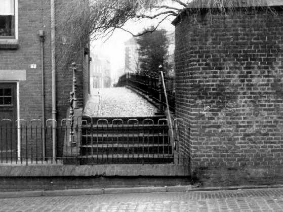
Adjacent we see the ‘trepkes’ (steps) between the old Helenakerk and Elim House. This path was excavated and widened around 1955. During the excavation of the steps, numerous bone fragments came to light from old-time residents of Aalten who had been buried there in the old churchyard.
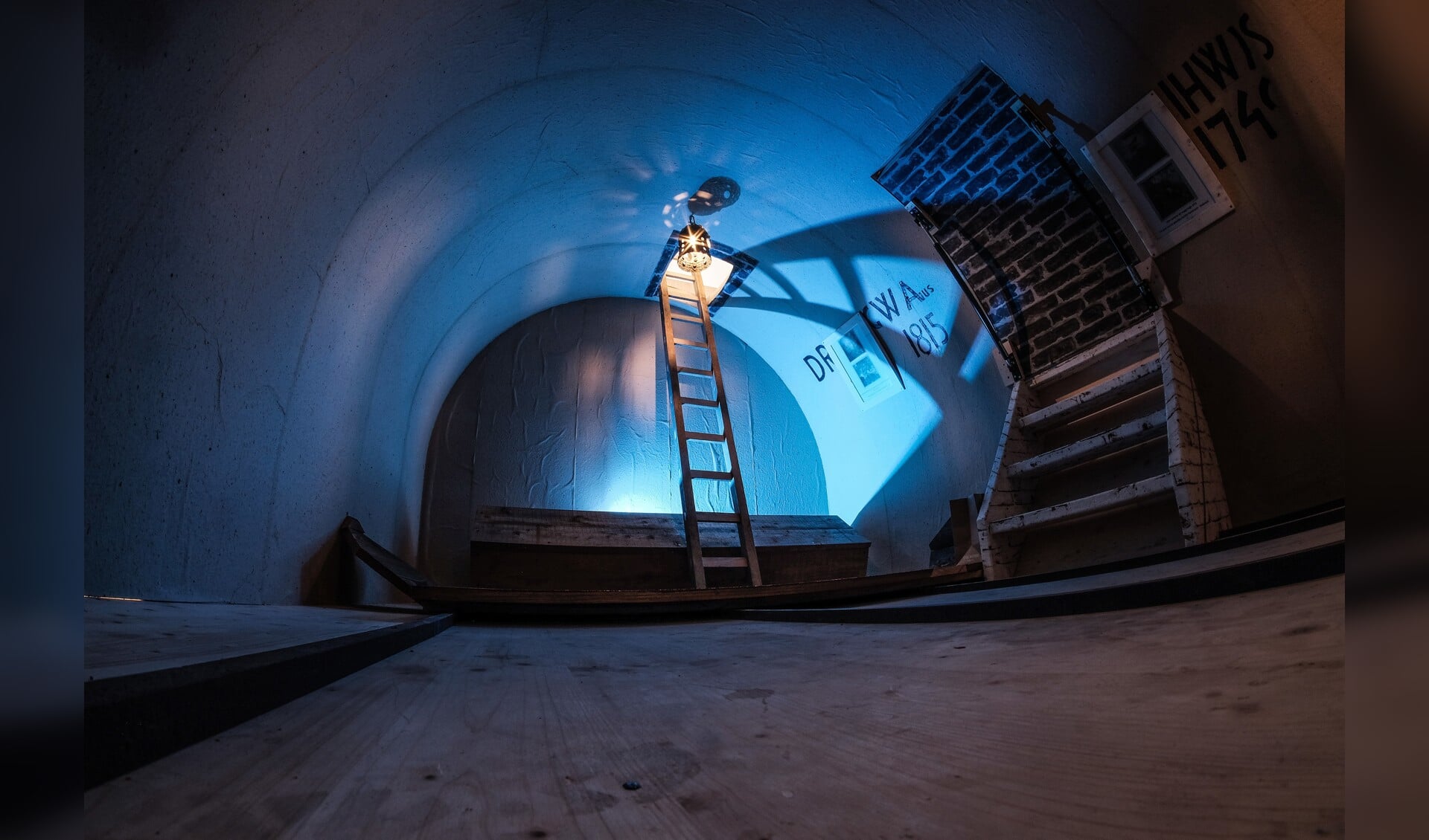
Replica of the burial vault in the old Helenakerk in Aalten, photo: Aalten Vooruit, 4 October 2024
Burial vault in the old Helenakerk
16 October 1973
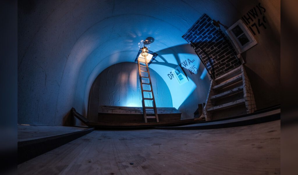
In 1973, whilst carrying out work in the Oude Helenakerk, carpenter Henk Heijnen discovered a burial vault beneath the floor of the chancel. An outsider had claimed that the ‘last priest’ had been buried where Heijnen was working, together with his golden chalice. Heijnen wanted to know more about this and did indeed discover a burial vault at that spot. The vault did not contain a golden chalice, however, but the coffins and remnants of three sets of mortal remains, with initials and dates on the wall. Decades later, Heijnen made a replica of the burial vault.
In 1973, during restoration work at the Old St Helen’s Church in Aalten, carpenter Henk Heijnen stumbled upon a burial vault beneath the choir containing three coffins with human remains. At the order of the church board, the vault was swiftly resealed. However, before this happened, Heijnen had already climbed inside to meticulously measure and photograph everything. In 2019, Heijnen completed a wooden replica of the burial vault.
The Discovery in 1973
On October 16, 1973, the then 23-year-old carpenter Henk Heijnen was involved in restoration and maintenance work at the Old St Helen’s Church. The floor of the choir had been removed, leaving only sand. During the work, he was visited by Jan Tinnevelt from the Kattenberg, who asked if they were searching for the golden chalice. According to legend, this chalice was buried alongside the last priest of the Old St Helen’s Church. Heijnen’s boss at the time ushered Tinnevelt out.
However, Tinnevelt was persistent, returning at least three more times to ask if anything had been found. This prompted Heijnen to start digging at the spot under the choir that Tinnevelt had pointed out. He soon struck a brick vault. Together with his boss, he used a sledgehammer to create a hole in the structure. Heijnen enlarged the opening until he could descend into the space using a ladder. Below, he found a burial vault containing three partially decayed coffins. Of the deceased, only dust and hair remained. He did not find a golden chalice…
Measured and Resealed
As always, Heijnen had a folding rule, a carpenter’s pencil, and paper with him. Before the vault was closed again, he measured the space precisely, noted the dimensions and initials, and made sketches and photographs of the vault, the inscriptions, and the dates. On the wall of the vault were the initials IHW with the year 1746, GWA with the year 1815, and DR, without a date. He preserved all these notes and images.
Meanwhile, his employer had informed the church council. Around ten o’clock that evening, the members of the church board arrived at the church, accompanied by the Reverend Van der Heiden. The minister pointed out that no one should descend into the vault as it would constitute grave robbery. Because the restoration was being carried out without the involvement of the National Heritage Agency (Monumentenzorg) and there were fears that the work would be halted, Heijnen was sworn to strict secrecy. At the request of the church board, he had to seal the manhole with concrete as soon as possible.
While he was closing the opening, Jan Tinnevelt entered the church once more. Upon realising what had been found, he was again politely requested to leave.
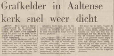
Dagblad Tubantia, 2 March 1974
In the week following the discovery, work began on laying the new natural stone floor in the choir, permanently sealing the access to the burial vault. Only Heijnen’s notes and his employer’s photographs remained as a source. Shortly after the completion of the choir, national news channels reported the discovery of a burial vault in the Old St Helen’s Church; it is not known who leaked this information.
Research and Replica
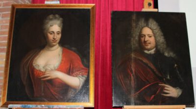
The portraits of Lambert Joost van Hambroick and his wife Mechteld Anna Bentinck-Van Diepenheim, photo: Lydia ter Welle
It was only years later, during a trip to Israel with his wife, that Henk Heijnen visited a burial vault in Jerusalem. This gave him the idea to build a replica of the burial vault in the Old St Helen’s Church.
He produced new construction drawings and came into contact with Herbert Welling from Bocholt and Thaddeus van Eijck from Bredevoort, both of whom were interested in cultural heritage. The trio hit it off, and their combined research led them to the historian J. Grooteboer from Borne.
They discovered that Lambert Joost von Hambroick and his wife Mechteld Anna Bentinck van Diepenheim were closely connected to St Helen’s Church. In 1706, they donated two silver communion cups to the Aalten church, which were later found in a safe within the church.
Replica of the burial vault in St Helen’s Church in Aalten, photo: Aalten Vooruit, 4 October 2024
Who Was Buried in the Vault?
Based on the research, it was determined that the following individuals were buried in the vault:
Judith Hambroick Welvelde († 1746) The connection to the Welvelde and Hambroick families is still visible in the church via the Welvelde coat of arms, which features a wolf’s head.
Gerharda Wilhelmina Arentsen (1777–1815) She had purchased the burial vault at a later date. She was the daughter of the sister of Mayor Christiaan Caspar Stumph and the granddaughter of Roelof Arentsen, the scholte (local official) of De Ahof.
Rev. De Roy († 1762/1785) Uncertainty remains regarding the initials DR. They were linked to a Reverend De Roy. However, in the second half of the 18th century, there were two ministers of that name: Philippus de Roy (1733–1762) and his son Adrianus Rudolphus de Roy (1762–1785). Which of the two might be buried in the vault remains unknown for now.
Completion of the Replica
In 2019, Heijnen completed a wooden replica of the burial vault. Two employees from Broekhout used his drawings to recreate the frame exactly. Heijnen personally handled the painting, including the initials and other details. The replica was later put on public display in the Helenahuis, opposite the church on Landstraat.
Thaddeus van Eijck produced a film titled “Verscholen erfgoed in beeld” (Hidden Heritage Portrayed), which documents the entire process surrounding the replica: from the initial notes and research to the craftsmanship with which the burial vault was reconstructed.
At the presentation of the replica in 2019, Heijnen mentioned that he still always carried his folding rule, even when sitting in church on Sundays, and that he felt nervous if he did not have it on him. That habit led to an extraordinary result: a booklet, a film, the recovery of two silver communion cups, and a skilfully and accurately crafted replica of the burial vault in the Old St Helen’s Church. Hidden heritage, beautifully brought to light.
A report on the presentation of the replica of the Old St Helen’s Church burial vault on the Market Square in Aalten. Video: RTV Slingeland / Henk Nijenhuis
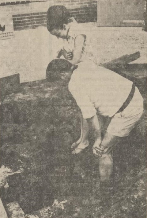
The engaged couple Ossendorf-Hubers in Aalten has no reason to feel down. On the contrary! Their engagement will soon be followed by marriage, and they are already busy furnishing a brand-new home on Molenstraat. And yet, this very house gives Mr. Ossendorf and his future wife reason to be careful not to literally end up in the well—the well found in the garden just behind the house, which is nearly fourteen meters deep.
At this location—as the name Molenstraat suggests—the Aalten mill once stood, the last remains of which were removed last year in the spring. Now, four beautiful homes stand there. The well is over a hundred years old and is constructed of heavy masonry. It belonged to the mill, and the former miller, Mr. Klomps, recalled that the well was to be found somewhere in this vicinity. The future residents of the houses were also informed. All four houses are currently still vacant, but work is already well underway in the gardens. In these gardens, four heavy millstones have since been found.
Mr. Ossendorf also went in search of such objects and the well. After a few “test drillings,” it did not take long before both the millstone and the well were located. That is to say: the well was covered with a millstone. With great effort, the stone—which was no longer in very good condition—was removed in pieces, and the couple then gazed into the depths. According to local residents, the well must have supplied the entire neighborhood with water in the latter part of the previous century. The water is currently at a depth of about thirteen meters. Consequently, the houses will not be much troubled by groundwater. Following tradition, this mill was also built on the highest part of the village.
The well has a diameter of one meter, and climbing bolts have been bricked into the wall, allowing one to descend. Since its rediscovery, no one has yet ventured this experiment. It is unknown what will happen to the deep well. Filling it in or developing it into a beautiful antique well with a lever, for example. That is still a matter of consideration. The latter seems appealing, but in the back of one’s mind, there is also the thought of filling it in before any accidents occur.
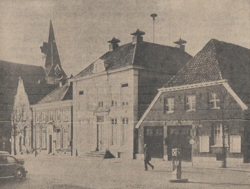
Demolition of buildings on the Market Square – New town hall and cultural center on the site of the old festival building.
The municipality of Aalten has commissioned an ambitious structural plan that will give the Aalten village center a completely different appearance. According to this plan, several well-known buildings on the Market Square, including the old town hall (see photo), will have to disappear. In their place, a kiosk, bus station, and small shops will be established.
Aalten Market Square with the old town hall, 1967
The old festival building on the Pol will have to disappear according to the plan, and a modern new Town Hall and a Cultural Center are envisioned for this location.
Furthermore, new streets have been projected, which will require quite a few breakthroughs. Realizing all these plans will likely take several decades. But in any case, the residents of Aalten will then know what to expect.
It is sound policy to guide the future growth of the village in a timely, well-considered manner. One remaining question is whether the old Town Hall is actually allowed to be demolished; “Monumentenzorg” (Heritage Netherlands) might object.
The latest insights regarding the construction of a new post office point toward new construction on the site of the existing office. The grounds near the monastery, which were initially intended for this purpose, will soon serve as a parking lot.
Land is available north of the Ringweg for a general Christian hospital that may be assigned to Aalten. Expansion of the industrial estate is possible in a northerly direction up to the railway line, and finally, land is available near the Keizersbeek where farmers who are “displaced” by the land consolidation can settle.
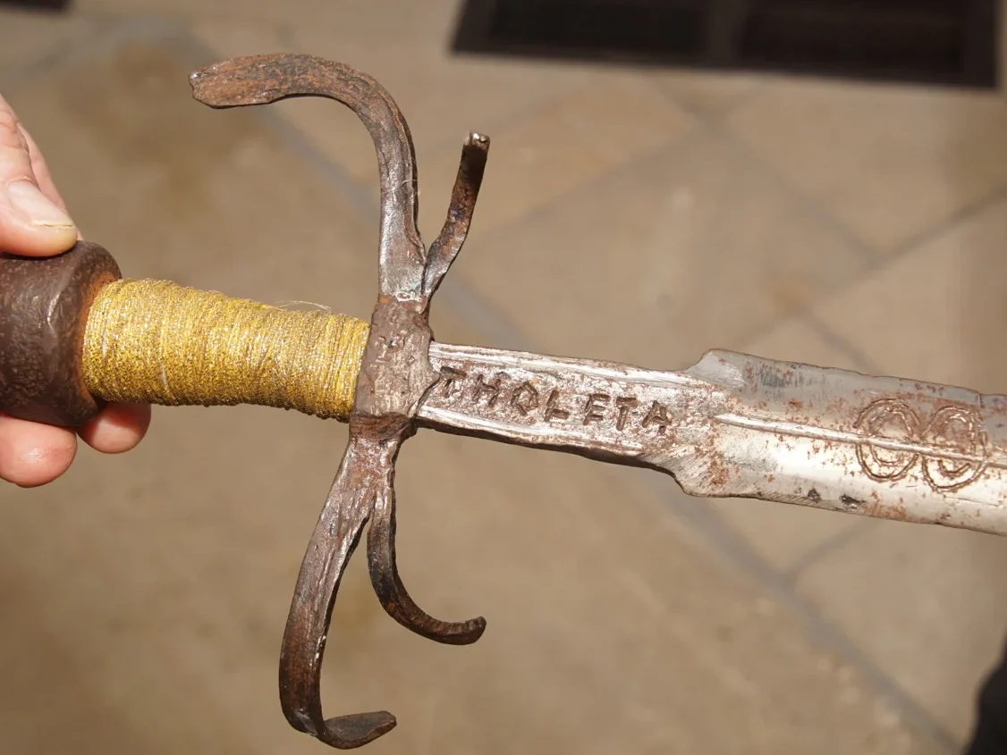
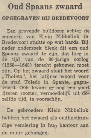
In 1964, during excavation work for the construction of a new workshop on the premises of the Klein Nibbelink smithy, various items were discovered, including remnants of walls, moat fill, wooden posts, and an iron fire grate. However, the most impressive find was a Spanish sword from the Eighty Years’ War, bearing the inscription ‘Tholeta’, the Latin name for the city of Toledo in Spain.
Johan Klein Nibbelink currently has the sword in his possession and tells about it in the video below.
Nieuwe Winterswijksche Courant, 12 October 1964
Sources
Nieuwe Winterswijksche Courant, 12 October 1964 (Delpher)
Workers will then earn around ƒ 15,000 – Smaller towns (including Winterswijk-Aalten) merged into large cities – Further industrial revolution with possibilities currently beyond imagination!
One can indulge in the most elaborate fantasies regarding the rise in labor productivity in the near future, but with normal, steady development over the next 37 years, real income per capita will be 2.5 to 3 times greater than in 1963. The amount available for spending exceeds our imagination: a worker currently earning ƒ 6,000 per year will then have more than ƒ 15,000 to spend.
Prof. P. de Wolff, director of the Central Planning Bureau, presented this as a topic for discussion to the participants of the “Netherlands in the Year 2000” conference of the Netherlands Discussion Centre in Oosterbeek. He had calculated that by the year 2000, the population of our country would number 20 million souls. Prof. Jac. P. Thijsse of the Institute of Social Studies in The Hague also based his work on this figure. In his plans, he concluded, among other things, that by 2000, perhaps 95 percent of the population would live in cities. These people would not only live in cities, but according to his vision, there would be many cities in the Netherlands outside the Randstad Holland with 750,000 to one million inhabitants. He had assumed a density of 50 people per hectare. This relatively high population density need not hinder the “livability” of the cities, as this is a matter of quality in urban planning and housing construction.
The Netherlands in the year 2000, according to Prof. Jac. P. Thijsse
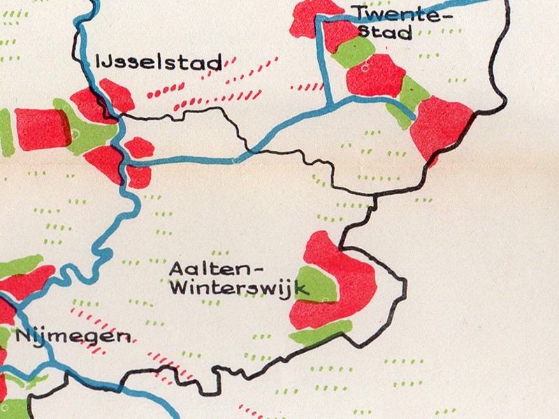
Prof. Thijsse stated that to accommodate the expected population growth, it is necessary to begin building 125,000 homes per year immediately. Using a map of the Netherlands in 2000, he showed that cities are hubs within an area with a radius of fifty kilometers. He had also formed “ring cities” from, among others, Apeldoorn, Deventer, and Zutphen; Arnhem-Nijmegen; Winterswijk-Aalten; and Enschede-Hengelo-Almelo, disregarding provincial borders. He also anticipated that national borders would no longer exist by then. In this regard, he pointed to the large city formed by the towns of Sittard, Geleen, Heerlen, the German city of Aachen, and the surrounding areas.
According to Prof. Thijsse, not a single airport in our country is in the right location. He had projected the major airport of 2000 onto the Wadden Sea, which was yet to be reclaimed. If the Netherlands maintains its function, as currently derived from transport to and from the European hinterland, Prof. Thijsse envisioned new port and industrial areas in the Western Scheldt and on the land yet to be reclaimed between Den Helder and Wieringen.
In his economic vision for the future, Prof. de Wolff assumed that no major conflicts or enormous depressions would occur in the coming 37 years. He calculated that if productivity increases by 2.7 to 3.25 percent per year and working hours are reduced to 35 hours per week, gigantic tasks must be completed in the Netherlands, given the then-altered composition of the workforce.
How the industrial revolution will proceed cannot yet be foreseen, but this development will be completely different from what is currently imagined. Perhaps certain types of labor will become so scarce that, for example, clothes will no longer be washed but thrown away, and washing dishes will likewise no longer be feasible. Perhaps people will then have to perform auxiliary tasks themselves during part of their free time, such as washing cars and painting houses. Prof. de Wolff also saw major tasks for the government and could find no room to lower taxes over the next 37 years. Not even if the defense budget were to disappear because the concept of war had become obsolete.
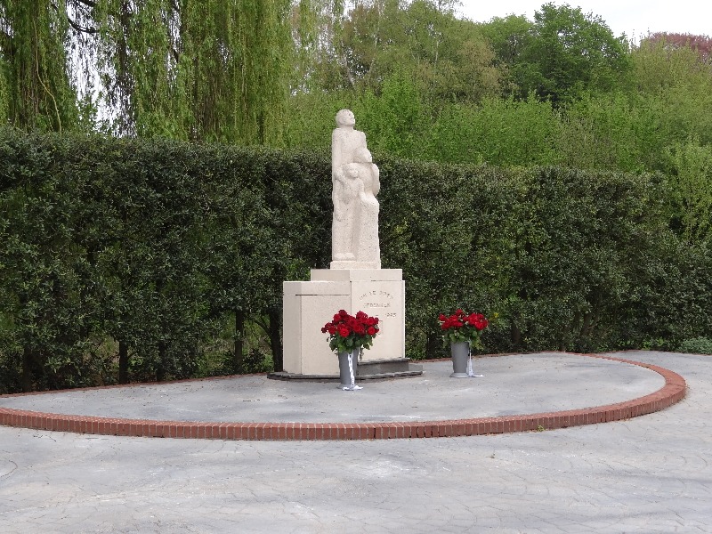
The war memorial on the Wheme was erected in memory of all fellow citizens who died during the occupation years as a result of acts of war. The memorial also commemorates the liberation.
The establishment of the memorial was an initiative of the Monument Foundation 1940-1945 committee. Immediately after the liberation, the population of Aalten felt the need to honour the war victims with a monument.
The monument consists of a statue of a male figure with a woman and child. The sculpture of French limestone is placed on a terrace. The pedestal consists of masonry, concrete and natural stone. The memorial is 1 meter 31 high, 1 meter 43 wide and 90 centimeters deep.
The group faces south from where the tribulation, but also the deliverance, came. Artist Bé Thoden van Velzen described the sculpture as follows: “… representing man, woman and child, as a symbol of the entire Dutch people, expectantly looking forward to liberation, unbowed and unweakened.”
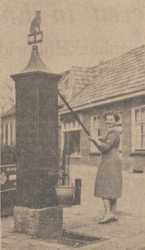
In 1939, the water supply in Aalten underwent a major improvement with the installation of a mains drinking water network by the N.V. “Waterleiding Oostelijk Gelderland” (Eastern Gelderland Water Supply Company), in cooperation with the Aalten municipal council. Before that time, the people in the village of Aalten obtained their water from so-called neighbourhood pumps, one or more of which stood in the various streets. These pumps were owned by the municipality, and there were very few people in the village who had a pump of their own inside the house.
The Kattenberg pump, circa 1925
Each pump was used by an average of ten or twelve families, and one can well imagine that during periods of severe drought – when, in the long run, the pumps began to yield mud instead of water – this occasionally gave rise to friction among the female neighbourhood residents. Any disputes that arose, however, were usually settled within a short space of time by the “pumpmaster”. The neighbourhood residents, who were also responsible for the maintenance of the pump, were appointed as pumpmaster in rotation. The pumpmaster also collected the contributions towards the expenses from his fellow users.
However, the use of some pumps had to be prohibited because the water was harmful to health. When later, upon closer inspection, the pump water in general proved to contain constituents that were less favourable to health, this was all the more reason to proceed with the installation of a mains drinking water network.
One advantage of the former pumps was that they stood in the street. In the past, even more so than today, the inhabitants of the village of Aalten kept the street in front of their own houses clean. The pumps came in very handy for this, as they had the water for scrubbing the street close at hand.
Until recently, there was also a pump standing on the Markt (Market Square) in Aalten. Regrettably, the municipal council had this pump dismantled last year, presumably because it was in a dilapidated state. Had this pump been restored, however, a small piece of history would have been preserved in the centre of Aalten.
Whilst the houses in the village of Aalten are connected to the water mains, this is not yet the case in the hamlets (buurtschappen). It is true that in the hamlet of Lintelo, persistent efforts have been made in recent years to persuade the W.O.G. to connect a large number of farmers and others in this hamlet, but although the W.O.G. was in principle sympathetic to the idea, the execution of the plans foundered on the high costs of installation and operation.
One street pump remaining
One street pump remained standing in Aalten, namely the pump on the Kattenberg. When their pump was under threat, the residents of this neighbourhood put their heads together and decided to try to preserve the pump from a folkloric perspective. In this they succeeded, and voluntary contributions were subsequently raised to thoroughly do up the pump, on which no maintenance work had been carried out in recent years.
Now, no one should think that the residents of the Kattenberg are conservative and do not want mains water. That is by no means the case; all have connected their homes to the W.O.G. network, but they nevertheless wish to retain the pump because, as they say, adapting a well-known proverb, they do not want to throw the pump out with the pump water. And it seems to us that they are quite right.
Mrs Vieberink-Bennink — better known in Aalten as Annie Bennink — recently moved to Gendringen with her husband. Shortly, probably next week, the young couple hope to emigrate to Canada, where Mr Vieberink will become a farm manager in New Brunswick. These past few days, Annie Bennink was back home at her parental house on the Kattenberg, and on that occasion she wished — in all probability for the last time — to have another go at the handle of the old, familiar pump on the Kattenberg, of which her father is now pumpmaster. It was on that occasion that we took the picture reproduced here.
“On the border of two worlds”, Annie Bennink tries the old pump one last time
Other Village Pumps
We have examined countless old photographs to trace the locations where neighborhood pumps once stood in Aalten. The overview below is still a ‘work in progress’ and subject to change. If you know of any other locations to supplement this list, please leave a comment at the bottom of this page.
German workers received a pound of coffee for Christmas; Dutch staff later received a rixdollar…
While one of the German girls employed at a textile factory in Aalten was recently the cause of a sensational incident (she defaced the Dutch flag with a swastika), German textile workers in Aalten have once again been the catalyst for an event that has caused quite a stir in the quiet village, as two textile factories were involved.
Sixteen German girls are employed at a textile factory in Dijkstraat. As Christmas approached, they began to ponder a surprise they could provide for their relatives across the border. It had to be coffee, was the general opinion!
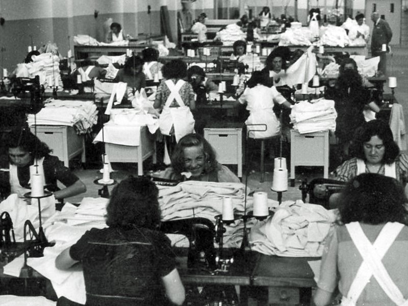
Girls at work at the Driessen textile factory, Hofstraat. Photo for illustrative purposes.
The German girls enlisted the help of a staff member from Aalten, who knew just how to manage it. He, in turn, went to a businessman who proved able and willing to supply 16 pounds of coffee—one pound for each of the German girls. That evening, the girls cheerfully headed home by bus with their coffee. However, on that same bus were 19 female workers from a textile factory in Hofstraat.
Understandably, they were none too pleased that their friends could take coffee home for “Weihnachten” while they could not. The matter was promptly raised the following day with the management in Hofstraat. They felt they could do little else but promise each of their German workers a pound of coffee as well. And the 19 pounds of coffee indeed materialised.
But the difficulties did not end there! The Dutch staff had caught wind of the Christmas gift and now began to demand coffee too. After all, coffee is an item that has been very scarce in this country of late. The management of the Hofstraat factory restored industrial peace by giving every staff member a bonus of ƒ2.50. With that, the whole matter seemed to be settled.
However, with so many people involved, it was almost inevitable that the police and the C.C.D. (Central Investigation Service) would hear of the case. The latter has since launched an investigation, which has already led to an official report (proces-verbaal) being filed against the management of the textile factory in Hofstraat. A second report followed for the granting of a bonus without the permission of the Board of Government Mediators. An official report has also been filed against the shopkeeper involved.
We understand that the reason the German girls were able to export the coffee is that the Dutch customs, contrary to standing orders, allowed the coffee to pass; it was apparently assumed that it could be exported freely as long as its value was below ƒ15. The German customs had already promised the German girls that they would make an exception in view of the approaching Christmas holiday.
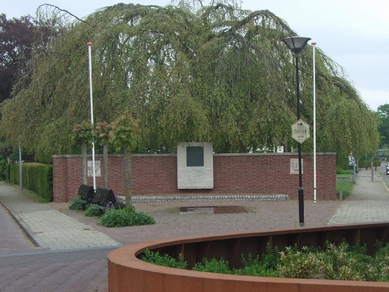
The memorial for people in hiding (Onderduikersmonument) on Stationsstraat is an expression of gratitude from those who were once in hiding to the people of Aalten for their hospitality, and to the members of the Resistance who were the driving force behind finding accommodation for them.
The monument consists of a brick memorial wall with a fountain. A bronze plaque and two sculpted fragments of natural stone are set into the memorial wall.
The monument was unveiled on 4 October 1947 by Mrs D.G. Wikkerink-Eppink, the wife of Resistance leader Hendrik Jan (Ome Jan) Wikkerink.
The text on the plaque reads (translated from Dutch):
PRESENTED TO THE MUNICIPALITY OF AALTEN BY PERSONS IN HIDING WHO DURING THE YEARS OF OCCUPATION 1940-1945 FOUND A SAFE HAVEN HERE.
The sculpted fragments bear the text of Psalm 91:5 and 6.
The text of the left fragment reads:
THOU SHALT NOT BE AFRAID FOR THE TERROR BY NIGHT, NOR FOR THE ARROW THAT FLIETH BY DAY; NOR FOR THE PESTILENCE THAT WALKETH IN DARKNESS, NOR FOR THE DESTRUCTION THAT WASTETH AT NOONDAY.
The text of the right fragment reads:
FOR HE SHALL COVER THEE WITH HIS FEATHERS, AND UNDER HIS WINGS SHALT THOU TRUST.
The sculpture on the left depicts three studded boots belonging to the barbarian horde, threatening to trample a young, sprouting fruit. This symbolises the overwhelming force and occupation, portraying the vulnerability of young life that continues to germinate despite the danger. The fragment on the right depicts a pelican with outspread wings, protecting its nest and young. The pelican is a Christian symbol of total self-sacrifice; according to legend, the bird feeds its young with its own blood. It symbolises the contribution of the resistance in the struggle against the occupier. The waning swastika in the background represents the transience of the threat.
Aalten in Oorlogstijd, J.G. ter Horst – Messink & Prinsen, 1985, ISBN: 9090008802
Beheer toestemming
Deze website gebruikt cookies voor een optimale ervaring en analyse van bezoekgegevens. Ga je hiermee akkoord? Zonder toestemming werken sommige onderdelen van de site mogelijk minder goed.
Functioneel
Always active
De technische opslag of toegang is strikt noodzakelijk voor het legitieme doel het gebruik mogelijk te maken van een specifieke dienst waarom de abonnee of gebruiker uitdrukkelijk heeft gevraagd, of met als enig doel de uitvoering van de transmissie van een communicatie over een elektronisch communicatienetwerk.
Voorkeuren
De technische opslag of toegang is noodzakelijk voor het legitieme doel voorkeuren op te slaan die niet door de abonnee of gebruiker zijn aangevraagd.
Statistieken
De technische opslag of toegang die uitsluitend voor statistische doeleinden wordt gebruikt.De technische opslag of toegang die uitsluitend wordt gebruikt voor anonieme statistische doeleinden. Zonder dagvaarding, vrijwillige naleving door je Internet Service Provider, of aanvullende gegevens van een derde partij, kan informatie die alleen voor dit doel wordt opgeslagen of opgehaald gewoonlijk niet worden gebruikt om je te identificeren.
Marketing
De technische opslag of toegang is nodig om gebruikersprofielen op te stellen voor het verzenden van reclame, of om de gebruiker op een site of over verschillende sites te volgen voor soortgelijke marketingdoeleinden.