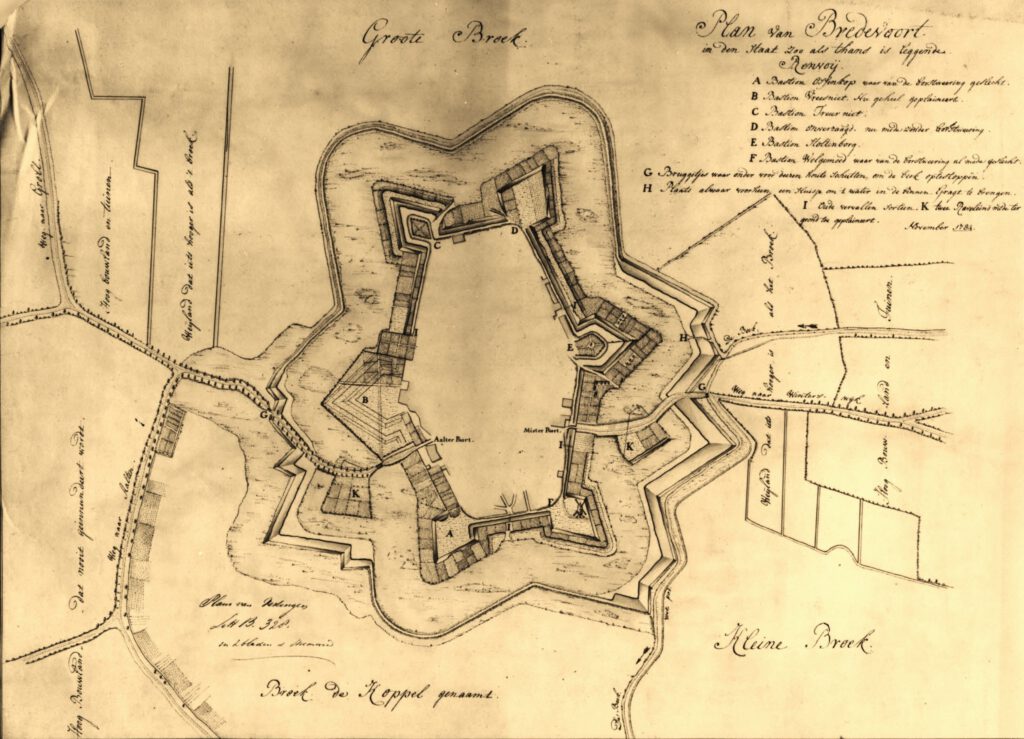
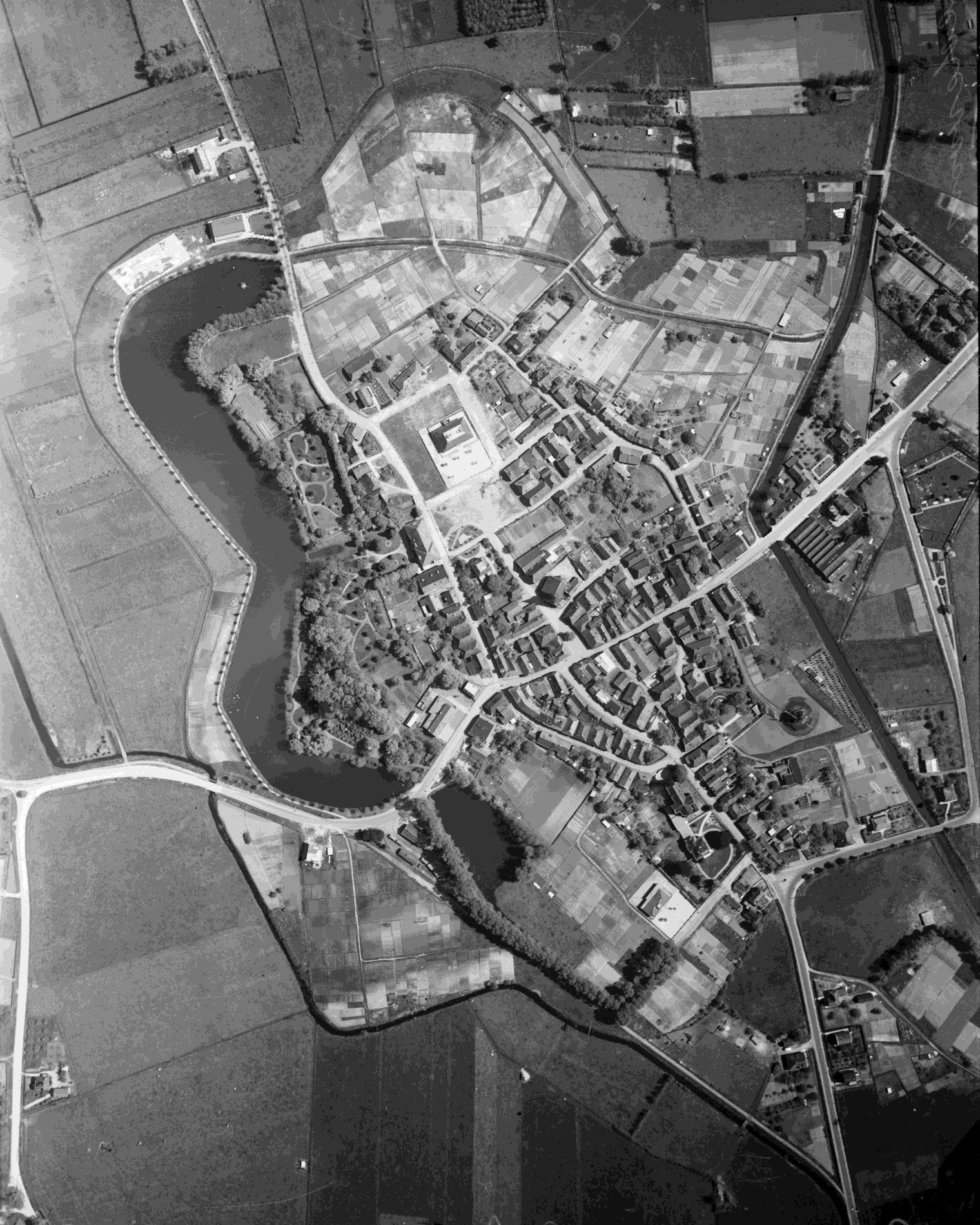
De Halve Maone (The Half Moon) is a former ravelin and historical fortification in the small Gelderland fortified town of Bredevoort. The fortified, pentagonal island was situated on the western side of the town in the town moat, directly in front of the Aalterpoort (Aalten Gate). Together with the surrounding field of fire, ‘de Koppele’, the complex forms an important cultural-historical element, recalling the strategic significance of Bredevoort during the Eighty Years’ War and the centuries that followed.
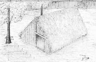
A ravelin is an outwork of a fortification that primarily served to protect vulnerable town gates and the curtain wall behind them against enemy fire and assaults. De Halve Maone was constructed as a pentagonal island and was situated between the Ossenkop (Ox Head) and Vreesniet (Fear Not) bastions. The island was surrounded by an additional moat (the ravelin moat).
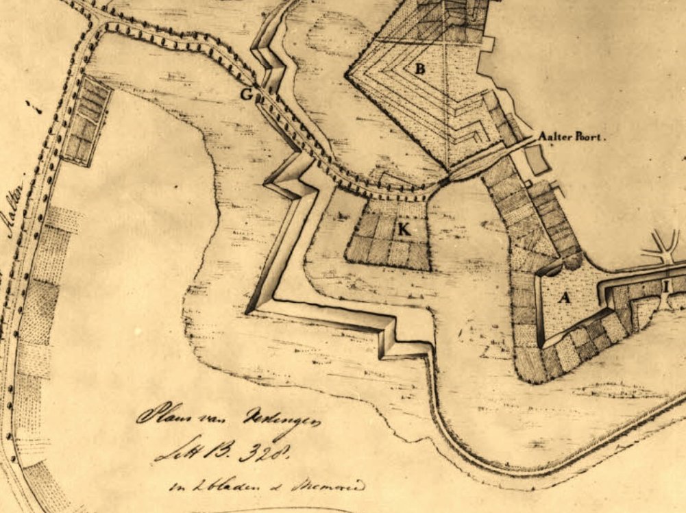
Access to the town via the western side was divided at the time: travellers coming from the old road to Aalten crossed a first bridge over the outer moat onto the ravelin. From the ravelin, a second bridge, designed as a drawbridge, led across the town moat to the Aalterpoort. On the eastern side of Bredevoort, in front of the Misterpoort, a similar defensive work was situated at the time.
History and Development
The Middle Ages and the early ‘half moon’ (until 1606)
Although it is not known when the first Aalterpoort was built, accounts from the year 1500 show that maintenance work was already being carried out on the town gates around that time. The foundation for the later ravelin was presumably laid between 1545 and 1555, when the Gelderland warlord Maarten van Rossum was appointed drossard (bailiff) of Bredevoort. Van Rossum had the medieval fortification radically modernised to render it resistant to the rise of cannon fire; he widened the moats, threw up earthen ramparts, and placed an early ‘half moon’ in front of the Aalterpoort.
A map by the cartographer Jacob van Deventer from circa 1560 still shows the Aalterpoort as a heavy tower with an outlying roundel or barbican. On later siege maps from 1597 onwards – the year in which Maurice of Orange captured the town after a fierce siege – the gate is depicted with a drawbridge and the characteristic crescent-shaped advance fortification.
Modernisation to the Old Dutch fortification system
After the States forces gained control of the town and Frederick Henry of Orange successfully relieved the fortress in 1606, it was decided to thoroughly renew the medieval fortifications. The old medieval Aalterpoort was demolished in 1606. In its place, a new, brick-built gate arose that lay recessed into the main rampart. On this occasion, Van Rossum’s relatively simple ‘half moon’ made way for a larger, pentagonal ravelin.
Decay and the Fortifications Act (19th century)
With the introduction of the Vestingwet (Fortifications Act) in 1874, Bredevoort officially lost its military status. To save on high maintenance costs, the inhabitants of the town decided to dismantle the Aalterpoort. The wooden bridges over the moats were replaced by a permanent, earthen embankment.
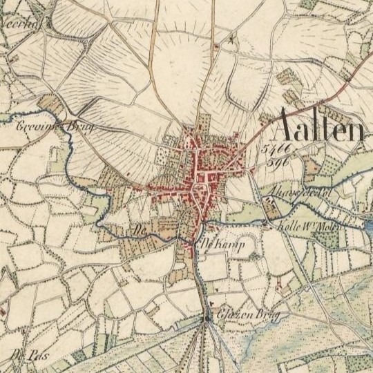
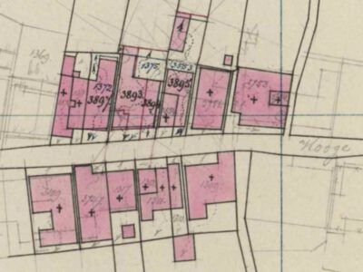
Cadastral maps from 1828 reveal that the fortifications were already in decay at that time, yet the contours of De Halve Maone and the Aalterpoort were still prominently recognisable. The maps also show the historical water management system: at the time, the Slingebeek still flowed on the eastern side of the town around the eastern ravelin. To the north and north-east of the small town, the moat around De Halve Maone was fed by the Schaersbeek, which merged into the low-lying lands and flowed on towards a weir near the former Fort Oranje. Following the dismantling, the culverted moats and the levelled ramparts on the northern side were largely put to use as allotments.
Landscape context: ‘De Koppele’ field of fire
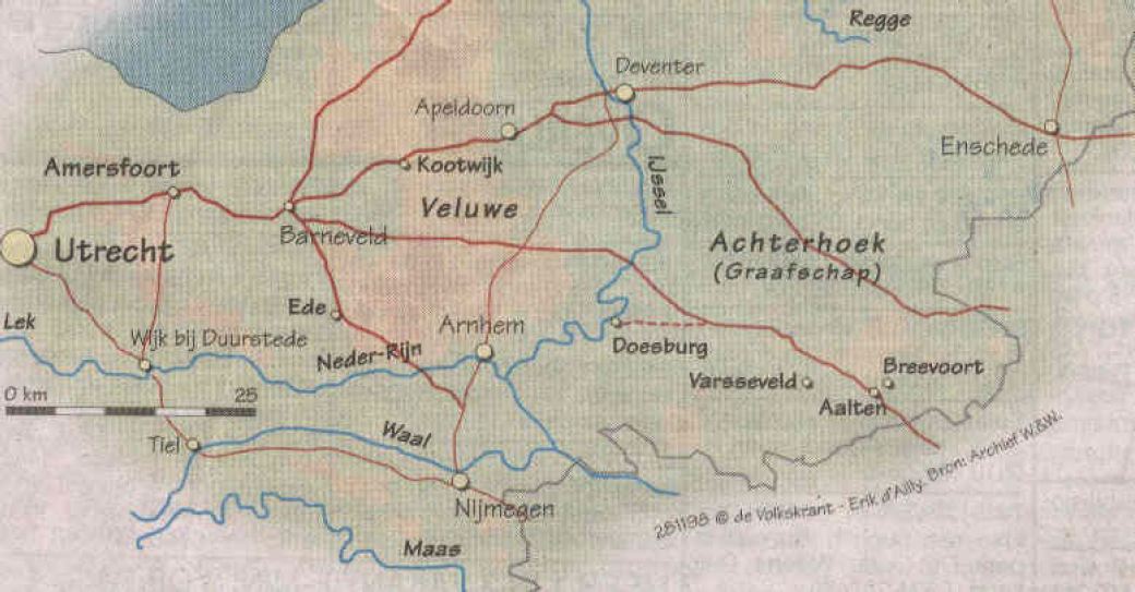
Directly adjacent to De Halve Maone lies de Koppele (historically also referred to on maps as the Kleine Broek). This characteristic lowland peat area extends between the historical town centre and the current Bolwerkweg and Tolhuisweg, over which the old connecting road to Aalten used to run.
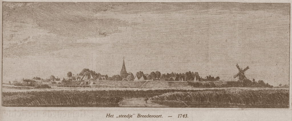
In military terms, this open, marshy terrain functioned as the field of fire. It offered the defenders on the ramparts a clear and unobstructed view of approaching enemies. The artist Jan de Beijer captured this open landscape in 1743 in a well-known drawing from the Tolhuisweg. In the foreground of his work, a portion of the ‘voorde’ (a ford) is visible – the landscape element to which Bredevoort owes its name (‘broad ford’). Today, de Koppele is the only remaining area around Bredevoort that recalls this original, strategic setting.
Recent Situation and Archaeology
Culverting in the 20th century
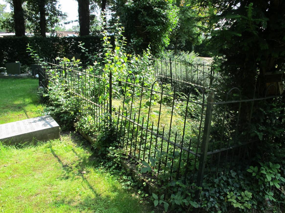
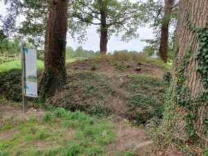
In the course of the 20th century, the historical structure became largely hidden from view. In 1972, the ravelin moat – which formed the course of the Schaersbeek right alongside the Tramstraat – was culverted and filled in. Further down into the de Koppele area, the brook was straightened towards the weir. The island of the former ravelin itself was transformed into an allotment complex with 40 plots, causing the historical layers to disappear from sight.
Archaeological discoveries
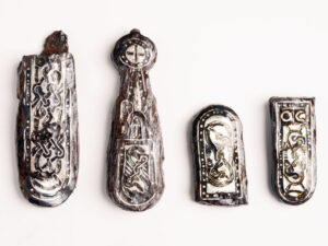
In 2022, at the instigation of the local interest group Bredevoorts Belang, an archaeological investigation took place during excavation works by grid operator Liander near the entrance to Bredevoort on the Landstraat. On this occasion, various monumental remains were encountered in the soil, including a section of brickwork that structurally belonged to the ravelin De Halve Maone.
Future Plans and Redevelopment
As the historical fortification structure is barely recognisable to visitors and residents in the current situation, Bredevoorts Belang presented proposals in 2025 to make this ‘veiled heritage’ more visible and accessible.
One of the proposals is the removal of the current dam and the culvert that separate the so-called Kleine Gracht and Grote Gracht (Small Moat and Large Moat). By replacing this barrier with a new bridge in the Landstraat, the moats will once again be brought into open connection with each other.
Regarding the status and progress of these plans, nothing is currently known to us (as of June 2026).