Old Aalten

Category: War & Resistance

  • De Halve Maone

    De Halve Maone

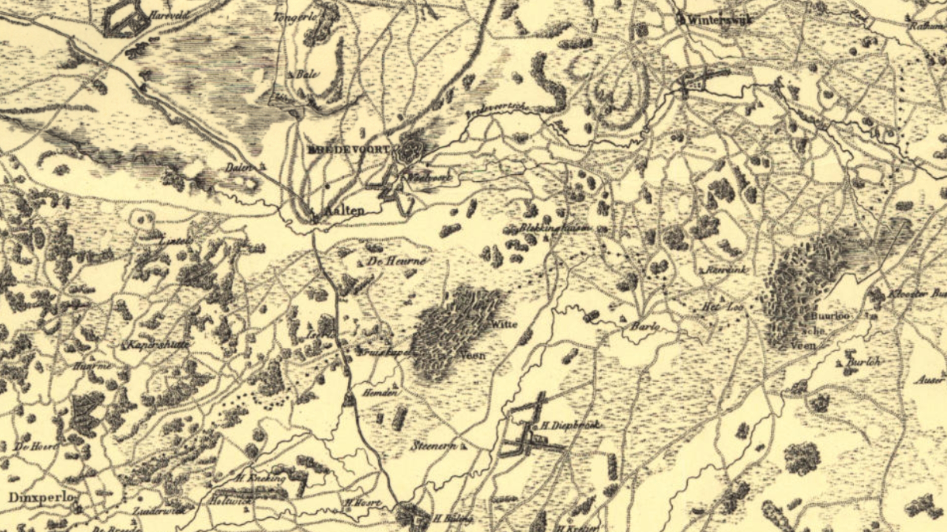
    De Halve Maone (The Half Moon) is a former ravelin and historical fortification in the small Gelderland fortified town of Bredevoort. The fortified, pentagonal island was situated on the western side of the town in the town moat, directly in front of the Aalterpoort (Aalten Gate). Together with the surrounding field of fire, ‘de Koppele’, the complex forms an important cultural-historical element, recalling the strategic significance of Bredevoort during the Eighty Years’ War and the centuries that followed.

    A ravelin is an outwork of a fortification that primarily served to protect vulnerable town gates and the curtain wall behind them against enemy fire and assaults. De Halve Maone was constructed as a pentagonal island and was situated between the Ossenkop (Ox Head) and Vreesniet (Fear Not) bastions. The island was surrounded by an additional moat (the ravelin moat).

    Access to the town via the western side was divided at the time: travellers coming from the old road to Aalten crossed a first bridge over the outer moat onto the ravelin. From the ravelin, a second bridge, designed as a drawbridge, led across the town moat to the Aalterpoort. On the eastern side of Bredevoort, in front of the Misterpoort, a similar defensive work was situated at the time.

    History and Development

    The Middle Ages and the early ‘half moon’ (until 1606)

    Although it is not known when the first Aalterpoort was built, accounts from the year 1500 show that maintenance work was already being carried out on the town gates around that time. The foundation for the later ravelin was presumably laid between 1545 and 1555, when the Gelderland warlord Maarten van Rossum was appointed drossard (bailiff) of Bredevoort. Van Rossum had the medieval fortification radically modernised to render it resistant to the rise of cannon fire; he widened the moats, threw up earthen ramparts, and placed an early ‘half moon’ in front of the Aalterpoort.

    A map by the cartographer Jacob van Deventer from circa 1560 still shows the Aalterpoort as a heavy tower with an outlying roundel or barbican. On later siege maps from 1597 onwards – the year in which Maurice of Orange captured the town after a fierce siege – the gate is depicted with a drawbridge and the characteristic crescent-shaped advance fortification.

    Modernisation to the Old Dutch fortification system

    After the States forces gained control of the town and Frederick Henry of Orange successfully relieved the fortress in 1606, it was decided to thoroughly renew the medieval fortifications. The old medieval Aalterpoort was demolished in 1606. In its place, a new, brick-built gate arose that lay recessed into the main rampart. On this occasion, Van Rossum’s relatively simple ‘half moon’ made way for a larger, pentagonal ravelin.

    Decay and the Fortifications Act (19th century)

    With the introduction of the Vestingwet (Fortifications Act) in 1874, Bredevoort officially lost its military status. To save on high maintenance costs, the inhabitants of the town decided to dismantle the Aalterpoort. The wooden bridges over the moats were replaced by a permanent, earthen embankment.

    Cadastral maps from 1828 reveal that the fortifications were already in decay at that time, yet the contours of De Halve Maone and the Aalterpoort were still prominently recognisable. The maps also show the historical water management system: at the time, the Slingebeek still flowed on the eastern side of the town around the eastern ravelin. To the north and north-east of the small town, the moat around De Halve Maone was fed by the Schaersbeek, which merged into the low-lying lands and flowed on towards a weir near the former Fort Oranje. Following the dismantling, the culverted moats and the levelled ramparts on the northern side were largely put to use as allotments.

    Landscape context: ‘De Koppele’ field of fire

    Directly adjacent to De Halve Maone lies de Koppele (historically also referred to on maps as the Kleine Broek). This characteristic lowland peat area extends between the historical town centre and the current Bolwerkweg and Tolhuisweg, over which the old connecting road to Aalten used to run.

    In military terms, this open, marshy terrain functioned as the field of fire. It offered the defenders on the ramparts a clear and unobstructed view of approaching enemies. The artist Jan de Beijer captured this open landscape in 1743 in a well-known drawing from the Tolhuisweg. In the foreground of his work, a portion of the ‘voorde’ (a ford) is visible – the landscape element to which Bredevoort owes its name (‘broad ford’). Today, de Koppele is the only remaining area around Bredevoort that recalls this original, strategic setting.

    Recent Situation and Archaeology

    Culverting in the 20th century

    In the course of the 20th century, the historical structure became largely hidden from view. In 1972, the ravelin moat – which formed the course of the Schaersbeek right alongside the Tramstraat – was culverted and filled in. Further down into the de Koppele area, the brook was straightened towards the weir. The island of the former ravelin itself was transformed into an allotment complex with 40 plots, causing the historical layers to disappear from sight.

    Archaeological discoveries

    In 2022, at the instigation of the local interest group Bredevoorts Belang, an archaeological investigation took place during excavation works by grid operator Liander near the entrance to Bredevoort on the Landstraat. On this occasion, various monumental remains were encountered in the soil, including a section of brickwork that structurally belonged to the ravelin De Halve Maone.

    Future Plans and Redevelopment

    As the historical fortification structure is barely recognisable to visitors and residents in the current situation, Bredevoorts Belang presented proposals in 2025 to make this ‘veiled heritage’ more visible and accessible.

    One of the proposals is the removal of the current dam and the culvert that separate the so-called Kleine Gracht and Grote Gracht (Small Moat and Large Moat). By replacing this barrier with a new bridge in the Landstraat, the moats will once again be brought into open connection with each other.

    Regarding the status and progress of these plans, nothing is currently known to us (as of June 2026).

    Sources


  • Interactive route ‘Dwars door Barlo’ brings wartime stories to life

    Interactive route ‘Dwars door Barlo’ brings wartime stories to life

    A 19-kilometre journey past eleven historical locations

    Dwars door Barlo
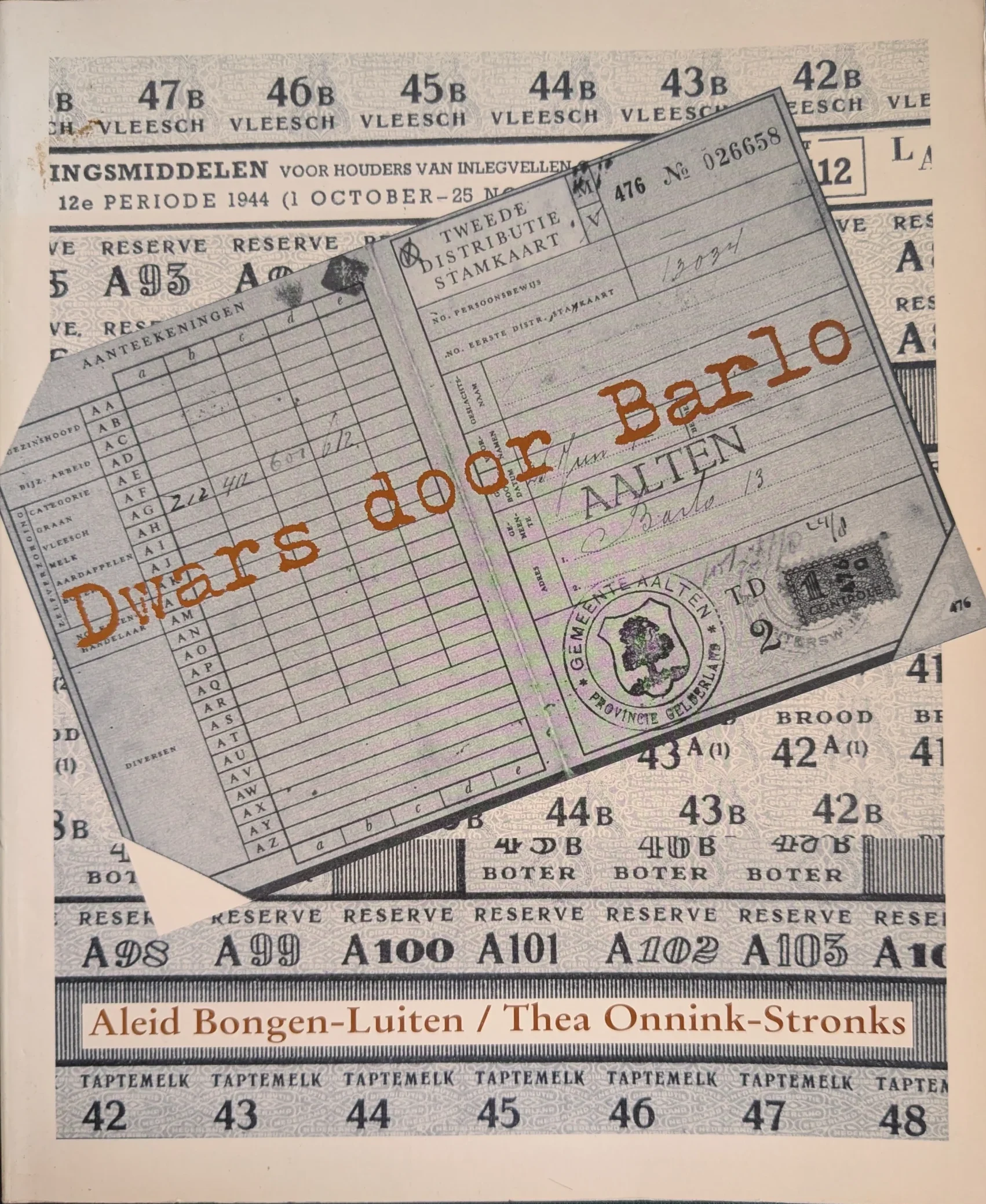
    Book cover ‘Dwars door Barlo’, 1995

    What was daily life like in Barlo during the war years? To keep the memories of this poignant time alive, the ‘Dwars door Barlo’ (National Museum of Hiding and Resistance) committee has launched a special interactive route. Using QR codes, walkers, cyclists, and motorists can listen to and watch stories from World War II at various locations via their smartphones.

    The foundations of this project were laid back in 1994. To safeguard the memories of the war years in Barlo for the future, the former ‘Dwars Door Barlo’ (National Museum of Hiding and Resistance) foundation interviewed numerous local residents. These conversations, recorded on over seventy cassette tapes, provided the source material for the book ‘Dwars door Barlo’ (1995) at the time.

    More than thirty years later, these stories have been brought to life once again. Not just on paper, but in the heart of the landscape where these events actually took place.

    The route

    The foundation has compiled a unique route that leads past the locations described so extensively in the book. The route is 19 kilometres long in total and passes eleven historical sites in Barlo. The journey can be completed on foot, by bicycle, or by car. The start and end points are located at pancake restaurant De Neeth (Neethweg 6).

    How does it work?

    Green posts with a number and a name are situated along the route. Each post features a QR code. By scanning this code with a smartphone, the story of that specific location appears instantly on the screen. There is also an audio button to have the story read aloud, allowing everyone to listen to the events of the past on-site.

    Navigation is straightforward: a link to Google Maps is provided below each story to guide the visitor to the next point.

    View from home

    Those who prefer to view the route at home first or wish to listen to the stories beforehand can visit the website:

  • Lordship of Bredevoort

    Lordship of Bredevoort

    This page is still ‘under construction’…

    County of Lohn

    De voormalige heerlijkheid Bredevoort maakte oorspronkelijk deel uit van het graafschap Lohn, dat vermoedelijk in de 11e eeuw is ontstaan. Dit graafschap omvatte in 1152 de kerspelen Lohn, Winterswijk, Aalten, Varsseveld, Zelhem en Hengelo (G). In hun streven naar onafhankelijkheid kwamen de graven van Lohn in conflict met de bisschop van Münster, wiens leenheerschappij zij in 1152 tenslotte moesten erkennen. De burcht Bredevoort was in 1246 voor de helft eigendom van graaf Herman van Lohn, die in dat jaar zijn deel in leen opdroeg aan graaf Otto van Gelre.

    Upon the death of the last Count of Lohn in 1316, his territory disintegrated. The parishes of Varsseveld and Silvolde went to the Lord of Wisch; the parishes of Zelhem and Hengelo had already been sold to Guelders. In 1316, the Bishop of Münster purchased half of Bredevoort Castle, along with its share of Lohnish rights, from Otto van Ahaus, one of the heirs. The other half of the castle had already been in episcopal possession since 1284.

    County of Guelders

    This purchase led to a dispute between Münster and Guelders, resulting in a war in 1324. Count Reinald of Guelders invaded the Bishopric of Münster and was defeated at Coesfeld, though he had already conquered Bredevoort. At the peace treaty concluded in Wesel in 1326, Reinald retained Bredevoort and received the jurisdictions of the surrounding parishes of Aalten, Dinxperlo, and Winterswijk as a pledge. The Bishop of Münster was entitled to redeem this pledge at any time for 3,500 gold marks, which, however, never occurred. From 1326 onwards, the area became an independent territory administered by a ducal official.

    Gemen and Steinfurt Pledge (1388-1526)

    In 1388, William of Jülich, as Duke of Guelders, pledged his castle, town, and the District of Bredevoort with its three parishes to Lord Henry III of Gemen in exchange for a substantial loan. Successive generations of this family remained pledge-holders of the lordship until 1492, when the pledge passed to his heirs and subsequently to the Counts of Bentheim-Steinfurt. It was not until 1526 that Duke Charles of Guelders redeemed the pledge and took the lordship back under his own administration. In 1534, he entrusted Bredevoort to his commander Marten van Rossum, who received the lordship as a pledge in 1545 from Emperor Charles V, the legal successor to the Dukes of Guelders.

    Anholt Pledge (1562-1612)

    When Van Rossum died in 1555, the pledge passed via Johan van Isendoorn to Hendrik van Isendoorn à Blois, who received the pledge sum back in 1562. King Philip II of Spain, acting as Duke of Guelders, then pledged the lordship for 50,000 Flemish shields to his vassal Dietrich van Bronckhorst-Batenburg. He was the Lord of neighboring Anholt in Westphalia, who already possessed many properties and rights within the Lordship of Bredevoort.

    After the Reformation, the Lords of Anholt remained Roman Catholic and aligned with the Spanish side. Consequently, Bredevoort was besieged and conquered by Prince Maurice of Nassau in 1597. Lady Gertrud von Milendonck, the widow of Jacob van Bronckhorst-Batenburg, had the lordship returned to her by the Republic in 1602. However, the pledge was redeemed by the States of Gelderland in 1612 and subsequently taken over by Prince Maurice.

    Many archival documents concerning the period 1526-1612 are located in the Bredevoort Collection within the Fürstlich Salm-Salmsches Archiv at the Wasserburg Anholt near Isselburg (D). Older documents from before 1562 were likely transferred to their house archive at the time by order of the Anholt pledge-holders as evidence of their rights. After the termination of the

    Pledge City of the House of Orange

    In 1697, Bredevoort was granted as a free lordship to King-Stadtholder William III, whose heirs possessed it until 1795.

    Van het Rijksarchief in Friesland werd in 1986 uit de collectie van het Fries Genootschap het reglement voor de poortwachters te Bredevoort van 1726 ontvangen.

    In het huisarchief van de voormalige herberg De Leste Stuver te Bredevoort, berustend te Aalten, bevindt zich o.a. een almanak, gebruikt door de Stadhouder of de Landschrijver als zakagenda in de periode 1737/38.

    In 1646 werd het kasteel te Bredevoort verwoest tengevolge van blikseminslag in de kruittoren. Het duurde ruim 50 jaar, eer nieuwe huisvesting werd gerealiseerd. In 1699 verrees aan de Landstraat te Bredevoort een nieuwe kanselarij, het Ambthuis.

    District of Bredevoort (1795-1811)

    After the Batavian Revolution in 1795, the possessions of the House of Orange were declared forfeit; the Lordship of Bredevoort was placed under civil administration. In 1798, the lordships were officially abolished. The former municipalities of Aalten, Bredevoort, Dinxperlo, and Winterswijk were established in 1795 and abolished in 1798. Following the abolition of the lordships in 1798, the former municipality of Lichtenvoorde was added to the District of Bredevoort and separated from it again in 1802.

    In 1994, Dr. G.J.H. Krosenbrink of Winterswijk donated a report concerning the administrative organization of the old District, prepared for the new District administration in the period 1798-1802, originating from the then-district board member H. Willink Azn. of Winterswijk.

    Het Ambt Bredevoort bleef als bestuurlijke eenheid in stand tot de Franse overheersing. In de jaren 1811 en 1812 werd het opgedeeld in de Mairieën Aalten, Bredevoort, Dinxperlo en Winterswijk.

    Het archief van het Ambt werd bewaard op de kanselarij, het Ambthuis te Bredevoort. In 1795 werd het op last van het Provisioneel Bewind in beslag genomen en geïnventariseerd, waarna het onder het beheer werd gesteld van de secretaris van de Municipaliteit van Aalten. Na de Franse overheersing werden bij het herstel van het Nederlands bestuur bescheiden uit het archief gelicht en overgedragen aan de nieuwe gemeenten Aalten, Dinxperlo en Winterswijk. Ook de voormalige rentmeester J.B. Roelvink van de Nassause Domeinen behield het kanselarij-archief onder zich, dat in 1985 helaas door een rechtsopvolger werd vernietigd.

    Administration

    Bredevoort was originally a small ‘borgman’ town based on the Westphalian model. The noble defenders of the castle lived in fortified houses on the outer bailey, which consequently took on the character of a fortress. In the neighboring Bishopric of Münster, such ‘borgmannen’ exercised authority and jurisdiction over their staff and the serf inhabitants of the castle complexes they managed in Horstmar and Nienborg.

    Upon the transfer of Bredevoort in 1326, the Bishop of Münster released his Bredevoort ‘borgmannen’ from their oath so they could enter Guelders’ service. In 1503, the Bredevoort ‘borgmannen’ obtained similar privileges from the then-pledge-holder, Everwijn van Steinfurt. However, no city rights for Bredevoort have survived. The military and administrative role of the ‘borgmannen’ ended after the defense was entrusted to a garrison during the 16th century.

    The daily administration of the Lordship of Bredevoort rested with the Drost (Bailiff). Following the Münster occupation during the war years 1672-1674, a separate urban administration of a stadtholder and regents of the city of Bredevoort existed briefly within the walls. The Drost often also served as the Richter (Judge). Jurisdiction was provided by the Richter with two ‘keurnoten’ (assessors). The court was held once every two weeks in Aalten, Bredevoort, and Winterswijk. Court days for Dinxperlo were held in Aalten.

    Jurisdiction in the city of Bredevoort was exercised by the Richter of the lordship with two ‘keurnoten’, as in the other parishes. Other officials at the court were the Land Scribe (secretary) and the Advocate-Fiscal (public prosecutor). The Land Scribe also served as the secretary to the Drost. Since the latter usually did not reside in the lordship, the Land Scribe often also acted as his deputy as acting-Drost or Stadtholder. Bredevoort had a fortress commander, the “Commandeur der Forteresse”. This position was often combined with that of acting-Drost in a single person. Furthermore, there was a whole series of lower officials, including a gauger, a tool sharpener, a surveyor, and armenjagers (rural constables).

    Due to the fact that members of the noble Van Pallandt family and the related families of Van Lintelo and Van Coeverden held the position of Drost of Bredevoort for a long time, a large number of documents concerning Bredevoort matters from the period 1638-1796 are also found in the archive of House Keppel, likewise held at the Gelders Archief in Arnhem.

    The last Drost of the District of Bredevoort, since the Batavian Revolution in 1795, was the Winterswijk citizen W. Paschen Gzn. of Winterswijk. His accounts for the period August 1808 – March 1811 were audited and deposited in Winterswijk on September 4, 1812, by the joint mayors of Aalten, Bredevoort, Dinxperlo, and Winterswijk. As early as 1811, Paschen, as temporary mayor of Winterswijk, requested the former Land Scribe to transfer documents concerning Winterswijk matters. According to a letter in the archive of the Municipality of Winterswijk, a chest of archival records was transported by wheelbarrow from Aalten to Winterswijk in 1813. The selection process at the time was somewhat arbitrary, so other Bredevoort documents also ended up in Winterswijk. Steward J.B. Roelvink also transferred Bredevoort documents to the Mayor of Winterswijk in 1815. Incidentally, Lichtenvoorde was only part of the District during the years 1798-1802.

    Since 1612, officials were appointed by the Nassau Domain Council. For appointment data, see the so-called ‘Ambtboek’, held in the archive of the aforementioned Domain Council at the National Archives in The Hague. Information on appointments in the District of Bredevoort can also be found in the archive of the Drost and Geërfden, inv. nos. 22-33, and in the archival collection Local Government Winterswijk, inv. no. 14. Through the Drosten, many personnel records also ended up in the Keppel house archive, held at the Gelders Archief in Arnhem.

    Besides the city of Bredevoort, the lordship consisted of three judicial districts, which coincided with the three parishes of Aalten, Dinxperlo, and Winterswijk. In each parish, a ‘voogd’ (warden) and one or two ‘ondervoogden’ (sub-wardens) were appointed, acting as intermediaries between the inhabitants of the parishes and the administration in Bredevoort. Each parish consisted of a village and a number of rural districts, called guilds, which were divided into wards. These were headed by ward and guild masters, who were responsible for the further dissemination of messages and the execution of orders. Additionally, each rural district had a messenger, an office tied to a specific farm.

    Financial matters were handled per parish by the local ‘geërfden’ (landed stakeholders). These representatives of the population were delegated per village and rural district and were accountable to the Drost. The town of Bredevoort had its own Steward, who acted on behalf of the local ‘geërfden’. Each parish had its own collector of the ‘verponding’ (land tax). In Bredevoort, the ward masters sometimes acted collectively as collectors of the ‘verponding’. The churchwardens in each parish, responsible for managing the capital and property of the local church, were elected from the ‘geërfden’ and had to provide accounts to the Drost and their fellow ‘geërfden’. Alongside the ‘diaconie’ as a church institution, there was also a secular institution for poor relief, the ‘provisorie’. Like the churchwardens, ‘provisoren’ were elected from the ‘geërfden’ and were required to account for their management in the same manner.

    Sources


  • Fallen in the organized resistance

    Fallen in the organized resistance

    Köstersbulte, Aalten

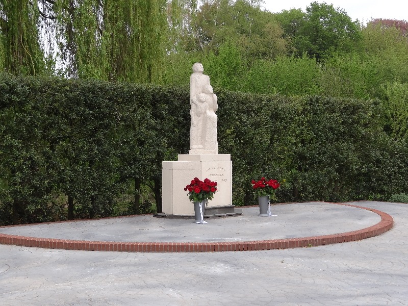
    On the lawn of the Old St Helen’s Church on the Markt in Aalten stands a special memorial stone. The bronze plaque on the stone lists the names of seven resistance fighters within the organized resistance in Aalten.

    Resistance during World War II (1940-1945) only developed over the course of the war. As the German occupiers’ measures became stricter, small groups emerged that resisted the occupation, initially with limited means. As the war progressed, more and more people faced difficulties. These small resistance groups grew in strength due to increasing membership and the networks that formed between various resistance cells.

    Within the resistance, two main currents could be distinguished. The first group was the National Organization for Help to People in Hiding (LO). This group organized hiding places for Jews, for men who refused to work for the enemy in Germany, and for resistance fighters who had to go into hiding. The LO was dependent on sufficient ration coupons for the food supply to the people in hiding . The second group, the Knokploegen (KP), took care of that. This armed group carried out raids on distribution offices, tried to sabotage the enemy at vital points and in the last phase of the war prepared to assist the Allied troops in the liberation of the Netherlands.

    In the Achterhoek, especially in the region of Aalten, Lichtenvoorde and Winterswijk, the resistance was particularly active. Some of the resistance fighters lost their lives during the war. Those who survived the harsh time did not feel like heroes. Many testified to the fear they would carry with them for the rest of their lives. The courageous acts of the resistance are recorded in several books.

    The names of the fallen (click on the links for more information):

  • People in hiding

    People in hiding

    ‘Hide the outcasts; Do not betray him who escapes’. This text (Isaiah 16:3) was used by several pastors at the beginning of World War II. With this, the congregation members were called upon to contribute to helping people fleeing the Nazi regime. And with success: at one point, one in five residents of Aalten was in hiding, relatively more than anywhere else in the Netherlands.

    The inhabitants of Aalten played an important role in protecting people in hiding during the war. Their courage and determination have saved the lives of many. The church’s involvement, close family ties and rural location are seen as reasons for the great willingness to offer help. It is relatively easier to hide people in a remote farmyard than in a city. But despite that, helping people in hiding and other refugees took a lot of courage and sometimes cost lives.

    Hiding and resistance

    During the war years, there were several reasons why people chose to go into hiding. For example, Jews tried to escape deportation to concentration camps. In addition, there were people who wanted to avoid the Arbeitseinsatz or who wanted to resist the German occupier.

    Heleen Kuipers-Rietberg uit Winterswijk, beter bekend als tante Riek, zorgde voor schuilplaatsen voor veel werkweigeraars en Joden. Samen met Ome Jan Wikkerink, een aannemer uit Aalten en leider van de plaatselijke verzetsorganisatie, en met dominee Slomp stond zij aan de wieg van de Landelijke Onderduikorganisatie (LO).

    People in hiding were often hidden in attics, in barns, in secret rooms or in remote places in the landscape. Although there was always a risk of betrayal and arrest, relatively few people in hiding in Aalten were discovered by the German occupiers. The local population had a strong mutual solidarity and the resistance was well organized. Moreover, there was an active network that helped people in hiding to cross the border to safer areas abroad.

    In 1947 schonken oud-onderduikers de Aaltense bevolking een monument als dankbetuiging voor hun gastvrijheid en aan de verzetsmensen die de stuwende kracht waren bij het onderbrengen van de onderduikers. Het monument bevindt zich in de Stationsstraat, tegenover het treinstation.

    On June 9, 1945, Dagblad Trouw wrote:

    Aalten a record?

    Most probably the beautiful village in the Gelderschen Achterhoek Aalten was the place that housed proportionally the most people in hiding during the war. The village has only 11,000 inhabitants and no less than 2500 people were placed in hiding. For the time being, we will be able to assume that this is a record in the Netherlands.

    Aalten’s taak is hiermede niet af geweest. Boven dit getal zijn er nog honderden kinderen, vooral uit Rotterdam en omgeving, geweest die daar hun zomervacantie hebben doorgebracht. We overdrijven verder niet dat duizenden in den lande in den voedselnood geprofiteerd hebben van de honderdduizenden roggebrooden, zakjes meel en havermout, spek en eieren, die vanuit dit dorp het land zijn ingezonden. De directeur van het Aaltensche postkantoor droeg den naam onder zijn collega’s van roggebrood-directeur.

    We will remain grateful to Aalten for this war activity. The 2500 people in hiding are too. They sent a request to H.M. the Queen and asked her to visit Aalten during a trip through the liberated Netherlands. We sincerely hope that it will happen. Aalten deserves it.

    Almost a quarter of a century after the liberation, on March 14, 1970, the newspaper Trouw wrote in an article about a planned reunion of former people in hiding and former combatants:

    In the years that the Germans occupied the Netherlands, in the small, agricultural town of Aalten, there was hardly a house in which there were no people in hiding. The people who live there are closed by nature. The Hague resident and the Amsterdammer, who went under water, had to get used to it. The Germans too, by the way, and once an SD officer spoke in anger of ‘abscheuliche Leute’ and he added: ‘Wir sind Luft, Luft!’ However, the silence of the Aaltenaar has benefited many people in hiding.

    During the war years, Rev. J. Klijn (of De Open Deur), Rev. P. Kuyper and Rev. J. van Dijken respectively as a reformed, reformed and christian-reformed minister. One evening, two farmers, who had made a long bike ride for it, arrived at one of the three rectories. It matters little which one. They told the preacher about a naober, who was unwilling to take in people in hiding. In some houses there are eight, why doesn’t he want to accommodate one? Can’t the pastor go and talk to that man and point out his responsibility? They get the promise from the pastor that he will exchange a hearty word with the brother in question. It turned out not to be necessary. On the day that the Allied tanks thunder into Aalten, the farmer, who has been complained about, stands in front of his stee, laughing and waving. He is there with his wife and his family, but also with a bunch of Jews. He accommodated them, without the nearest neighbors having any suspicion of it.

    Not all Jews who were given shelter in Aalten survived the years of occupation. A number of them were discovered, sent to Poland and liquidated there.

    Church services

    Aalten would not be Aalten if it had only provided the people in hiding with equipment. The churches held special church services for people in hiding, usually on remote farms, where people met in smaller groups. The congregation of God started to function here as a hidden church, in the summer the services were held on the deel, in the winter in the large Achterhoek kitchen. People did not ‘go’ in large numbers, but came with two or three people at a time. Guard posts were often posted to be alert to danger. There were also special catechisms for people in hiding. Even separate Jewish catechisms. A number of Jews came to believe in the Messiah.

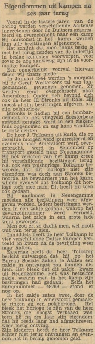
    Begin ’44, tijdens een gewone dienst in de gereformeerde Westerkerk, omsingelden de Duitsers de kerk. Eén jongeman die in Scheveningse vrouwenkleren de kerk verliet, ontkwam. Hoe die knaap aan dat Scheveningse gewaad kwam? Tussen neus en lippen door had Aalten ook nog een flinke groep Scheveningers, die uit de kuststreek weg moesten, gastvrij opgenomen. 48 Onderduikers werden in een vrachtauto geladen en naar Amersfoort getransporteerd, en van daaruit voor een groot deel naar Duitsland. Ook werd de christelijke gereformeerde kerk op een zondag overvallen. Hierbij werd een dozijn onderduikers gepakt.

    Some boys did not return. In an issue of De Open Deur, which appeared the following year, Rev. Klijn of a service that was held on Christmas Eve ’44 on a farm in Aalten. We quote a few passages: “The Christmas Gospel was read in many wonderful places last year, in that time of need and misery, of shelters and shelters. But it was robbery in order. Also here in this simple peasant kitchen with its international circle of resistance fighters, herded together from all over the world; Achterhoek farm boys, heavily wanted illegals, navy people in hiding and secretarial staff, and allied pilots from San Francisco and Florida. Brighton and Plato Sask, Canada. It was as quiet as in a church, when the familiar words of Luke 2 were read, first in Dutch and then from the Moffat translation in English. And there was a twilight of emotion over some of those tough faces, when the old Christmas message came to them in their own language, here, so far from home, Christmas after all, the Christmas message: Today you have a Saviour born in the town of David, the Lord Messiah. And in the silence of Christmas night, their hearts, filled with thoughts of war by day and by night, knocked on the door of a different peace from that for which they were fighting, the peace of which the English sang: Glory to God in high heaven, and peace on earth for men whom the favours! By a puzzling achievement, the underground from the Achterhoek had also collected a few English church books and so the Christmas carols were sung bilingually: Honor be to God, Now sijt wellecome and the Silent Night, Holy Night, known all over the world…”

    Nationaal Onderduikmuseum

    To record the memory of this part of history and to keep it alive, the National Hiding Museum was established in Aalten. The museum focuses on showing and documenting the stories of people in hiding and the people who helped them. It shows how ordinary people can show courage and humanity in extraordinary circumstances.

    Het museum is deels gevestigd in een pand met een bijzondere onderduikgeschiedenis: Markt 12. Dit was indertijd het woonhuis van een gezin met kinderen, maar op zolder werden onderduikers (tijdelijk) verstopt en de kelder was de schuilplaats voor buurtbewoners tijdens bombardementen. Extra opmerkelijk: de grote woonkamer was door de bezetter gevorderd en in gebruik als ‘Ortskommandatur’.

    More information about (a visit to) the Nationaal Onderduikmuseum: nationaalonderduikmuseum.nl

    Escape Room

    The Nationaal Onderduikmuseum also has an escape room. Players are confronted with issues and dilemmas that everyone will encounter when they have to flee. If you choose to flee from your world, you have to renounce what you know and know. You will have to do everything in your power to keep yourself going in your new situation.

    It is now important that you have insight into that new situation, have a sharp vision, so that you can recognize signs, dare to make decisions and distance yourself from what you have known until now. “Can you manage to dive under the radar, become invisible, become inaudible to the enemy?”

    More information: escaperoom-aalten.nl

  • Hidden in Aalten

    Hidden in Aalten

    Text: Ad Ermstrang

    During the final years of the Second World War, many people in hiding (onderduikers) found refuge in the Achterhoek region. Aalten topped the list, with an estimated 2,400 people pursued by the Germans. “The inhabitants were not only devout, but also linked that faith to providing shelter to those who had been driven from their homes.”

    Pieter Schaap (84) now lives in a tidy apartment in the centre of Aalten, having purchased the property with his wife, who is nearly 80, several years ago. “We lived a little further away, but the house was too big, and we could no longer keep up with the garden.”

    That is not to say that the Aalten resident and his wife are not spry. The couple regularly visits their children in the west of the Netherlands and travels by plane to visit a son in Norway. Pieter’s wife regrets that they can no longer make those trips by car and boat. “You see so much more that way.”

    The Aalten resident, distinguished by a thick shock of grey hair, still drives in the Netherlands. Among other things, he delivers meals for Tafeltje Dekje (Meals on Wheels). “But the physical ailments are starting to show. I recently had cataract surgery on one eye, and my hands shake a little; I can no longer write properly. I am considering stopping with the meal deliveries this year.”

    Spoiled butter

    Sixty-five years ago, Pieter Schaap came to the Achterhoek for the first time. The native of The Hague was forced to report to Winterswijk in late 1942 following a summons from the Germans, who were coercing young men into forced labour. “I reported to Kamp Vosseveld as instructed. It was very German there, very strict. We were allowed to go to church on Sundays, at least.”

    Schaap grew up in a Reformed family but later joined the Gereformeerde church. “After the service, the minister invited us for coffee. We were regularly allowed to stay for a meal. They thought we were starving in that camp. That wasn’t true, but as a young guy, you could always manage a bit extra.”

    He disliked the conditions. “We repaired backroads and replaced sections of railway track. Everything was done by hand. You only had a spade and a wheelbarrow. Meanwhile, you were being drilled. We had to sing all sorts of nasty songs. I didn’t like the regime. I spoke about it, and then the minister said: ‘Why don’t you go into hiding?’ He said he could arrange an address. However, we were being watched closely; there were constant roll calls, making it impossible to escape. Until the moment we were served spoiled butter. That was early 1943; I don’t remember the exact date. Almost everyone had diarrhoea, and there was no roll call. That was when I slipped away. Together with Henk Bossemeijer, a lad from the Alphen aan den Rijn area.”

    Pieter and Henk exchanged their uniforms at a family’s home in Winterswijk, put on civilian clothes that had been laid out for them, and boarded the train to Aalten. “The minister had said we would be taken care of. And indeed, we were met by members of the resistance. Through Ome Jan, the leader in Aalten, we were given shelter for the night. The next day, we went to ‘t Paske farm in the rural district of Dale.”

    Schaap immediately felt that the presence of him and Bossemeijer was too much of a burden on the farming family. “The responsibility for two people in hiding was too great. ‘Do you know of another place for one of us?’ I asked. After a few weeks, I was able to go to ‘t Heegt farm in Lintelo, another rural district. There, with the Rensink family, I stayed until the end of the war.”

    A hollow above the horse stable

    The young man from the west with a technical background was quickly retrained as a farmer. He ploughed and harrowed the land using horses, cleaned stables, and fed the cows. “I even learned to milk, thanks to the family’s eldest daughter, who had just taken a course in it.”

    At first, Schaap slept in the opkamer (parlour) of the farmhouse. Later, a group of 500 people from Scheveningen arrived in Aalten, having been driven from their village by the Germans in connection with the construction of the Atlantikwall. Schaap remembers it well. “The Gereformeerde evacuees went to Aalten, while the Hervormde evacuees from Scheveningen went to Winterswijk. That had been agreed upon with the local churches. Some of the Scheveningen evacuees were also offered shelter at ‘t Heegt.”

    For the rest of the war, he slept in a hollow above the horse stable. “Above the manger where the horses ate. If I stood on that, I could just reach a small hatch that couldn’t be seen from below. I had a bed there, and some light fell in through a glass roof tile.”

    He was not there often. Pieter spent most of his time in the fields. The man in hiding did not find it truly dangerous. “We didn’t have much trouble from the Germans. We did have to watch out for landwachters (Dutch collaborators), but they were always spotted in this area long in advance. I would usually go to a piece of land further away, somewhat hidden behind the trees. Or I would crawl away. I never stayed on the farm if there was trouble.”

    A wagon full of crispbread

    He stayed at ‘t Heegt for two and a half years, amidst many other people in hiding. Aalten was teeming with them. “There were more and more of them. The Germans also began to notice, and on 30 January 1944, the Westerkerk was surrounded by SS soldiers during a service. A number of people in hiding tried in vain to escape past the organ. The churchgoers were checked and fined if they had left their identity cards at home.”

    The story of Gerrit Hoopman (19), a person in hiding, is well-known; in the chaos, he was provided with an outer skirt, a shawl, and a traditional headpiece by a woman from Scheveningen, allowing him to escape the church. That did not apply to a large group of other people in hiding; more than forty men were arrested.

    Schaap, a faithful visitor to the Westerkerk, was not there that day. “We felt it was becoming too dangerous, so that Sunday we organised a service in a secret location for one of the first times. We called that the ‘underground church’. We did that at farms, always at different addresses. Often one of the boys would lead the service; sometimes we had a minister.”

    Later, German soldiers were billeted at the farm. “They were young boys, paratroopers who no longer had any planes and therefore had to serve in the infantry.” He had little trouble from them. “To them, I belonged to the family. When they requisitioned a horse and wagon from the farmer at one point and gave the command ‘Bauer mit!’ (Farmer, come with us!), I jumped onto the driver’s seat. We headed toward Bocholt, but during a bombing raid, my passengers quickly disappeared—they looked for cover elsewhere. I waited for a while until I saw farmers with horses and wagons driving back and forth from a large warehouse in the area. I went over and said I had been sent to pick something up. I was given a wagon full of knäckebröd (crispbread), ha ha! I drove back with that.”

    He was also part of the farming family to others. “All those years, I was ‘Piet van ‘t Heegt’. Some people still know me by that name today. We were recently at a gathering where we met an acquaintance from that time. She lives in Zeeland now. ‘Hey, there’s Piet van ‘t Heegt,’ she said.”

    He did not suffer from hunger in the Achterhoek. “Every two weeks, I even sent a large rye bread to my parents. The postman was called ‘the baker’ at their place; he helped distribute the bread.”

    Until his retirement, Schaap worked as a technician for the Royal Netherlands Army. His pre-war ideal of becoming a marine engineer did not come to fruition due to the war. In the hamlet, Pieter met his future wife. “She lived a few farms away.” The courtship did not go smoothly, as her father thought she was too young, and after the liberation, Pieter signed up as a volunteer for the Dutch East Indies. Only years later did he return to Aalten, where the farmer’s daughter was still waiting for him. “We have now been married for 56 years. We were truly destined for one another.”

    Pieter Schaap passed away on 11 October 2013.

    For more information on the period in hiding: Nationaal Onderduikmuseum, Aalten

  • Gooswijn van der Lawick

    Gooswijn van der Lawick

    Gooswijn van der Lawick or Goosen van der Lauwick (Diepenheim, ca. 1547 – Bredevoort, June 23, 1629) was a captain, Lord of Geldermalsen, vassal of ter Hegge and ten Velde, bailiff of Bredevoort, and a member of the knighthood of Zutphen and Nijmegen.

    Gooswijn was a son of Goossen van der Lawick, Lord of Geldermalsen and bailiff of Buren, and Anna van Asperen van Vueren. He married the widow of Floris van Buckhorst, Joanna Bentinck, and was consequently enfeoffed with the castle and lordship of Buckhorst near Zalk in Overijssel. Two of his sons, Christoffel and Georg Nicolaas, would later also become bailiffs of Bredevoort.

    Service to the States

    Gooswijn van der Lawick became famous during the siege and relief of Bredevoort in 1606. After the Spaniards managed to overrun Bredevoort, the citizens and garrison were able to flee to Bredevoort Castle to continue the defense of the city while awaiting relief from surrounding States’ armies. However, the Spaniards had no powder and shot. These had coincidentally been brought into the castle by Gooswijn van der Lawick the day before. As a result, the Spaniards failed to take the town; they ran out of ammunition. In 1629, as commander, Van der Lawick also participated in the Capture of Wesel, together with Wolf Mislich.

    Sources


  • Wolf Misslich († 1639)

    Wolf Misslich († 1639)

    Captain Wolf Misslich was the commander of the States’ garrison in Bredevoort during the early 17th century. In 1629, he participated in the capture of Wesel, for which he was rewarded by the States-General. Later that same year, he was appointed governor of the Lordship of Bredevoort. His substantial legacy to the poor established him as one of the greatest benefactors in the history of the town.

    From soldier to governor

    In August 1629, during the Eighty Years’ War, Gooswijn van der Lawick and Wolf Misslich (respectively the drossaard and military commander of Bredevoort) were ordered by Prince Frederick Henry to march to Emmerich with six hundred soldiers to participate in the capture of Wesel, a major fortified city then held by the Spanish.

    Misslich and his troops captured two Spanish redoubts on the Lippe. For his services, he received a gold medal valued at one hundred rijksdaalders from the States-General.1

    Following these military successes, Misslich was appointed governor of Bredevoort, a strategically located fortified town in the east of Gelderland.

    Family, legacy, and charity

    In a deed dated June 27, 1629, Misslich is referred to as “van Paterborn” (Paderborn), indicating his place of origin.2 He was initially married to Catharina van Jeveren; from this marriage, a daughter, Anna Margaretha, was born. Anna Margaretha married Captain Robert van Giffen; they had a daughter named Catharina. Both Anna Margaretha and her daughter passed away in the summer of 1639, shortly before Misslich himself. After the death of his first wife, Misslich remarried his maidservant, Nelleke Servaes.3

    In a will dated December 26, 1628, Misslich already demonstrated his philanthropic nature. In it, he bequeathed, among other things, 500 Carolus guilders to the poor of Emmerich; he named his daughter Anna Margaretha as the heir to the rest of his estate and also left five hundred guilders to his nephew (his namesake, Sergeant Wolf Misslich), three hundred guilders to his—then—maidservant Nelleken, and twenty rijksdaalders and a cloak to his servant Jurrien.4

    His charitable work took further shape in the following years. In 1637, he purchased a house with a barn, garden, and appurtenances within the town of Bredevoort from the Deputies of the County of Zutphen, with the provision that the property would pass to the poor after his death.5 On July 13, 1639, he bequeathed 6,000 Carolus guilders to the New Orphanage in Zutphen and 100 rijksdaalders to the poor of Lochem.6

    However, the most well-known part of his legacy went to the poor of Bredevoort. According to his will, he left his house, garden, and associated lands to the city’s poor relief—a donation later estimated at 15,000 guilders, an exceptionally large sum for that time. This gift gave rise to the local saying: “The poor of Bredevoort are rich.” 7

    Misslich’s house was likely located near the Ambthuis. The rental income from the property was entirely dedicated to poor relief. Until the nineteenth century, the fund resulting from his legacy was still managed by the church’s deacons and provisors. In 1808, the fund still represented a value of over 6,000 guilders.

    One of the properties that passed to the poor of Bredevoort was the Erff und Guedt Lenckhoff in Aalten, which Misslich had purchased in 1638 from Count Georg Ernst van Limburg Stirum.8 This estate was situated in the area between the current Bodenvoor, Bredevoortsestraat, and Haartsestraat (later known as Lankhaverstegge) and extended to the Smees. The Lankhofstraat is named after it.

    Death

    On August 1, 1639, Misslich transferred part of his assets to his son-in-law Robert van Giffen, including an estate in Nieuw Vossemeer near Steenbergen and significant annuities in the Veluwe and Emmerich.9

    Shortly thereafter, Misslich passed away; on August 17, 1639, his will was opened.10 He was buried in Saint George’s Church in Bredevoort.11

    In 1661, he is still mentioned in the archives as “the stern and valiant governor” in connection with the sale of a house “for the benefit of the poor”.12

    Wolf Misslich was not only a capable military officer and administrator but also a man with a profound social conscience. His generous donations ensured that the poor of Bredevoort received support for generations. Nearly four centuries after his death, his name lives on in the history of the town he served.

  • Izaak Antonie de Moor

    Izaak Antonie de Moor

    Izaak Antonie de Moor, born on May 31, 1905, in Goedereede, was appointed mayor of Breskens in 1939. In 1941, he joined the N.S.B. there. After ‘Dolle Dinsdag‘ (Mad Tuesday), he fled to Aalten, where he took over the mayoral duties from September 18, 1944, during the period when Mayor Monnik was in hiding. When things became too difficult for him a few days before the liberation, he fled to Grijpskerk, where he was arrested upon liberation. After 1½ years of internment, he was provisionally released.

    On March 10, 1947, De Moor stood trial before the war tribunal in Groenlo. The charges were as follows: group leader and sub-district leader of the N.S.B., neighborhood head of the N.V.D., member of the N.A.F. during his term in Breskens; taking the oath of allegiance to Mussert; organizing N.V.D. training afternoons; threatening the municipal messenger J.J. Bliek; applying for a weapons permit from the Representative of the Reich Commissioner; stating, when returning Dutch soldiers to Germany as prisoners of war: “They deserve no better; they have done nothing but sabotage”; distributing the publications Volk en Vaderland and De Zeeuwsche Stroom; cooperating with the labor deployment for coastal defense works; and providing a training course for mayors in Goes.

    The term of office in Aalten

    The summons regarding his term of office in Aalten included the following charges: cooperating with the O.T. labor deployment in Zevenaar and Bocholt; calling in the assistance of the Landwacht to check for people in hiding, for the requisitioning of bicycles, and for the arrest of a person in hiding at Te Giffel. Furthermore, the accused dismissed all municipal officials who were in hiding and informed the Sicherheitspolizei in Doetinchem of the arrest of three individuals, including B.H. Wikkerink, for engaging in illegal activities. Finally, he called in the assistance of the Grüne Polizei stationed in Aalten in connection with the arrest of the Baruch family, a Jewish family in hiding.

    The accused explained that by accepting the office of mayor in Aalten, he had intended to be of as much service as possible to the population. The president: “You have given all your strength to the German, and thus enemy, cause for the destruction of both the Dutch material and spiritual resistance. When you saw in Breskens who and what the Germans were, you should no longer have acted as mayor in Aalten.” The accused: “I had to choose between being a member of the Landwacht or a mayor. I had no desire for the Landwacht.” The president: “You could also have chosen another path: neither.”

    The discussion then turned to why the accused had been present on October 10, 1944, when the S.S. had conducted a raid in Aalten and the detained persons were brought to the community center. The accused: “The S.S. intended to cordone off the churches. I knew this would cause much unrest in Aalten, so I tried to make amends where possible. In some cases, I was able to do something in favor of those detained.” The accused denied having ordered the arrest of the six hostages. “In the report to Doetinchem,” the accused stated, “I did declare it. The late Mr. v.d. Glas, the Landwacht commander, gave the order to arrest the hostages. As mayor, I was required to report it.”

    The president: “Why did you attempt to compile a new population register, when you knew that the old one had been deliberately disappeared? You were in every respect a mindless tool in the hands of the Germans.” Furthermore, the speaker pointed out how dangerous it was to inform Vossers that the municipal secretary, Bijlsma, had made off with the municipal papers and documents, and to tell the aforementioned Vossers where B. was likely located. President: “You were a convinced and fierce member of the N.S.B.” The accused: “Not fierce, I was an idealist. I considered it my calling and task to do something for the Dutch people.”

    After the various points of the indictment during his term in Breskens were addressed, the arrest of the Baruch family, who were in hiding in Aalten, was finally discussed. The accused admitted to having acted incautiously. He had mentioned it in a conversation with the Grüne Polizei. The president: “You knew yourself what kind of beasts the G.P. were.” The accused: “It did not sink in at that moment. I was able to prevent the Oberleutnant from having the three Jews in question shot. At my insistence, they were to be transported to Doetinchem. As the liberation approached, they were able to remain in Aalten. And upon my departure, I told Tilbusscher that the Jews could be released immediately, which is what happened.”

    Verdict

    The accused, who had no defense counsel, said in his closing statement that he is now back in the workforce. He appealed for the clemency of the Tribunal. “I have had a lesson for life. Moreover, my house in Breskens was bombed, and my 17 years of pension are gone. I was a civil servant heart and soul; I admit to having been completely wrong. Give me the opportunity now to care for my family again,” he exclaimed.

    After deliberation, the president stated that it would be fair to impose an internment longer than the pre-trial detention. However, the Tribunal wished to take into account the circumstances in which the accused currently finds himself. The following measures were imposed upon him: internment equal to the pre-trial detention; disqualification from holding any public or semi-public office; deprivation of both voting rights; and confiscation of his radio.

    De Moor passed away on February 17, 1984, at the age of 78, in Warnsveld.

  • Aron Jedwab (Willem Herfstink)

    Aron Jedwab (Willem Herfstink)

    In the early morning of 21 September 1943, Piet Hoogenkamp, the assistant of the Aalten general practitioner and resistance fighter Joop der Weduwen, placed a package in front of the house with address Patrimoniumstraat 12 in Aalten. Resistance leader Hendrik Jan Wikkerink alias Uncle Jan lives at that address with his family. The doorbell rings.

    The package turns out to be a newborn baby. He is the son of Lena Jedwab-Kropveld and Yitzack Jedwab, rabbi (pastor) of the Jewish community in Aalten. From mid-1942 the couple was in hiding on the De Ronde farm of the Veldboom family in Lintelo. Resistance leader Uncle Jan and doctor Der Weduwen have agreed in advance to lay the foundling.

    Foundling

    Daughter Jo Wikkerink later told about this:

    “We knew that the delivery was coming and the baby would be brought to us. Father and mother only told the oldest three. The youngest knew nothing. They could not talk past their mouths. Father and mother waited in the dark room in the evening. It seemed to the neighborhood as if they had gone to bed. When the doorbell rang, they knew the baby was there. They got the youngest out of bed and shouted in surprise: “Come and see what is there now!”

    The Jewish child was therefore born in hiding and was registered three days later by Mrs. Dela Wikkerink-Eppink with the name ‘Willem Herfstink’ and registered as such in the birth register of the municipality of Aalten. The name was chosen symbolically. Willem refers to Queen Wilhelmina, Herfstink to the first day of autumn (21 September) and the Saxon suffix ‘ink’ means ‘belonging to the yard or family of’.

    Because only a few people – such as doctors – were allowed to be on the street at one o’clock in the morning, four o’clock in the morning was given as the time when the baby was found. This made the investigation into the origin of the child considerably more difficult. “I sometimes came home late at night with a big belly by train. Then I had ‘contraband’ with me as if I was heavily pregnant. When Wimke was put on the sidewalk, they said: “That’s what they say, but it must be one of the girls.”

    Declared Aryan

    The next day, the municipal doctor on duty, Dr. Knol, had to examine the foundling. The baby was not circumcised and therefore he issued the declaration that the child was 100% Aryan. “The next day father immediately went to Schepers, who lived diagonally across from us (he worked at Paske). Father knew: if I tell it there, everyone in Aalten will know it immediately. Behind us, next to Vossers, lived an NSB woman. She was on her knees in front of Wimke’s crib to see if he had any Aryan features.”

    Lennie and Yitzchak had meanwhile moved to another hiding place in Lintelo. In June 1944, the resistance moved them in a hay-covered wagon to the house of Bernard and Gesina Wevers in the hamlet of Dale, behind the Ringweg, just outside the village of Aalten.

    Initially, they did not want to take the Jedwab couple into their home because they were already sheltering evacuees. A minister of the Reformed Church changed the pious Calvinists’ minds: he preached that the persecuted should be helped.

    Bernard, a carpenter, built them a room behind the closet where they spent all their time. Mrs. Wevers cooked for her Jewish guests as much as possible according to kosher rules.

    In the meantime, Willem had been lovingly taken into the family of the Wikkerink family. Especially mother Dela and eldest daughter Lien Wikkerink took care of ‘Wimke’ as they called him. Dela Wikkerink regularly walked with the baby in the pram to the hiding place of the Jewish parents in Dale. She often took some fruit from the vegetable garden with her in her bag. There were people in Aalten who said: “What does Mrs. Wikker always have to do with Wevers?”

    Towards the end of the war, two German soldiers were billeted in the Wevers house. While the soldiers were in the house, Lena and Yitzack sat in chairs in their hidden room and were not allowed to move or make a sound, sometimes for days.

    Patrimoniumstraat 12, Aalten
    Patrimoniumstraat 12, Aalten

    After the war

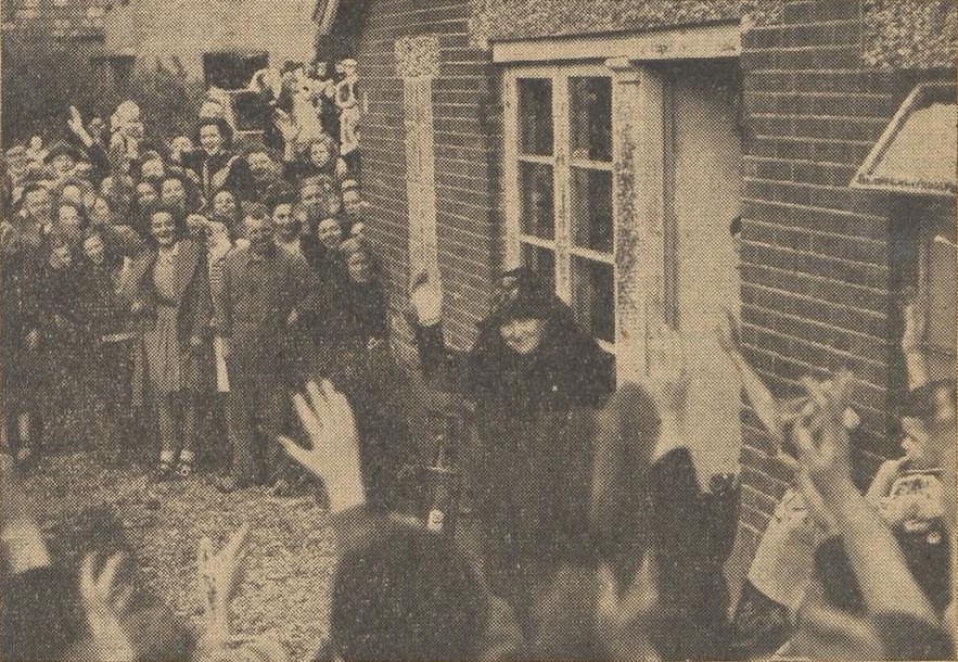
    After the liberation in March 1945, the family was reunited and the little one was given his real name: Aron Jan Willem Jedwab. The name Willem remained and the second first name Jan refers to his rescuer Jan Wikkerink. Queen Wilhelmina came to Aalten soon after the war and visited the Wikkerink family to honour them for their actions in the resistance. Jo Bulsink-Wikkerink: “I can still see Wilhelmina. She slapped my grandfather on the shoulder and said: Wikkerink, you have a brave son.”

    The young child Willem hardly knew his own parents. Jo Wikkerink – the second daughter in the family – then moved in with the Jedwab family for a year, so that Willem could get used to his own parents and new environment a little easier. The Jedwab family emigrated to the US in 1947 and there they changed their surname to Jade.

  • Patrimoniumstraat 12

    Patrimoniumstraat 12

    Aalten

    The house is of particular significance due to its history of occupation. During the Second World War, it was inhabited by the resistance leader ‘Ome Jan’ (Uncle Jan) Wikkerink and his family. Motivated by his religious convictions, Wikkerink was deeply involved in assisting those in hiding. He became the leader of the Landelijke Organisatie voor hulp aan Onderduikers (LO – National Organisation for Aid to People in Hiding) and the Landelijke Knokploegen (KP – National Assault Teams) in Aalten.

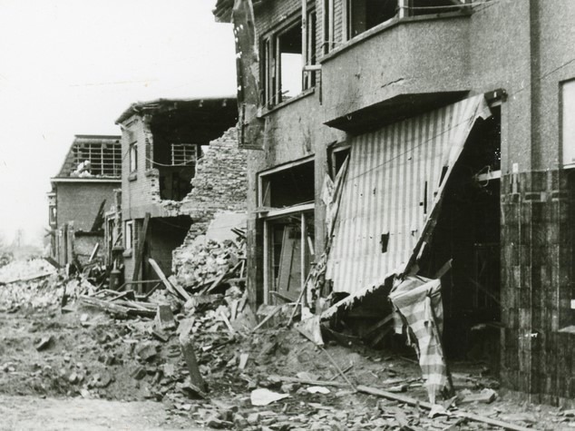
    On Sunday, 15 September 1944, the house was surrounded and he was arrested along with several others. However, he was liberated that very same day. In retaliation for the rescue operation, the Germans threw hand grenades into the house on Patrimoniumstraat, causing the interior to go up in flames.

    The house was built in the traditional brick architecture characteristic of the Interwar period, featuring a substantial overhang and strong horizontal elements, such as the bay window at the front of the property.


    Owners

    Overview is incomplete.

    YearPlotOwnerDescription
    1832I-167de Hervormde Armen van Bredevoort (Reformed Poor of Bredevoort)57.570 m² farmland

    Residents

    Population register 1930-1940

    Hendrik Jan Wikkerink (Aalten, 30-06-1896), bricklayer
    Dela Gesina Eppink (Dale, 28-02-1898)

    Address directory 1934

    Aalten C439/2 > Patrimoniumstraat 12

    H.J. Wikkerink

    Address directory 1967

    Patrimoniumstraat 12

    G.C. Wikkerink

    Features


    Cadastral no.I-12553
    FunctionHouse
    Year of construction1932
    Listedno
  • Nieuw Nonhof

    Nieuw Nonhof

    Pasopweg, Dale (no longer extant)

    This farm was built around 1910 on the instructions of its first occupants, Herman Bulsink—originally from the Nonhof farm—and his wife Everdina Hendrina Blekkink. Their foster son, Adolf Melitz, later became the primary occupant.

    Melitz was German by birth, but became a naturalised Dutch citizen in 1938. Shortly after the German invasion, he joined the Dutch National Socialist Movement (NSB) and in 1941 enlisted in the Waffen SS, with the rank of Obergefreiter. In September of that year, he took part in fighting on the German–Russian front near Dnepropetrovsk and Rostov, where he sustained permanent injuries to his nose and arm.

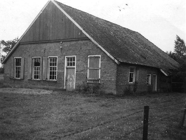
    In 1942, the farm was listed in the telephone directory as a ‘Regional Farm’ of the N.J.S. (Nationale Jeugdstorm, a youth movement). Reportedly, following the Liberation, the farm was set on fire by local people as an act of retaliation and was never rebuilt.

    In 1947, Melitz was sentenced to three years’ imprisonment, a fine of 2,000 guilders, and disenfranchisement.


    Owners

    Overview is incomplete.

    YearPlotOwnerDescription
    1915C-4316Herman Bulsink, farmer9.290 m² house, barn & pasture

    Residents

    Population register 1900-1910

    Dale 33

    Following their marriage, the following moved into this newly built farm:

    Herman Bulsink (Dale, 04-02-1867), coming from Nonhof
    married on 04-05-1910 in Aalten to
    Everdina Hendrina Blekkink (Woold, 01-05-1872)

    Population register 1910-1920

    Dale 33 > 36

    Herman Bulsink (Dale, 04-02-1867)
    Everdina Hendrina Blekkink (Woold, 01-05-1872)

    Population register 1920-1930

    Dale 36

    Herman Bulsink (Dale, 04-02-1867)
    Everdina Hendrina Blekkink (Woold, 01-05-1872)

    Adolf Melitz (Alstaden (D), 12-08-1914), foster son

    Address directory 1934

    Dale 36 > 28

    H. Bulsink

    Features


    Cadastral no.unknown
    FunctionFarmhouse
    Year of constructionc. 1910
    Destroyed1945

    Related farms


  • The Misterpoort City Gate

    The Misterpoort City Gate

    Bredevoort

    De Misterpoort is een voormalige stadspoort in Bredevoort. De poort maakte deel uit van de vestingwerken van Bredevoort. Tegenwoordig herinnert een café-restaurant met deze naam nog aan de oude stadspoort, die haar naam weer dankt aan de weg naar buurtschap Miste. In een poortwachtersreglement uit 1726 werd de poort Munsterspoort genoemd.

    Following the Siege of Bredevoort in 1606, work began in late March on the construction of fortifications designed by the urban planner Adriaen Anthonisz van Alcmaer. During this process, the medieval city walls and their gates disappeared. The town was equipped with bastions and ravelins, and the Misterpoort was replaced by a brick structure set within the rampart. The name ‘Misterpoort’, however, remained.

    In 1704 werden er nog verbeteringen aangebracht aan zowel de Misterpoort, als aan de tegenoverliggende Aalterpoort volgens de nieuwste inzichten van die tijd van Menno van Coehoorn.

    In 1727, two new counterscarps were constructed in front of both city gates, a project that took two years to complete. In 1755, the fortifications were decommissioned by the Council of State and transferred to the civil authorities. Some time later, in 1784, a government inspection of the fortifications revealed that citizens had excavated more than half of the ramparts down to ground level—with the exception of two bastions—and had demolished the gates and bridges. Plans were drawn up to restore the fortifications and add three lunettes, but these were never carried out.

    Archeology

    Excavations took place at the site in 1963 and 1979. In 1963, the State Service for Archaeological Heritage (ROB) was present and reported: “The foundation remnants were found to have been constructed using brick blind arches over the fill of a moat. On the inner side (the town side) of the moat, the remains of exceptionally heavy, vertically buried oak posts were found within the embankments.”

    During the 1979 excavations, a wall with a thickness of 1.70 metres, featuring transverse foundations, was discovered and quickly demolished. However, the remains were measured and photographed by the newly established local ADW Archaeological Working Group. These findings have raised more questions than answers, and it remains difficult to conclude which remnants date from which specific period.

    Waarschijnlijk is het enige zichtbare overblijfsel van de stadspoort bewaard gebleven in de hal van de Sint-Georgiuskerk. Het betreft hier een gevelsteen met een afbeelding van het schutspatroon van Bredevoort, St. Joris en de draak.

    Features


    FunctionCity gate
    Year of constructionunknown
    Demolitionunknown

    Sources


  • The Aalterpoort City Gate

    The Aalterpoort City Gate

    Bredevoort

    The Aalterpoort was one of the two city gates of Bredevoort and formed part of the fortifications of Bredevoort. The gate was situated on the western side of the fortified town and marks the start of the Landstraat.

    It is unknown when the first gate was constructed at this site. Accounts from the year 1500 show that maintenance work was carried out on the gates that year. A map by Jacob van Deventer from 1560 depicts a heavy tower with a bulwark or barbacane in front of it. On siege maps (from 1597 onwards), the city gate is shown with a drawbridge. The gate is flanked by two towers topped with spires. A “half-moon” (halve maan) outwork is situated in front of this gate.

    Improvements ca. 1550

    It is known that Maarten van Rossum ordered improvements between 1545 and 1555. It is possible that the gatehouse was also renovated during this period. This medieval gate was demolished in 1606, shortly after the relief of the town by Frederick Henry. From that time onwards, Bredevoort was equipped with fortifications according to the latest insights of the era, which included a new gate. This was a brick-built gate set within the rampart. The half-moon was replaced by a larger ravelin.

    Demolition

    Following the introduction of the Fortifications Act (Vestingwet) in 1874, the gate was demolished by residents to save on maintenance costs. The bridge was replaced by a causeway.

    Today, two residential buildings stand at this location, completed in 1998 on the site of the former city gate. A remnant of the original city gate was incorporated into the design.

    Features


    FunctionCity gate
    Year of constructionunknown
    Demolition19th century

    Sources


    • ‘Breevoort can ick vergeten niet’ (blz. 126), H.A. Hauer
    • ‘Bredevoort een Heerlijkheid’, Staring Instituut
    • Wikipedia
  • Bastion Stoltenborg

    Bastion Stoltenborg

    Bredevoort

    Bastion Stoltenborg was one of the six bastions of Bredevoort. It was situated to the east of the town, at what is now the start of Pater Jan de Vriesstraat, and formed part of the Bredevoort fortifications.

    Behind the houses on the Ambthuiswal lay the eight-metre-high hollow bastion, equipped with three cavaliers (katten) in each corner. The terreplein was accessible from Hozenstraat and Ambthuiswal. The gorge (keel), or entrance to the bastion, was located just past the junction with Gasthuisstraat, directly in front of the town farm situated next to the Ambtshof.

    The name Stoltenborg is thought to be related to the German word ‘stolz’ (proud), perhaps referring to the proud ‘borg’ (stronghold) of Bredevoort.

    Reconstruction

    The image shows a reconstruction of Bastion Stoltenborg. It illustrates the bastion’s position relative to the houses that stand there today; the adjacent building is the town farm next to the Ambtshof, with Gasthuisstraat running in front of it. The reconstruction also shows the onderwal (lower rampart) situated in front of the bastion. The moat has since been filled in; the site is now occupied by ‘t Bastion school and the surrounding modern housing.

    Features


    FunctionBastion
    Year of constructionunknown
    Demolitionunknown

    Sources


  • Bastion Ossenkop

    Bastion Ossenkop

    Bredevoort

    Bastion Ossenkop (‘Ox Head’) was one of the six bastions of Bredevoort. It was situated to the south-west of the town, at what is now the start of Kerkstraat coming from Koppelstraat, and formed part of the Bredevoort fortifications.

    On the site behind St George’s Church lay the eight-metre-high ‘solid’ bastion, equipped with three cavaliers (katten) in each corner. The terreplein was accessible via ramps (oprillen), possibly from Koppelstraat and Kerkstraat.

    Reconstruction

    The image shows a reconstruction of Bastion Ossenkop. It illustrates its position relative to the houses that stand there today; St George’s Church now stands upon the curtain wall (courtine). The gorge (keel) of the bastion is now occupied by gardens, and the site of the bastion itself is currently the Ossenkop playground.

    The reconstruction also shows the lower rampart situated in front of the bastion. The moat has been filled in; this area is now the site of the school and the surrounding modern housing on Schoolstraat and Tramstraat. Nothing has been preserved to serve as a physical reminder of the former bastion.

    Features


    FunctionBastion
    Year of constructionunknown
    Demolitionunknown

    Sources


  • Bastion Vreesniet

    Bastion Vreesniet

    Bredevoort

    Bastion Vreesniet (‘Fear not’) was one of the six bastions of Bredevoort. It was situated to the west of the town, in the area now behind Prinsenstraat, and formed part of the Bredevoort fortifications. Its remains are protected as a national monument (rijksmonument).

    At this location, the outline of the bastion is still vaguely visible on the modern map of Bredevoort. It was once an eight-metre-high ‘hollow’ bastion, equipped with three cavaliers (katten) in each corner. The gorge (keel), or entrance to the bastion, was situated just past the junction of Landstraat and Kerkstraat; the alley behind these houses still exists today. The present-day town meadow once served as the bastion’s terreplein (the level space behind the ramparts).

    In 1782, the bulwark was granted under a long-term lease (erfpacht) to Bernard Andries Roelvink. During the 19th century, the fortifications were dismantled to make way for the gardens that are still there today. A small section of the onderwal (lower rampart) has been preserved, upon which the Roelvink family’s tea pavilion was built.

    Reconstruction

    The image shows a reconstruction of Bastion Vreesniet. It illustrates the bastion’s position relative to the houses that stand there today, with Sint Bernardus visible on the right. The lower rampart in front of the bastion is also shown. The terreplein is now the small meadow situated between the gardens and Kerkstraat.

    The moat in front of it is known today as the Grote Gracht (Large Moat). The section of the moat to the left of the ravelin is now known as the Kleine Gracht (Small Moat). The filled-in section of the moat and the glacis (sloping bank) that were once here are now occupied by the ‘De Halve Maan’ (Half Moon) allotments.

    Features


    FunctionBastion
    Year of constructionunknown
    Demolitionunknown

    Sources


  • Bastion Treurniet (Kruittoren)

    Bastion Treurniet (Kruittoren)

    Bredevoort

    Bastion Treurniet (‘Grieve Not’), or Kruittoren (Powder Tower) in common parlance, is a national monument (rijksmonument) and was one of the six bastions of Bredevoort. It is situated to the north of the town, on what is now the Kruittorenstraat opposite the community centre Ons Huis, and formed part of the Bredevoort fortifications.

    At this location, a rise in the landscape can still be seen today; this was the onderwal (lower rampart) of the bastion. Behind it lay an eight-metre-high hollow bastion, equipped with three cavaliers (katten) in each corner. A powder magazine (kruithuis) for the garrison stood upon the terreplein. The gorge (keel), or entrance to the bastion, was situated just past the junction of Kruittorenstraat and ’t Zand.

    The powder tower of Bredevoort Castle must also have stood at this site. The curtain wall (courtine) of the main rampart ran behind the houses towards Sint Bernardus. In 2010, an artwork was placed on the remnants of the lower rampart in the form of steel ribs that represent its original profile.

    Reconstruction

    The image shows a reconstruction of Bastion Treurniet. It illustrates the bastion’s position relative to the houses that stand there today. The lower rampart situated in front of the bastion is also visible. The section on the right is the part that remains today as a shapeless mound.

    The terreplein is now the small meadow on Kruittorenstraat. The powder magazine would once have stood on the spot now occupied by the Bredevoort Schittert building. The section of the moat shown in the reconstruction still exists today.

    Features


    FunctionBastion
    Year of constructionunknown
    Demolitionunknown

    Sources


  • Bastion Welgemoed

    Bastion Welgemoed

    Bredevoort

    Bastion Welgemoed is een voormalig bastion, zuidelijk gelegen tegen het stadje Bredevoort. Het was onderdeel van de Vestingwerken van Bredevoort. Doordat molen De Prins van Oranje op dit bastion werd gebouwd bleef deze gespaard van ontmanteling en is dit dan ook Bredevoorts enige overgebleven bastion.

    The bastion is no longer easily recognisable. It was once eight metres high and equipped with three cavaliers (katten) plus a breastwork. Due to the excavation of the breastwork, the bastion now stands six metres high. The lower rampart has also been removed, and the surrounding moats have been filled in.

    Reconstruction

    Op de afbeelding een weergave van een reconstructie van het bastion Welgemoed. Zichtbaar gemaakt is de ligging ten opzichte van de huizen die er tegenwoordig staan. Ook zichtbaar de onderwal die voor het bastion ligt. Het deel aan de rechterkant is tevens het deel dat er tegenwoordig vormloos ligt. De courtine aan de linkerkant op de afbeelding is grotendeels verdwenen, alleen een verhoging ter hoogte van de Sint Georgiuskerk is een laatste restant van de hoofdwal die hier naar Bastion Ossenkop liep.

    Features


    FunctionBastion
    Year of constructionunknown

    Sources


  • Bastion Onversaegt (Izerman)

    Bastion Onversaegt (Izerman)

    Bredevoort

    Bastion Onversaegt (‘Undaunted’), popularly known as Izerman, was one of the six bastions of Bredevoort. It was situated to the north-east of the town, near the site of ’t Kleuterbastion school on Izermanstraat, and formed part of the Bredevoort fortifications. The bastion was excavated and levelled during the 1930s.

    On the grounds of ’t Kleuterbastion (nursery school) and the adjacent football pitch lay the eight-metre-high ‘solid’ bastion, equipped with three cavaliers (katten) in each corner. The terreplein was accessible via ramps (oprillen) from Hozenstraat, and possibly via ’t Zand.

    Reconstruction

    The image shows a reconstruction of Bastion Onversaegt. It illustrates the bastion’s position relative to the houses that stand there today, with the Breede Huus on the left and a corner of the Meestershuus on the right. Some maps suggest that this bastion was equipped with a water reservoir. This is not certain, however, as many houses in Bredevoort possessed their own wells.

    The tip of this bastion was located approximately on the centre circle of the football pitch. The flanking streets next to the Kleuterbastion run parallel to the original shape of the bastion. The position of the curtain wall (courtine) between the school and the Breede Huus is still clearly visible today by the line of the hedge. This curtain wall connected the bastion with the adjacent Bastion Treurniet. The outlines of the filled-in moat are still clearly visible on aerial photographs, and remnants of this singel (moat/canal) still exist today.

    Features


    FunctionBastion
    Year of constructionunknown
    Demolition1930

    Sources